Àird Dhubh

Landscape Feature in Argyllshire

Scotland

Àird Dhubh

Moorland beside unsurfaced road to RSPB reserve A minor road crosses the peninsula of The Oa eventually becoming unsurfaced and presumably unadopted. It reaches the RSPB reserve after a kilometre or so of rough motoring.
Moorland beside unsurfaced road to RSPB reserve Credit: Trevor Littlewood

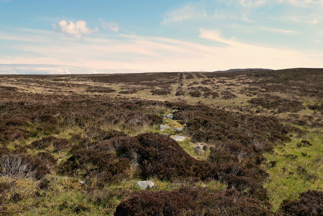
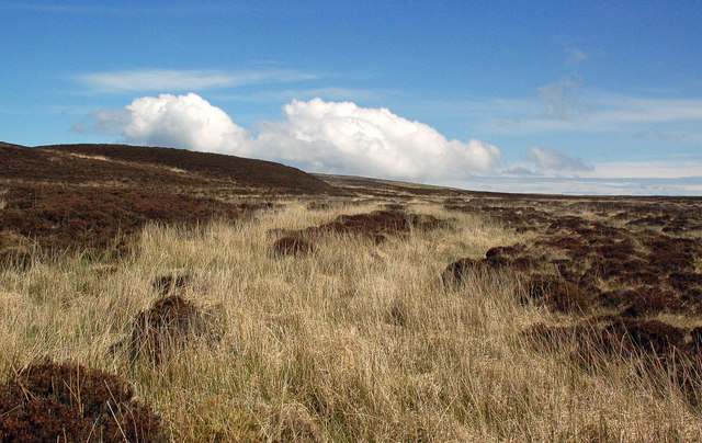
Àird Dhubh is a stunning landscape feature located in Argyllshire, Scotland. Situated on the west coast of the country, this area is known for its rugged beauty and breathtaking views. Àird Dhubh is characterized by its dramatic cliffs, rolling hills, and picturesque coastline.

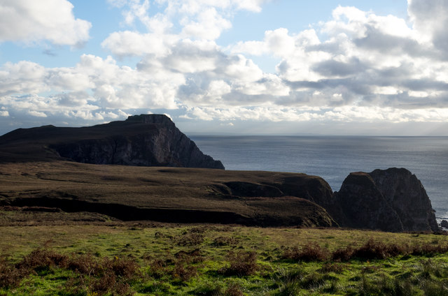
The cliffs of Àird Dhubh are particularly impressive, reaching heights of over 100 meters in some areas. They are composed of ancient rocks, showcasing a variety of colors and textures. These cliffs provide a nesting habitat for several seabird species, including puffins, guillemots, and razorbills. Their calls can often be heard echoing along the coastline.

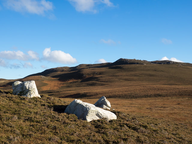
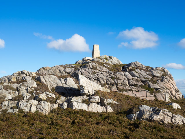
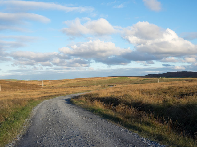
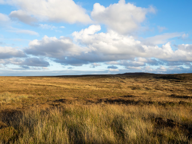
The rolling hills of Àird Dhubh are covered in a patchwork of heather, grasses, and wildflowers, creating a rich tapestry of colors. This landscape feature is also crossed by several small streams and rivers, which add to the charm of the area. These waterways are home to various fish species, such as salmon and trout, making the region popular for fishing enthusiasts.

The coastline of Àird Dhubh is a mix of sandy beaches, rocky coves, and sea stacks. It provides a habitat for a diverse range of marine life, including seals, dolphins, and even occasional sightings of whales. The crashing waves and salty sea air create a sense of tranquility and natural beauty that is truly captivating.

Overall, Àird Dhubh is a must-visit destination for those seeking to immerse themselves in Scotland's stunning natural landscapes. Whether it's hiking along the cliffs, exploring the hills, or simply taking in the coastal views, this landscape feature offers an unforgettable experience for nature lovers and adventurers alike.

If you have any feedback on the listing, please let us know in the comments section below.

Àird Dhubh Images

Images are sourced within 2km of 55.599452/-6.2889217 or Grid Reference NR2942. Thanks to Geograph Open Source API. All images are credited.

Moorland beside unsurfaced road to RSPB reserve A minor road crosses the peninsula of The Oa eventually becoming unsurfaced and presumably unadopted. It reaches the RSPB reserve after a kilometre or so of rough motoring.
Moorland beside unsurfaced road to RSPB reserve
A minor road crosses the peninsula of The Oa eventually becoming unsurfaced and presumably unadopted. It reaches the RSPB reserve after a kilometre or so of rough motoring.
Three white rocks on heather The rocks are on heather moorland north-west of Beinn Mhòr which is the distant hill.
Three white rocks on heather
The rocks are on heather moorland north-west of Beinn Mhòr which is the distant hill.
Trig point atop rock plinth The triangulation column is at the summit of Beinn Mhòr on The Oa peninsula, of Islay.
Trig point atop rock plinth
The triangulation column is at the summit of Beinn Mhòr on The Oa peninsula, of Islay.
Heather moorland beyond bracken Beyond the heather lies Beinn Mhòr and Dùn Athad is to the right of the notch against the sea.
Heather moorland beyond bracken
Beyond the heather lies Beinn Mhòr and Dùn Athad is to the right of the notch against the sea.
Unsurfaced public road near to Kinnabus The road serves farms on The Oa but is also the access for the RSPB reserve on the peninsula.
Unsurfaced public road near to Kinnabus
The road serves farms on The Oa but is also the access for the RSPB reserve on the peninsula.
Moorland with rushes on The Oa The Oa, a peninsula at the south end of Islay, is largely as at this location,  a moorland area. The view is eastwards from the only public road which generally runs west to east.
Moorland with rushes on The Oa
The Oa, a peninsula at the south end of Islay, is largely as at this location, a moorland area. The view is eastwards from the only public road which generally runs west to east.
Old field boundary Grassed over dyke, Upper Killeyan.
Old field boundary
Grassed over dyke, Upper Killeyan.
Bog near Kinnabus Peat cuttings.
Bog near Kinnabus
Peat cuttings.
On the Oa The rugged coastline of the southern tip of Islay - the Oa has some quite spectacular cliffs and inaccessible bays.
On the Oa
The rugged coastline of the southern tip of Islay - the Oa has some quite spectacular cliffs and inaccessible bays.
Car Park at the start of the route to the American Monument, Islay The route starts out as a track leaving the car park at the far end. Soon after this point a path leading to the American Monument leaves the track.
Car Park at the start of the route to the American Monument, Islay
The route starts out as a track leaving the car park at the far end. Soon after this point a path leading to the American Monument leaves the track.
Moorland Road On The Oa This lonely road gives access to farms at Killeyan on the island of Islay.
Moorland Road On The Oa
This lonely road gives access to farms at Killeyan on the island of Islay.
Oa Moorland Moorland on the Oa viewed at the beginning of May.
Oa Moorland
Moorland on the Oa viewed at the beginning of May.
Approaching Glenavulin The start of the tarmac road on Islay's Oa peninsula.
Approaching Glenavulin
The start of the tarmac road on Islay's Oa peninsula.
Old Gate Post At first I thought that I had found the standing stone that's shown on the maps but it was only an old concrete gate post.
Old Gate Post
At first I thought that I had found the standing stone that's shown on the maps but it was only an old concrete gate post.
Old Moorland Dyke Now tumbled down and overgrown, this old boundary can still be traced across the moor.
Old Moorland Dyke
Now tumbled down and overgrown, this old boundary can still be traced across the moor.
Old Moorland Bridge I had gone into the moor in search of a standing stone and, at first, thought that I had found it. However, it was only the remains of a field boundary dyke crossing a moorland burn.
Old Moorland Bridge
I had gone into the moor in search of a standing stone and, at first, thought that I had found it. However, it was only the remains of a field boundary dyke crossing a moorland burn.
No Standing Stone I had gone into the moor to look for the standing stone that's shown on the maps but I couldn't find it at all. It might have fallen or it could have become overgrown and hidden by heather.
No Standing Stone
I had gone into the moor to look for the standing stone that's shown on the maps but I couldn't find it at all. It might have fallen or it could have become overgrown and hidden by heather.
Beinn Mhor summit, The Oa, Islay View from Beinn Mhor summit, The Oa, Islay looking in a westerly direction along the coast to the American Monument in the far distance.
Beinn Mhor summit, The Oa, Islay
View from Beinn Mhor summit, The Oa, Islay looking in a westerly direction along the coast to the American Monument in the far distance.
Show me another place!

Àird Dhubh is located at Grid Ref: NR2942 (Lat: 55.599452, Lng: -6.2889217)

Unitary Authority: Argyll and Bute

Police Authority: Argyll and West Dunbartonshire

What 3 Words

///soaps.desiring.version. Near Port Ellen, Argyll & Bute

Related Wikis

Eas Mòr, upper

Eas Mor is a waterfall is a waterfall on the Abhainn Ghil on the island of Islay in Scotland. It lies on The Oa peninsula south of Giol and west of Lenavore...

The Oa

The Oa ( OH) (Scottish Gaelic: An Obha) is a rocky peninsula in the southwest of the island of Islay, in Argyll, Scotland. It is an RSPB nature reserve...

Eas Mòr, lower

Eas Mor (lower) is a waterfall on the Abhainn Ghil on the island of Islay, in Scotland. It lies on the west coast of The Oa peninsula north of Lower Killeyan...

Port Ellen distillery

Port Ellen distillery is located in Port Ellen on the isle of Islay, Scotland. It initially operated between 1825 and 1983 when production shut down....

Machrie golf course

The Machrie Golf Course, or "The Machrie Links", is located on Islay, in Scotland. The word "machrie" is a corruption of the Scottish Gaelic machair, which...

St John's Church, Port Ellen

St John's Church, Port Ellen is a Category B listed building in Port Ellen, Islay, Argyll and Bute, Scotland. == History == The memorial stone for the...

Port Ellen

Port Ellen (Scottish Gaelic: Port Ìlein) is a small town on the island of Islay, in Argyll, Scotland. The town is named after the wife of its founder,...

Laphroaig distillery

Laphroaig distillery ( lə-FROYG) is an Islay single malt Scotch whisky distillery. It is named after the area of land at the head of Loch Laphroaig on...

Nearby Amenities

Located within 500m of 55.599452,-6.2889217
Power: pole
Lat/Long: 55.6004804/-6.2963442
Kinnabus
Place: hamlet
Lat/Long: 55.6000663/-6.2968047
The data included in this document is from www.openstreetmap.org. The data is made available under ODbL.

Have you been to Àird Dhubh?

Leave your review of Àird Dhubh below (or comments, questions and feedback).