Àird an Troim

Landscape Feature in Ross-shire

Scotland

Àird an Troim

Abandoned House A house near the shore of Tòb Cheann Tarabhaigh, an ilnet of Loch Seaforth.
Abandoned House Credit: Anne Burgess

Àird an Troim, located in Ross-shire, Scotland, is a captivating landscape feature known for its stunning natural beauty and historical significance. This picturesque area is nestled amidst the majestic Scottish Highlands, offering breathtaking views and a serene environment for visitors.

The landscape of Àird an Troim is characterized by rolling hills, lush green valleys, and sparkling lochs. It is surrounded by towering mountains, including the iconic Ben Wyvis, which stands as a dominant peak in the region. The diverse flora and fauna found here contribute to the area's rich biodiversity, making it a haven for nature enthusiasts and wildlife lovers.

One of the notable features of Àird an Troim is its historical importance. The region is scattered with ancient archaeological sites, including burial mounds, stone circles, and remnants of settlements from the Iron Age. These historical remnants provide a glimpse into the lives of the early inhabitants of the area, adding an extra layer of intrigue to the already captivating landscape.

Visitors to Àird an Troim can explore the area through various walking trails, offering opportunities to immerse oneself in the natural beauty and tranquility of the surroundings. Outdoor activities such as hiking, birdwatching, and fishing are popular here, allowing visitors to engage with the landscape in a more immersive way.

Overall, Àird an Troim stands out as a landscape feature that seamlessly combines natural beauty, rich history, and outdoor recreational opportunities. It is a must-visit destination for those seeking a peaceful retreat in the heart of the Scottish Highlands.

If you have any feedback on the listing, please let us know in the comments section below.

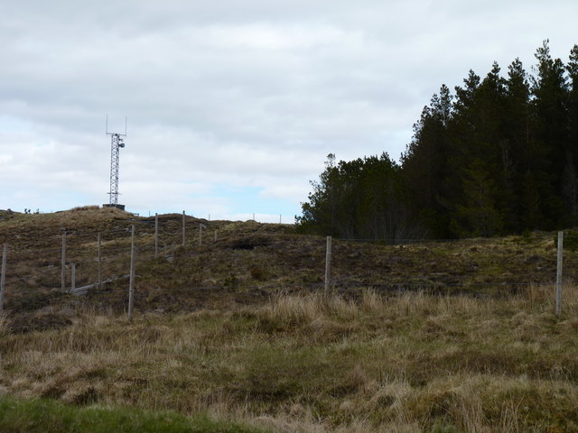
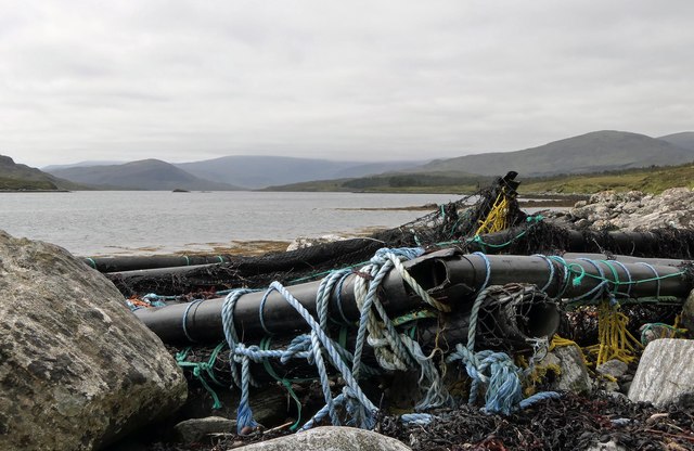
Àird an Troim Images

Images are sourced within 2km of 58.04709/-6.6886784 or Grid Reference NB2316. Thanks to Geograph Open Source API. All images are credited.

Abandoned House A house near the shore of Tòb Cheann Tarabhaigh, an ilnet of Loch Seaforth.
Abandoned House
A house near the shore of Tòb Cheann Tarabhaigh, an ilnet of Loch Seaforth.
Abandoned croft house at Airidh a Bhruaich On the shore of Tòb Cheann Tarabhaigh.
Abandoned croft house at Airidh a Bhruaich
On the shore of Tòb Cheann Tarabhaigh.
The Open Road Looking south-west along the A859 from Ceann Tarabhaigh / Kintarvie. It crosses moorland as it heads into the hills of North Harris.
The Open Road
Looking south-west along the A859 from Ceann Tarabhaigh / Kintarvie. It crosses moorland as it heads into the hills of North Harris.
Croft at Airidh a Bhruaich Almost no change over 5 years <a href="https://www.geograph.org.uk/photo/572440">NB2417 : Croft at  Airidh  a'  Bhruaich</a>
Croft at Airidh a Bhruaich
Almost no change over 5 years NB2417 : Croft at Airidh a' Bhruaich
Port Griogaspuil Always marked on OS maps right back to the very first in 1858, but very little to see other than the ruins of old quays and the low walls of three buildings. Rumoured to be the site of a mill, but not much of a stream to turn a mill wheel
Port Griogaspuil
Always marked on OS maps right back to the very first in 1858, but very little to see other than the ruins of old quays and the low walls of three buildings. Rumoured to be the site of a mill, but not much of a stream to turn a mill wheel
Croft houses at Airidh a' Bhruaich By the A859, overlooking Tob Cheann Tarabhaigh.
Croft houses at Airidh a' Bhruaich
By the A859, overlooking Tob Cheann Tarabhaigh.
Mast on a hill Telecoms mast close to woodland above Loch an Rathaid.
Mast on a hill
Telecoms mast close to woodland above Loch an Rathaid.
Old bridge on the A859
Ãird an Troim Looking over Loch an Rathaid.
Ãird an Troim
Looking over Loch an Rathaid.
House at Arivruaich / Airidh a' Bhruaich
Debris on the shore of Loch Seaforth/Loch Shiphoirt, Isle of Lewis I assume the debris has drifted from a fish farm.
Debris on the shore of Loch Seaforth/Loch Shiphoirt, Isle of Lewis
I assume the debris has drifted from a fish farm.
View across moorland from Corra Chnoc, Isle of Lewis Looking towards Cearnabhal, the top of which is in the cloud.
View across moorland from Corra Chnoc, Isle of Lewis
Looking towards Cearnabhal, the top of which is in the cloud.
Loch a' Chorra Chnoic, Isle of Lewis According to the OS Name Book of 1848-1852, Loch a' Chorra Chnoic means Steep Hill Loch.
Loch a' Chorra Chnoic, Isle of Lewis
According to the OS Name Book of 1848-1852, Loch a' Chorra Chnoic means Steep Hill Loch.
Ruined farmstead by Loch Seaforth/Loch Shiphoirt, Isle of Lewis The farmstead is marked as a ruin on the 1st Edition OS map surveyed during 1850-53.
Ruined farmstead by Loch Seaforth/Loch Shiphoirt, Isle of Lewis
The farmstead is marked as a ruin on the 1st Edition OS map surveyed during 1850-53.
Salt marsh by Loch Seaforth/Loch Shiphoirt, Isle of Lewis The Aline Community Woodland can be seen on the right and in the centre of the horizon is the unnamed hill on Eilean Shìophoirt.
Salt marsh by Loch Seaforth/Loch Shiphoirt, Isle of Lewis
The Aline Community Woodland can be seen on the right and in the centre of the horizon is the unnamed hill on Eilean Shìophoirt.
Dorus Beag, Loch Seaforth/Loch Shiphoirt, Isle of Lewis Dorus Beag is the channel between the shore and a rock called Sgeir Liath which was under water at the time the photo was taken.  Dorus Beag means Little Door.
Dorus Beag, Loch Seaforth/Loch Shiphoirt, Isle of Lewis
Dorus Beag is the channel between the shore and a rock called Sgeir Liath which was under water at the time the photo was taken. Dorus Beag means Little Door.
Shieling mound, Rubha Àirigh an t-Sruth, Loch Seaforth/Loch Shiphoirt, Isle of Lewis According to the OS Name Book of 1848-1852, Rubha Àirigh an t-Sruth means The Streams Shieling's point.
Shieling mound, Rubha Àirigh an t-Sruth, Loch Seaforth/Loch Shiphoirt, Isle of Lewis
According to the OS Name Book of 1848-1852, Rubha Àirigh an t-Sruth means The Streams Shieling's point.
Building remains by Loch Seaforth/Loch Shiphoirt, Isle of Lewis The 1st Edition OS map, surveyed in 1850-53, shows two buildings, already unroofed at that time.
Building remains by Loch Seaforth/Loch Shiphoirt, Isle of Lewis
The 1st Edition OS map, surveyed in 1850-53, shows two buildings, already unroofed at that time.
Show me another place!

Àird an Troim is located at Grid Ref: NB2316 (Lat: 58.04709, Lng: -6.6886784)

Unitary Authority: Na h-Eileanan an Iar

Police Authority: Highlands and Islands

What 3 Words

///clays.ambitions.rungs. Near Leurbost, Na h-Eileanan Siar

Related Wikis

Airidh a' Bhruaich

Airidh a' Bhruaich (Arivruaich - anglicised) is a scattered crofting township in the South Lochs district of the Isle of Lewis in the Outer Hebrides of...

Seaforth Island

Seaforth Island (Scottish Gaelic: Eilean Shìphoirt/Shìophoirt or Mulag) is an uninhabited island in the Outer Hebrides of Scotland. Unlike many other...

Eilean Mòr, Loch Langavat

Eilean Mòr is an island in Loch Langavat on the Isle of Lewis in the Outer Hebrides of Scotland. == Footnotes ==

Balallan

Balallan (Scottish Gaelic: Baile Ailein, Bail' Ailein), meaning "Allan's Town", is a crofting township on the Isle of Lewis, in the Outer Hebrides, Scotland...

Have you been to Àird an Troim?

Leave your review of Àird an Troim below (or comments, questions and feedback).