Àird Faodhail Chiorabhal

Landscape Feature in Ross-shire

Scotland

Àird Faodhail Chiorabhal

Fishing boats on Loch Fadhail Chiorabhal Looking south towards Roineaval, which is the hill on the left.
Fishing boats on Loch Fadhail Chiorabhal Credit: Richard Barrett

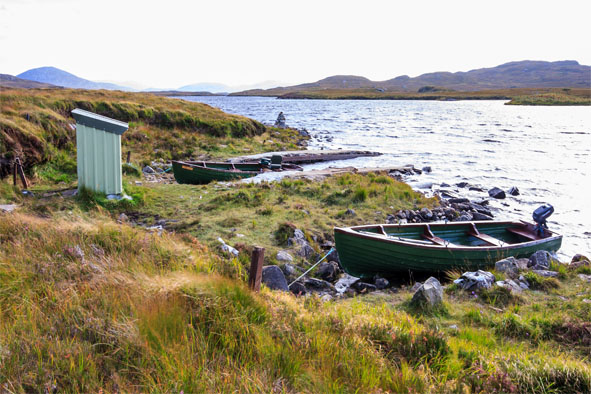
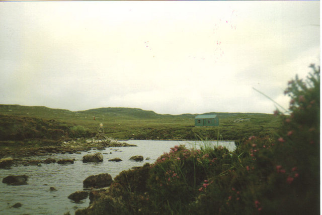
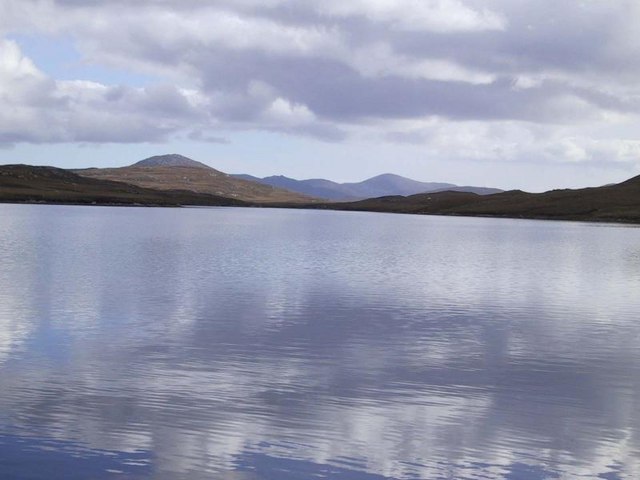
Àird Faodhail Chiorabhal is a stunning landscape feature located in Ross-shire, Scotland. Situated on the Isle of Lewis, it is a prominent headland that offers breathtaking views of the surrounding area.

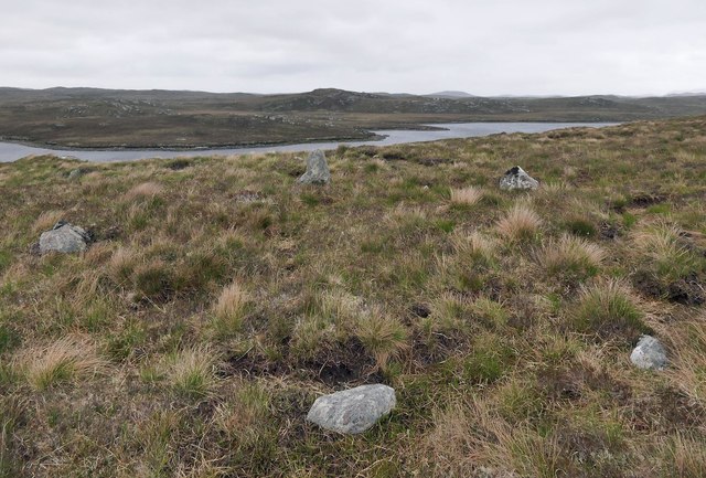
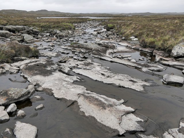
This landscape feature is characterized by its rugged cliffs and rocky terrain, which provide a dramatic backdrop against the crashing waves of the Atlantic Ocean. The headland is also home to a variety of flora and fauna, including seabirds such as gannets and puffins.

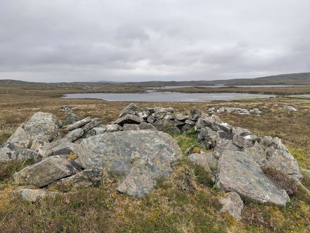
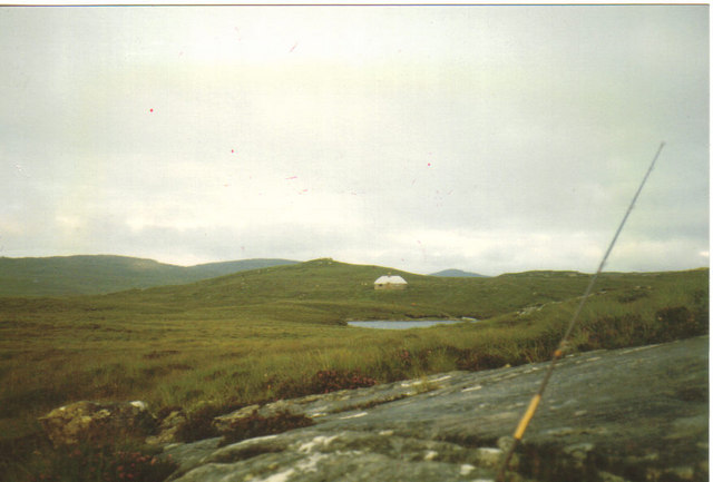
At the top of Àird Faodhail Chiorabhal, there is a small hill that offers panoramic views of the surrounding countryside. From this vantage point, visitors can see the rolling hills of Lewis, the sparkling waters of the ocean, and the distant mountains of the mainland.

The headland is a popular spot for outdoor enthusiasts, offering opportunities for hiking, birdwatching, and photography. The rocky cliffs provide a challenging terrain for climbers, while the nearby beach offers a peaceful setting for picnics and relaxation.

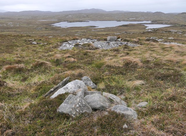
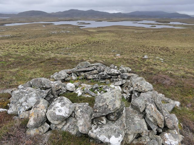
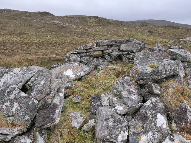
In addition to its natural beauty, Àird Faodhail Chiorabhal also has historical significance. There are ancient ruins scattered throughout the area, including the remains of a broch - an Iron Age fortified structure. These archaeological sites provide a glimpse into the rich history of the region.

Overall, Àird Faodhail Chiorabhal is a must-visit destination for nature lovers and history enthusiasts alike. Its stunning landscapes, diverse wildlife, and historical significance make it a truly unique and captivating place to explore.

If you have any feedback on the listing, please let us know in the comments section below.

Àird Faodhail Chiorabhal Images

Images are sourced within 2km of 58.126939/-6.7396542 or Grid Reference NB2125. Thanks to Geograph Open Source API. All images are credited.

Fishing boats on Loch Fadhail Chiorabhal Looking south towards Roineaval, which is the hill on the left.
Fishing boats on Loch Fadhail Chiorabhal
Looking south towards Roineaval, which is the hill on the left.
Stone setting, Druim Cam, Isle of Lewis Looking towards Loch Faoghail Charrasan, most of which lies within the grid square.

From Discovery and Excavation in Scotland, 1991: "Possible kerb cairn or hut circle.  There is a sub-circular setting of 7 stones on edge set firmly into the ground, now under 20cm to 40cm of peat. The largest stone is 0.5m high. The internal dimensions are approximately 5.5m by 4.0m.  It is located on near-level ground on a gently sloping rock and heather ridge overlooking land on the shore of the loch."
Stone setting, Druim Cam, Isle of Lewis
Looking towards Loch Faoghail Charrasan, most of which lies within the grid square. From Discovery and Excavation in Scotland, 1991: "Possible kerb cairn or hut circle. There is a sub-circular setting of 7 stones on edge set firmly into the ground, now under 20cm to 40cm of peat. The largest stone is 0.5m high. The internal dimensions are approximately 5.5m by 4.0m. It is located on near-level ground on a gently sloping rock and heather ridge overlooking land on the shore of the loch."
Cairn, Cleit na Faoghalach, Isle of Lewis Looking towards Loch an Easa Ghil.

The cairn is shown on OS maps with a scale of 1:25,000 and larger.
Cairn, Cleit na Faoghalach, Isle of Lewis
Looking towards Loch an Easa Ghil. The cairn is shown on OS maps with a scale of 1:25,000 and larger.
Shieling hut, Airigh Cnoc Corrach Cul na Beinne, Isle of Lewis Looking towards Loch nan Eilean.
Shieling hut, Airigh Cnoc Corrach Cul na Beinne, Isle of Lewis
Looking towards Loch nan Eilean.
The Abhainn an Easa Ghil, Isle of Lewis The river runs from Loch Airigh a' Bhealaich to Loch Beag an Easa Ghil, which it is seen flowing into in the distance.
The Abhainn an Easa Ghil, Isle of Lewis
The river runs from Loch Airigh a' Bhealaich to Loch Beag an Easa Ghil, which it is seen flowing into in the distance.
Shieling hut, Airigh a' Chuailein, Isle of Lewis Shielings were moorland summer grazings for cattle.  Shieling huts (often also referred to as shielings) were dwellings located within the shieling.  They were usually occupied from May until the “flitting” in September.  In early May the men of a village would go onto the moor to check and repair the shieling huts.  They would be joined by the women and children for one night before the men returned to the village to tend to crops or to travel away for summer work such as fishing.  The women and children would spend the summer at the shielings tending the cattle and making cheese and butter, some of which was for immediate use but most was salted to preserve it for the winter.  Peat cutting for fuel would also be done.  Evenings would be spent making music and story telling.  Visits were made between the shielings of different villages.

The shieling huts were made from materials available in the immediate vicinity.  They usually had walls made of stone or turf, turf roofs and compacted earth or clay floors.  In coastal areas and on the islands rafters would be made from locally collected driftwood.  Usually there would be a single doorway, facing away from the prevailing wind (although some shieling huts have two doors opposite each other), and often no windows.  Furniture built into shieling huts included stone or turf beds covered with heather, turf seats and cupboards and niches built into the stone wall, often one above the door.  Other furniture would be carried out onto the moor for the season.  In places where the practice of using shielings continued into the 20th century, shieling huts can be found which are constructed making more extensive use of timber than in the traditional type, along with other materials such as tin and bitumen.  There are also examples of buses and caravans used as shieling huts.

The Clearances and ongoing changes in agricultural methods meant that the shieling tradition had generally ended by the close of the nineteenth century.  In places it continued for longer and, particularly on Lewis, some shieling huts are still used today during the peat cutting season and as summer retreats.

The remains of shieling huts can be seen as

changes in vegetation: <a href="https://www.geograph.org.uk/photo/1962348">ND1340 : Shieling site by the Allt a' Cheracher</a> ;
shieling mounds where successive shieling huts have been built on the same site: <a href="https://www.geograph.org.uk/photo/5238987">NB5059 : Shieling mounds by the Abhainn Dhail, Isle of Lewis</a> ;
footings: <a href="https://www.geograph.org.uk/photo/5027765">NB5357 : Shieling footings beside the Feadan Mòr, Isle of Lewis</a> ; and
more substantial remains: <a href="https://www.geograph.org.uk/photo/5238993">NB3040 : Shieling above Gleann Leitir, Isle of Lewis</a> .

Examples of modern shielings are shown at:

<a href="https://www.geograph.org.uk/photo/5238999">NB5458 : Shieling, Airigh A' Bhealaich, Isle of Lewis</a> and <a href="https://www.geograph.org.uk/photo/5048077">NB5458 : Disused shieling, Airigh A' Bhealaich, Isle of Lewis</a> .
Shieling hut, Airigh a' Chuailein, Isle of Lewis
Shielings were moorland summer grazings for cattle. Shieling huts (often also referred to as shielings) were dwellings located within the shieling. They were usually occupied from May until the “flitting” in September. In early May the men of a village would go onto the moor to check and repair the shieling huts. They would be joined by the women and children for one night before the men returned to the village to tend to crops or to travel away for summer work such as fishing. The women and children would spend the summer at the shielings tending the cattle and making cheese and butter, some of which was for immediate use but most was salted to preserve it for the winter. Peat cutting for fuel would also be done. Evenings would be spent making music and story telling. Visits were made between the shielings of different villages. The shieling huts were made from materials available in the immediate vicinity. They usually had walls made of stone or turf, turf roofs and compacted earth or clay floors. In coastal areas and on the islands rafters would be made from locally collected driftwood. Usually there would be a single doorway, facing away from the prevailing wind (although some shieling huts have two doors opposite each other), and often no windows. Furniture built into shieling huts included stone or turf beds covered with heather, turf seats and cupboards and niches built into the stone wall, often one above the door. Other furniture would be carried out onto the moor for the season. In places where the practice of using shielings continued into the 20th century, shieling huts can be found which are constructed making more extensive use of timber than in the traditional type, along with other materials such as tin and bitumen. There are also examples of buses and caravans used as shieling huts. The Clearances and ongoing changes in agricultural methods meant that the shieling tradition had generally ended by the close of the nineteenth century. In places it continued for longer and, particularly on Lewis, some shieling huts are still used today during the peat cutting season and as summer retreats. The remains of shieling huts can be seen as changes in vegetation: ND1340 : Shieling site by the Allt a' Cheracher ; shieling mounds where successive shieling huts have been built on the same site: NB5059 : Shieling mounds by the Abhainn Dhail, Isle of Lewis ; footings: NB5357 : Shieling footings beside the Feadan Mòr, Isle of Lewis ; and more substantial remains: NB3040 : Shieling above Gleann Leitir, Isle of Lewis . Examples of modern shielings are shown at: NB5458 : Shieling, Airigh A' Bhealaich, Isle of Lewis and NB5458 : Disused shieling, Airigh A' Bhealaich, Isle of Lewis .
Shieling hut,  Airigh Cnoc na h-Aibhne, Isle of Lewis Looking towards Loch Beag an Easa Ghil and Loch an Easa Ghil beyond.
Shieling hut, Airigh Cnoc na h-Aibhne, Isle of Lewis
Looking towards Loch Beag an Easa Ghil and Loch an Easa Ghil beyond.
Bothy on Loch Faoghail Charrasan Uig Hills in Distance
Bothy on Loch Faoghail Charrasan
Uig Hills in Distance
Bothy and cairn at Faoghail Kirrival Faoghail is the gaelic word for Ford or crossing place.
Bothy and cairn at Faoghail Kirrival
Faoghail is the gaelic word for Ford or crossing place.
Loch Faoghail Charrasen The second loch up on the famous Grimersta salmon system. A huge number of salmon pass through this loch each year and the loch below is famous for producing 333 salmon to one rod for a week. The fishing is protected and held by Grimersta and anyone wishing to fish should ask at the lodge.
Loch Faoghail Charrasen
The second loch up on the famous Grimersta salmon system. A huge number of salmon pass through this loch each year and the loch below is famous for producing 333 salmon to one rod for a week. The fishing is protected and held by Grimersta and anyone wishing to fish should ask at the lodge.
Show me another place!

Àird Faodhail Chiorabhal is located at Grid Ref: NB2125 (Lat: 58.126939, Lng: -6.7396542)

Unitary Authority: Na h-Eileanan an Iar

Police Authority: Highlands and Islands

What 3 Words

///vessel.undulation.perused. Near Leurbost, Na h-Eileanan Siar

Related Wikis

Eilean Mòr, Loch Langavat

Eilean Mòr is an island in Loch Langavat on the Isle of Lewis in the Outer Hebrides of Scotland. == Footnotes ==

Callanish IV

The Callanish IV stone circle (Scottish Gaelic: Ceann Hulavig) is one of many megalithic structures around the better-known (and larger) Calanais I on...

Garynahine

Garynahine (Scottish Gaelic: Gearraidh na h-aibhne) is a settlement on Lewis, in the Outer Hebrides, Scotland. Garynahine is situated at a T-junction where...

Garynahine Estate

Garynahine Estate (Scottish Gaelic: Gearraidh na h-aibhne) in Garynahine, a village on the Isle of Lewis, Outer Hebrides was owned by Sir James Matheson...

Callanish II

The Callanish II stone circle (Scottish Gaelic: Cnoc Ceann a' Gharaidh) is one of many megalithic structures around the better-known (and larger) Calanais...

Callanish III

The Callanish III stone circle (Scottish Gaelic: Cnoc Fillibhir Bheag) is one of many megalithic structures around the better-known (and larger) Calanais...

Callanish Stones

The Callanish Stones (or "Callanish I": Scottish Gaelic: Clachan Chalanais or Tursachan Chalanais) are an arrangement of standing stones placed in a cruciform...

Gisla Hydro-Electric Scheme

Gisla Hydro-Electric Scheme was a small scheme promoted by the North of Scotland Hydro-Electric Board on the Isle of Lewis, Outer Hebrides, Scotland. It...

Have you been to Àird Faodhail Chiorabhal?

Leave your review of Àird Faodhail Chiorabhal below (or comments, questions and feedback).