Sròn Ardhasaig

Landscape Feature in Inverness-shire

Scotland

Sròn Ardhasaig

Long abandoned whaling station at Bunavoneader Viewed from across the water, with the bulk of Mònan rising beyond.

Whaling Station, 1904 Gaunt remains of a long-defunct industry, with a lone, tapering red brick chimney rising from the foundations of the boiling house/desiccator. Little else but the carcass ramp survives. Founded by Norwegian Karl Herlofsen, the factory was acquired by Lever Bros in 1922 when the market was declining, but was abandoned by them in 1929, a financial failure. Leverhulme never pursued his bizarre notion of turning whale meat into tinned sausages for Africans. The whaling station finally closed in 1951.

Taken from "Western Seaboard: An Illustrated Architectural Guide", by Mary Miers, 2008. Published by the Rutland Press.
Long abandoned whaling station at Bunavoneader Credit: Richard Dorrell

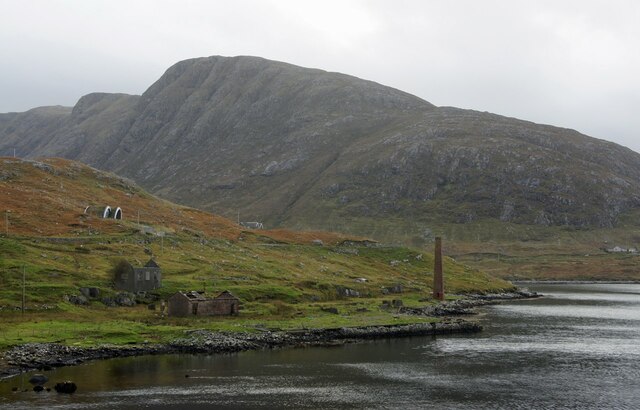
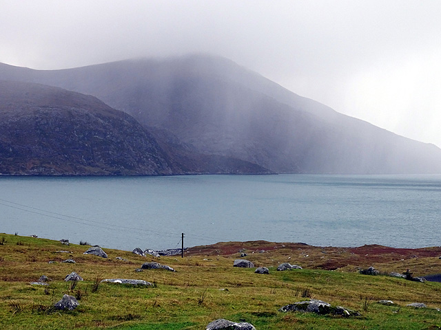
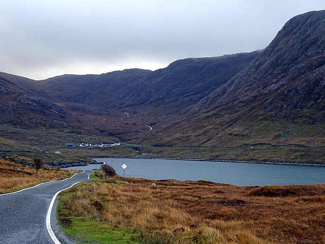
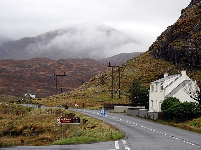
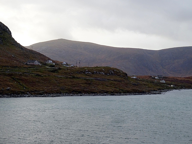
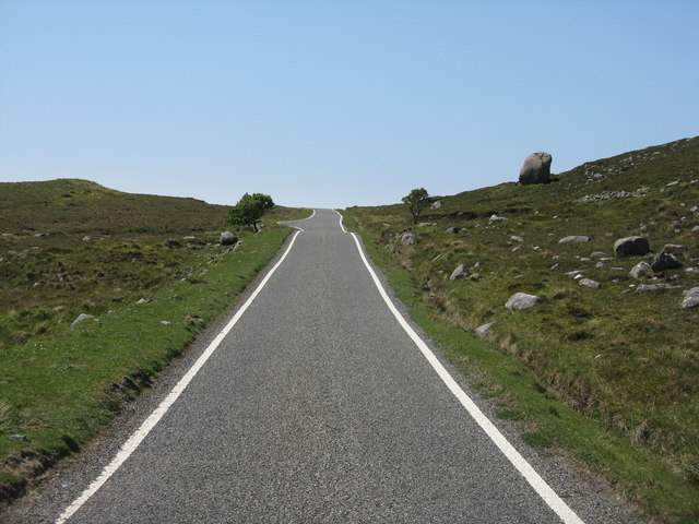
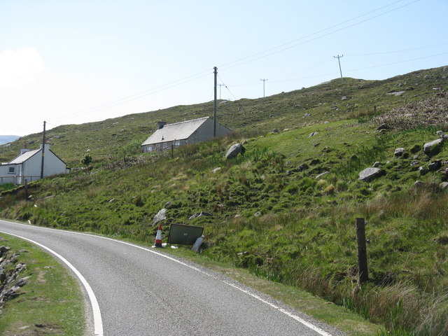
Sròn Ardhasaig is a prominent landscape feature located in Inverness-shire, Scotland. It is a distinctive hill that rises to an elevation of approximately 300 meters above sea level. The hill is situated in a rural area, surrounded by rolling hills and picturesque countryside.

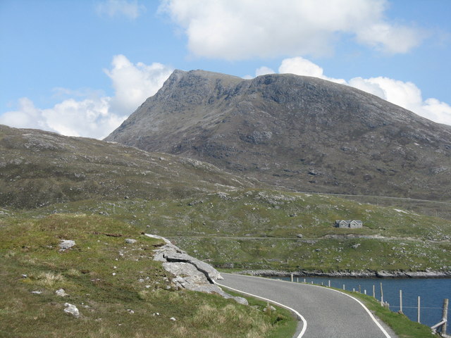
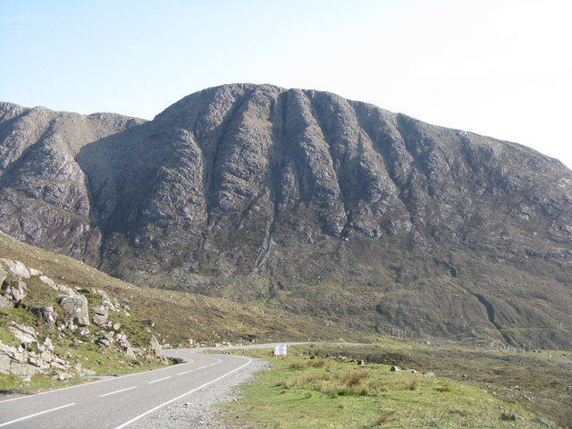
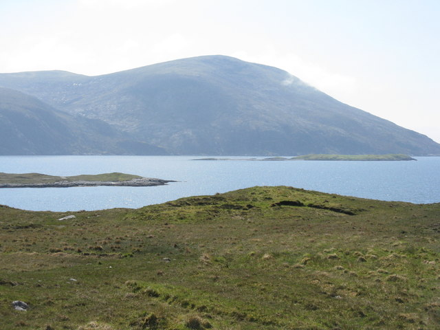
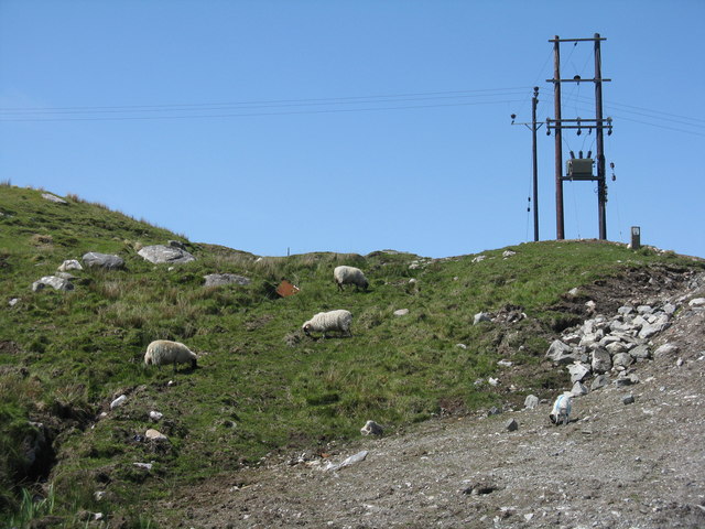
The terrain of Sròn Ardhasaig is characterized by its steep slopes and rocky outcrops. Its summit offers breathtaking panoramic views of the surrounding landscape, including the nearby lochs and mountains. The hill is covered in a variety of vegetation, including heather, grasses, and scattered trees.

The geological composition of Sròn Ardhasaig consists mainly of metamorphic rocks, such as gneiss and schist, which have been shaped by millions of years of geological processes. These rocks give the hill its rugged and distinctive appearance.

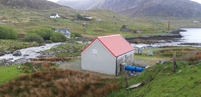
The hill is also known for its rich biodiversity. It is home to a variety of plant and animal species, including red deer, mountain hares, and various bird species. The hill provides a habitat for these species, as well as offering opportunities for recreational activities such as hiking and birdwatching.

The local community has recognized the importance of preserving the natural beauty and ecological significance of Sròn Ardhasaig. Efforts have been made to protect the hill and its surrounding environment from development and other forms of disruption. As a result, Sròn Ardhasaig remains a pristine landscape feature that attracts visitors from near and far who are seeking to experience the beauty and tranquility of the Scottish Highlands.

If you have any feedback on the listing, please let us know in the comments section below.

Sròn Ardhasaig Images

Images are sourced within 2km of 57.923053/-6.8400776 or Grid Reference NB1302. Thanks to Geograph Open Source API. All images are credited.

Long abandoned whaling station at Bunavoneader Viewed from across the water, with the bulk of Mònan rising beyond.

Whaling Station, 1904 Gaunt remains of a long-defunct industry, with a lone, tapering red brick chimney rising from the foundations of the boiling house/desiccator. Little else but the carcass ramp survives. Founded by Norwegian Karl Herlofsen, the factory was acquired by Lever Bros in 1922 when the market was declining, but was abandoned by them in 1929, a financial failure. Leverhulme never pursued his bizarre notion of turning whale meat into tinned sausages for Africans. The whaling station finally closed in 1951.

Taken from "Western Seaboard: An Illustrated Architectural Guide", by Mary Miers, 2008. Published by the Rutland Press.
Long abandoned whaling station at Bunavoneader
Viewed from across the water, with the bulk of Mònan rising beyond. Whaling Station, 1904 Gaunt remains of a long-defunct industry, with a lone, tapering red brick chimney rising from the foundations of the boiling house/desiccator. Little else but the carcass ramp survives. Founded by Norwegian Karl Herlofsen, the factory was acquired by Lever Bros in 1922 when the market was declining, but was abandoned by them in 1929, a financial failure. Leverhulme never pursued his bizarre notion of turning whale meat into tinned sausages for Africans. The whaling station finally closed in 1951. Taken from "Western Seaboard: An Illustrated Architectural Guide", by Mary Miers, 2008. Published by the Rutland Press.
Hydro-electric Power Station at Bun Abhainn Eadarra The nearby whaling station is visible in the background.
Hydro-electric Power Station at Bun Abhainn Eadarra
The nearby whaling station is visible in the background.
Abhainn Eadarra after heavy rain
Ceann an Ora A row of modern houses dwarfed by Sròn a' Sgaoth rising above.
Ceann an Ora
A row of modern houses dwarfed by Sròn a' Sgaoth rising above.
By Ãird Asaig Looking towards Beinn Dhubh which is swathed in a rainstorm.
By Ãird Asaig
Looking towards Beinn Dhubh which is swathed in a rainstorm.
Skirting Ãird Bun Abhainn Eadarra Beside Loch Bun Abhainn Eadarra.
Skirting Ãird Bun Abhainn Eadarra
Beside Loch Bun Abhainn Eadarra.
Road junction at Ãird Asaig/Ardhasaig The appropriately named 'Roadside Cottage' on the right, with Mulla bho Dheas partially obscured by cloud.
Road junction at Ãird Asaig/Ardhasaig
The appropriately named 'Roadside Cottage' on the right, with Mulla bho Dheas partially obscured by cloud.
A view towards Ãird Asaig/Ardhasaig Looking across Loch Bun Abhainn Eadarra.
A view towards Ãird Asaig/Ardhasaig
Looking across Loch Bun Abhainn Eadarra.
Glacial erratic by the B887 The road to Hushinish from Tarbert.
Glacial erratic by the B887
The road to Hushinish from Tarbert.
Looking east from Ãird Bun Abhainn Eadarra With Sgaoth Iosal beyond and Loch Bun Abhainn Eadarra below to the right.
Looking east from Ãird Bun Abhainn Eadarra
With Sgaoth Iosal beyond and Loch Bun Abhainn Eadarra below to the right.
The A859 on Harris Looking north to the bridges [old and new] over Abhainn Ceann an Ora and, on the left, the entrance to a quarry.
The A859 on Harris
Looking north to the bridges [old and new] over Abhainn Ceann an Ora and, on the left, the entrance to a quarry.
The cliffs of Geodhan Dubh The northern aspect of Gillaval Dubh, seen from the A859 looking south.
The cliffs of Geodhan Dubh
The northern aspect of Gillaval Dubh, seen from the A859 looking south.
Loch Bun Abhainn Eadarra Looking southwest from above Gob an Sgurr to Beinn Dubh.
Loch Bun Abhainn Eadarra
Looking southwest from above Gob an Sgurr to Beinn Dubh.
Rough grazing at Bun Abhainn Eadarra With electricity transmission poles; these seem to be replacements for those seen in Google Earth imagery of 2009.
Rough grazing at Bun Abhainn Eadarra
With electricity transmission poles; these seem to be replacements for those seen in Google Earth imagery of 2009.
Houses at Bun Abhainn Eadarra On a rough hillside. The road is the B887, ending at Huisinis.
Houses at Bun Abhainn Eadarra
On a rough hillside. The road is the B887, ending at Huisinis.
Remains of whaling station at Bun Abhainn Eadarra Apart from the chimney, not much now remains of the whaling station on Loch Bun Abhainn Eadarra, near Ardhasaig.
Remains of whaling station at Bun Abhainn Eadarra
Apart from the chimney, not much now remains of the whaling station on Loch Bun Abhainn Eadarra, near Ardhasaig.
Old whaling station remains At Bun Abhainn Eadarra; little remains apart from the chimney <a href="https://www.geograph.org.uk/photo/5007689">NB1303 : Remains of whaling station at Bun Abhainn Eadarra</a> and concrete bases of buildings.
Old whaling station remains
At Bun Abhainn Eadarra; little remains apart from the chimney NB1303 : Remains of whaling station at Bun Abhainn Eadarra and concrete bases of buildings.
The B887 at Loch Bun Abhainn Eadarra Looking north, to the road end at Huisinis, about 20km further on. The hill is possibly Uisgneabhal Mòr, west of the main North Harris summit of An Cliseam.
The B887 at Loch Bun Abhainn Eadarra
Looking north, to the road end at Huisinis, about 20km further on. The hill is possibly Uisgneabhal Mòr, west of the main North Harris summit of An Cliseam.
Show me another place!

Sròn Ardhasaig is located at Grid Ref: NB1302 (Lat: 57.923053, Lng: -6.8400776)

Unitary Authority: Na h-Eileanan an Iar

Police Authority: Highlands and Islands

What 3 Words

///valid.hello.vandalism. Near Tarbert, Na h-Eileanan Siar

Nearby Locations

Sròn Ardhasaig

Related Wikis

Ardhasaig

Ardhasaig (Scottish Gaelic: Àird Àsaig) is a settlement on the western coast of north Harris, in the Outer Hebrides, Scotland. Ardhasaig is also within...

Bun Abhainn Eadarra

Bun Abhainn Eadarra or Bunavoneadar is a hamlet adjacent to the Loch Bun Abhainn Eadarra, on the south shore of North Harris, in the Outer Hebrides, Scotland...

Harris, Outer Hebrides

Harris (Scottish Gaelic: Na Hearadh, pronounced [nə ˈhɛɾəɣ] ) is the southern and more mountainous part of Lewis and Harris, the largest island in the...

Tarbert, Harris

Tarbert (Scottish Gaelic: An Tairbeart [ən̪ˠ ˈt̪ɛrʲɛbərˠʃt̪]) is the main community on Harris in the Western Isles of Scotland. The name means "isthmus...

Nearby Amenities

Located within 500m of 57.923053,-6.8400776
Barrier: cattle_grid
Source: survey
Lat/Long: 57.9234519/-6.8470241
Fuel
Ardhasaig Filling Station
Opening Hours: Mo-Fr 08:00-18:00, 20:00-21:00, 09:00-18:00; Sa 09:00-21:00
Operator: Gleaner
Source: survey
Lat/Long: 57.9218635/-6.8480727
Ardhasaig
Naptan AtcoCode: 6010731509
Naptan Bearing: SW
Naptan BusStopType: CUS
Naptan CommonName: Ardhasaig
Naptan Indicator: Shop
Naptan Landmark: shop/filling station
Naptan NaptanCode: 94723685
Naptan Street: Shop
Naptan Verified: no
Source: naptan_import
Lat/Long: 57.9215251/-6.8480181
Power: pole
Lat/Long: 57.9269334/-6.8371932
Power: pole
Lat/Long: 57.9228455/-6.8467035
Power: pole
Lat/Long: 57.9268638/-6.8384213
Power: pole
Lat/Long: 57.9268065/-6.8394289
Power: pole
Lat/Long: 57.9265648/-6.8406283
Power: pole
Lat/Long: 57.9261919/-6.8423042
Power: pole
Lat/Long: 57.9259161/-6.8435228
Power: pole
Lat/Long: 57.9256223/-6.8448463
Power: pole
Lat/Long: 57.9249228/-6.8456829
Power: pole
Lat/Long: 57.9243335/-6.8463745
Power: pole
Lat/Long: 57.9236809/-6.8464965
Power: pole
Lat/Long: 57.9222032/-6.8468745
Power: pole
Lat/Long: 57.9214571/-6.8470588
Power: pole
Lat/Long: 57.920806/-6.8472161
Barrier: cattle_grid
Source: OS_OpenData_StreetView
Lat/Long: 57.9225103/-6.8480153
Bus Stop
Bench: no
Shelter: yes
Lat/Long: 57.9243024/-6.8470656
Barrier: cattle_grid
Lat/Long: 57.9245762/-6.8467063
Barrier: cattle_grid
Lat/Long: 57.9252803/-6.8459634
Material: wood
Power: pole
Lat/Long: 57.9273057/-6.8405284
Material: wood
Power: pole
Lat/Long: 57.9271575/-6.8415718
Material: wood
Power: pole
Lat/Long: 57.9270336/-6.8423765
Material: wood
Power: pole
Lat/Long: 57.9267502/-6.8433984
Material: wood
Power: pole
Lat/Long: 57.9264668/-6.8443854
Material: wood
Power: pole
Lat/Long: 57.9259896/-6.8453081
Material: wood
Power: pole
Lat/Long: 57.9255168/-6.8462335
Material: wood
Power: pole
Lat/Long: 57.9251906/-6.8468504
Material: wood
Power: pole
Lat/Long: 57.924608/-6.8474056
Material: wood
Power: pole
Lat/Long: 57.9241145/-6.8473131
Material: wood
Power: pole
Lat/Long: 57.9241266/-6.8478509
Material: wood
Power: pole
Lat/Long: 57.924138/-6.8482103
The data included in this document is from www.openstreetmap.org. The data is made available under ODbL.

Have you been to Sròn Ardhasaig?

Leave your review of Sròn Ardhasaig below (or comments, questions and feedback).