Àird Bhearraraigh

Landscape Feature in Inverness-shire

Scotland

Àird Bhearraraigh

Loch Uiseadair Remote lochs in the wilds of north Harris.
Loch Uiseadair Credit: Andrew Spenceley

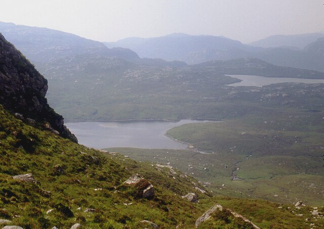
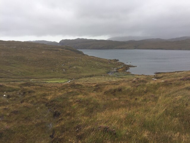
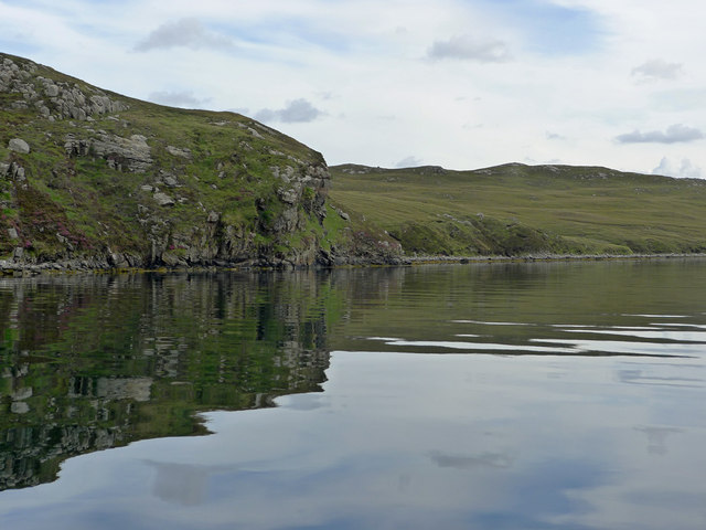
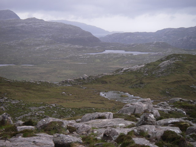
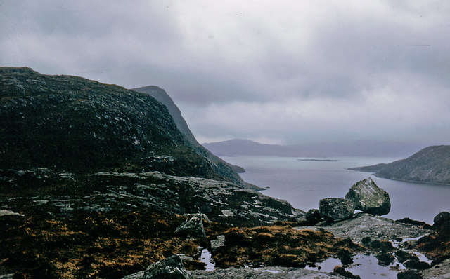
Àird Bhearraraigh, also known as Bearreraig Point, is a prominent landscape feature located in Inverness-shire, Scotland. Situated on the western coast of the Isle of Skye, it is a point of land that juts out into the waters of Loch Bracadale.

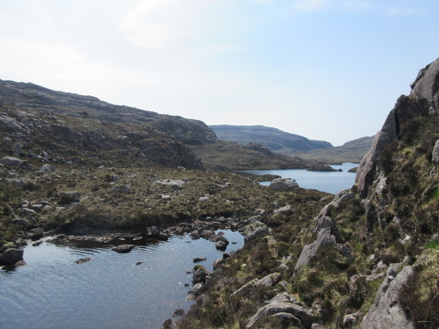
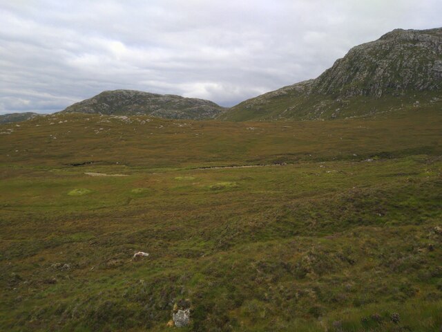
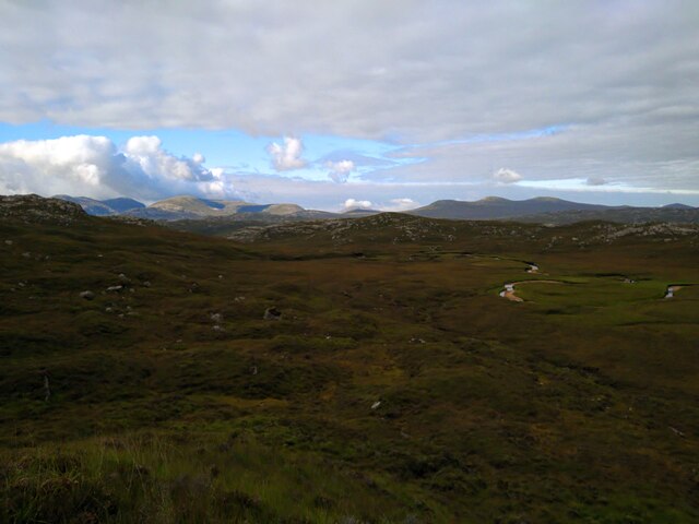
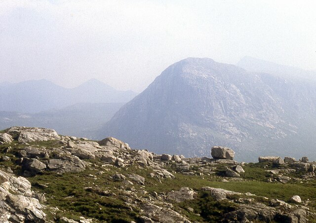
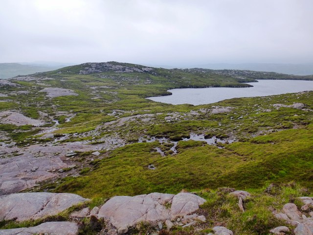
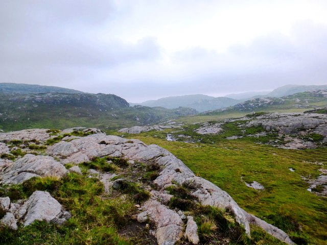
The geographical setting of Àird Bhearraraigh is characterized by its rugged and dramatic scenery. The point is surrounded by steep cliffs, which provide stunning panoramic views of the surrounding landscape. The rocky coastline is interspersed with small beaches and coves, adding to the natural beauty of the area.

The vegetation on Àird Bhearraraigh is predominantly comprised of heather, grasses, and scattered shrubs, which provide a habitat for a variety of bird species. Seabirds such as gannets and puffins can often be seen nesting on the cliffs, while eagles and buzzards soar overhead. The surrounding waters of Loch Bracadale are rich in marine life, making it a popular spot for fishing and wildlife enthusiasts.

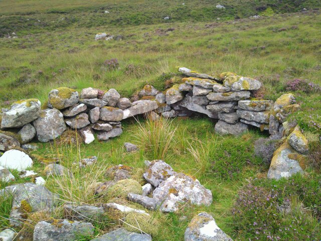
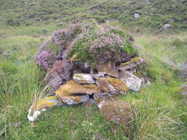
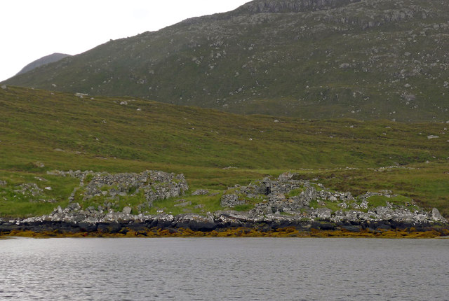
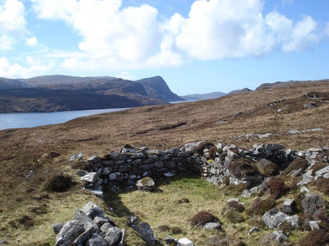
Historically, Àird Bhearraraigh has played a significant role in the local community. It was once home to a small settlement of crofters, who relied on the land and sea for their livelihoods. Today, the area is mainly used for recreational purposes, with visitors drawn to its natural beauty and tranquility.

In summary, Àird Bhearraraigh is a captivating landscape feature in Inverness-shire, boasting stunning cliff formations, diverse vegetation, and a rich history. Its picturesque setting makes it a must-visit destination for those seeking to immerse themselves in the beauty of the Scottish Highlands.

If you have any feedback on the listing, please let us know in the comments section below.

Àird Bhearraraigh Images

Images are sourced within 2km of 58.039438/-6.9816698 or Grid Reference NB0616. Thanks to Geograph Open Source API. All images are credited.

Loch Uiseadair Remote lochs in the wilds of north Harris.
Loch Uiseadair
Remote lochs in the wilds of north Harris.
Overview of Ruined Beehive Dwellings in Gleann Bhearraraigh Looking down on ruined beehive dwellings in Gleann Bhearraraigh, coming from Loch Uiseader.
Overview of Ruined Beehive Dwellings in Gleann Bhearraraigh
Looking down on ruined beehive dwellings in Gleann Bhearraraigh, coming from Loch Uiseader.
Ruined Beehive Dwelling in Gleann Bhearraraigh Ruined beehive dwelling, one of the best preserved in the area. Part of a group of eight or so (most others are heavily overgrown).
Ruined Beehive Dwelling in Gleann Bhearraraigh
Ruined beehive dwelling, one of the best preserved in the area. Part of a group of eight or so (most others are heavily overgrown).
Gleann Bhearraraigh Beehive Cell The most complete beehive cell in Gleann Bhearraraigh. Roof is partially collapsed and it is heavily overgrown.
Gleann Bhearraraigh Beehive Cell
The most complete beehive cell in Gleann Bhearraraigh. Roof is partially collapsed and it is heavily overgrown.
Looking North Over Gleann Bhearraraigh View North over Gleann Bhearraraigh to the Uig hills beyond.
Looking North Over Gleann Bhearraraigh
View North over Gleann Bhearraraigh to the Uig hills beyond.
Loch Brunabhal and Loch na Gillean
On Feadan Dìrigil Sròn Uladail beyond.
On Feadan Dìrigil
Sròn Uladail beyond.
Old Shielings at Dirascal Abandoned shielings at Dirascal between Cravadale and Loch Reasort (water in background).
Old Shielings at Dirascal
Abandoned shielings at Dirascal between Cravadale and Loch Reasort (water in background).
Creag an Fhithich The coastline of Loch Resort becomes less rugged on its northern side as you venture further up the loch, and beyond this point evidence appears sporadically of shielings, lazybeds and once used buildings.
Creag an Fhithich
The coastline of Loch Resort becomes less rugged on its northern side as you venture further up the loch, and beyond this point evidence appears sporadically of shielings, lazybeds and once used buildings.
The derelict houses at Dirascal This would have been a very harsh environment to make a living.
The derelict houses at Dirascal
This would have been a very harsh environment to make a living.
Abhainn Bhearraraigh Meanders in the middle stretch of a river on Harris that flows north into Loch Reasort.
Abhainn Bhearraraigh
Meanders in the middle stretch of a river on Harris that flows north into Loch Reasort.
Abhainn Bhearraraigh View upstream into Gleann Bhearraraigh.
Abhainn Bhearraraigh
View upstream into Gleann Bhearraraigh.
Loch na Gillean Western corner of Loch na Gillean on Harris.
Loch na Gillean
Western corner of Loch na Gillean on Harris.
Across the lower valley of the Abhainn Bhearraraigh This rocky valley contains the Abhainn Bhearraraigh that flows north into Loch Reasort between the photographer and the crags in the middle ground.
Across the lower valley of the Abhainn Bhearraraigh
This rocky valley contains the Abhainn Bhearraraigh that flows north into Loch Reasort between the photographer and the crags in the middle ground.
Boulder on North Shore of Loch Reasort Reached this point after a 13 mile cycle/walk from Uig. While sitting here the bay was circled by a golden eagle.
Boulder on North Shore of Loch Reasort
Reached this point after a 13 mile cycle/walk from Uig. While sitting here the bay was circled by a golden eagle.
Mullach an Ron View towards Scarp from Mullach an Ron.
Mullach an Ron
View towards Scarp from Mullach an Ron.
South side of Loch Resort Very rough terrain.  We had hoped to walk to Taran Mor, the symmetrical hill in the distance, but gave up at Taran Beag.  We had started from Kinlochresort.
South side of Loch Resort
Very rough terrain. We had hoped to walk to Taran Mor, the symmetrical hill in the distance, but gave up at Taran Beag. We had started from Kinlochresort.
Shielings above Loch Resort A view of the shielings shown on the map at this location
Shielings above Loch Resort
A view of the shielings shown on the map at this location
Show me another place!

Àird Bhearraraigh is located at Grid Ref: NB0616 (Lat: 58.039438, Lng: -6.9816698)

Unitary Authority: Na h-Eileanan an Iar

Police Authority: Highlands and Islands

What 3 Words

///denser.stiffly.bridges. Near Tarbert, Na h-Eileanan Siar

Related Wikis

Uladail

Uladail is a location near Amhuinnsuidhe, on Harris in the Outer Hebrides, Scotland. Sron Ulladail is a sheer cliff which at 370 metres (1,210 ft) is one...

Tiorga Mor

Tiorga Mor (679 m) is a mountain in Harris, in the Outer Hebrides of Scotland. The most westerly peak of the high mountains of Harris, it is a very rugged...

Oireabhal

Oireabhal (662 m) is a mountain in Harris, in the Outer Hebrides of Scotland. The peak is the highest point on a complex ridge that runs from north to...

Chliostair Hydro-Electric Scheme

Chliostair Hydro-Electric Scheme is a small scheme promoted by the North of Scotland Hydro-Electric Board on Harris, Outer Hebrides. It consists of a single...

Nearby Amenities

Located within 500m of 58.039438,-6.9816698
Created By: dmgroom_coastlines
Lat/Long: 58.04227/-6.98798
Created By: dmgroom_coastlines
Lat/Long: 58.0425/-6.98652
Created By: dmgroom_coastlines
Lat/Long: 58.0425/-6.98604
Created By: dmgroom_coastlines
Lat/Long: 58.04235/-6.9846
The data included in this document is from www.openstreetmap.org. The data is made available under ODbL.

Have you been to Àird Bhearraraigh?

Leave your review of Àird Bhearraraigh below (or comments, questions and feedback).