Àird na Cliobhadh
Landscape Feature in Inverness-shire
Scotland
Àird na Cliobhadh

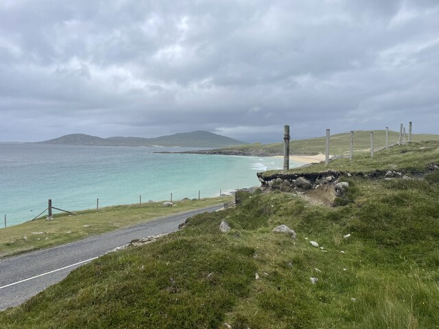
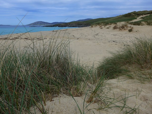
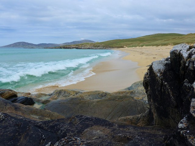
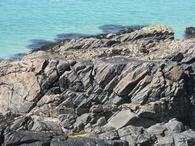
Àird na Cliobhadh is a prominent landscape feature located in Inverness-shire, Scotland. It is a coastal headland that stretches out into the North Sea, offering breathtaking views and a diverse range of natural beauty.
The headland is characterized by its rugged cliffs, which rise dramatically from the sea, creating an impressive sight. These cliffs are composed of various rock formations, including sandstone and granite, which add to the uniqueness and visual appeal of the area.
Vegetation covers much of Àird na Cliobhadh, with grasses, heather, and wildflowers dotting the landscape. This creates a vibrant and colorful scenery, particularly during the summer months when the flowers are in full bloom.
The headland is also home to a rich and diverse wildlife population. Seabirds, such as puffins, gannets, and kittiwakes, can be seen nesting along the cliffs, while seals and dolphins can often be spotted swimming in the surrounding waters. The area is also known for its diverse marine life, with a variety of fish and shellfish species thriving in the nutrient-rich waters.
Visitors to Àird na Cliobhadh can enjoy various outdoor activities, including hiking along the coastal paths, birdwatching, and photography. The headland offers stunning panoramic views, especially during sunrise and sunset, making it a popular spot for nature enthusiasts and photographers alike.
Overall, Àird na Cliobhadh is a captivating landscape feature in Inverness-shire, renowned for its dramatic cliffs, diverse wildlife, and stunning natural beauty.
If you have any feedback on the listing, please let us know in the comments section below.
Àird na Cliobhadh Images
Images are sourced within 2km of 57.85499/-6.9620973 or Grid Reference NG0595. Thanks to Geograph Open Source API. All images are credited.


Àird na Cliobhadh is located at Grid Ref: NG0595 (Lat: 57.85499, Lng: -6.9620973)
Unitary Authority: Na h-Eileanan an Iar
Police Authority: Highlands and Islands
What 3 Words
///ready.tinned.huddling. Near Leverburgh, Na h-Eileanan Siar
Nearby Locations
Related Wikis

Borve, Harris
Borve (Scottish Gaelic: Na Buirgh) is a village in Harris in the Outer Hebrides, Scotland. Borve is also within the parish of Harris, and is on the A859...

Luskentyre
Luskentyre (Scottish Gaelic: Losgaintir) is a sparse settlement on the west coast of Harris, in the Outer Hebrides, Scotland. Luskentyre is situated within...

Taransay
Taransay (Scottish Gaelic: Tarasaigh, pronounced [ˈt̪ʰaɾas̪aj]) is an island in the Outer Hebrides of Scotland. It was the host of the British television...

1990 Scotland RAF Shackleton crash
On 30 April 1990, a Royal Air Force Avro Shackleton AEW Mk II aircraft, of No. 8 Squadron RAF, based at RAF Lossiemouth, crashed into a hill on the Isle...
West Loch Tarbert
West Loch Tarbert (Scottish Gaelic: Loch A Siar) is a sea loch that separates the northern and southern parts of Harris in the Outer Hebrides of Scotland...

Soay Mòr
Soay Mòr (Scottish Gaelic: Sòdhaigh Mòr) is an island in West Loch Tarbert, between the northern and southern parts of Harris. The uninhabited island is...

Stockinish Island
Stockinish Island (Scottish Gaelic: Eilean Stocainis) is an uninhabited island off Harris, in the Outer Hebrides. == Geography and geology == Stockinish...

Roineabhal
Roineabhal is a hill in Harris, in the Western Isles of Scotland. The granite on the summit plateau of the mountain is anorthosite, and is similar in composition...
Have you been to Àird na Cliobhadh?
Leave your review of Àird na Cliobhadh below (or comments, questions and feedback).