Àird Chirenis

Landscape Feature in Argyllshire

Scotland

Àird Chirenis

Tiree - Old chapel near Gott This four-square chapel just inland from Gott Bay is, I think redundant - it would make a fine house. More information about it here: <a href="https://www.geograph.org.uk/photo/562266">NM0446 : Kirkapol Church of Scotland / Eaglais Chirceapoil</a> (Geograph photo by "Tiger")
The building a little further away is Gottvay at NM04014667
This area has a number of former ecclesiastical buildings, notably <a href="https://www.geograph.org.uk/photo/6899890">NM0447 : Tiree - Kirkapol church and chapel ruins</a>
The little building atop the hill in the distance on the left is, I believe, part of the old "Camp (disused)" at NM03244567
Tiree - Old chapel near Gott Credit: Rob Farrow

Àird Chirenis is a picturesque landscape feature located in Argyllshire, Scotland. Situated on the western coast of Scotland, this stunning coastal headland offers breathtaking views of the surrounding area.

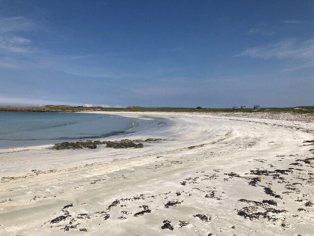
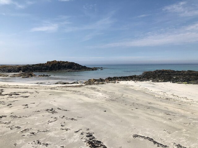
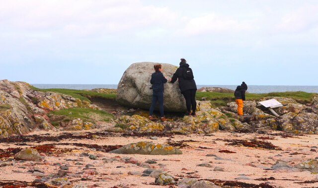
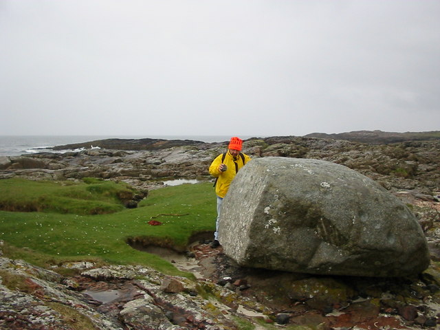
The headland itself is composed of rocky cliffs, which provide a dramatic backdrop to the wild and rugged coastline. The cliffs extend out into the sea, creating a natural barrier against the waves, and offering a sense of protection to the land behind.

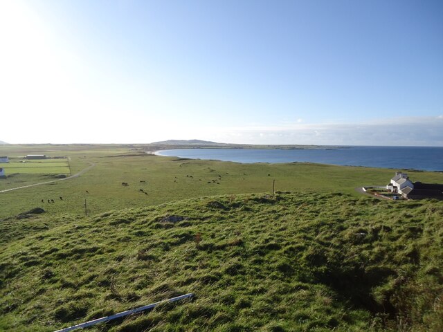
The high vantage point of Àird Chirenis allows visitors to enjoy panoramic views of the sea, with its deep blue waters stretching out to the horizon. On clear days, the nearby islands of Mull and Jura can be seen in the distance, adding to the enchanting beauty of the area.

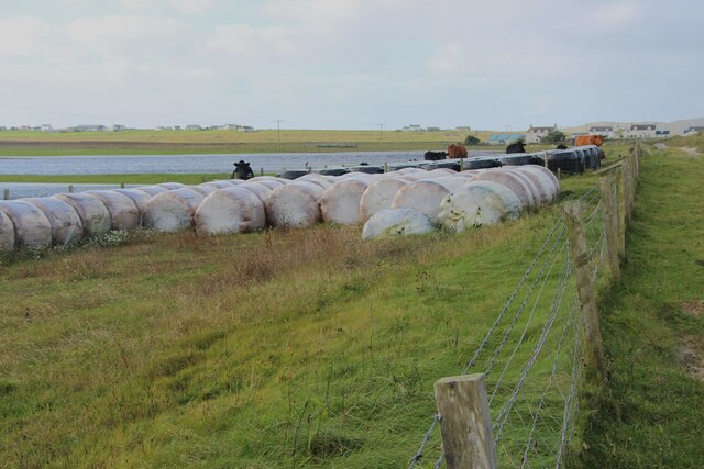
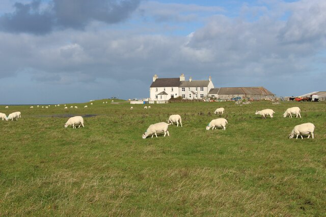
The landscape surrounding Àird Chirenis is rich in biodiversity, with a variety of flora and fauna inhabiting the area. The cliffs are home to nesting seabirds, such as gulls and puffins, which can be observed from a safe distance. The surrounding meadows and fields are also teeming with wildflowers and grazing sheep, adding to the natural charm of the location.

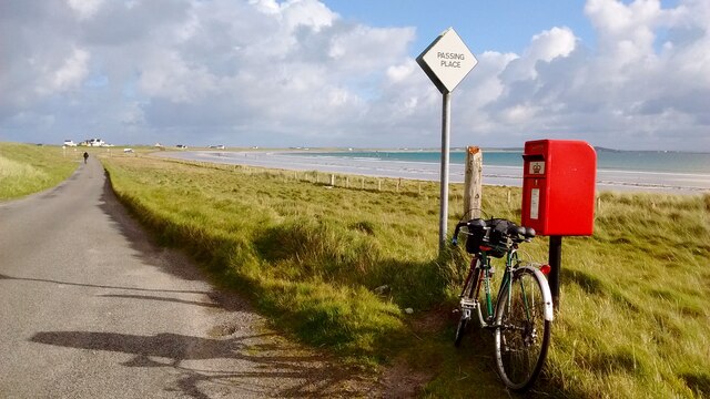
Visitors to Àird Chirenis can explore the area by foot, following the well-marked coastal paths that wind along the cliffs. The sound of crashing waves and the fresh sea breeze create a serene and tranquil atmosphere, making it an ideal spot for nature lovers and those seeking a peaceful escape.

In summary, Àird Chirenis in Argyllshire offers a stunning coastal landscape with its rocky cliffs, panoramic views, and diverse wildlife. It is a haven for nature enthusiasts and provides a peaceful retreat for visitors to enjoy the beauty of Scotland's western coast.

If you have any feedback on the listing, please let us know in the comments section below.

Àird Chirenis Images

Images are sourced within 2km of 56.524489/-6.8429174 or Grid Reference NM0247. Thanks to Geograph Open Source API. All images are credited.

Tiree - Old chapel near Gott This four-square chapel just inland from Gott Bay is, I think redundant - it would make a fine house. More information about it here: <a href="https://www.geograph.org.uk/photo/562266">NM0446 : Kirkapol Church of Scotland / Eaglais Chirceapoil</a> (Geograph photo by "Tiger")
The building a little further away is Gottvay at NM04014667
This area has a number of former ecclesiastical buildings, notably <a href="https://www.geograph.org.uk/photo/6899890">NM0447 : Tiree - Kirkapol church and chapel ruins</a>
The little building atop the hill in the distance on the left is, I believe, part of the old "Camp (disused)" at NM03244567
Tiree - Old chapel near Gott
This four-square chapel just inland from Gott Bay is, I think redundant - it would make a fine house. More information about it here: NM0446 : Kirkapol Church of Scotland / Eaglais Chirceapoil (Geograph photo by "Tiger") The building a little further away is Gottvay at NM04014667 This area has a number of former ecclesiastical buildings, notably NM0447 : Tiree - Kirkapol church and chapel ruins The little building atop the hill in the distance on the left is, I believe, part of the old "Camp (disused)" at NM03244567
Post Box at Gott Bay Another bike propped up by the modern post box
Post Box at Gott Bay
Another bike propped up by the modern post box
Tràigh Bheag East side of Balephetrish Bay, Tiree
Tràigh Bheag
East side of Balephetrish Bay, Tiree
Tràigh Bheag
Tràigh Bheag
From the summit of Balephetrish Hill, Tiree Central and eastern Tiree is very flat, and this hill, though only 36m high, gives an extensive view. In the distance, about 6km away, is Beinn Hough, which at only 119m is the second highest hill on Tiree.
From the summit of Balephetrish Hill, Tiree
Central and eastern Tiree is very flat, and this hill, though only 36m high, gives an extensive view. In the distance, about 6km away, is Beinn Hough, which at only 119m is the second highest hill on Tiree.
Tràigh Bheag, Balephetrish
Port Bàn, Balephetrish
Port Bàn, Balephetrish Got a telling off from the local oystercatchers, there was a lot of activity here, the isolated rock on the left in particular seemed to be a nesting site for several species. Retreat made.
Port Bàn, Balephetrish
Got a telling off from the local oystercatchers, there was a lot of activity here, the isolated rock on the left in particular seemed to be a nesting site for several species. Retreat made.
Crops harvested and baled at Balephetrish
Balephetrish, a farm on north Tiree
Rough grazing and moor at Aird Chirenis
Wet track to Cnoc Ruaidh
Scattered houses at Gott
Barnacle geese over Tiree They may be resting en route to Galloway from Greenland via Iceland. A low flying jet has disturbed these and others.
Barnacle geese over Tiree
They may be resting en route to Galloway from Greenland via Iceland. A low flying jet has disturbed these and others.
Inspecting the Ringing Stone
Balephretish Hill Communications station for nearby RAF ROTOR radar station
Balephretish Hill
Communications station for nearby RAF ROTOR radar station
The Ringing Stone A large cup marked rock that rings when hit.
The Ringing Stone
A large cup marked rock that rings when hit.
Sandy beach of Balephetrish Bay Very little land in this square, and it's just about all beach.
Sandy beach of Balephetrish Bay
Very little land in this square, and it's just about all beach.
Show me another place!

Àird Chirenis is located at Grid Ref: NM0247 (Lat: 56.524489, Lng: -6.8429174)

Unitary Authority: Argyll and Bute

Police Authority: Argyll and West Dunbartonshire

What 3 Words

///shower.arose.flattery. Near Scarinish, Argyll & Bute

Related Wikis

Tiree

Tiree (; Scottish Gaelic: Tiriodh, pronounced [ˈtʲʰiɾʲəɣ]) is the most westerly island in the Inner Hebrides of Scotland. The low-lying island, southwest...

Dun Mor Vaul

Dun Mor Vaul (or simply Dun Mor; Scottish Gaelic: Dùn Mòr) is an iron-age broch located on the north coast of the island of Tiree, in Scotland. ��2�...

Tiree Airport

Tiree Airport (Scottish Gaelic: Port-adhair Thiriodh) (IATA: TRE, ICAO: EGPU) is located 2.5 nautical miles (4.6 km; 2.9 mi) north northeast of Balemartine...

Scarinish

Scarinish (Scottish Gaelic: Sgairinis [ˈs̪kaɾʲɪnɪʃ]) is the main village on the island of Tiree, in the Inner Hebrides of Scotland. It is located on the...

Tiree Music Festival

Tiree Music Festival is a Scottish folk music festival held annually on the Island of Tiree in the Inner Hebrides. The festival was founded in 2010 by...

Mannal

Mannal is a coastal hamlet on the west side of Hynish Bay, on the island of Tiree, Scotland. The township of Mannal lies on the southwest corner of Tiree...

Gunna, Scotland

Gunna (Gaelic: Gunnaigh) is an island in the Inner Hebrides of Scotland. == Geography and geology == Gunna lies between Coll and Tiree, closer to Coll...

Nearby Amenities

Located within 500m of 56.524489,-6.8429174
Passing Place
Lat/Long: 56.5224594/-6.8444205
Passing Place
Lat/Long: 56.5229413/-6.8459325
Passing Place
Lat/Long: 56.521556/-6.842039
Passing Place
Lat/Long: 56.5208228/-6.8411756
Power: pole
Lat/Long: 56.522109/-6.849779
Power: pole
Lat/Long: 56.5229034/-6.8496734
Power: pole
Lat/Long: 56.5232598/-6.8494158
Power: pole
Lat/Long: 56.5235627/-6.8496692
The data included in this document is from www.openstreetmap.org. The data is made available under ODbL.

Have you been to Àird Chirenis?

Leave your review of Àird Chirenis below (or comments, questions and feedback).