Àird Mheadhonach

Landscape Feature in Ross-shire

Scotland

Àird Mheadhonach

Mangurstadh Coastline Looking South The cliffs here are spectacular and the Lewisian Gneiss makes for some great climbing.
Mangurstadh Coastline Looking South Credit: RIJones

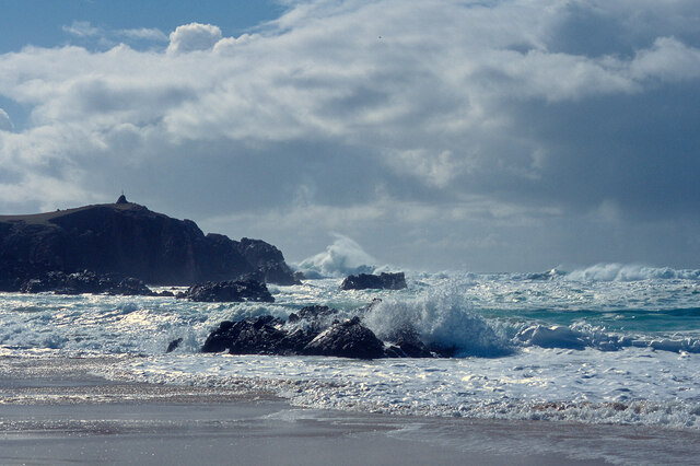
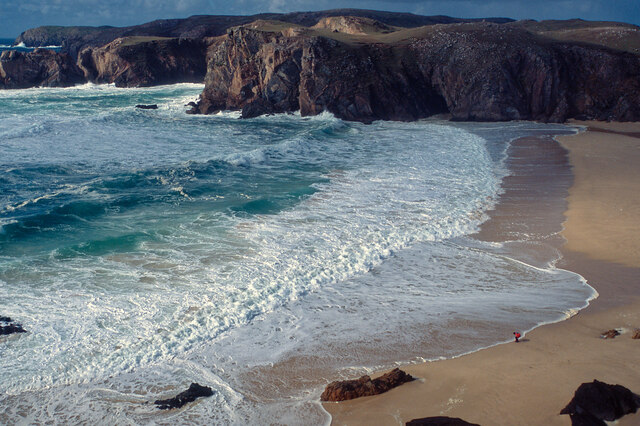
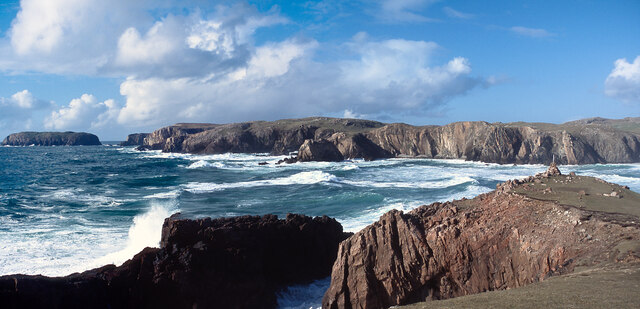
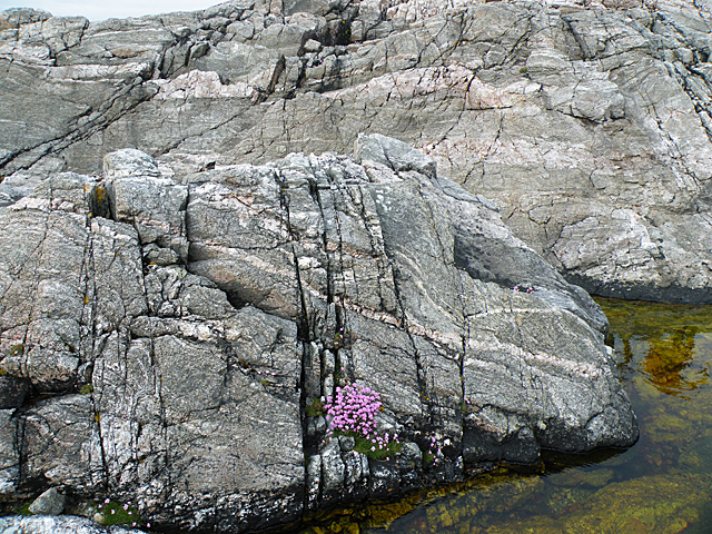
Àird Mheadhonach is a prominent landscape feature located in Ross-shire, Scotland. Situated in the northern part of the country, it is known for its dramatic and picturesque scenery. Àird Mheadhonach is an elevated plateau that stretches across a vast area and offers breathtaking views of the surrounding landscape.

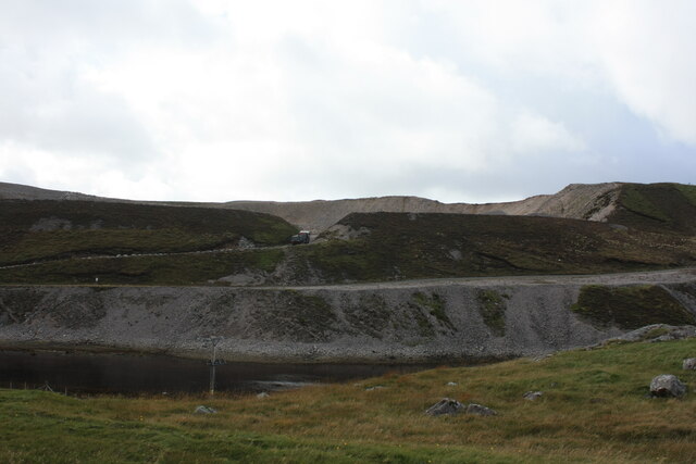
The plateau is characterized by its rugged terrain, with steep cliffs and deep valleys. It is composed mainly of sedimentary rock formations, which have been shaped by glacial activity over thousands of years. The landscape is dotted with lochs, small streams, and cascading waterfalls, adding to its natural beauty.

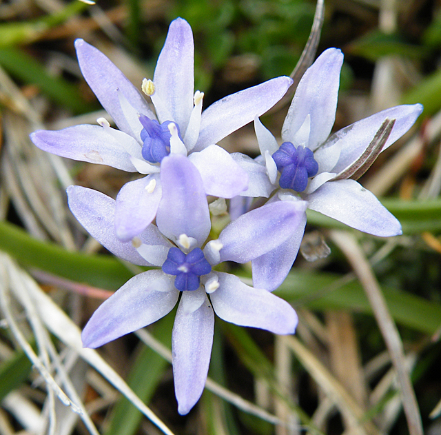
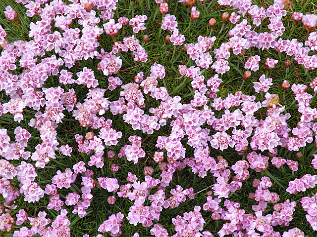
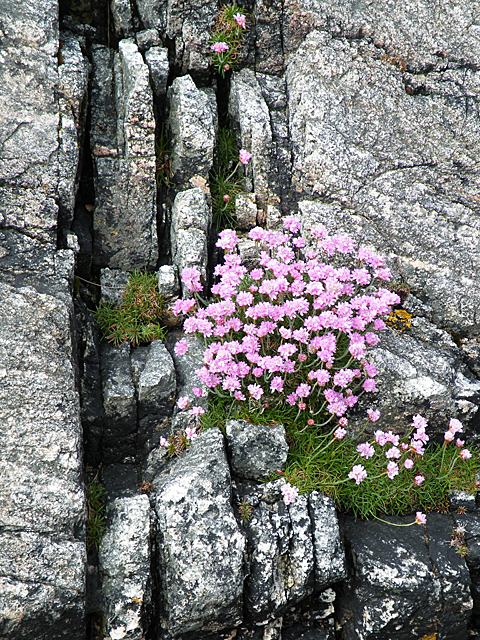
The vegetation on Àird Mheadhonach is diverse, ranging from heather-covered moorland to patches of ancient Caledonian pine forests. These forests are home to a variety of wildlife species, including red deer, golden eagles, and ospreys. It is also a haven for birdwatchers, with numerous species of birds nesting and migrating through the area.

The weather on Àird Mheadhonach can be unpredictable, with frequent changes in temperature and precipitation. Summers are generally mild, with longer daylight hours, while winters can be harsh, with snowfall and freezing temperatures.

Due to its natural beauty and rich biodiversity, Àird Mheadhonach attracts outdoor enthusiasts and nature lovers from around the world. Hiking, mountain biking, and birdwatching are popular activities in the area. The plateau is also a designated nature reserve, ensuring the preservation of its unique ecosystem for future generations to enjoy.

If you have any feedback on the listing, please let us know in the comments section below.

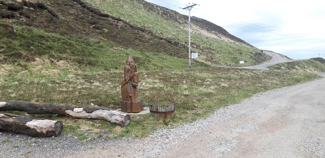
Àird Mheadhonach Images

Images are sourced within 2km of 58.178825/-7.0761718 or Grid Reference NB0132. Thanks to Geograph Open Source API. All images are credited.

Mangurstadh Coastline Looking South The cliffs here are spectacular and the Lewisian Gneiss makes for some great climbing.
Mangurstadh Coastline Looking South
The cliffs here are spectacular and the Lewisian Gneiss makes for some great climbing.
North end of Traigh Mhangarstaidh A beautiful beach with a fine Atlantic swell pounding in.
North end of Traigh Mhangarstaidh
A beautiful beach with a fine Atlantic swell pounding in.
Atlantic swell, Traigh Mhangarstaidh An exciting time being beside to a tumultuous sea - and at close range.
Atlantic swell, Traigh Mhangarstaidh
An exciting time being beside to a tumultuous sea - and at close range.
Looking down on Traigh Mhangarstaidh A walk for the view with my son on the beach.
Looking down on Traigh Mhangarstaidh
A walk for the view with my son on the beach.
Coast line near Traigh Mhangarstaidh A wide view from stitching images.  An amazing experience.
Coast line near Traigh Mhangarstaidh
A wide view from stitching images. An amazing experience.
Radio masts at Mangastra/Mhangarstaidh, Lewis, 1989 Compared to more recent images, it would appear a number of these buildings and one mast have been demolished in the intervening years.
Radio masts at Mangastra/Mhangarstaidh, Lewis, 1989
Compared to more recent images, it would appear a number of these buildings and one mast have been demolished in the intervening years.
Cappadale Sands
Cappadale Sands
Beach and headland at Carnais
Beach at Carnais
Beach at Carnais
Wooden sculpture of a Lewis Knight Chess Piece at the Abhainn Dearg Distillery car park
Tom A small tidal island near Carnais.
Tom
A small tidal island near Carnais.
The Gravel Pits at Carnais, on the Red River, Uig, Lewis The Abhainn Dearg Distillery lies to the left of the picture. The Red River - Ahbainn Dearg flows to the sea at the foot of the scree slope, but is shown on the OS Sheet as Abhainn Caslabhat.
The Gravel Pits at Carnais, on the Red River, Uig, Lewis
The Abhainn Dearg Distillery lies to the left of the picture. The Red River - Ahbainn Dearg flows to the sea at the foot of the scree slope, but is shown on the OS Sheet as Abhainn Caslabhat.
Cappadale Sands The map names this arm of Tràigh Uige as Cappadale Sands. As the tide is in, the sand is only visible through the water, giving it that characteristic Hebridean turquoise colour. It would have been even better in sunshine. The hill on the skyline is Forsnabhal (205 metres), and the houses at the far side of the bay are at Timsgearraidh.
Cappadale Sands
The map names this arm of Tràigh Uige as Cappadale Sands. As the tide is in, the sand is only visible through the water, giving it that characteristic Hebridean turquoise colour. It would have been even better in sunshine. The hill on the skyline is Forsnabhal (205 metres), and the houses at the far side of the bay are at Timsgearraidh.
Càrnais (Carinish) Two cottages overlooking Tràigh Lèire at the head of Cappadale Sands in Uig Bay.
Càrnais (Carinish)
Two cottages overlooking Tràigh Lèire at the head of Cappadale Sands in Uig Bay.
Spring Squill (Scilla verna) Surprisingly, given how exposed the headland at Mangarstadh is, and how scarce the soil, there was a carpet of stunted wildflowers including this Spring Squill.
Spring Squill (Scilla verna)
Surprisingly, given how exposed the headland at Mangarstadh is, and how scarce the soil, there was a carpet of stunted wildflowers including this Spring Squill.
Thrift (Armeria maritima) A cushion of thrift provides a splash of colour on the bleak and windswept clifftop. The flower stalks are taller in more benign conditions, but here they are stunted by the wind and weather. I wonder whether any insects brave the wind to pollinate the flowers>
Thrift (Armeria maritima)
A cushion of thrift provides a splash of colour on the bleak and windswept clifftop. The flower stalks are taller in more benign conditions, but here they are stunted by the wind and weather. I wonder whether any insects brave the wind to pollinate the flowers>
Gneiss Rocks This headland is mostly composed of striped grey Lewisian gneiss. The sloping rock face behind the foreground rock is a thrust plane which dips towards the east.
Gneiss Rocks
This headland is mostly composed of striped grey Lewisian gneiss. The sloping rock face behind the foreground rock is a thrust plane which dips towards the east.
Thrift in a Cleft This Thrift plant has found a less exposed spot than <a href="https://www.geograph.org.uk/photo/2432622">NB0033 : Thrift (Armeria maritima)</a>, so has been able to grow into a more 'normal' shape. It is exploiting a crack in the inhospitable Lewisian gneiss, probably created by movement on the adjacent thrust.
Thrift in a Cleft
This Thrift plant has found a less exposed spot than NB0033 : Thrift (Armeria maritima), so has been able to grow into a more 'normal' shape. It is exploiting a crack in the inhospitable Lewisian gneiss, probably created by movement on the adjacent thrust.
Show me another place!

Àird Mheadhonach is located at Grid Ref: NB0132 (Lat: 58.178825, Lng: -7.0761718)

Unitary Authority: Na h-Eileanan an Iar

Police Authority: Highlands and Islands

What 3 Words

///running.elbowing.silently. Near Carloway, Na h-Eileanan Siar

Related Wikis

Stac Dhòmhnaill Chaim

Stac Dhòmnuill Chaim, or Stac Dhòmhnaill Chaim, or Stac Domhnuill Chaim, is a fortified promontory located near Mangursta (or Mangersta, Scottish Gaelic...

Abhainn Dearg distillery

Abhainn Dearg distillery ( AV-in JAIRG) or Red River distillery is a Scotch whisky distillery in Uig, on the west coast of the Isle of Lewis in the Outer...

Ardroil

Ardroil (Scottish Gaelic: Eadar Dhà Fhadhail) is a village on the Isle of Lewis in the Outer Hebrides, Scotland. Ardroil is within the parish of Uig....

Uig, Lewis

Uig (Scottish Gaelic: Ùig [uːkʲ]), also known as Sgìr' Ùig, is a civil parish and community in the west of the Isle of Lewis in the Outer Hebrides, Scotland...

Timsgarry

Timsgarry (Scottish Gaelic: Tuimisgearraidh) is a village on the Isle of Lewis, in the Outer Hebrides, Scotland. Timsgarry is home to the Baile na Cille...

Gasker

Gasker is a small uninhabited islet in the Outer Hebrides of Scotland, 8 kilometres (4+1⁄2 nautical miles) southwest of Scarp, off the west coast of Harris...

Camas Uig

Camas Uig (Uig Bay) is a bay on the west coast of the Isle of Lewis, in the Outer Hebrides of Scotland. The Lewis Chessmen were discovered in the dunes...

Aird Uig

Aird Uig (Scottish Gaelic: Àird Ùig) is a village on the Isle of Lewis, in the Outer Hebrides, Scotland. Aird Uig is within the parish of Uig, and is situated...

Have you been to Àird Mheadhonach?

Leave your review of Àird Mheadhonach below (or comments, questions and feedback).