Stare Dam

Lake, Pool, Pond, Freshwater Marsh in Perthshire

Scotland

Stare Dam

Cones, A9 The A9 is a strategic link between the Highlands of Scotland and the Central Belt. It runs 279 miles from junction 5 of the M9 at Polmont to Scrabster. Originally it ran from Edinburgh.
<span class="nowrap"><a title="https://www.sabre-roads.org.uk/wiki/index.php?title=A9" rel="nofollow ugc noopener" href="https://www.sabre-roads.org.uk/wiki/index.php?title=A9">Link</a><img style="margin-left:2px;" alt="External link" title="External link - shift click to open in new window" src="https://s1.geograph.org.uk/img/external.png" width="10" height="10"/></span>
Cones, A9 Credit: N Chadwick

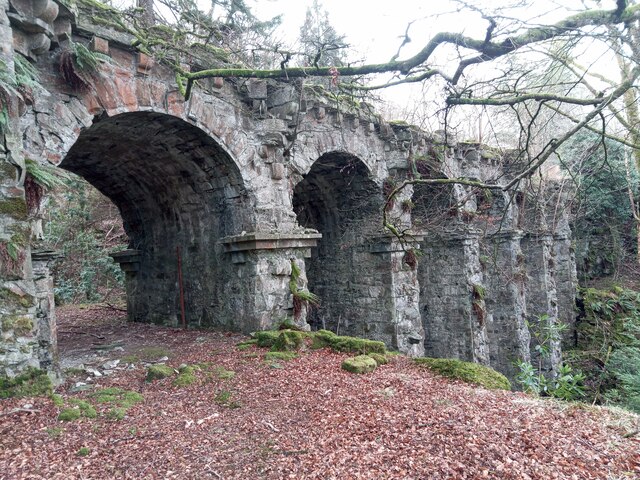
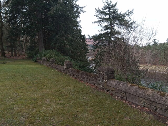
Stare Dam, located in Perthshire, Scotland, is a picturesque freshwater loch nestled within the stunning landscape of the Scottish Highlands. Covering an area of approximately 50 hectares, the dam is surrounded by lush greenery and offers a tranquil retreat for nature lovers and outdoor enthusiasts alike.

The calm and clear waters of Stare Dam provide a haven for a variety of aquatic life. The loch is home to various species of fish, including trout, pike, and perch, making it a popular spot for fishing enthusiasts. Anglers can be seen casting their lines from the banks or from small boats, hoping to catch their next big prize.

The surrounding area of Stare Dam is also teeming with diverse flora and fauna. The lush banks of the loch are adorned with a variety of vegetation, including reeds, rushes, and water lilies, creating a vibrant and colorful environment. This natural habitat attracts a wide range of bird species, making it a paradise for birdwatchers. Visitors can spot graceful swans, majestic herons, and an array of other waterfowl gracefully gliding across the waters or nesting in the nearby marshes.

For those seeking a peaceful retreat, Stare Dam offers numerous scenic walking trails that wind their way through the surrounding woodland and along the loch's edge. These trails provide ample opportunities to observe the local wildlife and take in the breathtaking views of the tranquil waters and surrounding hills.

Overall, Stare Dam is a serene and idyllic freshwater loch, offering a haven for both wildlife and outdoor enthusiasts, and providing a picturesque escape within the beautiful Perthshire landscape.

If you have any feedback on the listing, please let us know in the comments section below.
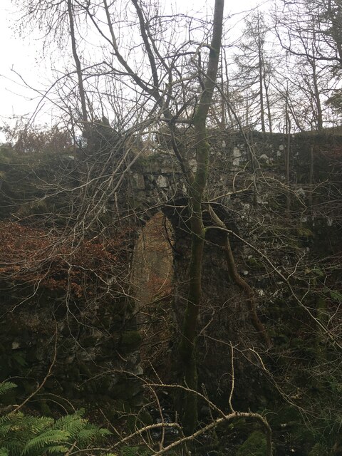
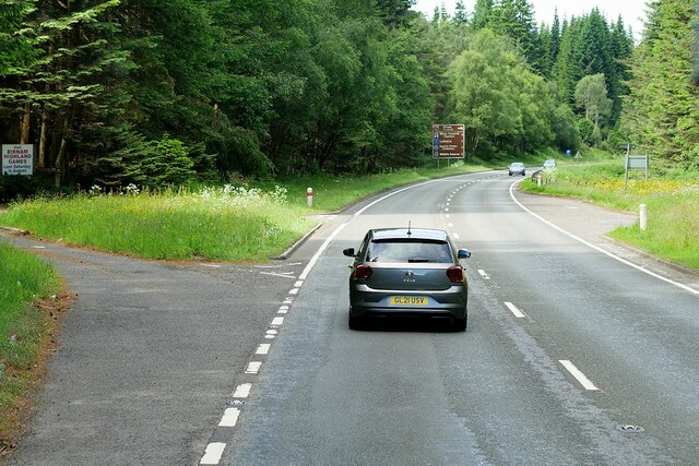
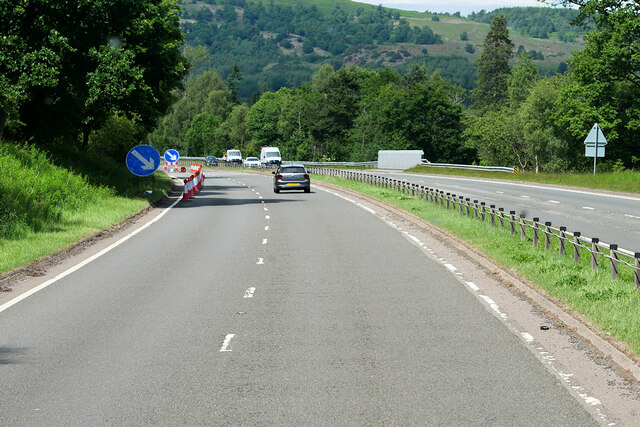
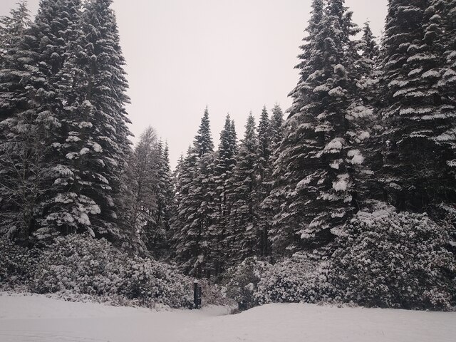
Stare Dam Images

Images are sourced within 2km of 56.529826/-3.5487316 or Grid Reference NO0438. Thanks to Geograph Open Source API. All images are credited.

Cones, A9 The A9 is a strategic link between the Highlands of Scotland and the Central Belt. It runs 279 miles from junction 5 of the M9 at Polmont to Scrabster. Originally it ran from Edinburgh.
<span class="nowrap"><a title="https://www.sabre-roads.org.uk/wiki/index.php?title=A9" rel="nofollow ugc noopener" href="https://www.sabre-roads.org.uk/wiki/index.php?title=A9">Link</a><img style="margin-left:2px;" alt="External link" title="External link - shift click to open in new window" src="https://s1.geograph.org.uk/img/external.png" width="10" height="10"/></span>
Cones, A9
The A9 is a strategic link between the Highlands of Scotland and the Central Belt. It runs 279 miles from junction 5 of the M9 at Polmont to Scrabster. Originally it ran from Edinburgh. LinkExternal link
A9, northbound The A9 is a strategic link between the Highlands of Scotland and the Central Belt. It runs 279 miles from junction 5 of the M9 at Polmont to Scrabster. Originally it ran from Edinburgh.
<span class="nowrap"><a title="https://www.sabre-roads.org.uk/wiki/index.php?title=A9" rel="nofollow ugc noopener" href="https://www.sabre-roads.org.uk/wiki/index.php?title=A9">Link</a><img style="margin-left:2px;" alt="External link" title="External link - shift click to open in new window" src="https://s1.geograph.org.uk/img/external.png" width="10" height="10"/></span>
A9, northbound
The A9 is a strategic link between the Highlands of Scotland and the Central Belt. It runs 279 miles from junction 5 of the M9 at Polmont to Scrabster. Originally it ran from Edinburgh. LinkExternal link
A9, northbound
A9, northbound
A9, Pass of Birnam The A9 is a strategic link between the Highlands of Scotland and the Central Belt. It runs 279 miles from junction 5 of the M9 at Polmont to Scrabster. Originally it ran from Edinburgh.
<span class="nowrap"><a title="https://www.sabre-roads.org.uk/wiki/index.php?title=A9" rel="nofollow ugc noopener" href="https://www.sabre-roads.org.uk/wiki/index.php?title=A9">Link</a><img style="margin-left:2px;" alt="External link" title="External link - shift click to open in new window" src="https://s1.geograph.org.uk/img/external.png" width="10" height="10"/></span>
A9, Pass of Birnam
The A9 is a strategic link between the Highlands of Scotland and the Central Belt. It runs 279 miles from junction 5 of the M9 at Polmont to Scrabster. Originally it ran from Edinburgh. LinkExternal link
Tourist information on A9 The A9 is a strategic link between the Highlands of Scotland and the Central Belt. It runs 279 miles from junction 5 of the M9 at Polmont to Scrabster. Originally it ran from Edinburgh.
<span class="nowrap"><a title="https://www.sabre-roads.org.uk/wiki/index.php?title=A9" rel="nofollow ugc noopener" href="https://www.sabre-roads.org.uk/wiki/index.php?title=A9">Link</a><img style="margin-left:2px;" alt="External link" title="External link - shift click to open in new window" src="https://s1.geograph.org.uk/img/external.png" width="10" height="10"/></span>
Tourist information on A9
The A9 is a strategic link between the Highlands of Scotland and the Central Belt. It runs 279 miles from junction 5 of the M9 at Polmont to Scrabster. Originally it ran from Edinburgh. LinkExternal link
Signage - A9 northbound
Stair Bridge
Stair Bridge
A9, Birnam Wood The A9 is a strategic link between the Highlands of Scotland and the Central Belt. Running for 273 miles, it is the longest road in Scotland and the fifth-longest A-road in the United Kingdom. Historically it was the main road between Edinburgh and John o' Groats but its importance has been eclipsed somewhat in the south by the A90 across the Forth Road Bridge and the M90 motorway, which now links Edinburgh more directly with Perth, and the M9, which is now the main road between Edinburgh and Bridge of Allan.
A9, Birnam Wood
The A9 is a strategic link between the Highlands of Scotland and the Central Belt. Running for 273 miles, it is the longest road in Scotland and the fifth-longest A-road in the United Kingdom. Historically it was the main road between Edinburgh and John o' Groats but its importance has been eclipsed somewhat in the south by the A90 across the Forth Road Bridge and the M90 motorway, which now links Edinburgh more directly with Perth, and the M9, which is now the main road between Edinburgh and Bridge of Allan.
Northbound A9, Kingswood The A9 is a strategic link between the Highlands of Scotland and the Central Belt. Running for 273 miles, it is the longest road in Scotland and the fifth-longest A-road in the United Kingdom. Historically it was the main road between Edinburgh and John o' Groats but its importance has been eclipsed somewhat in the south by the A90 across the Forth Road Bridge and the M90 motorway, which now links Edinburgh more directly with Perth, and the M9, which is now the main road between Edinburgh and Bridge of Allan.
Northbound A9, Kingswood
The A9 is a strategic link between the Highlands of Scotland and the Central Belt. Running for 273 miles, it is the longest road in Scotland and the fifth-longest A-road in the United Kingdom. Historically it was the main road between Edinburgh and John o' Groats but its importance has been eclipsed somewhat in the south by the A90 across the Forth Road Bridge and the M90 motorway, which now links Edinburgh more directly with Perth, and the M9, which is now the main road between Edinburgh and Bridge of Allan.
Roadworks on the A9 The deployment of Orange traffic cones has temporarily reduced the northbound carriageway of the A9 to a single lane.
Roadworks on the A9
The deployment of Orange traffic cones has temporarily reduced the northbound carriageway of the A9 to a single lane.
Snow covered forest at the A9 Photographed from the car, through the open window, while sitting in very slow moving traffic.
Snow covered forest at the A9
Photographed from the car, through the open window, while sitting in very slow moving traffic.
Traffic jam on the A9 On December 27th, inclement weather combined with the heavy traffic to cause a quite epic traffic jam on the A9. Several miles of traffic at walking speed around Dunkeld, just before one of the sections that has not been dualled yet.
Traffic jam on the A9
On December 27th, inclement weather combined with the heavy traffic to cause a quite epic traffic jam on the A9. Several miles of traffic at walking speed around Dunkeld, just before one of the sections that has not been dualled yet.
"Roman" Bridge over Birnam Burn This bridge carried the carriage drive from Murthly Castle westwards to Birnam. It was begun in 1832 but only completed in 1858, for a total cost of £1,019 5/3d.
The bridge has six arches over a deep ravine and was deliberately 'antiqued' to give the impression of a Roman aqueduct. (There was a strong Roman presence in the area circa AD 85 with a huge fort at Inchtuthill just a few miles down the Tay.)
"Roman" Bridge over Birnam Burn
This bridge carried the carriage drive from Murthly Castle westwards to Birnam. It was begun in 1832 but only completed in 1858, for a total cost of £1,019 5/3d. The bridge has six arches over a deep ravine and was deliberately 'antiqued' to give the impression of a Roman aqueduct. (There was a strong Roman presence in the area circa AD 85 with a huge fort at Inchtuthill just a few miles down the Tay.)
Viewpoint over the River Tay This crenelated picnic spot has a view up river to Birnam Hill and also overlooks Boat of Murthly Cottage. It was once a stopping point on the carriage road from Birnam to Murthly Castle and can now be enjoyed as part of the core path following the Tay through Murthly estate.
Viewpoint over the River Tay
This crenelated picnic spot has a view up river to Birnam Hill and also overlooks Boat of Murthly Cottage. It was once a stopping point on the carriage road from Birnam to Murthly Castle and can now be enjoyed as part of the core path following the Tay through Murthly estate.
Railway Cottages
Railway Cottages
A Very Rural Turnstile No one expects the Spanish Inquisition . . . or to pech to the top of a rocky crag and have to negotiate a turnstile. Neatly in the frame is the Buffalo Hut, a very stylish bothy so called by locals as it sits in the park on the slope of Birnam Hill where Sir William Drummond Stewart kept a small herd of American Bison. Souvenirs of his adventures with the Mountain Men across the Great Plains and into the Rockies in the 1830s.
A Very Rural Turnstile
No one expects the Spanish Inquisition . . . or to pech to the top of a rocky crag and have to negotiate a turnstile. Neatly in the frame is the Buffalo Hut, a very stylish bothy so called by locals as it sits in the park on the slope of Birnam Hill where Sir William Drummond Stewart kept a small herd of American Bison. Souvenirs of his adventures with the Mountain Men across the Great Plains and into the Rockies in the 1830s.
Show me another place!

Stare Dam is located at Grid Ref: NO0438 (Lat: 56.529826, Lng: -3.5487316)

Unitary Authority: Perth and Kinross

Police Authority: Tayside

Also known as: Rohallion Loch

What 3 Words

///lollipop.coherent.merit. Near Bankfoot, Perth & Kinross

Nearby Locations

Stare Dam Rohallion Loch

Related Wikis

Rohallion railway station

Rohallion railway station was a private station from 1860 to 1864 on the Perth and Dunkeld Railway. == History == The station opened in February 1860 by...

Waterloo, Perth and Kinross

Waterloo is a small hamlet in Perth and Kinross, Scotland approximately 1⁄2 mile (800 metres) north of Bankfoot on the old A9. == Etymology == Local opinion...

Murthly House

Murthly House, also known as New Murthly Castle, was a substantial mansion in Perth and Kinross, Scotland, designed by James Gillespie Graham and demolished...

River Braan

The River Braan (Scottish Gaelic: Breamhainn) is a tributary of the River Tay in Scotland. Within the county of Perth and Kinross, it flows 11 miles...

Birnam, Perth and Kinross

Birnam is a village in Perth and Kinross, Scotland. It is located 12 miles (19 km) north of Perth on the A9 road, the main tourist route through Perthshire...

Dunkeld & Birnam railway station

Dunkeld & Birnam railway station serves the town of Dunkeld and village of Birnam in Perth and Kinross, Scotland. It is located on the Highland Main Line...

Perth Road drill hall, Birnam

The Perth Road drill hall is a former military installation on Perth Road in Birnam, Perth and Kinross, Scotland. == History == The building was designed...

Birnam Arts

Birnam Arts is a multipurpose arts centre in Birnam, Perthshire, central Scotland. It is also known as the Birnam Arts and Conference Centre, and was originally...

Nearby Amenities

Located within 500m of 56.529826,-3.5487316
Bus Stop
Naptan AtcoCode: 64802164
Naptan NaptanCode: 73724592
Lat/Long: 56.5316831/-3.5425284
Power: pole
Lat/Long: 56.5286759/-3.5417526
Power: pole
Lat/Long: 56.5292645/-3.5411163
Power: pole
Lat/Long: 56.5269836/-3.5454835
Power: pole
Lat/Long: 56.5268807/-3.54397
Power: pole
Lat/Long: 56.5254742/-3.5472385
Power: pole
Lat/Long: 56.5258538/-3.546828
Power: pole
Lat/Long: 56.5262197/-3.5463926
Power: pole
Lat/Long: 56.5265994/-3.5459406
Power: pole
Lat/Long: 56.5273289/-3.5452855
Power: pole
Lat/Long: 56.5263592/-3.5524628
Power: pole
Lat/Long: 56.5271154/-3.5521601
Power: pole
Lat/Long: 56.5278601/-3.5518738
Power: pole
Lat/Long: 56.5288474/-3.5514548
Power: pole
Lat/Long: 56.5293468/-3.5512662
Power: pole
Lat/Long: 56.5298321/-3.5519367
Power: pole
Lat/Long: 56.5320968/-3.5551468
Power: pole
Lat/Long: 56.5270769/-3.5507378
Power: pole
Lat/Long: 56.527073/-3.5495226
Power: pole
Lat/Long: 56.5270422/-3.5483238
Power: pole
Lat/Long: 56.5270204/-3.5472809
Archaeological Site: megalith
Historic: archaeological_site
Megalith Type: menhir
Lat/Long: 56.5268941/-3.5460916
Archaeological Site: megalith
Historic: archaeological_site
Megalith Type: menhir
Lat/Long: 56.5269306/-3.5460243
The data included in this document is from www.openstreetmap.org. The data is made available under ODbL.

Have you been to Stare Dam?

Leave your review of Stare Dam below (or comments, questions and feedback).