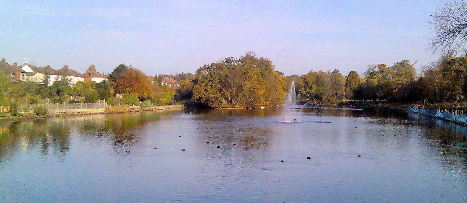
Park Lake
Lake, Pool, Pond, Freshwater Marsh in Essex
England
Park Lake

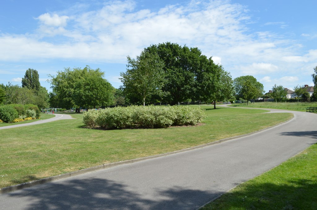
Park Lake is a picturesque freshwater body located in Essex, England. Spanning an area of approximately 50 acres, it offers a serene and natural escape for visitors seeking relaxation and tranquility. The lake is surrounded by lush greenery and is a popular destination for both locals and tourists alike.
The crystal-clear waters of Park Lake provide an ideal habitat for a diverse range of aquatic flora and fauna. The lake boasts a rich biodiversity, with various species of fish, birds, and insects residing within its depths and along its banks. Anglers frequent the lake to try their luck at catching carp, pike, and tench, among other species.
The lake is well-maintained and offers a range of amenities to ensure visitors have a pleasant experience. There are designated areas for picnicking and barbecuing, as well as ample parking facilities. Additionally, the lake provides opportunities for water-based activities such as kayaking and paddleboarding, allowing visitors to fully immerse themselves in the natural surroundings.
Adjacent to the lake, there is a small pool and pond, which are perfect for children to paddle and play in. These areas are shallow and supervised, ensuring the safety of young visitors. Furthermore, Park Lake is surrounded by a freshwater marsh, which serves as a vital habitat for various wetland species, including frogs, dragonflies, and waterfowl.
Overall, Park Lake in Essex is a haven for nature enthusiasts and those seeking a peaceful respite. With its stunning scenery, abundant wildlife, and recreational offerings, it is a must-visit destination for anyone looking to connect with nature in the heart of Essex.
If you have any feedback on the listing, please let us know in the comments section below.
Park Lake Images
Images are sourced within 2km of 51.585183/0.19070611 or Grid Reference TQ5189. Thanks to Geograph Open Source API. All images are credited.


Park Lake is located at Grid Ref: TQ5189 (Lat: 51.585183, Lng: 0.19070611)
Unitary Authority: Havering
Police Authority: Metropolitan
Also known as: Blacks Canal
What 3 Words
///fines.sleep.rates. Near Romford, London
Nearby Locations
Related Wikis
Lodge Farm Park
Lodge Farm Park is a public park in Gidea Park in the London Borough of Havering, United Kingdom. It is one of a series of parks which stretch northwards...
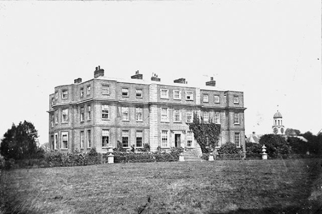
Gidea Hall
Gidea Hall was a manor house in Gidea Park, the historic parish and Royal liberty of Havering-atte-Bower, whose former area today is part of the north...

Romford (UK Parliament constituency)
Romford is a constituency in Greater London represented in the House of Commons of the UK Parliament since 2001 by Andrew Rosindell, a Conservative.It...
Raphael Park
Raphael Park (pronounced "Ra-fai-el”) is a public park in Gidea Park, Romford, in the London Borough of Havering, United Kingdom. It is one of a series...
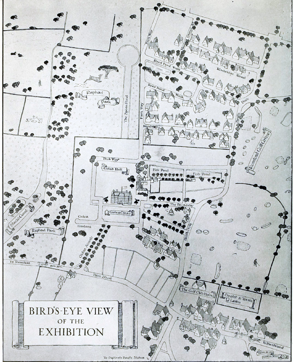
Romford Garden Suburb
Romford Garden Suburb (otherwise known as the Gidea Park Exhibition Estate), is a late-Edwardian housing development in Gidea Park, in the London Borough...
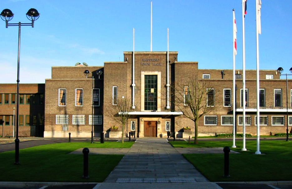
Havering Town Hall
Havering Town Hall is a municipal building in Main Road, Romford, London. The town hall, which is the headquarters of Havering London Borough Council,...
Municipal Borough of Romford
Romford was a local government district in southwest Essex from 1851 to 1965. It was significantly expanded in 1934 and gained the status of municipal...

Marshalls Park Academy
Marshalls Park Academy (formerly Marshalls Park School) is a coeducational secondary school located in Romford, London, England. == History == In January...
Nearby Amenities
Located within 500m of 51.585183,0.19070611Have you been to Park Lake?
Leave your review of Park Lake below (or comments, questions and feedback).