Greenfaulds
Settlement in Dunbartonshire
Scotland
Greenfaulds

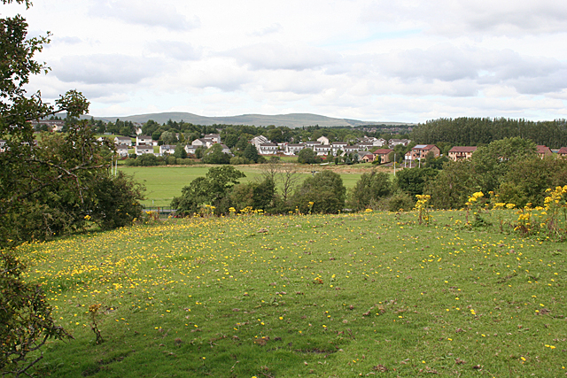
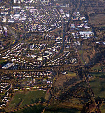
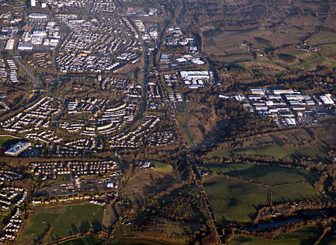
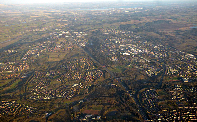
Greenfaulds is a suburban area located in the county of Dunbartonshire in Scotland. Situated near the town of Cumbernauld, it is approximately 14 miles northeast of Glasgow city center. Greenfaulds is predominantly a residential area, known for its tranquil atmosphere and family-friendly environment.
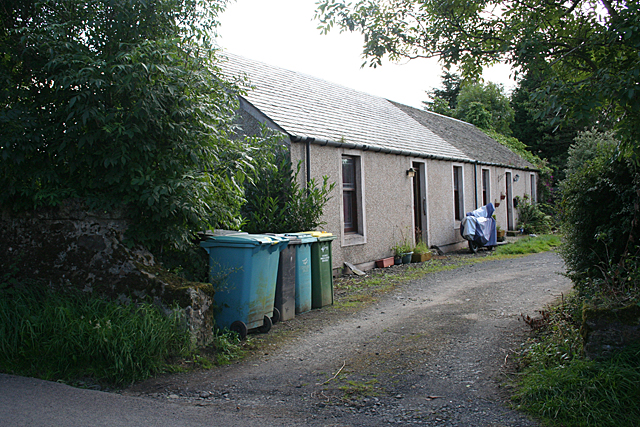
The area offers a variety of housing options, including detached houses, semi-detached houses, and apartments, catering to a range of budgets and preferences. The architecture in Greenfaulds is a mix of modern and traditional styles, with well-maintained properties and neatly landscaped gardens.
Residents of Greenfaulds benefit from a range of amenities and facilities within close proximity. The local shopping center, Greenfaulds Village, provides convenient access to a supermarket, post office, pharmacy, and several small shops. Additionally, there are various schools in the area, including Greenfaulds High School, making it an attractive location for families.
For recreational activities, Greenfaulds offers several green spaces and parks where residents can enjoy outdoor activities such as walking, jogging, or picnicking. Local sports facilities, including a nearby leisure center, provide opportunities for swimming, fitness classes, and other activities.
Transport links in Greenfaulds are convenient, with regular bus services connecting the area to nearby towns and cities. Cumbernauld train station is also easily accessible, offering direct services to Glasgow and other major destinations.
Overall, Greenfaulds in Dunbartonshire provides a peaceful and well-connected residential area for families and individuals, with a range of amenities and recreational opportunities within reach.
If you have any feedback on the listing, please let us know in the comments section below.
Greenfaulds Images
Images are sourced within 2km of 55.937375/-4.000686 or Grid Reference NS7573. Thanks to Geograph Open Source API. All images are credited.


Greenfaulds is located at Grid Ref: NS7573 (Lat: 55.937375, Lng: -4.000686)
Unitary Authority: North Lanarkshire
Police Authority: Lanarkshire
What 3 Words
///spell.flap.brush. Near Cumbernauld, North Lanarkshire
Nearby Locations
Related Wikis

Greenfaulds High School
Greenfaulds High School is a mixed, non-denominational six-year comprehensive secondary school. The original building was opened in 1971, while the new...
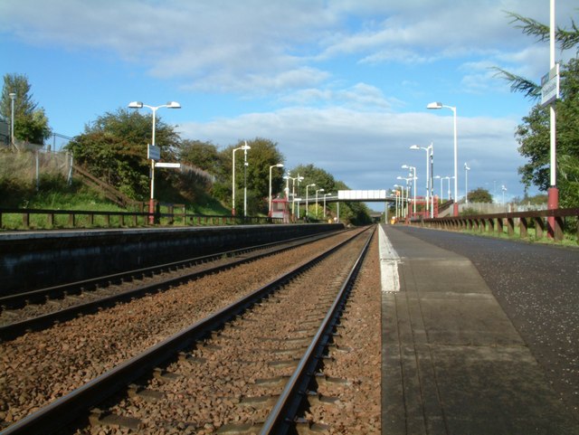
Greenfaulds railway station
Greenfaulds railway station serves the Greenfaulds area of Cumbernauld, North Lanarkshire, Scotland. It is also within walking distance of the Lenziemill...
Greenfaulds
Greenfaulds (Scottish Gaelic: A' Bhuaile Ghlas, IPA:[əˈvuələˈɣɫ̪as̪]) is an area of the town of Cumbernauld in Scotland. Greenfaulds was a half council...
Ravenswood, Cumbernauld
Ravenswood is an area of Cumbernauld, Scotland. == History == Ravenswood, sometimes known as Bogedge, was formerly a retreat for Glasgow churchmen. There...
Our Lady's High School, Cumbernauld
Our Lady's High School is a six-year Roman Catholic co-educational comprehensive school which opened in Ravenswood in 1968. It caters for pupils living...
Lenziemill
Lenziemill is the site one of Cumbernauld's several industrial estates, built as satellite developments on the periphery of the Scottish town's residential...
Cumbernauld
Cumbernauld (; Scottish Gaelic: Comar nan Allt) is a large town in the historic county of Dunbartonshire and council area of North Lanarkshire, Scotland...

Blairlinn
Blairlinn is the site of one of Cumbernauld's several industrial estates built as satellite developments on the periphery of the Scottish town's residential...
Nearby Amenities
Located within 500m of 55.937375,-4.000686Have you been to Greenfaulds?
Leave your review of Greenfaulds below (or comments, questions and feedback).