Decoy Water

Lake, Pool, Pond, Freshwater Marsh in Norfolk King's Lynn and West Norfolk

England

Decoy Water

Wolferton railway station (site), Norfolk Opened in 1862 as "Wolverton" by the Lynn & Hunstanton Railway, later part of the Great Eastern Railway, the name was changed to "Wolferton" the following year. The station closed in 1969. It was the nearest one to Sandringham and had royal retiring rooms.
View north east towards Dersingham and Hunstanton.
Wolferton railway station (site), Norfolk Credit: Nigel Thompson

Decoy Water, located in Norfolk, is a picturesque freshwater marshland situated in the eastern part of England. Spanning across an area of approximately 500 acres, it serves as a crucial habitat for a wide variety of flora and fauna.

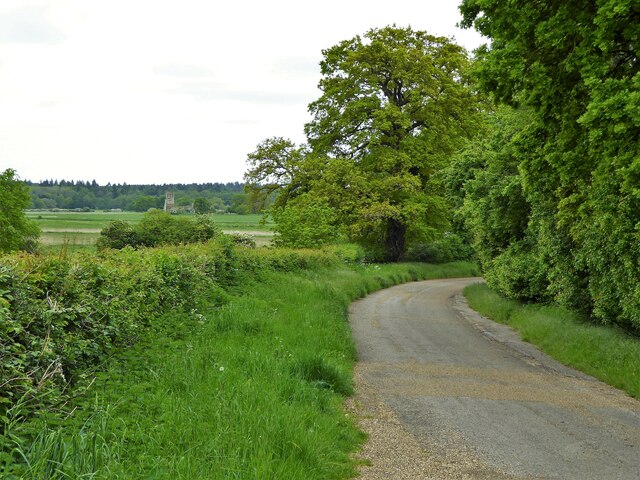
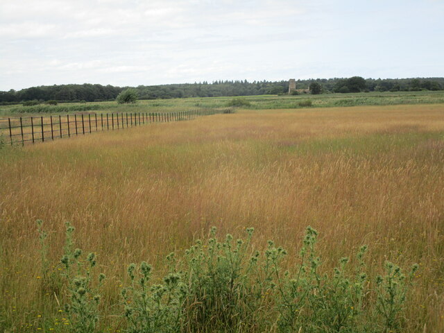
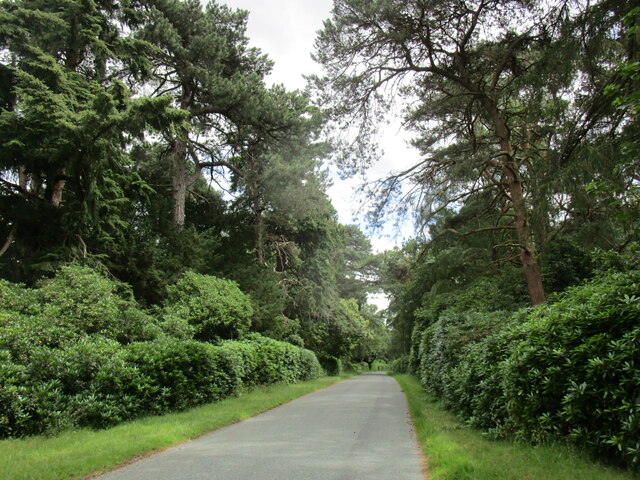
The main feature of Decoy Water is its expansive lake, which covers a significant portion of the area. The lake is surrounded by lush vegetation, including reed beds, willow trees, and other wetland plants, creating a serene and tranquil environment. This natural setting attracts numerous bird species, making it an ideal spot for birdwatchers and nature enthusiasts.

The lake itself is home to several species of fish, such as pike, roach, and perch, making it a popular destination for anglers. Additionally, the lake serves as a breeding ground for waterfowl, including mallards, coots, and swans, adding to the biodiversity of the area.

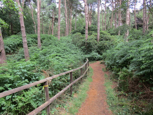
Decoy Water also features a small pool and pond, which provide additional habitats for amphibians, such as frogs and newts. These smaller bodies of water are surrounded by dense vegetation, offering shelter and food sources for the resident wildlife.

The freshwater marshland of Decoy Water plays a vital role in maintaining the local ecosystem. The reed beds act as natural filters, helping to purify the water and improve its quality. It also serves as a floodplain, absorbing excess water during heavy rainfall and minimizing the risk of flooding in surrounding areas.

Overall, Decoy Water offers visitors a unique opportunity to immerse themselves in the beauty of a freshwater marshland, observe a diverse range of wildlife, and appreciate the importance of preserving such fragile ecosystems.

If you have any feedback on the listing, please let us know in the comments section below.

Decoy Water Images

Images are sourced within 2km of 52.81556/0.47345246 or Grid Reference TF6627. Thanks to Geograph Open Source API. All images are credited.

Wolferton railway station (site), Norfolk Opened in 1862 as "Wolverton" by the Lynn & Hunstanton Railway, later part of the Great Eastern Railway, the name was changed to "Wolferton" the following year. The station closed in 1969. It was the nearest one to Sandringham and had royal retiring rooms.
View north east towards Dersingham and Hunstanton.
Wolferton railway station (site), Norfolk
Opened in 1862 as "Wolverton" by the Lynn & Hunstanton Railway, later part of the Great Eastern Railway, the name was changed to "Wolferton" the following year. The station closed in 1969. It was the nearest one to Sandringham and had royal retiring rooms. View north east towards Dersingham and Hunstanton.
Old Hunstanton Road On the now private road on the Castle Rising Estate with a view far across the fields to the ruined church of St Felix
Old Hunstanton Road
On the now private road on the Castle Rising Estate with a view far across the fields to the ruined church of St Felix
Old Milestone by A149, roadside The Milestone is located on the verge on the East of the road.  Parish of Sandringham (Kings Lynn and West Norfolk District). Metal plate attached to stone post, Lynn metal number design, erected by the Lynn - East Gate (Dersingham & Hillington) turnpike trust in the 19th Century, metal number rusty. An earlier photograph can be found here: <a title="https://www.geograph.org.uk/photo/6044415" href="https://www.geograph.org.uk/photo/6044415">Link</a> 

Inscription reads:-  
6  

Milestone Society National ID: NO_KLW06
Old Milestone by A149, roadside
The Milestone is located on the verge on the East of the road.  Parish of Sandringham (Kings Lynn and West Norfolk District). Metal plate attached to stone post, Lynn metal number design, erected by the Lynn - East Gate (Dersingham & Hillington) turnpike trust in the 19th Century, metal number rusty. An earlier photograph can be found here: Link  Inscription reads:- 6 Milestone Society National ID: NO_KLW06
A distant glimpse of the coast from the viewing platform on Princess's Drive in the Sandringham Estate
Night Marsh Looking towards the remains of St Felix's church, Babingley.
Night Marsh
Looking towards the remains of St Felix's church, Babingley.
St Felix Chapel, Babingley Part of the British Orthodox Church. Dates from 1880 <span class="nowrap"><a title="http://www.norfolkchurches.co.uk/babingley/babingley.htm" rel="nofollow ugc noopener" href="http://www.norfolkchurches.co.uk/babingley/babingley.htm">Link</a><img style="margin-left:2px;" alt="External link" title="External link - shift click to open in new window" src="https://s1.geograph.org.uk/img/external.png" width="10" height="10"/></span>
St Felix Chapel, Babingley
Part of the British Orthodox Church. Dates from 1880 LinkExternal link
Road through Edinburgh Plantation
Footpath to Dersingham Bog Nature Reserve
Pine trees on the edge of the churchyard, Wolferton
Old Hunstanton Road, Castle Rising Now a bridleway.
Old Hunstanton Road, Castle Rising
Now a bridleway.
Footpath along the edge of Night Marsh
St Felix Chapel, Babingley Part of the British Orthodox Church. Dates from 1880. <span class="nowrap"><a title="http://www.norfolkchurches.co.uk/babingley/babingley.htm" rel="nofollow ugc noopener" href="http://www.norfolkchurches.co.uk/babingley/babingley.htm">Link</a><img style="margin-left:2px;" alt="External link" title="External link - shift click to open in new window" src="https://s1.geograph.org.uk/img/external.png" width="10" height="10"/></span>
St Felix Chapel, Babingley
Part of the British Orthodox Church. Dates from 1880. LinkExternal link
Field and shelter belt, Babingley
St Peter, Wolferton: churchyard (1)
St Peter, Wolferton: churchyard (2)
St Peter, Wolferton: churchyard (3)
St Peter, Wolferton: churchyard (4)
Show me another place!

Decoy Water is located at Grid Ref: TF6627 (Lat: 52.81556, Lng: 0.47345246)

Administrative County: Norfolk

District: King's Lynn and West Norfolk

Police Authority: Norfolk

What 3 Words

///special.laces.constrain. Near Dersingham, Norfolk

Related Wikis

Babingley

Babingley is a village and former civil parish, now in the parish of Sandringham, in the King's Lynn and West Norfolk district, in the county of Norfolk...

Wood Farm

Wood Farm is a farmhouse on the British Royal Family's Sandringham Estate in Norfolk, England. Historically occupied by members of the Royal Family and...

Wolferton railway station

Wolferton was a railway station on the Lynn and Hunstanton Railway line which opened in 1862 to serve the village of Wolferton in Norfolk, England. The...

Wolferton

Wolferton is a village and former civil parish, now in the parish of Sandringham, in the King's Lynn and West Norfolk district, in the county of Norfolk...

Dersingham Bog

Dersingham Bog is a 159.1-hectare (393-acre) biological and geological Site of Special Scientific Interest in Norfolk, England. It is a Nature Conservation...

Castle Rising

Castle Rising is a village and civil parish in the English county of Norfolk. The village is situated some 8 kilometres (5 mi) north-east of the town of...

Castle Rising Castle

Castle Rising is a ruined medieval fortification in the village of Castle Rising, Norfolk, England. It was built soon after 1138 by William d'Aubigny II...

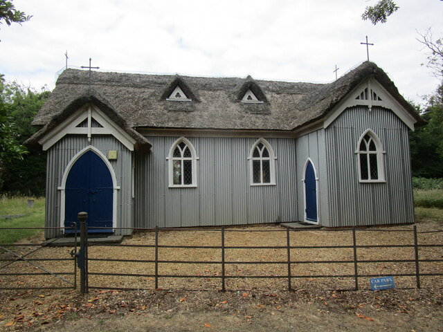
St Mary Magdalene Church, Sandringham

St Mary Magdalene Church is a church in Sandringham, Norfolk, England, located just to the southwest of Sandringham House. Members of the British Royal...

Have you been to Decoy Water?

Leave your review of Decoy Water below (or comments, questions and feedback).