Windmill Lake

Lake, Pool, Pond, Freshwater Marsh in Lincolnshire East Lindsey

England

Windmill Lake

Cut Mark: Bilsby, Holy Trinity Church Cut bench mark on the outward face of the buttress at the north-east angle of the church.  See <span class="nowrap"><a title="https://www.bench-marks.org.uk/bm83274" rel="nofollow ugc noopener" href="https://www.bench-marks.org.uk/bm83274">Link</a><img style="margin-left:2px;" alt="External link" title="External link - shift click to open in new window" src="https://s1.geograph.org.uk/img/external.png" width="10" height="10"/></span> for details of the mark.
Cut Mark: Bilsby, Holy Trinity Church Credit: Brian Westlake

Windmill Lake is a picturesque freshwater marsh located in the county of Lincolnshire, England. It is a popular destination for nature enthusiasts and birdwatchers due to its diverse range of wildlife and stunning scenery.

Covering an area of approximately 10 acres, the lake is surrounded by lush vegetation and reed beds, providing a haven for various bird species. Visitors can expect to see a variety of waterfowl, including ducks, swans, and herons, as well as wading birds such as lapwings and avocets. The lake also attracts migratory birds during the winter months, adding to its appeal for birdwatchers.

The lake itself is a tranquil body of freshwater, fed by natural springs and rainwater runoff. Its calm and clear waters make it ideal for fishing, and it is home to a variety of fish species, including carp, pike, and perch. Anglers can enjoy a peaceful day by the lake, casting their lines and enjoying the peaceful surroundings.

Windmill Lake is not only a haven for wildlife but also a place of historical significance. The lake takes its name from the nearby windmill, which dates back to the 19th century. The windmill, now restored and preserved as a local landmark, offers visitors a glimpse into the area's industrial heritage.

In conclusion, Windmill Lake in Lincolnshire offers a unique combination of natural beauty, wildlife diversity, and historical charm. Whether visitors are looking to observe birds, engage in fishing, or simply enjoy the peaceful surroundings, Windmill Lake provides a memorable experience for all nature enthusiasts.

If you have any feedback on the listing, please let us know in the comments section below.

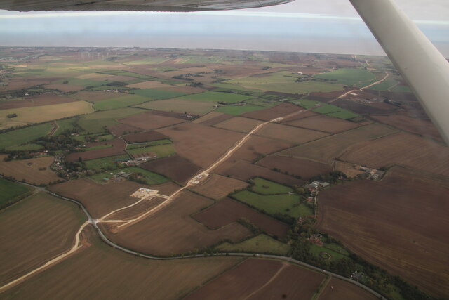
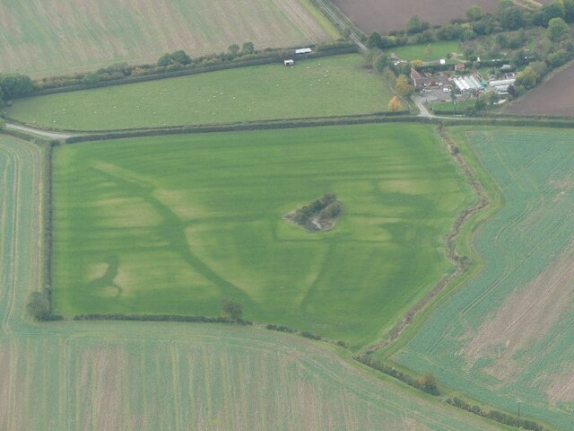
Windmill Lake Images

Images are sourced within 2km of 53.270866/0.18305863 or Grid Reference TF4577. Thanks to Geograph Open Source API. All images are credited.

Cut Mark: Bilsby, Holy Trinity Church Cut bench mark on the outward face of the buttress at the north-east angle of the church.  See <span class="nowrap"><a title="https://www.bench-marks.org.uk/bm83274" rel="nofollow ugc noopener" href="https://www.bench-marks.org.uk/bm83274">Link</a><img style="margin-left:2px;" alt="External link" title="External link - shift click to open in new window" src="https://s1.geograph.org.uk/img/external.png" width="10" height="10"/></span> for details of the mark.
Cut Mark: Bilsby, Holy Trinity Church
Cut bench mark on the outward face of the buttress at the north-east angle of the church. See LinkExternal link for details of the mark.
Direction Sign – Signpost at Bilsby Field, Alford Located at Bilsby Field on the southwest side of the t junction of Farlesthorpe Road and Back Lane in Alford parish. 3 arms and no finial. See also <a title="https://www.geograph.org.uk/photo/6279810" href="https://www.geograph.org.uk/photo/6279810">Link</a>.

Milestone Society National ID: LI_TF4675
Direction Sign – Signpost at Bilsby Field, Alford
Located at Bilsby Field on the southwest side of the t junction of Farlesthorpe Road and Back Lane in Alford parish. 3 arms and no finial. See also Link. Milestone Society National ID: LI_TF4675
Viking Link cable run passing Saleby and Thoresthorpe: aerial 2021
Cropmarks in a field at Ailby: aerial 2021
St. Wilfrid's church hall, Alford
Former chapel, Alford
12 South Market Place, Alford Late eighteenth century house <span class="nowrap"><a title="https://historicengland.org.uk/listing/the-list/list-entry/1308717?section=official-list-entry" rel="nofollow ugc noopener" href="https://historicengland.org.uk/listing/the-list/list-entry/1308717?section=official-list-entry">Link</a><img style="margin-left:2px;" alt="External link" title="External link - shift click to open in new window" src="https://s1.geograph.org.uk/img/external.png" width="10" height="10"/></span>
12 South Market Place, Alford
Late eighteenth century house LinkExternal link
Former Mechanics Institute, Alford Dated 1854.
Former Mechanics Institute, Alford
Dated 1854.
South Market Place, Alford. East side
Market in Alford
Market in Alford
Drinking fountain, Market Place, Alford Commemorates Queen Victoria's Diamond Jubilee 1897 <span class="nowrap"><a title="https://historicengland.org.uk/listing/the-list/list-entry/1147007?section=official-list-entry" rel="nofollow ugc noopener" href="https://historicengland.org.uk/listing/the-list/list-entry/1147007?section=official-list-entry">Link</a><img style="margin-left:2px;" alt="External link" title="External link - shift click to open in new window" src="https://s1.geograph.org.uk/img/external.png" width="10" height="10"/></span>
Drinking fountain, Market Place, Alford
Commemorates Queen Victoria's Diamond Jubilee 1897 LinkExternal link
6 High Street, Alford Late eighteenth century house <span class="nowrap"><a title="https://historicengland.org.uk/listing/the-list/list-entry/1063033?section=official-list-entry" rel="nofollow ugc noopener" href="https://historicengland.org.uk/listing/the-list/list-entry/1063033?section=official-list-entry">Link</a><img style="margin-left:2px;" alt="External link" title="External link - shift click to open in new window" src="https://s1.geograph.org.uk/img/external.png" width="10" height="10"/></span>
6 High Street, Alford
Late eighteenth century house LinkExternal link
The George Hotel, Alford Dates from the early eighteenth century <span class="nowrap"><a title="https://historicengland.org.uk/listing/the-list/list-entry/1146974?section=official-list-entry" rel="nofollow ugc noopener" href="https://historicengland.org.uk/listing/the-list/list-entry/1146974?section=official-list-entry">Link</a><img style="margin-left:2px;" alt="External link" title="External link - shift click to open in new window" src="https://s1.geograph.org.uk/img/external.png" width="10" height="10"/></span>
The George Hotel, Alford
Dates from the early eighteenth century LinkExternal link
Alford: aerial 2022
Alford: aerial 2022
The sign of The George Inn See <a href="https://www.geograph.org.uk/photo/7213327">TF4576 : The George Hotel, Alford</a>
The sign of The George Inn
South Street, Alford With The White Hart on the left.
South Street, Alford
With The White Hart on the left.
3 East Street, Alford A view of the rear and street-facing elevations of a rather splendid early 18th century house. The side facing the street here has a series of blocked doors and windows, and was originally the frontage, but it's been re-configured in such a way that the main entrance is now on the side facing away from us here, and not easily seen due to hedges and the like. The whole place attracted a Grade II listing <span class="nowrap"><a title="https://britishlistedbuildings.co.uk/101146933-3-east-street-alford#.Y6Htw3bP3IU" rel="nofollow ugc noopener" href="https://britishlistedbuildings.co.uk/101146933-3-east-street-alford#.Y6Htw3bP3IU">Link</a><img style="margin-left:2px;" alt="External link" title="External link - shift click to open in new window" src="https://s1.geograph.org.uk/img/external.png" width="10" height="10"/></span> & <span class="nowrap"><a title="https://historicengland.org.uk/listing/the-list/list-entry/1146933" rel="nofollow ugc noopener" href="https://historicengland.org.uk/listing/the-list/list-entry/1146933">Link</a><img style="margin-left:2px;" alt="External link" title="External link - shift click to open in new window" src="https://s1.geograph.org.uk/img/external.png" width="10" height="10"/></span> in 1953.
3 East Street, Alford
A view of the rear and street-facing elevations of a rather splendid early 18th century house. The side facing the street here has a series of blocked doors and windows, and was originally the frontage, but it's been re-configured in such a way that the main entrance is now on the side facing away from us here, and not easily seen due to hedges and the like. The whole place attracted a Grade II listing LinkExternal link & LinkExternal link in 1953.
South along East Street, Alford View towards the centre of the town, and St Wilfrid's Church
South along East Street, Alford
View towards the centre of the town, and St Wilfrid's Church
Show me another place!

Windmill Lake is located at Grid Ref: TF4577 (Lat: 53.270866, Lng: 0.18305863)

Administrative County: Lincolnshire

District: East Lindsey

Police Authority: Lincolnshire

What 3 Words

///coasted.ratio.stamp. Near Alford, Lincolnshire

Related Wikis

Alford Windmill

Alford Windmill is a five-sailed windmill in Alford, Lincolnshire and the only surviving windmill out of four. Though the windmill has been restored to...

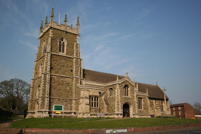
St Wilfrid's Church, Alford

St Wilfrid's, Alford is the Church of England parish church in Alford, Lincolnshire, England. It is a Grade I listed building. == Background == The church...

Alford Manor House

The Manor House is a Grade II* listed building which can be found on West street within Alford, Lincolnshire, England. It is believed to be the largest...

Corn Exchange, Alford

The Corn Exchange is a commercial building in the Market Place in Alford, Lincolnshire, England. The structure, which is currently used as a community...

Alford, Lincolnshire

Alford (pronounced OL-fərd) is a town in the East Lindsey district of Lincolnshire, England, at the foot of the Lincolnshire Wolds, which form an Area...

Tothby

Tothby is a hamlet less than 1 mile (1.6 km) north from the town of Alford, in the East Lindsey district of Lincolnshire, England. In the 1086 Domesday...

John Spendluffe Technology College

John Spendluffe Technology College is a secondary school with academy status situated on Hanby Lane in the rural market town of Alford, Lincolnshire, England...

Saleby

Saleby is a village in the civil parish of Beesby with Saleby, in the East Lindsey district of Lincolnshire, England. It is on the Alford road to Louth...

Nearby Amenities

Located within 500m of 53.270866,0.18305863
High Bibers
Place: locality
Source: Bing
Lat/Long: 53.273102/0.1875832
Lake House
Place: isolated_dwelling
Source: Bing
Lat/Long: 53.2713101/0.1823463
The data included in this document is from www.openstreetmap.org. The data is made available under ODbL.

Have you been to Windmill Lake?

Leave your review of Windmill Lake below (or comments, questions and feedback).