Amwell Magna Fishery

Lake, Pool, Pond, Freshwater Marsh in Hertfordshire East Hertfordshire

England

Amwell Magna Fishery

Gazebo reflections at Ware
Gazebo reflections at Ware Credit: Peter S

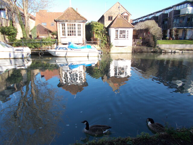
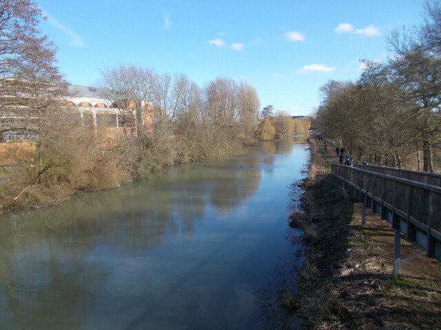
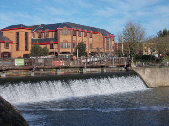
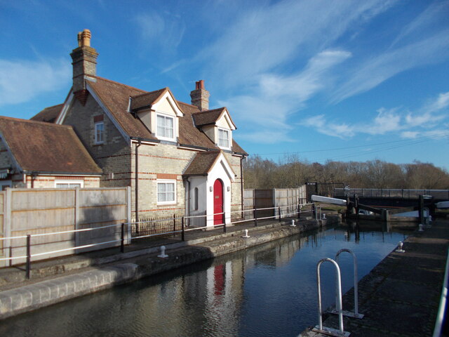
Amwell Magna Fishery is a picturesque freshwater marsh located in Hertfordshire, England. Spanning across a vast area, it comprises a combination of lakes, pools, ponds, and marshland, making it a haven for aquatic wildlife and a popular destination for anglers and nature enthusiasts alike.

The fishery boasts several well-maintained lakes, each offering a unique fishing experience. These lakes are home to a diverse range of fish species, including carp, pike, roach, and tench, providing ample opportunities for anglers of all skill levels. The tranquil surroundings and calm waters make it an ideal spot for those seeking a peaceful day of fishing.

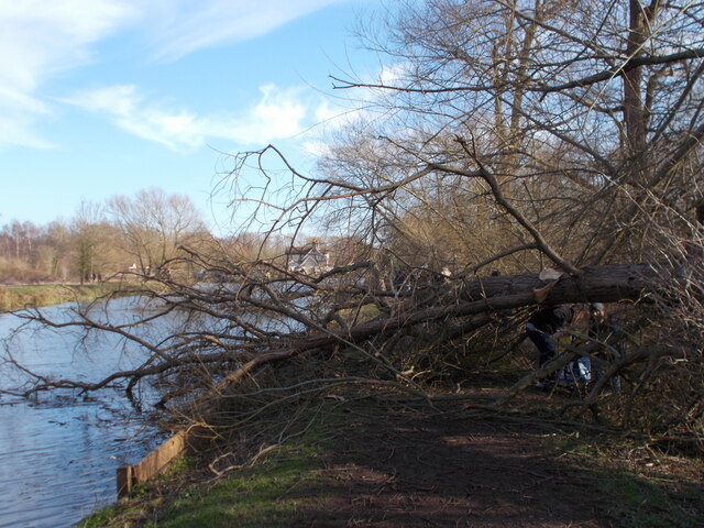
Apart from the lakes, the fishery also features smaller pools and ponds, which are teeming with various aquatic life. These areas are often frequented by birdwatchers, as they attract a wide array of waterfowl, including herons, ducks, and swans. The freshwater marshland surrounding the lakes serves as a vital habitat for many plant and animal species, offering a unique opportunity for nature enthusiasts to observe a thriving ecosystem.

Amwell Magna Fishery is well-equipped to cater to visitors' needs, with fishing platforms, picnic areas, and amenities available on-site. The management ensures the conservation of the fishery and its surroundings, maintaining a healthy balance between angling activities and the preservation of the natural environment.

Overall, Amwell Magna Fishery in Hertfordshire provides a delightful escape into nature, offering a diverse range of fishing experiences and a chance to observe the beauty of freshwater ecosystems.

If you have any feedback on the listing, please let us know in the comments section below.

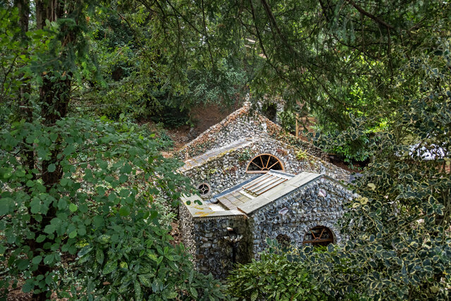
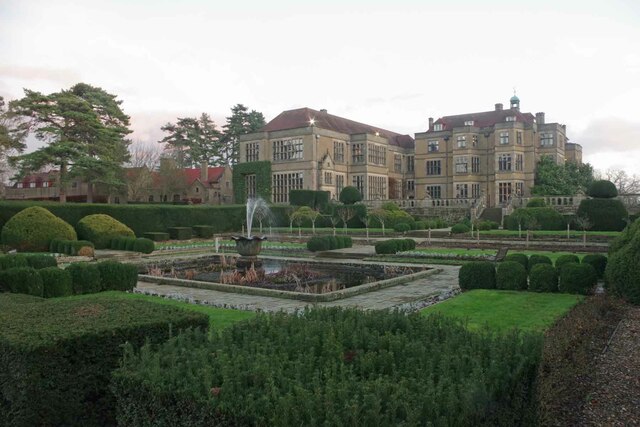
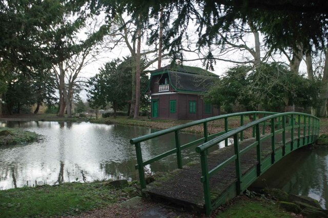
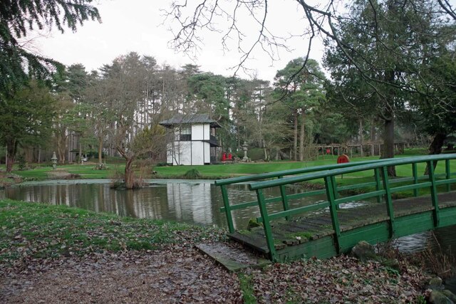
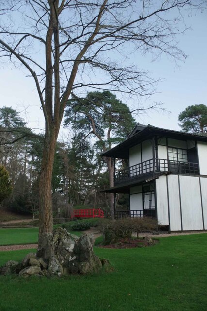
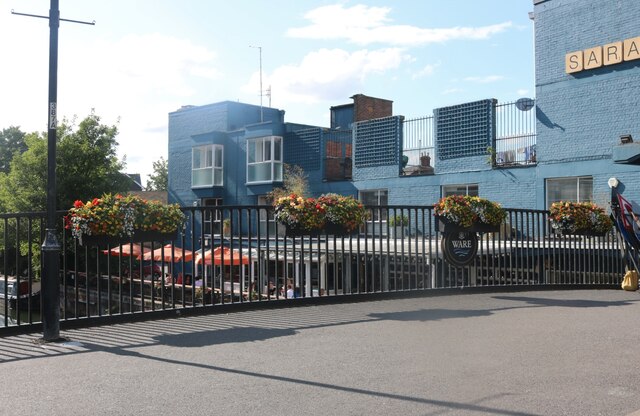
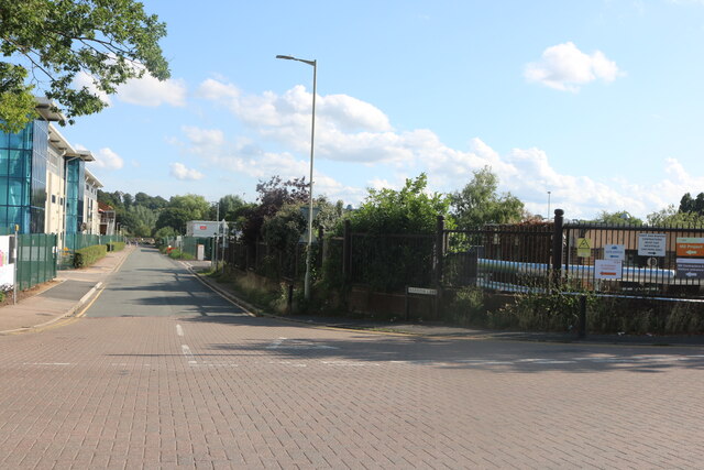
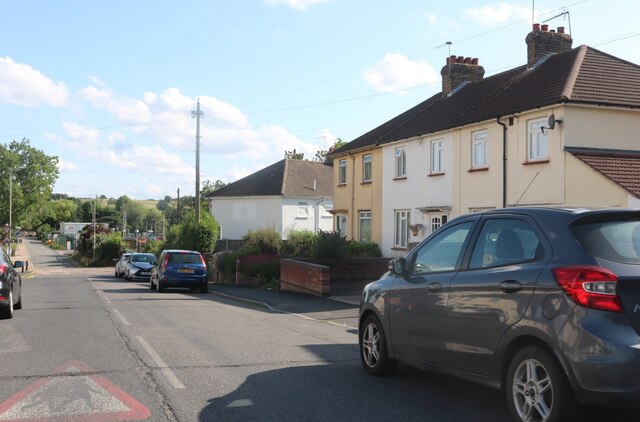
Amwell Magna Fishery Images

Images are sourced within 2km of 51.809195/-0.022591194 or Grid Reference TL3614. Thanks to Geograph Open Source API. All images are credited.

Gazebo reflections at Ware
River Lea from a footbridge
River Lea weir
River Lea weir
Fallen tree by the river near to Hardmead Lock Presumably a result of the havoc wreaked by Storm Eunice the previous weekend.
Fallen tree by the river near to Hardmead Lock
Presumably a result of the havoc wreaked by Storm Eunice the previous weekend.
Hardmead Lock Lock number 3 on the River Lee Navigation at Great Amwell, near to the town of Ware in Hertfordshire.
Hardmead Lock
Lock number 3 on the River Lee Navigation at Great Amwell, near to the town of Ware in Hertfordshire.
Ware : New River bridge weight warning sign
Ware : Scott's Grotto summerhouse Grade II* listed - <span class="nowrap"><a title="https://historicengland.org.uk/listing/the-list/list-entry/1275397" rel="nofollow ugc noopener" href="https://historicengland.org.uk/listing/the-list/list-entry/1275397">Link</a><img style="margin-left:2px;" alt="External link" title="External link - shift click to open in new window" src="https://s1.geograph.org.uk/img/external.png" width="10" height="10"/></span>.
Ware : Scott's Grotto summerhouse
Grade II* listed - LinkExternal link.
Ware : Scott's Grotto summerhouse
Ware : Scott's Grotto Grade I listed - <span class="nowrap"><a title="https://historicengland.org.uk/listing/the-list/list-entry/1238171?section=official-list-entry" rel="nofollow ugc noopener" href="https://historicengland.org.uk/listing/the-list/list-entry/1238171?section=official-list-entry">Link</a><img style="margin-left:2px;" alt="External link" title="External link - shift click to open in new window" src="https://s1.geograph.org.uk/img/external.png" width="10" height="10"/></span>.
Ware : Scott's Grotto
Grade I listed - LinkExternal link.
Fanhams Hall Now a Country House Hotel, this C18th Jacobean style mansion (remodelled in 1901) is Grade II listed. It was the former home to Henry Page-Croft, Winston Churchill's Under Secretary of State for War.
Fanhams Hall
Now a Country House Hotel, this C18th Jacobean style mansion (remodelled in 1901) is Grade II listed. It was the former home to Henry Page-Croft, Winston Churchill's Under Secretary of State for War.
Fanhams Hall & Formal Gardens Just a small part of the gardens of <a href="https://www.geograph.org.uk/photo/7380046">TL3715 : Fanhams Hall</a>
Fanhams Hall & Formal Gardens
Just a small part of the gardens of TL3715 : Fanhams Hall
The Courtyard at Fanhams Hall The courtyard of <a href="https://www.geograph.org.uk/photo/7380046">TL3715 : Fanhams Hall</a>
The Courtyard at Fanhams Hall
The courtyard of TL3715 : Fanhams Hall
Bridge & Austrian Tea Room Part of the gardens of <a href="https://www.geograph.org.uk/photo/7380046">TL3715 : Fanhams Hall</a>
Bridge & Austrian Tea Room
Part of the gardens of TL3715 : Fanhams Hall
Bridge and Japanese Tea Room Part of the Japanese Gardens in <a href="https://www.geograph.org.uk/photo/7380046">TL3715 : Fanhams Hall</a>.
Bridge and Japanese Tea Room
Part of the Japanese Gardens in TL3715 : Fanhams Hall.
Japanese Tea House Part of the Japanese garden at <a href="https://www.geograph.org.uk/photo/7380046">TL3715 : Fanhams Hall</a>
Japanese Tea House
Part of the Japanese garden at TL3715 : Fanhams Hall
The Saracens Head, Ware By the River Lea
The Saracens Head, Ware
By the River Lea
Harris's Lane, Ware
Harris's Lane, Ware
Fanshawe Crescent, Ware
Show me another place!

Amwell Magna Fishery is located at Grid Ref: TL3614 (Lat: 51.809195, Lng: -0.022591194)

Administrative County: Hertfordshire

District: East Hertfordshire

Police Authority: Hertfordshire

What 3 Words

///exam.rabble.tonic. Near Ware, Hertfordshire

Nearby Locations

Amwell Magna Fishery

Related Wikis

Beaver Group

Beaver Group is an organization whose focus is the delivery of digital signage, content design and web technologies. Beaver Group clients are spread across...

Ware railway station

Ware railway station is on the Hertford East branch line off the West Anglia Main Line in the east of England, serving the town of Ware, Hertfordshire...

Christ Church, Ware

Christ Church is a Church of England church in Ware, Hertfordshire, England. The parish was formed out of the ancient parish in 1858 and covers the East...

Ware, Hertfordshire

Ware is a town and civil parish in the East Hertfordshire district, in the county of Hertfordshire, England. It is close to the county town of Hertford...

Nearby Amenities

Located within 500m of 51.809195,-0.022591194
Mini Roundabout
Direction: clockwise
Lat/Long: 51.8055193/-0.0264702
Mini Roundabout
Direction: clockwise
Lat/Long: 51.8059428/-0.0264809
Mini Roundabout
Direction: clockwise
Lat/Long: 51.8100737/-0.0291436
Mini Roundabout
Direction: clockwise
Lat/Long: 51.8097934/-0.0261078
Ware
Public Transport: stop_position
Railway: stop
Train: yes
Lat/Long: 51.8080699/-0.0295435
Crossing
Crossing: marked
Crossing Island: no
Tactile Paving: no
Traffic Signals: yes
Lat/Long: 51.8102504/-0.0293801
Pub
The Saracen's Head
Wheelchair: no
Lat/Long: 51.8098569/-0.0294291
Direction: both
Traffic Calming: table
Lat/Long: 51.8120491/-0.0251172
Pub
The Royal Oak
Wikidata: Q26565020
Lat/Long: 51.8071881/-0.0290442
Railway: switch
Lat/Long: 51.8074841/-0.0264548
Barrier: bollard
Bollard: fixed
Material: metal
Motor Vehicle: no
Lat/Long: 51.8078802/-0.0269165
Turning Circle
Lat/Long: 51.8133383/-0.0213548
Direction: both
Traffic Calming: table
Lat/Long: 51.8111226/-0.026675
Pub
Dog and Whistle (Pop-Up)
Lat/Long: 51.8098087/-0.0272834
Turning Circle
Lat/Long: 51.812825/-0.0192085
Turning Circle
Lat/Long: 51.8129506/-0.0210952
Pub
The Angel
Wikidata: Q26512174
Lat/Long: 51.8096684/-0.0236608
Bus Stop
Ware Railway Station
Bus: yes
Local Ref: F
Naptan AtcoCode: 210021302370
Naptan Bearing: S
Naptan CommonName: Ware Railway Station
Naptan Crossing: Viaduct Road
Naptan Indicator: Stop F
Naptan Landmark: Viaduct Road
Naptan NaptanCode: hrtdtwdp
Naptan PlusbusZoneRef: WARE
Naptan ShortCommonName: NA
Naptan Street: Station Road
Naptan Verified: no
Public Transport: platform
Source: naptan_import
Lat/Long: 51.8085368/-0.0280659
Bus Stop
Ware Railway Station
Bus: yes
Local Ref: E
Naptan AtcoCode: 210021302375
Naptan Bearing: SW
Naptan CommonName: Ware Railway Station
Naptan Crossing: Viaduct Road
Naptan Indicator: Stop E
Naptan Landmark: Viaduct Road
Naptan NaptanCode: hrtdtwdt
Naptan PlusbusZoneRef: WARE
Naptan ShortCommonName: NA
Naptan Street: Station Road
Naptan Verified: no
Public Transport: platform
Source: naptan_import
Lat/Long: 51.8086963/-0.0279284
Bus Stop
Bowling Road
Bench: yes
Bus: yes
Naptan AtcoCode: 210021303020
Naptan Bearing: E
Naptan CommonName: Bowling Road
Naptan Crossing: Bowling Road
Naptan Indicator: adj
Naptan Landmark: Bowling Road
Naptan NaptanCode: hrtdtmpw
Naptan PlusbusZoneRef: WARE
Naptan ShortCommonName: NA
Naptan Street: Star Street
Naptan Verified: no
Public Transport: platform
Shelter: yes
Source: naptan_import
Lat/Long: 51.8100605/-0.028304
Bus Stop
The Angel PH
Bus: yes
Naptan AtcoCode: 210021303040
Naptan Bearing: NE
Naptan CommonName: The Angel PH
Naptan Crossing: The Angel PH
Naptan Indicator: opp
Naptan Landmark: The Angel PH
Naptan NaptanCode: hrtdtmta
Naptan PlusbusZoneRef: WARE
Naptan ShortCommonName: NA
Naptan Street: Star Street
Naptan Verified: no
Public Transport: platform
Source: naptan_import
Lat/Long: 51.8099337/-0.0228984
Musley Lane
Naptan AtcoCode: 210021303042
Naptan Bearing: NE
Naptan BusStopType: CUS
Naptan CommonName: Musley Lane
Naptan Crossing: opp Belle Vue Road
Naptan Indicator: opp
Naptan Landmark: opp Belle Vue Road
Naptan NaptanCode: hrtdtmtd
Naptan PlusbusZoneRef: WARE
Naptan ShortCommonName: NA
Naptan Street: Jeffries Road
Naptan Verified: no
Source: naptan_import
Lat/Long: 51.8119999/-0.0217054
Winton Road
Naptan AtcoCode: 210021303043
Naptan Bearing: NE
Naptan BusStopType: CUS
Naptan CommonName: Winton Road
Naptan Crossing: opp Lower Clabdens
Naptan Indicator: opp
Naptan Landmark: opp Lower Clabdens
Naptan NaptanCode: hrtdtmtg
Naptan PlusbusZoneRef: WARE
Naptan ShortCommonName: NA
Naptan Street: Cromwell Road
Naptan Verified: no
Source: naptan_import
Lat/Long: 51.8122037/-0.0188529
Hollycross Road
Naptan AtcoCode: 210021303045
Naptan Bearing: E
Naptan BusStopType: CUS
Naptan CommonName: Hollycross Road
Naptan Crossing: Little Widbury Lane
Naptan Indicator: opp
Naptan Landmark: Little Widbury Lane
Naptan NaptanCode: hrtgwmam
Naptan PlusbusZoneRef: WARE
Naptan ShortCommonName: NA
Naptan Street: Widbury Hill
Naptan Verified: no
Source: naptan_import
Lat/Long: 51.8090834/-0.0172634
Bus Stop
Winton Road
Bus: yes
Naptan AtcoCode: 210021303220
Naptan Bearing: SW
Naptan CommonName: Winton Road
Naptan Crossing: Lower Clabdens
Naptan Indicator: adj
Naptan Landmark: Lower Clabdens
Naptan NaptanCode: hrtdtmdt
Naptan PlusbusZoneRef: WARE
Naptan ShortCommonName: NA
Naptan Street: Cromwell Road
Naptan Verified: no
Public Transport: platform
Source: naptan_import
Lat/Long: 51.8121388/-0.0187397
Bus Stop
Musley Lane
Bus: yes
Naptan AtcoCode: 210021303240
Naptan Bearing: SW
Naptan CommonName: Musley Lane
Naptan Crossing: Belle Vue Road
Naptan Indicator: adj
Naptan Landmark: Belle Vue Road
Naptan NaptanCode: hrtdtmdw
Naptan PlusbusZoneRef: WARE
Naptan ShortCommonName: NA
Naptan Street: Jeffries Road
Naptan Verified: no
Public Transport: platform
Source: naptan_import
Lat/Long: 51.8119705/-0.0215616
Bus Stop
Marsh Lane
Bus: yes
Naptan AtcoCode: 210021309450
Naptan Bearing: NE
Naptan CommonName: Marsh Lane
Naptan Crossing: Viaduct Road
Naptan Indicator: NE-bound
Naptan Landmark: Viaduct Road
Naptan NaptanCode: hrtdpjdt
Naptan PlusbusZoneRef: WARE
Naptan ShortCommonName: NA
Naptan Street: Marsh Lane
Naptan Verified: no
Public Transport: platform
Source: naptan_import
Lat/Long: 51.8063298/-0.0255473
Hollycross Road
Naptan AtcoCode: 210021309535
Naptan Bearing: W
Naptan BusStopType: CUS
Naptan CommonName: Hollycross Road
Naptan Crossing: opp Little Widbury Lane
Naptan Indicator: adj
Naptan Landmark: opp Little Widbury Lane
Naptan NaptanCode: hrtgwmaj
Naptan PlusbusZoneRef: WARE
Naptan ShortCommonName: NA
Naptan Street: Widbury Hill
Naptan Verified: no
Source: naptan_import
Lat/Long: 51.8088401/-0.0172306
Bus Stop
Bowling Road
Bench: yes
Bus: yes
Naptan AtcoCode: 210021309550
Naptan Bearing: W
Naptan CommonName: Bowling Road
Naptan Crossing: opp Bowling Road
Naptan Indicator: opp
Naptan Landmark: opp Bowling Road
Naptan NaptanCode: hrtdpjmg
Naptan PlusbusZoneRef: WARE
Naptan ShortCommonName: NA
Naptan Street: Star Street
Naptan Verified: no
Public Transport: platform
Shelter: yes
Source: naptan_import
Lat/Long: 51.8100305/-0.0285333
Bus Stop
The Angel PH
Bus: yes
Naptan AtcoCode: 210021309560
Naptan Bearing: W
Naptan CommonName: The Angel PH
Naptan Crossing: The Angel PH
Naptan Indicator: o/s
Naptan Landmark: The Angel PH
Naptan NaptanCode: hrtdpjdm
Naptan PlusbusZoneRef: WARE
Naptan ShortCommonName: NA
Naptan Street: Star Street
Naptan Verified: no
Public Transport: platform
Source: naptan_import
Lat/Long: 51.8097111/-0.023561
Bus Stop
Gilpin Mews
Bench: yes
Bin: no
Bus: yes
Naptan AtcoCode: 210021311400
Naptan Bearing: NW
Naptan CommonName: John Gilpin PH
Naptan Indicator: o/s
Naptan Landmark: Unknown
Naptan NaptanCode: hrtdpatg
Naptan PlusbusZoneRef: WARE
Naptan ShortCommonName: NA
Naptan Street: London Road
Naptan Verified: no
Public Transport: platform
Shelter: yes
Source: naptan_import
Lat/Long: 51.8056261/-0.0270216
Fuel
Esso
Brand: Esso
Brand Wikidata: Q867662
Brand Wikipedia: en:Esso
Contact Website: https://www.esso.co.uk/en-gb/find-station/esso-ware-essorontecwidburyhill-100347212
Operator: Rontec
Operator Website: http://www.rontec-servicestations.co.uk/ss_results-id.cfm?id=7226
Operator Wikidata: Q107439152
Lat/Long: 51.8097414/-0.0214001
Post Box
Collection Times: Mo-Fr 17:15; Sa 12:00
Post Box Type: lamp
Ref: SG12 47
Lat/Long: 51.812016/-0.017698
Post Box
Brand: Royal Mail
Brand Wikidata: Q638098
Brand Wikipedia: en:Royal Mail
Collection Times: Mo-Fr 17:15; Sa 12:00
Operator: Royal Mail
Operator Wikidata: Q638098
Post Box Type: pillar
Ref: SG12 7
Royal Cypher: EIIR
Royal Cypher Wikidata: Q33102113
Lat/Long: 51.81073/-0.029315
Post Box
Vicarage Road
Collection Times: Mo-Fr 17:15; Sa 12:00
Post Box Type: pillar
Ref: SG12 4
Royal Cypher: GVIR
Royal Cypher Wikidata: Q33102169
Lat/Long: 51.8110471/-0.022653
Post Box
SG12 9WF – Ware Delivery Office
Collection Times: Mo-Fr 18:30; Sa 13:00
Ref: SG12 44
Lat/Long: 51.8057882/-0.0229998
Parking
Lat/Long: 51.80814/-0.027906
Clinic
Ware Health Centre
Healthcare: clinic
Lat/Long: 51.8110703/-0.0271784
Bench
Backrest: yes
Lat/Long: 51.8096437/-0.0297292
Bicycle Parking
Bicycle Parking: stands
Capacity: 6
Lat/Long: 51.809514/-0.0295905
Tumbling Bay
Place: locality
Lat/Long: 51.8085982/-0.0229389
Bench
Backrest: yes
Lat/Long: 51.8096166/-0.02983
Crossing
Crossing: unmarked
Crossing Island: no
Crossing Markings: no
Tactile Paving: yes
Traffic Calming: table
Lat/Long: 51.8074979/-0.0247992
Crossing
Crossing: unmarked
Crossing Island: no
Crossing Markings: no
Tactile Paving: yes
Lat/Long: 51.808125/-0.0241706
Give Way
Lat/Long: 51.8128421/-0.0240997
Give Way
Lat/Long: 51.812857/-0.0243679
Give Way
Lat/Long: 51.812465/-0.0224016
Give Way
Lat/Long: 51.8122538/-0.0214657
Give Way
Lat/Long: 51.8122248/-0.0204371
Give Way
Lat/Long: 51.8120415/-0.0193374
Give Way
Lat/Long: 51.812238/-0.0184844
Barrier: cycle_barrier
Bicycle: yes
Foot: yes
Image: https://www.mapillary.com/map/im/WSJmXA0vvwoYzHx3SiUJ6A
Maxwidth: 2
Lat/Long: 51.8122126/-0.0198498
Image: https://www.mapillary.com/map/im/qm4fltGPVAXaAe1r-fvuoQ
Lat/Long: 51.8128543/-0.0191919
Grit Bin
Ref: 0294
Lat/Long: 51.8130828/-0.0203324
Fire Hydrant
Emergency: fire_hydrant
Fire Hydrant Type: pillar
Operator: Thames Water
Lat/Long: 51.8131251/-0.0201621
Operator: Thames Water
Pipeline: valve
Substance: sewage
Lat/Long: 51.8122467/-0.0204387
Grit Bin
Image: https://www.mapillary.com/map/im/G4bWSdnSO_Z7NhnCPnVnwg
Lat/Long: 51.8122537/-0.0204374
Image: https://www.mapillary.com/map/im/fxa4DqB1yE5e0utDJiGRwQ
Operator: Thames Water
Pipeline: valve
Substance: sewage
Lat/Long: 51.8128772/-0.0239658
Fire Hydrant
Emergency: fire_hydrant
Fire Hydrant Type: pillar
Image: https://www.mapillary.com/map/im/9vYdV-qXsA9tWX3_b6dGSA
Operator: Thames Water
Ref: 10184
Lat/Long: 51.8126832/-0.0236412
Image: https://www.mapillary.com/map/im/iu_gJE5FeIOu7_rciYk9aw
Lat/Long: 51.8125423/-0.0225321
Fire Hydrant
Emergency: fire_hydrant
Fire Hydrant Type: pillar
Operator: Thames Water
Lat/Long: 51.8123789/-0.0216323
Image: https://www.mapillary.com/map/im/MOrxUVnKJ4S-bomcJZ_jVg
Operator: Thames Water
Pipeline: valve
Substance: sewage
Lat/Long: 51.8123516/-0.0214512
Fire Hydrant
Emergency: fire_hydrant
Fire Hydrant Type: underground
Image: https://www.mapillary.com/map/im/uCpqb2pLS5wE6UjhB2_IhQ
Operator: Thames Water
Ref: 1018?
Lat/Long: 51.813353/-0.0249581
Crossing
Crossing: marked
Crossing Ref: zebra
Source: Bing
Lat/Long: 51.8061171/-0.0265128
Ware
Naptan AtcoCode: 9100WARE
Network: National Rail
Network Website: https://www.nationalrail.co.uk/stations/war/
Network Wikidata: Q26334
Platforms: 1
Public Transport: station
Railway: station
Ref Crs: WAR
Wikidata: Q2084928
Wikipedia: en:Ware railway station
Lat/Long: 51.8080948/-0.0295377
Barrier: kissing_gate
Community Centre: club_home
Source: survey
Lat/Long: 51.8055127/-0.0262356
Bus Stop
Gilpin Mews
Bench: no
Bin: no
Bus: yes
Naptan AtcoCode: 210021303335
Naptan NaptanCode: hrtjdmta
Naptan Verified: no
Public Transport: platform
Shelter: no
Source: naptan
Lat/Long: 51.8060153/-0.0275462
Post Office
Ware Post Office
Addr City: Ware
Addr Country: GB
Addr Housenumber: 11
Addr Postcode: SG12 9BP
Addr Street: High Street
Brand: Post Office
Brand Wikidata: Q1783168
Contact Website: https://www.postoffice.co.uk/branch-finder/1511297/ware
Opening Hours: Mo-Fr 06:00-18:00; Sa 07:00-18:00; Su 07:00-13:00
Ref Pol Id: 17729
Lat/Long: 51.8102027/-0.029555
Post Box
Collection Times: Mo-Fr 17:30; Sa 12:30
Note: Inside Post Office
Ref: SG12 18
Lat/Long: 51.8101845/-0.0295805
Barrier: lift_gate
Motor Vehicle: no
Lat/Long: 51.8096987/-0.0211358
Crossing
Crossing: marked
Lat/Long: 51.8107952/-0.0293408
Parking Entrance
Lat/Long: 51.8081131/-0.0278445
Parking Entrance
Lat/Long: 51.8080792/-0.0276465
Entrance: main
Lat/Long: 51.8061493/-0.0259602
Entrance: yes
Lat/Long: 51.8061704/-0.0261907
Bicycle Parking
Bicycle Parking: stands
Covered: yes
Lat/Long: 51.8062506/-0.0258136
Leisure: outdoor_seating
Lat/Long: 51.8061129/-0.0261891
Restaurant
Brand: Beefeater
Brand Wikidata: Q4879766
Brand Wikipedia: en:Beefeater (restaurant)
Cuisine: british
Website: https://www.beefeater.co.uk/en-gb/locations/hertfordshire/ware
Lat/Long: 51.80619/-0.0259665
Crossing
Lat/Long: 51.8073476/-0.023344
Crossing
Crossing: unmarked
Crossing Island: no
Direction: both
Tactile Paving: yes
Traffic Calming: table
Lat/Long: 51.8075333/-0.0236627
Crossing
Crossing: unmarked
Crossing Island: no
Direction: both
Tactile Paving: yes
Traffic Calming: table
Lat/Long: 51.8071924/-0.0232712
Direction: both
Traffic Calming: table
Lat/Long: 51.8079444/-0.0262475
Crossing
Crossing: unmarked
Crossing Island: no
Crossing Markings: no
Tactile Paving: yes
Traffic Calming: table
Lat/Long: 51.8077849/-0.02634
Crossing
Crossing: marked
Crossing Island: no
Tactile Paving: yes
Lat/Long: 51.8086187/-0.0270818
Bench
Backrest: yes
Material: wood
Lat/Long: 51.8086995/-0.0164053
Tea On The Lea
Addr City: Ware
Addr Housename: Tumbland Bridge Near Ware River Lee
Addr Postcode: SG12 9FQ
Addr Street: River Lee Navigation
Payment Cards: yes
Payment Cash: yes
Shop: coffee
Lat/Long: 51.8084982/-0.0225807
Board Type: notice
Information: board
Operator: Ware Town Council
Tourism: information
Lat/Long: 51.8105916/-0.0293359
Barrier: bollard
Bicycle: unknown
Bollard: fixed
Material: metal
Motor Vehicle: no
Lat/Long: 51.8076913/-0.0265682
The data included in this document is from www.openstreetmap.org. The data is made available under ODbL.

Have you been to Amwell Magna Fishery?

Leave your review of Amwell Magna Fishery below (or comments, questions and feedback).