Warwick Reservoir East
Lake, Pool, Pond, Freshwater Marsh in Essex
England
Warwick Reservoir East

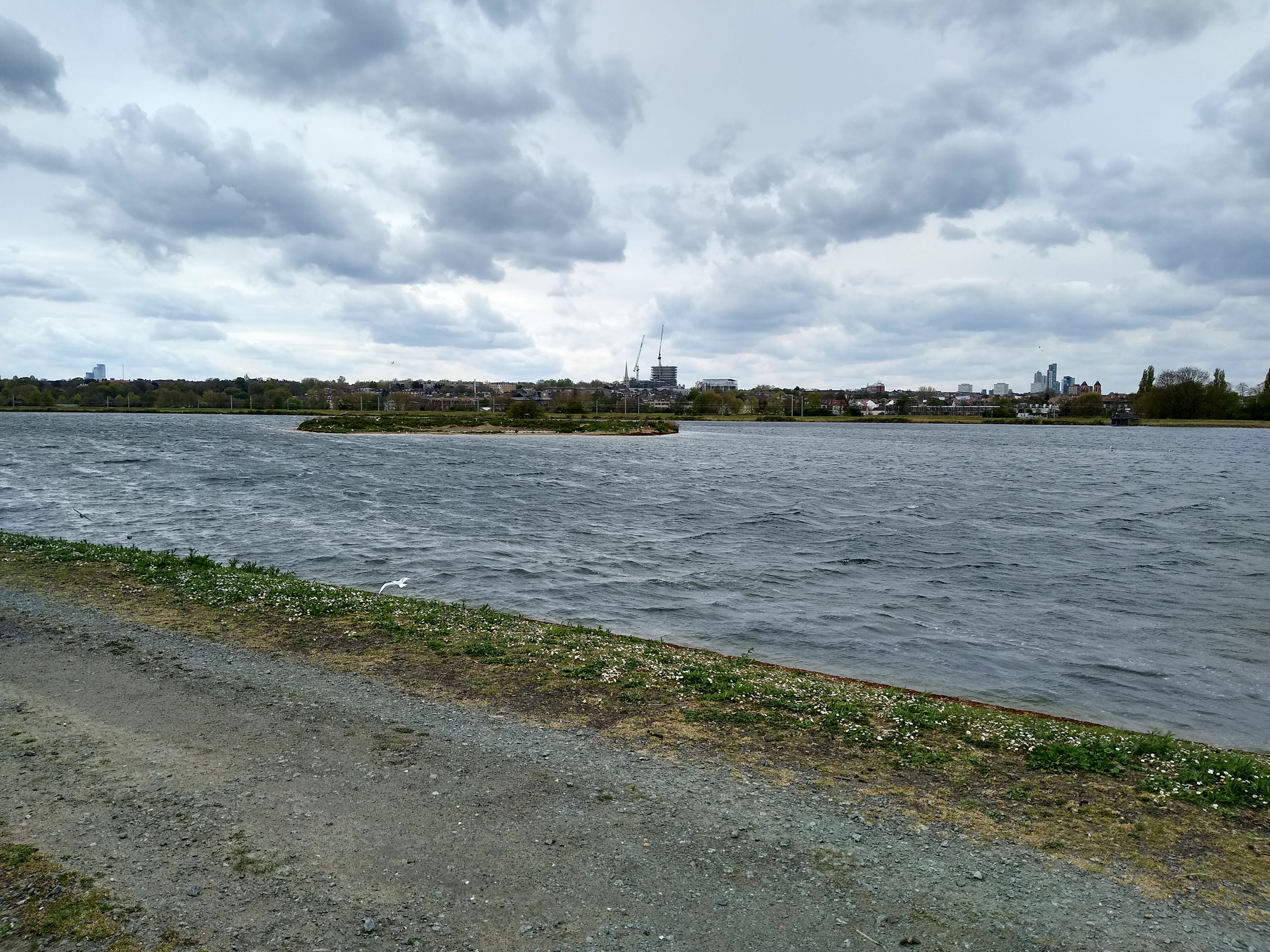
Warwick Reservoir East, located in Essex, is a picturesque freshwater body encompassing a variety of aquatic ecosystems. It is a combination of a lake, pool, pond, and freshwater marsh, providing a diverse range of habitats for numerous flora and fauna species.
The reservoir covers a substantial area, with a surface reflecting the changing colors of the sky. Its calm waters are surrounded by lush vegetation, including reeds, rushes, and water lilies, creating a serene and tranquil atmosphere. The shoreline is predominantly covered with tall grasses, shrubs, and trees, offering shade and nesting sites for various bird species.
The reservoir is a popular destination for birdwatchers, attracting a wide range of avian species throughout the year. Visitors may spot herons, swans, ducks, and geese gracefully gliding across the water or nesting among the reeds. The diverse bird population is a testament to the reservoir's importance as a breeding and feeding ground.
The underwater ecosystem of Warwick Reservoir East is equally fascinating, harboring a variety of fish species, such as perch, pike, and carp. These fish contribute to the overall ecological balance of the reservoir, providing a food source for predators and helping control the population of smaller aquatic organisms.
Additionally, the reservoir's freshwater marsh plays a crucial role in water filtration and purification, ensuring the quality of the surrounding ecosystem. The marsh is characterized by its wet, marshy ground and is inhabited by specialized plant species that thrive in such conditions.
Warwick Reservoir East offers a scenic and biodiverse environment, making it an ideal location for nature enthusiasts, photographers, and those seeking a peaceful retreat in the heart of Essex.
If you have any feedback on the listing, please let us know in the comments section below.
Warwick Reservoir East Images
Images are sourced within 2km of 51.579757/-0.055631458 or Grid Reference TQ3488. Thanks to Geograph Open Source API. All images are credited.


Warwick Reservoir East is located at Grid Ref: TQ3488 (Lat: 51.579757, Lng: -0.055631458)
Unitary Authority: Waltham Forest
Police Authority: Metropolitan
What 3 Words
///curving.sheep.lush. Near Walthamstow, London
Related Wikis
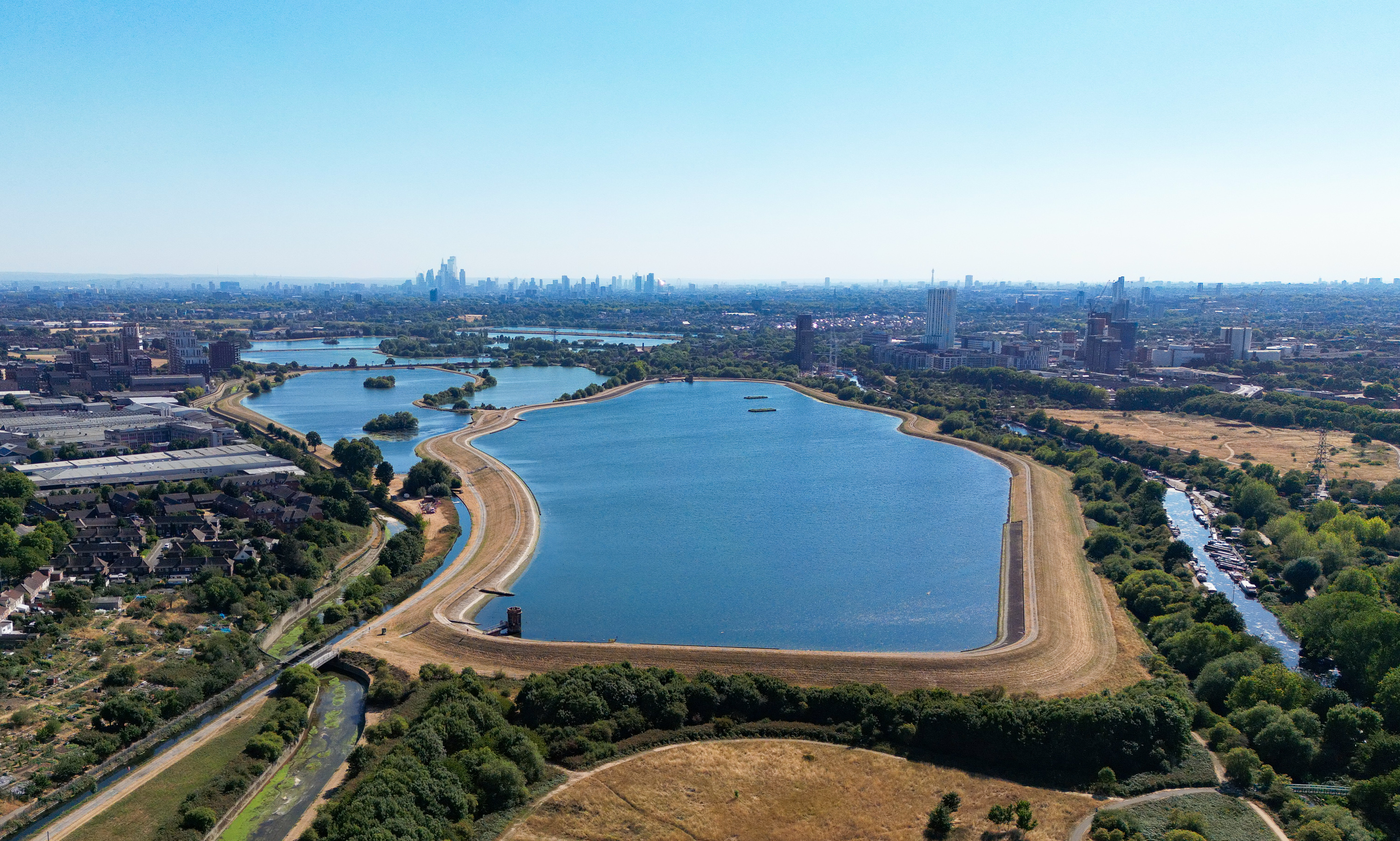
East Warwick Reservoir
East Warwick Reservoir is located in the London Borough of Waltham Forest at Walthamstow. The storage reservoir is part of the Lee Valley Reservoir Chain...

West Warwick Reservoir
West Warwick Reservoir is located in the London Borough of Waltham Forest at Walthamstow. The storage reservoir is part of the Lee Valley Reservoir Chain...
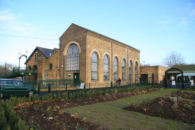
Markfield Beam Engine and Museum
Markfield Road Pumping Station, now known as Markfield Beam Engine and Museum or sometimes just as Markfield Beam Engine is a Grade II listed building...

Lee Valley Reservoir Chain
The Lee Valley Reservoir Chain is located in the Lee Valley, and comprises 13 reservoirs that supply drinking water to London.The Reservoir Chain, together...
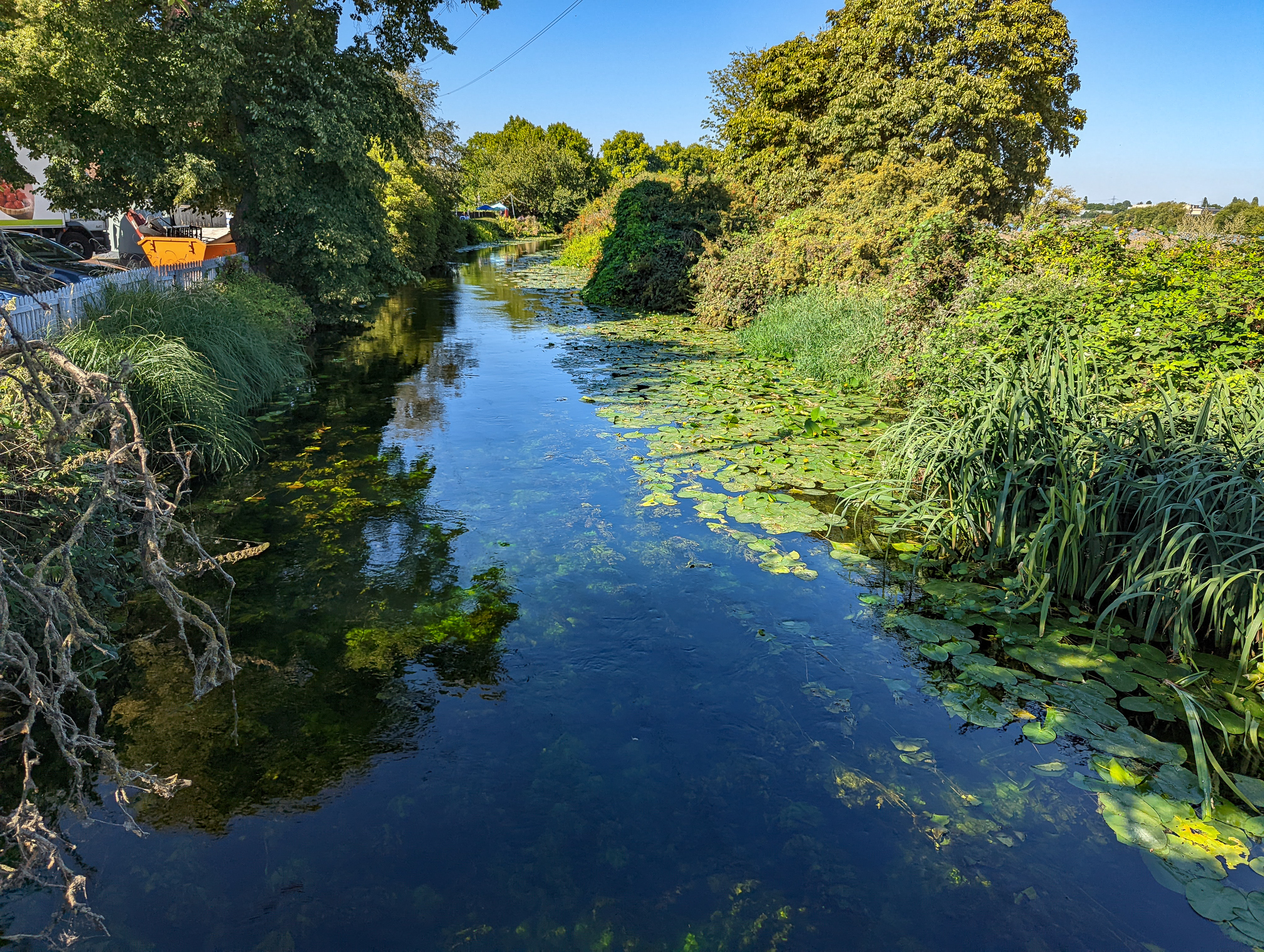
Coppermill Stream
The Coppermill Stream is a short waterway near Walthamstow in the Lea Valley. Originally a minor tributary of the River Lea, the approximately 2-mile...

Gladesmore Community School
Gladesmore Community School is a coeducational secondary school located in Tottenham, London, England.The school's specialisms include Gifted and Talented...

Coppermills Water Treatment Works
The Coppermills Water Treatment Works is a large water treatment works in the Lea Valley in east London. Completed in 1969 by the Metropolitan Water Board...
Walthamstow Wetlands
Walthamstow Wetlands is a 211-hectare (520-acre; 2.11 km2) nature reserve in Walthamstow, east London, adjacent to the historic Essex-Middlesex border...
Nearby Amenities
Located within 500m of 51.579757,-0.055631458Have you been to Warwick Reservoir East?
Leave your review of Warwick Reservoir East below (or comments, questions and feedback).