Warwick Reservoir West

Lake, Pool, Pond, Freshwater Marsh in Essex

England

Warwick Reservoir West

Lee Navigation, Tottenham Workboat Enfield chugging south alongside industrial premises on the east bank just to the north of Tottenham Lock and Ferry Road bridge.
Lee Navigation, Tottenham Credit: John Davies

Warwick Reservoir West is a picturesque freshwater body located in Essex, England. Covering an area of approximately 20 hectares, the reservoir is a popular destination for nature enthusiasts and locals seeking tranquility amidst the bustling city life.

Surrounded by lush greenery and rolling hills, Warwick Reservoir West offers a diverse range of aquatic habitats, including a lake, pool, pond, and freshwater marsh. These habitats support a variety of plant and animal species, making it an important ecological site in the region.

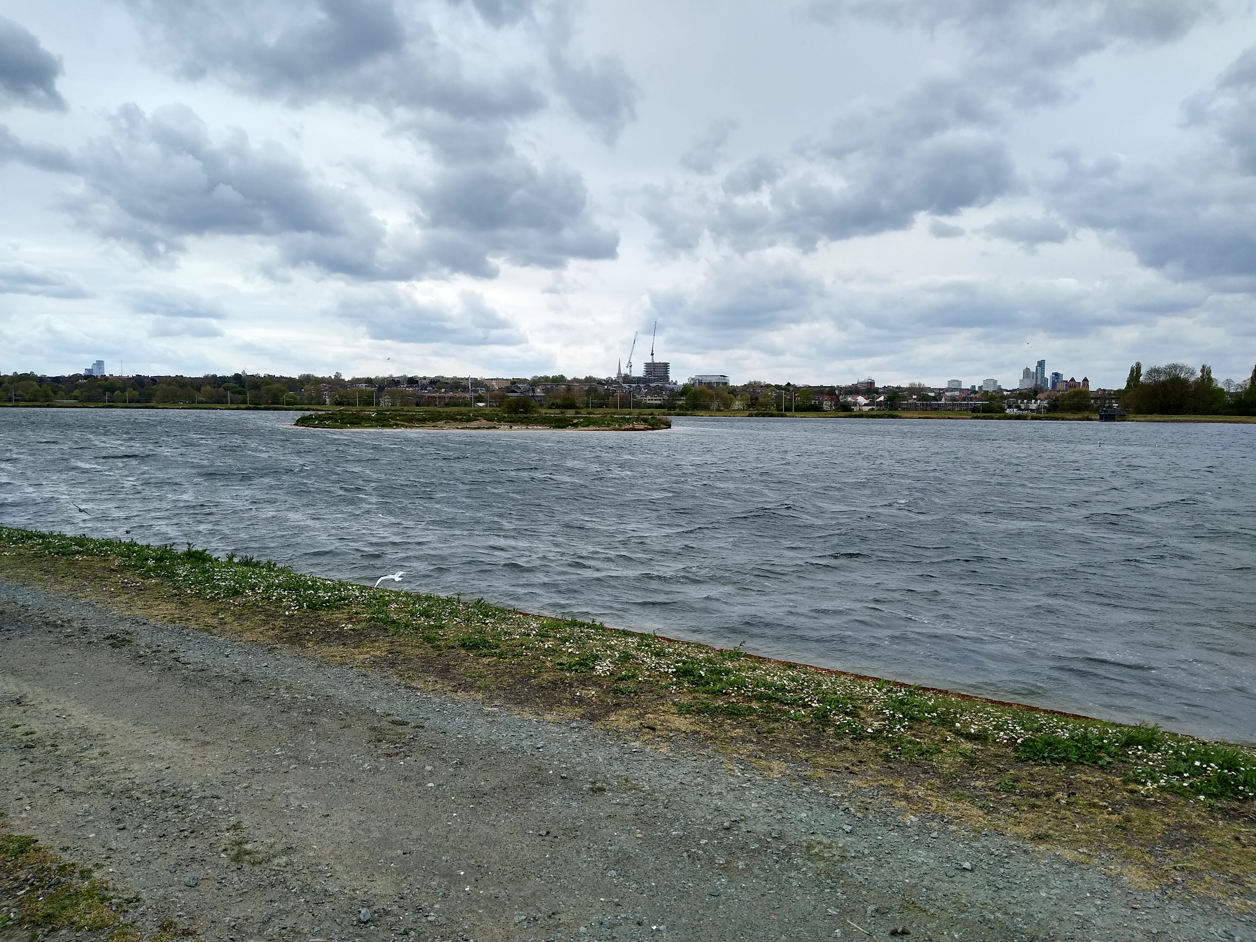
The lake is the main feature of the reservoir, with its calm and crystal-clear waters stretching across a significant portion of the area. It provides a serene environment for recreational activities such as fishing and boating. Anglers can try their luck at catching a variety of fish species, including carp, perch, and roach, while boating enthusiasts can navigate the lake's tranquil waters.

The pool and pond, located adjacent to the lake, are smaller bodies of water that offer a different experience. These areas are home to various aquatic plants and provide a habitat for frogs, newts, and other amphibians. Visitors can observe these creatures in their natural habitat and learn about their fascinating life cycles.

The freshwater marsh, located at the outskirts of the reservoir, is a wetland area with tall grasses and reeds. It provides an ideal habitat for numerous bird species, including herons and ducks, which can be observed nesting and feeding in the marsh. The marsh also supports a diverse range of insects, providing a food source for the birds and other wildlife in the area.

Overall, Warwick Reservoir West is a haven of natural beauty, offering a range of aquatic habitats and wildlife for visitors to appreciate and enjoy.

If you have any feedback on the listing, please let us know in the comments section below.

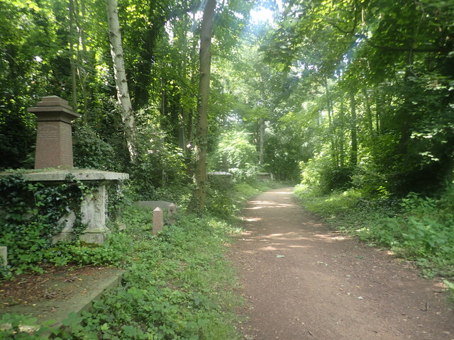
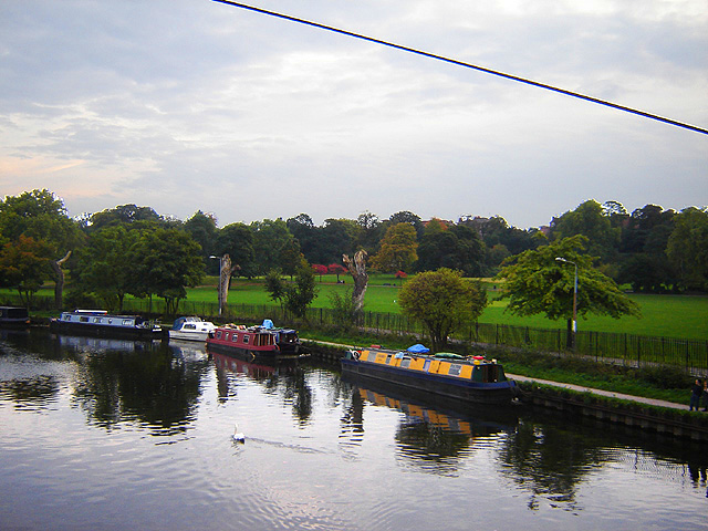
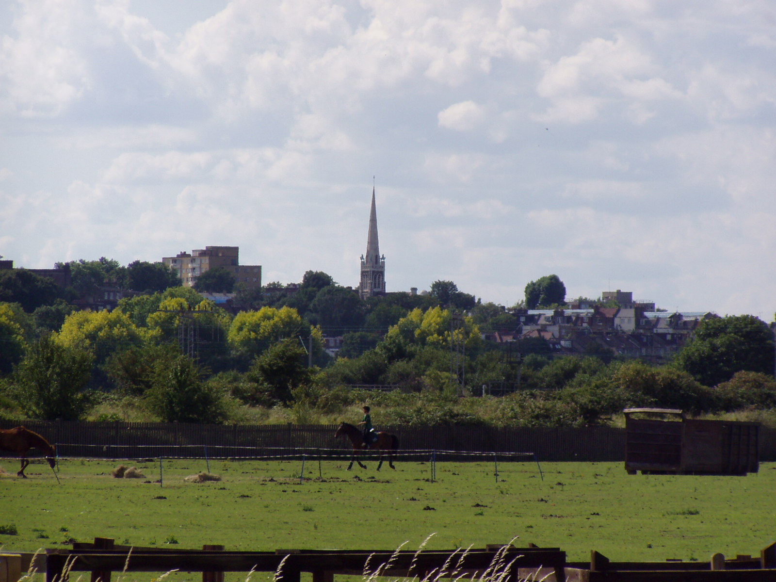
Warwick Reservoir West Images

Images are sourced within 2km of 51.576078/-0.058299645 or Grid Reference TQ3488. Thanks to Geograph Open Source API. All images are credited.

Lee Navigation, Tottenham Workboat Enfield chugging south alongside industrial premises on the east bank just to the north of Tottenham Lock and Ferry Road bridge.
Lee Navigation, Tottenham
Workboat Enfield chugging south alongside industrial premises on the east bank just to the north of Tottenham Lock and Ferry Road bridge.
Ladysmith Road N17 A side road typical of the ones in this part of Tottenham.
Ladysmith Road N17
A side road typical of the ones in this part of Tottenham.
Down Lane Recreation Ground Down Lane Recreation Ground path from Park View Road heading to Ashley Road
Down Lane Recreation Ground
Down Lane Recreation Ground path from Park View Road heading to Ashley Road
Lea Navigation The Lee Navigation is a canalised river incorporating the River Lea (River Lee). It runs from Hertford Castle Weir to the River Thames at Bow Creek; its first lock is Hertford Lock and its last Bow Locks.
See Wikipedia article: <span class="nowrap"><a title="http://en.wikipedia.org/wiki/Lee_Navigation" rel="nofollow ugc noopener" href="http://en.wikipedia.org/wiki/Lee_Navigation">Link</a><img style="margin-left:2px;" alt="External link" title="External link - shift click to open in new window" src="https://s1.geograph.org.uk/img/external.png" width="10" height="10"/></span>
Lea Navigation
The Lee Navigation is a canalised river incorporating the River Lea (River Lee). It runs from Hertford Castle Weir to the River Thames at Bow Creek; its first lock is Hertford Lock and its last Bow Locks. See Wikipedia article: LinkExternal link
River Lee Navigation, near Tottenham This stretch of the River Lee Navigation is noted for the variety of vessels moored against its banks - including one or two that are in less than perfect condition!
River Lee Navigation, near Tottenham
This stretch of the River Lee Navigation is noted for the variety of vessels moored against its banks - including one or two that are in less than perfect condition!
The southern end of Tottenham Marshes by Pymme's Brook
East Hale Allotments
East Hale Allotments (2)
East Hale Allotments (3)
Path on the east side of East Hale Allotments
Industrial roofscape by Watermead Way, N17
Cycle path towards the River Lea Navigation
The pond in Springfield Park Springfield Park was formed in 1905 from the grounds of three private houses, of which one, the White Lodge (or ‘Springfield House’), dating from the 19th century, survives in the south-west corner of the park. Springfield Park provides fine views across the Lea Valley and Walthamstow Marshes. The flower is purple loosestrife.
The pond in Springfield Park
Springfield Park was formed in 1905 from the grounds of three private houses, of which one, the White Lodge (or ‘Springfield House’), dating from the 19th century, survives in the south-west corner of the park. Springfield Park provides fine views across the Lea Valley and Walthamstow Marshes. The flower is purple loosestrife.
The chapel in Abney Park Cemetery Abney Park was originally laid out in the early 18th century by Lady Mary Abney and Dr. Isaac Watts, and the neighbouring Hartopp family. In 1840 it became a non-denominational garden cemetery, a semi-public park arboretum, and an educational institute. Abney Park Cemetery was the first cemetery to become an arboretum, housing more than 2,500 trees and shrubs from around the world.

The opening ceremony of Abney Park Cemetery was on 20th May 1840 and at the same time the first foundation stone of the chapel was laid. Central to the design of the cemetery, the chapel is the oldest non-denominational chapel in Europe. The chapel has a single interdenominational cell and one covered horse carriage entrance. The steeple standing at 120 feet was designed to be the tallest in the district at that time. The Abney Park chapel is Grade II listed and has been closed for many years due to fire damage and vandalism but seems to have been recently stabilised.

Abney Park is one of the Magnificent Seven London cemeteries. A total number of 196,843 burials took place here as of the year 2000. In 1978, apart from one forecourt building, the cemetery passed to the London Borough of Hackney as a burial ground and open space. It is now a Local Nature Reserve.
The chapel in Abney Park Cemetery
Abney Park was originally laid out in the early 18th century by Lady Mary Abney and Dr. Isaac Watts, and the neighbouring Hartopp family. In 1840 it became a non-denominational garden cemetery, a semi-public park arboretum, and an educational institute. Abney Park Cemetery was the first cemetery to become an arboretum, housing more than 2,500 trees and shrubs from around the world. The opening ceremony of Abney Park Cemetery was on 20th May 1840 and at the same time the first foundation stone of the chapel was laid. Central to the design of the cemetery, the chapel is the oldest non-denominational chapel in Europe. The chapel has a single interdenominational cell and one covered horse carriage entrance. The steeple standing at 120 feet was designed to be the tallest in the district at that time. The Abney Park chapel is Grade II listed and has been closed for many years due to fire damage and vandalism but seems to have been recently stabilised. Abney Park is one of the Magnificent Seven London cemeteries. A total number of 196,843 burials took place here as of the year 2000. In 1978, apart from one forecourt building, the cemetery passed to the London Borough of Hackney as a burial ground and open space. It is now a Local Nature Reserve.
I never knew Elvis had such power This is in Abney Park Cemetery. See <a title="https://www.geograph.org.uk/photo/3519843" href="https://www.geograph.org.uk/photo/3519843">Link</a>  for more about Abney Park Cemetery.
I never knew Elvis had such power
This is in Abney Park Cemetery. See Link for more about Abney Park Cemetery.
Path in Abney Park Cemetery Abney Park was originally laid out in the early 18th century by Lady Mary Abney and Dr. Isaac Watts, and the neighbouring Hartopp family. In 1840 it became a non-denominational garden cemetery, a semi-public park arboretum, and an educational institute. Abney Park Cemetery was the first cemetery to become an arboretum, housing more than 2,500 trees and shrubs from around the world.

The opening ceremony of Abney Park Cemetery was on 20th May 1840 and at the same time the first foundation stone of the chapel was laid.

Abney Park is one of the Magnificent Seven London cemeteries. A total number of 196,843 burials took place here as of the year 2000. In 1978, apart from one forecourt building, the cemetery passed to the London Borough of Hackney as a burial ground and open space. It is now a Local Nature Reserve and as can be seen is an oasis of greenery in this densely built-up part of London.
Path in Abney Park Cemetery
Abney Park was originally laid out in the early 18th century by Lady Mary Abney and Dr. Isaac Watts, and the neighbouring Hartopp family. In 1840 it became a non-denominational garden cemetery, a semi-public park arboretum, and an educational institute. Abney Park Cemetery was the first cemetery to become an arboretum, housing more than 2,500 trees and shrubs from around the world. The opening ceremony of Abney Park Cemetery was on 20th May 1840 and at the same time the first foundation stone of the chapel was laid. Abney Park is one of the Magnificent Seven London cemeteries. A total number of 196,843 burials took place here as of the year 2000. In 1978, apart from one forecourt building, the cemetery passed to the London Borough of Hackney as a burial ground and open space. It is now a Local Nature Reserve and as can be seen is an oasis of greenery in this densely built-up part of London.
Show me another place!

Warwick Reservoir West is located at Grid Ref: TQ3488 (Lat: 51.576078, Lng: -0.058299645)

Unitary Authority: Waltham Forest

Police Authority: Metropolitan

What 3 Words

///ending.fakes.split. Near Hackney, London

Related Wikis

West Warwick Reservoir

West Warwick Reservoir is located in the London Borough of Waltham Forest at Walthamstow. The storage reservoir is part of the Lee Valley Reservoir Chain...

Lea Rowing Club

Lea Rowing Club is a rowing club based in Hackney, London, U.K. on the River Lea.Founded in 1980 by the merger of several clubs, it is now the largest...

East Warwick Reservoir

East Warwick Reservoir is located in the London Borough of Waltham Forest at Walthamstow. The storage reservoir is part of the Lee Valley Reservoir Chain...

Springfield Park (London)

Springfield Park is a park in Upper Clapton in the London Borough of Hackney. Spring Hill Recreation Ground, immediately to the north of the park, is an...

Springfield (Hackney ward)

Springfield is a ward in the London Borough of Hackney occupying much of Upper Clapton and some of Stamford Hill; the ward is part of the Hackney North...

Gladesmore Community School

Gladesmore Community School is a coeducational secondary school located in Tottenham, London, England.The school's specialisms include Gifted and Talented...

Cathedral of the Nativity of Our Lord, Upper Clapton

The Cathedral of the Nativity of Our Lord is a Georgian Orthodox church located on the border of Upper Clapton and Stamford Hill, London. Since its opening...

Clapton, London

Clapton is a district of East London, England, in the London Borough of Hackney. Clapton is divided into Upper Clapton, in the north, and Lower Clapton...

Nearby Amenities

Located within 500m of 51.576078,-0.058299645
Railway: switch
Lat/Long: 51.5741874/-0.0528648
Ref GB Tflcid: RWG146678
Traffic Calming: hump
Lat/Long: 51.5768164/-0.0518255
Power: tower
Lat/Long: 51.5757916/-0.0521629
Ref GB Tflcid: RWG014515
Traffic Calming: hump
Lat/Long: 51.5750142/-0.0612992
Ref GB Tflcid: RWG014512
Traffic Calming: hump
Lat/Long: 51.5749643/-0.0611862
Bicycle Parking
Bicycle Parking: stands
Capacity: 10
Covered: no
Source: survey
Lat/Long: 51.5747191/-0.0530695
Club: rowing
Lat/Long: 51.5757502/-0.0604652
Bus Stop
Craven Park Road
Bus: yes
Naptan AtcoCode: 490005721N
Naptan Bearing: N
Naptan CommonName: Craven Park Road
Naptan Verified: no
Public Transport: platform
Lat/Long: 51.5766104/-0.0653067
Bus Stop
Craven Park Road
Bus: yes
Naptan AtcoCode: 490005721S
Naptan Bearing: N
Naptan CommonName: Craven Park Road
Naptan Verified: no
Public Transport: platform
Lat/Long: 51.5764005/-0.0650755
Bus Stop
Egerton Road
Bus: yes
Naptan AtcoCode: 490007561N
Naptan Bearing: S
Naptan CommonName: Grovelands Road Riverside Rd
Naptan Indicator: Stop
Naptan Verified: no
Public Transport: platform
Lat/Long: 51.5779242/-0.0637504
Bus Stop
Grovelands Road
Bus: yes
Naptan AtcoCode: 490007561S
Naptan Bearing: N
Naptan CommonName: Grovelands Road Riverside Rd
Naptan Indicator: Stop
Naptan Verified: no
Public Transport: platform
Lat/Long: 51.5779821/-0.0639268
Car Sharing
Operator: Streetcar
Operator Wikidata: Q7623070
Lat/Long: 51.5753534/-0.0614446
Historic: ruins
Lat/Long: 51.5785537/-0.0643143
Barrier: cycle_barrier
Bicycle: yes
Cycle Barrier: double
Cycle Barrier Installation: openable
Foot: yes
Lat/Long: 51.5747282/-0.053182
Railway: railway_crossing
Lat/Long: 51.5739227/-0.0523797
Railway: switch
Lat/Long: 51.5742111/-0.0528273
Barrier: kissing_gate
Foot: yes
Lat/Long: 51.5727936/-0.0553712
Recycling
Recycling Beverage Cartons: yes
Recycling Cans: yes
Recycling Cardboard: yes
Recycling Clothes: yes
Recycling Foil: yes
Recycling Glass Bottles: yes
Recycling Newspaper: yes
Recycling Paper: yes
Recycling Plastic Bottles: yes
Recycling Plastic Packaging: yes
Recycling Small Appliances: yes
Recycling Small Electrical Appliances: yes
Recycling Type: container
Lat/Long: 51.5730688/-0.0589256
Access: yes
Barrier: height_restrictor
Check Date: 2023-08-27
Colour: yellow
Material: metal
Maxheight: 2.3
Wheelchair: yes
Lat/Long: 51.5730929/-0.0593719
Timber Crane
Historic: yes
Note: This is the timber crane from the old timber merchant that was based on the site. It was kept here as a condition of planning for the Oak Wharf development.
Lat/Long: 51.5766594/-0.0608809
Barrier: kissing_gate
Lat/Long: 51.5745476/-0.0538763
Ref GB Tflcid: RWG013855
Traffic Calming: hump
Lat/Long: 51.5721225/-0.0608427
Crossing
Crossing: unmarked
Crossing Island: no
Crossing Markings: no
Lat/Long: 51.5721736/-0.0609087
Railway: level_crossing
Lat/Long: 51.5747/-0.0537165
Railway: level_crossing
Lat/Long: 51.5747216/-0.0536799
Stop
Direction: forward
Lat/Long: 51.5762806/-0.0521768
Walthamstow Wetlands
Rcn: yes
Rcn Name: Walthamstow Wetlands
Lat/Long: 51.575808/-0.0526511
Ref: 6
Source: gps+mapnoter
Tourism: information
Lat/Long: 51.5790631/-0.0530326
Ref: 9
Source: gps+mapnoter
Tourism: information
Lat/Long: 51.5766799/-0.0523388
Recycling
Location: overground
Recycling Type: container
Lat/Long: 51.5758644/-0.052708
Welcome to the Lee Valley
Tourism: information
Lat/Long: 51.5732543/-0.0580497
Tourism: viewpoint
Lat/Long: 51.5773496/-0.0521535
Give Way
Direction: forward
Lat/Long: 51.5770824/-0.0644995
Barrier: kissing_gate
Lat/Long: 51.5757389/-0.0526576
Coppermill North Junction
Railway: junction
Lat/Long: 51.5741625/-0.0527844
Barrier: cycle_barrier
Bicycle: yes
Cycle Barrier: double
Cycle Barrier Installation: fixed
Foot: yes
Lat/Long: 51.573173/-0.0582549
Brand: Legible London
Brand Wikidata: Q6518074
Information: map
Map Size: local
Map Type: street
Network: legible_london
Operator: Transport for London
Operator Type: government
Operator Wikidata: Q682520
Tourism: information
Lat/Long: 51.5731576/-0.0589583
Coppermill Junction
Railway: junction
Lat/Long: 51.5741978/-0.0528442
Bench: yes
Covered: no
Leisure: picnic_table
Survey Date: 2021-11-15
Lat/Long: 51.5748314/-0.0529047
Barrier: swing_gate
Survey Date: 2021-11-15
Swing Gate Type: single
Lat/Long: 51.5748486/-0.0534037
Fixme: Retrace path once aerial map is updated
Lat/Long: 51.5759252/-0.0532392
Give Way
Direction: forward
Lat/Long: 51.578403/-0.06409
Give Way
Direction: forward
Lat/Long: 51.5784789/-0.0639978
Give Way
Direction: backward
Lat/Long: 51.5781803/-0.0638707
Give Way
Direction: forward
Lat/Long: 51.5776981/-0.0636724
Give Way
Direction: backward
Lat/Long: 51.5773799/-0.0635565
Give Way
Direction: backward
Lat/Long: 51.5771727/-0.0645569
Give Way
Direction: backward
Lat/Long: 51.5769063/-0.065363
Give Way
Direction: backward
Lat/Long: 51.5744809/-0.0643157
Camera Mount: pole
Camera Type: fixed
Man Made: surveillance
Surveillance: public
Surveillance Type: camera
Survey Date: 2022-04-16
Lat/Long: 51.5736863/-0.0613537
Camera Mount: pole
Camera Type: fixed
Man Made: surveillance
Surveillance: public
Surveillance Type: camera
Survey Date: 2022-04-16
Lat/Long: 51.5733443/-0.0615112
Bicycle Parking
Bicycle Parking: stands
Capacity: 8
Covered: no
Survey Date: 2022-04-16
Lat/Long: 51.5730605/-0.0614192
Bench: yes
Covered: no
Leisure: picnic_table
Material: wood
Lat/Long: 51.5719029/-0.0580832
Leisure: pitch
Sport: table_tennis
Lat/Long: 51.571667/-0.0580356
Traffic Calming: hump
Lat/Long: 51.5746713/-0.0643478
Traffic Calming: hump
Lat/Long: 51.5748113/-0.0617959
Bicycle Parking
Bicycle Parking: stands
Capacity: 8
Covered: no
Lat/Long: 51.577048/-0.0523053
Bicycle Parking
Bicycle Parking: stands
Capacity: 4
Covered: no
Ref GB Tflcid: RWG010033
Lat/Long: 51.5720844/-0.0607194
Ref GB Tflcid: RWG013909
Traffic Calming: hump
Lat/Long: 51.5752358/-0.064605
Ref GB Tflcid: RWG146686
Traffic Calming: hump
Lat/Long: 51.5753374/-0.0530661
Ref GB Tflcid: RWG146676
Traffic Calming: hump
Lat/Long: 51.577034/-0.0513149
Ref GB Tflcid: RWG013913
Traffic Calming: cushion
Lat/Long: 51.576097/-0.0649977
Ref GB Tflcid: RWG013920
Traffic Calming: cushion
Lat/Long: 51.5761662/-0.0640754
Ref GB Tflcid: RWG013914
Traffic Calming: cushion
Lat/Long: 51.5765178/-0.0651877
Ref GB Tflcid: RWG146681
Traffic Calming: hump
Lat/Long: 51.5761611/-0.052335
Ref GB Tflcid: RWG288608
Traffic Calming: hump
Lat/Long: 51.57722/-0.0642029
Ref GB Tflcid: RWG013918
Traffic Calming: cushion
Lat/Long: 51.5768603/-0.0643967
Ref GB Tflcid: RWG288014
Traffic Calming: hump
Lat/Long: 51.5770421/-0.0648911
Ref GB Tflcid: RWG013906
Traffic Calming: hump
Lat/Long: 51.5742493/-0.0647158
Ref GB Tflcid: RWG288019
Traffic Calming: hump
Lat/Long: 51.5774504/-0.0646834
Ref GB Tflcid: RWG287110
Traffic Calming: cushion
Lat/Long: 51.5777908/-0.0637754
Ref GB Tflcid: RWG287111
Traffic Calming: cushion
Lat/Long: 51.5782792/-0.0639749
Bicycle Parking
Access: yes
Bicycle Parking: stands
Capacity: 2
Colour: black
Covered: no
Fee: no
Indoor: no
Level: 0
Lit: yes
Ref GB Tflcid: RWG010031
Lat/Long: 51.5730653/-0.0592253
Bicycle Parking
Access: yes
Bicycle Parking: stands
Capacity: 2
Colour: black
Covered: no
Fee: no
Indoor: no
Level: 0
Lit: yes
Ref GB Tflcid: RWG010030
Lat/Long: 51.5731015/-0.0591607
Barrier: cycle_barrier
Lat/Long: 51.5764728/-0.060805
Barrier: bollard
Lat/Long: 51.5777921/-0.0615629
Reliance Veneer
Addr City: London
Addr Street: Leadale Wharf
Man Made: works
Lat/Long: 51.574687/-0.0627522
Traffic Calming: bump
Lat/Long: 51.574589/-0.0625656
Addr City: London
Addr Housenumber: 1
Addr Street: Watermint Quay
Lat/Long: 51.5747211/-0.0626058
Addr City: London
Addr Housenumber: 2
Addr Street: Watermint Quay
Lat/Long: 51.5745135/-0.0624303
Addr City: London
Addr Housenumber: 77
Addr Street: Watermint Quay
Lat/Long: 51.5753945/-0.0604516
Addr City: London
Addr Housenumber: 76
Addr Street: Watermint Quay
Lat/Long: 51.5750448/-0.0602859
Bench
Access: yes
Backrest: yes
Colour: brown
Direction: 80
Inscription: Eve often used to sit here on a sunny or drizzly day Please take her place
Level: 0
Lit: no
Material: wood
Seats: 3
Lat/Long: 51.5734074/-0.0590526
Bicycle Parking
Access: yes
Bicycle Parking: rack
Capacity: 4
Check Date: 2024-03-16
Colour: grey
Covered: no
Fee: no
Indoor: no
Level: 0
Lit: no
Lat/Long: 51.5733315/-0.0591118
Bench
Backrest: yes
Check Date: 2023-06-04
Lat/Long: 51.5731469/-0.0589673
Bench
Backrest: yes
Check Date: 2023-06-04
Lat/Long: 51.5731412/-0.0589866
Waste Basket
Colour: black
Material: metal
Waste: trash
Lat/Long: 51.5731512/-0.0589413
Bar
Access: customers
Level: 1
Lat/Long: 51.5734877/-0.0591044
Waste Basket
Waste: dog_excrement
Lat/Long: 51.5732827/-0.0570617
Waste Basket
Check Date: 2023-08-19
Waste: dog_excrement
Lat/Long: 51.572909/-0.0555733
Board Title: Horse Shoe Thicket
Board Type: nature
Information: board
Tourism: information
Lat/Long: 51.5730153/-0.0555608
Information: board
Tourism: information
Lat/Long: 51.574683/-0.0531388
Waste Basket
Waste: dog_excrement
Lat/Long: 51.5746748/-0.0531013
Board Title: Coppermill Fields
Check Date: 2023-08-21
Information: board
Tourism: information
Lat/Long: 51.574758/-0.0530723
Check Date: 2023-08-29
Marker: post
Material: wood
Ref: 12
Lat/Long: 51.5747367/-0.0530634
Bench
Backrest: no
Lat/Long: 51.5742178/-0.0594783
Noexit: yes
Lat/Long: 51.5735933/-0.0596237
Information: guidepost
Source: Survey 2024-03
Tourism: information
Lat/Long: 51.5761907/-0.0522655
The data included in this document is from www.openstreetmap.org. The data is made available under ODbL.

Have you been to Warwick Reservoir West?

Leave your review of Warwick Reservoir West below (or comments, questions and feedback).