Heronswood Mere

Lake, Pool, Pond, Freshwater Marsh in Surrey Reigate and Banstead

England

Heronswood Mere

Watercolour A major housing development on the site of the old Holmethorpe sand quarry, marketed as Watercolour, built over the first 15 years or so of the 21st Century. The lake was landscaped from the quarry itself and is now a nature reserve.
Watercolour Credit: Ian Capper

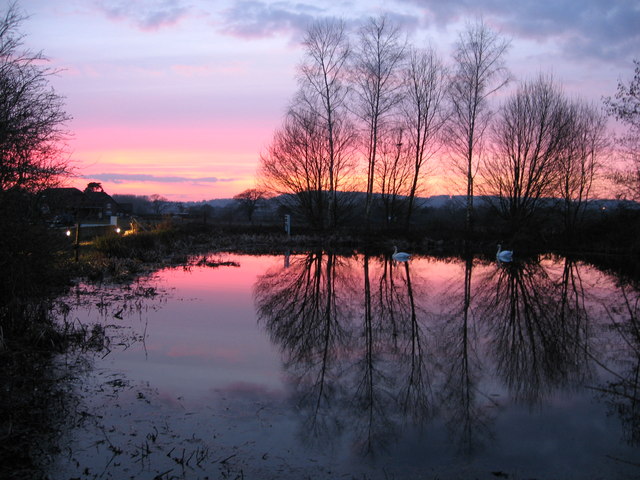
Heronswood Mere is a picturesque freshwater marsh located in the mesmerizing county of Surrey, England. Situated amidst the rolling green hills and serene countryside, this natural oasis offers a serene and tranquil escape for nature enthusiasts and those seeking solace in the beauty of the great outdoors.

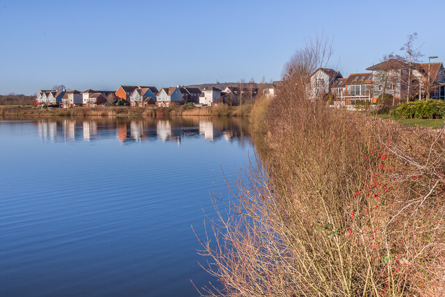
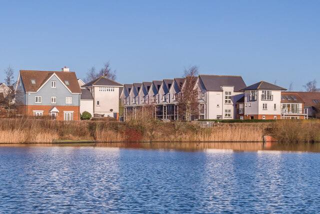
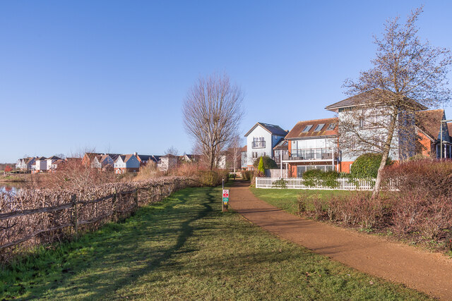
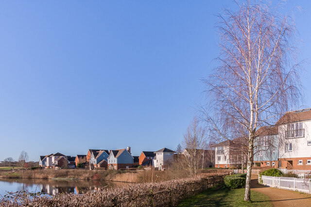
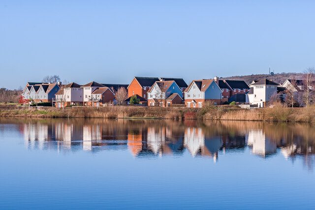
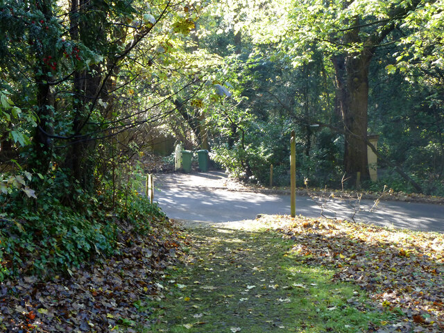
Spanning over an area of approximately 10 acres, Heronswood Mere is a diverse ecosystem that comprises a lake, pool, pond, and a flourishing freshwater marsh. The lake, with its crystal-clear waters, is a glistening centerpiece attracting a variety of waterfowl and mesmerizing aquatic plants. The pool, a smaller body of water adjacent to the lake, provides a safe haven for various fish species and serves as a crucial habitat for amphibians.

Surrounding the lake and pool, the pond is a haven for an array of aquatic plants, including lilies and reeds, creating a vibrant and colorful landscape. The gentle sound of water trickling and the sight of dragonflies hovering above make the pond a peaceful spot for contemplation.

The freshwater marsh, a vital part of the ecosystem, supports a wide range of plant and animal species. The wetland area is home to numerous water-loving plants, such as cattails and water lilies, while providing a habitat for a diverse array of birds, insects, and small mammals.

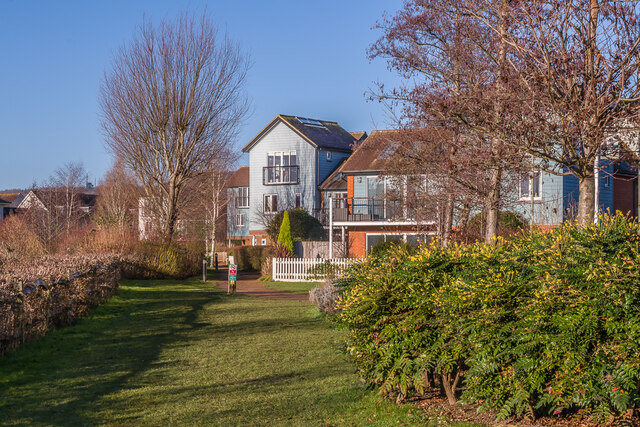
Heronswood Mere, with its interconnected bodies of water and lush vegetation, offers a harmonious and balanced environment. The peaceful atmosphere, combined with the abundance of wildlife, makes this natural gem a haven for both wildlife enthusiasts and those seeking a tranquil retreat in the heart of Surrey.

If you have any feedback on the listing, please let us know in the comments section below.

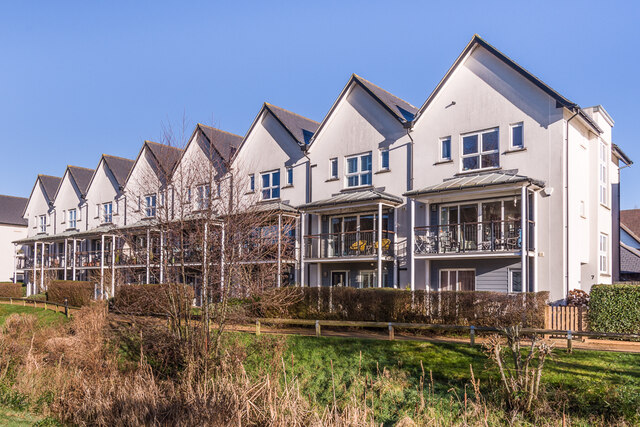
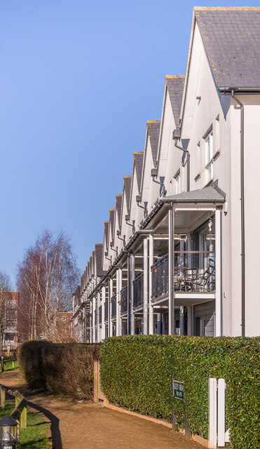
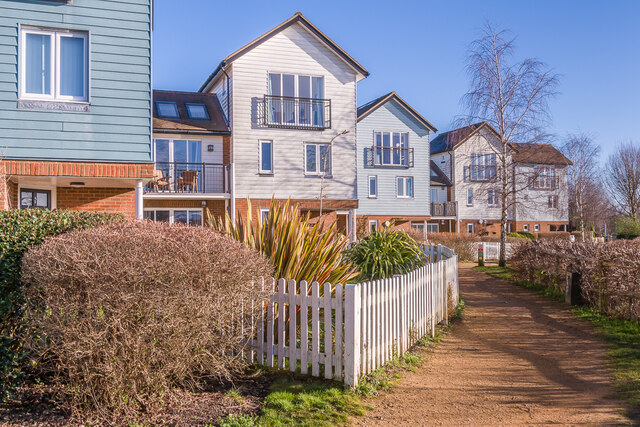
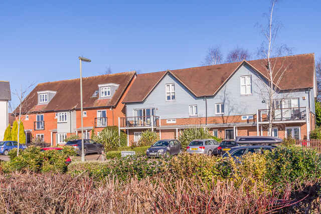
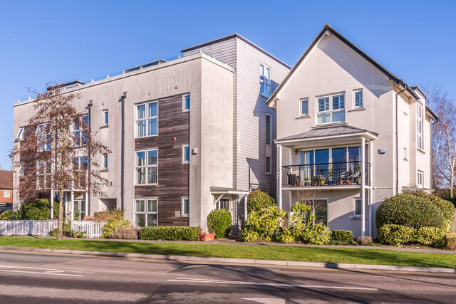
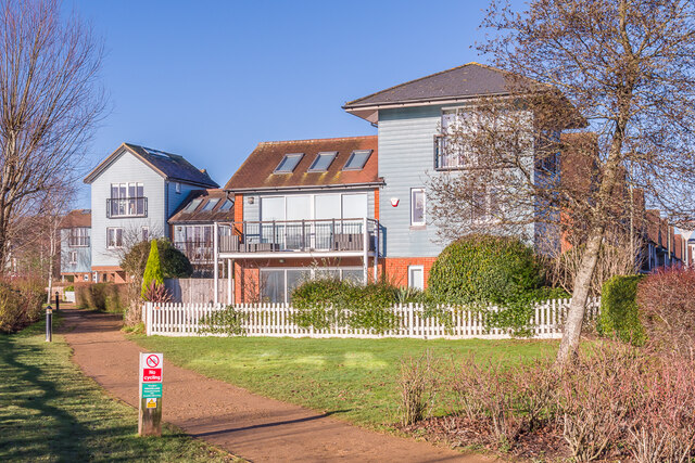
Heronswood Mere Images

Images are sourced within 2km of 51.266078/-0.13893877 or Grid Reference TQ2953. Thanks to Geograph Open Source API. All images are credited.

Watercolour A major housing development on the site of the old Holmethorpe sand quarry, marketed as Watercolour, built over the first 15 years or so of the 21st Century. The lake was landscaped from the quarry itself and is now a nature reserve.
Watercolour
A major housing development on the site of the old Holmethorpe sand quarry, marketed as Watercolour, built over the first 15 years or so of the 21st Century. The lake was landscaped from the quarry itself and is now a nature reserve.
Watercolour A major housing development on the site of the old Holmethorpe sand quarry, marketed as Watercolour, built over the first 15 years or so of the 21st Century. The houses here are in Lilley Mead and Holmesdale Avenue.
Watercolour
A major housing development on the site of the old Holmethorpe sand quarry, marketed as Watercolour, built over the first 15 years or so of the 21st Century. The houses here are in Lilley Mead and Holmesdale Avenue.
Watercolour A major housing development on the site of the old Holmethorpe sand quarry, marketed as Watercolour, built over the first 15 years or so of the 21st Century. The houses here are in The Moors and Lilley Mead.  The lake was landscaped from the quarry itself and is now a nature reserve.
Watercolour
A major housing development on the site of the old Holmethorpe sand quarry, marketed as Watercolour, built over the first 15 years or so of the 21st Century. The houses here are in The Moors and Lilley Mead. The lake was landscaped from the quarry itself and is now a nature reserve.
Hylton Place Houses in Hylton Place, part of Watercolour, a major housing development on the site of the old Holmethorpe sand quarry, built over the first 15 years or so of the 21st Century.  These buildings were completed in 2009.
Hylton Place
Houses in Hylton Place, part of Watercolour, a major housing development on the site of the old Holmethorpe sand quarry, built over the first 15 years or so of the 21st Century. These buildings were completed in 2009.
Hylton Place/Daws Place Houses in Hylton Place (the left hand end of this block) and Daws Place (the right hand end), part of Watercolour, a major housing development on the site of the old Holmethorpe sand quarry, built over the first 15 years or so of the 21st Century.  These buildings were completed in 2008/9.
Hylton Place/Daws Place
Houses in Hylton Place (the left hand end of this block) and Daws Place (the right hand end), part of Watercolour, a major housing development on the site of the old Holmethorpe sand quarry, built over the first 15 years or so of the 21st Century. These buildings were completed in 2008/9.
Daws Place/Lilley Mead Houses in Daws Place (the left hand end of this block) and Lilley Mead (the right hand end), part of Watercolour, a major housing development on the site of the old Holmethorpe sand quarry, built over the first 15 years or so of the 21st Century.  These buildings were completed in 2008/9.
Daws Place/Lilley Mead
Houses in Daws Place (the left hand end of this block) and Lilley Mead (the right hand end), part of Watercolour, a major housing development on the site of the old Holmethorpe sand quarry, built over the first 15 years or so of the 21st Century. These buildings were completed in 2008/9.
Daws Place/Lilley Mead Houses in Lilley Mead (nearest) and Daws Place (beyond), part of Watercolour, a major housing development on the site of the old Holmethorpe sand quarry, built over the first 15 years or so of the 21st Century.  These buildings were completed in 2008/9.
Daws Place/Lilley Mead
Houses in Lilley Mead (nearest) and Daws Place (beyond), part of Watercolour, a major housing development on the site of the old Holmethorpe sand quarry, built over the first 15 years or so of the 21st Century. These buildings were completed in 2008/9.
Lilley Mead Houses in Lilley Mead, part of Watercolour, a major housing development on the site of the old Holmethorpe sand quarry, built over the first 15 years or so of the 21st Century.  These buildings were completed in 2007.
Lilley Mead
Houses in Lilley Mead, part of Watercolour, a major housing development on the site of the old Holmethorpe sand quarry, built over the first 15 years or so of the 21st Century. These buildings were completed in 2007.
2 - 10 Holmesdale Avenue Houses in Holmesdale Avenue, part of Watercolour, a major housing development on the site of the old Holmethorpe sand quarry, built over the first 15 years or so of the 21st Century.  These buildings were completed in 2006.
2 - 10 Holmesdale Avenue
Houses in Holmesdale Avenue, part of Watercolour, a major housing development on the site of the old Holmethorpe sand quarry, built over the first 15 years or so of the 21st Century. These buildings were completed in 2006.
12 - 18 Holmesdale Avenue Houses in Holmesdale Avenue, part of Watercolour, a major housing development on the site of the old Holmethorpe sand quarry, built over the first 15 years or so of the 21st Century.  These buildings were completed in 2006/7.
12 - 18 Holmesdale Avenue
Houses in Holmesdale Avenue, part of Watercolour, a major housing development on the site of the old Holmethorpe sand quarry, built over the first 15 years or so of the 21st Century. These buildings were completed in 2006/7.
Watercolour A major housing development on the site of the old Holmethorpe sand quarry, marketed as Watercolour, built over the first 15 years or so of the 21st Century. The houses here are in Lilley Mead and Holmesdale Avenue.
Watercolour
A major housing development on the site of the old Holmethorpe sand quarry, marketed as Watercolour, built over the first 15 years or so of the 21st Century. The houses here are in Lilley Mead and Holmesdale Avenue.
Watercolour A major housing development on the site of the old Holmethorpe sand quarry, marketed as Watercolour, built over the first 15 years or so of the 21st Century. The nearer houses here are in Lilley Mead and Holmesdale Avenue.
Watercolour
A major housing development on the site of the old Holmethorpe sand quarry, marketed as Watercolour, built over the first 15 years or so of the 21st Century. The nearer houses here are in Lilley Mead and Holmesdale Avenue.
Watercolour A major housing development on the site of the old Holmethorpe sand quarry, marketed as Watercolour, built over the first 15 years or so of the 21st Century. The nearer houses here are in Lilley Mead.
Watercolour
A major housing development on the site of the old Holmethorpe sand quarry, marketed as Watercolour, built over the first 15 years or so of the 21st Century. The nearer houses here are in Lilley Mead.
Watercolour A major housing development on the site of the old Holmethorpe sand quarry, marketed as Watercolour, built over the first 15 years or so of the 21st Century.  The lake was landscaped from the quarry itself and is now a nature reserve.  In the right background are the TV transmitters on Reigate Hill.
Watercolour
A major housing development on the site of the old Holmethorpe sand quarry, marketed as Watercolour, built over the first 15 years or so of the 21st Century. The lake was landscaped from the quarry itself and is now a nature reserve. In the right background are the TV transmitters on Reigate Hill.
Carrington Place New housing under construction on Thornton Side on the site of the former Quarryside Business Park.
Carrington Place
New housing under construction on Thornton Side on the site of the former Quarryside Business Park.
Carrington Place New housing under construction on Thornton Side on the site of the former Quarryside Business Park.
Carrington Place
New housing under construction on Thornton Side on the site of the former Quarryside Business Park.
Merstham church St. Katherine's is a grade II*(star) listed building, oldest parts 13th century.
Merstham church
St. Katherine's is a grade II*(star) listed building, oldest parts 13th century.
North Downs Way crosses Gatton Bottom The footpath crosses the road from Merstham churchyard to a path across the M25 towards the village. The path is to the left of the far white post, to the right is a house entrance.
North Downs Way crosses Gatton Bottom
The footpath crosses the road from Merstham churchyard to a path across the M25 towards the village. The path is to the left of the far white post, to the right is a house entrance.
Show me another place!

Heronswood Mere is located at Grid Ref: TQ2953 (Lat: 51.266078, Lng: -0.13893877)

Administrative County: Surrey

District: Reigate and Banstead

Police Authority: Surrey

What 3 Words

///liability.foil.spicy. Near Redhill, Surrey

Nearby Locations

Merstham Heronswood Mere

Related Wikis

Merstham railway station

Merstham railway station is in Merstham, Surrey, England. It is on the Brighton Main Line, 20 miles 59 chains (33.4 km) measured from London Charing Cross...

Merstham

Merstham is a town in the borough of Reigate and Banstead in Surrey, England. It lies 17 miles south of Charing Cross just beyond the Greater London border...

Merstham F.C.

Merstham Football Club is a football club based in Merstham, Surrey, England. Affiliated to the Surrey FA, they are currently members of the Isthmian League...
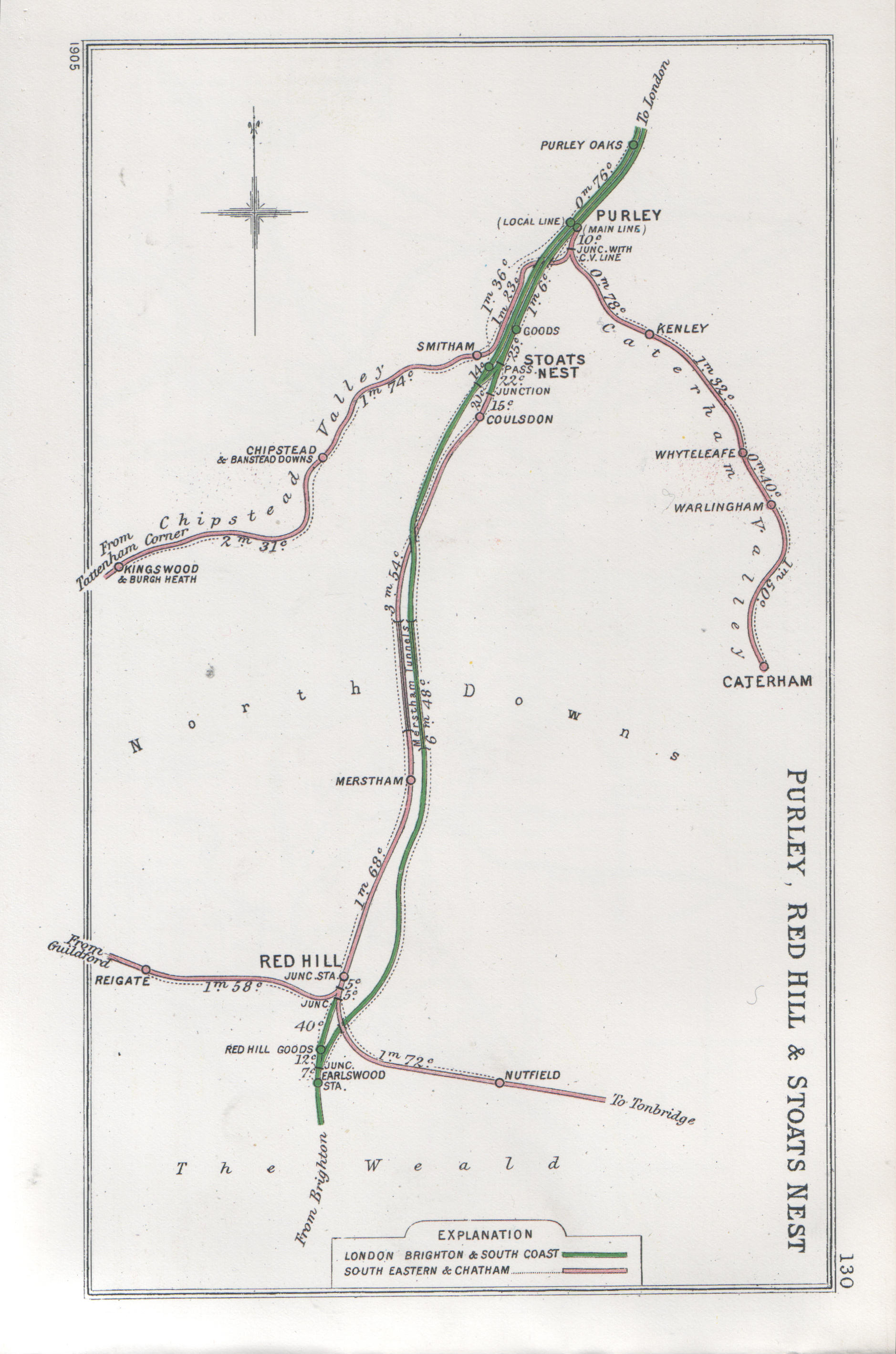
Merstham tunnels

The Merstham and Quarry tunnels are two neighbouring railway tunnels on the Brighton Main Line between Merstham and Coulsdon (formerly Stoats Nest) in...

Quarry Hangers

Quarry Hangers is a 28.5-hectare (70-acre) biological Site of Special Scientific Interest south-west of Caterham in Surrey. An area of 11 hectares (27...

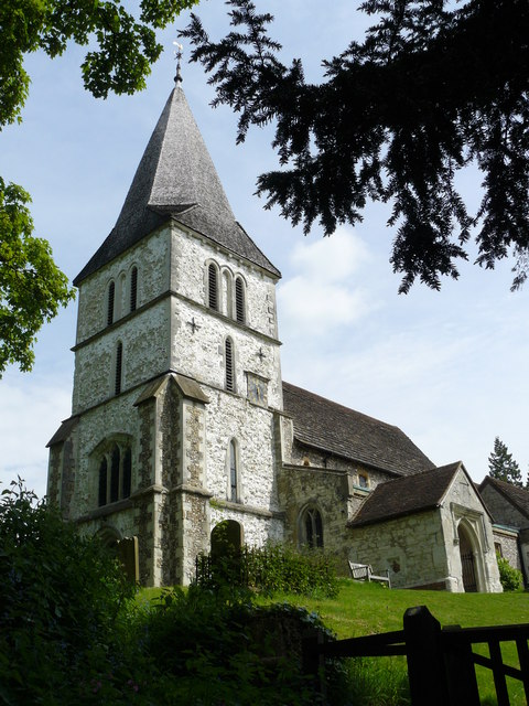
Church of St Peter and St Paul, Chaldon

The Church of Saints Peter and Paul at Chaldon, Surrey, is a Church of England parish church in the Diocese of Southwark. The building was begun before...

Reigate and Banstead

Reigate and Banstead is a local government district with borough status in east Surrey, England. It includes the towns of Reigate, Redhill, Horley and...

Nutfield Marshes

Nutfield Marshes is a 62-hectare (150-acre) nature reserve near Nutfield in Surrey. It is managed by the Surrey Wildlife Trust.These former sand quarries...

Nearby Amenities

Located within 500m of 51.266078,-0.13893877
Motorway Junction
Merstham
Ref: 7
Lat/Long: 51.2653651/-0.1439495
Motorway Junction
Merstham
Ref: 8
Lat/Long: 51.2697784/-0.1351619
Barrier: kissing_gate
Foot: yes
Lat/Long: 51.2658251/-0.1457325
Phone
Emergency: phone
Operator: National Highways
Operator Type: government
Operator Wikidata: Q5760006
Lat/Long: 51.2642458/-0.1324052
Phone
Emergency: phone
Operator: National Highways
Operator Type: government
Operator Wikidata: Q5760006
Lat/Long: 51.2645976/-0.132327
Phone
Emergency: phone
Lat/Long: 51.2653506/-0.1458995
Phone
Emergency: phone
Lat/Long: 51.2657054/-0.1457546
Barrier: cycle_barrier
Lat/Long: 51.2628319/-0.1406241
Barrier: cycle_barrier
Lat/Long: 51.2632125/-0.1404716
Barrier: kissing_gate
Lat/Long: 51.2679723/-0.140349
Barrier: cycle_barrier
Lat/Long: 51.2626471/-0.1409467
Waste Basket
Lat/Long: 51.2626687/-0.1406532
Post Box
Collection Plate: CP1D
Collection Times: Mo-Fr 09:00; Sa 07:00
Operator: Royal Mail
Operator Wikidata: Q638098
Post Box Type: pillar
Ref: RH1 291D
Royal Cypher: EIIR
Royal Cypher Wikidata: Q33102113
Lat/Long: 51.2619555/-0.1372524
Barrier: entrance
Lat/Long: 51.2638962/-0.141634
Barrier: bollard
Lat/Long: 51.2635207/-0.1418952
Post Box
Collection Times: Mo-Fr 09:00; Sa 07:00; Su off
Drive Through: no
Operator: Royal Mail
Operator Wikidata: Q638098
Post Box Type: wall
Ref: RH1 99D
Royal Cypher: EIIR
Royal Cypher Wikidata: Q33102113
Source: survey
Lat/Long: 51.2677476/-0.135598
Traffic Sign: variable_message
Variable Message Model: AMI
Lat/Long: 51.2653569/-0.1456326
Traffic Sign: variable_message
Variable Message Model: AMI
Lat/Long: 51.265391/-0.1456202
Traffic Sign: variable_message
Variable Message Model: AMI
Lat/Long: 51.2654215/-0.1456091
Traffic Sign: variable_message
Variable Message Model: AMI
Lat/Long: 51.2654523/-0.1455979
Traffic Sign: variable_message
Variable Message Model: MS2
Lat/Long: 51.2652926/-0.145656
Traffic Sign: variable_message
Variable Message Model: AMI
Lat/Long: 51.2643615/-0.1328849
Traffic Sign: variable_message
Variable Message Model: AMI
Lat/Long: 51.2643921/-0.1328783
Traffic Sign: variable_message
Variable Message Model: AMI
Lat/Long: 51.264426/-0.132871
Traffic Sign: variable_message
Variable Message Model: MS3
Lat/Long: 51.264294/-0.1328994
Phone
Emergency: phone
Operator: National Highways
Operator Type: government
Operator Wikidata: Q5760006
Lat/Long: 51.2651549/-0.1334821
Traffic Sign: variable_message
Variable Message Model: AMI
Lat/Long: 51.2648868/-0.1340218
Traffic Sign: variable_message
Variable Message Model: AMI
Lat/Long: 51.2649259/-0.1340231
Traffic Sign: variable_message
Variable Message Model: AMI
Lat/Long: 51.2650136/-0.134026
Traffic Sign: variable_message
Variable Message Model: AMI
Lat/Long: 51.2650513/-0.1340272
Traffic Sign: variable_message
Variable Message Model: MS2
Lat/Long: 51.265061/-0.1388443
Traffic Sign: variable_message
Variable Message Model: AMI
Lat/Long: 51.264964/-0.1388593
Traffic Sign: variable_message
Variable Message Model: AMI
Lat/Long: 51.2650055/-0.1388529
Traffic Sign: variable_message
Variable Message Model: AMI
Lat/Long: 51.2650349/-0.1388484
Traffic Sign: variable_message
Variable Message Model: AMI
Lat/Long: 51.2650919/-0.1388396
Traffic Sign: variable_message
Variable Message Model: AMI
Lat/Long: 51.2651376/-0.1388325
Traffic Sign: variable_message
Variable Message Model: AMI
Lat/Long: 51.2655838/-0.1460131
Traffic Sign: variable_message
Variable Message Model: AMI
Lat/Long: 51.2656173/-0.1460005
Traffic Sign: variable_message
Variable Message Model: AMI
Lat/Long: 51.2656482/-0.1459889
Traffic Sign: variable_message
Variable Message Model: AMI
Lat/Long: 51.2656745/-0.145979
Traffic Sign: variable_message
Variable Message Model: MS2
Lat/Long: 51.2657381/-0.1459551
Traffic Sign: variable_message
Variable Message Model: MS1
Lat/Long: 51.2696851/-0.1350425
Traffic Sign: variable_message
Variable Message Model: MS1
Lat/Long: 51.2697148/-0.1350221
Traffic Sign: variable_message
Variable Message Model: MS1
Lat/Long: 51.2697545/-0.1349948
Traffic Sign: variable_message
Variable Message Model: MS1
Lat/Long: 51.2697904/-0.1349701
Phone
Emergency: phone
Operator: National Highways
Operator Type: government
Operator Wikidata: Q5760006
Lat/Long: 51.2641907/-0.1341212
Albury Edge West
Addr Housename: Albury Edge West
Lat/Long: 51.2677906/-0.1386327
Albury Edge East
Addr Housename: Albury Edge East
Lat/Long: 51.2677764/-0.1383343
The data included in this document is from www.openstreetmap.org. The data is made available under ODbL.

Have you been to Heronswood Mere?

Leave your review of Heronswood Mere below (or comments, questions and feedback).