Abbey Gate

Settlement in Kent Maidstone

England

Abbey Gate

Foot crossing on the Medway Valley Walk The Medway Valley Line was built in two stages by the South Eastern Railway. The first stage opened in 1844 was from Paddock Wood following the Medway Valley to Maidstone. In 1856 the line was extended down the Medway Valley to the North Kent Line at Strood (which had opened in 1847). 

This foot crossing is on the latter section and carries the Medway Valley Walk across the line. The next station in this direction is Maidstone Barracks. An old siding to Allington leads off on the right.
Foot crossing on the Medway Valley Walk Credit: Marathon

Abbey Gate is a small village located in the county of Kent, in southeastern England. Situated in the district of Canterbury, it is surrounded by picturesque countryside and is known for its charming rural setting. The village is situated just a few miles to the northeast of Canterbury, making it a popular choice for those seeking a peaceful and scenic place to live while still having easy access to the amenities of a larger town.

Abbey Gate takes its name from the nearby St. Augustine's Abbey, a historic site that was once one of the most important Christian monasteries in England. Today, the abbey ruins are a popular tourist attraction and provide a glimpse into the region's rich history.

The village itself is small, with a close-knit community and a relaxed atmosphere. It is characterized by its traditional architecture, with many houses dating back several centuries. The surrounding countryside offers opportunities for outdoor activities such as walking, cycling, and horse riding, with numerous trails and paths to explore.

While Abbey Gate may be a quiet village, it benefits from its proximity to Canterbury, which offers a wide range of amenities including shops, restaurants, and cultural attractions. The village is well-connected by road, with the A2 and A28 providing easy access to the surrounding areas.

Overall, Abbey Gate is a charming and historical village that offers a tranquil lifestyle in a beautiful setting, making it an appealing place to live or visit for those seeking a peaceful retreat in the heart of the Kentish countryside.

If you have any feedback on the listing, please let us know in the comments section below.
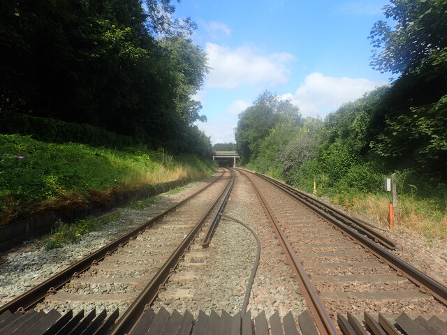
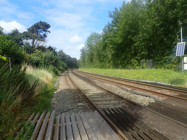
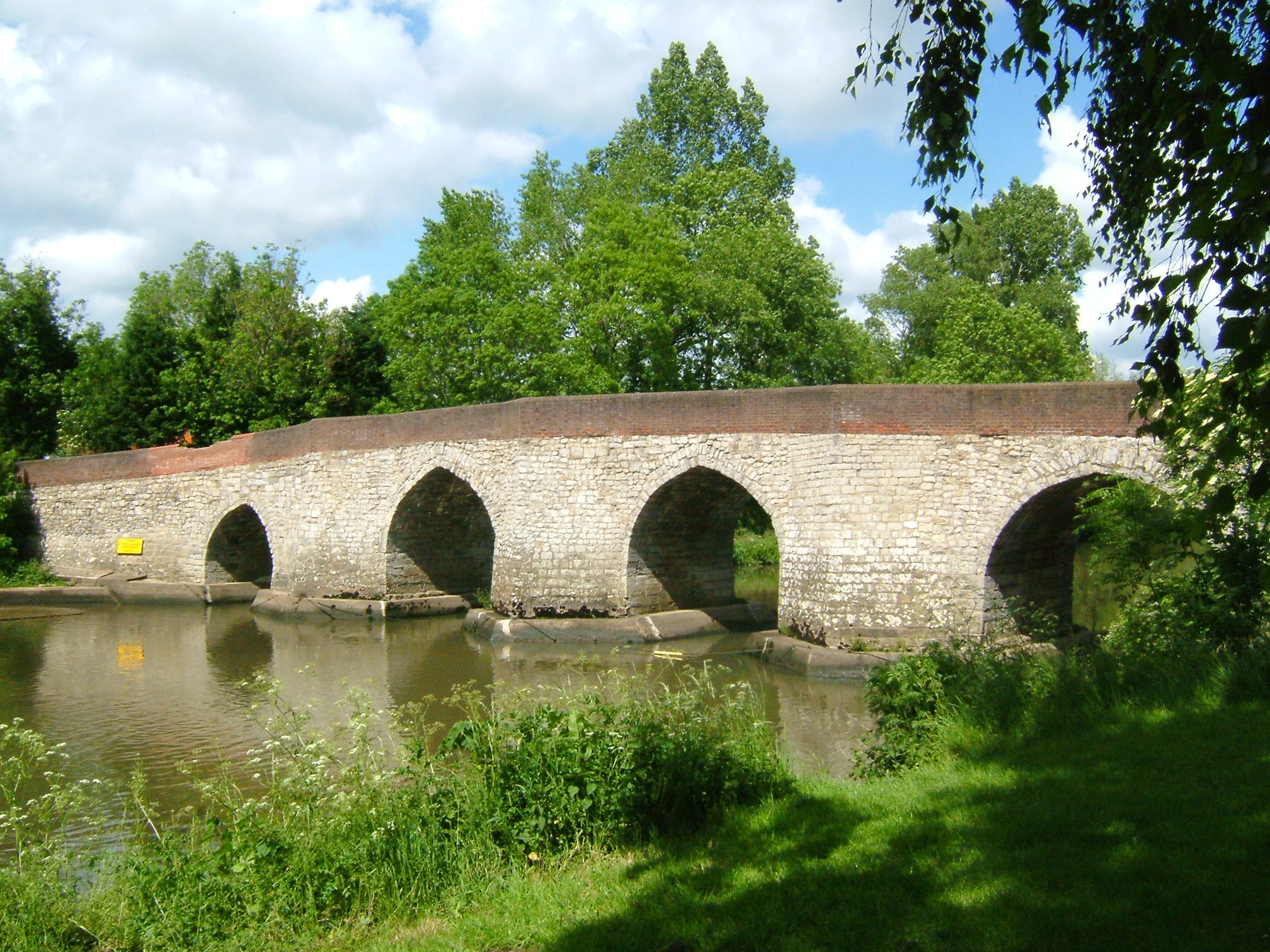
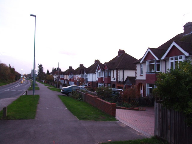
Abbey Gate Images

Images are sourced within 2km of 51.294236/0.50858103 or Grid Reference TQ7558. Thanks to Geograph Open Source API. All images are credited.

Foot crossing on the Medway Valley Walk The Medway Valley Line was built in two stages by the South Eastern Railway. The first stage opened in 1844 was from Paddock Wood following the Medway Valley to Maidstone. In 1856 the line was extended down the Medway Valley to the North Kent Line at Strood (which had opened in 1847). 

This foot crossing is on the latter section and carries the Medway Valley Walk across the line. The next station in this direction is Maidstone Barracks. An old siding to Allington leads off on the right.
Foot crossing on the Medway Valley Walk
The Medway Valley Line was built in two stages by the South Eastern Railway. The first stage opened in 1844 was from Paddock Wood following the Medway Valley to Maidstone. In 1856 the line was extended down the Medway Valley to the North Kent Line at Strood (which had opened in 1847). This foot crossing is on the latter section and carries the Medway Valley Walk across the line. The next station in this direction is Maidstone Barracks. An old siding to Allington leads off on the right.
View from a foot crossing on The Medway Valley Walk The Medway Valley Line was built in two stages by the South Eastern Railway. The first stage opened in 1844 was from Paddock Wood following the Medway Valley to Maidstone. In 1856 the line was extended down the Medway Valley to the North Kent Line at Strood (which had opened in 1847). 

This foot crossing is on the latter section and carries the Medway Valley Walk across the line. The next station in this direction is Aylesford. The bridge just ahead carries the M20 over the line.
View from a foot crossing on The Medway Valley Walk
The Medway Valley Line was built in two stages by the South Eastern Railway. The first stage opened in 1844 was from Paddock Wood following the Medway Valley to Maidstone. In 1856 the line was extended down the Medway Valley to the North Kent Line at Strood (which had opened in 1847). This foot crossing is on the latter section and carries the Medway Valley Walk across the line. The next station in this direction is Aylesford. The bridge just ahead carries the M20 over the line.
Foot crossing on the Medway Valley Walk The Medway Valley Line was built in two stages by the South Eastern Railway. The first stage opened in 1844 was from Paddock Wood following the Medway Valley to Maidstone. In 1856 the line was extended down the Medway Valley to the North Kent Line at Strood (which had opened in 1847). 

This foot crossing is on the latter section and carries the Medway Valley Walk across the line. The next station to the right is Maidstone Barracks and to the left is Aylesford.
Foot crossing on the Medway Valley Walk
The Medway Valley Line was built in two stages by the South Eastern Railway. The first stage opened in 1844 was from Paddock Wood following the Medway Valley to Maidstone. In 1856 the line was extended down the Medway Valley to the North Kent Line at Strood (which had opened in 1847). This foot crossing is on the latter section and carries the Medway Valley Walk across the line. The next station to the right is Maidstone Barracks and to the left is Aylesford.
View from a foot crossing on The Medway Valley Walk The Medway Valley Line was built in two stages by the South Eastern Railway. The first stage opened in 1844 was from Paddock Wood following the Medway Valley to Maidstone. In 1856 the line was extended up the Medway Valley to the North Kent Line at Strood (which had opened in 1847). 

This foot crossing is on the latter section and carries the Medway Valley Walk across the line. The next station in this direction is Aylesford.
View from a foot crossing on The Medway Valley Walk
The Medway Valley Line was built in two stages by the South Eastern Railway. The first stage opened in 1844 was from Paddock Wood following the Medway Valley to Maidstone. In 1856 the line was extended up the Medway Valley to the North Kent Line at Strood (which had opened in 1847). This foot crossing is on the latter section and carries the Medway Valley Walk across the line. The next station in this direction is Aylesford.
Foot crossing on the Medway Valley Walk The Medway Valley Line was built in two stages by the South Eastern Railway. The first stage opened in 1844 was from Paddock Wood following the Medway Valley to Maidstone. In 1856 the line was extended up the Medway Valley to the North Kent Line at Strood (which had opened in 1847). 

This foot crossing is on the latter section and carries the Medway Valley Walk across the line. The next station to the right is Maidstone Barracks and to the left is Aylesford.
Foot crossing on the Medway Valley Walk
The Medway Valley Line was built in two stages by the South Eastern Railway. The first stage opened in 1844 was from Paddock Wood following the Medway Valley to Maidstone. In 1856 the line was extended up the Medway Valley to the North Kent Line at Strood (which had opened in 1847). This foot crossing is on the latter section and carries the Medway Valley Walk across the line. The next station to the right is Maidstone Barracks and to the left is Aylesford.
The Medway Valley Walk The Medway Valley Walk in the centre of Maidstone passes under the railway, just west of Maidstone East station, ahead. The line from Otford to Maidstone East was opened on 1st June 1874 by the London, Chatham & Dover Railway.
The Medway Valley Walk
The Medway Valley Walk in the centre of Maidstone passes under the railway, just west of Maidstone East station, ahead. The line from Otford to Maidstone East was opened on 1st June 1874 by the London, Chatham & Dover Railway.
Elephant on the Medway Valley Walk This is at the end of Lock Lane near Allington Lock. There were 51 of these 'Elmer's sculptures' in the area and they were to be shortly auctioned off to raise money for the Heart of Kent Hospice.
Elephant on the Medway Valley Walk
This is at the end of Lock Lane near Allington Lock. There were 51 of these 'Elmer's sculptures' in the area and they were to be shortly auctioned off to raise money for the Heart of Kent Hospice.
The Medway Valley Walk crosses the M20 The Medway Valley Walk has come up from Allington Lock before crossing the Medway Valley Line and here crosses the M20 Motorway. The North Downs can be seen in the distance.
The Medway Valley Walk crosses the M20
The Medway Valley Walk has come up from Allington Lock before crossing the Medway Valley Line and here crosses the M20 Motorway. The North Downs can be seen in the distance.
London Rd The A20 runs from the London Borough of Lewisham to Dover, Kent. It runs through the major towns of Maidstone, Ashford and Folkestone, terminating at the port of Dover.
London Rd
The A20 runs from the London Borough of Lewisham to Dover, Kent. It runs through the major towns of Maidstone, Ashford and Folkestone, terminating at the port of Dover.
Roundabout, A20 The A20 runs from the London Borough of Lewisham to Dover, Kent. It runs through the major towns of Maidstone, Ashford and Folkestone, terminating at the port of Dover.
Roundabout, A20
The A20 runs from the London Borough of Lewisham to Dover, Kent. It runs through the major towns of Maidstone, Ashford and Folkestone, terminating at the port of Dover.
A20 The A20 runs from the London Borough of Lewisham to Dover, Kent. It runs through the major towns of Maidstone, Ashford and Folkestone, terminating at the port of Dover.
A20
The A20 runs from the London Borough of Lewisham to Dover, Kent. It runs through the major towns of Maidstone, Ashford and Folkestone, terminating at the port of Dover.
The Poppy Fields
The Poppy Fields
Roundabout, A20 The A20 runs from the London Borough of Lewisham to Dover, Kent. It runs through the major towns of Maidstone, Ashford and Folkestone, terminating at the port of Dover.
Roundabout, A20
The A20 runs from the London Borough of Lewisham to Dover, Kent. It runs through the major towns of Maidstone, Ashford and Folkestone, terminating at the port of Dover.
The Poppy Fields
The Poppy Fields
Railway bridge, A20 The A20 runs from the London Borough of Lewisham to Dover, Kent. It runs through the major towns of Maidstone, Ashford and Folkestone, terminating at the port of Dover.
Railway bridge, A20
The A20 runs from the London Borough of Lewisham to Dover, Kent. It runs through the major towns of Maidstone, Ashford and Folkestone, terminating at the port of Dover.
Entering Maidstone, A20 The A20 runs from the London Borough of Lewisham to Dover, Kent. It runs through the major towns of Maidstone, Ashford and Folkestone, terminating at the port of Dover.
Entering Maidstone, A20
The A20 runs from the London Borough of Lewisham to Dover, Kent. It runs through the major towns of Maidstone, Ashford and Folkestone, terminating at the port of Dover.
Railway bridge, A20 The A20 runs from the London Borough of Lewisham to Dover, Kent. It runs through the major towns of Maidstone, Ashford and Folkestone, terminating at the port of Dover.
Railway bridge, A20
The A20 runs from the London Borough of Lewisham to Dover, Kent. It runs through the major towns of Maidstone, Ashford and Folkestone, terminating at the port of Dover.
Show me another place!

Abbey Gate is located at Grid Ref: TQ7558 (Lat: 51.294236, Lng: 0.50858103)

Administrative County: Kent

District: Maidstone

Police Authority: Kent

What 3 Words

///portfolio.masses.inviting. Near Aylesford, Kent

Nearby Locations

Abbey Gate Sandling

Related Wikis

Related Videos

Birchington Vale - Holiday Home Ownership 2024

Set within 100 acres of countryside whilst still only being a short drive away from the North Kent coast, Birchington Vale Holiday ...

New Beach - Holiday Home Ownership 2024

Ideally situated between the coastal towns of Dymchurch and Hythe, and just footsteps away from the Kent coast with views out to ...

What is Active Travel?

Active travel simply means making journeys by walking or cycling. These are usually short journeys, like walking to the shops, ...

Visit Broadstairs, Kent and Botany Bay, UK - a walking TOUR 🌞

Our walking tour of Broadstairs and Botany Bay in Kent, England - a perfect seaside escape from London! As expat travel vloggers ...

Nearby Amenities

Located within 500m of 51.294236,0.50858103
Waterway: weir
Lat/Long: 51.2957345/0.506257
Motorway Junction
Lat/Long: 51.2939714/0.5153379
Motorway Junction
Sandling
Ref: 6
Lat/Long: 51.2986992/0.5084494
Crossing
Crossing: uncontrolled
Crossing Ref: zebra
Lat/Long: 51.2958086/0.5126797
Crossing
Crossing: uncontrolled
Crossing Ref: zebra
Lat/Long: 51.295346/0.5127703
Crossing
Crossing: uncontrolled
Crossing Ref: zebra
Lat/Long: 51.2958248/0.5129136
Parking
Lat/Long: 51.2911584/0.505467
Post Box
Operator: Royal Mail
Post Box Type: lamp
Ref: ME16 187D
Lat/Long: 51.2922907/0.5062483
Bus Stop
The Running Horse
Bus: yes
Flag: no
Naptan AtcoCode: 2400100806
Naptan Bearing: SE
Naptan BusStopType: CUS
Naptan CommonName: Running Horse Harvester
Naptan Indicator: adj
Naptan Landmark: Harvester
Naptan Street: Sandling Lane
Naptan Verified: no
Public Transport: platform
Source: naptan_import
Lat/Long: 51.294518/0.5155084
Bus Stop
The Running Horse
Bus: yes
Flag: no
Naptan AtcoCode: 2400100808
Naptan Bearing: NW
Naptan BusStopType: CUS
Naptan CommonName: Running Horse Harvester
Naptan Indicator: opp
Naptan Landmark: Harvester
Naptan Street: Sandling Lane
Naptan Verified: no
Public Transport: platform
Source: naptan_import
Lat/Long: 51.2943859/0.5156376
Bus Stop
Running Horse
Bus: yes
Naptan AtcoCode: 2400A003560A
Naptan Bearing: N
Naptan CommonName: Running Horse
Naptan Indicator: opp
Naptan Landmark: Opp Running Horse
Naptan NaptanCode: kntagjpg
Naptan PlusbusZoneRef: MSTONEB
Naptan Street: Chatham Rd Rdbt
Naptan Verified: no
Public Transport: platform
Source: naptan_import
Lat/Long: 51.2949862/0.5138215
Bus Stop
The Running Horse
Bus: yes
Naptan AtcoCode: 2400A003630A
Naptan Bearing: S
Naptan CommonName: Running Horse
Naptan Indicator: adj
Naptan Landmark: Sandling Road
Naptan NaptanCode: kntagjtg
Naptan PlusbusZoneRef: MSTONEB
Naptan Street: Old Chatham Road
Naptan Verified: no
Public Transport: platform
Source: naptan_import
Lat/Long: 51.2945765/0.5150341
Bus Stop
Malta Inn
Bus: yes
Naptan AtcoCode: 2400A003690A
Naptan Bearing: NW
Naptan CommonName: Malta Inn
Naptan Indicator: adj
Naptan Landmark: Malta Inn
Naptan NaptanCode: kntagjwd
Naptan PlusbusZoneRef: MSTONEB
Naptan Street: Forstal Road
Naptan Verified: no
Public Transport: platform
Ref: kntagjwd
Source: naptan_import
Source Date: 2018-02-21T10:49:00
Lat/Long: 51.296999/0.5094203
Bus Stop
Malta Inn
Bus: yes
Naptan AtcoCode: 2400A003850A
Naptan Bearing: SE
Naptan CommonName: Malta Inn
Naptan Indicator: opp
Naptan Landmark: The Village
Naptan NaptanCode: kntagmdm
Naptan PlusbusZoneRef: MSTONEB
Naptan Street: Forstal Road
Naptan Verified: no
Public Transport: platform
Ref: kntagmdm
Source: naptan_import
Source Date: 2018-02-21T10:51:00
Lat/Long: 51.2963185/0.5113771
Seamark Type: gate
Waterway: lock_gate
Lat/Long: 51.2955198/0.504803
Crossing
Crossing: uncontrolled
Crossing Ref: zebra
Lat/Long: 51.2955791/0.5121725
Crossing
Crossing: uncontrolled
Crossing Ref: zebra
Lat/Long: 51.2956177/0.5119529
Post Box
Operator: Royal Mail
Post Box Type: lamp
Ref: ME14 77
Lat/Long: 51.2965897/0.510081
Quad-Bikes
Leisure: track
Lat/Long: 51.2975488/0.5079306
Kent Life Admissions
Tourism: attraction
Lat/Long: 51.2967985/0.5072215
Seamark Type: gate
Waterway: lock_gate
Lat/Long: 51.2955599/0.5039418
Barrier: cycle_barrier
Material: metal
Note: This may be in slightly the wrong position. Feel free to correct and/or delete this note
Lat/Long: 51.2956706/0.5075195
Seamark Type: gate
Waterway: lock_gate
Lat/Long: 51.2955388/0.5043591
Bus Stop
Kent Life
Flag: no
Naptan AtcoCode: 2400104521
Naptan Bearing: SW
Naptan BusStopType: CUS
Naptan CommonName: Kent Life
Naptan Indicator: o/s
Naptan Landmark: Kent Life
Naptan NaptanCode: kntjpdwp
Naptan Street: Lock Lane
Naptan Verified: no
Public Transport: platform
Ref: kntjpdwp
Source: NAPTAN
Source Date: 2011-07-25T15:58:00
Lat/Long: 51.2965592/0.5077035
Generator Method: photovoltaic
Generator Output Electricity: yes
Generator Source: solar
Generator Type: solar_photovoltaic_panel
Location: roof
Power: generator
Lat/Long: 51.2908753/0.5045852
Crossing
Crossing: unmarked
Lat/Long: 51.295905/0.5143446
Crossing
Crossing: unmarked
Tactile Paving: no
Lat/Long: 51.2959355/0.5136273
Crossing
Crossing: unmarked
Crossing Markings: no
Lat/Long: 51.2958531/0.514978
Man Made: surveillance
Surveillance: camera
Lat/Long: 51.2984488/0.5068497
Railway: buffer_stop
Lat/Long: 51.2935825/0.5024877
Generator Method: photovoltaic
Generator Output Electricity: yes
Generator Source: solar
Generator Type: solar_photovoltaic_panel
Location: roof
Power: generator
Lat/Long: 51.293299/0.5141446
Generator Method: photovoltaic
Generator Output Electricity: yes
Generator Source: solar
Generator Type: solar_photovoltaic_panel
Location: roof
Power: generator
Lat/Long: 51.2929938/0.5142948
Generator Method: photovoltaic
Generator Output Electricity: yes
Generator Source: solar
Generator Type: solar_photovoltaic_panel
Location: roof
Power: generator
Lat/Long: 51.2931045/0.5142707
Generator Method: photovoltaic
Generator Output Electricity: yes
Generator Source: solar
Generator Type: solar_photovoltaic_panel
Location: roof
Power: generator
Lat/Long: 51.2969268/0.508469
Bicycle Parking
Bicycle Parking: stands
Capacity: 10
Covered: yes
Lat/Long: 51.2964681/0.5070381
Entrance: yes
Lat/Long: 51.2970072/0.5071783
Barrier: bollard
Bollard: fixed
Lat/Long: 51.2970511/0.5082229
The data included in this document is from www.openstreetmap.org. The data is made available under ODbL.

Have you been to Abbey Gate?

Leave your review of Abbey Gate below (or comments, questions and feedback).