Great Stew Pond

Lake, Pool, Pond, Freshwater Marsh in Surrey Epsom and Ewell

England

Great Stew Pond

Ashtead - Craddocks Avenue Residential road near Ashtead Station.
Ashtead - Craddocks Avenue Credit: James Emmans

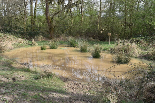
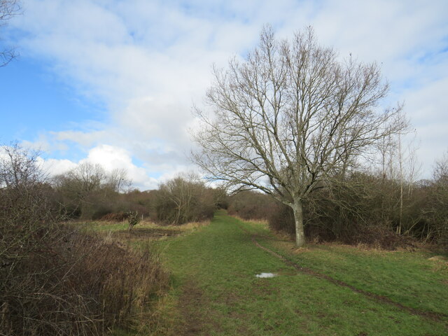
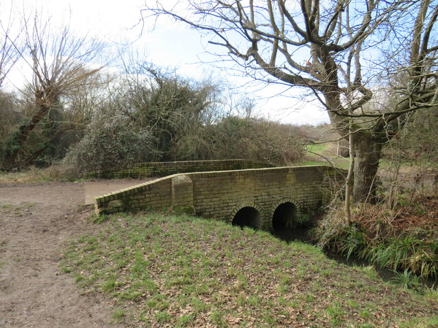
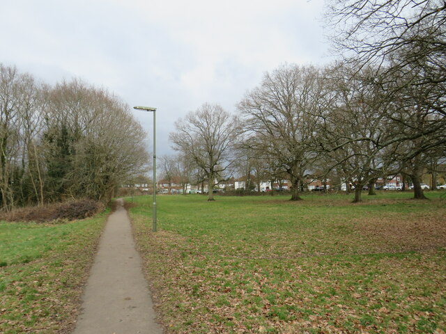
Great Stew Pond, located in Surrey, England, is a picturesque freshwater marsh surrounded by a diverse range of flora and fauna. Spanning over an area of approximately 15 acres, the pond is nestled within the scenic countryside, offering visitors a tranquil and serene environment.

The pond itself boasts crystal-clear freshwater, providing a habitat for various aquatic species. It is home to a diverse range of fish, including carp, perch, and roach, making it a popular spot for anglers. The calm and peaceful nature of the water also attracts a variety of birdlife, with species such as swans, ducks, and herons frequently seen in the area.

Surrounding the pond is an abundance of lush vegetation, including reeds, rushes, and water lilies. These plants not only provide a beautiful and natural aesthetic to the pond but also serve as important habitats for smaller creatures such as frogs, toads, and dragonflies. The vegetation also acts as a natural filter, aiding in maintaining the water quality and overall ecosystem balance.

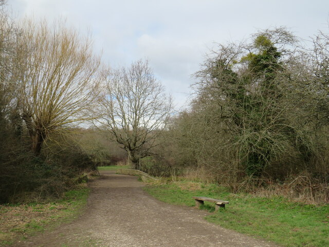
Great Stew Pond offers a range of recreational activities for visitors to enjoy. Fishing is a popular pastime, with designated areas and platforms for anglers to cast their lines. In addition, the pond is a great place for nature lovers to observe and appreciate the diverse wildlife that thrives in the area.

Overall, Great Stew Pond is a hidden gem of Surrey, offering a peaceful and idyllic setting for those seeking nature's beauty. Whether it's fishing, birdwatching, or simply enjoying the tranquility of the surroundings, this freshwater marsh provides a haven for both local wildlife and visitors alike.

If you have any feedback on the listing, please let us know in the comments section below.

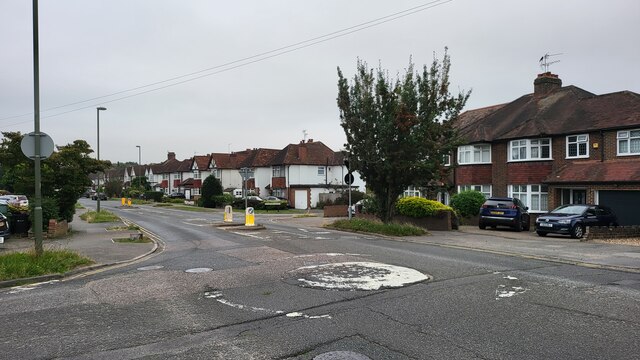
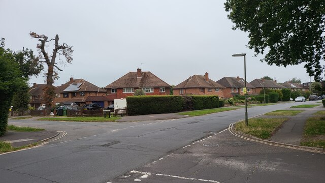
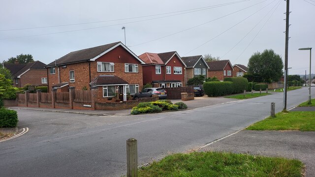
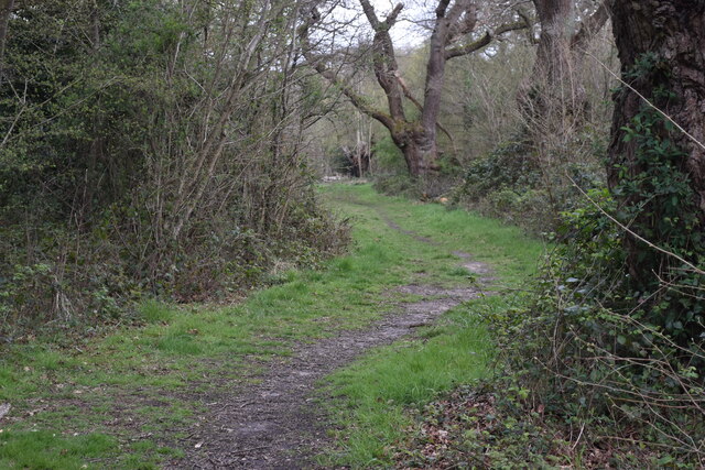
Great Stew Pond Images

Images are sourced within 2km of 51.333651/-0.30117688 or Grid Reference TQ1860. Thanks to Geograph Open Source API. All images are credited.

Ashtead - Craddocks Avenue Residential road near Ashtead Station.
Ashtead - Craddocks Avenue
Residential road near Ashtead Station.
Bramley Way Junction with Cray Avenue and Berry Meade.
Bramley Way
Junction with Cray Avenue and Berry Meade.
Bramley Way junction with Stonny Croft
Path into woodland, on Ashtead Common
Very muddy path on Ashtead Common
Shaun's Puddle A small pond created in 2016 to aid with drainage of a very muddy area.
Shaun's Puddle
A small pond created in 2016 to aid with drainage of a very muddy area.
Cycle route along the edge of Newton Wood
Path near Ashtead A path leading onto Ashtead Common, in Surrey.

This image was taken during the month of February.  Trees were bare for the winter season.
Path near Ashtead
A path leading onto Ashtead Common, in Surrey. This image was taken during the month of February. Trees were bare for the winter season.
Path over The Rye Brook on Ashtead Common A path on Ashtead Common, crossing The Rye Brook, which flows beneath through a duct.

This image was taken during the month of February.  Trees were bare for the winter season.
Path over The Rye Brook on Ashtead Common
A path on Ashtead Common, crossing The Rye Brook, which flows beneath through a duct. This image was taken during the month of February. Trees were bare for the winter season.
Path on Ashtead Common A path on Ashtead Common in Surrey.  The path is a public bridleway.

This image was taken in the month of February.  Trees were bare for the winter season.
Path on Ashtead Common
A path on Ashtead Common in Surrey. The path is a public bridleway. This image was taken in the month of February. Trees were bare for the winter season.
Bridge over The Rye Brook, Ashtead Common A bridge taking a bridleway over The Rye Brook on Ashtead Common, in Surrey.

This image was taken in the month of February.  Trees were bare for the winter season.
Bridge over The Rye Brook, Ashtead Common
A bridge taking a bridleway over The Rye Brook on Ashtead Common, in Surrey. This image was taken in the month of February. Trees were bare for the winter season.
Track onto Ashtead Common A track leading onto Ashtead Common in Surrey.  The track is a public right of way as a bridleway.

This image was taken in the month of February.  Trees were bare for the winter season.
Track onto Ashtead Common
A track leading onto Ashtead Common in Surrey. The track is a public right of way as a bridleway. This image was taken in the month of February. Trees were bare for the winter season.
Level crossing at Ashtead A level crossing at Ashtead in Surrey.  Cars and pedestrians wait as a train passes through.

This image was taken in the month of February.  Trees were bare for the winter season.
Level crossing at Ashtead
A level crossing at Ashtead in Surrey. Cars and pedestrians wait as a train passes through. This image was taken in the month of February. Trees were bare for the winter season.
Woodfield Lane, Ashtead Woodfield Lane is a residential road in the village of Ashtead in Surrey.
Woodfield Lane, Ashtead
Woodfield Lane is a residential road in the village of Ashtead in Surrey.
Path on Wood Field, Ashtead A path across Wood Field in the village of Ashtead in Surrey.

This image was taken in the month of February.  Trees were bare for the winter season.
Path on Wood Field, Ashtead
A path across Wood Field in the village of Ashtead in Surrey. This image was taken in the month of February. Trees were bare for the winter season.
Level crossing at Ashtead A level crossing taking a railway across the road in the village of Ashtead in Surrey.

This image was taken in the month of February.  Trees were bare for the winter season.
Level crossing at Ashtead
A level crossing taking a railway across the road in the village of Ashtead in Surrey. This image was taken in the month of February. Trees were bare for the winter season.
Overdale, Ashtead Overdale is a residential road in the village of Ashtead in Surrey.
Overdale, Ashtead
Overdale is a residential road in the village of Ashtead in Surrey.
Bridleway on Ashtead Common A public bridleway leading onto Ashtead Common, in Surrey.

This image was taken on a February day.  Trees were bare for the winter season.
Bridleway on Ashtead Common
A public bridleway leading onto Ashtead Common, in Surrey. This image was taken on a February day. Trees were bare for the winter season.
Show me another place!

Great Stew Pond is located at Grid Ref: TQ1860 (Lat: 51.333651, Lng: -0.30117688)

Administrative County: Surrey

District: Epsom and Ewell

Police Authority: Surrey

What 3 Words

///open.manual.income. Near Epsom, Surrey

Related Wikis

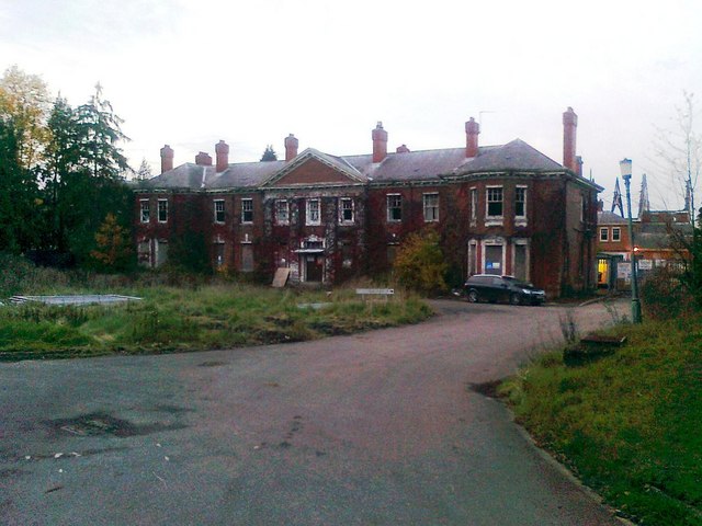
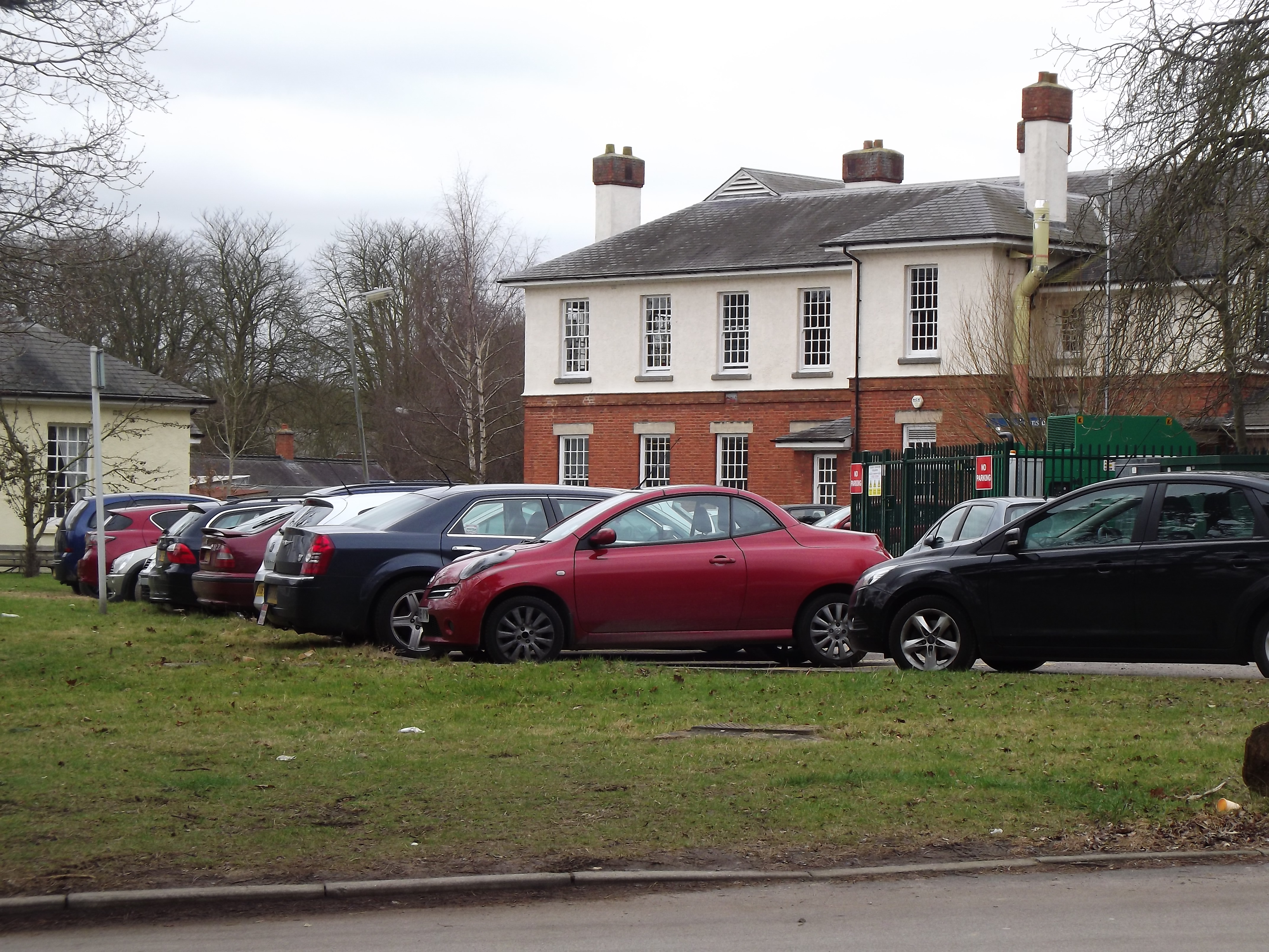
West Park Hospital, Epsom

West Park Hospital (sometimes erroneously referred to as West Park Asylum) was a large psychiatric hospital in Epsom, Surrey. == History == === Origins... ===

Epsom and Ashtead Commons

Epsom and Ashtead Commons are a 360.4-hectare (891-acre) biological Site of Special Scientific Interest on the outskirts of Epsom and Ashtead in Surrey...

Epsom Common

Epsom Common is a 177.4-hectare (438-acre) Local Nature Reserve in Epsom in Surrey. It is owned and managed by Epsom and Ewell Borough Council. It is...

Epsom Cottage Hospital

Epsom and Ewell Cottage Hospital is a small hospital in West Park Road, Horton Lane, Epsom, Surrey. It is managed by CSH Surrey. == History == The hospital...

Manor Hospital, Epsom

The Manor Hospital, formerly The Manor Asylum and The Manor Certified Institution was a mental handicap and psychiatric hospital in Horton, near Epsom...

Thames Down Link

The Thames Down Link is a 24 km (15 mi) official walking route linking the Thames Path and the North Downs Way. It starts in the town centre of Kingston...

Malden Rushett

Malden Rushett is a small village in the Royal Borough of Kingston upon Thames, London. It is located at the southernmost tip of the Royal Borough, surrounded...

Kingswood House School

Kingswood House School is a private school in Epsom, Surrey in the United Kingdom. It was founded in 1899 and moved to its present site in West Hill in...

Nearby Amenities

Located within 500m of 51.333651,-0.30117688
Information: board
Source: local_knowledge
Tourism: information
Lat/Long: 51.3369194/-0.3029735
Bench
Lat/Long: 51.3340158/-0.3066819
Information: board
Tourism: information
Lat/Long: 51.3366375/-0.3038666
Bench
Lat/Long: 51.3334364/-0.3054974
Map board
Tourism: information
Lat/Long: 51.3345757/-0.3075833
Bench
Lat/Long: 51.3346394/-0.3074975
Fishing Platform
Leisure: fishing
Lat/Long: 51.3350167/-0.3031543
Fishing Platform
Leisure: fishing
Lat/Long: 51.3354675/-0.302634
Fishing Platform
Leisure: fishing
Lat/Long: 51.3351675/-0.3032079
Fishing Platform
Leisure: fishing
Lat/Long: 51.3348441/-0.3030229
Fishing Platform
Leisure: fishing
Lat/Long: 51.3349429/-0.3031194
Fishing Platform
Leisure: fishing
Lat/Long: 51.3352664/-0.3022289
Fishing Platform
Leisure: fishing
Lat/Long: 51.335139/-0.3021324
Fishing Platform
Leisure: fishing
Lat/Long: 51.3350871/-0.3031945
Fishing Platform
Leisure: fishing
Lat/Long: 51.3352814/-0.3032562
Fishing Platform
Leisure: fishing
Lat/Long: 51.3353753/-0.3023014
Fishing Platform
Leisure: fishing
Lat/Long: 51.3350435/-0.3021324
Fishing Platform
Leisure: fishing
Lat/Long: 51.3346313/-0.3024221
Bench
Lat/Long: 51.3330795/-0.2942065
Hospital
Ramsay House
Description: community team for people with learning disbilities
Healthcare: hospital
Website: https://www.sabp.nhs.uk/services/learning-disabilities/ld/community/epsom-ewell-and-banstead-ctpld
Lat/Long: 51.3369899/-0.2979945
Coal tax post
Historic: boundary_stone
Inscription: 24 & 25 VICT CAP 42
Material: iron
Note: Coal tax boundary marker 118
Lat/Long: 51.337383/-0.3030881
Coal tax post
Historic: boundary_stone
Inscription: 24 & 25 VICT CAP 42
Material: iron
Note: Coa; tax boundary marker 120
Lat/Long: 51.3351143/-0.3055604
Description: charcoal kiln
Historic: charcoal_pile
Lat/Long: 51.3346885/-0.2965573
Fishing Platform
Leisure: fishing
Lat/Long: 51.3347639/-0.3021534
The data included in this document is from www.openstreetmap.org. The data is made available under ODbL.

Have you been to Great Stew Pond?

Leave your review of Great Stew Pond below (or comments, questions and feedback).