Stew Pond

Lake, Pool, Pond, Freshwater Marsh in Surrey Epsom and Ewell

England

Stew Pond

Ashtead - Craddocks Avenue Residential road near Ashtead Station.
Ashtead - Craddocks Avenue Credit: James Emmans

Stew Pond is a small freshwater body located in the county of Surrey, England. Situated within the vast Surrey Hills Area of Outstanding Natural Beauty, the pond offers a serene and picturesque environment for visitors to enjoy.

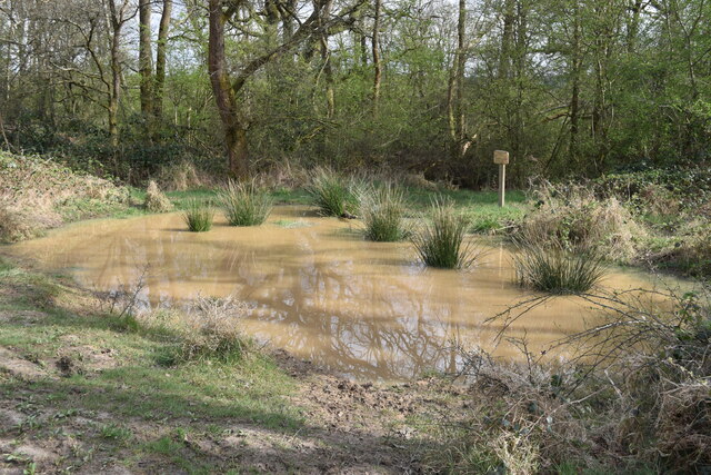
Spanning an area of approximately 1.5 acres, Stew Pond is often referred to as a lake due to its size. However, it more accurately resembles a pond or pool due to its shallow depth, which averages around 3 meters. The pond is fed by a natural spring, ensuring a constant flow of freshwater throughout the year.

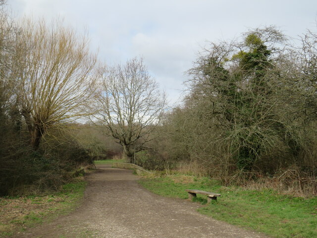
Surrounded by a diverse range of flora, Stew Pond is a haven for wildlife. The surrounding marshland creates a rich habitat for many species of birds, frogs, and insects. Visitors can expect to see a variety of waterfowl gliding across the pond's calm surface, such as ducks and geese.

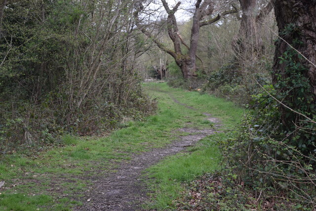
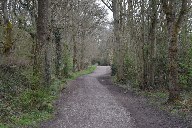
The tranquil atmosphere and scenic beauty of Stew Pond make it an ideal spot for relaxation and recreation. It is a popular destination for picnics, fishing, and leisurely walks. There are several benches scattered around the pond, inviting visitors to sit and soak in the peaceful surroundings.

Stew Pond is easily accessible, with a small car park located nearby, and is within walking distance of the charming village of Shere. With its natural beauty and abundant wildlife, Stew Pond offers a delightful escape from the hustle and bustle of everyday life, making it a cherished destination for nature lovers and those seeking tranquility in the heart of Surrey.

If you have any feedback on the listing, please let us know in the comments section below.
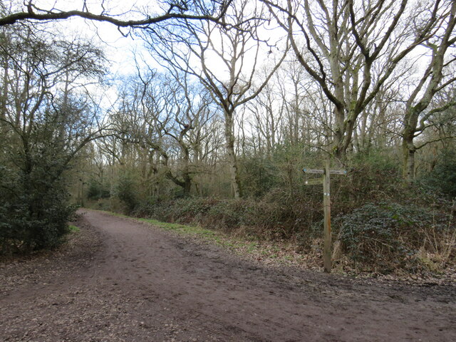
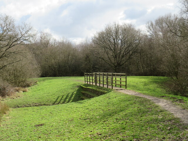
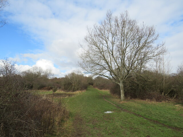
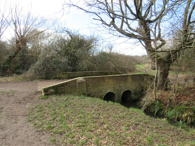
Stew Pond Images

Images are sourced within 2km of 51.335039/-0.30261858 or Grid Reference TQ1860. Thanks to Geograph Open Source API. All images are credited.

Ashtead - Craddocks Avenue Residential road near Ashtead Station.
Ashtead - Craddocks Avenue
Residential road near Ashtead Station.
Path into woodland, on Ashtead Common
Very muddy path on Ashtead Common
Shaun's Puddle A small pond created in 2016 to aid with drainage of a very muddy area.
Shaun's Puddle
A small pond created in 2016 to aid with drainage of a very muddy area.
Cycle route along the edge of Newton Wood
Path near Ashtead A path leading onto Ashtead Common, in Surrey.

This image was taken during the month of February.  Trees were bare for the winter season.
Path near Ashtead
A path leading onto Ashtead Common, in Surrey. This image was taken during the month of February. Trees were bare for the winter season.
Path over The Rye Brook on Ashtead Common A path on Ashtead Common, crossing The Rye Brook, which flows beneath through a duct.

This image was taken during the month of February.  Trees were bare for the winter season.
Path over The Rye Brook on Ashtead Common
A path on Ashtead Common, crossing The Rye Brook, which flows beneath through a duct. This image was taken during the month of February. Trees were bare for the winter season.
Path on Ashtead Common A path on Ashtead Common in Surrey.  The path is a public bridleway.

This image was taken in the month of February.  Trees were bare for the winter season.
Path on Ashtead Common
A path on Ashtead Common in Surrey. The path is a public bridleway. This image was taken in the month of February. Trees were bare for the winter season.
Bridge over The Rye Brook, Ashtead Common A bridge taking a bridleway over The Rye Brook on Ashtead Common, in Surrey.

This image was taken in the month of February.  Trees were bare for the winter season.
Bridge over The Rye Brook, Ashtead Common
A bridge taking a bridleway over The Rye Brook on Ashtead Common, in Surrey. This image was taken in the month of February. Trees were bare for the winter season.
Track onto Ashtead Common A track leading onto Ashtead Common in Surrey.  The track is a public right of way as a bridleway.

This image was taken in the month of February.  Trees were bare for the winter season.
Track onto Ashtead Common
A track leading onto Ashtead Common in Surrey. The track is a public right of way as a bridleway. This image was taken in the month of February. Trees were bare for the winter season.
Level crossing at Ashtead A level crossing at Ashtead in Surrey.  Cars and pedestrians wait as a train passes through.

This image was taken in the month of February.  Trees were bare for the winter season.
Level crossing at Ashtead
A level crossing at Ashtead in Surrey. Cars and pedestrians wait as a train passes through. This image was taken in the month of February. Trees were bare for the winter season.
Woodfield Lane, Ashtead Woodfield Lane is a residential road in the village of Ashtead in Surrey.
Woodfield Lane, Ashtead
Woodfield Lane is a residential road in the village of Ashtead in Surrey.
Level crossing at Ashtead A level crossing taking a railway across the road in the village of Ashtead in Surrey.

This image was taken in the month of February.  Trees were bare for the winter season.
Level crossing at Ashtead
A level crossing taking a railway across the road in the village of Ashtead in Surrey. This image was taken in the month of February. Trees were bare for the winter season.
Overdale, Ashtead Overdale is a residential road in the village of Ashtead in Surrey.
Overdale, Ashtead
Overdale is a residential road in the village of Ashtead in Surrey.
Bridleway on Ashtead Common A public bridleway leading onto Ashtead Common, in Surrey.

This image was taken on a February day.  Trees were bare for the winter season.
Bridleway on Ashtead Common
A public bridleway leading onto Ashtead Common, in Surrey. This image was taken on a February day. Trees were bare for the winter season.
Paths diverge on Ashtead Common Paths diverging on Ashtead Common.

Both are public rights of way.  The path to the left is a footpath while the path on the right is a bridleway, open to horse riders and cyclists as well as walkers.

This image was taken in the month of February.  Trees were bare for the winter season.
Paths diverge on Ashtead Common
Paths diverging on Ashtead Common. Both are public rights of way. The path to the left is a footpath while the path on the right is a bridleway, open to horse riders and cyclists as well as walkers. This image was taken in the month of February. Trees were bare for the winter season.
Paths join in woods near Ashtead A junction of footpaths in woodland on Ashtead Common, in Surrey.

This image was taken in the month of February.  Trees were bare for the winter season.
Paths join in woods near Ashtead
A junction of footpaths in woodland on Ashtead Common, in Surrey. This image was taken in the month of February. Trees were bare for the winter season.
Ashtead Common A clearing in woodland on Ashtead Common, in Surrey.  A footpath leads into the woods to the left.

This image was taken in the month of February.  Trees were bare for the winter season.
Ashtead Common
A clearing in woodland on Ashtead Common, in Surrey. A footpath leads into the woods to the left. This image was taken in the month of February. Trees were bare for the winter season.
Show me another place!

Stew Pond is located at Grid Ref: TQ1860 (Lat: 51.335039, Lng: -0.30261858)

Administrative County: Surrey

District: Epsom and Ewell

Police Authority: Surrey

What 3 Words

///solved.path.master. Near Epsom, Surrey

Related Wikis

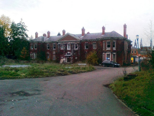
West Park Hospital, Epsom

West Park Hospital (sometimes erroneously referred to as West Park Asylum) was a large psychiatric hospital in Epsom, Surrey. == History == === Origins... ===

Epsom Cottage Hospital

Epsom and Ewell Cottage Hospital is a small hospital in West Park Road, Horton Lane, Epsom, Surrey. It is managed by CSH Surrey. == History == The hospital...

Epsom and Ashtead Commons

Epsom and Ashtead Commons are a 360.4-hectare (891-acre) biological Site of Special Scientific Interest on the outskirts of Epsom and Ashtead in Surrey...

Thames Down Link

The Thames Down Link is a 24 km (15 mi) official walking route linking the Thames Path and the North Downs Way. It starts in the town centre of Kingston...

Epsom Common

Epsom Common is a 177.4-hectare (438-acre) Local Nature Reserve in Epsom in Surrey. It is owned and managed by Epsom and Ewell Borough Council. It is...

Manor Hospital, Epsom

The Manor Hospital, formerly The Manor Asylum and The Manor Certified Institution was a mental handicap and psychiatric hospital in Horton, near Epsom...

Malden Rushett

Malden Rushett is a small village in the Royal Borough of Kingston upon Thames, London. It is located at the southernmost tip of the Royal Borough, surrounded...

Horton Light Railway

The Horton Light Railway had its origins in a contractor's line (the Ewell & Long Grove Railway) built in 1905 to transport building materials, coal and...

Related Videos

Epsom Town Centre Street View, UK, England ๐Ÿ‡ฌ๐Ÿ‡ง, 4K HDR

DATE RECORDED - 23 August 2022 LOCATION - https://goo.gl/maps/Y6cUN42KNvSRDEfp7 #Surrey #UK #England ...

โดแดท EPSOM Walking Tour, Surrey ENGLAND ๐Ÿ‡ฌ๐Ÿ‡ง GB

It is warm Friday afternoon, 13th of August 2021. Let's take a walk together around Epsom Thank you to my father for sharing ...

Nearby Amenities

Located within 500m of 51.335039,-0.30261858
Information: board
Source: local_knowledge
Tourism: information
Lat/Long: 51.3369194/-0.3029735
Bench
Lat/Long: 51.3340158/-0.3066819
Information: board
Tourism: information
Lat/Long: 51.3366375/-0.3038666
Bench
Lat/Long: 51.3334364/-0.3054974
Map board
Tourism: information
Lat/Long: 51.3345757/-0.3075833
Bench
Lat/Long: 51.3346394/-0.3074975
Fishing Platform
Leisure: fishing
Lat/Long: 51.3350167/-0.3031543
Fishing Platform
Leisure: fishing
Lat/Long: 51.3354675/-0.302634
Fishing Platform
Leisure: fishing
Lat/Long: 51.3351675/-0.3032079
Fishing Platform
Leisure: fishing
Lat/Long: 51.3348441/-0.3030229
Fishing Platform
Leisure: fishing
Lat/Long: 51.3349429/-0.3031194
Fishing Platform
Leisure: fishing
Lat/Long: 51.3352664/-0.3022289
Fishing Platform
Leisure: fishing
Lat/Long: 51.335139/-0.3021324
Fishing Platform
Leisure: fishing
Lat/Long: 51.3350871/-0.3031945
Fishing Platform
Leisure: fishing
Lat/Long: 51.3352814/-0.3032562
Fishing Platform
Leisure: fishing
Lat/Long: 51.3353753/-0.3023014
Fishing Platform
Leisure: fishing
Lat/Long: 51.3350435/-0.3021324
Fishing Platform
Leisure: fishing
Lat/Long: 51.3346313/-0.3024221
Bus Stop
Clifton Green
Naptan AtcoCode: 40004406025A
Naptan NaptanCode: surwtpag
Public Transport: platform
Lat/Long: 51.3384627/-0.2984926
Bus Stop
Granton Court
Naptan AtcoCode: 40004406024A
Naptan NaptanCode: surwtdpd
Public Transport: platform
Lat/Long: 51.3388062/-0.3000475
Hospital
Ramsay House
Description: community team for people with learning disbilities
Healthcare: hospital
Website: https://www.sabp.nhs.uk/services/learning-disabilities/ld/community/epsom-ewell-and-banstead-ctpld
Lat/Long: 51.3369899/-0.2979945
Note: Additional node marks deviation of Low Emission Zone.
Lat/Long: 51.3380377/-0.3051824
Coal tax post
Historic: boundary_stone
Inscription: 24 & 25 VICT CAP 42
Material: iron
Note: Coal tax boundary marker 118
Lat/Long: 51.337383/-0.3030881
Coal tax post
Historic: boundary_stone
Inscription: ACT 24 & 25 VICT CAP 42
Material: iron
Note: Coal tax boundary marker 119
Lat/Long: 51.3377037/-0.3048097
Coal tax post
Historic: boundary_stone
Inscription: 24 & 25 VICT CAP 42
Material: iron
Note: Coa; tax boundary marker 120
Lat/Long: 51.3351143/-0.3055604
Description: charcoal kiln
Historic: charcoal_pile
Lat/Long: 51.3346885/-0.2965573
Fishing Platform
Leisure: fishing
Lat/Long: 51.3347639/-0.3021534
The data included in this document is from www.openstreetmap.org. The data is made available under ODbL.

Have you been to Stew Pond?

Leave your review of Stew Pond below (or comments, questions and feedback).