Jersey Lagoon

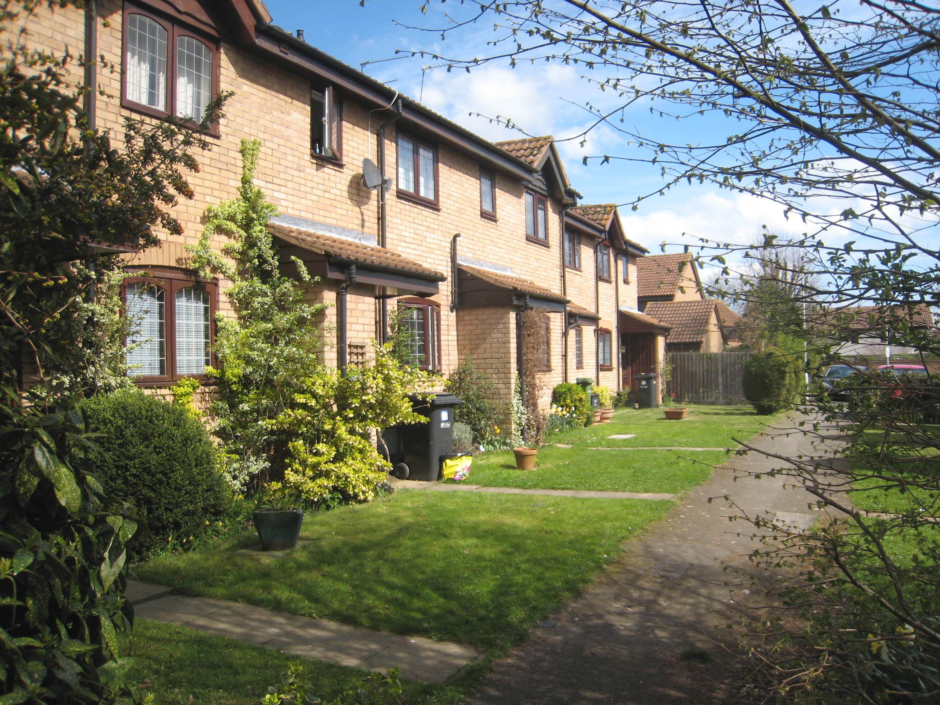
Lake, Pool, Pond, Freshwater Marsh in Hertfordshire St. Albans

England

Jersey Lagoon

The Green Man, Sandridge
The Green Man, Sandridge Credit: David Howard

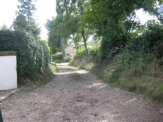
Jersey Lagoon is a small, picturesque freshwater marsh located in Hertfordshire, England. Nestled amidst the rolling landscapes of the county, the lagoon is a haven for wildlife and a popular destination for nature enthusiasts.

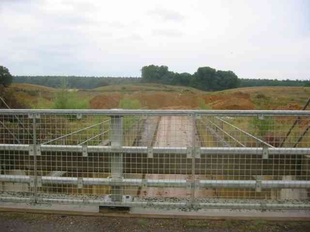
Covering an area of approximately 3 acres, Jersey Lagoon is characterized by its calm, still waters and abundant vegetation. The lagoon is fed by a combination of natural springs and rainfall, ensuring a constant flow of freshwater. The water in the lagoon is crystal clear, allowing visitors to catch glimpses of the diverse aquatic life thriving beneath the surface.

Surrounding the lagoon is a rich tapestry of reeds, rushes, and other wetland plants. These provide a habitat for a wide range of bird species, including herons, kingfishers, and ducks. The lagoon also supports a vibrant community of fish, such as carp and perch, which attract anglers from near and far.

Visitors to Jersey Lagoon can explore the area by following a network of footpaths that meander through the marshland. These paths offer stunning views of the lagoon and its surroundings, and provide opportunities for birdwatching and photography.

The lagoon is managed by the local council, which ensures that the area remains protected and accessible to the public. To maintain the delicate ecosystem, fishing is regulated and visitors are encouraged to respect the wildlife and vegetation that call Jersey Lagoon home.

Overall, Jersey Lagoon is a serene and ecologically significant site, offering a peaceful retreat for both wildlife and humans alike. Its natural beauty and diverse flora and fauna make it a must-visit destination for nature lovers in Hertfordshire.

If you have any feedback on the listing, please let us know in the comments section below.

Jersey Lagoon Images

Images are sourced within 2km of 51.773997/-0.29579503 or Grid Reference TL1709. Thanks to Geograph Open Source API. All images are credited.

The Green Man, Sandridge
High Street, Sandridge
Sandridge : "Green Man" public house
Sandridge : village shop Grade II listed - <span class="nowrap"><a title="https://historicengland.org.uk/listing/the-list/list-entry/1308275?section=official-list-entry" rel="nofollow ugc noopener" href="https://historicengland.org.uk/listing/the-list/list-entry/1308275?section=official-list-entry">Link</a><img style="margin-left:2px;" alt="External link" title="External link - shift click to open in new window" src="https://s1.geograph.org.uk/img/external.png" width="10" height="10"/></span>.
Sandridge : village shop
Grade II listed - LinkExternal link.
Sandridge : "Queens Head" public house Grade II listed - <span class="nowrap"><a title="https://historicengland.org.uk/listing/the-list/list-entry/1102874?section=official-list-entry" rel="nofollow ugc noopener" href="https://historicengland.org.uk/listing/the-list/list-entry/1102874?section=official-list-entry">Link</a><img style="margin-left:2px;" alt="External link" title="External link - shift click to open in new window" src="https://s1.geograph.org.uk/img/external.png" width="10" height="10"/></span>.
Sandridge : "Queens Head" public house
Grade II listed - LinkExternal link.
Sandridge : Queens Head and flag
Sandridge : Church of St Leonard Grade II* listed church : description at this <span class="nowrap"><a title="https://historicengland.org.uk/listing/the-list/list-entry/1308298?section=official-list-entry" rel="nofollow ugc noopener" href="https://historicengland.org.uk/listing/the-list/list-entry/1308298?section=official-list-entry">Link</a><img style="margin-left:2px;" alt="External link" title="External link - shift click to open in new window" src="https://s1.geograph.org.uk/img/external.png" width="10" height="10"/></span>.
Sandridge : Church of St Leonard
Grade II* listed church : description at this LinkExternal link.
Sandridge : lych-gate to Church of St Leonard "Built 1920, dedicated as a war memorial 1921" - <span class="nowrap"><a title="https://historicengland.org.uk/listing/the-list/list-entry/1102872?section=official-list-entry" rel="nofollow ugc noopener" href="https://historicengland.org.uk/listing/the-list/list-entry/1102872?section=official-list-entry">Link</a><img style="margin-left:2px;" alt="External link" title="External link - shift click to open in new window" src="https://s1.geograph.org.uk/img/external.png" width="10" height="10"/></span>.
Sandridge : lych-gate to Church of St Leonard
"Built 1920, dedicated as a war memorial 1921" - LinkExternal link.
St Leonard's church, Sandridge Looking East from TL171106 to St Leonard's church (with a steeple).
St Leonard's church, Sandridge
Looking East from TL171106 to St Leonard's church (with a steeple).
Signal mast Looking E to the signal mast at TL184103.
Signal mast
Looking E to the signal mast at TL184103.
Signal mast and razor wire Looking almost straight into the sun from TL185104 at the signal mast on the road coming east out of Sandridge.
No normal phone mast this; the thing's ringed with two layers of razor wire fence and has a sign at the entrance with a royal coat of arms on it. Photo notes: for better results take photo in morning, not afternoon like I did - the mast's partially obscured by trees from the west, so better to be east of it with the sun behind you.
Signal mast and razor wire
Looking almost straight into the sun from TL185104 at the signal mast on the road coming east out of Sandridge. No normal phone mast this; the thing's ringed with two layers of razor wire fence and has a sign at the entrance with a royal coat of arms on it. Photo notes: for better results take photo in morning, not afternoon like I did - the mast's partially obscured by trees from the west, so better to be east of it with the sun behind you.
Fork in the path Looking North from TL188105, the path forking right into Symondshyde Great Wood
Fork in the path
Looking North from TL188105, the path forking right into Symondshyde Great Wood
Ramp into tunnel under the road called Woodcockhill There is evidence of sand pit workings on both sides of the road.The trees in the distance are in Symondshydes Great Wood
Ramp into tunnel under the road called Woodcockhill
There is evidence of sand pit workings on both sides of the road.The trees in the distance are in Symondshydes Great Wood
New Dutch Barn workshops Fairfolds Farm This is obviously a farm refurbished as business premises
New Dutch Barn workshops Fairfolds Farm
This is obviously a farm refurbished as business premises
Fairshot Court in Woodcockhill Sandridge The gates were shut and barred but with no fence alongside the gate posts.
Fairshot Court in Woodcockhill Sandridge
The gates were shut and barred but with no fence alongside the gate posts.
Entrance gates, Sandridgebury Entrance gate on the lane leading to Sandridgebury Farm, though not the entrance to the farm.
Entrance gates, Sandridgebury
Entrance gate on the lane leading to Sandridgebury Farm, though not the entrance to the farm.
Farmhouse at Hammonds Farm Nr Coleman Green This is a fine Victorian building with much dignity
Farmhouse at Hammonds Farm Nr Coleman Green
This is a fine Victorian building with much dignity
Lane opposite Hammonds Farm Nr Coleman Green This track leads to at least two more houses.
Lane opposite Hammonds Farm Nr Coleman Green
This track leads to at least two more houses.
Show me another place!

Jersey Lagoon is located at Grid Ref: TL1709 (Lat: 51.773997, Lng: -0.29579503)

Administrative County: Hertfordshire

District: St. Albans

Police Authority: Hertfordshire

What 3 Words

///clips.ears.studio. Near St Albans, Hertfordshire

Related Wikis

Jersey Farm

Jersey Farm is a residential neighbourhood in the civil parish of Sandridge centred 1.5 miles (2.4 km) north-east of the city centre of St Albans. It is...

Sandringham School

Sandringham School is a secondary school with academy status in Marshalswick, St Albans, Hertfordshire. It was established in 1988 following a merger of...

Sandridge

Sandridge is a village and civil parish between the city centre of St Albans (2.5 miles (4.0 km) to the south-west) and Wheathampstead in Hertfordshire...

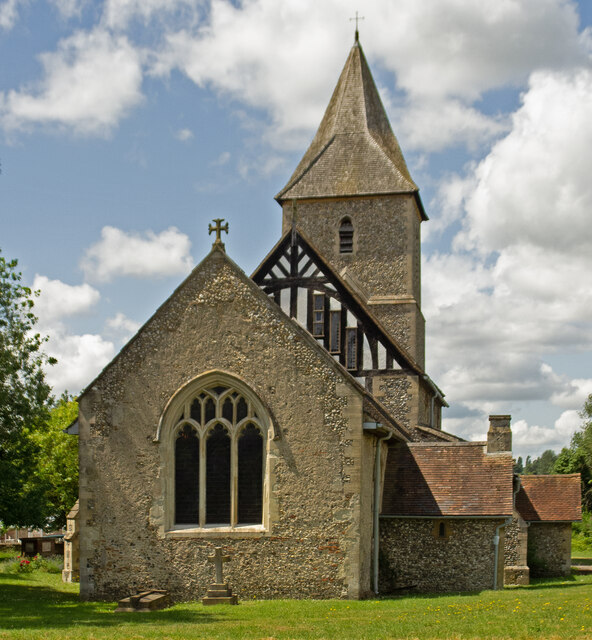
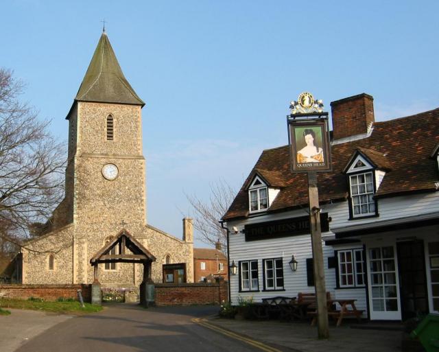
St Leonard's Church, Sandridge

St Leonard's Church is in Sandridge, a village in Hertfordshire, England. It is an active Anglican parish church. The building is Grade II* listed: notable...
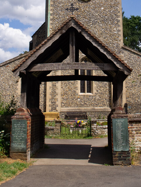
Sandridge Lychgate

Sandridge Lychgate is a war memorial in the village of Sandridge, Hertfordshire, England. The timber lychgate with its flanking walls is listed Grade II...

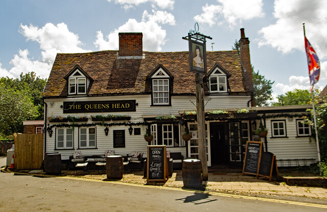
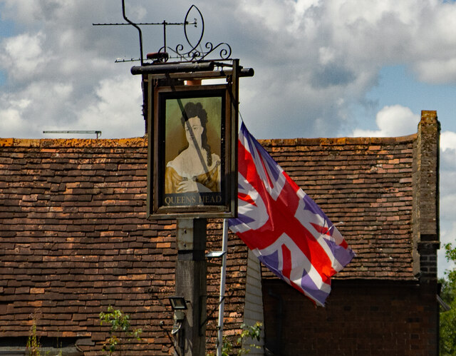
The Queen's Head, Sandridge

The Queens Head is a public house in the village of Sandridge to the north of St Albans, Hertfordshire, England. The timber framed building is weather...

Sandridge Rovers F.C.

Sandridge Rovers Football Club is an English football club based in Sandridge, Hertfordshire. They currently compete in the Herts County League Premier...

Marshalswick

Marshalswick is a suburb of St Albans in Hertfordshire, England, located around 1.5 miles northeast of the city centre. The area was developed from the...

Nearby Amenities

Located within 500m of 51.773997,-0.29579503
Crossing
Crossing Island: no
Crossing Markings: no
Crossing Signals: no
Tactile Paving: yes
Lat/Long: 51.7711958/-0.2975233
Traffic Calming: cushion
Lat/Long: 51.7725554/-0.2986787
Crossing
Crossing: unmarked
Crossing Island: no
Tactile Paving: yes
Lat/Long: 51.7731609/-0.2999713
St Albans Cycles
Operator: Independent
Shop: bicycle
Lat/Long: 51.7697914/-0.297842
Bus Stop
Portman Close
Bus: yes
Local Ref: NR
Naptan AtcoCode: 210021501880
Naptan Bearing: N
Naptan CommonName: Portman Close
Naptan Crossing: Mayfair Close
Naptan Indicator: nr
Naptan Landmark: Mayfair Close
Naptan NaptanCode: hrtdadwm
Naptan PlusbusZoneRef: STALBCY
Naptan ShortCommonName: NA
Naptan Street: Sandringham Crescent
Naptan Verified: no
Public Transport: platform
Source: naptan_import
Lat/Long: 51.7720681/-0.298457
Bus Stop
Wilstone Drive
Bus: yes
Local Ref: NR
Naptan AtcoCode: 210021501900
Naptan Bearing: W
Naptan CommonName: Wilstone Drive
Naptan Crossing: opp Highview Gardens
Naptan Indicator: nr
Naptan Landmark: opp Highview Gardens
Naptan NaptanCode: hrtdadwp
Naptan PlusbusZoneRef: STALBCY
Naptan ShortCommonName: NA
Naptan Street: Sandringham Crescent
Naptan Verified: no
Public Transport: platform
Shelter: yes
Source: naptan_import
Lat/Long: 51.7733149/-0.3011262
Bus Stop
Wilstone Drive
Bus: yes
Naptan AtcoCode: 210021509880
Naptan Bearing: E
Naptan CommonName: Wilstone Drive
Naptan Crossing: Belsize Close
Naptan Indicator: opp
Naptan Landmark: Belsize Close
Naptan NaptanCode: hrtatmtm
Naptan PlusbusZoneRef: STALBCY
Naptan ShortCommonName: NA
Naptan Street: Sandringham Crescent
Naptan Verified: no
Public Transport: platform
Shelter: no
Source: naptan_import
Lat/Long: 51.7732801/-0.3005756
Bus Stop
Portman Close
Bus: yes
Naptan AtcoCode: 210021509900
Naptan Bearing: S
Naptan CommonName: Portman Close
Naptan Crossing: Langham Close
Naptan Indicator: opp
Naptan Landmark: Langham Close
Naptan NaptanCode: hrtatmtp
Naptan PlusbusZoneRef: STALBCY
Naptan ShortCommonName: NA
Naptan Street: Sandringham Crescent
Naptan Verified: no
Public Transport: platform
Shelter: no
Source: naptan_import
Lat/Long: 51.7721086/-0.2983712
Bus Stop
Blackberry Jack PH
Bus: yes
Naptan AtcoCode: 210021509910
Naptan Bearing: S
Naptan CommonName: Blackberry Jack PH
Naptan Crossing: Craiglands
Naptan Indicator: opp
Naptan Landmark: Craiglands
Naptan NaptanCode: hrtatmtw
Naptan PlusbusZoneRef: STALBCY
Naptan ShortCommonName: NA
Naptan Street: Sandringham Crescent
Naptan Verified: no
Public Transport: platform
Shelter: no
Source: naptan_import
Lat/Long: 51.7703833/-0.2974343
Crossing
Crossing: marked
Lat/Long: 51.7699347/-0.2974498
Crossing
Bicycle: yes
Crossing: unmarked
Lat/Long: 51.7727644/-0.2990612
Restaurant
Bengal Spice
Addr City: St Albans
Addr Housenumber: 6
Addr Postcode: AL4 9RG
Addr Street: St Brelades Place
Cuisine: indian
Fhrs Id: 306158
Fhrs Local Authority Id: PI/000030051
Lat/Long: 51.7700068/-0.2977589
Atm
Cash In: no
Drive Through: no
Operator: RBS
Lat/Long: 51.7698383/-0.2982055
Post Office
Jersey Farm Post Office
Addr Country: GB
Addr Postcode: AL4 9RG
Brand: Post Office
Brand Wikidata: Q1783168
Brand Wikipedia: en:Post Office Ltd
Contact Website: https://www.postoffice.co.uk/branch-finder/0730335/jersey-farm
Ref Pol Id: 18298
Lat/Long: 51.7698831/-0.2981076
Crossing: informal
Lat/Long: 51.7724444/-0.2937814
Power: pole
Lat/Long: 51.7726998/-0.2905154
Material: wood
Power: pole
Lat/Long: 51.7756409/-0.2938851
Material: wood
Power: pole
Lat/Long: 51.7745361/-0.2931892
Communication Mobile Phone: yes
Man Made: mast
Source: Yahoo
Tower Type: communication
Lat/Long: 51.7735106/-0.2892347
Material: wood
Power: pole
Lat/Long: 51.7765837/-0.294504
Material: wood
Power: pole
Lat/Long: 51.777282/-0.2960435
Material: wood
Power: pole
Lat/Long: 51.7779525/-0.2975911
Post Box
Brand: Royal Mail
Brand Wikidata: Q638098
Brand Wikipedia: en:Royal Mail
Operator: Royal Mail
Operator Wikidata: Q638098
Post Box Type: pillar
Ref: AL4 120
Royal Cypher: EIIR
Royal Cypher Wikidata: Q33102113
Lat/Long: 51.7698529/-0.2979752
Communication Mobile Phone: yes
Man Made: mast
Tower Type: communication
Lat/Long: 51.7736007/-0.289424
Communication Mobile Phone: yes
Man Made: mast
Tower Type: communication
Lat/Long: 51.7736443/-0.2895012
Direction: 135
Generator Method: photovoltaic
Generator Output Electricity: yes
Generator Solar Modules: 16
Generator Source: solar
Generator Type: solar_photovoltaic_panel
Location: roof
Power: generator
Lat/Long: 51.7720826/-0.2969766
Direction: 150
Fixme: survey for panel count
Generator Method: photovoltaic
Generator Output Electricity: yes
Generator Solar Modules: 16
Generator Source: solar
Generator Type: solar_photovoltaic_panel
Location: roof
Power: generator
Lat/Long: 51.7728149/-0.2969779
Direction: 150
Generator Method: photovoltaic
Generator Output Electricity: yes
Generator Solar Modules: 12
Generator Source: solar
Generator Type: solar_photovoltaic_panel
Location: roof
Power: generator
Lat/Long: 51.773385/-0.2979759
Direction: 170
Fixme: survey for panel count
Generator Method: photovoltaic
Generator Output Electricity: yes
Generator Solar Modules: 6
Generator Source: solar
Generator Type: solar_photovoltaic_panel
Location: roof
Power: generator
Lat/Long: 51.7737848/-0.2990675
Direction: 230
Generator Method: photovoltaic
Generator Output Electricity: yes
Generator Solar Modules: 16
Generator Source: solar
Generator Type: solar_photovoltaic_panel
Location: roof
Power: generator
Lat/Long: 51.7738486/-0.299582
Direction: 170
Generator Method: photovoltaic
Generator Output Electricity: yes
Generator Solar Modules: 16
Generator Source: solar
Generator Type: solar_photovoltaic_panel
Location: roof
Power: generator
Lat/Long: 51.7748003/-0.2990456
Direction: 220
Fixme: survey: additional panels - thermal?
Generator Method: photovoltaic
Generator Output Electricity: yes
Generator Solar Modules: 8
Generator Source: solar
Generator Type: solar_photovoltaic_panel
Location: roof
Power: generator
Lat/Long: 51.7743712/-0.2996695
Direction: 135
Generator Method: photovoltaic
Generator Output Electricity: yes
Generator Solar Modules: 8
Generator Source: solar
Generator Type: solar_photovoltaic_panel
Location: roof
Power: generator
Lat/Long: 51.7717025/-0.3012456
Direction: 160
Fixme: survey for panel count
Generator Method: photovoltaic
Generator Output Electricity: yes
Generator Solar Modules: 8
Generator Source: solar
Generator Type: solar_photovoltaic_panel
Location: roof
Power: generator
Lat/Long: 51.7699128/-0.2957778
Direction: 150
Generator Method: photovoltaic
Generator Output Electricity: yes
Generator Solar Modules: 10
Generator Source: solar
Generator Type: solar_photovoltaic_panel
Location: roof
Power: generator
Lat/Long: 51.7708363/-0.2997203
Direction: 230
Generator Method: photovoltaic
Generator Output Electricity: yes
Generator Solar Modules: 10
Generator Source: solar
Generator Type: solar_photovoltaic_panel
Location: roof
Power: generator
Lat/Long: 51.7708061/-0.3003126
Direction: 270
Generator Method: photovoltaic
Generator Output Electricity: yes
Generator Solar Modules: 5
Generator Source: solar
Generator Type: solar_photovoltaic_panel
Location: roof
Power: generator
Lat/Long: 51.7700926/-0.2967828
Direction: 90
Generator Method: photovoltaic
Generator Output Electricity: yes
Generator Solar Modules: 5
Generator Source: solar
Generator Type: solar_photovoltaic_panel
Location: roof
Power: generator
Lat/Long: 51.7700912/-0.296701
Direction: 130
Generator Method: photovoltaic
Generator Output Electricity: yes
Generator Solar Modules: 8
Generator Source: solar
Generator Type: solar_photovoltaic_panel
Location: roof
Power: generator
Lat/Long: 51.7702267/-0.2988711
Fixme: solar panels?
Lat/Long: 51.7747566/-0.2982601
Direction: 240
Generator Method: photovoltaic
Generator Output Electricity: yes
Generator Solar Modules: 20
Generator Source: solar
Generator Type: solar_photovoltaic_panel
Location: roof
Power: generator
Lat/Long: 51.7717223/-0.2988293
Turning Circle
Lat/Long: 51.7721859/-0.3000459
Twisted Dreadlocks
Addr Housenumber: 6
Addr Postcode: AL4 9BA
Addr Street: Richmond Walk
Email: natalietrivalle73@gmail.com
Internet Access: wlan
Phone: +44 7909 956821
Shop: hairdresser
Website: https://www.twisteddreadlocks.com
Lat/Long: 51.7698399/-0.293686
The data included in this document is from www.openstreetmap.org. The data is made available under ODbL.

Have you been to Jersey Lagoon?

Leave your review of Jersey Lagoon below (or comments, questions and feedback).