Hampton Hill Pond

Lake, Pool, Pond, Freshwater Marsh in Middlesex

England

Hampton Hill Pond

Old Milestone A308, Hampton Court Road Carved stone post by the A308, in parish of TEDDINGTON AND HAMPTON (RICHMOND UPON THAMES District), Hampton Court Road, Hampton, opposite Western end of Taggs Island; opposite Boat House, East of St Alban's Lodge, in park, on South side of road. Erected by the Staines & Hampton turnpike trust in the 19th century. Eastern face see <a href="https://www.geograph.org.uk/photo/6060937">TQ1469 : Old Milestone by the A308, Hampton Court Road, Hampton</a>

Inscription reads:-
HAMPTON / COURT / BRIDGE / VI / FURLONGS / KINGSTON / BRIDGE / II / MILES //
HAMPTON / PARISH // 
SUNBURY / II / MILES / STAINES / VII / MILES / WINDSOR / XIII / MILES

Rivet benchmark on top representing 11.3 m ASL.

Grade II Listed see <span class="nowrap"><a title="https://historicengland.org.uk/listing/the-list/list-entry/1065454" rel="nofollow ugc noopener" href="https://historicengland.org.uk/listing/the-list/list-entry/1065454">Link</a><img style="margin-left:2px;" alt="External link" title="External link - shift click to open in new window" src="https://s1.geograph.org.uk/img/external.png" width="10" height="10"/></span>

Milestone Society National ID: MX_STHP07
Old Milestone A308, Hampton Court Road Credit: Ivan Clare

Hampton Hill Pond, located in Middlesex, is a picturesque freshwater pond that serves as a popular recreational area for both locals and tourists alike. Spanning an area of about 5 acres, the pond is surrounded by lush greenery and offers a serene environment for visitors to relax and unwind.

The water in Hampton Hill Pond is sourced from natural springs and rainfall, resulting in crystal clear and pristine freshwater. The pond is relatively shallow, with a maximum depth of around 10 feet, making it ideal for various water activities such as swimming, kayaking, and fishing.

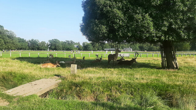
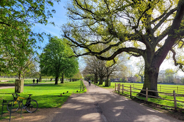
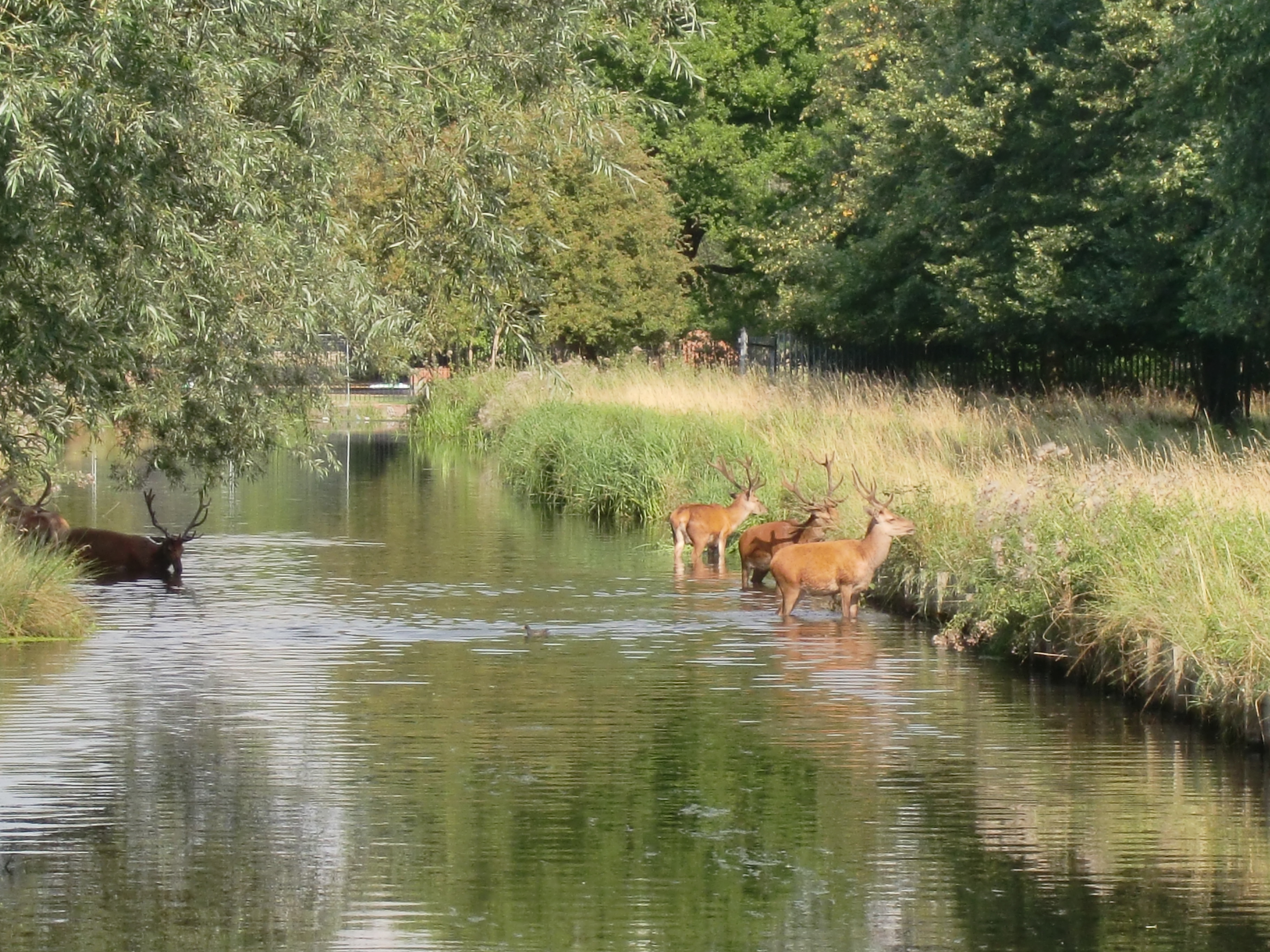
Surrounding the pond is a well-maintained walking trail that allows visitors to explore the area and enjoy the scenic beauty of the surrounding marshland. The freshwater marsh, with its diverse plant and animal life, adds to the ecological significance of the pond. Visitors can spot a variety of bird species, including ducks, herons, and swans, making it a haven for birdwatchers.

Hampton Hill Pond is equipped with amenities to ensure a pleasant experience for visitors. There are picnic areas with tables and benches, providing a perfect spot for families and friends to enjoy a meal amidst the tranquil surroundings. Additionally, there are restroom facilities and ample parking spaces available for convenience.

The pond is open to the public year-round, although swimming and other water activities may be restricted during winter months. Hampton Hill Pond is a hidden gem in Middlesex, offering a haven of natural beauty and recreational opportunities for all who visit.

If you have any feedback on the listing, please let us know in the comments section below.

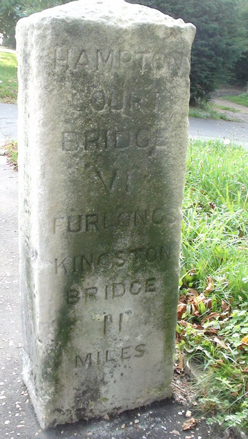
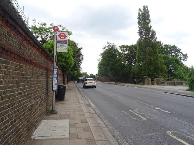
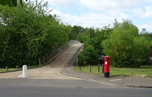
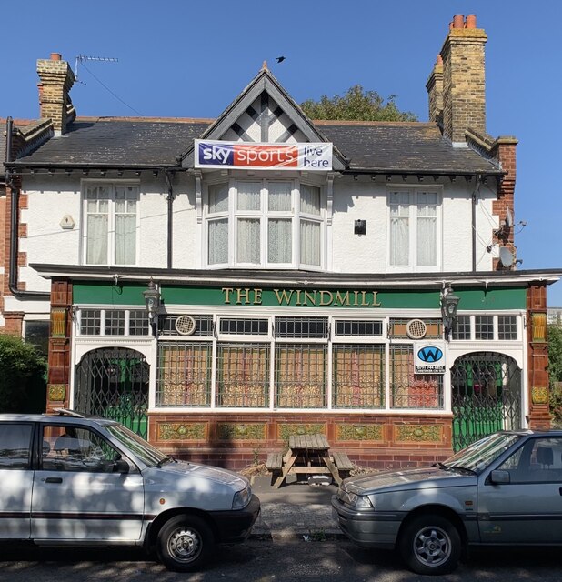
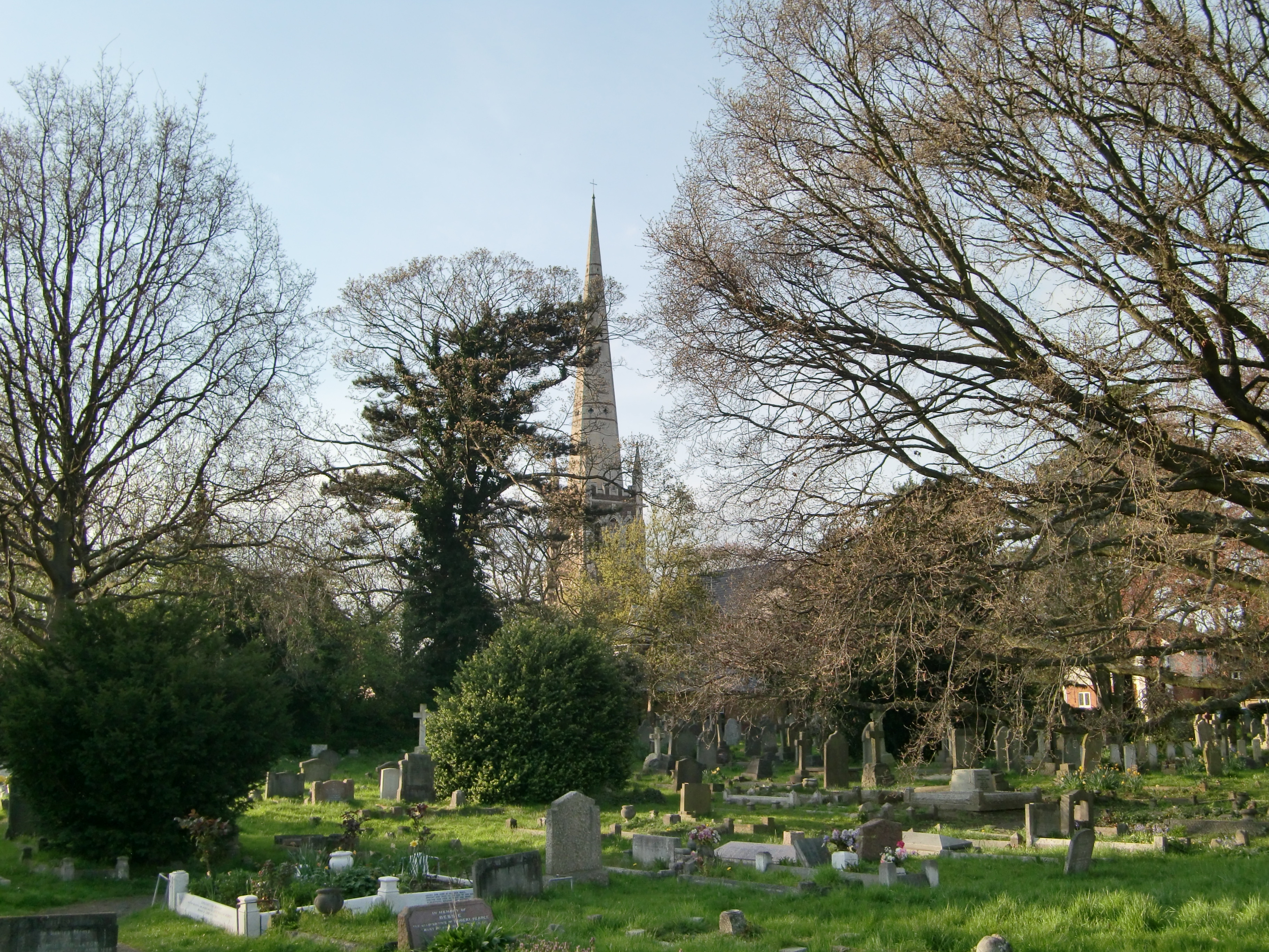
Hampton Hill Pond Images

Images are sourced within 2km of 51.425133/-0.35222996 or Grid Reference TQ1470. Thanks to Geograph Open Source API. All images are credited.

Old Milestone A308, Hampton Court Road Carved stone post by the A308, in parish of TEDDINGTON AND HAMPTON (RICHMOND UPON THAMES District), Hampton Court Road, Hampton, opposite Western end of Taggs Island; opposite Boat House, East of St Alban's Lodge, in park, on South side of road. Erected by the Staines & Hampton turnpike trust in the 19th century. Eastern face see <a href="https://www.geograph.org.uk/photo/6060937">TQ1469 : Old Milestone by the A308, Hampton Court Road, Hampton</a>

Inscription reads:-
HAMPTON / COURT / BRIDGE / VI / FURLONGS / KINGSTON / BRIDGE / II / MILES //
HAMPTON / PARISH // 
SUNBURY / II / MILES / STAINES / VII / MILES / WINDSOR / XIII / MILES

Rivet benchmark on top representing 11.3 m ASL.

Grade II Listed see <span class="nowrap"><a title="https://historicengland.org.uk/listing/the-list/list-entry/1065454" rel="nofollow ugc noopener" href="https://historicengland.org.uk/listing/the-list/list-entry/1065454">Link</a><img style="margin-left:2px;" alt="External link" title="External link - shift click to open in new window" src="https://s1.geograph.org.uk/img/external.png" width="10" height="10"/></span>

Milestone Society National ID: MX_STHP07
Old Milestone A308, Hampton Court Road
Carved stone post by the A308, in parish of TEDDINGTON AND HAMPTON (RICHMOND UPON THAMES District), Hampton Court Road, Hampton, opposite Western end of Taggs Island; opposite Boat House, East of St Alban's Lodge, in park, on South side of road. Erected by the Staines & Hampton turnpike trust in the 19th century. Eastern face see TQ1469 : Old Milestone by the A308, Hampton Court Road, Hampton Inscription reads:- HAMPTON / COURT / BRIDGE / VI / FURLONGS / KINGSTON / BRIDGE / II / MILES // HAMPTON / PARISH // SUNBURY / II / MILES / STAINES / VII / MILES / WINDSOR / XIII / MILES Rivet benchmark on top representing 11.3 m ASL. Grade II Listed see LinkExternal link Milestone Society National ID: MX_STHP07
Water works, Hampton
River Thames, Hampton
Bus stop on the A308, Hampton
Bushy Park
Bushy Park
Trees, Bushy Park
Trees, Bushy Park
Elizabeth II postbox on Hampton Court Road Postbox No. TW12 262.
See <a href="https://www.geograph.org.uk/photo/7299852">TQ1469 : Bridge to Taggs Island</a> for context.
Elizabeth II postbox on Hampton Court Road
Postbox No. TW12 262. See TQ1469 : Bridge to Taggs Island for context.
Bridge to Taggs Island Showing position of Postbox No. TW12 262.
See <a href="https://www.geograph.org.uk/photo/7299851">TQ1469 : Elizabeth II postbox on Hampton Court Road</a> for postbox.
Bridge to Taggs Island
Showing position of Postbox No. TW12 262. See TQ1469 : Elizabeth II postbox on Hampton Court Road for postbox.
Hampton Ferry Passengers and cycles.
Hampton Ferry
Passengers and cycles.
Old Milestone A308, Hampton Court Road Carved stone post by the A308, in parish of TEDDINGTON AND HAMPTON (RICHMOND UPON THAMES District), Hampton Court Road, Hampton, opposite Western end of Taggs Island; opposite Boat House, East of St Alban's Lodge, in park, on South side of road. Erected by the Staines & Hampton turnpike trust in the 19th century. 

Inscription reads:-
HAMPTON / COURT / BRIDGE / VI / FURLONGS / KINGSTON / BRIDGE / II / MILES //
HAMPTON / PARISH // 
SUNBURY / II / MILES / STAINES / VII / MILES / WINDSOR / XIII / MILES

Rivet benchmark on top representing 11.3 m ASL.

Grade II Listed see <span class="nowrap"><a title="https://historicengland.org.uk/listing/the-list/list-entry/1065454" rel="nofollow ugc noopener" href="https://historicengland.org.uk/listing/the-list/list-entry/1065454">Link</a><img style="margin-left:2px;" alt="External link" title="External link - shift click to open in new window" src="https://s1.geograph.org.uk/img/external.png" width="10" height="10"/></span>

Milestone Society National ID: MX_STHP07
Old Milestone A308, Hampton Court Road
Carved stone post by the A308, in parish of TEDDINGTON AND HAMPTON (RICHMOND UPON THAMES District), Hampton Court Road, Hampton, opposite Western end of Taggs Island; opposite Boat House, East of St Alban's Lodge, in park, on South side of road. Erected by the Staines & Hampton turnpike trust in the 19th century. Inscription reads:- HAMPTON / COURT / BRIDGE / VI / FURLONGS / KINGSTON / BRIDGE / II / MILES // HAMPTON / PARISH // SUNBURY / II / MILES / STAINES / VII / MILES / WINDSOR / XIII / MILES Rivet benchmark on top representing 11.3 m ASL. Grade II Listed see LinkExternal link Milestone Society National ID: MX_STHP07
The Windmill Pub Hampton Hill, September 2019 The sadly now shut Windmill Pub in Hampton Hill.
The Windmill Pub Hampton Hill, September 2019
The sadly now shut Windmill Pub in Hampton Hill.
Big sky over Bushy Park View of the Teddington Cricket Club pitch as the sun breaks through clouds.
Big sky over Bushy Park
View of the Teddington Cricket Club pitch as the sun breaks through clouds.
Young stags in the shade A corner of Bushy Park adjacent to Teddington Cricket Club's pitches.
Young stags in the shade
A corner of Bushy Park adjacent to Teddington Cricket Club's pitches.
Bushy Park at New Lodge Gate A lovely Sunday morning in spring.
Bushy Park at New Lodge Gate
A lovely Sunday morning in spring.
Hampton School on Hanworth Road, Hampton
Open Day at RATP Dev Bus Depot, Fulwell Situated in Wellington Road TW2 5NX, this bus depot was holding an Open Day to mark the 60th Anniversary of the ending of trolleybus operation from this depot on Tuesday 8th May 1962. It now has about 170 vehicles based here working on day routes 33, 65, 71, 85, 281, 290, 371, 481, 671, 681, and K3 plus night routes N33, N65, 85 and 281. Abellio also has a bus depot in Stanley Road adjacent to the RATP Dev depot which houses approximately 130 vehicles <a title="https://www.geograph.org.uk/photo/5121651" href="https://www.geograph.org.uk/photo/5121651">Link</a> refers.
Open Day at RATP Dev Bus Depot, Fulwell
Situated in Wellington Road TW2 5NX, this bus depot was holding an Open Day to mark the 60th Anniversary of the ending of trolleybus operation from this depot on Tuesday 8th May 1962. It now has about 170 vehicles based here working on day routes 33, 65, 71, 85, 281, 290, 371, 481, 671, 681, and K3 plus night routes N33, N65, 85 and 281. Abellio also has a bus depot in Stanley Road adjacent to the RATP Dev depot which houses approximately 130 vehicles Link refers.
Benchmark on #72 Waldegrave Road, Teddington This benchmark is on the side wall of #72 Waldegrave Road, which is actually Teddington Park. Some re-pointing has infilled part of the cut mark. Ordnance Survey cut mark benchmark levelled at 9.330m above Newlyn Datum verified 1957.

For a wider view see <a href="https://www.geograph.org.uk/photo/7377239">TQ1571 : Teddington Park junction with Waldegrave Road, Teddington</a>
Benchmark on #72 Waldegrave Road, Teddington
This benchmark is on the side wall of #72 Waldegrave Road, which is actually Teddington Park. Some re-pointing has infilled part of the cut mark. Ordnance Survey cut mark benchmark levelled at 9.330m above Newlyn Datum verified 1957. For a wider view see TQ1571 : Teddington Park junction with Waldegrave Road, Teddington
Show me another place!

Hampton Hill Pond is located at Grid Ref: TQ1470 (Lat: 51.425133, Lng: -0.35222996)

Unitary Authority: Richmond upon Thames

Police Authority: Metropolitan

What 3 Words

///scam.bill.frames. Near Teddington, London

Related Wikis

Hampton Hill

Hampton Hill (initially known as "New Hampton") is a district in the London Borough of Richmond upon Thames to the south of Twickenham. It is bounded by...

Hampton Hill United Reformed Church

Hampton Hill United Reformed Church, in the London Borough of Richmond upon Thames, is a United Reformed Church congregation. Located on 35 High Street...

Upper Lodge Water Gardens

The Upper Lodge Water Gardens are a partially restored complex of early eighteenth century water gardens with garden canals in Bushy Park, near London...

Twickenham (UK Parliament constituency)

Twickenham is a constituency in Greater London represented in the House of Commons of the UK Parliament since 2019 by Munira Wilson of the Liberal Democrats...

National Physical Laboratory (United Kingdom)

The National Physical Laboratory (NPL) is the national measurement standards laboratory of the United Kingdom. It sets and maintains physical standards...

Longford River

The Longford River is an artificial waterway, a distributary designed to embellish a park, that diverts water 12 miles (19 km) from the River Colne at...

St James's Church, Hampton Hill

St James's Church is a Grade II listed parish church in the Church of England in Hampton Hill, London. == History == The first church building was opened...

St Francis de Sales, Hampton Hill and Upper Teddington

The Church of St Francis de Sales is a Roman Catholic church in Hampton Hill, in the London Borough of Richmond upon Thames. It is the parish church for...

Related Videos

HAMPTON COURT CIRCULAR WALK BEGINNER WALKERS!! DAY SUNDAY | šŸ‡¬šŸ‡§ Hiking UK | England

This walk explores the two royal parks next to Hampton Court Palace. This was originally built for Cardinal Wolsey, but when he ...

Hampton Court and Bushy Park walk | The Best Walk Near London | šŸ‡¬šŸ‡§ Hiking UK | England

2 deer parks and a royal palace Length: 7km. Walk Notes Through Hampton Court and Bushy Parks. This walk is best avoided ...

Beginner Walkers!! Hampton Court Circular London Walk | Hiking UK | England šŸ‡¬šŸ‡§

Attention all beginner walkers! Embark on a delightful Hampton Court Circular London Walk, specially designed for those starting ...

Beginner Walkers!! Discover the Enchanting Hampton Court Walk | šŸ‡¬šŸ‡§ Hiking UK | England

Calling all beginner walkers! Embark on a delightful walking adventure along the enchanting Hampton Court Walk, perfect for ...

Nearby Amenities

Located within 500m of 51.425133,-0.35222996
Hampton Hill
Is In District: Richmond upon Thames
Place: suburb
Wikidata: Q5646227
Lat/Long: 51.4278442/-0.355081
Telephone
Booth: KX100
Covered: booth
Lat/Long: 51.4279873/-0.3551535
Bicycle Parking
Capacity: 8
Lat/Long: 51.4279917/-0.355173
Recycling
Lat/Long: 51.4280571/-0.3559219
Bicycle Parking
Bicycle Parking: stands
Capacity: 3
Covered: no
Lat/Long: 51.425968/-0.356823
Bench
Lat/Long: 51.4251099/-0.3563984
Bench
Backrest: yes
Lat/Long: 51.4257303/-0.354807
Bench
Lat/Long: 51.4240645/-0.355682
Bench
Lat/Long: 51.4255156/-0.3564228
Bench
Lat/Long: 51.4249966/-0.3570209
Bench
Lat/Long: 51.4269017/-0.3539947
Bench
Backrest: no
Description: In memory of Sholagh Voughton
Lat/Long: 51.4263996/-0.3554521
Bus Stop
Wellington Road
Bus: yes
Local Ref: HH
Naptan AtcoCode: 490007731W
Naptan Bearing: W
Naptan CommonName: Hampton Hill
Naptan Indicator: Stop HH
Naptan Verified: no
Network: London Buses
Network Wikidata: Q1192411
Public Transport: platform
Ref: 74564
Source Ref: naptan
Lat/Long: 51.428898/-0.3536507
Bus Stop
Cross Street
Bench: yes
Bin: no
Bus: yes
Lit: no
Local Ref: HM
Naptan AtcoCode: 490007732N
Naptan Bearing: N
Naptan CommonName: Hampton HillDuke Of Clarence
Naptan Indicator: Stop HM
Naptan Street: HAMPTON HILL HIGH STREET
Naptan Verified: no
Network: London Buses
Network Wikidata: Q1192411
Public Transport: platform
Shelter: yes
Tactile Paving: no
Lat/Long: 51.4266406/-0.3561173
Bus Stop
Cross Street
Bench: no
Bin: yes
Bus: yes
Lit: no
Local Ref: HB
Naptan AtcoCode: 490007732S
Naptan Bearing: S
Naptan CommonName: Hampton HillDuke Of Clarence
Naptan Indicator: Stop HB
Naptan Street: HAMPTON HILL HIGH STREET
Naptan Verified: no
Network: London Buses
Network Wikidata: Q1192411
Public Transport: platform
Shelter: no
Tactile Paving: no
Lat/Long: 51.4262577/-0.3563574
Bus Stop
Holly Road
Bus: yes
Local Ref: HL
Naptan AtcoCode: 490007733N
Naptan Bearing: N
Naptan CommonName: Hampton Hill The Star
Naptan Indicator: Stop HL
Naptan Street: HAMPTON HILL HIGH STREET
Naptan Verified: no
Network: London Buses
Network Wikidata: Q1192411
Public Transport: platform
Ref: 47720
Source Ref: naptan
Lat/Long: 51.4248103/-0.3578303
Bus Stop
Holly Road
Bench: yes
Bin: yes
Bus: yes
Local Ref: HC
Naptan AtcoCode: 490007733S
Naptan Bearing: S
Naptan CommonName: Hampton Hill The Star
Naptan Indicator: Stop HC
Naptan Street: HAMPTON HILL HIGH STREET
Naptan Verified: no
Network: London Buses
Network Wikidata: Q1192411
Public Transport: platform
Ref: 57043
Shelter: yes
Source Ref: naptan
Tactile Paving: no
Lat/Long: 51.4241469/-0.3580766
Bus Stop
Kings Road
Naptan AtcoCode: 490008814E
Naptan Bearing: N
Naptan CommonName: Kings Road Hampton Road
Naptan Street: HAMPTON ROAD
Naptan Verified: no
Public Transport: platform
Lat/Long: 51.4284512/-0.3511193
Bus Stop
Oxford Road
Bus: yes
Naptan AtcoCode: 490010685E
Naptan Bearing: N
Naptan CommonName: Oxford Road Hampton Road
Naptan Street: HAMPTON ROAD
Naptan Verified: no
Public Transport: platform
Lat/Long: 51.4277285/-0.3484102
Bus Stop
Oxford Road
Bench: no
Bus: yes
Naptan AtcoCode: 490010685W
Naptan Bearing: N
Naptan CommonName: Oxford Road Hampton Road
Naptan Street: HAMPTON ROAD
Naptan Verified: no
Public Transport: platform
Shelter: no
Lat/Long: 51.4280223/-0.3498605
Bus Stop
Parkside
Bus: yes
Local Ref: HN
Naptan AtcoCode: 490010806N
Naptan Bearing: N
Naptan CommonName: Park Rd Hampton Hill High St
Naptan Indicator: Stop HN
Naptan Street: HAMPTON HILL HIGH STREET
Naptan Verified: no
Network: London Buses
Network Wikidata: Q1192411
Public Transport: platform
Ref: 54712
Source Ref: naptan
Lat/Long: 51.428141/-0.3549707
Bus Stop
Parkside
Bus: yes
Local Ref: HA
Naptan AtcoCode: 490010806S
Naptan Bearing: S
Naptan CommonName: Park Rd Hampton Hill High St
Naptan Indicator: Stop HA
Naptan Street: HAMPTON HILL HIGH STREET
Naptan Verified: no
Network: London Buses
Network Wikidata: Q1192411
Public Transport: platform
Ref: 50367
Source Ref: naptan
Lat/Long: 51.428427/-0.354629
Entrance: yes
Lat/Long: 51.4220471/-0.355853
Bench
Lat/Long: 51.4226171/-0.3536104
Tourism: artwork
Lat/Long: 51.4226276/-0.3547333
Bicycle Parking
Capacity: 6
Lat/Long: 51.422637/-0.3536749
Bench
Lat/Long: 51.4226575/-0.3543332
Bicycle Parking
Capacity: 6
Lat/Long: 51.4227671/-0.3558716
Bench
Lat/Long: 51.4228925/-0.3543901
Post Box
Brand: Royal Mail
Brand Wikidata: Q638098
Collection Times: Mo-Fr 17:00; Sa 12:15
Operator: Royal Mail
Operator Wikidata: Q638098
Ref: TW12 233
Lat/Long: 51.4262243/-0.3563947
Traffic Signals
Source: bing
Lat/Long: 51.429076/-0.354264
Turning Circle
Lat/Long: 51.4283108/-0.3535778
Laurel Road Gate
Barrier: kissing_gate
Bicycle: yes
Foot: yes
Lat/Long: 51.426598/-0.3505604
Hampton Hill New Gate
Barrier: kissing_gate
Bicycle: dismount
Foot: yes
Lat/Long: 51.4262351/-0.3557794
Crossing
Button Operated: yes
Crossing: traffic_signals
Crossing Island: no
Lat/Long: 51.4282766/-0.3506081
Crossing
Crossing: uncontrolled
Crossing Island: no
Crossing Ref: zebra
Tactile Paving: yes
Traffic Calming: table
Lat/Long: 51.425871/-0.35683
Addr Housename: Templeton Court
Addr Street: High Street
Lat/Long: 51.4279797/-0.3546171
Addr Housenumber: 50
Addr Street: Hampton Road
Lat/Long: 51.4279555/-0.3482535
Post Box
Brand: Royal Mail
Brand Wikidata: Q638098
Operator: Royal Mail
Operator Wikidata: Q638098
Post Box Type: wall
Ref: TW11 189
Royal Cypher: GR
Royal Cypher Wikidata: Q33102273
Lat/Long: 51.427518/-0.3468791
Vending Machine
Vending: parking_tickets
Lat/Long: 51.4281485/-0.3564375
Fixme: investigate; numbers and names required
Lat/Long: 51.4280749/-0.3551963
Waste Basket
Lat/Long: 51.4283179/-0.3549421
Waste Basket
Lat/Long: 51.4288424/-0.354307
Bicycle Parking
Capacity: 8
Lat/Long: 51.4289299/-0.3542935
Entrance: yes
Lat/Long: 51.4287455/-0.3543327
Waste Basket
Lat/Long: 51.4284787/-0.3546359
Bench
Lat/Long: 51.428157/-0.3550641
Waste Basket
Lat/Long: 51.4281965/-0.355039
Waste Basket
Lat/Long: 51.4282553/-0.3550486
Information: board
Tourism: information
Lat/Long: 51.4282456/-0.3550103
Entrance: yes
Lat/Long: 51.4276837/-0.3549017
Bicycle Parking
Lat/Long: 51.4278343/-0.3549487
Little Gym
Leisure: sports_centre
Sport: gymnastics
Lat/Long: 51.4276566/-0.3547863
Doctors
Hampton Hill Medical Centre
Healthcare: doctor
Lat/Long: 51.4277467/-0.3547749
Atm
Lat/Long: 51.4283365/-0.3550038
Post Box
Brand: Royal Mail
Brand Wikidata: Q638098
Collection Times: Mo-Fr 16:45; Sa 12:15
Operator: Royal Mail
Operator Wikidata: Q638098
Ref: TW12 227
Lat/Long: 51.4285192/-0.3547426
Addr Housenumber: 25-29
Addr Street: Deerhurst Crescent
Entrance: yes
Lat/Long: 51.4272382/-0.3552723
75
Opening Hours: Mo 09:00-17:30; Tu-We,Fr 09:30-18:30; Th 10:00-19:45; Sa 09:00-17:15
Shop: hairdresser
Lat/Long: 51.427004/-0.3555673
Addr Housenumber: 86
Addr Street: High Street
Entrance: yes
Lat/Long: 51.4272083/-0.3554236
Coral
Brand: Coral
Brand Wikidata: Q54621344
Brand Wikipedia: en:Coral (bookmaker)
Opening Hours: Mo-Fr,Su 10:00-19:00; Sa 09:00-19:00
Shop: bookmaker
Lat/Long: 51.4270433/-0.3555411
Cafe
Georgias Kitchen
Addr Housenumber: 52
Addr Street: High Street
Contact Phone: +44 20 8977 3586
Opening Hours: Mo-Fr 07:30-17:00; Sa 08:00-17:00; Su 09:00-14:00
Lat/Long: 51.4260586/-0.3564823
Bicycle Parking
Bicycle Parking: stands
Capacity: 2
Covered: no
Lat/Long: 51.425934/-0.3566907
Bright ā€™nā€™ Breezy Laundry Services
Addr Housenumber: 52
Addr Street: High Street
Opening Hours: Mo-Su 07:30-21:00
Self Service: yes
Shop: laundry
Lat/Long: 51.4259987/-0.3565236
Alex Hair Design 4U
Male: yes
Opening Hours: Mo-Fr 09:00-19:00; Sa 08:45-18:30; Su 09:30-17:00
Shop: hairdresser
Lat/Long: 51.4260473/-0.3568369
Bicycle Parking
Capacity: 4
Lat/Long: 51.4282978/-0.3549553
Generator Method: photovoltaic
Generator Output Electricity: yes
Generator Source: solar
Generator Type: solar_photovoltaic_panel
Location: roof
Power: generator
Lat/Long: 51.4241419/-0.358769
Ford: yes
Lat/Long: 51.422094/-0.3514862
Waterway: weir
Lat/Long: 51.4213599/-0.354465
Admiralty Cascade
Waterway: weir
Lat/Long: 51.4224165/-0.3554839
Barrier: bollard
Bicycle: yes
Bollard: fixed
Foot: yes
Height: 1
Material: wood
Motor Vehicle: no
Lat/Long: 51.4285017/-0.3556475
Barrier: bollard
Bicycle: yes
Bollard: fixed
Foot: yes
Height: 1
Material: wood
Motor Vehicle: no
Lat/Long: 51.4285361/-0.3556097
Crossing
Crossing: marked
Crossing Island: no
Tactile Paving: yes
Lat/Long: 51.4290513/-0.3541432
Crossing
Crossing: marked
Crossing Island: no
Tactile Paving: yes
Lat/Long: 51.4291701/-0.354248
Crossing
Crossing: marked
Crossing Island: no
Tactile Paving: yes
Lat/Long: 51.4289936/-0.3543264
Crossing
Crossing: marked
Crossing Island: no
Tactile Paving: yes
Lat/Long: 51.4291158/-0.3544411
Bench
Backrest: yes
Lat/Long: 51.4258341/-0.3550312
Crossing
Crossing: uncontrolled
Crossing Island: no
Crossing Ref: zebra
Kerb: flush
Raised: yes
Tactile Paving: yes
Traffic Calming: table
Lat/Long: 51.4239074/-0.3582899
Height: 2
Waterway: weir
Lat/Long: 51.422741/-0.3547948
Advertising: board
Lit: no
Lat/Long: 51.4236519/-0.3524006
Crossing
Crossing: unmarked
Crossing Island: yes
Tactile Paving: no
Lat/Long: 51.4275561/-0.3477765
Crossing
Crossing: unmarked
Crossing Island: yes
Tactile Paving: no
Lat/Long: 51.4274411/-0.3467422
Crossing
Crossing: unmarked
Crossing Island: yes
Tactile Paving: no
Lat/Long: 51.4279254/-0.3493116
Defibrillator
Access: permissive
Defibrillator Location: Inside Tesco
Emergency: defibrillator
Indoor: yes
Opening Hours: Mo-Su 07:00-23:00
Ref GB The Circuit: 3EBDBFEC-6390-4068-9C03-AE3C00BD2D52
Lat/Long: 51.4283115/-0.3550732
Restaurant
Ureshi Sushi Master
Addr City: Hampton Hill
Addr Housenumber: 169B
Addr Postcode: TW12 1NL
Addr Street: High Street Hampton Hill
Addr Suburb: Hampton Hill
Cuisine: sushi
Fhrs Id: 1574127
Fixme: Location is guessed, needs converting to a building
Source: FHRS Open Data
Source Addr: FHRS Open Data
Lat/Long: 51.4279782/-0.3553677
Childcare
Ivytree Nursery Hampton
Addr City: Hampton Hill
Addr Housenumber: 35b
Addr Postcode: TW12 1NB
Addr Street: High Street Hampton Hill
Fhrs Id: 354604
Source: FHRS Open Data
Website: http://www.ivytreenursery.co.uk/
Lat/Long: 51.4237143/-0.3585515
Andy's Kitchen
Addr City: Hampton Hill
Addr Housenumber: 15
Addr Postcode: TW12 1NZ
Addr Street: Deerhurst Crescent
Craft: caterer
Website: https://andyskitchen-cateringfoodanddrinksupplies.business.site/
Lat/Long: 51.4271269/-0.354789
Ref GB Tflcid: RWG134438
Traffic Calming: cushion
Lat/Long: 51.4263602/-0.3586323
Bicycle Parking
Bicycle Parking: stands
Capacity: 4
Ref GB Tflcid: RWG125386
Lat/Long: 51.4275363/-0.3552212
Bicycle Parking
Bicycle Parking: stands
Capacity: 2
Ref GB Tflcid: RWG125382
Lat/Long: 51.4264021/-0.3561345
Bicycle Parking
Bicycle Parking: stands
Capacity: 4
Ref GB Tflcid: RWG125383
Lat/Long: 51.4264642/-0.3561319
Bicycle Parking
Bicycle Parking: stands
Capacity: 4
Ref GB Tflcid: RWG125384
Lat/Long: 51.4268989/-0.3559102
Bicycle Parking
Bicycle Parking: stands
Capacity: 4
Ref GB Tflcid: RWG125385
Lat/Long: 51.4270873/-0.3557447
Bicycle Parking
Capacity: 6
Ref GB Tflcid: RWG277928
Lat/Long: 51.4261664/-0.3557313
Bicycle Parking
Bicycle Parking: stands
Capacity: 4
Ref GB Tflcid: RWG124783
Lat/Long: 51.4240086/-0.3581478
Bicycle Parking
Bicycle Parking: stands
Capacity: 10
Covered: no
Ref GB Tflcid: RWG124782
Lat/Long: 51.4239659/-0.3578174
Bicycle Parking
Bicycle Parking: stands
Capacity: 2
Ref GB Tflcid: RWG124786
Lat/Long: 51.4250377/-0.3576758
Bicycle Parking
Bicycle Parking: stands
Capacity: 4
Ref GB Tflcid: RWG124784
Lat/Long: 51.4240408/-0.3583113
Bicycle Parking
Bicycle Parking: stands
Capacity: 2
Ref GB Tflcid: RWG124785
Lat/Long: 51.4251958/-0.357554
Ref GB Tflcid: RWG134561
Traffic Calming: hump
Lat/Long: 51.4276427/-0.3552425
Telephone
Note: not BT
Lat/Long: 51.4280286/-0.3551311
Telephone
Note: not BT
Lat/Long: 51.4280373/-0.3551257
Bench
Lat/Long: 51.428077/-0.3550883
Bench
Lat/Long: 51.4278928/-0.3552646
Bench
Lat/Long: 51.4278861/-0.3553112
Bench
Lat/Long: 51.4278565/-0.3552909
Post Office
Addr City: Hampton
Addr Housenumber: 58
Addr Postcode: TW12 1PD
Addr Street: High Street
Addr Village: Hampton Hill
Brand: Post Office
Brand Wikidata: Q1783168
Ref Pol Id: 18120
Website: https://www.postoffice.co.uk/branch-finder/0600253/hampton-hill
Lat/Long: 51.4261696/-0.3562295
Haxton Chartered Accountants
Office: accountant
Website: https://www.haxton.co.uk/
Lat/Long: 51.4292741/-0.3539262
London Mortgages
Addr City: Hampton Hill
Addr Housenumber: 124
Addr Postcode: TW12 1NS
Addr Street: High Street
Contact Website: https://www.londonmortgages.co.uk/
Office: accountant
Lat/Long: 51.4293294/-0.3538865
The data included in this document is from www.openstreetmap.org. The data is made available under ODbL.

Have you been to Hampton Hill Pond?

Leave your review of Hampton Hill Pond below (or comments, questions and feedback).