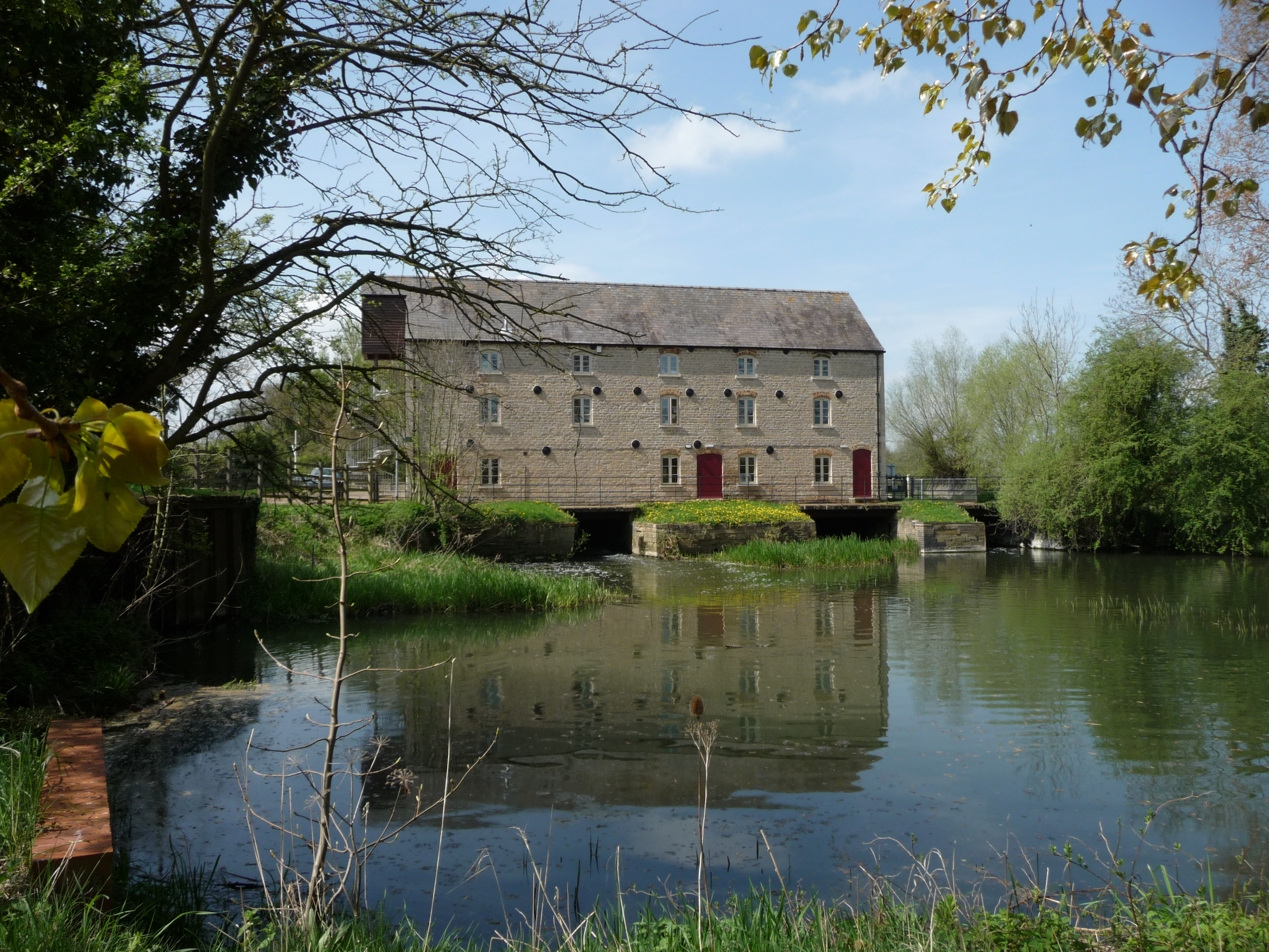
Mill Stream
Lake, Pool, Pond, Freshwater Marsh in Northamptonshire
England
Mill Stream

Mill Stream is a picturesque freshwater body located in the county of Northamptonshire, England. This idyllic water feature is commonly referred to as a lake, pool, pond, or freshwater marsh due to its diverse characteristics and natural beauty. Spanning approximately 5 acres, it serves as a vital habitat for numerous species of plants and animals, making it a popular destination for nature enthusiasts and wildlife photographers.
Surrounded by lush greenery and tall reeds, Mill Stream boasts crystal-clear water that reflects the surrounding landscape. The stream is fed by natural springs and rainwater runoff, ensuring a constant flow of freshwater throughout the year. The water is remarkably clean and supports a healthy ecosystem, making it an ideal home for various aquatic plants and creatures.
The diversity of plant life in Mill Stream is truly remarkable. The water is adorned with vibrant lily pads, water lilies, and other floating plants, creating a stunning visual spectacle. The surrounding marshland is carpeted with sedges, rushes, and reeds, providing nesting grounds for waterfowl and other wetland birds.
The tranquil atmosphere of Mill Stream offers a sanctuary for a wide range of wildlife. Ducks, geese, swans, moorhens, and coots can be spotted gracefully gliding across the water's surface. The reed beds provide shelter for numerous species of insects, amphibians, and small mammals.
Visitors to Mill Stream can enjoy leisurely walks along its banks, observing the abundant wildlife and taking in the serene beauty of the surroundings. The site is also a popular spot for fishing, with anglers often reeling in carp, tench, and roach.
In conclusion, Mill Stream in Northamptonshire is a captivating freshwater feature that offers a haven for both flora and fauna. Its diverse ecosystem and stunning scenery make it a must-visit destination for nature lovers and those seeking a peaceful escape.
If you have any feedback on the listing, please let us know in the comments section below.
Mill Stream Images
Images are sourced within 2km of 52.527148/-0.43925015 or Grid Reference TL0593. Thanks to Geograph Open Source API. All images are credited.


Mill Stream is located at Grid Ref: TL0593 (Lat: 52.527148, Lng: -0.43925015)
Unitary Authority: North Northamptonshire
Police Authority: Northamptonshire
What 3 Words
///topples.postings.chill. Near Oundle, Northamptonshire
Nearby Locations
Related Wikis
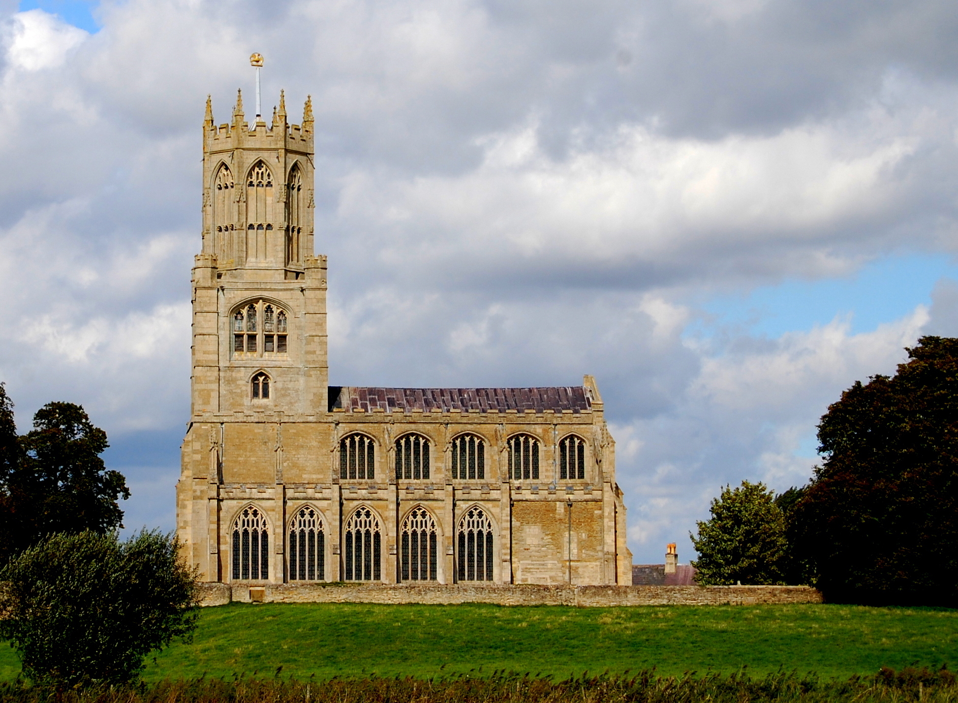
Church of St Mary and All Saints, Fotheringhay
The Church of St Mary and All Saints, Fotheringhay is a parish church in the Church of England in Fotheringhay, Northamptonshire. It is noted for containing...

Fotheringhay Castle
Fotheringhay Castle, also known as Fotheringay Castle, was a High Middle Age Norman Motte-and-bailey castle in the village of Fotheringhay 3+1⁄2 miles...
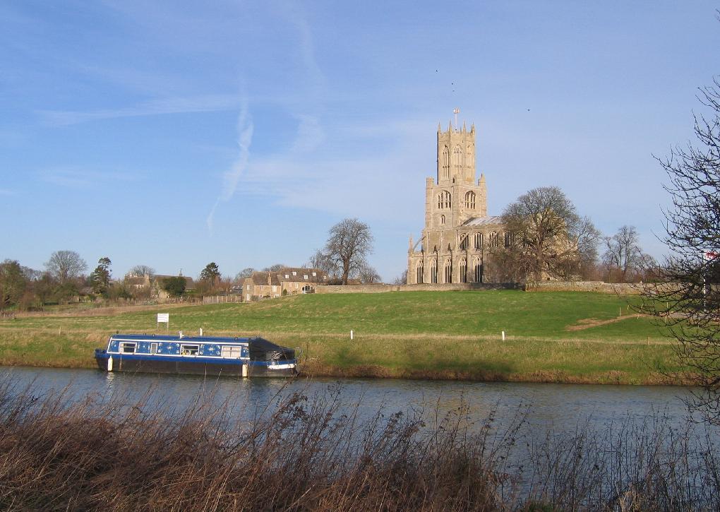
Fotheringhay
Fotheringhay is a village and civil parish in North Northamptonshire, England. It is 4 miles (6.4 km) north-east of Oundle and around 13 miles (21 km)...

Tansor
Tansor is a village and civil parish in the English county of Northamptonshire. Lying near the River Nene, three miles north-east of the town of Oundle...
Warmington, Northamptonshire
Warmington is a village and civil parish in North Northamptonshire, England with a population of 874 (as of the 2001 census), increasing to 939 at the...
Elton railway station
Elton railway station is a former railway station in Elton, Cambridgeshire on former Northampton and Peterborough Railway which connected Peterborough...

Elton, Cambridgeshire
Elton is a village and civil parish in Cambridgeshire, England. Elton lies approximately 7 miles (11 km) south-west of Peterborough. Elton is situated...

Woodnewton
Woodnewton is a village in Northamptonshire, England. Essentially a pair of parallel streets, the village lies to the north of a small stream, the Willow...
Nearby Amenities
Located within 500m of 52.527148,-0.43925015Have you been to Mill Stream?
Leave your review of Mill Stream below (or comments, questions and feedback).