Wilbraham, Great

Settlement in Cambridgeshire South Cambridgeshire

England

Wilbraham, Great

Towards Fulbourn on Wilbraham Road A cloudless December morning. These fields are some of the southernmost in the Cambridgeshire Fens.
Towards Fulbourn on Wilbraham Road Credit: John Sutton

Wilbraham, Great is a small village located in Cambridgeshire, England. Situated in the East of England region, it lies approximately 6 miles east of the historic city of Cambridge. The village is part of the South Cambridgeshire district and has a population of around 1,000 residents.

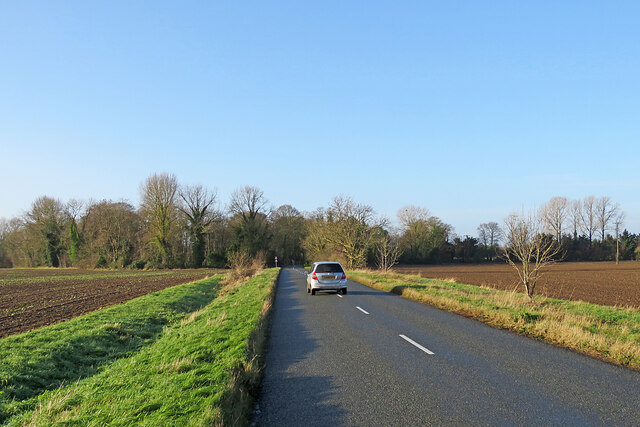
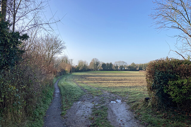
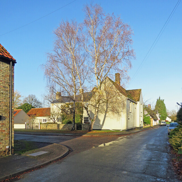
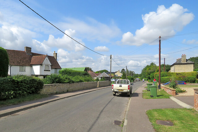
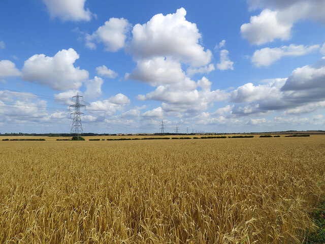
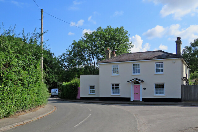
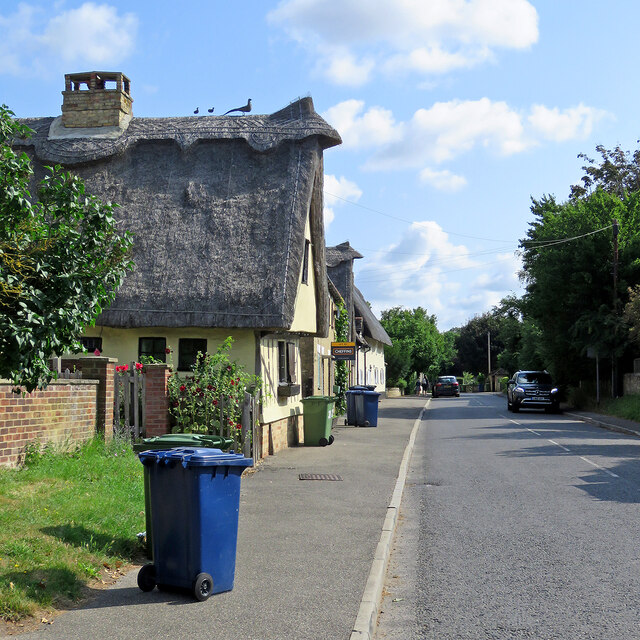
Wilbraham, Great is known for its picturesque countryside and quintessential English charm. It is surrounded by rolling hills, lush meadows, and beautiful farmland, offering residents and visitors a tranquil and idyllic setting. The village is characterized by its traditional thatched-roof cottages, stone houses, and historic buildings, which add to its rural appeal.

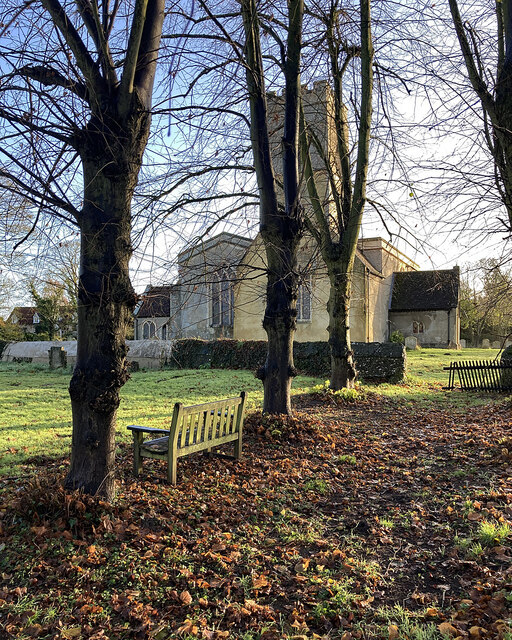
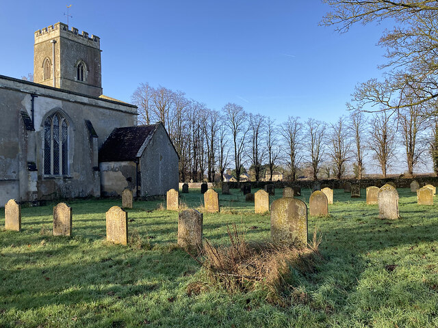
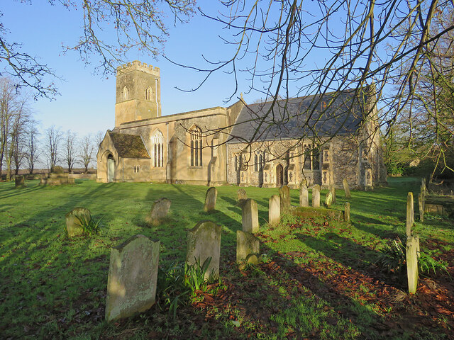
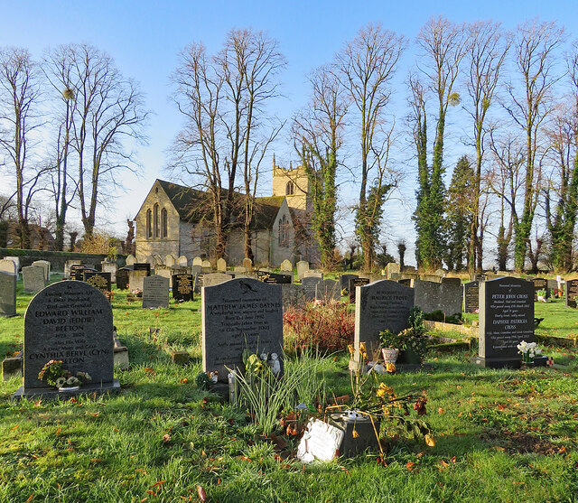
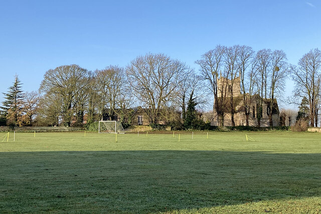
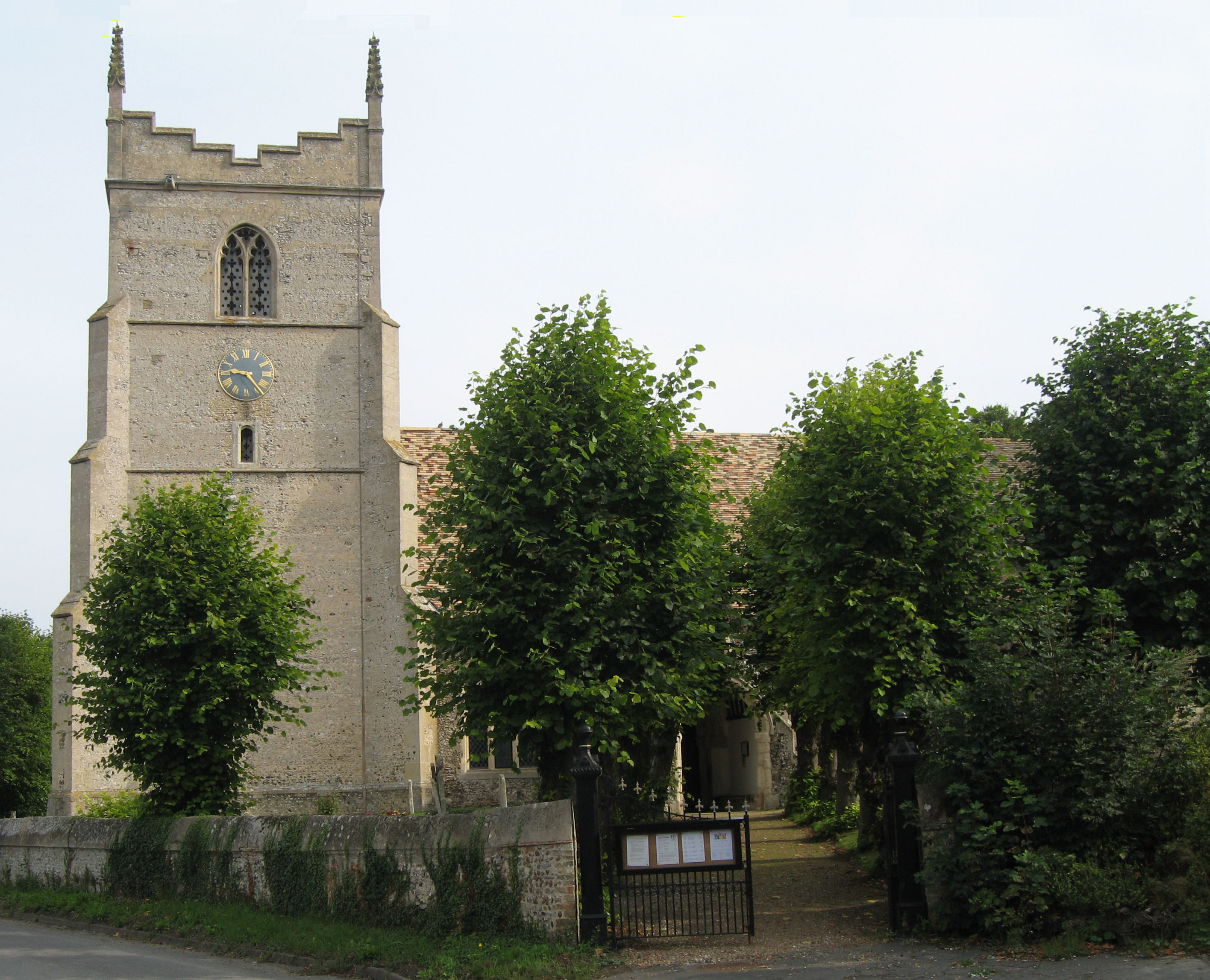
The heart of the village features St. Nicholas Church, a Grade II listed building that dates back to the 13th century. The church is a prominent landmark and serves as a focal point for community events and activities. Additionally, Wilbraham, Great offers a range of amenities including a local pub, village hall, and a primary school, catering to the needs of its residents.

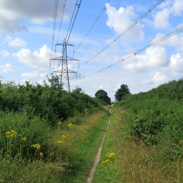
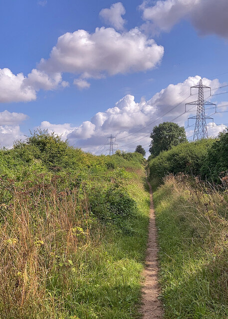
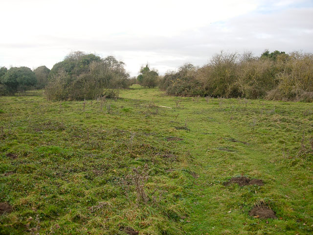
The village benefits from its proximity to Cambridge, a world-renowned center for education and innovation. This allows residents to enjoy the benefits of both a peaceful rural lifestyle and convenient access to the city's amenities and employment opportunities. The surrounding area also provides ample opportunities for outdoor activities such as walking, cycling, and exploring the nearby nature reserves.

In summary, Wilbraham, Great is a charming village in Cambridgeshire that offers a serene countryside atmosphere, historic architecture, and a close-knit community.

If you have any feedback on the listing, please let us know in the comments section below.

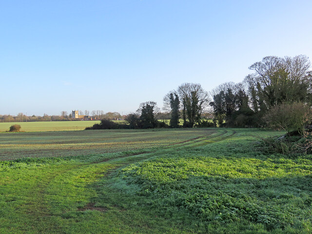
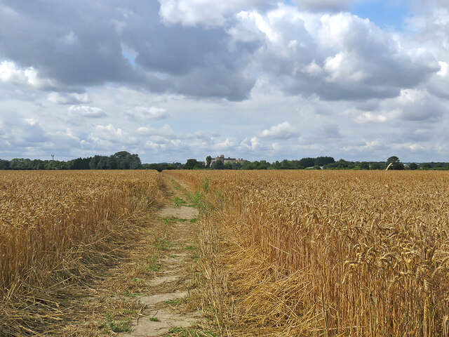
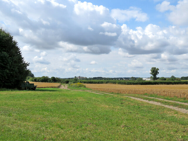
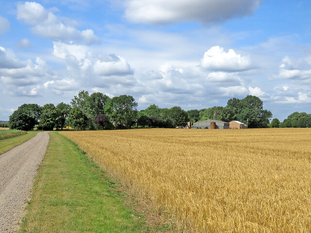
Wilbraham, Great Images

Images are sourced within 2km of 52.194613/0.265008 or Grid Reference TL5457. Thanks to Geograph Open Source API. All images are credited.

Towards Fulbourn on Wilbraham Road A cloudless December morning. These fields are some of the southernmost in the Cambridgeshire Fens.
Towards Fulbourn on Wilbraham Road
A cloudless December morning. These fields are some of the southernmost in the Cambridgeshire Fens.
Great Wilbraham: road ends and path begins This is where the metalled road ends and Toft Lane continues as a path to the Cambridge road near the western edge of this Fenland village.
Great Wilbraham: road ends and path begins
This is where the metalled road ends and Toft Lane continues as a path to the Cambridge road near the western edge of this Fenland village.
Little Wilbraham churchyard in December St John's is an endearing church with a north aisle (left of the tower in this view) as large as the nave.
Little Wilbraham churchyard in December
St John's is an endearing church with a north aisle (left of the tower in this view) as large as the nave.
Little Wilbraham: the north side of the churchyard A cloudless December morning in a village near the southern edge of the Cambridgeshire Fens.
Little Wilbraham: the north side of the churchyard
A cloudless December morning in a village near the southern edge of the Cambridgeshire Fens.
Little Wilbraham: St John's Church A pleasing mediaeval church whose rebuilt chancel dates from 1850. The photograph was taken on a fine morning in December.
Little Wilbraham: St John's Church
A pleasing mediaeval church whose rebuilt chancel dates from 1850. The photograph was taken on a fine morning in December.
Great Wilbraham: St Nicholas's Church and burial ground Photographed from Angle End on a cloudless December morning.
Great Wilbraham: St Nicholas's Church and burial ground
Photographed from Angle End on a cloudless December morning.
Great Wilbraham: church and cricket square Looking across the recreation ground from Angle End on a cloudless December morning. The cricket square is roped off for the winter.
Great Wilbraham: church and cricket square
Looking across the recreation ground from Angle End on a cloudless December morning. The cricket square is roped off for the winter.
Great Wilbraham: silver birch and Angle End Farmhouse Angle End on a bright December morning.
Great Wilbraham: silver birch and Angle End Farmhouse
Angle End on a bright December morning.
Great Wilbraham: over the fields to St Nicholas's Church Photographed from just inside an open farm gate on a sparkling December morning.
Great Wilbraham: over the fields to St Nicholas's Church
Photographed from just inside an open farm gate on a sparkling December morning.
Through wheat to Fulbourn This path - always well defined - runs from Hawk Mill Farm at Little Wilbraham to Fulbourn (ahead). These fields are near the southern end of the Cambridgeshire Fens and are not so pancake-flat as those further north. Comparable views: <a href="https://www.geograph.org.uk/photo/5499134">TL5357 : Path through beans</a> and <a href="https://www.geograph.org.uk/photo/6462676">TL5357 : Footpath to Fulbourn</a>.
Through wheat to Fulbourn
This path - always well defined - runs from Hawk Mill Farm at Little Wilbraham to Fulbourn (ahead). These fields are near the southern end of the Cambridgeshire Fens and are not so pancake-flat as those further north. Comparable views: TL5357 : Path through beans and TL5357 : Footpath to Fulbourn.
From Hawk Mill Farm to Fulbourn The farm track is shared by the public footpath to Fulbourn, which diverges to the left 150 yards or so ahead. The S&B Herba plant on Station Road in Fulbourn shows on the skyline just to the left of centre.
From Hawk Mill Farm to Fulbourn
The farm track is shared by the public footpath to Fulbourn, which diverges to the left 150 yards or so ahead. The S&B Herba plant on Station Road in Fulbourn shows on the skyline just to the left of centre.
Little Wilbraham: a barley field at Hawk Mill Farm The farm road is shared by a public footpath, which passes through the farmyard. Thereafter, turn left for Fulbourn or right to Quy, both pleasant routes.
Little Wilbraham: a barley field at Hawk Mill Farm
The farm road is shared by a public footpath, which passes through the farmyard. Thereafter, turn left for Fulbourn or right to Quy, both pleasant routes.
Little Wilbraham High Street A sunny early-August morning which was about to cloud over. For a better idea of the Grade II listed 16th-century house on the left, see <a href="https://www.geograph.org.uk/photo/5312748">TL5458 : Little Wilbraham: White Hall</a>. I was taken by the bright green corrugated-iron roof of the outbuildings next door and the post box's vivid splash of red opposite.
Little Wilbraham High Street
A sunny early-August morning which was about to cloud over. For a better idea of the Grade II listed 16th-century house on the left, see TL5458 : Little Wilbraham: White Hall. I was taken by the bright green corrugated-iron roof of the outbuildings next door and the post box's vivid splash of red opposite.
Ripe wheat, big sky, pylons Looking north from the byway from Great Wilbraham to Bottisham or Six Mile Bottom on a bright morning in early August. <a href="https://www.geograph.org.uk/photo/3299980">TL5658 : Power line and snowy fields</a> is a wintry view of the pylons, taken from nearer the road.
Ripe wheat, big sky, pylons
Looking north from the byway from Great Wilbraham to Bottisham or Six Mile Bottom on a bright morning in early August. TL5658 : Power line and snowy fields is a wintry view of the pylons, taken from nearer the road.
Path to Great Wilbraham This track runs from Heath Road (which links Bottisham and Six Mile Bottom) to Great Wilbraham (ahead).
Path to Great Wilbraham
This track runs from Heath Road (which links Bottisham and Six Mile Bottom) to Great Wilbraham (ahead).
Path and pylons This track runs from Great Wilbraham to Heath Road (which links Bottisham and Six Mile Bottom). The picture was taken on a bright morning in early August.
Path and pylons
This track runs from Great Wilbraham to Heath Road (which links Bottisham and Six Mile Bottom). The picture was taken on a bright morning in early August.
Great Wilbraham: a pink front door Clare House, at the corner of High Street, Angle End (left) and Butt Lane (right), has been repainted since I last pointed a camera in this direction, in January 2015: <a href="https://www.geograph.org.uk/photo/4311518">TL5557 : A January morning in Great Wilbraham</a>.
Great Wilbraham: a pink front door
Clare House, at the corner of High Street, Angle End (left) and Butt Lane (right), has been repainted since I last pointed a camera in this direction, in January 2015: TL5557 : A January morning in Great Wilbraham.
Great Wilbraham: recycling bins day Blue (recyclable card, paper, metal, glass and plastic) and green (compostable garden and kitchen waste) bins are waiting to be collected. The timber-framed houses are some of a good number of Grade II listed historic houses in the village.
Great Wilbraham: recycling bins day
Blue (recyclable card, paper, metal, glass and plastic) and green (compostable garden and kitchen waste) bins are waiting to be collected. The timber-framed houses are some of a good number of Grade II listed historic houses in the village.
Show me another place!

Wilbraham, Great is located at Grid Ref: TL5457 (Lat: 52.194613, Lng: 0.265008)

Administrative County: Cambridgeshire

District: South Cambridgeshire

Police Authority: Cambridgeshire

What 3 Words

///swells.officials.rides. Near Bottisham, Cambridgeshire

Related Wikis

Great Wilbraham

Great Wilbraham is a small village situated in a rural area some seven miles (11 km) to the east of Cambridge, between the edge of an area of low-lying...

Great Wilbraham Preceptory

Great Wilbraham Preceptory is a preceptory in Great and Little Wilbraham, Cambridgeshire. Much of the Church of Saint Nicholas at Great Wilbraham dates...

Little Wilbraham

Little Wilbraham is a village in Cambridgeshire, England, 6 miles (10 km) east of Cambridge between the A1303 and the A11. It is in the district of South...

Great Wilbraham Common

Great Wilbraham Common is a 23.5-hectare (58-acre) biological Site of Special Scientific Interest west of Great Wilbraham in Cambridgeshire. It is managed...

RAF Bottisham

Royal Air Force Bottisham or more simply RAF Bottisham is a former Royal Air Force station located 5 miles (8 km) east of Cambridge, Cambridgeshire, England...

Zouches Manor

Zouches Manor (also Zouches Castle) was an Anglo-Saxon moated manor in Fulbourn Fen, a Site of Special Scientific Interest in the village of Fulbourn,...

Fulbourn Fen

Fulbourn Fen is a 27.3-hectare (67-acre) biological Site of Special Scientific Interest east of Fulbourn, Cambridgeshire. It is privately owned and managed...

Fulbourn railway station

Fulbourn railway station (for some time misspelled "Fulbourne" by British Rail) is a disused railway station on the Ipswich to Ely Line, and located between...

Nearby Amenities

Located within 500m of 52.194613,0.265008
Crossing: uncontrolled
Fixme: buildout. No parking 08:30-09:30,3:00-3:45 mo-fri either side 10m and round corner
Lat/Long: 52.1970642/0.2640319
Great Wilbraham
Is In: Cambridgeshire, England, UK
Place: village
Population: 630
Source Population: http://www.scambs.gov.uk/CommunityandLiving/VillageServicesAndAmenities/
Wikidata: Q649811
Lat/Long: 52.194124/0.2651614
Bus Stop
Church Street
Naptan AtcoCode: 0500SGREW002
Naptan Bearing: NW
Naptan CommonName: Church Street
Naptan Indicator: NW-bound
Naptan Landmark: Church Close
Naptan NaptanCode: cmbdwmwa
Naptan ShortCommonName: Church Street
Naptan Street: Church Street
Naptan Verified: no
Source: naptan_import
Lat/Long: 52.1939082/0.2662153
Bus Stop
Angle End
Naptan AtcoCode: 0500SGREW003
Naptan Bearing: S
Naptan CommonName: Angle End
Naptan Indicator: near
Naptan Landmark: Angle End
Naptan NaptanCode: cmbdwmwd
Naptan Street: Church Road
Naptan Verified: no
Source: naptan_import
Lat/Long: 52.1968739/0.2639663
Bus Stop
Church Street
Naptan AtcoCode: 0500SGREW005
Naptan Bearing: SW
Naptan CommonName: Church Street
Naptan Indicator: opp
Naptan Landmark: Church Street
Naptan NaptanCode: cmbdwmwj
Naptan ShortCommonName: Church Street
Naptan Street: High Street
Naptan Verified: no
Source: naptan_import
Lat/Long: 52.1929997/0.2666958
Bench
Lat/Long: 52.1942662/0.2674661
Bench
Backrest: yes
Material: wood
Seats: 4
Lat/Long: 52.1963649/0.265834
Barrier: cattle_grid
Lat/Long: 52.1952364/0.2695034
Post Box
Collection Times: Mo-Fr 09:00; Sa 07:00
Operator: Royal Mail
Post Box Type: lamp
Ref: CB21 344
Royal Cypher: EIIR
Royal Cypher Wikidata: Q33102113
Source: survey
Survey Date: 2017-09-25
Lat/Long: 52.1910427/0.2626793
Bench
Lat/Long: 52.1911209/0.2626558
Bench
Lat/Long: 52.1935561/0.2668385
Power: pole
Lat/Long: 52.1943866/0.2611696
Power: pole
Lat/Long: 52.1955341/0.2594152
Line Management: branch
Power: pole
Lat/Long: 52.1966235/0.2624812
Power: pole
Lat/Long: 52.1938094/0.2620376
Power: pole
Lat/Long: 52.1949588/0.2602898
Power: pole
Lat/Long: 52.1963078/0.260605
Line Management: branch
Power: pole
Lat/Long: 52.1960045/0.258695
Power: pole
Lat/Long: 52.1967902/0.2635994
Power: portal
Transformer: distribution
Lat/Long: 52.1958489/0.2633017
Post Box
Collection Times: Mo-Fr 17:30; Sa 11:00
Operator: Royal Mail
Post Box Type: wall
Ref: CB21 345
Royal Cypher: EIIR
Royal Cypher Wikidata: Q33102113
Source: survey
Lat/Long: 52.1952577/0.2666838
Power: pole
Lat/Long: 52.1926535/0.2619444
Bench
Backrest: yes
Material: wood
Seats: 4
Lat/Long: 52.1948793/0.2648029
Leisure: picnic_table
Material: wood
Lat/Long: 52.1949221/0.2649155
Bench
Material: steel
Seats: 4
Lat/Long: 52.1949399/0.264984
Leisure: picnic_table
Material: wood
Lat/Long: 52.1949477/0.2650655
Bench
Backrest: yes
Material: wood
Seats: 4
Lat/Long: 52.1966885/0.2651835
Bench
Backrest: yes
Material: wood
Seats: 4
Lat/Long: 52.1968005/0.265007
Public Bookcase
Booth: K6
Disused Amenity: telephone
Man Made: telephone_box
Public Bookcase Type: phone_box
Lat/Long: 52.1926666/0.2659998
Great Wilbraham
Man Made: village_sign
Source: survey
Tourism: artwork
Lat/Long: 52.1935096/0.2671146
Give Way
Lat/Long: 52.1921609/0.2649262
Give Way
Lat/Long: 52.1919051/0.2647481
Give Way
Lat/Long: 52.19202/0.2645687
Power: pole
Lat/Long: 52.1930669/0.2631395
Power: pole
Lat/Long: 52.193228/0.262886
Street Lamp
Lamp Mount: straight_mast
Ref: L1THL
Lat/Long: 52.1970309/0.2646388
Height: 5
Man Made: utility_pole
Material: wood
Ref: 1
Utility: telecom
Lat/Long: 52.1971885/0.2644661
Street Lamp
Lamp Mount: straight_mast
Ref: L8THP
Lat/Long: 52.1954942/0.2640707
Man Made: utility_pole
Ref: 1
Lat/Long: 52.1936524/0.2667313
Street Lamp
Lamp Mount: straight_mast
Ref: L7THR
Lat/Long: 52.1918721/0.264112
Line Attachment: suspension
Material: wood
Power: pole
Ref: 16
Lat/Long: 52.1978847/0.2647399
Man Made: utility_pole
Material: wood
Ref: I
Utility: telecom
Lat/Long: 52.1933646/0.2669713
Street Lamp
Lamp Mount: straight_mast
Ref: L3THL
Lat/Long: 52.1965588/0.2654462
Guyed: yes
Line Attachment: anchor
Location Transition: yes
Material: wood
Power: pole
Ref: 15
Lat/Long: 52.197669/0.2645566
Street Lamp
Lamp Mount: straight_mast
Ref: L10THP
Lat/Long: 52.1962444/0.2637866
Height: 7
Man Made: utility_pole
Material: wood
Ref: DP24
Utility: telecom
Lat/Long: 52.1934776/0.2674448
Street Lamp
Lamp Mount: straight_mast
Lamp Type: led
Ref: SC010
Lat/Long: 52.196996/0.2640246
Man Made: utility_pole
Ref: I
Utility: telecom
Lat/Long: 52.1930154/0.2667203
Height: 6
Man Made: utility_pole
Material: wood
Utility: telecom
Lat/Long: 52.1971737/0.2640588
Street Lamp
Lamp Mount: straight_mast
Ref: L6THP
Lat/Long: 52.1949235/0.2646357
Height: 5
Man Made: utility_pole
Material: wood
Ref: 1
Utility: telecom
Lat/Long: 52.1974709/0.2645042
Guyed: yes
Line Attachment: anchor
Power: pole
Lat/Long: 52.1986077/0.2653653
Street Lamp
Lamp Mount: straight_mast
Ref: L11THP
Lat/Long: 52.1965071/0.2636652
Height: 5
Man Made: utility_pole
Material: wood
Ref: 1
Utility: telecom
Lat/Long: 52.1979914/0.2647098
Street Lamp
Lamp Mount: straight_mast
Ref: L12THP
Lat/Long: 52.1968818/0.2638803
Man Made: utility_pole
Utility: telecom
Lat/Long: 52.1938746/0.2664109
Guyed: yes
Line Attachment: suspension
Power: pole
Lat/Long: 52.1982043/0.265029
Height: 7
Man Made: utility_pole
Material: wood
Ref: DP112
Utility: telecom
Lat/Long: 52.1954462/0.2641267
Man Made: utility_pole
Lat/Long: 52.1945792/0.2648184
Height: 5
Man Made: utility_pole
Material: wood
Ref: 1
Utility: telecom
Lat/Long: 52.1966035/0.2655181
Street Lamp
Lamp Mount: straight_mast
Ref: L6THR
Lat/Long: 52.1921484/0.2647277
Height: 6
Man Made: utility_pole
Material: wood
Ref: DP219
Utility: telecom
Lat/Long: 52.1968352/0.2650723
Street Lamp
Lamp Mount: straight_mast
Ref: L1THR
Lat/Long: 52.1933483/0.267202
Street Lamp
Lamp Mount: straight_mast
Ref: L5THR
Lat/Long: 52.1923279/0.2652361
Height: 6
Man Made: utility_pole
Material: wood
Ref: DP218
Utility: telecom
Lat/Long: 52.1964812/0.2655976
Street Lamp
Lamp Mount: straight_mast
Ref: SC012
Lat/Long: 52.1942567/0.2653757
Street Lamp
Lamp Mount: straight_mast
Ref: L4THR
Lat/Long: 52.1925794/0.2658064
Height: 6
Man Made: utility_pole
Material: wood
Ref: 1
Utility: telecom
Lat/Long: 52.1951999/0.2644536
Street Lamp
Lamp Mount: straight_mast
Ref: L09THP
Lat/Long: 52.1959151/0.2639694
Street Lamp
Lamp Mount: straight_mast
Ref: L4THP
Lat/Long: 52.1944453/0.2655115
Street Lamp
Lamp Mount: straight_mast
Ref: L1THP
Lat/Long: 52.1934949/0.2669114
Street Lamp
Lamp Mount: straight_mast
Ref: L2THR
Lat/Long: 52.193081/0.26681
Man Made: utility_pole
Material: wood
Ref: IA
Utility: telecom
Lat/Long: 52.1936997/0.2676345
Street Lamp
Lamp Mount: straight_mast
Ref: L3THR
Lat/Long: 52.1928253/0.2663047
Street Lamp
Lamp Mount: straight_mast
Ref: L5THP
Lat/Long: 52.1947101/0.2650667
Bench
Backrest: yes
Material: wood+metal
Seats: 3
Lat/Long: 52.1936725/0.2666806
Height: 5
Man Made: utility_pole
Material: wood
Ref: 2
Utility: telecom
Lat/Long: 52.1984425/0.2650853
Street Lamp
Lamp Mount: straight_mast
Ref: L4THP
Lat/Long: 52.1941818/0.2659545
Street Lamp
Lamp Mount: straight_mast
Ref: L7THP
Lat/Long: 52.1951933/0.2644585
Street Lamp
Lamp Mount: straight_mast
Ref: L12THL
Lat/Long: 52.1935981/0.2677131
Height: 6
Man Made: utility_pole
Material: wood
Utility: telecom
Lat/Long: 52.1973913/0.2643711
Guyed: yes
Height: 7
Man Made: utility_pole
Material: wood
Ref: 1
Utility: telecom
Lat/Long: 52.195074/0.2644685
Power: pole
Lat/Long: 52.1964867/0.2626245
The data included in this document is from www.openstreetmap.org. The data is made available under ODbL.

Have you been to Wilbraham, Great?

Leave your review of Wilbraham, Great below (or comments, questions and feedback).