Boathouse Pond

Lake, Pool, Pond, Freshwater Marsh in Lincolnshire South Kesteven

England

Boathouse Pond

Green Lane, Syston, Grantham Running by the estate wall of the former Syston Park, on the edge of the Jurassic limestone scarpment overlooking Grantham
Green Lane, Syston, Grantham Credit: Tim Heaton

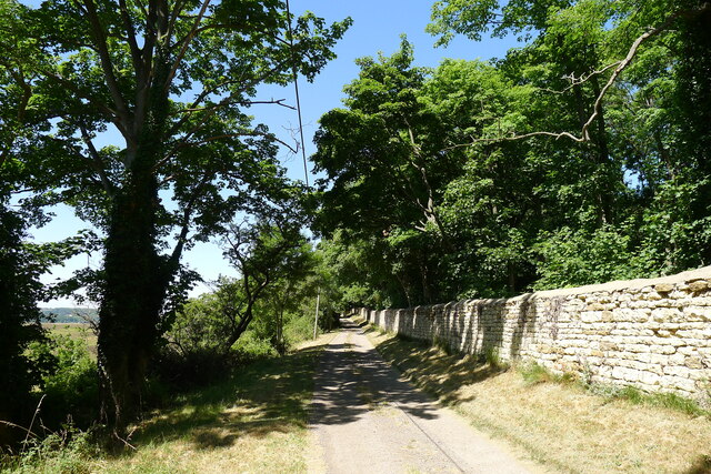
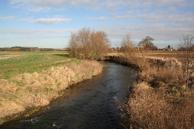
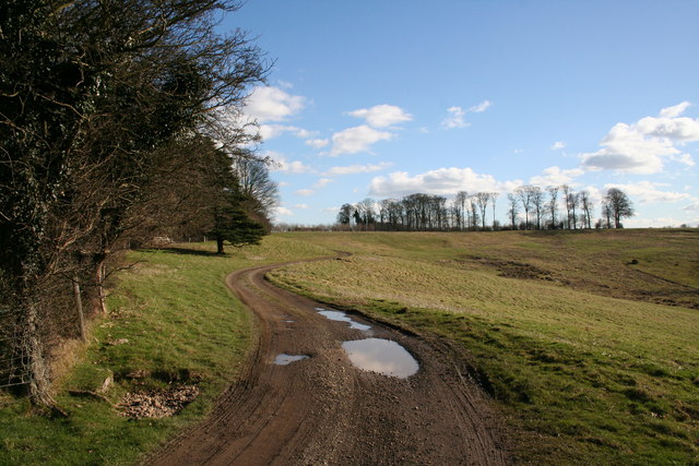
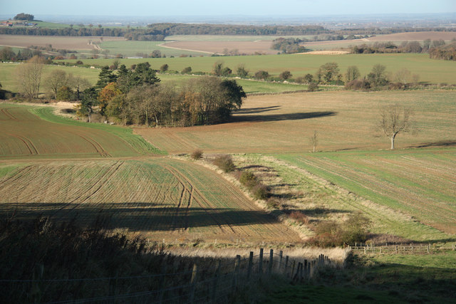
Boathouse Pond, located in Lincolnshire, is a picturesque freshwater marsh that offers a tranquil and scenic environment for visitors to enjoy. Spanning an area of approximately 5 acres, this serene pond is surrounded by lush vegetation and diverse wildlife, making it a haven for nature enthusiasts.

The pond is characterized by its calm and still waters, which reflect the surrounding landscape, creating a mirror-like effect that adds to its charm. Boathouse Pond is fed by freshwater springs and small streams, ensuring a constant supply of clean water and maintaining a healthy ecosystem.

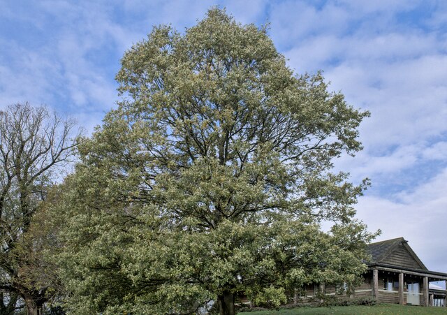
The diverse flora and fauna found in and around the pond make it a popular spot for birdwatching and wildlife observation. Visitors can often spot a variety of bird species, including ducks, swans, herons, and kingfishers, as well as various water-loving mammals, such as otters and water voles. The surrounding vegetation includes reeds, water lilies, and other aquatic plants, providing a habitat for a range of insect species.

Boathouse Pond also offers recreational activities such as fishing and boating. Anglers can try their luck at catching various fish species, including carp, roach, and perch, while boating enthusiasts can explore the calm waters and enjoy the peaceful surroundings.

Overall, Boathouse Pond in Lincolnshire is a natural gem that provides a serene and harmonious environment for both wildlife and visitors alike. Its diverse ecosystem and recreational opportunities make it a delightful destination for nature lovers and those seeking a tranquil escape from the hustle and bustle of daily life.

If you have any feedback on the listing, please let us know in the comments section below.

Boathouse Pond Images

Images are sourced within 2km of 52.943291/-0.608751 or Grid Reference SK9339. Thanks to Geograph Open Source API. All images are credited.

Green Lane, Syston, Grantham Running by the estate wall of the former Syston Park, on the edge of the Jurassic limestone scarpment overlooking Grantham
Green Lane, Syston, Grantham
Running by the estate wall of the former Syston Park, on the edge of the Jurassic limestone scarpment overlooking Grantham
Turkey Oak Quercus cerris, the Turkey Oak was introduced in 1700.
Turkey Oak
Quercus cerris, the Turkey Oak was introduced in 1700.
Quercus cerris The trunk of the tree seen in <a href="https://www.geograph.org.uk/photo/7339767">SK9340 : Turkey Oak</a>.
Quercus cerris
The trunk of the tree seen in SK9340 : Turkey Oak.
Always look up The crown and upper parts of the tree seen in <a href="https://www.geograph.org.uk/photo/7339767">SK9340 : Turkey Oak</a>.
Always look up
The crown and upper parts of the tree seen in SK9340 : Turkey Oak.
Quercus cerris, Turkey Oak The bark of the tree seen in <a href="https://www.geograph.org.uk/photo/7339767">SK9340 : Turkey Oak</a> and <a href="https://www.geograph.org.uk/photo/7339769">SK9340 : Quercus cerris</a>.
Quercus cerris, Turkey Oak
The bark of the tree seen in SK9340 : Turkey Oak and SK9340 : Quercus cerris.
Church of St Mary, Syston Listed Grade II, from the 11th century <span class="nowrap"><a title="https://historicengland.org.uk/listing/the-list/list-entry/1147012?section=official-list-entry" rel="nofollow ugc noopener" href="https://historicengland.org.uk/listing/the-list/list-entry/1147012?section=official-list-entry">Link</a><img style="margin-left:2px;" alt="External link" title="External link - shift click to open in new window" src="https://s1.geograph.org.uk/img/external.png" width="10" height="10"/></span>
Church of St Mary, Syston
Listed Grade II, from the 11th century LinkExternal link
Churchyard wall, Syston Listed Grade II, early 19th century. The opening, which now allows access to the extended graveyard, was originally made to frame the vista of the church when seen from Syston Park to the east   <span class="nowrap"><a title="https://historicengland.org.uk/listing/the-list/list-entry/1360319?section=official-list-entry" rel="nofollow ugc noopener" href="https://historicengland.org.uk/listing/the-list/list-entry/1360319?section=official-list-entry">Link</a><img style="margin-left:2px;" alt="External link" title="External link - shift click to open in new window" src="https://s1.geograph.org.uk/img/external.png" width="10" height="10"/></span>
Churchyard wall, Syston
Listed Grade II, early 19th century. The opening, which now allows access to the extended graveyard, was originally made to frame the vista of the church when seen from Syston Park to the east LinkExternal link
South door, Church of St Mary, Syston "South door has a restored Saxon lintel with standing figures of saints under an architectural arcade. Above is a C12 tympanum with a billet moulded hood mould, a double order of star motifs and a central panel filled with diagonal trellis lines. The central parts of the lintel and the tympanum were cut by the insertion of a pointed arch during the C13, but this was removed during the C19 and an approximation of the original design substituted." <span class="nowrap"><a title="https://historicengland.org.uk/listing/the-list/list-entry/1147012?section=official-list-entry" rel="nofollow ugc noopener" href="https://historicengland.org.uk/listing/the-list/list-entry/1147012?section=official-list-entry">Link</a><img style="margin-left:2px;" alt="External link" title="External link - shift click to open in new window" src="https://s1.geograph.org.uk/img/external.png" width="10" height="10"/></span>
South door, Church of St Mary, Syston
"South door has a restored Saxon lintel with standing figures of saints under an architectural arcade. Above is a C12 tympanum with a billet moulded hood mould, a double order of star motifs and a central panel filled with diagonal trellis lines. The central parts of the lintel and the tympanum were cut by the insertion of a pointed arch during the C13, but this was removed during the C19 and an approximation of the original design substituted." LinkExternal link
St.Mary's church, Syston, Lincs. A Norman tower, nave and chancel arch, also, a restored tympanum over the south door. A fine church tucked away by the old hall.
St.Mary's church, Syston, Lincs.
A Norman tower, nave and chancel arch, also, a restored tympanum over the south door. A fine church tucked away by the old hall.
River Witham Looking north towards Barkston from Hambleton Bridge
River Witham
Looking north towards Barkston from Hambleton Bridge
St Mary's Church, Syston
Gashouse Plantation A handsome house with a wonderful view in Gashouse Plantation, Syston Park. Syston Hall, home of the Thorold family has gone but the splendid parkland remains.
Gashouse Plantation
A handsome house with a wonderful view in Gashouse Plantation, Syston Park. Syston Hall, home of the Thorold family has gone but the splendid parkland remains.
Whipperstall Hill View towards Grantham from Whipperstall Hill
Whipperstall Hill
View towards Grantham from Whipperstall Hill
Punchbowl The dip to the right is known as Punchbowl, this track leads from Beggar's Lane
Punchbowl
The dip to the right is known as Punchbowl, this track leads from Beggar's Lane
Sunset over Syston Park On the northern edge of Syston Park, Mountain Slough Wood straight ahead.
Sunset over Syston Park
On the northern edge of Syston Park, Mountain Slough Wood straight ahead.
The Lake, Syston Park A well established 10 acre spring fed lake in parkland on the old Syston Park Estate. Managed by Syston Park Farm, the lake is stocked with both rainbow and brown trout. Even on a dull October afternoon the lake looks beautiful.
The Lake, Syston Park
A well established 10 acre spring fed lake in parkland on the old Syston Park Estate. Managed by Syston Park Farm, the lake is stocked with both rainbow and brown trout. Even on a dull October afternoon the lake looks beautiful.
Farmland at Syston Park Farm The "big house" no longer exists, (it was demolished in 1923), but many of the landscape features are in evidence including a tree lined approach to the farmhouse. The large farm has diversified into pick-your-own fruit and has a successful and award winning farm shop and cafe.
Farmland at Syston Park Farm
The "big house" no longer exists, (it was demolished in 1923), but many of the landscape features are in evidence including a tree lined approach to the farmhouse. The large farm has diversified into pick-your-own fruit and has a successful and award winning farm shop and cafe.
River Witham near Syston View northeast from Hambleton Bridge. Compare with the February picture: <a href="https://www.geograph.org.uk/photo/119669">SK9241 : River Witham</a>
River Witham near Syston
View northeast from Hambleton Bridge. Compare with the February picture: SK9241 : River Witham
Show me another place!

Boathouse Pond is located at Grid Ref: SK9339 (Lat: 52.943291, Lng: -0.608751)

Administrative County: Lincolnshire

District: South Kesteven

Police Authority: Lincolnshire

What 3 Words

///soon.owned.portable. Near Great Gonerby, Lincolnshire

Related Wikis

Belton House Boathouse

The Boathouse on Boathouse Pond, Belton House, Belton, Lincolnshire was designed by Anthony Salvin in 1838–1839. It is a Grade II listed building. ��2...
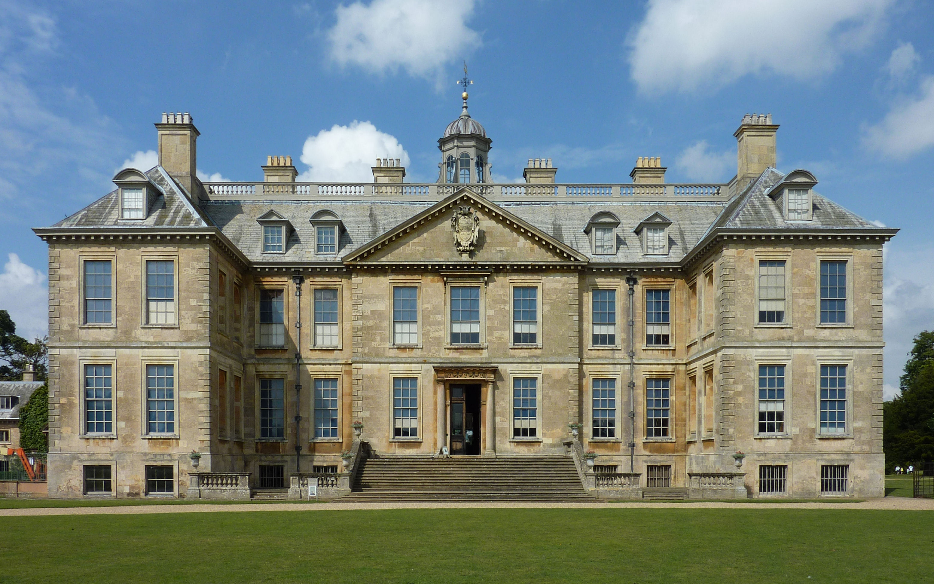
Belton House

Belton House is a Grade I listed country house in the parish of Belton near Grantham in Lincolnshire, England, built between 1685 and 1687 by Sir John...

Belton, South Kesteven

Belton is a village in the civil parish of Belton and Manthorpe, in the South Kesteven district of Lincolnshire, England. It is situated on the A607 road...

St Peter and St Paul's Church, Belton

The Church of St Peter and St Paul, Belton, South Kesteven, Lincolnshire is a functioning parish church and a Grade I listed building. Since the 17th century...

Syston, Lincolnshire

Syston is a village and civil parish in the South Kesteven district of Lincolnshire, England. The population of the civil parish was 162 at the 2011 census...

RAF Belton Park

RAF Belton Park was established in 1942 as the Royal Air Force Regiment Depot, for training RAF Regiment personnel in airfield defence. Belton Park is...

Belton and Manthorpe

Belton and Manthorpe is a civil parish in the South Kesteven district of Lincolnshire, England, consisting of Belton and Manthorpe, just north of Grantham...

Barkston

Barkston is an English village and civil parish in the South Kesteven district of Lincolnshire. The parish population was 497 at the 2001 census and 493...

Nearby Amenities

Located within 500m of 52.943291,-0.608751
Belton Park
Place: locality
Source: Bing
Lat/Long: 52.9393135/-0.6071468
Ice House
Historic: ruins
Historic Civilization: modern
Inscription: Historic brick-lined ice storage bunker.
Lat/Long: 52.9437173/-0.6146361
Belton House Maze
Attraction: maze
Tourism: attraction
Lat/Long: 52.9429012/-0.6136938
The data included in this document is from www.openstreetmap.org. The data is made available under ODbL.

Have you been to Boathouse Pond?

Leave your review of Boathouse Pond below (or comments, questions and feedback).