Gold Valley Lakes

Lake, Pool, Pond, Freshwater Marsh in Hampshire Rushmoor

England

Gold Valley Lakes
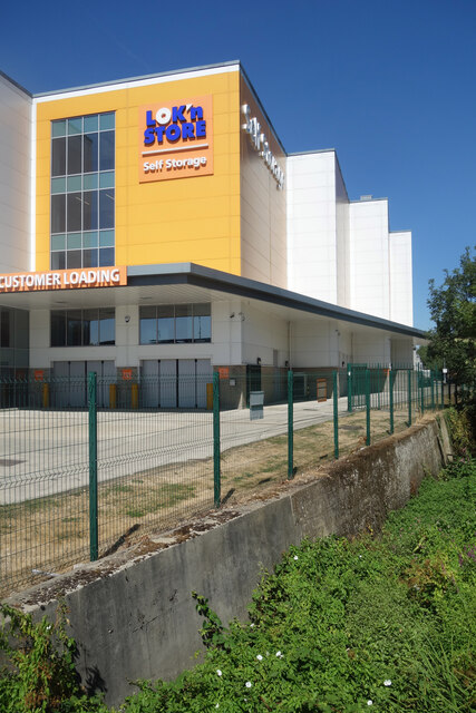
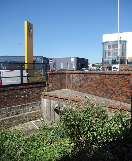
Storage Warehouse by the Blackwater Now upstream of the generous input from Aldershot Sewage Works and much depleted as a result, the diminutive River Blackwater goes past here in a concrete trough of weeds after culverting under the busy A323.
Storage Warehouse by the Blackwater Credit: Des Blenkinsopp

Gold Valley Lakes is a picturesque fishing complex located in the county of Hampshire, England. Situated near the village of Ash Green, the complex consists of four distinct bodies of water: a lake, a pool, a pond, and a freshwater marsh.

The main attraction of Gold Valley Lakes is the 14-acre lake, which offers a tranquil setting for anglers of all abilities. The lake is well-stocked with a variety of fish species, including carp, bream, roach, tench, and perch, providing ample opportunities for both pleasure and match fishing. Anglers can choose from 48 well-maintained pegs around the lake, ensuring a comfortable and enjoyable fishing experience.

Adjacent to the lake is a smaller, more intimate pool that offers a more secluded fishing experience. This pool is ideal for those seeking a quieter environment or for beginners looking to hone their skills.

The complex also includes a smaller pond, perfect for families and novices. This pond is stocked with smaller fish species, ensuring a fun and rewarding experience for younger anglers.

Lastly, the freshwater marsh at Gold Valley Lakes provides a unique opportunity for birdwatchers and nature enthusiasts. The marsh is home to a diverse range of bird species, including herons, kingfishers, swans, and ducks, making it a haven for wildlife lovers.

Overall, Gold Valley Lakes offers a range of fishing opportunities and natural beauty in a peaceful countryside setting. With its well-stocked waters and abundant wildlife, it is a popular destination for anglers and nature enthusiasts alike.

If you have any feedback on the listing, please let us know in the comments section below.

Gold Valley Lakes Images

Images are sourced within 2km of 51.256419/-0.73327973 or Grid Reference SU8851. Thanks to Geograph Open Source API. All images are credited.

Storage Warehouse by the Blackwater Now upstream of the generous input from Aldershot Sewage Works and much depleted as a result, the diminutive River Blackwater goes past here in a concrete trough of weeds after culverting under the busy A323.
Storage Warehouse by the Blackwater
Now upstream of the generous input from Aldershot Sewage Works and much depleted as a result, the diminutive River Blackwater goes past here in a concrete trough of weeds after culverting under the busy A323.
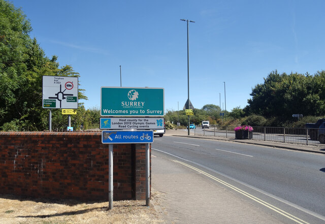
Welcome to Surrey The River Blackwater is used as a county border for its whole length, firstly between Hampshire and Surrey and later between Hampshire and Berkshire. Here is where it goes under the A323 as that road crosses into Surrey county.
Welcome to Surrey
The River Blackwater is used as a county border for its whole length, firstly between Hampshire and Surrey and later between Hampshire and Berkshire. Here is where it goes under the A323 as that road crosses into Surrey county.
Weeds & Warehouses, River Blackwater The Blackwater is not at its best through here as it enters a culvert under the A323.
Weeds & Warehouses, River Blackwater
The Blackwater is not at its best through here as it enters a culvert under the A323.
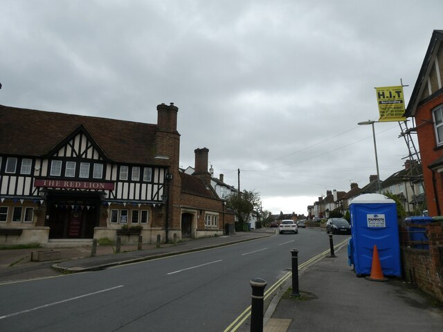
Passing the Red Lion in Brighton Road
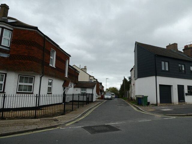
Looking from Brighton Road into Commercial Road
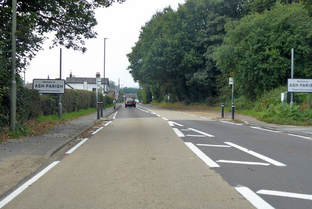
A323 Guildford Road entering Ash Parish
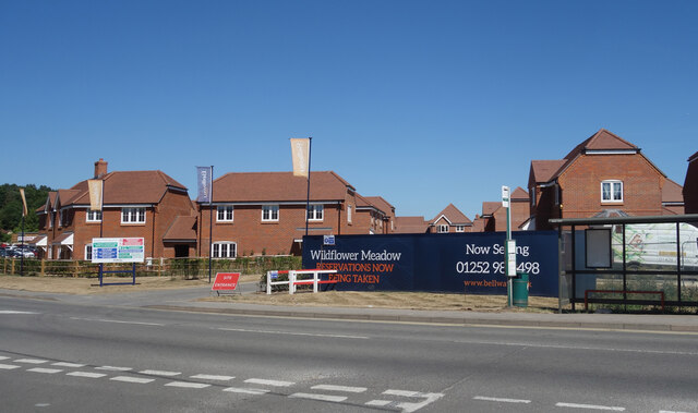
Wildflower Meadow - Now Selling A new housing development off Guildford Road.
Not that there's much meadow left, or wildflowers come to that, but I'm sure they're very nice houses.
Wildflower Meadow - Now Selling
A new housing development off Guildford Road. Not that there's much meadow left, or wildflowers come to that, but I'm sure they're very nice houses.
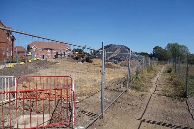
Footpath past the building site A public footpath fenced off from where new houses are being built.
Footpath past the building site
A public footpath fenced off from where new houses are being built.
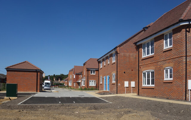
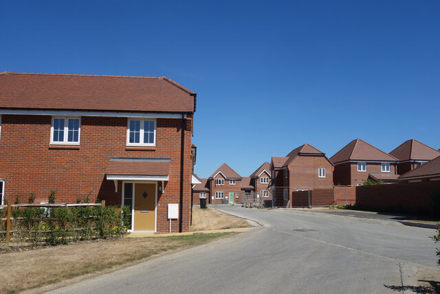
New Houses on Wildflower Meadow A nice rustic sounding name for this new extension to suburbia.
Taken from the footpath along the edge of the site.
New Houses on Wildflower Meadow
A nice rustic sounding name for this new extension to suburbia. Taken from the footpath along the edge of the site.
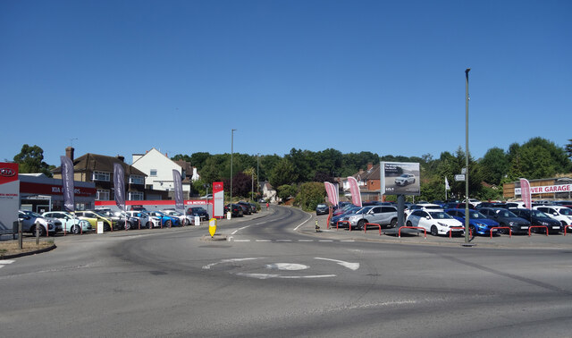
Car Sales at the Junction, Ash Cars for sale on both sides of Ash Hill Road.
Car Sales at the Junction, Ash
Cars for sale on both sides of Ash Hill Road.
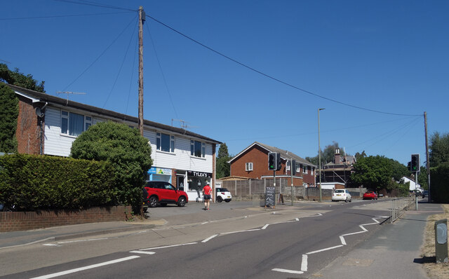
Shops on Guildford Road A couple of local businesses, including a very welcome sandwich bar where I managed to get some lunch in a bit of a pub and shop free zone.
Shops on Guildford Road
A couple of local businesses, including a very welcome sandwich bar where I managed to get some lunch in a bit of a pub and shop free zone.
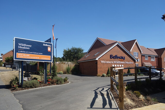
Welcome to Wildflower Meadows The northern entrance to a large new housing development, most of which is in SU9050.
Welcome to Wildflower Meadows
The northern entrance to a large new housing development, most of which is in SU9050.
New Houses near Ash Station
Navigating northwards up the Basher (19) Path eastwards from Chandlers Road to Stony Hill
Navigating northwards up the Basher (19)
Path eastwards from Chandlers Road to Stony Hill
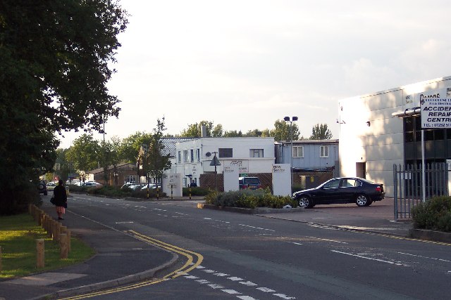
Lysons Avenue industrial units Lysons Avenue is lined with light industrial units of all shapes, sizes, and designs. In age they range from possibly the 1930s (the white building in the centre) to the ultra-modern (on the right).
Lysons Avenue industrial units
Lysons Avenue is lined with light industrial units of all shapes, sizes, and designs. In age they range from possibly the 1930s (the white building in the centre) to the ultra-modern (on the right).
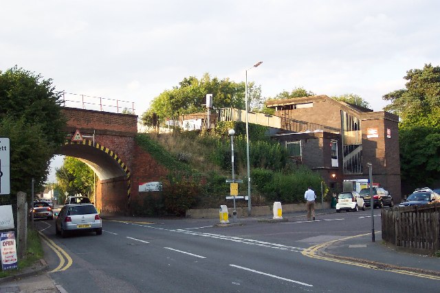
Ash Vale station and bridge The railway from Woking to Alton via Aldershot crosses the Ash to Frimley road on a high embankment, just by Ash Vale station. The station structure - comprising mostly a staircase leading to the platforms - is a less than elegant structure.
Ash Vale station and bridge
The railway from Woking to Alton via Aldershot crosses the Ash to Frimley road on a high embankment, just by Ash Vale station. The station structure - comprising mostly a staircase leading to the platforms - is a less than elegant structure.
Ash Wharf The Basingstoke Canal at Ash Wharf, taken from the adjacent road bridge looking east. Just west of here was Ash Embankment which burst in September 1968 and nearly led to the total loss of the canal.
Ash Wharf
The Basingstoke Canal at Ash Wharf, taken from the adjacent road bridge looking east. Just west of here was Ash Embankment which burst in September 1968 and nearly led to the total loss of the canal.
Ash Wharf Looking south-east across the road junction. This spot seems none too clear whether it's in Ash or Ash Vale but it's probably the most thriving centre in the surrounding area. The road ahead climbs up the hill towards Ash, behind leads to Ash Vale, and to the right is the road to Aldershot.
Ash Wharf
Looking south-east across the road junction. This spot seems none too clear whether it's in Ash or Ash Vale but it's probably the most thriving centre in the surrounding area. The road ahead climbs up the hill towards Ash, behind leads to Ash Vale, and to the right is the road to Aldershot.
Show me another place!

Gold Valley Lakes is located at Grid Ref: SU8851 (Lat: 51.256419, Lng: -0.73327973)

Administrative County: Hampshire

District: Rushmoor

Police Authority: Hampshire

What 3 Words

///plays.vase.flows. Near Aldershot, Hampshire

Related Wikis

Lakeside Park, Guildford

Lakeside Park is a 14.7-hectare (36-acre) Local Nature Reserve west of Guildford in Surrey. It is owned and managed by Guildford Borough Council.The Blackwater...

Ash United F.C.

Ash United Football Club is a football club based in Ash, Surrey, England. They are currently members of the Wessex League Division One and play at Shawfields...

Aldershot Military Cemetery

Aldershot Military Cemetery is a burial ground for military personnel, or ex-military personnel and their families, located in Aldershot Military Town...

Frank Goodden

Major Frank Widenham Goodden (3 October 1889 – 28 January 1917) was a pioneering British aviator who served as chief test pilot for the Royal Aircraft...

Nearby Amenities

Located within 500m of 51.256419,-0.73327973
Created By: osm2go v0.6-10
Lat/Long: 51.2534485/-0.7298003
Created By: osm2go v0.6-10
Lat/Long: 51.2534332/-0.7295578
Created By: osm2go v0.6-10
Lat/Long: 51.2560158/-0.7306358
Created By: osm2go v0.6-10
Lat/Long: 51.2560425/-0.7303842
Created By: osm2go v0.6-10
Lat/Long: 51.2544594/-0.7299171
Created By: osm2go v0.6-10
Lat/Long: 51.2545128/-0.7297015
Created By: osm2go v0.6-10
Lat/Long: 51.2554283/-0.7302585
Created By: osm2go v0.6-10
Lat/Long: 51.2554283/-0.7300249
Created By: osm2go v0.6-10
Lat/Long: 51.2567558/-0.7312466
Railway: switch
Lat/Long: 51.2598431/-0.7331762
Crossing
Bicycle: yes
Crossing: unmarked
Crossing Island: no
Crossing Markings: no
Kerb: lowered
Tactile Paving: no
Lat/Long: 51.2582467/-0.7385817
Created By: osm2go v0.6-10
Lat/Long: 51.2602119/-0.7341033
Created By: osm2go v0.6-10
Lat/Long: 51.2596512/-0.7341302
Created By: osm2go v0.6-10
Lat/Long: 51.2597198/-0.7339595
Crossing
Bicycle: yes
Crossing: unmarked
Crossing Island: no
Crossing Markings: no
Kerb: lowered
Tactile Paving: no
Lat/Long: 51.2598734/-0.7337683
Man Made: pumping_station
Lat/Long: 51.2597431/-0.7337149
Addr Street: Eskdale Court
Lat/Long: 51.2601623/-0.7316016
Addr Street: Windermere Court
Lat/Long: 51.2600619/-0.7315179
Addr Street: Haineswater Court
Lat/Long: 51.260273/-0.7311716
Addr Street: Langdale Court
Lat/Long: 51.2603876/-0.7308498
Addr Street: Ullswater Court
Lat/Long: 51.2604481/-0.7305306
Crossing
Bicycle: yes
Crossing: unmarked
Crossing Island: no
Crossing Markings: no
Kerb: lowered
Tactile Paving: no
Lat/Long: 51.2591787/-0.7310604
Barrier: kerb
Kerb: lowered
Tactile Paving: no
Lat/Long: 51.2592165/-0.7310297
Barrier: kerb
Kerb: lowered
Tactile Paving: no
Lat/Long: 51.2593922/-0.7302188
Crossing
Bicycle: yes
Crossing: unmarked
Crossing Markings: no
Kerb: lowered
Tactile Paving: no
Lat/Long: 51.259391/-0.7301739
Barrier: kerb
Kerb: lowered
Tactile Paving: no
Lat/Long: 51.2593814/-0.7301171
Barrier: kerb
Kerb: lowered
Tactile Paving: no
Lat/Long: 51.2591061/-0.7297218
Crossing
Bicycle: yes
Crossing: unmarked
Crossing Markings: no
Kerb: lowered
Tactile Paving: no
Lat/Long: 51.2590712/-0.7297127
Barrier: kerb
Kerb: lowered
Tactile Paving: no
Lat/Long: 51.259015/-0.7296956
Barrier: kerb
Kerb: lowered
Tactile Paving: no
Lat/Long: 51.2591349/-0.7310687
Barrier: swing_gate
Lat/Long: 51.2575136/-0.7396558
Barrier: kerb
Kerb Left: raised
Kerb Right: lowered
Wheelchair: limited
Lat/Long: 51.2526329/-0.7361319
Turning Circle
Turning Circle: hammer
Lat/Long: 51.254678/-0.73513
Turning Circle
Turning Circle: hammer
Lat/Long: 51.2535982/-0.7321622
Maxwidth: 3
Source Maxwidth: ARCore
Traffic Calming: choker
Lat/Long: 51.2535603/-0.73695
Barrier: swing_gate
Colour: red;white
Locked: no
Material: metal
Lat/Long: 51.2585725/-0.7385956
Ash Lock
Material: wood
Seamark Type: gate
Waterway: lock_gate
Lat/Long: 51.2582222/-0.7389148
Ash Lock
Material: wood
Seamark Type: gate
Waterway: lock_gate
Lat/Long: 51.2584601/-0.7390359
Parking
Access: private
Parking: surface
Lat/Long: 51.2563474/-0.7365448
Bus Stop
Farm Road
Bench: no
Bin: no
Bus: yes
Lit: yes
Naptan AtcoCode: 1900HA090229
Naptan Bearing: SE
Naptan CommonName: Farm Road
Naptan Crossing: Farm Road
Naptan NaptanCode: hamjamjw
Naptan PlusbusZoneRef: ALDRSHT
Naptan Street: Field Way
Naptan Verified: no
Public Transport: platform
Shelter: no
Source: naptan_import
Tactile Paving: no
Lat/Long: 51.2522943/-0.7359866
Railway: switch
Lat/Long: 51.2598991/-0.7331603
Barrier: kerb
Kerb: lowered
Tactile Paving: no
Lat/Long: 51.2599328/-0.7336876
Deadbrook Farm
Historic Place: farm
Lat/Long: 51.2532233/-0.735612
Willow Park
Place: locality
Lat/Long: 51.2537727/-0.7278912
Gold Farm
Place: farm
Lat/Long: 51.2587569/-0.7357494
Maxwidth: 3
Source Maxwidth: ARCore
Traffic Calming: choker
Lat/Long: 51.2536582/-0.738846
Barrier: cycle_barrier
Cycle Barrier: double
Cycle Barrier Installation: fixed
Lat/Long: 51.2550776/-0.731387
Barrier: cycle_barrier
Cycle Barrier: double
Cycle Barrier Installation: fixed
Lat/Long: 51.2550132/-0.731206
Bench
Backrest: yes
Lat/Long: 51.2551001/-0.7285338
Crossing
Bicycle: yes
Crossing: unmarked
Crossing Island: yes
Crossing Markings: no
Kerb: lowered
Tactile Paving: yes
Lat/Long: 51.2592641/-0.7301602
Crossing
Bicycle: yes
Crossing: unmarked
Crossing Island: yes
Crossing Markings: no
Kerb: lowered
Tactile Paving: yes
Lat/Long: 51.2592787/-0.7302439
Crossing
Bicycle: yes
Crossing: unmarked
Crossing Island: yes
Crossing Markings: no
Kerb: lowered
Tactile Paving: yes
Lat/Long: 51.2590288/-0.7299341
Crossing
Bicycle: yes
Crossing: unmarked
Crossing Island: yes
Crossing Markings: no
Kerb: lowered
Tactile Paving: yes
Lat/Long: 51.2591279/-0.7305659
Crossing
Bicycle: yes
Crossing: unmarked
Crossing Island: yes
Crossing Markings: no
Kerb: lowered
Tactile Paving: yes
Lat/Long: 51.2590748/-0.7305839
Crossing
Bicycle: yes
Crossing: unmarked
Crossing Island: yes
Crossing Markings: no
Kerb: lowered
Tactile Paving: yes
Lat/Long: 51.2591054/-0.7299338
Barrier: kerb
Kerb: raised
Tactile Paving: no
Lat/Long: 51.2548166/-0.7374608
Barrier: bollard
Bollard: foldable
Lat/Long: 51.2581958/-0.7385515
Aldershot North Junction
Railway: junction
Lat/Long: 51.2599292/-0.733092
Barrier: bollard
Bollard: removable
Lat/Long: 51.2581808/-0.7274757
Barrier: cycle_barrier
Cycle Barrier: double
Cycle Barrier Installation: fixed
Lat/Long: 51.252671/-0.7362241
Waste Basket
Waste: trash
Lat/Long: 51.2543579/-0.7327105
Man Made: street_cabinet
Utility: telecom
Lat/Long: 51.2543448/-0.733097
Grit Bin
Seasonal: no
Lat/Long: 51.2543547/-0.7331647
Playground: swing
Lat/Long: 51.254478/-0.7331142
Playground: climbingframe
Lat/Long: 51.2544656/-0.7329929
Playground: structure
Lat/Long: 51.2543897/-0.7328859
Playground: roundabout
Lat/Long: 51.2545106/-0.7329677
Playground: structure
Lat/Long: 51.2544476/-0.732814
Playground: structure
Lat/Long: 51.2544859/-0.732903
Barrier: swing_gate
Foot: designated
Material: metal
Wheelchair: yes
Lat/Long: 51.2543615/-0.7331989
Barrier: swing_gate
Motor Vehicle: private
Lat/Long: 51.254353/-0.7330521
Barrier: swing_gate
Foot: designated
Material: metal
Wheelchair: yes
Lat/Long: 51.2543349/-0.7327257
Turning Circle
Turning Circle: hammer
Lat/Long: 51.2545372/-0.7312922
Turning Circle
Lat/Long: 51.253827/-0.733108
Barrier: cycle_barrier
Bicycle: permissive
Cycle Barrier: double
Cycle Barrier Installation: fixed
Foot: permissive
Motor Vehicle: no
Lat/Long: 51.2550979/-0.7287354
Barrier: cycle_barrier
Bicycle: permissive
Cycle Barrier: double
Cycle Barrier Installation: fixed
Foot: permissive
Motor Vehicle: no
Lat/Long: 51.255182/-0.7286761
Railway: railway_crossing
Lat/Long: 51.2600648/-0.7328982
Artwork Type: sculpture
Tourism: artwork
Lat/Long: 51.2585738/-0.7272726
Post Box
Collection Times: Mo-Fr 09:00; Sa 07:00
Colour: red
Drive Through: no
Ref: GU12 198D
Royal Cypher: EIIR
Royal Cypher Wikidata: Q33102113
Lat/Long: 51.2524297/-0.7363024
Covered: no
Leisure: picnic_table
Lat/Long: 51.2583334/-0.7388723
Barrier: swing_gate
Colour: red;white
Material: metal
Lat/Long: 51.2583081/-0.7384784
Fire Hydrant
Emergency: fire_hydrant
Fire Hydrant Diameter: 100
Fire Hydrant Position: sidewalk
Fire Hydrant Type: underground
Water Source: main
Lat/Long: 51.2523182/-0.7337807
Fire Hydrant
Emergency: fire_hydrant
Fire Hydrant Diameter: 100
Fire Hydrant Position: sidewalk
Fire Hydrant Type: underground
Water Source: main
Lat/Long: 51.2542034/-0.7330538
Fire Hydrant
Emergency: fire_hydrant
Fire Hydrant Diameter: 100
Fire Hydrant Position: lane
Fire Hydrant Type: underground
Water Source: main
Lat/Long: 51.2544602/-0.7371445
Fire Hydrant
Emergency: fire_hydrant
Fire Hydrant Diameter Signed: no
Fire Hydrant Position: lane
Fire Hydrant Type: underground
Water Source: main
Lat/Long: 51.2575846/-0.7397175
Fire Hydrant
Emergency: fire_hydrant
Fire Hydrant Diameter: 100
Fire Hydrant Position: lane
Fire Hydrant Type: underground
Water Source: main
Lat/Long: 51.2536987/-0.736414
Barrier: bollard
Bollard: fixed
Lat/Long: 51.2584489/-0.7385836
Barrier: height_restrictor
Lat/Long: 51.2600907/-0.7337497
Fire Hydrant
Emergency: fire_hydrant
Fire Hydrant Diameter: 3"
Fire Hydrant Position: green
Fire Hydrant Type: underground
Water Source: main
Lat/Long: 51.2577679/-0.739673
Barrier: bollard
Lat/Long: 51.2581721/-0.7385922
Barrier: bollard
Lat/Long: 51.258204/-0.7386048
Maxwidth: 3
Source Maxwidth: ARCore
Traffic Calming: choker
Lat/Long: 51.2540303/-0.7376664
Maxwidth: 3
Traffic Calming: choker
Lat/Long: 51.2543667/-0.7377179
Board Type: nature
Information: board
Tourism: information
Lat/Long: 51.2579044/-0.7301396
Maxwidth: 3
Source Maxwidth: ARCore
Traffic Calming: choker
Lat/Long: 51.2539276/-0.7372996
Waste Basket
Lat/Long: 51.2538069/-0.7366137
Board Type: history
Information: board
Tourism: information
Lat/Long: 51.2584855/-0.7386657
Bench
Lat/Long: 51.2543624/-0.7329215
Bench
Lat/Long: 51.2544073/-0.7329587
Contact Email: info@hants.gov.uk
Contact Phone: +441252370073
Contact Website: www.basingstoke-canal.co.uk
Distance: 25.0
Material: metal
Waterway: milestone
Lat/Long: 51.2549445/-0.7337154
Contact Email: info@hants.gov.uk
Contact Phone: +441252370073
Contact Website: www.basingstoke-canal.co.uk
Distance: 25.5
Material: metal
Waterway: milestone
Lat/Long: 51.257782/-0.7385064
Waste Basket
Waste: cigarettes;dog_excrement;trash
Lat/Long: 51.2546/-0.7379922
Generator Method: photovoltaic
Generator Output Electricity: 415 W
Generator Source: solar
Generator Type: solar_photovoltaic_panel
Location: roof
Power: generator
Lat/Long: 51.254496/-0.7344689
Generator Method: photovoltaic
Generator Output Electricity: 415 W
Generator Source: solar
Generator Type: solar_photovoltaic_panel
Location: roof
Power: generator
Lat/Long: 51.2545103/-0.7344656
Generator Method: photovoltaic
Generator Output Electricity: 415 W
Generator Source: solar
Generator Type: solar_photovoltaic_panel
Location: roof
Power: generator
Lat/Long: 51.2545075/-0.7344474
Generator Method: photovoltaic
Generator Output Electricity: 415 W
Generator Source: solar
Generator Type: solar_photovoltaic_panel
Location: roof
Power: generator
Lat/Long: 51.2544932/-0.7344507
Generator Method: photovoltaic
Generator Output Electricity: 415 W
Generator Source: solar
Generator Type: solar_photovoltaic_panel
Location: roof
Power: generator
Lat/Long: 51.2545019/-0.7344102
Generator Method: photovoltaic
Generator Output Electricity: 415 W
Generator Source: solar
Generator Type: solar_photovoltaic_panel
Location: roof
Power: generator
Lat/Long: 51.2544876/-0.7344136
Generator Method: photovoltaic
Generator Output Electricity: 415 W
Generator Source: solar
Generator Type: solar_photovoltaic_panel
Location: roof
Power: generator
Lat/Long: 51.2545342/-0.7344577
Generator Method: photovoltaic
Generator Output Electricity: 415 W
Generator Source: solar
Generator Type: solar_photovoltaic_panel
Location: roof
Power: generator
Lat/Long: 51.2545306/-0.7344315
Generator Method: photovoltaic
Generator Output Electricity: 415 W
Generator Source: solar
Generator Type: solar_photovoltaic_panel
Location: roof
Power: generator
Lat/Long: 51.254527/-0.7344054
Generator Method: photovoltaic
Generator Output Electricity: 415 W
Generator Source: solar
Generator Type: solar_photovoltaic_panel
Location: roof
Power: generator
Lat/Long: 51.2545527/-0.7344254
Generator Method: photovoltaic
Generator Output Electricity: 415 W
Generator Source: solar
Generator Type: solar_photovoltaic_panel
Location: roof
Power: generator
Lat/Long: 51.2545563/-0.7344516
Generator Method: photovoltaic
Generator Output Electricity: 415 W
Generator Source: solar
Generator Type: solar_photovoltaic_panel
Location: roof
Power: generator
Lat/Long: 51.2545492/-0.7343993
Life Ring
Emergency: life_ring
Lat/Long: 51.2550342/-0.7335915
Life Ring
Emergency: life_ring
Lat/Long: 51.2552538/-0.7350615
Man Made: street_cabinet
Lat/Long: 51.2523711/-0.7326471
Bench
Lat/Long: 51.2557122/-0.7362444
Life Ring
Emergency: life_ring
Lat/Long: 51.2559282/-0.7332115
Life Ring
Emergency: life_ring
Lat/Long: 51.2560983/-0.73443
Bench
Backrest: no
Lat/Long: 51.2556439/-0.7361737
Life Ring
Emergency: life_ring
Lat/Long: 51.2560583/-0.7359514
Bench
Lat/Long: 51.2558162/-0.7362127
Bench
Lat/Long: 51.2559152/-0.7361089
Man Made: street_cabinet
Lat/Long: 51.2529452/-0.7369113
Waste Basket
Lat/Long: 51.2530692/-0.7359649
Man Made: street_cabinet
Lat/Long: 51.2529452/-0.7318353
Man Made: street_cabinet
Lat/Long: 51.2543863/-0.7342845
Man Made: street_cabinet
Lat/Long: 51.2542973/-0.7345283
Man Made: street_cabinet
Lat/Long: 51.2535232/-0.7340916
The data included in this document is from www.openstreetmap.org. The data is made available under ODbL.

Have you been to Gold Valley Lakes?

Leave your review of Gold Valley Lakes below (or comments, questions and feedback).