Shipton Beck

Lake, Pool, Pond, Freshwater Marsh in Yorkshire

England

Shipton Beck

BP at Shipton Bridge from Langlands Garden Centre
BP at Shipton Bridge from Langlands Garden Centre Credit: Chris Morgan

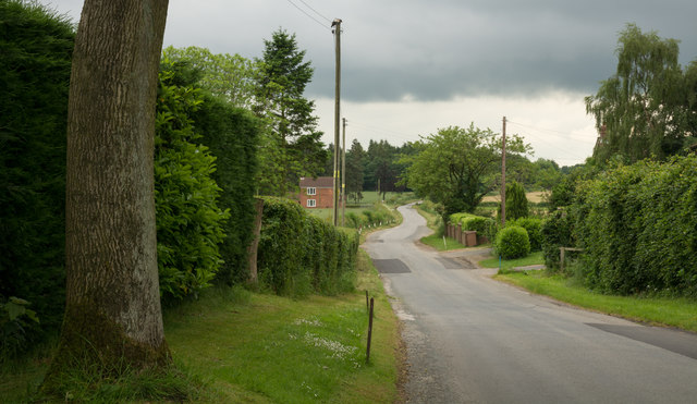
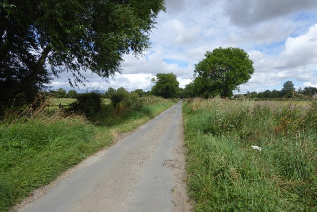
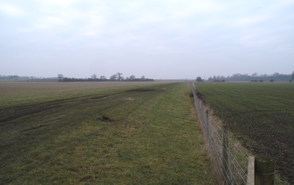
Shipton Beck is a picturesque freshwater marsh located in Yorkshire, England. Situated amidst the serene and idyllic countryside, it is a popular destination for nature enthusiasts and those seeking tranquility. The beck, or stream, meanders through the landscape, adding to the beauty of the area.

The marsh is characterized by its diverse ecosystem, attracting a wide range of flora and fauna. The water body itself is a combination of a lake, a pool, and a pond, offering a variety of habitats for aquatic plants and animals. The still waters of the lake provide a peaceful and reflective surface, while the pool and the pond offer a more enclosed and intimate setting.

The surrounding vegetation is rich and lush, with reeds and bullrushes lining the edges of the water. These plants not only provide shelter and nesting sites for birds but also contribute to the overall aesthetic appeal of the marsh.

Shipton Beck is home to a plethora of wildlife, making it a prime spot for birdwatching and nature photography. Visitors can spot a wide variety of bird species, including herons, swans, and ducks, among others. The marsh also attracts water voles, frogs, and various insects, adding to the biodiversity of the area.

The marsh is easily accessible, with well-maintained footpaths and designated viewing points. It offers a peaceful retreat from the hustle and bustle of urban life, allowing visitors to immerse themselves in the beauty of nature. Whether one is seeking a leisurely walk, birdwatching, or simply a moment of solitude, Shipton Beck is a hidden gem worth exploring in the heart of Yorkshire.

If you have any feedback on the listing, please let us know in the comments section below.

Shipton Beck Images

Images are sourced within 2km of 53.876915/-0.70390155 or Grid Reference SE8543. Thanks to Geograph Open Source API. All images are credited.

BP at Shipton Bridge from Langlands Garden Centre
Hen house at Manor Farm Manor Farm is on the south side of the A1079 near to  Shiptonthorpe; the hen house is the small building near to the centre of the image.
Hen house at Manor Farm
Manor Farm is on the south side of the A1079 near to Shiptonthorpe; the hen house is the small building near to the centre of the image.
Minor road at Thorpe le Street The road leaves the A1079 at Thorpe le Street heading south-west, soon passing between two farms, North Farm and South Farm, which is from where the image was recorded.
Minor road at Thorpe le Street
The road leaves the A1079 at Thorpe le Street heading south-west, soon passing between two farms, North Farm and South Farm, which is from where the image was recorded.
Along Londesborough Avenue Leading towards Shiptonthorpe.
Along Londesborough Avenue
Leading towards Shiptonthorpe.
Sheep near Londesborough Moor The map marks a track across the field here.
Sheep near Londesborough Moor
The map marks a track across the field here.
Approaching Shiptonthorpe Looking from Londesborough Avenue at the junction with Back Lane.
Approaching Shiptonthorpe
Looking from Londesborough Avenue at the junction with Back Lane.
Back Lane Looking along the western arm of the horseshoe shaped Back Lane.
Back Lane
Looking along the western arm of the horseshoe shaped Back Lane.
Harswell Lane Leading out of Shiptonthorpe south of the A1079.
Harswell Lane
Leading out of Shiptonthorpe south of the A1079.
Along Harswell Lane A no through road leading to farms and bridleways.
Along Harswell Lane
A no through road leading to farms and bridleways.
Along Harswell Lane to Shiptonthorpe A lane serving a few farms and bridleways south of Shiptonthorpe and the A1079.
Along Harswell Lane to Shiptonthorpe
A lane serving a few farms and bridleways south of Shiptonthorpe and the A1079.
Pylons beside Harswell Lane Looking across farmland with overhead high tension powerlines.
Pylons beside Harswell Lane
Looking across farmland with overhead high tension powerlines.
Bridleway leading to Harswell Lane Looking in the general direction of Shiptonthorpe.
Bridleway leading to Harswell Lane
Looking in the general direction of Shiptonthorpe.
Towards Brouncey Looking towards the farm and a collection of bridleways.
Towards Brouncey
Looking towards the farm and a collection of bridleways.
Garden Centre, Shiptonthorpe Langlands, a large garden centre <span class="nowrap"><a title="http://www.langlandsgardencentre.co.uk/" rel="nofollow ugc noopener" href="http://www.langlandsgardencentre.co.uk/">Link</a><img style="margin-left:2px;" alt="External link" title="External link - shift click to open in new window" src="https://s1.geograph.org.uk/img/external.png" width="10" height="10"/></span> by the A1079 York Road which boasts, accurately, that it is 'more than just a garden centre', featuring the now obligatory catering outlets, Christmas decorations, delicatessen and gift department, as well as the more traditional horticultural wares.
Garden Centre, Shiptonthorpe
Langlands, a large garden centre LinkExternal link by the A1079 York Road which boasts, accurately, that it is 'more than just a garden centre', featuring the now obligatory catering outlets, Christmas decorations, delicatessen and gift department, as well as the more traditional horticultural wares.
Thorpe le Street, East Yorks For a narrow country lane through a tiny hamlet, this road seems to carry a lot of heavy traffic - no doubt it is the easiest route from the busy A1079 to villages like Everingham and Seaton Ross.
Thorpe le Street, East Yorks
For a narrow country lane through a tiny hamlet, this road seems to carry a lot of heavy traffic - no doubt it is the easiest route from the busy A1079 to villages like Everingham and Seaton Ross.
Town Street, Shiptonthorpe Main street through the settlement - a fair-sized village at best, so 'Town' seems to be stretching it a bit.
Town Street, Shiptonthorpe
Main street through the settlement - a fair-sized village at best, so 'Town' seems to be stretching it a bit.
Shiptonthorpe - Town Street The northern end of this village on the north side of the A1079 Hull to York road.
Shiptonthorpe - Town Street
The northern end of this village on the north side of the A1079 Hull to York road.
Fields near Shiptonthorpe Grazing land seen from the adjacent Harswell Lane; houses on York Road are visible in the background
Fields near Shiptonthorpe
Grazing land seen from the adjacent Harswell Lane; houses on York Road are visible in the background
Show me another place!

Shipton Beck is located at Grid Ref: SE8543 (Lat: 53.876915, Lng: -0.70390155)

Division: East Riding

Unitary Authority: East Riding of Yorkshire

Police Authority: Humberside

What 3 Words

///palettes.shifting.officials. Near Londesborough, East Yorkshire

Related Wikis

Shiptonthorpe

Shiptonthorpe is a village and civil parish in the East Riding of Yorkshire, England. It is situated approximately 5 miles (8 km) south-east of the market...

Londesborough railway station

Londesborough railway station was a station on the York to Beverley Line in the East Riding of Yorkshire, England. It opened on 4 October 1847 and served...

Londesborough Park railway station

Londesborough Park railway station was a short-lived private station on the York to Beverley Line at Londesborough in the East Riding of Yorkshire, England...

Thorpe le Street

Thorpe le Street is a hamlet and former civil parish, now in the parish of Hayton, in the East Riding of Yorkshire, England. It is situated approximately...

Market Weighton railway station

Market Weighton railway station was a railway station at the junction of the Selby to Driffield and York to Beverley lines in the East Riding of Yorkshire...

Vixen 101

Vixen 101 (or Vixen 87 as it was originally known) is a community radio organisation based in the town of Market Weighton, East Riding of Yorkshire, England...

Londesborough

Londesborough is a village and civil parish in the East Riding of Yorkshire, England. It is situated approximately 2.5 miles (4 km) north of the market...

Market Weighton

Market Weighton ( WEE-tən) is a town and civil parish in the East Riding of Yorkshire, England. It is one of the main market towns in the East Yorkshire...

Nearby Amenities

Located within 500m of 53.876915,-0.70390155
Shiptonthorpe
Is In: East Riding of Yorkshire, England, UK
Is In County: East Riding of Yorkshire
Place: village
Lat/Long: 53.8800751/-0.7060285
Disused Amenity: pub
Old Name: The Crown
Lat/Long: 53.8769864/-0.7052841
Disused Amenity: pub
Old Name: The Ship
Lat/Long: 53.8776727/-0.7055419
Post Box
Collection Times: Mo-Fr 16:30; Sa 12:15
Post Box Type: lamp
Ref: YO43 421
Royal Cypher: EIIR
Royal Cypher Wikidata: Q33102113
Lat/Long: 53.8786324/-0.7070939
Bus Stop
Shiptonthorpe A1079
Kerb: raised
Layby: yes
Naptan AtcoCode: 2200YEA00519
Naptan Bearing: SE
Naptan CommonName: Shiptonthorpe A1079
Naptan Street: York Road
Shelter: no
Source: naptan + survey
Lat/Long: 53.877638/-0.7056283
Bus Stop
Shiptonthorpe A1079
Kerb: raised
Naptan AtcoCode: 2200YEA00520
Naptan Bearing: NW
Naptan CommonName: Shiptonthorpe A1079
Naptan Street: York Road
Shelter: no
Source: naptan + survey
Lat/Long: 53.87674/-0.7048803
Defibrillator
Defibrillator Location: outside Langlands Garden Centre, on corner of building towards road and petrol station
Emergency: defibrillator
Fixme: there is now a defibrillator outside the Spar shop next door, idoes this mean there are two or has this one been moved there?
Indoor: no
Ref: no
Lat/Long: 53.8746061/-0.701742
Noexit: yes
Lat/Long: 53.8775408/-0.7055087
Bench
Lat/Long: 53.8772768/-0.7052175
Telephone
Booth: K6
Covered: booth
Man Made: telephone_box
Note: looks like it might be used for information or community library
Tourism: information
Lat/Long: 53.8772436/-0.7051102
Entrance: yes
Lat/Long: 53.8747015/-0.7019048
Bicycle Parking
Bicycle Parking: stands
Capacity: 12
Covered: no
Lat/Long: 53.8746534/-0.7015292
Post Box
Collection Times: Mo-Fr 09:00; Sa 07:00
Post Box Type: wall
Ref: YO43 360D
Royal Cypher: GR
Royal Cypher Wikidata: Q33102273
Lat/Long: 53.8802055/-0.705031
Crossing
Crossing: unmarked
Crossing Island: no
Crossing Markings: no
Tactile Paving: yes
Lat/Long: 53.8740574/-0.7000685
Crossing
Crossing: unmarked
Crossing Island: no
Crossing Markings: no
Tactile Paving: yes
Lat/Long: 53.8739968/-0.7001688
Crossing
Crossing: uncontrolled
Crossing Island: no
Crossing Ref: zebra
Tactile Paving: yes
Lat/Long: 53.8739437/-0.700427
Defibrillator
Defibrillator Location: outside Shiptonthorpe Village Hall, Station Road, Shiptonthorpe, YO43 3PB
Emergency: defibrillator
Indoor: no
Ref: NCPAD547
Lat/Long: 53.8791677/-0.707826
Shiptonthorpe Arms B&B
Addr City: York
Addr Postcode: YO43 3PG
Addr Street: York Road
Addr Suburb: Shiptonthorpe
Tourism: guest_house
Lat/Long: 53.8782925/-0.7064236
Information: board
Tourism: information
Lat/Long: 53.8772061/-0.7050287
Crossing
Crossing: unmarked
Crossing Island: no
Crossing Markings: no
Tactile Paving: yes
Lat/Long: 53.8738809/-0.6990184
Crossing
Crossing: unmarked
Crossing Island: no
Crossing Markings: no
Tactile Paving: yes
Lat/Long: 53.874181/-0.6996042
Crossing
Crossing: unmarked
Crossing Island: no
Crossing Markings: no
Tactile Paving: yes
Lat/Long: 53.8741694/-0.6994546
Crossing
Crossing: unmarked
Crossing Island: no
Crossing Markings: no
Tactile Paving: yes
Lat/Long: 53.8739681/-0.6990573
Crossing
Crossing: unmarked
Crossing Island: no
Crossing Markings: no
Tactile Paving: yes
Lat/Long: 53.8770819/-0.7049908
Crossing
Crossing: unmarked
Crossing Island: no
Crossing Markings: no
Tactile Paving: yes
Lat/Long: 53.8762841/-0.7041837
Crossing
Crossing: unmarked
Crossing Island: no
Crossing Markings: no
Tactile Paving: yes
Lat/Long: 53.8755251/-0.7027709
Crossing
Crossing: traffic_signals
Lat/Long: 53.876623/-0.7045362
Crossing
Crossing: unmarked
Crossing Island: no
Crossing Markings: no
Tactile Paving: yes
Lat/Long: 53.8745648/-0.7011218
Crossing
Crossing: unmarked
Crossing Island: no
Crossing Markings: no
Tactile Paving: yes
Lat/Long: 53.8745072/-0.7010287
Crossing
Crossing: unmarked
Crossing Island: no
Crossing Markings: no
Tactile Paving: yes
Lat/Long: 53.8742879/-0.7006541
Crossing
Crossing: unmarked
Crossing Island: no
Crossing Markings: no
Tactile Paving: yes
Lat/Long: 53.8746702/-0.7012171
Crossing
Crossing: unmarked
Crossing Island: no
Crossing Markings: no
Tactile Paving: no
Lat/Long: 53.8768522/-0.7049903
Crossing
Crossing: unmarked
Crossing Markings: no
Lat/Long: 53.8770829/-0.7052764
Crossing
Crossing: unmarked
Crossing Markings: no
Lat/Long: 53.8774059/-0.7056473
The data included in this document is from www.openstreetmap.org. The data is made available under ODbL.

Have you been to Shipton Beck?

Leave your review of Shipton Beck below (or comments, questions and feedback).