Upper Lake

Lake, Pool, Pond, Freshwater Marsh in Berkshire

England

Upper Lake

Crowthorne, Berks Wellington College Public School, the grounds of which take up a considerable amount of this square.
Crowthorne, Berks Credit: Brendan and Ruth McCartney

Upper Lake is a picturesque body of water located in Berkshire, England. Stretching over an area of approximately 20 acres, it is a serene and tranquil spot nestled amidst lush greenery and rolling hills. The lake is a popular destination for both locals and tourists, offering a variety of recreational activities and natural beauty to be enjoyed.

As a freshwater lake, Upper Lake is fed by several small streams and springs, ensuring a constant flow of clean water. The crystal-clear waters of the lake are perfect for swimming, boating, and fishing. Many visitors flock to the lake to engage in these activities and take advantage of the stunning surroundings.

Surrounded by dense woodland and verdant meadows, Upper Lake provides a habitat for a diverse range of plant and animal species. The lake is home to various fish species, including trout and perch, making it a popular spot for anglers. The surrounding marshland also attracts a variety of bird species, making it a haven for birdwatching enthusiasts.

In addition to its natural beauty, Upper Lake also offers various amenities for visitors. There are well-maintained walking trails that wind their way around the lake, providing the perfect opportunity for a leisurely stroll or a more challenging hike. Picnic areas and benches are scattered along the shore, allowing visitors to relax and take in the breathtaking views.

Upper Lake is truly a hidden gem in Berkshire, offering a peaceful retreat for those seeking a break from the hustle and bustle of daily life. With its stunning scenery, abundant wildlife, and recreational opportunities, it is a must-visit destination for nature lovers and outdoor enthusiasts.

If you have any feedback on the listing, please let us know in the comments section below.

Upper Lake Images

Images are sourced within 2km of 51.366187/-0.80077098 or Grid Reference SU8363. Thanks to Geograph Open Source API. All images are credited.

Crowthorne, Berks Wellington College Public School, the grounds of which take up a considerable amount of this square.
Crowthorne, Berks
Wellington College Public School, the grounds of which take up a considerable amount of this square.
Crowthorne, Berks Crowthorne old and new. The shops in Duke's Ride near Crowthorne Station, which have been there for many years, and the new flats on the right side of the picture which blend in well with the older buildings.
Crowthorne, Berks
Crowthorne old and new. The shops in Duke's Ride near Crowthorne Station, which have been there for many years, and the new flats on the right side of the picture which blend in well with the older buildings.
Jubilee Party, Crowthorne, Berkshire The Golden Jubilee Party for HM The Queen, outside Nos 17 & 18 Thornbury Close.
Jubilee Party, Crowthorne, Berkshire
The Golden Jubilee Party for HM The Queen, outside Nos 17 & 18 Thornbury Close.
Snaprails Park Snaprails Park, just to the west of Owlsmoor in Sandhurst.
Snaprails Park
Snaprails Park, just to the west of Owlsmoor in Sandhurst.
The Catholic Church of the Holy Ghost, Crowthorne
Cambridge Road, Crowthorne
Crowthorne Police Station
Broadmoor Farm
Broadmoor Farm
Broadmoor Hospital The Vision of Britain map describes this is a criminal lunatic asylum. I think a secure hospital is today's terminology.
Broadmoor Hospital
The Vision of Britain map describes this is a criminal lunatic asylum. I think a secure hospital is today's terminology.
Crowthorne Methodist Church
Ravenswood A community for the mentally and physically disabled.
Ravenswood
A community for the mentally and physically disabled.
Hatch Ride Primary School
Heathland near Sandhurst Looking east beneath Edgebarrow Hill, part of the Wellington Estate.
Heathland near Sandhurst
Looking east beneath Edgebarrow Hill, part of the Wellington Estate.
Wildmoor Heath This is a BBOWT nature reserve <span class="nowrap"><a title="http://www.bbowt.org.uk/" rel="nofollow ugc noopener" href="http://www.bbowt.org.uk/">Link</a><img style="margin-left:2px;" alt="External link" title="External link - shift click to open in new window" src="https://s1.geograph.org.uk/img/external.png" width="10" height="10"/></span> consisting of heath and bog habitats. The western edge of Owlsmoor is behind.
Wildmoor Heath
This is a BBOWT nature reserve LinkExternal link consisting of heath and bog habitats. The western edge of Owlsmoor is behind.
East Berkshire Golf Club
Lupin Ride, Crowthorne A new estate to the north of Crowthorne.
Lupin Ride, Crowthorne
A new estate to the north of Crowthorne.
Oaklands Lane, Wokingham Without A residential byway to the north of Crowthorne.
Oaklands Lane, Wokingham Without
A residential byway to the north of Crowthorne.
Crowthorne Road, Sandhurst Looking south from the side of Edgebarrow Hill.
Crowthorne Road, Sandhurst
Looking south from the side of Edgebarrow Hill.
Show me another place!

Upper Lake is located at Grid Ref: SU8363 (Lat: 51.366187, Lng: -0.80077098)

Unitary Authority: Bracknell Forest

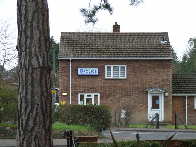
Police Authority: Thames Valley

What 3 Words

///excuse.scenes.faces. Near Crowthorne, Berkshire

Related Wikis

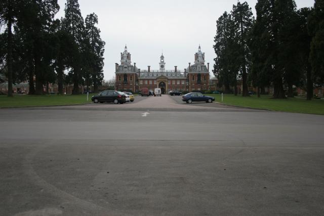
Wellington College, Berkshire

Wellington College is a private school (English fee-charging boarding and day school) in the village of Crowthorne, Berkshire, England. Wellington is a...
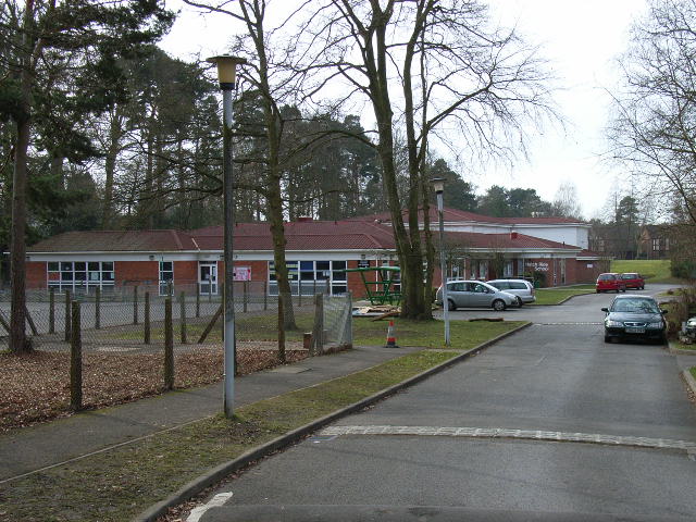
Edgbarrow School

Edgbarrow School is a secondary Academy School in Crowthorne, Berkshire, England. The school is the main state secondary school in the area, and includes...
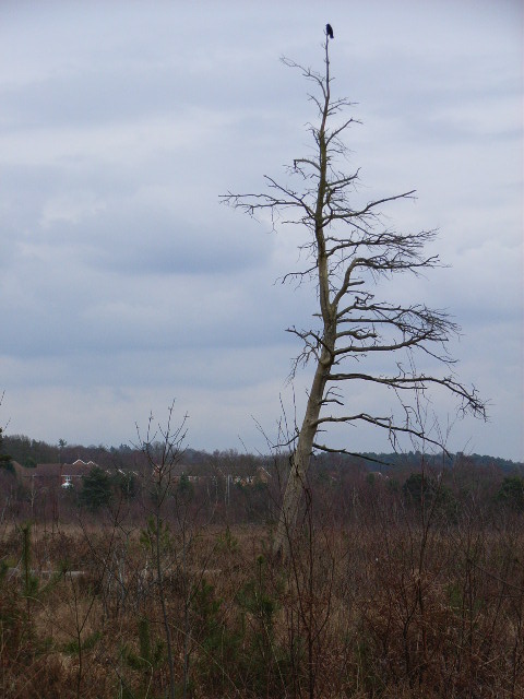
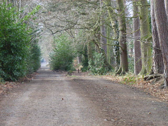
Edgbarrow Woods

Edgbarrow Woods is a 36.8-hectare (91-acre) Local Nature Reserve on the northern outskirts of Sandhurst in Berkshire. It is owned and managed by Wellington...
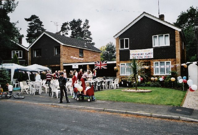
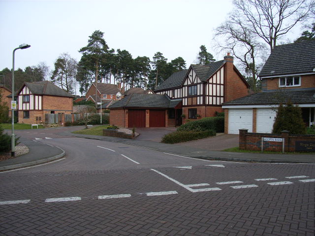
Crowthorne

Crowthorne is a village and civil parish in the Bracknell Forest district of south-eastern Berkshire, England. It had a population of 7,806 at the 2021...

Nearby Amenities

Located within 500m of 51.366187,-0.80077098
Mini Roundabout
Direction: clockwise
Lat/Long: 51.3666377/-0.7948014
Barrier: bollard
Bicycle: yes
Bollard: fixed
Foot: yes
Lat/Long: 51.3693462/-0.7969408
Crossing
Crossing: uncontrolled
Crossing Island: no
Crossing Ref: zebra
Source: Bing
Tactile Paving: yes
Traffic Calming: hump
Lat/Long: 51.3672853/-0.7942539
Barrier: bollard
Bicycle: yes
Bollard: fixed
Foot: yes
Lat/Long: 51.3669581/-0.7980066
Mordaunt Gate
Access: no
Barrier: lift_gate
Foot: permissive
Locked: yes
Motor Vehicle: permit
Lat/Long: 51.3639098/-0.7997628
Townhall
Parish Hall
Addr Housename: Parish Hall
Addr Postcode: RG45 7BN
Addr Street: Heath Hill road South
Lat/Long: 51.3681143/-0.7952372
Recycling
Recycling Batteries: no
Recycling Books: no
Recycling Cans: no
Recycling Cardboard: no
Recycling Cartons: no
Recycling Clothes: no
Recycling Electrical Appliances: no
Recycling Glass: yes
Recycling Glass Bottles: yes
Recycling Green Waste: no
Recycling Magazines: no
Recycling Newspaper: no
Recycling Paper: no
Recycling Paper Packaging: no
Recycling Plastic: no
Recycling Plastic Bottles: no
Recycling Plastic Packaging: no
Recycling Scrap Metal: no
Recycling Small Appliances: no
Recycling Waste: no
Recycling Wood: no
Recycling Type: container
Lat/Long: 51.3680574/-0.794961
Recycling
Recycling Batteries: no
Recycling Books: yes
Recycling Cans: no
Recycling Cardboard: no
Recycling Cartons: no
Recycling Clothes: yes
Recycling Electrical Appliances: no
Recycling Glass: no
Recycling Glass Bottles: no
Recycling Green Waste: no
Recycling Magazines: no
Recycling Newspaper: no
Recycling Paper: no
Recycling Paper Packaging: no
Recycling Plastic: no
Recycling Plastic Bottles: no
Recycling Plastic Packaging: no
Recycling Scrap Metal: no
Recycling Small Appliances: no
Recycling Waste: no
Recycling Wood: no
Recycling Type: container
Lat/Long: 51.3681478/-0.7950602
Cafe
The Rolling Feast
Cuisine: sandwich
Wheelchair: yes
Lat/Long: 51.3669354/-0.7946819
G S Supermarket
Shop: convenience
Wheelchair: yes
Lat/Long: 51.3667864/-0.7947544
C T Bell
Shop: hifi
Lat/Long: 51.3675885/-0.7941912
Newmans
Disused Shop: shoes
Shop: shoes
Lat/Long: 51.3672737/-0.7944218
Pharmacy
McParland Pharmacy
Addr City: Crowthorne
Addr Housenumber: 182
Addr Postcode: RG45 7AP
Addr Street: High Street
Dispensing: yes
Drive Through: no
Healthcare: pharmacy
Operator: H A McParland
Wheelchair: limited
Lat/Long: 51.3673725/-0.7943548
Cafe
Louie's
Cuisine: coffee_shop
Source: Mapillary
Lat/Long: 51.3671609/-0.7942835
That's Nice
Shop: gift
Wheelchair: no
Lat/Long: 51.3674981/-0.7939793
Monica
Shop: clothes
Lat/Long: 51.3677711/-0.7940249
Sarai
Shop: hairdresser
Wheelchair: limited
Lat/Long: 51.3674947/-0.794277
Male: yes
Shop: hairdresser
Wheelchair: no
Lat/Long: 51.3669328/-0.7950788
Bus Stop
Edgbarrow School
Public Transport: platform
Route Ref: 194
Lat/Long: 51.362289/-0.7981255
Barrier: bollard
Bicycle: yes
Bollard: fixed
Foot: yes
Lat/Long: 51.3671527/-0.7978798
Turning Circle
Source: Bing
Lat/Long: 51.3657113/-0.8055843
Crossing
Crossing: unmarked
Kerb: lowered
Lat/Long: 51.3649031/-0.7959611
Crossing
Crossing: traffic_signals
Crossing Ref: pelican
Kerb: lowered
Lat/Long: 51.365002/-0.7959744
Crossing
Crossing: traffic_signals
Crossing Ref: pelican
Kerb: lowered
Lat/Long: 51.3648164/-0.7961147
Crossing
Bicycle: dismount
Crossing: unmarked
Lat/Long: 51.3634781/-0.7969485
Barrier: kerb
Kerb: lowered
Tactile Paving: yes
Lat/Long: 51.3625753/-0.7977137
Bicycle: dismount
Crossing: unmarked
Lat/Long: 51.3626312/-0.7976704
Barrier: kerb
Kerb: lowered
Tactile Paving: yes
Lat/Long: 51.3626968/-0.7976195
Traffic Signals
Source: Bing
Traffic Signals Direction: backward
Lat/Long: 51.364885/-0.7957833
Traffic Signals
Source: Bing
Traffic Signals Direction: backward
Lat/Long: 51.365028/-0.7959544
Traffic Signals
Source: Bing
Traffic Signals Direction: forward
Lat/Long: 51.3647755/-0.7961459
Crossing
Crossing: uncontrolled
Crossing Island: yes
Kerb: lowered
Lat/Long: 51.3665586/-0.7948394
Crossing
Crossing: uncontrolled
Crossing Island: yes
Lat/Long: 51.3633817/-0.7972145
Crossing
Crossing: uncontrolled
Crossing Island: yes
Kerb: lowered
Lat/Long: 51.3635935/-0.7970578
Crossing
Crossing: uncontrolled
Crossing Island: yes
Kerb: lowered
Lat/Long: 51.3632016/-0.7975257
Cafe
V&A Cafe
Lat/Long: 51.3641143/-0.8061488
Copenhagen
Artwork Type: sculpture
Tourism: artwork
Lat/Long: 51.3637688/-0.8057307
Post Box
Collection Times: Mo-Fr 16:30, Sa 11:45
Drive Through: no
Operator: Royal Mail
Post Box Type: pillar
Ref: RG45 19
Royal Cypher: EIIR
Royal Cypher Wikidata: Q33102113
Lat/Long: 51.366265/-0.7951746
Source: Bing
Traffic Calming: cushion
Lat/Long: 51.3669139/-0.7945313
Crossing
Crossing: unmarked
Kerb: lowered
Lat/Long: 51.3624921/-0.7978524
Crossing
Bicycle: yes
Crossing: unmarked
Kerb: no
Tactile Paving: no
Lat/Long: 51.3621288/-0.7980635
Crossing
Crossing: unmarked
Crossing Island: no
Kerb: lowered
Lat/Long: 51.366391/-0.7947776
Direction: 205
Generator Method: photovoltaic
Generator Output Electricity: yes
Generator Solar Modules: 190
Generator Source: solar
Generator Type: solar_photovoltaic_panel
Location: roof
Power: generator
Lat/Long: 51.362559/-0.8050244
Direction: 195
Generator Method: photovoltaic
Generator Output Electricity: yes
Generator Solar Modules: 99
Generator Source: solar
Generator Type: solar_photovoltaic_panel
Location: roof
Power: generator
Lat/Long: 51.3620997/-0.8035162
Fixme: survey: solar PV panels, or a glass roof?
Lat/Long: 51.3624682/-0.8022734
Traffic Calming: hump
Lat/Long: 51.3630985/-0.8000649
Direction: 205
Generator Method: photovoltaic
Generator Output Electricity: yes
Generator Solar Modules: 14
Generator Source: solar
Generator Type: solar_photovoltaic_panel
Location: roof
Power: generator
Lat/Long: 51.3627675/-0.7980778
Direction: 170
Generator Method: photovoltaic
Generator Output Electricity: yes
Generator Solar Modules: 12
Generator Source: solar
Generator Type: solar_photovoltaic_panel
Location: roof
Power: generator
Lat/Long: 51.3646558/-0.7990985
Direction: 180
Generator Method: photovoltaic
Generator Output Electricity: yes
Generator Solar Modules: 7
Generator Source: solar
Generator Type: solar_photovoltaic_panel
Location: roof
Power: generator
Lat/Long: 51.3646697/-0.7995583
Direction: 210
Generator Method: photovoltaic
Generator Output Electricity: yes
Generator Solar Modules: 8
Generator Source: solar
Generator Type: solar_photovoltaic_panel
Location: roof
Power: generator
Lat/Long: 51.3664033/-0.7956168
Direction: 115
Generator Method: photovoltaic
Generator Output Electricity: yes
Generator Solar Modules: 8
Generator Source: solar
Generator Type: solar_photovoltaic_panel
Location: roof
Power: generator
Lat/Long: 51.3664717/-0.795984
Direction: 115
Generator Method: photovoltaic
Generator Output Electricity: yes
Generator Solar Modules: 8
Generator Source: solar
Generator Type: solar_photovoltaic_panel
Location: roof
Power: generator
Lat/Long: 51.3665115/-0.7959519
Direction: 115
Generator Method: photovoltaic
Generator Output Electricity: yes
Generator Solar Modules: 8
Generator Source: solar
Generator Type: solar_photovoltaic_panel
Location: roof
Power: generator
Lat/Long: 51.3665525/-0.7959207
Direction: 115
Generator Method: photovoltaic
Generator Output Electricity: yes
Generator Solar Modules: 8
Generator Source: solar
Generator Type: solar_photovoltaic_panel
Location: roof
Power: generator
Lat/Long: 51.3666233/-0.7959265
Direction: 115
Generator Method: photovoltaic
Generator Output Electricity: yes
Generator Solar Modules: 8
Generator Source: solar
Generator Type: solar_photovoltaic_panel
Location: roof
Power: generator
Lat/Long: 51.3666645/-0.7958974
Direction: 115
Generator Method: photovoltaic
Generator Output Electricity: yes
Generator Solar Modules: 8
Generator Source: solar
Generator Type: solar_photovoltaic_panel
Location: roof
Power: generator
Lat/Long: 51.3667041/-0.7958666
Direction: 115
Generator Method: photovoltaic
Generator Output Electricity: yes
Generator Solar Modules: 8
Generator Source: solar
Generator Type: solar_photovoltaic_panel
Location: roof
Power: generator
Lat/Long: 51.3667453/-0.7958327
Direction: 115
Generator Method: photovoltaic
Generator Output Electricity: yes
Generator Solar Modules: 8
Generator Source: solar
Generator Type: solar_photovoltaic_panel
Location: roof
Power: generator
Lat/Long: 51.3667865/-0.7958028
Direction: 140
Generator Method: photovoltaic
Generator Output Electricity: yes
Generator Solar Modules: 4
Generator Source: solar
Generator Type: solar_photovoltaic_panel
Location: roof
Power: generator
Lat/Long: 51.3667791/-0.7952954
Direction: 140
Generator Method: photovoltaic
Generator Output Electricity: yes
Generator Solar Modules: 6
Generator Source: solar
Generator Type: solar_photovoltaic_panel
Location: roof
Power: generator
Lat/Long: 51.3668177/-0.7953373
Direction: 140
Generator Method: photovoltaic
Generator Output Electricity: yes
Generator Solar Modules: 4
Generator Source: solar
Generator Type: solar_photovoltaic_panel
Location: roof
Power: generator
Lat/Long: 51.3668531/-0.7953848
Direction: 140
Generator Method: photovoltaic
Generator Output Electricity: yes
Generator Solar Modules: 4
Generator Source: solar
Generator Type: solar_photovoltaic_panel
Location: roof
Power: generator
Lat/Long: 51.366888/-0.7954325
Direction: 120
Generator Method: photovoltaic
Generator Output Electricity: yes
Generator Solar Modules: 11
Generator Source: solar
Generator Type: solar_photovoltaic_panel
Location: roof
Power: generator
Lat/Long: 51.3658626/-0.7997935
Barrier: bollard
Bollard: fixed
Lat/Long: 51.3658788/-0.7978736
Direction: 205
Generator Method: photovoltaic
Generator Output Electricity: yes
Generator Solar Modules: 16
Generator Source: solar
Generator Type: solar_photovoltaic_panel
Location: roof
Power: generator
Lat/Long: 51.3668655/-0.7983157
Direction: 255
Generator Method: photovoltaic
Generator Output Electricity: yes
Generator Solar Modules: 18
Generator Source: solar
Generator Type: solar_photovoltaic_panel
Location: roof
Power: generator
Lat/Long: 51.3665898/-0.7987682
Direction: 170
Generator Method: photovoltaic
Generator Output Electricity: yes
Generator Solar Modules: 15
Generator Source: solar
Generator Type: solar_photovoltaic_panel
Location: roof
Power: generator
Lat/Long: 51.3662513/-0.7997634
Direction: 195
Generator Method: photovoltaic
Generator Output Electricity: yes
Generator Solar Modules: 19
Generator Source: solar
Generator Type: solar_photovoltaic_panel
Location: roof
Power: generator
Lat/Long: 51.3685219/-0.8034924
Direction: 195
Generator Method: photovoltaic
Generator Output Electricity: yes
Generator Solar Modules: 18
Generator Source: solar
Generator Type: solar_photovoltaic_panel
Location: roof
Power: generator
Lat/Long: 51.3685435/-0.8032671
Direction: 120
Generator Method: photovoltaic
Generator Output Electricity: yes
Generator Solar Modules: 3
Generator Source: solar
Generator Type: solar_photovoltaic_panel
Location: roof
Power: generator
Lat/Long: 51.3672882/-0.7953578
Direction: 120
Generator Method: photovoltaic
Generator Output Electricity: yes
Generator Solar Modules: 3
Generator Source: solar
Generator Type: solar_photovoltaic_panel
Location: roof
Power: generator
Lat/Long: 51.367322/-0.7954129
Direction: 120
Generator Method: photovoltaic
Generator Output Electricity: yes
Generator Solar Modules: 3
Generator Source: solar
Generator Type: solar_photovoltaic_panel
Location: roof
Power: generator
Lat/Long: 51.3673613/-0.7954642
Direction: 120
Generator Method: photovoltaic
Generator Output Electricity: yes
Generator Solar Modules: 3
Generator Source: solar
Generator Type: solar_photovoltaic_panel
Location: roof
Power: generator
Lat/Long: 51.3673966/-0.7955221
Direction: 210
Generator Method: photovoltaic
Generator Output Electricity: yes
Generator Solar Modules: 4
Generator Source: solar
Generator Type: solar_photovoltaic_panel
Location: roof
Power: generator
Lat/Long: 51.367522/-0.7954194
Direction: 210
Generator Method: photovoltaic
Generator Output Electricity: yes
Generator Solar Modules: 4
Generator Source: solar
Generator Type: solar_photovoltaic_panel
Location: roof
Power: generator
Lat/Long: 51.3675618/-0.7953935
Direction: 210
Generator Method: photovoltaic
Generator Output Electricity: yes
Generator Solar Modules: 4
Generator Source: solar
Generator Type: solar_photovoltaic_panel
Location: roof
Power: generator
Lat/Long: 51.3675972/-0.7953693
Direction: 210
Generator Method: photovoltaic
Generator Output Electricity: yes
Generator Solar Modules: 4
Generator Source: solar
Generator Type: solar_photovoltaic_panel
Location: roof
Power: generator
Lat/Long: 51.3676438/-0.7953658
Direction: 185
Generator Method: photovoltaic
Generator Output Electricity: yes
Generator Solar Modules: 68
Generator Source: solar
Generator Type: solar_photovoltaic_panel
Location: roof
Power: generator
Lat/Long: 51.3691856/-0.8041075
Direction: 185
Generator Method: photovoltaic
Generator Output Electricity: yes
Generator Solar Modules: 26
Generator Source: solar
Generator Type: solar_photovoltaic_panel
Location: roof
Power: generator
Lat/Long: 51.3689926/-0.8044625
Bench
Backrest: yes
Seats: 3
Source: mapillary
Lat/Long: 51.3698911/-0.8028223
Bus Stop
Bus: yes
Naptan AtcoCode: 0380C971M703
Naptan NaptanCode: bknagpa
Public Transport: platform
Lat/Long: 51.3661868/-0.7951293
Bus Stop
Bus: yes
Naptan AtcoCode: 0380C975M681
Naptan NaptanCode: bknagpd
Public Transport: platform
Shelter: yes
Lat/Long: 51.366021/-0.7951559
Direction: 225
Generator Method: photovoltaic
Generator Output Electricity: yes
Generator Solar Modules: 12
Generator Source: solar
Generator Type: solar_photovoltaic_panel
Location: roof
Power: generator
Lat/Long: 51.3685289/-0.7960143
Direction: 130
Generator Method: photovoltaic
Generator Output Electricity: yes
Generator Solar Modules: 12
Generator Source: solar
Generator Type: solar_photovoltaic_panel
Location: roof
Power: generator
Lat/Long: 51.3688529/-0.7963635
Crossing
Crossing: unmarked
Crossing Island: no
Crossing Markings: no
Kerb: lowered
Tactile Paving: no
Lat/Long: 51.3638776/-0.7994431
Crossing
Crossing: uncontrolled
Crossing Island: no
Kerb: lowered
Source: Bing
Tactile Paving: yes
Lat/Long: 51.3659203/-0.8059698
Crossing
Crossing: uncontrolled
Crossing Island: no
Kerb: lowered
Source: Bing
Tactile Paving: yes
Lat/Long: 51.365896/-0.8061709
Crossing
Crossing: uncontrolled
Crossing Island: no
Kerb: lowered
Source: Bing
Tactile Paving: yes
Lat/Long: 51.3655408/-0.8050312
Crossing
Crossing: uncontrolled
Crossing Island: no
Kerb: lowered
Source: Bing
Tactile Paving: yes
Lat/Long: 51.3655173/-0.8047352
Direction: both
Surface: cobblestone
Traffic Calming: rumble_strip
Lat/Long: 51.3666286/-0.7983916
Give Way
Direction: backward
Lat/Long: 51.3676452/-0.7940573
Crowthorne Turkish Barbers
Addr City: Crowthorne
Addr Housenumber: 233
Addr Postcode: RG45 7AH
Addr Street: High Street
Check Date Currency XBT: 2022-12-01
Contact Facebook: crowthorneturkishbarbers
Contact Instagram: crowthorneturkishbarbers
Currency GBP: yes
Currency XBT: yes
Description: Full range of services from hot towel & wet shaves to skin fades, waxing (nose & ear) and threading.
Male: yes
Name En: Crowthorne Turkish Barbers
Opening Hours: Mo-Fr 09:00-18:00; Sa 08:00-18:00; Su 10:00-16:00
Payment Lightning: yes
Payment Lightning Contactless: yes
Payment Onchain: yes
Phone: +44 79039 94735
Shop: hairdresser
Website: https://crowthorneturkishbarbers.nearcut.com/
Lat/Long: 51.3673557/-0.7941157
Traffic Signals
Traffic Signals: junction
Traffic Signals Direction: forward
Lat/Long: 51.3697432/-0.8032271
Traffic Signals
Traffic Signals: junction
Traffic Signals Direction: backward
Lat/Long: 51.3696344/-0.8028926
Traffic Signals
Traffic Signals: junction
Traffic Signals Direction: forward
Lat/Long: 51.3698894/-0.8029549
Crossing
Crossing: unmarked
Kerb: lowered
Tactile Paving: yes
Lat/Long: 51.3697422/-0.8029177
Crossing
Crossing: traffic_signals
Crossing Ref: pelican
Kerb: lowered
Tactile Paving: yes
Lat/Long: 51.3698236/-0.8027656
Crossing
Crossing: traffic_signals
Crossing Ref: pelican
Kerb: lowered
Tactile Paving: yes
Lat/Long: 51.3698566/-0.8029462
Traffic Signals
Traffic Signals: junction
Traffic Signals Direction: backward
Lat/Long: 51.3698301/-0.8027281
Crossing
Crossing: traffic_signals
Crossing Ref: pelican
Kerb: lowered
Tactile Paving: yes
Lat/Long: 51.3697516/-0.8031789
Traffic Calming: island
Lat/Long: 51.36305/-0.7974664
Barrier: kerb
Kerb: lowered
Tactile Paving: no
Lat/Long: 51.3633649/-0.7971523
Barrier: kerb
Kerb: lowered
Tactile Paving: no
Lat/Long: 51.3632765/-0.7974707
Barrier: kerb
Kerb: lowered
Tactile Paving: no
Lat/Long: 51.3633952/-0.7972641
Barrier: kerb
Kerb: lowered
Tactile Paving: no
Lat/Long: 51.3633777/-0.7971996
Barrier: kerb
Kerb: lowered
Tactile Paving: no
Lat/Long: 51.3633849/-0.7972263
Barrier: kerb
Kerb: lowered
Tactile Paving: yes
Lat/Long: 51.3634553/-0.7969664
Barrier: kerb
Kerb: lowered
Tactile Paving: yes
Lat/Long: 51.3634958/-0.7969346
Barrier: kerb
Kerb: lowered
Tactile Paving: no
Lat/Long: 51.3635988/-0.7970773
Barrier: kerb
Kerb: lowered
Tactile Paving: no
Lat/Long: 51.3635895/-0.7970431
Barrier: kerb
Kerb: lowered
Tactile Paving: no
Lat/Long: 51.3635772/-0.7969984
Barrier: kerb
Kerb: lowered
Tactile Paving: no
Lat/Long: 51.3636103/-0.7971177
Regal Nails
Beauty: nails
Shop: beauty
Source: Mapillary
Lat/Long: 51.3670403/-0.7943635
The Village Cobbler
Shop: shoe_repair
Lat/Long: 51.367088/-0.7943429
Fast Food
Beijing
Cuisine: chinese
Takeaway: yes
Lat/Long: 51.3672115/-0.7942605
Restaurant
Villa Roma
Cuisine: italian
Takeaway: yes
Lat/Long: 51.3672735/-0.7942087
Communication 3G: yes
Communication 4G: yes
Man Made: antenna
Operator: Three and EE
Lat/Long: 51.3675806/-0.7954577
Direction: both
Traffic Calming: rumble_strip
Lat/Long: 51.3665515/-0.798195
Direction: both
Traffic Calming: rumble_strip
Lat/Long: 51.3651234/-0.7983615
Post Box
Lat/Long: 51.3637176/-0.7989457
Traffic Calming: hump
Lat/Long: 51.3662971/-0.7940169
Social Facility
St Brendans Care Home
Operator: B&M Care
Social Facility: group_home
Social Facility For: senior
Lat/Long: 51.3645156/-0.7969675
Give Way
Direction: forward
Lat/Long: 51.3631798/-0.7974562
Traffic Calming: hump
Lat/Long: 51.3652811/-0.8041931
Traffic Calming: hump
Lat/Long: 51.3646691/-0.8022211
The data included in this document is from www.openstreetmap.org. The data is made available under ODbL.

Have you been to Upper Lake?

Leave your review of Upper Lake below (or comments, questions and feedback).