Barge Dock

Lake, Pool, Pond, Freshwater Marsh in Yorkshire

England

Barge Dock

Track and field south of the allotment gardens
Track and field south of the allotment gardens Credit: David Brown

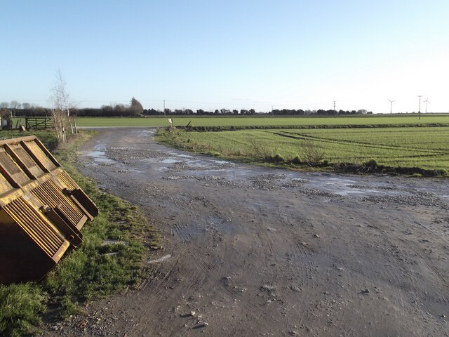
Barge Dock, located in Yorkshire, is a picturesque freshwater marsh that offers a serene and tranquil environment for visitors. Situated amidst breathtaking natural beauty, it is known for its calm lake, pool, pond, and lush green surroundings.

The main attraction of Barge Dock is the expansive lake, which spans across several acres. The lake is popular for recreational activities like boating and fishing, attracting both locals and tourists alike. Its clear and pristine waters are home to a variety of freshwater fish species, providing an excellent opportunity for anglers to try their luck.

Adjacent to the lake, there is a smaller pool that serves as a habitat for various aquatic plants and animals. The pool is particularly renowned for its vibrant water lilies, creating a stunning visual spectacle during the blooming season.

Another feature of Barge Dock is the tranquil pond, which is nestled amidst the marshland. The pond is a peaceful oasis, offering a perfect spot for visitors to relax and enjoy the natural surroundings. It is often frequented by waterfowl, adding to the charm of the area.

Surrounded by reeds, grasses, and wildflowers, the freshwater marsh at Barge Dock is a haven for wildlife enthusiasts and nature lovers. It provides a habitat for numerous bird species, including herons, ducks, and swans. The marshland also supports a diverse range of plant life, including sedges, rushes, and various wetland species.

Overall, Barge Dock in Yorkshire offers a unique opportunity to embrace the beauty of nature and enjoy a peaceful getaway in a stunning freshwater marsh setting.

If you have any feedback on the listing, please let us know in the comments section below.

Barge Dock Images

Images are sourced within 2km of 53.697856/-0.87225092 or Grid Reference SE7422. Thanks to Geograph Open Source API. All images are credited.

Track and field south of the allotment gardens
Goole Landmarks Showing the town's two historic water towers  - known locally as the salt n' pepper pots.
Goole Landmarks
Showing the town's two historic water towers - known locally as the salt n' pepper pots.
St John's Church, Goole Goole's main parish church is Grade II listed and was built in the 1840's.
St John's Church, Goole
Goole's main parish church is Grade II listed and was built in the 1840's.
Housing on Mayfield, Goole
Boothferry Road, Goole
Railway Bridge over the Aire and Calder Navigation This bridge is a replacement for the original one built by the North Eastern Railway.  It carries trains on the Hull to Doncaster and London route.
Railway Bridge over the Aire and Calder Navigation
This bridge is a replacement for the original one built by the North Eastern Railway. It carries trains on the Hull to Doncaster and London route.
Support for the Railway Bridge over the Aire and Calder Navigation For the replacement bridge, the old brick abutments have been cut back and new beam supports provided at both ends.  This is the northwest side of the canal and the removal of brickwork is likely to mean a railside Ordnance Survey flush bracket benchmark no longer exists.  See <span class="nowrap"><a title="https://www.bench-marks.org.uk/bm9890" rel="nofollow ugc noopener" href="https://www.bench-marks.org.uk/bm9890">Link</a><img style="margin-left:2px;" alt="External link" title="External link - shift click to open in new window" src="https://s1.geograph.org.uk/img/external.png" width="10" height="10"/></span> for details of the benchmark.
Support for the Railway Bridge over the Aire and Calder Navigation
For the replacement bridge, the old brick abutments have been cut back and new beam supports provided at both ends. This is the northwest side of the canal and the removal of brickwork is likely to mean a railside Ordnance Survey flush bracket benchmark no longer exists. See LinkExternal link for details of the benchmark.
Detail of the Northwest End of the Railway Bridge over the Aire and Calder Navigation This view shows the extent of old brickwork removal and replacement by new brickwork and steelwork.  As a result an Ordnance Survey flush bracket benchmark at rail level has probably gone.  See <span class="nowrap"><a title="https://www.bench-marks.org.uk/bm9890" rel="nofollow ugc noopener" href="https://www.bench-marks.org.uk/bm9890">Link</a><img style="margin-left:2px;" alt="External link" title="External link - shift click to open in new window" src="https://s1.geograph.org.uk/img/external.png" width="10" height="10"/></span> for details of the benchmark.
Detail of the Northwest End of the Railway Bridge over the Aire and Calder Navigation
This view shows the extent of old brickwork removal and replacement by new brickwork and steelwork. As a result an Ordnance Survey flush bracket benchmark at rail level has probably gone. See LinkExternal link for details of the benchmark.
Cut Mark: Goole, #68 Aire Street Cut bench mark on the building at the corner of Aire Street and Calder Street.  See <a title="https://www.geograph.org.uk/photo/7297521" href="https://www.geograph.org.uk/photo/7297521">Link</a> for a wider view and <span class="nowrap"><a title="https://www.bench-marks.org.uk/bm110325" rel="nofollow ugc noopener" href="https://www.bench-marks.org.uk/bm110325">Link</a><img style="margin-left:2px;" alt="External link" title="External link - shift click to open in new window" src="https://s1.geograph.org.uk/img/external.png" width="10" height="10"/></span> for details of the mark.
Cut Mark: Goole, #68 Aire Street
Cut bench mark on the building at the corner of Aire Street and Calder Street. See Link for a wider view and LinkExternal link for details of the mark.
Building at the Junction of Aire Street and Calder Street An appropriate pair of street names for Goole, where the Aire and Calder Navigation meets the tidal River Ouse.  The building carries a cut bench mark right of the doorway.  See <a title="https://www.geograph.org.uk/photo/7297500" href="https://www.geograph.org.uk/photo/7297500">Link</a> for a closer view and <span class="nowrap"><a title="https://www.bench-marks.org.uk/bm110325" rel="nofollow ugc noopener" href="https://www.bench-marks.org.uk/bm110325">Link</a><img style="margin-left:2px;" alt="External link" title="External link - shift click to open in new window" src="https://s1.geograph.org.uk/img/external.png" width="10" height="10"/></span> for details of the mark.
Building at the Junction of Aire Street and Calder Street
An appropriate pair of street names for Goole, where the Aire and Calder Navigation meets the tidal River Ouse. The building carries a cut bench mark right of the doorway. See Link for a closer view and LinkExternal link for details of the mark.
Cut Mark: Goole Police Station and Court House Cut bench mark on the frontage of the courthouse.  See <a title="https://www.geograph.org.uk/photo/7311652" href="https://www.geograph.org.uk/photo/7311652">Link</a> for a wider view and <span class="nowrap"><a title="https://www.bench-marks.org.uk/bm175098" rel="nofollow ugc noopener" href="https://www.bench-marks.org.uk/bm175098">Link</a><img style="margin-left:2px;" alt="External link" title="External link - shift click to open in new window" src="https://s1.geograph.org.uk/img/external.png" width="10" height="10"/></span> for details of the mark.
Cut Mark: Goole Police Station and Court House
Cut bench mark on the frontage of the courthouse. See Link for a wider view and LinkExternal link for details of the mark.
Goole Courthouse There is a cut bench mark on the frontage of the courthouse near the plant.  See <a title="https://www.geograph.org.uk/photo/7311632" href="https://www.geograph.org.uk/photo/7311632">Link</a> for a closer view and <span class="nowrap"><a title="https://www.bench-marks.org.uk/bm175098" rel="nofollow ugc noopener" href="https://www.bench-marks.org.uk/bm175098">Link</a><img style="margin-left:2px;" alt="External link" title="External link - shift click to open in new window" src="https://s1.geograph.org.uk/img/external.png" width="10" height="10"/></span> for details of the mark.
Goole Courthouse
There is a cut bench mark on the frontage of the courthouse near the plant. See Link for a closer view and LinkExternal link for details of the mark.
Blue Police Lamp over the Entrance to Goole Police Station A reminder of the TV show "Dixon of Dock Green".
Blue Police Lamp over the Entrance to Goole Police Station
A reminder of the TV show "Dixon of Dock Green".
Flush Bracket OSBM G2445: Goole, Osborne House This flush bracket benchmark is on the side of a garage in Airmyn Road.  See <a title="https://www.geograph.org.uk/photo/7312273" href="https://www.geograph.org.uk/photo/7312273">Link</a> for a wider view and <span class="nowrap"><a title="https://www.bench-marks.org.uk/bm14602" rel="nofollow ugc noopener" href="https://www.bench-marks.org.uk/bm14602">Link</a><img style="margin-left:2px;" alt="External link" title="External link - shift click to open in new window" src="https://s1.geograph.org.uk/img/external.png" width="10" height="10"/></span> for details of the mark.
Flush Bracket OSBM G2445: Goole, Osborne House
This flush bracket benchmark is on the side of a garage in Airmyn Road. See Link for a wider view and LinkExternal link for details of the mark.
A garage on Airmyn Road, Goole Just visible around the right-hand angle is a flush bracket benchmark.  See <a title="https://www.geograph.org.uk/photo/7312270" href="https://www.geograph.org.uk/photo/7312270">Link</a> for a close-up and <span class="nowrap"><a title="https://www.bench-marks.org.uk/bm14602" rel="nofollow ugc noopener" href="https://www.bench-marks.org.uk/bm14602">Link</a><img style="margin-left:2px;" alt="External link" title="External link - shift click to open in new window" src="https://s1.geograph.org.uk/img/external.png" width="10" height="10"/></span> for details of the mark.
A garage on Airmyn Road, Goole
Just visible around the right-hand angle is a flush bracket benchmark. See Link for a close-up and LinkExternal link for details of the mark.
Turf Zone "GooleStation" At Goole Railway Station.
Turf Zone "GooleStation"
At Goole Railway Station.
Victoria Hotel On Hook Road, Goole.
Victoria Hotel
On Hook Road, Goole.
Clifton Gardens, Goole (1) Seen from the junction with Boothferry Road.
Clifton Gardens, Goole (1)
Seen from the junction with Boothferry Road.
Show me another place!

Barge Dock is located at Grid Ref: SE7422 (Lat: 53.697856, Lng: -0.87225092)

Division: West Riding

Unitary Authority: East Riding of Yorkshire

Police Authority: Humberside

What 3 Words

///binds.gratuity.axed. Near Goole, East Yorkshire

Related Wikis

Port of Goole

The Port of Goole (also known as Goole Docks and The Port in Green Fields), is a maritime port at the mouth of the Aire and Calder Navigation where it...

Goole

Goole is a port town and civil parish on the River Ouse in the East Riding of Yorkshire, England. The town's historic county is the West Riding of Yorkshire...

River Don, Yorkshire

The River Don (also called River Dun in some stretches) is a river in South Yorkshire and the East Riding of Yorkshire, England. It rises in the Pennines...

St John's Church, Goole

St John's the Evangelist Church known by the congregation as St John's Goole is an active parish church in the town of Goole, East Riding of Yorkshire...

Nearby Amenities

Located within 500m of 53.697856,-0.87225092
Traffic Signals
Lat/Long: 53.6993069/-0.8746751
Traffic Signals
Access: yes
Barrier: lift_gate
Lat/Long: 53.6979919/-0.8741862
Traffic Signals
Access: yes
Barrier: lift_gate
Lat/Long: 53.6974804/-0.8739888
Access: yes
Barrier: lift_gate
Lat/Long: 53.6965212/-0.8735916
Access: yes
Barrier: lift_gate
Lat/Long: 53.6961521/-0.8734303
Old Goole
Is In: East Riding of Yorkshire, England, UK
Is In County: East Riding of Yorkshire
Place: village
Lat/Long: 53.6948574/-0.870163
Pub
The Vermuyden
Lat/Long: 53.6967564/-0.8734478
Pharmacy
Nigel R Drummond
Dispensing: yes
Lat/Long: 53.6957964/-0.8727479
Post Box
Lat/Long: 53.6942917/-0.8686319
Post Box
Ref: DN14 10
Royal Cypher: EIIR
Royal Cypher Wikidata: Q33102113
Lat/Long: 53.6959479/-0.8719701
Post Office
Old Goole Post Office
Addr City: Goole
Addr Country: GB
Addr Postcode: DN14 5UY
Addr Street: Swinefleet Road
Addr Suburb: Old Goole
Brand: Post Office
Brand Wikidata: Q1783168
Check Date: 2022-05-27
Contact Website: https://www.postoffice.co.uk/branch-finder/271311x/old-goole
Opening Hours: Mo-Fr 10:00-17:00; Sa 10:00-14:00
Ref Pol Id: 10810
Lat/Long: 53.6958606/-0.8720633
Pub
The Middle House
Lat/Long: 53.6970565/-0.872949
Goole Leisure Centre
Addr City: Goole
Addr Postcode: DN14 5QX
Addr Street: North Street
Fhrs Id: 112140
Fhrs Local Authority Id: 41402
Leisure: sports_centre
Sport: multi
Wheelchair: yes
Lat/Long: 53.7016907/-0.8683343
Bus Stop
Goole Cottingham Street
Naptan AtcoCode: 2200YEA00088
Naptan Bearing: SW
Naptan CommonName: Goole Cottingham Street
Naptan Street: Cottingham Street
Note: no sign
Shelter: yes
Source: naptan + survey
Lat/Long: 53.695174/-0.8739942
Bus Stop
Old Goole Swinefleet Road
Bench: no
Bin: no
Naptan AtcoCode: 2200YEZ01293
Naptan Bearing: E
Naptan CommonName: Old Goole Swinefleet Road
Naptan Landmark: Shops
Naptan Street: Swinefleet Road
Public Transport: platform
Shelter: no
Source: naptan + survey
Lat/Long: 53.6959809/-0.8718522
Waterway: lock_gate
Lat/Long: 53.7009109/-0.868334
Waterway: lock_gate
Lat/Long: 53.6975715/-0.8677244
Waterway: lock_gate
Lat/Long: 53.698261/-0.8690089
Railway: buffer_stop
Lat/Long: 53.7007718/-0.8741913
Railway: buffer_stop
Lat/Long: 53.7008115/-0.8742181
Railway: level_crossing
Lat/Long: 53.700637/-0.8751425
Railway: switch
Lat/Long: 53.7001841/-0.8781254
Railway: level_crossing
Lat/Long: 53.7006702/-0.8751542
Keeping it Local
Addr City: Goole
Addr Housenumber: 31
Addr Postcode: DN14 5QW
Addr Street: Aire Street
Level: 0
Old Name: Pizza Capri
Shop: yes
Lat/Long: 53.7017063/-0.8701314
Seamark Light Character: F
Seamark Light Colour: red
Seamark Type: light_minor
Lat/Long: 53.69816/-0.86719
Seamark Light Character: F
Seamark Light Colour: red
Seamark Type: light_minor
Lat/Long: 53.69824/-0.86725
Seamark Light Character: F
Seamark Light Colour: red
Seamark Type: light_minor
Lat/Long: 53.69823/-0.86731
Seamark Beacon Special Purpose Colour: yellow
Seamark Type: beacon_special_purpose
Lat/Long: 53.69833/-0.86707
Seamark Light 1 Character: F
Seamark Light 1 Colour: yellow
Seamark Light 1 Sector End: 313
Seamark Light 1 Sector Start: 257
Seamark Type: light_minor
Lat/Long: 53.69845/-0.86728
Seamark Beacon Special Purpose Colour: yellow
Seamark Type: beacon_special_purpose
Lat/Long: 53.69847/-0.86708
Waterway: lock_gate
Lat/Long: 53.7013512/-0.86749
Give Way
Direction: backward
Lat/Long: 53.6967002/-0.8729421
Crossing
Crossing: uncontrolled
Crossing Island: no
Crossing Markings: zebra;dots
Crossing Ref: zebra
Tactile Paving: yes
Lat/Long: 53.6959554/-0.8725985
Crossing
Crossing: unmarked
Crossing Island: no
Tactile Paving: yes
Lat/Long: 53.6966317/-0.8737297
Crossing
Crossing: unmarked
Crossing Island: no
Kerb: lowered
Tactile Paving: yes
Lat/Long: 53.6970745/-0.8738977
Crossing
Crossing: unmarked
Crossing Island: no
Kerb: lowered
Tactile Paving: yes
Lat/Long: 53.6970643/-0.8737387
Cycleway: aslb
Lat/Long: 53.6994774/-0.8747248
Telephone
Booth: KX100
Covered: booth
Lat/Long: 53.6959204/-0.8697986
Goole Dock
Place: locality
Waterway: port
Waterway Porttype: LoLo
Lat/Long: 53.7000588/-0.8685798
Seamark Name: Goole Docks
Seamark Radio Station Mmsi: 992351288
Seamark Type: virtual_aton
Seamark Virtual Aton Category: special_purpose
Lat/Long: 53.6977/-0.8677
J Petty Motors
Addr City: Goole
Addr Postcode: DN14 5RJ
Addr Street: Chapel Street
Phone: +44 1405 763507
Shop: car_repair
Lat/Long: 53.701609/-0.869394
Crossing
Crossing: unmarked
Crossing Island: yes
Tactile Paving: yes
Lat/Long: 53.6993882/-0.8749853
Crossing
Crossing: marked
Crossing Island: yes
Tactile Paving: yes
Lat/Long: 53.6994116/-0.8746971
Crossing
Crossing: marked
Crossing Island: no
Tactile Paving: yes
Lat/Long: 53.6993157/-0.8744801
Crossing
Crossing: marked
Crossing Island: yes
Tactile Paving: yes
Lat/Long: 53.6992872/-0.8749018
Crossing
Crossing: marked
Crossing Island: yes
Tactile Paving: yes
Lat/Long: 53.6991994/-0.8749094
Crossing
Lat/Long: 53.6985199/-0.8744524
Crossing
Lat/Long: 53.6988763/-0.8745912
Crossing
Lat/Long: 53.6992991/-0.8747647
Railway: crossing
Lat/Long: 53.7006311/-0.8751792
Railway: crossing
Lat/Long: 53.7006642/-0.8751912
Give Way
Direction: backward
Lat/Long: 53.6959137/-0.8733159
Crossing
Crossing: unmarked
Crossing Island: no
Kerb: lowered
Tactile Paving: no
Lat/Long: 53.6962377/-0.8761977
S. Walker Garage
Addr City: Goole
Addr Postcode: DN14 5TN
Addr Street: Swinefleet Road
Phone: +441405760926
Shop: car_repair
Lat/Long: 53.6947893/-0.8692878
Railway: crossing
Lat/Long: 53.7006493/-0.8750602
Railway: crossing
Lat/Long: 53.7006799/-0.8750722
South Dock
Waterway: dock
Lat/Long: 53.6973862/-0.8769385
Barge Dock
Waterway: dock
Lat/Long: 53.6978399/-0.8721742
Ship Dock
Waterway: dock
Lat/Long: 53.6985271/-0.8703763
Ouse Dock
Waterway: dock
Lat/Long: 53.6999418/-0.8684948
Aldam Dock
Waterway: dock
Lat/Long: 53.7009658/-0.8715294
Railway Dock
Waterway: dock
Lat/Long: 53.7005751/-0.8734412
Man Made: lighthouse
Lat/Long: 53.696813/-0.8773605
Traffic Signals
Crossing: no
Traffic Signals: traffic_lights
Traffic Signals Direction: forward
Lat/Long: 53.696553/-0.8736051
Traffic Signals
Crossing: no
Traffic Signals: traffic_lights
Traffic Signals Direction: backward
Lat/Long: 53.6961282/-0.8734177
Noexit: yes
Lat/Long: 53.6978086/-0.8698303
Life Ring
Emergency: life_ring
Support: wall_mounted
Lat/Long: 53.6976703/-0.8706754
Entrance: home
Lat/Long: 53.6966262/-0.873458
Barrier: cycle_barrier
Bicycle: dismount
Colour: yellow
Cycle Barrier: squeeze
Cycle Barrier Installation: fixed
Lat/Long: 53.6978473/-0.8694445
Colour: yellow
Crane Type: gantry_crane
Man Made: crane
Lat/Long: 53.698956/-0.8714554
Colour: yellow
Crane Type: gantry_crane
Man Made: crane
Lat/Long: 53.699861/-0.8716963
Fast Food
Taste of China
Addr City: Goole
Addr Housenumber: 11
Addr Postcode: DN14 5QW
Addr Street: Aire Street
Contact Phone: +44 1405 767342
Cuisine: chinese
Fhrs Id: 87496
Fhrs Local Authority Id: 226320
Level: 0
Takeaway: yes
Lat/Long: 53.7013519/-0.8700157
Entrance: main
Lat/Long: 53.7009295/-0.8699409
Mackintosh Arms
Addr City: Goole
Addr Housename: Mackintosh Arms
Addr Housenumber: 13
Addr Street: Aire Street
Disused Amenity: pub
Level: 0
Lat/Long: 53.7014031/-0.8700324
Addr City: Goole
Addr Housenumber: 15
Addr Street: Aire Street
Level: 0
Shop: tattoo
Lat/Long: 53.7014459/-0.8700464
Railway: level_crossing
Lat/Long: 53.7002727/-0.8775978
Railway: level_crossing
Lat/Long: 53.7002509/-0.8775974
The data included in this document is from www.openstreetmap.org. The data is made available under ODbL.

Have you been to Barge Dock?

Leave your review of Barge Dock below (or comments, questions and feedback).