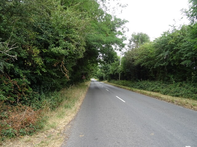
Tinepit Pond

Lake, Pool, Pond, Freshwater Marsh in Oxfordshire South Oxfordshire

England

Tinepit Pond
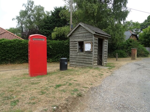
K6 telephone box and bus shelter, Cray's Pond
K6 telephone box and bus shelter, Cray's Pond Credit: JThomas

Tinepit Pond, located in Oxfordshire, England, is a picturesque freshwater pond surrounded by lush greenery and scenic landscapes. With its tranquil atmosphere and diverse ecosystem, it is a popular destination for nature enthusiasts, birdwatchers, and those seeking a peaceful retreat.

Covering an area of approximately 2 acres, Tinepit Pond boasts crystal-clear waters that are teeming with various species of freshwater fish, including perch, pike, and roach. The size and depth of the pond make it an ideal habitat for these fish to thrive and reproduce, attracting anglers from near and far.

The pond is also home to a variety of bird species, making it a birdwatcher's paradise. Visitors can spot ducks, geese, herons, and kingfishers among the many other resident and migratory birds that frequent the area. Additionally, the surrounding marshland provides a habitat for a diverse range of plants and wildlife, including dragonflies, frogs, and water voles.

Tinepit Pond offers several amenities for visitors to enjoy. There are well-maintained footpaths and picnic areas, allowing visitors to explore the pond and its surroundings at their leisure. Fishing is permitted with the appropriate permits and licenses, and there are designated areas for anglers to set up their equipment.

The pond, situated in a peaceful and idyllic setting, provides a welcome escape from the hustle and bustle of daily life. Whether one seeks a serene spot for reflection, an opportunity to observe nature, or a recreational fishing experience, Tinepit Pond offers a little piece of paradise in Oxfordshire.

If you have any feedback on the listing, please let us know in the comments section below.

Tinepit Pond Images

Images are sourced within 2km of 51.508005/-1.0823404 or Grid Reference SU6379. Thanks to Geograph Open Source API. All images are credited.
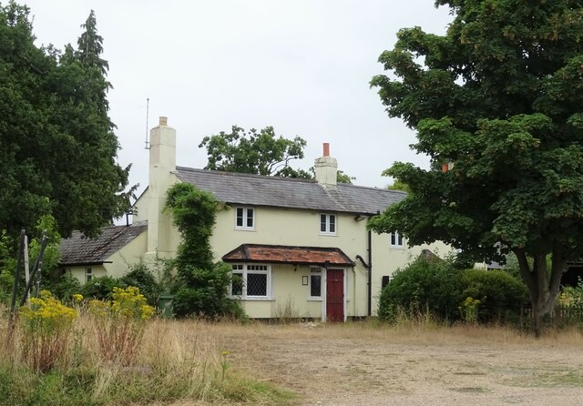
K6 telephone box and bus shelter, Cray's Pond
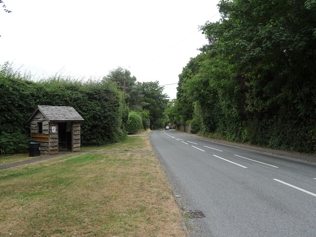
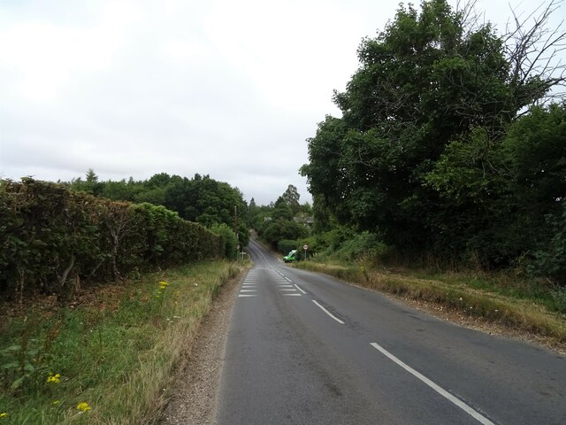
Bus shelter on the B4256, Cray's Pond
B4526, Cray's Pond
B4526, Cray's Pond
The White Lion, Cray's Pond Not currently open (2022).
See <a href="https://www.geograph.org.uk/photo/2829589">SU6380 : The White Lion, Crays Pond</a> for happier times.
The White Lion, Cray's Pond
Not currently open (2022). See SU6380 : The White Lion, Crays Pond for happier times.
Garage and car sales, Cray's Pond
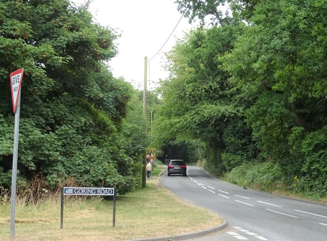
Goring Road The B471 towards Woodcote.
Goring Road
The B471 towards Woodcote.
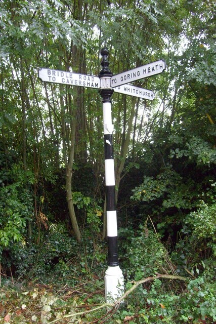
Direction Sign – Signpost on Hardwick Road, Whitchurch-on-Thames Located on the southwest side of the junction of Hardwick Road, Sheepwash Lane and a bridleway to Mapledurham, in Whitchurch-on-Thames parish. 3 arms and pawn finial. See also <a title="https://www.geograph.org.uk/photo/2182449" href="https://www.geograph.org.uk/photo/2182449">Link</a>.

Milestone Society National ID: OX_SU6577
Direction Sign – Signpost on Hardwick Road, Whitchurch-on-Thames
Located on the southwest side of the junction of Hardwick Road, Sheepwash Lane and a bridleway to Mapledurham, in Whitchurch-on-Thames parish. 3 arms and pawn finial. See also Link. Milestone Society National ID: OX_SU6577
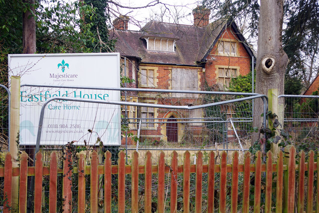
Eastfield House, Pangbourne Surrounded by Heras fencing and boarded up, Eastfield House operated as a care home until its closure in 2016. As is usually the case with derelict properties like this, there is a long history of planning wrangles that are still not resolved. The owner is Majesticare and the house was registered to provide accommodation for 27 residents; the company first applied to demolish the building in 2014 but this was rejected. Despite obtaining permission (on appeal) in 2016 to build an extension that would increase the provision to 45 bedrooms, Majesticare then announced that the building was unsuitable for continued use as a care home for several reasons amongst which was the impossibility of providing en-suite facilities for all of the bedrooms. Their new proposal was for a completely new building in a similar red brick style that would have a larger basement to accommodate a kitchen and laundry. This was again refused by South Oxfordshire District Council on the grounds that it could adversely affect the conservation area and could harm two protected trees on the site. That decision was reported early in 2019 and three years later nothing appears to have happened except that, no doubt, the building is gradually deteriorating. This must surely be an unsatisfactory state of affairs for all concerned.
Eastfield House, Pangbourne
Surrounded by Heras fencing and boarded up, Eastfield House operated as a care home until its closure in 2016. As is usually the case with derelict properties like this, there is a long history of planning wrangles that are still not resolved. The owner is Majesticare and the house was registered to provide accommodation for 27 residents; the company first applied to demolish the building in 2014 but this was rejected. Despite obtaining permission (on appeal) in 2016 to build an extension that would increase the provision to 45 bedrooms, Majesticare then announced that the building was unsuitable for continued use as a care home for several reasons amongst which was the impossibility of providing en-suite facilities for all of the bedrooms. Their new proposal was for a completely new building in a similar red brick style that would have a larger basement to accommodate a kitchen and laundry. This was again refused by South Oxfordshire District Council on the grounds that it could adversely affect the conservation area and could harm two protected trees on the site. That decision was reported early in 2019 and three years later nothing appears to have happened except that, no doubt, the building is gradually deteriorating. This must surely be an unsatisfactory state of affairs for all concerned.
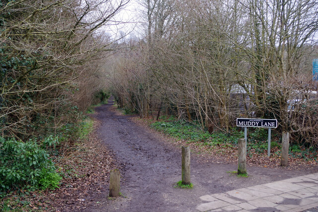
Muddy Lane, Whitchurch-on-Thames No doubt a local name that has been officially adopted, Muddy Lane seems appropriate following a period of heavy rainfall.
Muddy Lane, Whitchurch-on-Thames
No doubt a local name that has been officially adopted, Muddy Lane seems appropriate following a period of heavy rainfall.
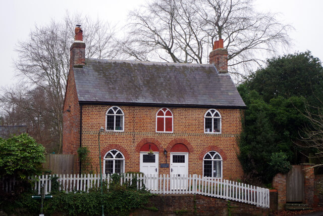
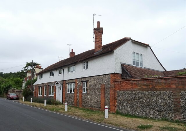
Coombeside Cottage, Whitchurch-on-Thames Somehow reminiscent of a doll's house, this building, originally two cottages now one, is dated by Historic England as 'probably late 18th century' although other sources suggest 1820. The gothic-style windows are a distinctive feature although the one above the doors has been painted on the wall. At one time one of the cottages served as the village post office. It is grade II listed.
Coombeside Cottage, Whitchurch-on-Thames
Somehow reminiscent of a doll's house, this building, originally two cottages now one, is dated by Historic England as 'probably late 18th century' although other sources suggest 1820. The gothic-style windows are a distinctive feature although the one above the doors has been painted on the wall. At one time one of the cottages served as the village post office. It is grade II listed.
House on High Street, Whitchurch-on-Thames
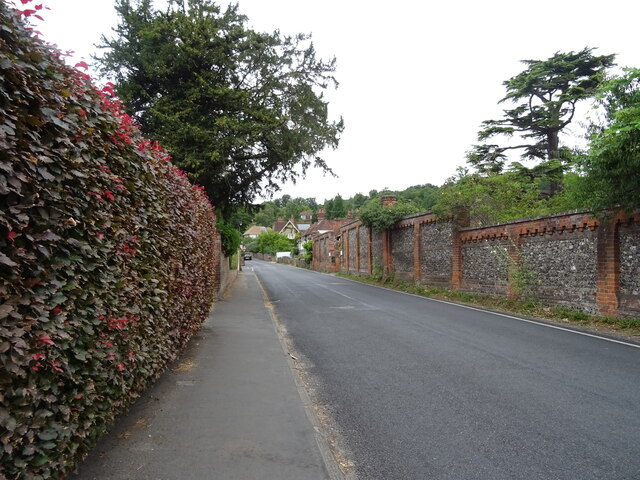
High Street (B471), Whitchurch-on-Thames
War Memorial, Whitchurch-on-Thames
Grazing off the B471
B471 heading north Towards Woodcote.
B471 heading north
Towards Woodcote.
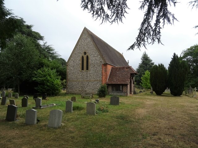
 St John the Baptist Church, Whitchurch Hill
St John the Baptist Church, Whitchurch Hill
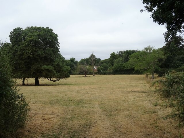
Grazing and woodland, Whitchurch Hill
B471, Whitchurch Hill Heading north towards Woodcote.
B471, Whitchurch Hill
Heading north towards Woodcote.
Show me another place!

Tinepit Pond is located at Grid Ref: SU6379 (Lat: 51.508005, Lng: -1.0823404)

Administrative County: Oxfordshire

District: South Oxfordshire

Police Authority: Thames Valley

What 3 Words

///parkland.decades.success. Near Pangbourne, Berkshire

Related Wikis

Whitchurch Hill

Whitchurch Hill is a village in the Chiltern Hills in Oxfordshire, about 5.5 miles (9 km) northwest of Reading, Berkshire, near Whitchurch-on-Thames. The...

Goring Rural District

Goring was a rural district in Oxfordshire, England from 1894 to 1932. It was formed from that part of the Bradfield rural sanitary district which was...

The Oratory Preparatory School

The Oratory Prep School is a Roman Catholic day and boarding school for some 330 boys and girls aged from two to thirteen, founded in 1925. The school...

Crays Pond

Crays Pond is a hamlet situated in the parish of Goring Heath in South Oxfordshire. Crays Pond is about 2.4 miles (3.9 km) northeast of Goring-on-Thames...

Goring Heath

Goring Heath is a hamlet and civil parish in the Chiltern Hills in South Oxfordshire. The civil parish includes the villages of Whitchurch Hill and Crays...

Hartslock

Hartslock, also known as Hartslock Woods, is a 41.8-hectare (103-acre) biological Site of Special Scientific Interest (SSSI) in a wooded area on the north...

Beale Wildlife Park

Beale Wildlife Park is situated by the River Thames, between the villages of Pangbourne and Lower Basildon in Berkshire, England. It has three main areas...

Whitchurch-on-Thames

Whitchurch-on-Thames is a village and civil parish on the Oxfordshire bank of the River Thames, about 5.5 miles (9 km) northwest of Reading, Berkshire...

Nearby Amenities

Located within 500m of 51.508005,-1.0823404
Whitchurch Hill
Place: village
Wikidata: Q7994201
Wikipedia: en:Whitchurch Hill
Lat/Long: 51.5072399/-1.077644
Barrier: kissing_gate
Lat/Long: 51.5063481/-1.0890312
Barrier: kissing_gate
Foot: yes
Lat/Long: 51.5050447/-1.087694
Bus Stop
Oakdown Close
Bus: yes
Naptan AtcoCode: 340000820CHU
Naptan Bearing: SW
Naptan CommonName: Oakdown Close
Naptan Indicator: Opposite
Naptan Landmark: Oakdown Close
Naptan NaptanCode: oxfapamw
Naptan Street: Village Road
Naptan Verified: no
Public Transport: platform
Source: naptan_import
Lat/Long: 51.5066117/-1.0756909
Oakdown Close
Naptan AtcoCode: 340000820DAR
Naptan Bearing: NE
Naptan BusStopType: CUS
Naptan CommonName: Oakdown Close
Naptan Indicator: Corner
Naptan Landmark: Oakdown Close
Naptan NaptanCode: oxfgmadt
Naptan Street: Village Road
Naptan Verified: no
Source: naptan_import
Lat/Long: 51.5067369/-1.0756019
Bus Stop
Orchard Combe
Bus: yes
Naptan AtcoCode: 340001609BF
Naptan Bearing: SW
Naptan CommonName: Orchard Combe
Naptan Indicator: Opposite
Naptan Landmark: Bus Shelter
Naptan NaptanCode: oxfgdwjp
Naptan Street: Village Road
Naptan Verified: no
Public Transport: platform
Shelter: no
Source: naptan_import
Lat/Long: 51.5048771/-1.0799748
Orchard Combe
Naptan AtcoCode: 340001609CNR
Naptan Bearing: NE
Naptan BusStopType: CUS
Naptan CommonName: Orchard Combe
Naptan Indicator: Corner
Naptan Landmark: Bus Shelter
Naptan NaptanCode: oxfgmadp
Naptan Street: Village Road
Naptan Verified: no
Source: naptan_import
Lat/Long: 51.5048934/-1.0801635
Barrier: kissing_gate
Foot: yes
Lat/Long: 51.5058126/-1.0878696
Barrier: kissing_gate
Foot: yes
Lat/Long: 51.5050524/-1.0862052
Public Building
Goring Heath Parish Hall
Lat/Long: 51.5053114/-1.083222
Power: pole
Lat/Long: 51.5104185/-1.0879093
Power: pole
Lat/Long: 51.5094019/-1.0882822
Power: pole
Lat/Long: 51.5085021/-1.0879201
Power: pole
Lat/Long: 51.5075655/-1.0875392
Power: pole
Lat/Long: 51.5071398/-1.0868767
Power: pole
Lat/Long: 51.5061615/-1.0863644
Power: pole
Lat/Long: 51.5051097/-1.0858038
Direction: 155
Generator Method: photovoltaic
Generator Output Electricity: yes
Generator Solar Modules: 12
Generator Source: solar
Generator Type: solar_photovoltaic_panel
Location: roof
Power: generator
Lat/Long: 51.5094407/-1.0868834
Direction: 150
Generator Method: photovoltaic
Generator Output Electricity: yes
Generator Solar Modules: 42
Generator Source: solar
Generator Type: solar_photovoltaic_panel
Location: roof
Power: generator
Lat/Long: 51.5080772/-1.0869777
Direction: 205
Generator Method: photovoltaic
Generator Output Electricity: yes
Generator Solar Modules: 14
Generator Source: solar
Generator Type: solar_photovoltaic_panel
Location: roof
Power: generator
Lat/Long: 51.5069573/-1.0786881
Direction: 210
Generator Method: photovoltaic
Generator Output Electricity: yes
Generator Solar Modules: 16
Generator Source: solar
Generator Type: solar_photovoltaic_panel
Location: roof
Power: generator
Lat/Long: 51.5081924/-1.07687
Direction: 240
Generator Method: photovoltaic
Generator Output Electricity: yes
Generator Solar Modules: 15
Generator Source: solar
Generator Type: solar_photovoltaic_panel
Location: roof
Power: generator
Lat/Long: 51.5077763/-1.0764463
Direction: 235
Generator Method: photovoltaic
Generator Output Electricity: yes
Generator Solar Modules: 16
Generator Source: solar
Generator Type: solar_photovoltaic_panel
Location: roof
Power: generator
Lat/Long: 51.5079402/-1.0759102
Direction: 235
Generator Method: photovoltaic
Generator Output Electricity: yes
Generator Solar Modules: 21
Generator Source: solar
Generator Type: solar_photovoltaic_panel
Location: roof
Power: generator
Lat/Long: 51.5078704/-1.0761006
Direction: 210
Generator Method: photovoltaic
Generator Output Electricity: yes
Generator Solar Modules: 17
Generator Source: solar
Generator Type: solar_photovoltaic_panel
Location: roof
Power: generator
Lat/Long: 51.508902/-1.0771381
The data included in this document is from www.openstreetmap.org. The data is made available under ODbL.

Have you been to Tinepit Pond?

Leave your review of Tinepit Pond below (or comments, questions and feedback).