Cropston Reservoir

Lake, Pool, Pond, Freshwater Marsh in Leicestershire Charnwood

England

Cropston Reservoir

Castle Hill Country Park, Anstey After a previous day of heavy rain.
Castle Hill Country Park, Anstey Credit: David Howard

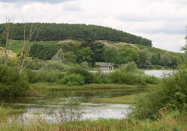
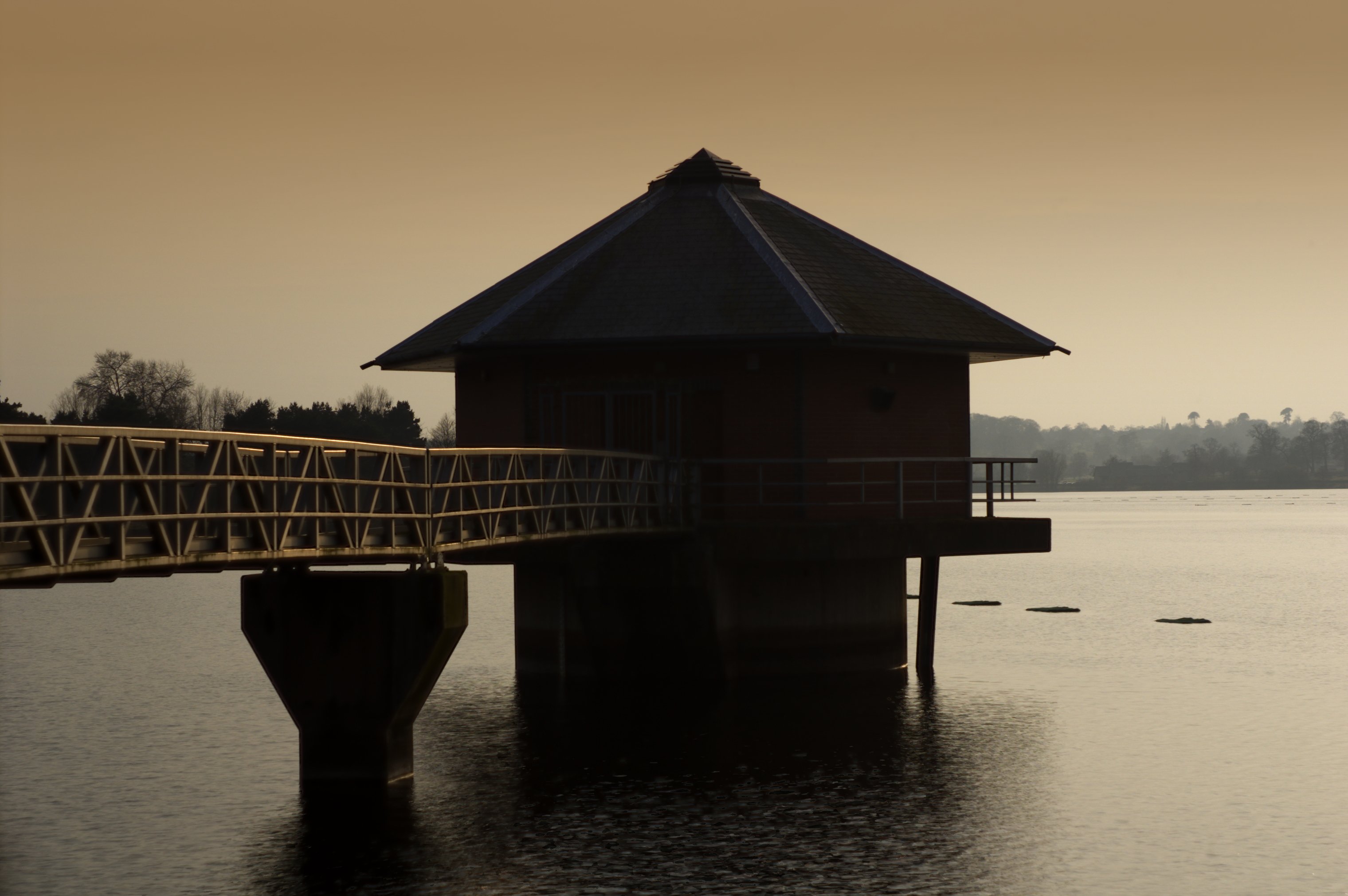
Cropston Reservoir is a picturesque freshwater lake located in Leicestershire, England. Situated in the heart of the Bradgate Park, it covers an area of approximately 50 acres and is a popular destination for nature enthusiasts and outdoor enthusiasts alike.

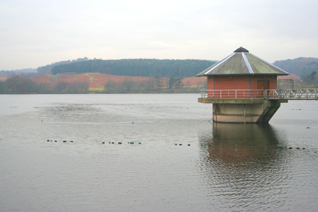
The reservoir was created in the 19th century to supply water to the nearby city of Leicester. It is fed by several natural springs and a small stream called the Linwood Brook. The water is primarily sourced from the surrounding upland areas, resulting in a clear and clean freshwater environment.

Surrounded by rolling hills and dense woodland, Cropston Reservoir offers a tranquil and scenic setting. The shores of the lake are lined with a variety of trees, including oak, ash, and willow, providing a habitat for numerous bird species. It is a designated site of Special Scientific Interest due to its importance for wildlife conservation.

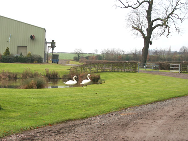
The reservoir is home to a diverse range of flora and fauna, making it a haven for birdwatchers and nature photographers. Visitors can spot a variety of waterfowl, such as grebes, swans, and ducks, as well as other bird species, including kingfishers and herons. The surrounding woodland is inhabited by mammals such as foxes, badgers, and bats.

In addition to its natural beauty, Cropston Reservoir offers a range of recreational activities. Fishing is a popular pastime, with anglers drawn to the lake in search of trout, pike, and perch. The reservoir also provides opportunities for sailing and canoeing, with local clubs offering training and rental services.

Overall, Cropston Reservoir is a valuable natural resource in Leicestershire, providing a habitat for wildlife, recreational opportunities for visitors, and a serene escape from the hustle and bustle of everyday life.

If you have any feedback on the listing, please let us know in the comments section below.

Cropston Reservoir Images

Images are sourced within 2km of 52.693728/-1.1943875 or Grid Reference SK5410. Thanks to Geograph Open Source API. All images are credited.

Castle Hill Country Park, Anstey After a previous day of heavy rain.
Castle Hill Country Park, Anstey
After a previous day of heavy rain.
Castle Hill Country Park, Anstey After a day of heavy rain. I wasn't going any further.
Castle Hill Country Park, Anstey
After a day of heavy rain. I wasn't going any further.
Flood at the entrance to Castle Hill Country Park, Anstey
Large puddle on Anstey Lane By Castle Hill Park which was also flooded.
Large puddle on Anstey Lane
By Castle Hill Park which was also flooded.
Large puddle on Anstey Lane By Castle Hill Park
Large puddle on Anstey Lane
By Castle Hill Park
Anstey Lane towards Thurcaston
New houses on Cropston Road, Anstey I have read there are now no minimum sizes for windows on new houses so many are being made as small as possible to cut costs. <span class="nowrap"><a title="https://www.fromthemurkydepths.co.uk/2021/01/26/smaller-windows-coming-to-new-build-homes-government-consultation-raises-possibility/" rel="nofollow ugc noopener" href="https://www.fromthemurkydepths.co.uk/2021/01/26/smaller-windows-coming-to-new-build-homes-government-consultation-raises-possibility/">Link</a><img style="margin-left:2px;" alt="External link" title="External link - shift click to open in new window" src="https://s1.geograph.org.uk/img/external.png" width="10" height="10"/></span>
New houses on Cropston Road, Anstey
I have read there are now no minimum sizes for windows on new houses so many are being made as small as possible to cut costs. LinkExternal link
Entering Anstey on Cropston Road
St Leonards, Swithland
Bradgate Park Bradgate Park is an ancient deer park and provides a very popular spot for a stroll for the inhabitants of nearby Leicester.
Bradgate Park
Bradgate Park is an ancient deer park and provides a very popular spot for a stroll for the inhabitants of nearby Leicester.
Boathouse and Cropston Reservoir The paths in Bradgate park lead round this reservoir.
Boathouse and Cropston Reservoir
The paths in Bradgate park lead round this reservoir.
All Saints Church, Thurcaston near Leicester
Station Road, Cropston, near Leicester Station Road meets Reservoir Road, Cropston Road and Causeway Lane at this crossroad in the centre of the old village.
Station Road, Cropston, near Leicester
Station Road meets Reservoir Road, Cropston Road and Causeway Lane at this crossroad in the centre of the old village.
Cropston House Farm This farm is on the southern edge of the village
Cropston House Farm
This farm is on the southern edge of the village
Cropston Road, Cropston near Leicester Cropston has grown into a substantial village. These houses are on Waterfield Road.
Cropston Road, Cropston near Leicester
Cropston has grown into a substantial village. These houses are on Waterfield Road.
Cropston Reservoir, near Leicester To the east of Bradgate Park, this Severn Trent reservoir was constructed in 1866 to supply water to Leicester. It is important for wildlife and has an Education Centre. Taken from Reservoir Road on the embankment.
Cropston Reservoir, near Leicester
To the east of Bradgate Park, this Severn Trent reservoir was constructed in 1866 to supply water to Leicester. It is important for wildlife and has an Education Centre. Taken from Reservoir Road on the embankment.
Cropston Reservoir, near Leicester This semi-circular weir in the south east corner is the emergency overflow for the reservoir. It appears that it hasn't been needed for a long time. See <a href="https://www.geograph.org.uk/photo/93663">SK5511 : Reservoir Spillway, Cropston</a>.
Cropston Reservoir, near Leicester
This semi-circular weir in the south east corner is the emergency overflow for the reservoir. It appears that it hasn't been needed for a long time. See SK5511 : Reservoir Spillway, Cropston.
Reservoir Spillway, Cropston This flood overflow doesn't look as if it has been used for several years although the OS map marks it as water. It runs along side the water treatment works between Reservoir Road (which goes along the dam) and Bradgate Road, before joining the stream that feeds Swithland reservoir in <a href="https://www.geograph.org.uk/gridref/SK5613">SK5613</a>. See <a href="https://www.geograph.org.uk/photo/93659">SK5510 : Cropston Reservoir, near Leicester</a>
Reservoir Spillway, Cropston
This flood overflow doesn't look as if it has been used for several years although the OS map marks it as water. It runs along side the water treatment works between Reservoir Road (which goes along the dam) and Bradgate Road, before joining the stream that feeds Swithland reservoir in SK5613. See SK5510 : Cropston Reservoir, near Leicester
Show me another place!

Cropston Reservoir is located at Grid Ref: SK5410 (Lat: 52.693728, Lng: -1.1943875)

Administrative County: Leicestershire

District: Charnwood

Police Authority: Leicestershire

What 3 Words

///hers.fetch.bunch. Near Anstey, Leicestershire

Related Wikis

Cropston Reservoir

Cropston Reservoir (originally known as Bradgate Reservoir) lies in Charnwood Forest in Leicestershire, England. The dam and associated water works are...

Charnwood (UK Parliament constituency)

Charnwood is a constituency in Leicestershire represented in the House of Commons of the UK Parliament since 2015 by Edward Argar, a Conservative. Further...

Cropston

Cropston is a village and former civil parish, now in the parish of Thurcaston and Cropston, part of the Borough of Charnwood in Leicestershire, England...

Bradgate Electoral Division

Bradgate Electoral Division is a County Council electoral division in Leicestershire, England, taking its name from Bradgate Park which is at the centre...

Nearby Amenities

Located within 500m of 52.693728,-1.1943875
Barrier: spikes
Lat/Long: 52.6973767/-1.1987273
The data included in this document is from www.openstreetmap.org. The data is made available under ODbL.

Have you been to Cropston Reservoir?

Leave your review of Cropston Reservoir below (or comments, questions and feedback).