Aldershot Water

Lake, Pool, Pond, Freshwater Marsh in Berkshire

England

Aldershot Water
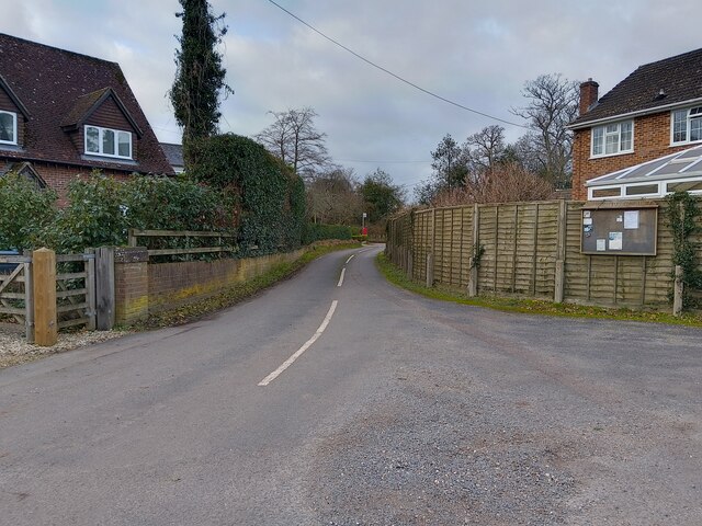
Hyde End Lane
Hyde End Lane Credit: Oscar

Aldershot Water is a picturesque freshwater marsh located in Berkshire, England. Situated amidst lush greenery and rolling hills, this natural gem offers a tranquil escape from the hustle and bustle of city life. With its serene atmosphere and abundant wildlife, it is a popular destination for nature enthusiasts and bird watchers alike.

Covering an area of approximately 20 acres, Aldershot Water is home to a diverse range of flora and fauna. The marsh is characterized by its calm, reflective waters and is surrounded by reed beds and tall grasses that provide a habitat for a variety of aquatic plants, insects, and small mammals. These lush surroundings create an ideal breeding ground for numerous bird species, making it a haven for birdwatchers.

Visitors can explore the marsh through a network of well-maintained walking trails that meander around the water's edge. The trails offer stunning views of the marsh, allowing visitors to observe its inhabitants in their natural habitat. The peaceful ambiance makes it an excellent spot for photography and nature appreciation.

Aldershot Water also attracts anglers who can enjoy a day of fishing in its calm waters. The lake is known for its abundance of freshwater fish, including carp, pike, and roach. Fishing enthusiasts can rent boats or fish directly from the shoreline, making it a popular spot for both beginners and experienced anglers.

Overall, Aldershot Water in Berkshire offers a serene and idyllic setting for nature lovers, birdwatchers, and anglers seeking a retreat in the heart of nature.

If you have any feedback on the listing, please let us know in the comments section below.

Aldershot Water Images

Images are sourced within 2km of 51.391051/-1.2192489 or Grid Reference SU5466. Thanks to Geograph Open Source API. All images are credited.

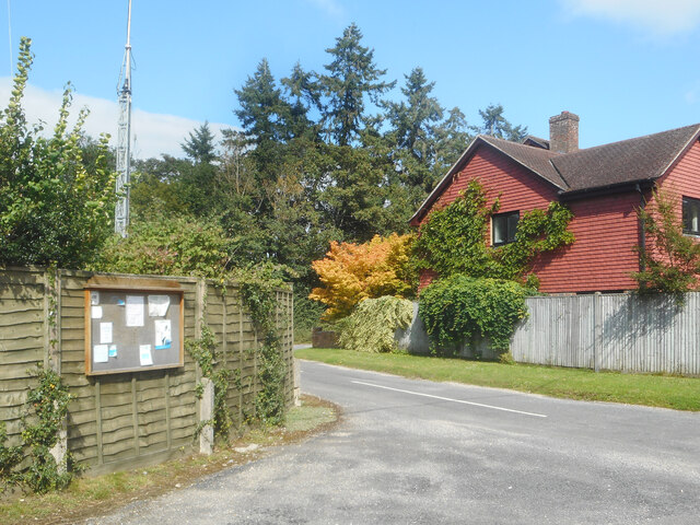
Hyde End Lane
Hyde End Lane
Parish Notices, Hyde End Lane Between Brimpton and Crookham is a group of houses around the junction of Crookham Common Road and Hyde End Lane. A Brimpton Parish Council notice board is on the back fence of a house on the corner.
Parish Notices, Hyde End Lane
Between Brimpton and Crookham is a group of houses around the junction of Crookham Common Road and Hyde End Lane. A Brimpton Parish Council notice board is on the back fence of a house on the corner.
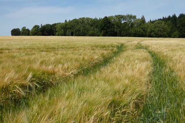
Farmland, Thatcham Spring barley and Blacklands Copse viewed from the footpath to the east of Colthrop Manor.
Farmland, Thatcham
Spring barley and Blacklands Copse viewed from the footpath to the east of Colthrop Manor.
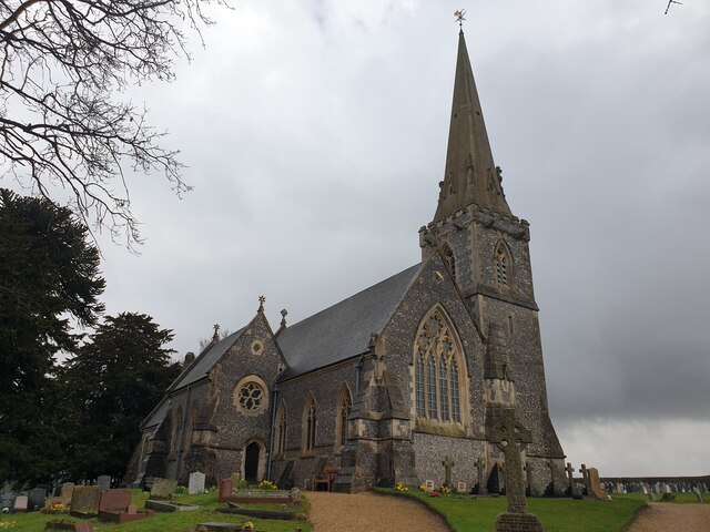
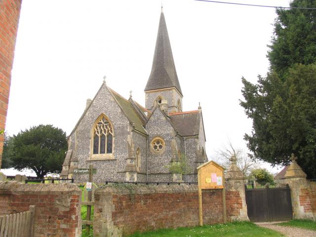
St Matthew's Church St Matthew's Church in Midgham, viewed from the gate by the car park. The church is Grade II listed, list entry number 1303395 <span class="nowrap"><a title="https://historicengland.org.uk/listing/the-list/list-entry/1303395" rel="nofollow ugc noopener" href="https://historicengland.org.uk/listing/the-list/list-entry/1303395">Link</a><img style="margin-left:2px;" alt="External link" title="External link - shift click to open in new window" src="https://s1.geograph.org.uk/img/external.png" width="10" height="10"/></span>
St Matthew's Church
St Matthew's Church in Midgham, viewed from the gate by the car park. The church is Grade II listed, list entry number 1303395 LinkExternal link
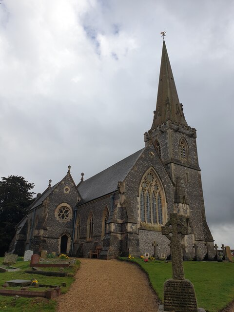
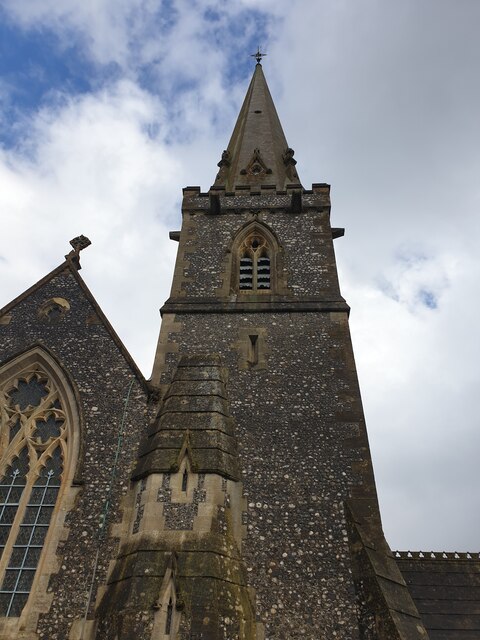
St Matthew's Church tower The tower of St Matthew's Church in Midgham.
St Matthew's Church tower
The tower of St Matthew's Church in Midgham.
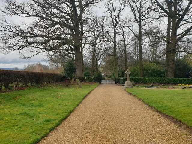
Path at St Matthew's Church The wide gravel path at St Matthew's Church. It leads from the car park to the various entrances.
Path at St Matthew's Church
The wide gravel path at St Matthew's Church. It leads from the car park to the various entrances.
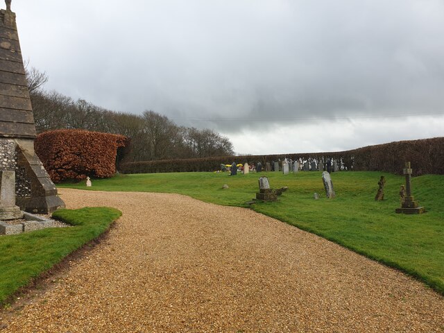
Graveyard at St Matthew's Church The graveyard at St Matthew's Church, viewed from the wide gravel path.
Graveyard at St Matthew's Church
The graveyard at St Matthew's Church, viewed from the wide gravel path.
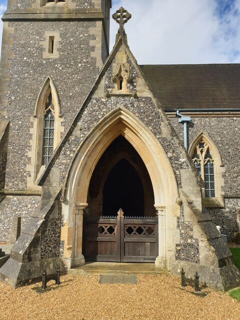
St Matthew's Church porch The porch leading to the main entrance of St Matthew's Church. There is a gate to enter the porch. There is an 'open' sign on one of the window sills in the porch, but the church was not open.
St Matthew's Church porch
The porch leading to the main entrance of St Matthew's Church. There is a gate to enter the porch. There is an 'open' sign on one of the window sills in the porch, but the church was not open.
St Matthew's Church St Matthew's Church in Midgham, viewed from the edge of the graveyard by a hedge. The church is Grade II listed, list entry number 1303395 <span class="nowrap"><a title="https://historicengland.org.uk/listing/the-list/list-entry/1303395" rel="nofollow ugc noopener" href="https://historicengland.org.uk/listing/the-list/list-entry/1303395">Link</a><img style="margin-left:2px;" alt="External link" title="External link - shift click to open in new window" src="https://s1.geograph.org.uk/img/external.png" width="10" height="10"/></span>
St Matthew's Church
St Matthew's Church in Midgham, viewed from the edge of the graveyard by a hedge. The church is Grade II listed, list entry number 1303395 LinkExternal link
Field south of St Matthew's Church A field to the south of St Matthew's Church. Over the slight hill is Bath Road (the A4).
Field south of St Matthew's Church
A field to the south of St Matthew's Church. Over the slight hill is Bath Road (the A4).
Church car park A large area used for parking cars at St Matthew's Church.
Church car park
A large area used for parking cars at St Matthew's Church.
Quaking Bridge A bridge over a small part of the River Kennet on Brimpton Road.
Quaking Bridge
A bridge over a small part of the River Kennet on Brimpton Road.
Corner to Quaking Bridge A corner on Brimpton Road leading to Quaking Bridge.
Corner to Quaking Bridge
A corner on Brimpton Road leading to Quaking Bridge.
Brimpton Road Looking south along Brimpton Road towards Brimpton.
Brimpton Road
Looking south along Brimpton Road towards Brimpton.
Monkey Marsh Lock pillbox The pillbox at Monkey Marsh Lock, dating from WWII. For a view of the lock, see <a href="https://www.geograph.org.uk/photo/7490185">SU5266 : Monkey Marsh Lock</a>
Monkey Marsh Lock pillbox
The pillbox at Monkey Marsh Lock, dating from WWII. For a view of the lock, see SU5266 : Monkey Marsh Lock
Train passes cows Looking from a footbridge over a weir by the Kennet and Avon Canal over a field of cows at a train passing, with electricity pylons overhead.
Train passes cows
Looking from a footbridge over a weir by the Kennet and Avon Canal over a field of cows at a train passing, with electricity pylons overhead.
Show me another place!

Aldershot Water is located at Grid Ref: SU5466 (Lat: 51.391051, Lng: -1.2192489)

Unitary Authority: West Berkshire

Police Authority: Thames Valley

What 3 Words

///coughed.schooling.steaming. Near Thatcham, Berkshire

Related Wikis

Nearby Amenities

Located within 500m of 51.391051,-1.2192489
Bench
Backrest: yes
Lat/Long: 51.392499/-1.2188186
Power: tower
Lat/Long: 51.3902019/-1.2212207
Power: tower
Lat/Long: 51.3895391/-1.2179054
Power: tower
Lat/Long: 51.3876913/-1.2149765
Barrier: yes
Lat/Long: 51.3939745/-1.2217583
Power: pole
Lat/Long: 51.3895792/-1.2228406
Power: pole
Lat/Long: 51.3891491/-1.2207511
Power: pole
Lat/Long: 51.3887323/-1.2187824
Power: pole
Lat/Long: 51.3883038/-1.2167841
Power: pole
Lat/Long: 51.3878318/-1.2146115
Barrier: bollard
Lat/Long: 51.3935799/-1.2250421
Bench
Backrest: yes
Lat/Long: 51.3929307/-1.2210731
Power: pole
Lat/Long: 51.3900224/-1.224859
Power: pole
Lat/Long: 51.3891612/-1.2251083
Power: pole
Lat/Long: 51.3893043/-1.223439
Power: pole
Lat/Long: 51.3894404/-1.2217982
Material: wood
Power: pole
Lat/Long: 51.3894368/-1.220273
Material: wood
Power: pole
Lat/Long: 51.3894223/-1.2188641
Power: pole
Lat/Long: 51.3894273/-1.2173406
Material: wood
Power: pole
Lat/Long: 51.389429/-1.2157313
Power: pole
Lat/Long: 51.3894323/-1.2141488
Power: pole
Lat/Long: 51.3894307/-1.2125797
The data included in this document is from www.openstreetmap.org. The data is made available under ODbL.

Have you been to Aldershot Water?

Leave your review of Aldershot Water below (or comments, questions and feedback).