Loch of Papil

Lake, Pool, Pond, Freshwater Marsh in Shetland

Scotland

Loch of Papil

Waves in Bluemull Sound from Westing
Waves in Bluemull Sound from Westing Credit: Mike Pennington

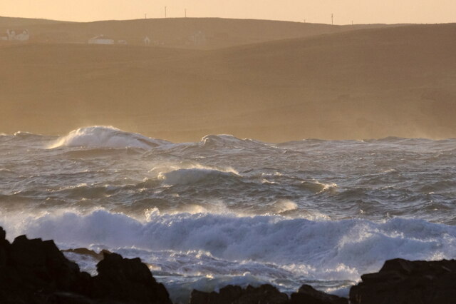
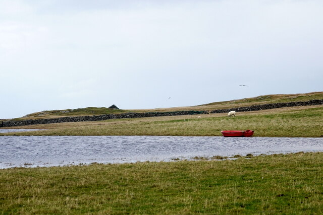
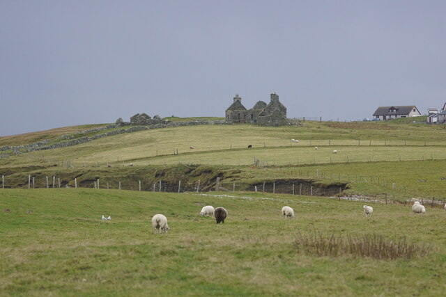
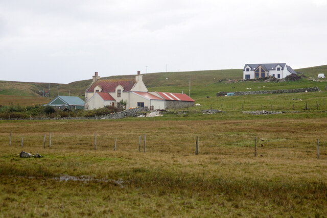
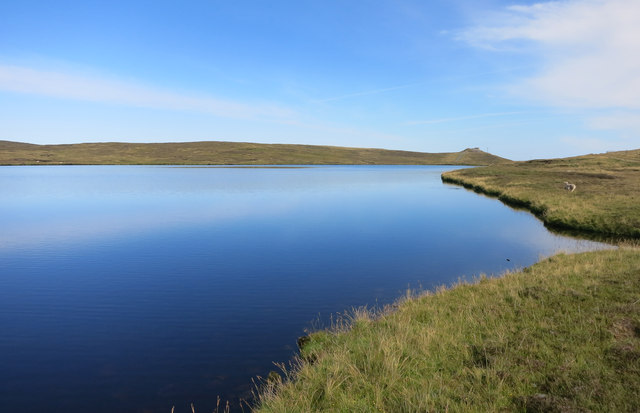
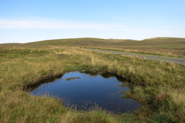
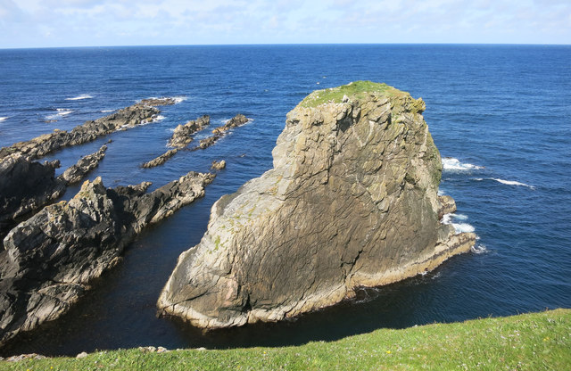
Loch of Papil is a picturesque freshwater loch located in the southern part of the Shetland Islands, Scotland. Nestled amidst rolling hills and heather-covered moorlands, this tranquil body of water covers an area of approximately 15 hectares. Surrounded by a diverse range of vegetation, the loch serves as an important habitat for various bird species and other wildlife.

The loch is characterized by its shallow depth, with an average depth of around 2 meters and a maximum depth of 4 meters. It is primarily fed by small streams and rainfall, ensuring a constant supply of freshwater. The water is generally clear and supports a rich ecosystem, providing a breeding ground for a variety of aquatic plants.

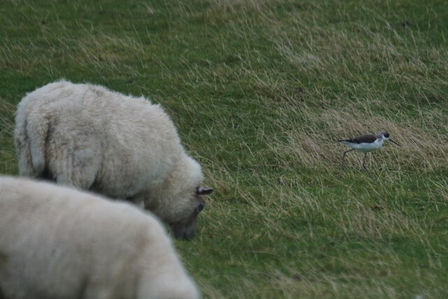
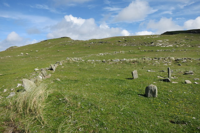
The vegetation around Loch of Papil is diverse and includes reed beds, rushes, and sedges, which create a freshwater marsh habitat. This marshland provides an ideal environment for numerous bird species, such as the red-throated diver, tufted duck, and teal, to name a few. The loch is also frequented by wading birds, including curlews and oystercatchers.

A popular spot for birdwatching enthusiasts, Loch of Papil offers fantastic opportunities to observe and appreciate the diverse avian life that calls this loch home. Additionally, the loch provides a picturesque setting for leisurely walks, picnics, and photography, attracting both locals and visitors alike.

Overall, Loch of Papil is a scenic freshwater loch nestled in the beautiful Shetland Islands, offering a peaceful retreat for nature lovers and an important habitat for a variety of bird species and other wildlife.

If you have any feedback on the listing, please let us know in the comments section below.

Loch of Papil Images

Images are sourced within 2km of 60.717598/-1.0107947 or Grid Reference HP5404. Thanks to Geograph Open Source API. All images are credited.

Waves in Bluemull Sound from Westing
Loch of Papil, Cullivoe
Backhouse, Cullivoe
Backhouse, Cullivoe
Houses at Cullivoe
Houses at Cullivoe
Black-winged Pratincole (Himantopus himantopus), feeding with sheep, Papil, Cullivoe Looking rather incongruous feeding in a field and a long way from the Mediterranean.
Black-winged Pratincole (Himantopus himantopus), feeding with sheep, Papil, Cullivoe
Looking rather incongruous feeding in a field and a long way from the Mediterranean.
Lamba Stack, Blue Mull, from the sea
Blue Mull from the sea
Geo south of Lamba Stack, Blue Mull
Fence and Grass The cliff edge is just at the top here.
Fence and Grass
The cliff edge is just at the top here.
Rocky Coast at Brei Wick
Loch of Brough
Loch of Brough
Small Pool by the Old Road Moorland scenery at the Cullivoe end of the track between there and Sellafirth.
Small Pool by the Old Road
Moorland scenery at the Cullivoe end of the track between there and Sellafirth.
Sheep in the Seaweed There were quite a few sheep down on the rocks here tucking into this stuff.
Sheep in the Seaweed
There were quite a few sheep down on the rocks here tucking into this stuff.
Rocky Shore, Ness of Houlland On one side of the Ness of Houlland is the beautiful Breckon Sands beach. On the other side, the shoreline reverts to being less hospitable. 
The orange thing is some of the assorted fishing debris that washes up from time to time.
Rocky Shore, Ness of Houlland
On one side of the Ness of Houlland is the beautiful Breckon Sands beach. On the other side, the shoreline reverts to being less hospitable. The orange thing is some of the assorted fishing debris that washes up from time to time.
Site of a Settlement, Ness of Houlland This is the site of a big area of archaeological remains. This view shows the large enclosure at the centre of the site. Closer to, the outlines of huts and buildings are easy to find.
Some of it has already vanished into the sea from erosion.
Site of a Settlement, Ness of Houlland
This is the site of a big area of archaeological remains. This view shows the large enclosure at the centre of the site. Closer to, the outlines of huts and buildings are easy to find. Some of it has already vanished into the sea from erosion.
Ancient Walls Part of a large settlement site near the Sands of Breckon.
Ancient Walls
Part of a large settlement site near the Sands of Breckon.
Birrier Stack A small island with a spot height of 23 metres marked on the map.
It looks like it should be more, somehow.
Birrier Stack
A small island with a spot height of 23 metres marked on the map. It looks like it should be more, somehow.
Show me another place!

Loch of Papil is located at Grid Ref: HP5404 (Lat: 60.717598, Lng: -1.0107947)

Unitary Authority: Shetland Islands

Police Authority: Highlands and Islands

What 3 Words

///potions.customers.salad. Near Gutcher, Shetland Islands

Related Wikis

Cullivoe

Cullivoe (Old Norse: Kollavágr - Bay of Kolli), is a village on Yell in the Shetland Islands. It is in the north east of the island, near Bluemull Sound...

St Olaf's Church, Unst

St Olaf's Church, Unst is a ruined medieval church located on the island of Unst, in Shetland, Scotland, UK. The church was built in the Celtic style,...

Brough Holm

Brough Holm is a small island off Unst, in the North Isles of Shetland. It is off Westing, which as the name implies is on the west coast of Unst. The...

Gloup

Note: Gloup is common in Scottish placenames referring to a sea jet. Gloup is a village in the far north of the island of Yell in the Shetland Islands...

Society of Our Lady of the Isles

The Society of Our Lady of the Isles (SOLI) is a small Anglican religious order for women, founded in the late 20th century. It is located in Shetland...

Bluemull Sound

Bluemull Sound is the strait between Unst and Yell in Shetland's North Isles. A ferry service crosses it regularly. Cullivoe is on the Yell side, and the...

Belmont House, Shetland

Belmont House is a neo classical Georgian Country House Estate on the island of Unst, the most northerly of the Shetland Islands, [United Kingdom] and...

Belmont, Shetland

Belmont is a settlement and ferry terminal in southern Unst in the Shetland Islands. The ferry crosses from here to Gutcher in Yell and to Hamars Ness...

Nearby Amenities

Located within 500m of 60.717598,-1.0107947
Police
Source: OS OpenData StreetView
Lat/Long: 60.7162412/-1.01744
Passing Place
Lat/Long: 60.7167001/-1.0180989
Post Box
Operator: Royal Mail
Ref: ZE2 40
Lat/Long: 60.7163835/-1.0176669
Turning Circle
Lat/Long: 60.7170248/-1.0155104
Bus Stop
Bus: yes
Public Transport: platform
Shelter: yes
Lat/Long: 60.7164669/-1.0170863
Power: pole
Lat/Long: 60.7202108/-1.0175122
Power: pole
Lat/Long: 60.7199983/-1.0168792
Power: pole
Lat/Long: 60.7197543/-1.0161416
Power: pole
Lat/Long: 60.7195444/-1.0155113
Power: pole
Lat/Long: 60.7193831/-1.0150178
Power: pole
Lat/Long: 60.7163851/-1.0054853
Power: pole
Lat/Long: 60.7163595/-1.0062966
Power: pole
Lat/Long: 60.7147802/-1.0173025
Power: pole
Lat/Long: 60.715595/-1.01837
Power: pole
Lat/Long: 60.7161867/-1.0162779
Power: pole
Lat/Long: 60.7163769/-1.0187536
Power: pole
Lat/Long: 60.7171759/-1.0191264
Power: pole
Lat/Long: 60.7178633/-1.0194563
Power: pole
Lat/Long: 60.7184471/-1.0197514
Power: pole
Lat/Long: 60.714476/-1.0139526
Power: pole
Lat/Long: 60.7142044/-1.0134966
Power: pole
Lat/Long: 60.7143028/-1.0126678
Power: pole
Lat/Long: 60.7139919/-1.0131372
Power: pole
Lat/Long: 60.713488/-1.0138748
Power: pole
Lat/Long: 60.7146046/-1.0121582
Power: pole
Lat/Long: 60.7160924/-1.0148699
Power: pole
Lat/Long: 60.7161462/-1.0155646
Power: pole
Lat/Long: 60.7165922/-1.0167448
Power: pole
Lat/Long: 60.716692/-1.0158569
Power: pole
Lat/Long: 60.7165017/-1.0176674
Power: pole
Lat/Long: 60.7167825/-1.0149074
Bay of Brough
Natural: bay
Source: OS Open Names
Lat/Long: 60.7216697/-1.0101539
Power: pole
Lat/Long: 60.71624/-1.0170185
Power: pole
Lat/Long: 60.7164693/-1.016848
Power: pole
Lat/Long: 60.7163393/-1.0070257
Power: pole
Lat/Long: 60.7163148/-1.0077867
Power: pole
Lat/Long: 60.7162786/-1.0091945
Power: pole
Lat/Long: 60.7162333/-1.0105359
Power: pole
Lat/Long: 60.7164736/-1.0124164
Power: pole
Lat/Long: 60.7166502/-1.0138706
The data included in this document is from www.openstreetmap.org. The data is made available under ODbL.

Have you been to Loch of Papil?

Leave your review of Loch of Papil below (or comments, questions and feedback).