Black Pool
Lake, Pool, Pond, Freshwater Marsh in Nottinghamshire Rushcliffe
England
Black Pool

Black Pool is a natural freshwater lake located in the county of Nottinghamshire, England. Situated in the heart of Sherwood Forest, it is a popular destination for nature lovers and outdoor enthusiasts alike. The pool covers an area of approximately 1.5 hectares and is surrounded by dense woodland, providing a serene and tranquil setting.
The pool itself is believed to have been formed during the last Ice Age, as a result of glacial activity. It is fed by natural springs and rainwater runoff, ensuring a constant supply of fresh water. The water is remarkably clear, allowing visitors to observe the diverse aquatic flora and fauna that call the pool home.
Black Pool is known for its rich biodiversity, supporting a wide range of plant and animal species. The surrounding marshland provides a suitable habitat for various wetland plants, including reeds, sedges, and water lilies. This, in turn, attracts a plethora of insects, amphibians, and birds, making it a haven for birdwatching enthusiasts.
The pool is also home to several species of fish, such as perch, roach, and pike, making it a popular spot for anglers. Fishing is permitted with the appropriate licensing and regulations.
Visitors to Black Pool can enjoy picturesque walks around the pool, taking in the scenic beauty of the surrounding forest. The area is well-maintained, with designated paths and picnic areas for visitors to relax and enjoy the peaceful ambiance. Overall, Black Pool offers a unique and captivating natural experience for those seeking a retreat into the beauty of Nottinghamshire's countryside.
If you have any feedback on the listing, please let us know in the comments section below.
Black Pool Images
Images are sourced within 2km of 52.833717/-1.2623087 or Grid Reference SK4926. Thanks to Geograph Open Source API. All images are credited.


Black Pool is located at Grid Ref: SK4926 (Lat: 52.833717, Lng: -1.2623087)
Administrative County: Nottinghamshire
District: Rushcliffe
Police Authority: Nottinghamshire
What 3 Words
///sprouting.screening.swear. Near Kegworth, Leicestershire
Nearby Locations
Related Wikis

Kegworth railway station
Kegworth railway station located in Nottinghamshire was a station serving the villages of Kegworth, Leicestershire, Sutton Bonington, and Kingston on...

Sutton Bonington weather station
The Sutton Bonington weather station is a functioning weather station located in Sutton Bonington, Nottinghamshire in England. The weather station is located...
University Farm (Nottinghamshire)
University Farm is a 445 hectare (4.45 km2) commercial research farm attached to the Sutton Bonington Campus of the University of Nottingham, England....
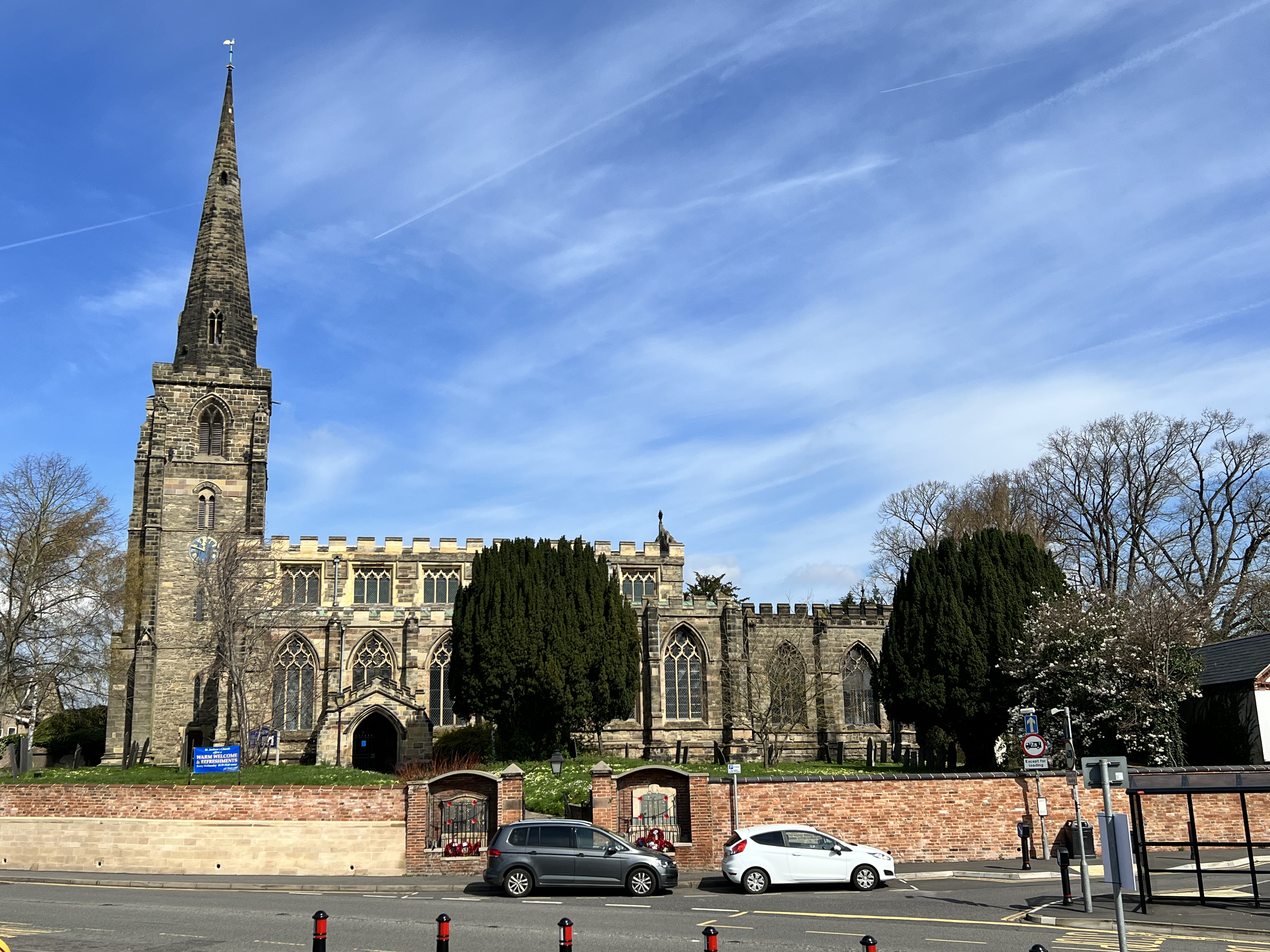
St Andrew's Church, Kegworth
St Andrew's Church, Kegworth is a Grade II* listed Church of England church in Kegworth, Leicestershire. == History == The church has existed since at...
Nearby Amenities
Located within 500m of 52.833717,-1.2623087Have you been to Black Pool?
Leave your review of Black Pool below (or comments, questions and feedback).