Lochs of Beosetter

Lake, Pool, Pond, Freshwater Marsh in Shetland

Scotland

Lochs of Beosetter

View across Gunnista churchyard to Aith Voe Gunnista is a little settlement at the north of the island of Bressay. There is a walled churchyard here for the long vanished St Ola's Church. The graveyard contains a notable mausoleum and gravestones many of them quite recent. Beyond the land can be seen the landward end of Aith Voe, an inlet that curls round southeastwards from the north, and beyond that the land is the southern end of Aith Ness. For photographs of the mausoleum and churchyard, see <a href="https://www.geograph.org.uk/photo/2707684">HU5043 : Churchyard and Mausoleum, Gunnista</a> <a href="https://www.geograph.org.uk/photo/2707683">HU5043 : Gunnista Mausoleum</a>
View across Gunnista churchyard to Aith Voe Credit: Rob Farrow

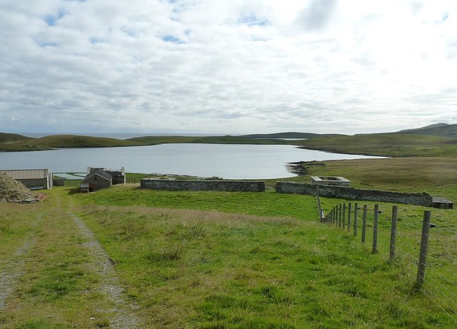
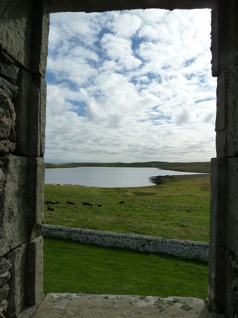
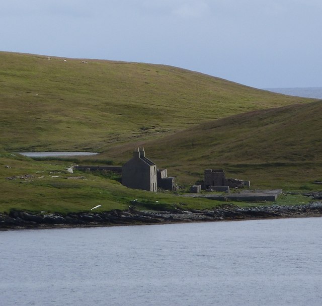
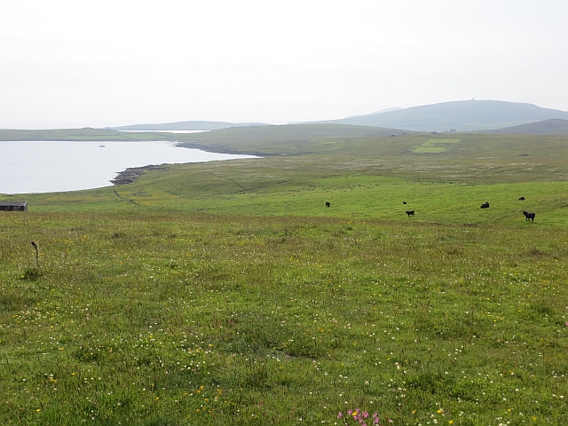
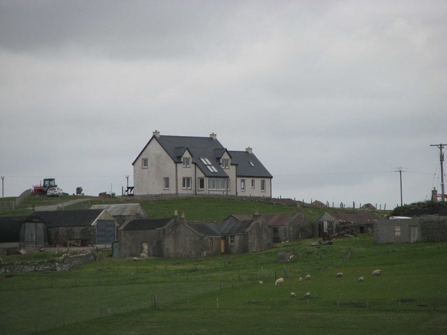
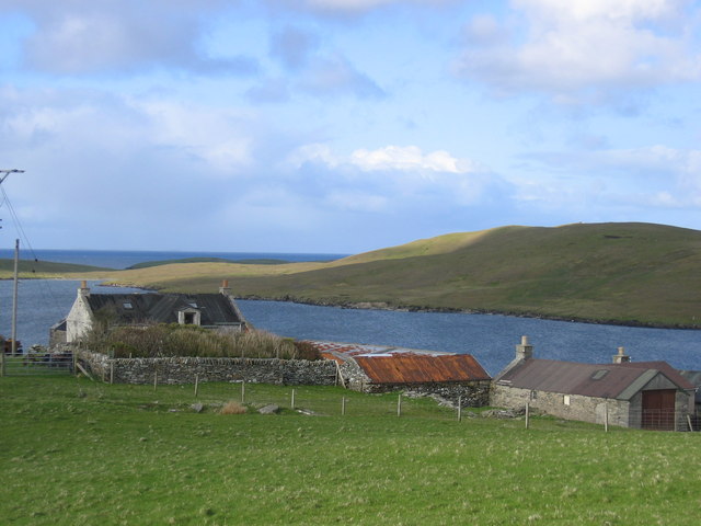
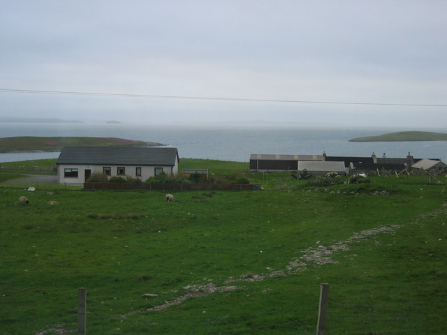
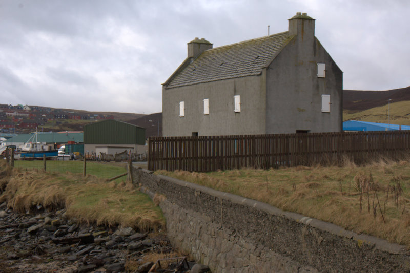
The Lochs of Beosetter, located in the Shetland Islands, Scotland, is a series of freshwater bodies comprising lakes, pools, ponds, and a freshwater marsh. These interconnected water features form a picturesque landscape that attracts both locals and visitors alike.

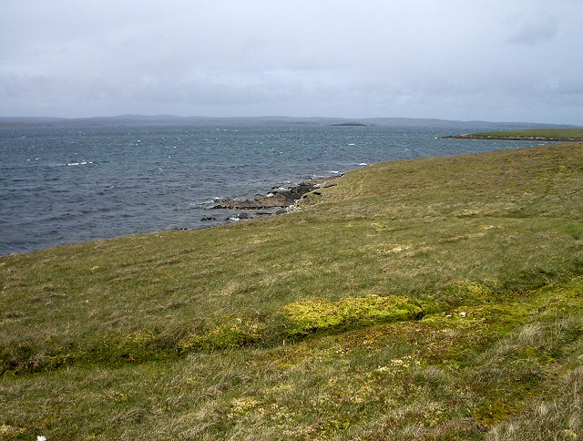
The Lochs of Beosetter are surrounded by stunning natural beauty, with rolling hills and rocky outcrops providing a scenic backdrop. The area is rich in biodiversity, supporting a diverse range of plant and animal species. The freshwater marsh, in particular, serves as a haven for various wetland plants and provides a valuable habitat for numerous bird species.

The lakes, pools, and ponds within the Lochs of Beosetter offer opportunities for various recreational activities. Fishing enthusiasts can enjoy angling for trout and other freshwater fish species, while birdwatchers can observe a multitude of bird species, including waders, waterfowl, and raptors. The tranquil waters also provide an ideal setting for boating, kayaking, and canoeing.

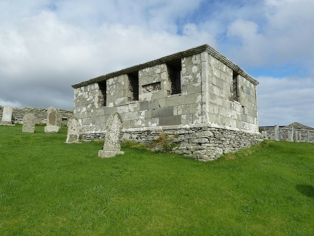
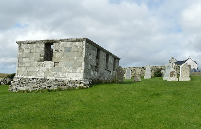
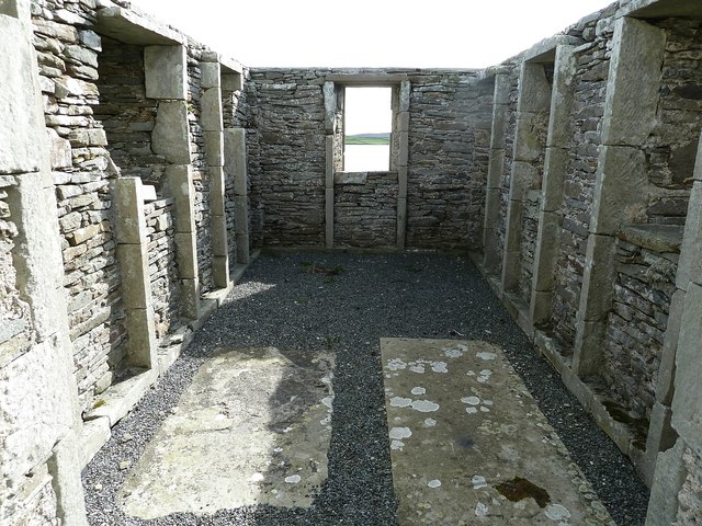
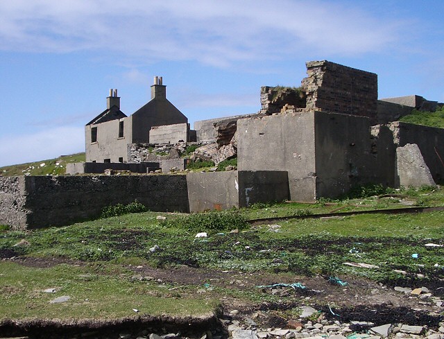
The Lochs of Beosetter are not only a natural gem but also hold historical significance. The surrounding area contains archaeological remains, including ancient settlements and standing stones, providing glimpses into the lives of the people who once inhabited these lands.

Visitors to the Lochs of Beosetter can enjoy the serenity and beauty of the Scottish countryside, explore the diverse flora and fauna, and immerse themselves in the rich history of the region. Whether it's fishing, birdwatching, or simply taking in the breathtaking scenery, Lochs of Beosetter offers a tranquil escape for nature lovers and history enthusiasts alike.

If you have any feedback on the listing, please let us know in the comments section below.

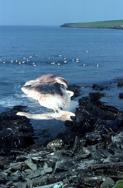
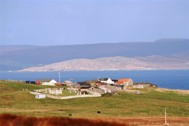
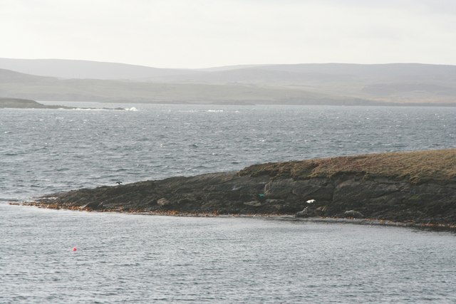
Lochs of Beosetter Images

Images are sourced within 2km of 60.176558/-1.1181851 or Grid Reference HU4943. Thanks to Geograph Open Source API. All images are credited.

View across Gunnista churchyard to Aith Voe Gunnista is a little settlement at the north of the island of Bressay. There is a walled churchyard here for the long vanished St Ola's Church. The graveyard contains a notable mausoleum and gravestones many of them quite recent. Beyond the land can be seen the landward end of Aith Voe, an inlet that curls round southeastwards from the north, and beyond that the land is the southern end of Aith Ness. For photographs of the mausoleum and churchyard, see <a href="https://www.geograph.org.uk/photo/2707684">HU5043 : Churchyard and Mausoleum, Gunnista</a> <a href="https://www.geograph.org.uk/photo/2707683">HU5043 : Gunnista Mausoleum</a>
View across Gunnista churchyard to Aith Voe
Gunnista is a little settlement at the north of the island of Bressay. There is a walled churchyard here for the long vanished St Ola's Church. The graveyard contains a notable mausoleum and gravestones many of them quite recent. Beyond the land can be seen the landward end of Aith Voe, an inlet that curls round southeastwards from the north, and beyond that the land is the southern end of Aith Ness. For photographs of the mausoleum and churchyard, see HU5043 : Churchyard and Mausoleum, Gunnista HU5043 : Gunnista Mausoleum
Gunnista Mausoleum This small mausoleum in the churchyard of the now vanished St Ola's Church was built for the Hendersons of Gardie. St Ola's was the parish church for the island of Bressay until the 1720s when a new church was built at Mail on the west of the island. The old church fell into ruin and was demolished. The mausoleum dates from the C18th and may stand where the old church once stood.
Gunnista Mausoleum
This small mausoleum in the churchyard of the now vanished St Ola's Church was built for the Hendersons of Gardie. St Ola's was the parish church for the island of Bressay until the 1720s when a new church was built at Mail on the west of the island. The old church fell into ruin and was demolished. The mausoleum dates from the C18th and may stand where the old church once stood.
Churchyard and Mausoleum, Gunnista The churchyard of the vanished St Ola's church, once the parish church for the island of Bressay contains the Henderson Mausoleum and a number of more recent headstones. Information about the Hendersons of Gardie here <span class="nowrap"><a title="http://shetlopedia.com/Henderson_of_Gardie_-_Grant%27s_County_Families" rel="nofollow ugc noopener" href="http://shetlopedia.com/Henderson_of_Gardie_-_Grant%27s_County_Families">Link</a><img style="margin-left:2px;" alt="External link" title="External link - shift click to open in new window" src="https://s1.geograph.org.uk/img/external.png" width="10" height="10"/></span>
Churchyard and Mausoleum, Gunnista
The churchyard of the vanished St Ola's church, once the parish church for the island of Bressay contains the Henderson Mausoleum and a number of more recent headstones. Information about the Hendersons of Gardie here LinkExternal link
Inside the Henderson Mausoleum at Gunnista The rectangular mausoleum in the churchyard of the former St Ola's church at Gunnista was built for the Hendersons of Gardie. see <span class="nowrap"><a title="http://shetlopedia.com/Henderson_of_Gardie_-_Grant%27s_County_Families" rel="nofollow ugc noopener" href="http://shetlopedia.com/Henderson_of_Gardie_-_Grant%27s_County_Families">Link</a><img style="margin-left:2px;" alt="External link" title="External link - shift click to open in new window" src="https://s1.geograph.org.uk/img/external.png" width="10" height="10"/></span>
Inside the Henderson Mausoleum at Gunnista
The rectangular mausoleum in the churchyard of the former St Ola's church at Gunnista was built for the Hendersons of Gardie. see LinkExternal link
A tomb with a view A view through the eastern window of the Henderson Mausoleum in the churchyard of the long-demolished church of St Ola at Gunnista on Bressay. Through the window can be seen the landward end of Aith Voe. Information on the Henderson family of Gardie here <span class="nowrap"><a title="http://shetlopedia.com/Henderson_of_Gardie_-_Grant%27s_County_Families" rel="nofollow ugc noopener" href="http://shetlopedia.com/Henderson_of_Gardie_-_Grant%27s_County_Families">Link</a><img style="margin-left:2px;" alt="External link" title="External link - shift click to open in new window" src="https://s1.geograph.org.uk/img/external.png" width="10" height="10"/></span>
A tomb with a view
A view through the eastern window of the Henderson Mausoleum in the churchyard of the long-demolished church of St Ola at Gunnista on Bressay. Through the window can be seen the landward end of Aith Voe. Information on the Henderson family of Gardie here LinkExternal link
Ruin across Aith Voe from Gunnista Looking across Aith Voe from the churchyard at Gunnista, the ruins of a building which I believe was a factory involved in the herring industry. It has a large concrete "courtyard" in front of it, presumably for dealing with the landed catch. Beyond the ruined building can be glimpsed a little of the small Loch of Aithness. It seems there were several quarries on Aith Ness which I think produced slate.
Ruin across Aith Voe from Gunnista
Looking across Aith Voe from the churchyard at Gunnista, the ruins of a building which I believe was a factory involved in the herring industry. It has a large concrete "courtyard" in front of it, presumably for dealing with the landed catch. Beyond the ruined building can be glimpsed a little of the small Loch of Aithness. It seems there were several quarries on Aith Ness which I think produced slate.
Gunnista croftland Northern Bressay.
Gunnista croftland
Northern Bressay.
Gunnista
Gunnista
Gunnista
Gunnista
Gunnista looking North
Ruin on the shore of Aith Voe This was a major location in the herring industry.
Ruin on the shore of Aith Voe
This was a major location in the herring industry.
Entrance to Aith Voe Looking just east of the Holm of Gunnista
Entrance to Aith Voe
Looking just east of the Holm of Gunnista
Dead whale in Aith Voe, Bressay A long dead Sperm Whale, with Fulmars.
Dead whale in Aith Voe, Bressay
A long dead Sperm Whale, with Fulmars.
Gunnista Gunnista Township from south east
Gunnista
Gunnista Township from south east
Seals on the point at the north side of Elvis Voe
Shoreline on west side of AithNess looking in the direction of Elvis Voe
Holm of Gunnista
Holm of Gunnista
Gunnista Crubs on west shore of Aith Voe
Show me another place!

Lochs of Beosetter is located at Grid Ref: HU4943 (Lat: 60.176558, Lng: -1.1181851)

Unitary Authority: Shetland Islands

Police Authority: Highlands and Islands

What 3 Words

///dial.crashing.lyricist. Near Lerwick, Shetland Islands

Related Wikis

Gardie House

Gardie House is an 18th-century estate house on Bressay in Shetland, Scotland. Located opposite Lerwick, across the Bressay Sound, Gardie is described...
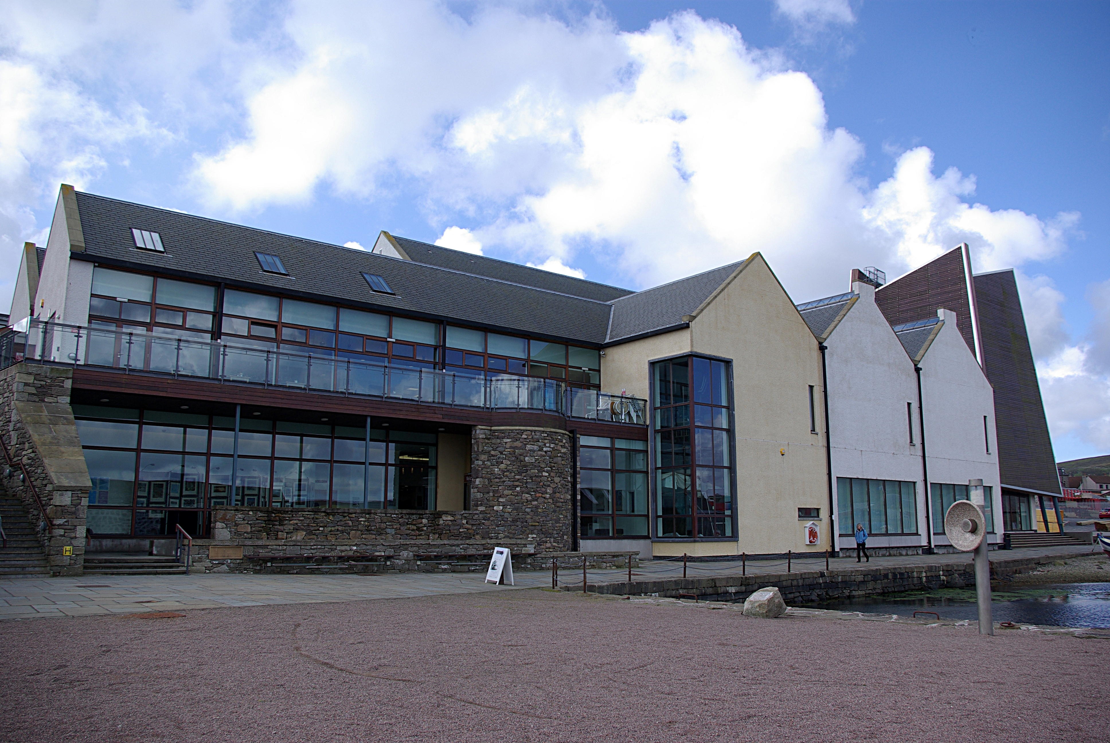
Mareel

Mareel is a multi-purpose entertainment venue located on the waterfront of Lerwick, the capital of Shetland. Opening in 2012, the facility includes a music...

Shetland Museum

The Shetland Museum and Archives is a museum in Lerwick, Shetland, Scotland. The new Shetland Museum at Hay's Dock was officially opened on 31 May 2007...

Böd of Gremista

The Böd of Gremista, situated at the north end of Lerwick, Shetland, Scotland, is a typical 18th century Shetland fishing booth (or böd). It is protected...

Nearby Amenities

Located within 500m of 60.176558,-1.1181851
Power: pole
Lat/Long: 60.1725919/-1.1214509
Power: pole
Lat/Long: 60.172643/-1.1203867
Power: pole
Lat/Long: 60.1727121/-1.1190141
Power: pole
Lat/Long: 60.1727551/-1.1180887
Power: pole
Lat/Long: 60.1728583/-1.1160247
Power: pole
Source: bing
Lat/Long: 60.1729241/-1.114601
Power: pole
Source: bing
Lat/Long: 60.1731272/-1.1133741
Power: pole
Source: bing
Lat/Long: 60.1733312/-1.1121605
Beosetter
Place: hamlet
Lat/Long: 60.1785341/-1.1124847
Power: pole
Lat/Long: 60.1784309/-1.1178343
Power: pole
Lat/Long: 60.1782861/-1.1171156
Power: pole
Lat/Long: 60.1780413/-1.1159046
Power: pole
Lat/Long: 60.1778907/-1.1151327
Power: pole
Lat/Long: 60.177677/-1.1141135
Power: pole
Lat/Long: 60.1775494/-1.1134641
Power: pole
Lat/Long: 60.1773195/-1.1123571
Power: pole
Lat/Long: 60.1780712/-1.1125512
Power: pole
Lat/Long: 60.1765541/-1.1121514
Power: pole
Lat/Long: 60.1760127/-1.1120104
Power: pole
Lat/Long: 60.1753736/-1.1118464
Power: pole
Lat/Long: 60.1748679/-1.1109635
Power: pole
Lat/Long: 60.1744966/-1.110328
The data included in this document is from www.openstreetmap.org. The data is made available under ODbL.

Have you been to Lochs of Beosetter?

Leave your review of Lochs of Beosetter below (or comments, questions and feedback).