Great Ponton

Settlement in Lincolnshire South Kesteven

England

Great Ponton

Green Lane, south-west of Great Ponton The northern part of a very pleasant bridleway from Stoke Rochford to Great Ponton.
Green Lane, south-west of Great Ponton Credit: Tim Heaton

Great Ponton is a small village located in the county of Lincolnshire, England. Situated approximately 5 miles south of Grantham, it falls within the South Kesteven district. The village is nestled on the banks of the River Witham and is surrounded by picturesque countryside.

With a population of around 500 residents, Great Ponton has a close-knit community feel. The village is primarily residential, with a mix of traditional stone cottages and more modern houses. The local parish church, St. Guthlac's, is a prominent feature of the village, dating back to the 13th century and showcasing beautiful architecture.

The village offers a range of amenities for its residents, including a primary school and a village hall, which serves as a hub for various community activities. The nearby market town of Grantham provides additional amenities such as supermarkets, shops, and leisure facilities.

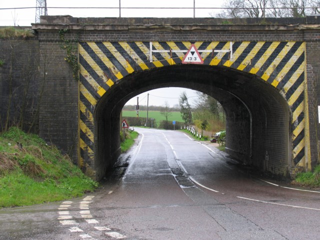
Great Ponton is well-connected to the surrounding areas, with easy access to major road networks. The A1 road runs close by, linking the village to larger cities such as Nottingham and Peterborough. The village also benefits from good public transport links, with regular bus services to Grantham and other nearby towns.

Surrounded by stunning countryside, Great Ponton is an ideal location for those seeking a quiet and rural lifestyle. The village offers a peaceful escape from urban life, while still providing convenient access to essential amenities and transport connections.

If you have any feedback on the listing, please let us know in the comments section below.
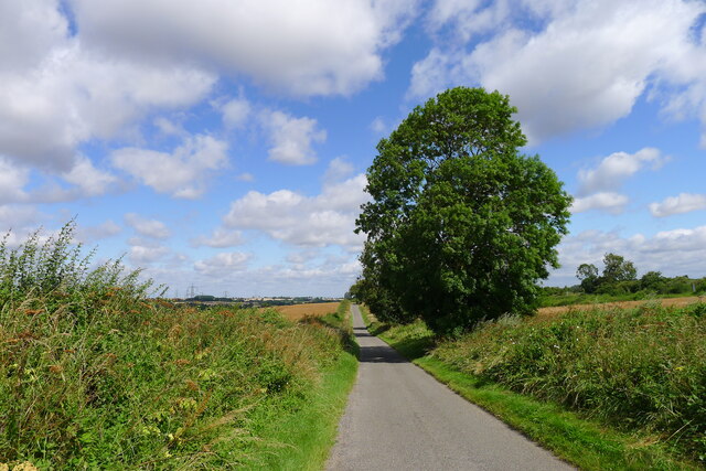
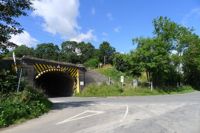
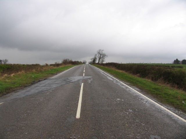
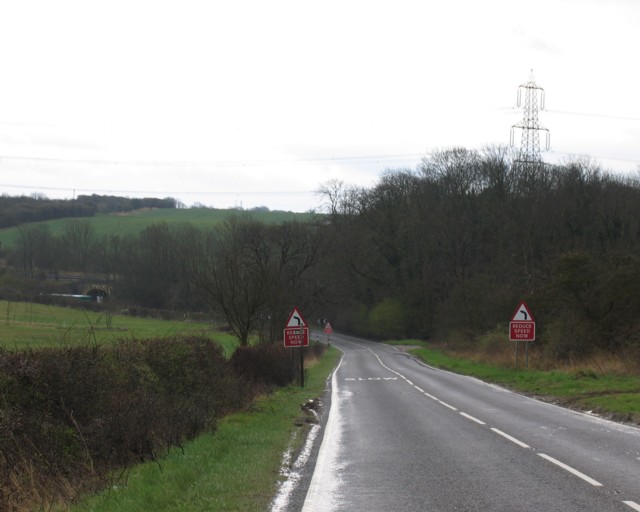
Great Ponton Images

Images are sourced within 2km of 52.863258/-0.625969 or Grid Reference SK9230. Thanks to Geograph Open Source API. All images are credited.

Green Lane, south-west of Great Ponton The northern part of a very pleasant bridleway from Stoke Rochford to Great Ponton.
Green Lane, south-west of Great Ponton
The northern part of a very pleasant bridleway from Stoke Rochford to Great Ponton.
Pit Lane leading from Great Ponton to Ermine Street The lane offers a gradual climb up from the Witham valley.
Pit Lane leading from Great Ponton to Ermine Street
The lane offers a gradual climb up from the Witham valley.
The B6403 passing under the East Coast Main Line The Roman road, Ermine Street, is forced out of its normal straight course, into a tight double bend, to pass under the line.
The B6403 passing under the East Coast Main Line
The Roman road, Ermine Street, is forced out of its normal straight course, into a tight double bend, to pass under the line.
Lay-by on the Great North Road (A1)
Great North Road (A1) Heading north.
Great North Road (A1)
Heading north.
Great North Road, Great Ponton
A1 southbound, leaving Great Ponton The A1 is the longest numbered road in the UK at 410 miles long. It connects London with Edinburgh, via the east of England. 
For much of its path it follows the Great North Road the old coaching route between London and Edinburgh. Several sections of the route are classified as motorway A1(M). The modern A1 bypasses the towns the Great North Road passed through and is dual carriageway for most of its route through England.
A1 southbound, leaving Great Ponton
The A1 is the longest numbered road in the UK at 410 miles long. It connects London with Edinburgh, via the east of England. For much of its path it follows the Great North Road the old coaching route between London and Edinburgh. Several sections of the route are classified as motorway A1(M). The modern A1 bypasses the towns the Great North Road passed through and is dual carriageway for most of its route through England.
Farmland near Great Ponton
Ermine Street towards the north. Where are the Roman Legions?
Ermine Street towards the north.
Where are the Roman Legions?
Ermine Street towards the south The main London to Edinburgh railway line crosses the centre of the picture. The Roman Ermine Street deviates from its straight line to pass beneath.
Ermine Street towards the south
The main London to Edinburgh railway line crosses the centre of the picture. The Roman Ermine Street deviates from its straight line to pass beneath.
Railway underpass The B6403 passes beneath the main London to Edinburgh railway line half a mile NW of Stoke Tunnel.
Railway underpass
The B6403 passes beneath the main London to Edinburgh railway line half a mile NW of Stoke Tunnel.
Washdyke Lane
Washdyke Lane
A1 looking northwards
Driveway to Riverside Cottages
A1 looking southwards This is the A1 slightly south of Great Ponton
A1 looking southwards
This is the A1 slightly south of Great Ponton
A1 looking towards Great Ponton
Lay by on a wet A1 South
The countryside from Grange Farm Looking towards Grantham a view of the countryside.
The countryside from Grange Farm
Looking towards Grantham a view of the countryside.
Show me another place!

Great Ponton is located at Grid Ref: SK9230 (Lat: 52.863258, Lng: -0.625969)

Division: Parts of Kesteven

Administrative County: Lincolnshire

District: South Kesteven

Police Authority: Lincolnshire

What 3 Words

///havens.includes.interviewer. Near Grantham, Lincolnshire

Related Wikis

Ellys Manor House

Ellys Manor House (pronounced "Ellis"), or the Old Rectory is a late-fifteenth to early sixteenth century manor house in Great Ponton, Lincolnshire, England...

Great Ponton

Great Ponton is an English village and civil parish in the South Kesteven district of Lincolnshire, 3 miles (5 km) south of Grantham on the A1 trunk road...

Great Ponton railway station

Great Ponton railway station was a station on the East Coast Main Line at Great Ponton, Lincolnshire, England. The Great Northern Railway opened it in...

Little Ponton and Stroxton

Little Ponton and Stroxton is a civil parish in the South Kesteven district of Lincolnshire, England. According to the 2001 Census it had a population...

Little Ponton

Little Ponton is a village in the civil parish of Little Ponton and Stroxton, in the South Kesteven district of Lincolnshire, England. It lies 2 miles...

Stroxton

Stroxton () is a village in the South Kesteven district of Lincolnshire, England. It is situated 3 miles (4.8 km) south from the centre of Grantham and...

Grantham Rural District

Grantham was a rural district in Lincolnshire, Parts of Kesteven from 1894 to 1931. It was created by the Local Government Act 1894 based on the Grantham...
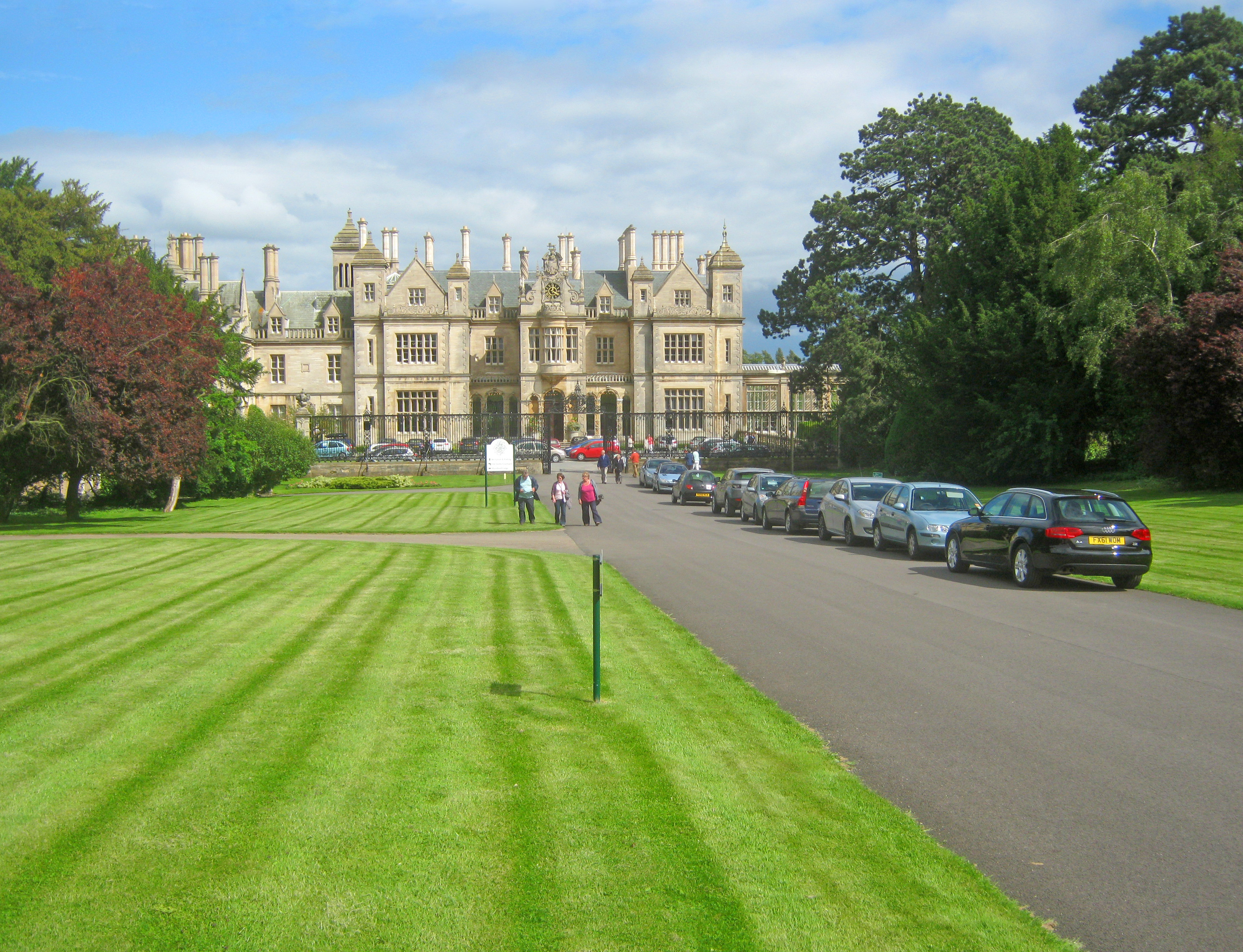
Stoke Rochford Hall

Stoke Rochford Hall is a large house built in scenic grounds, with a nearby golf course, next to the A1 in south Lincolnshire, England. The parkland and...

Nearby Amenities

Located within 500m of 52.863258,-0.625969
Great Ponton
Place: village
Lat/Long: 52.8630742/-0.6261511
Bus Stop
Telephone Exchange
Bus: yes
Naptan AtcoCode: 270000008603
Naptan Bearing: SW
Naptan CommonName: Telephone Exchange
Naptan Indicator: opp
Naptan Landmark: Telephone Exchange
Naptan NaptanCode: lingtjgd
Naptan Street: Heath Lane
Naptan Verified: no
Public Transport: platform
Source: naptan_import
Lat/Long: 52.8622781/-0.6316228
Bus Stop
Telephone Exchange
Bus: yes
Naptan AtcoCode: 270000008604
Naptan Bearing: NE
Naptan CommonName: Telephone Exchange
Naptan Indicator: adj
Naptan Landmark: Telephone Exchange
Naptan NaptanCode: lingtjgj
Naptan Street: Heath Lane
Naptan Verified: no
Public Transport: platform
Source: naptan_import
Lat/Long: 52.8623851/-0.6315452
Bus Stop
Heath Lane
Bus: yes
Naptan AtcoCode: 270000008605
Naptan Bearing: N
Naptan CommonName: Heath Lane
Naptan Indicator: adj
Naptan Landmark: Heath Lane
Naptan NaptanCode: lingtjgm
Naptan Street: Great North Road
Naptan Verified: no
Public Transport: platform
Source: naptan_import
Lat/Long: 52.863597/-0.6298284
Bus Stop
Dallygate Church
Bus: yes
Naptan AtcoCode: 270000014497
Naptan Bearing: E
Naptan CommonName: Dallygate Church
Naptan Indicator: adj
Naptan Landmark: Church
Naptan NaptanCode: linjptpd
Naptan Street: Dallygate
Naptan Verified: no
Public Transport: platform
Source: naptan_import
Lat/Long: 52.8634827/-0.6269352
Bus Stop
Dallygate Church
Bus: yes
Naptan AtcoCode: 270000014498
Naptan Bearing: W
Naptan CommonName: Dallygate Church
Naptan Indicator: opp
Naptan Landmark: Church
Naptan NaptanCode: linjptpg
Naptan Street: Dallygate
Naptan Verified: no
Public Transport: platform
Source: naptan_import
Lat/Long: 52.8633997/-0.6275321
Bus Stop
Heath Lane
Bus: yes
Naptan AtcoCode: 2700LGP01509
Naptan Bearing: S
Naptan CommonName: Heath Lane
Naptan Indicator: opp
Naptan Landmark: Heath Lane
Naptan NaptanCode: linamaga
Naptan Street: Great North Road
Naptan Verified: no
Public Transport: platform
Source: naptan_import
Lat/Long: 52.8641931/-0.6292897
Fuel
Ponton Main Service Station
Addr City: Grantham
Addr Postcode: NG33 5DW
Addr Street: Great North Road
Addr Suburb: Great Ponton
Brand: Gulf
Brand Wikidata: Q5617505
Check Date: 2023-12-31
Fhrs Authority: South Kesteven
Fhrs Id: 238211
Fhrs Local Authority Id: 4707
Lat/Long: 52.8621188/-0.629779
Design: barrel
Line Attachment: suspension
Material: steel
Power: tower
Structure: lattice
Lat/Long: 52.8667797/-0.6229058
Design: barrel
Line Attachment: anchor
Material: steel
Power: tower
Structure: lattice
Lat/Long: 52.8649527/-0.6199565
Parking
Access: yes
Ele: 80
Fee: no
Parking: layby
Lat/Long: 52.865792/-0.6298583
Odbl: clean
Lat/Long: 52.8623063/-0.6275672
Odbl: clean
Lat/Long: 52.8626318/-0.6274197
Odbl: clean
Lat/Long: 52.8624035/-0.6275672
Odbl: clean
Lat/Long: 52.8627484/-0.6266821
Odbl: clean
Lat/Long: 52.8619987/-0.6279883
Odbl: clean
Lat/Long: 52.8619242/-0.6284523
Odbl: clean
Lat/Long: 52.8620429/-0.6278443
Odbl: clean
Lat/Long: 52.8625962/-0.6275055
Odbl: clean
Lat/Long: 52.8622081/-0.6275672
Odbl: clean
Lat/Long: 52.8619614/-0.6282002
Odbl: clean
Lat/Long: 52.8626817/-0.6271971
Odbl: clean
Lat/Long: 52.862716/-0.6269074
Odbl: clean
Lat/Long: 52.8620877/-0.6276986
Odbl: clean
Lat/Long: 52.8625169/-0.6275538
Odbl: clean
Lat/Long: 52.8621784/-0.6275672
Power: pole
Lat/Long: 52.8637861/-0.6324708
Power: pole
Lat/Long: 52.8646672/-0.6326424
Power: pole
Lat/Long: 52.8626074/-0.6325405
Power: pole
Lat/Long: 52.8642071/-0.6308132
Power: pole
Lat/Long: 52.863362/-0.63165
Power: pole
Lat/Long: 52.8616121/-0.6317531
Access: yes
Barrier: cattle_grid
Lat/Long: 52.8619129/-0.6325934
Power: pole
Lat/Long: 52.8630254/-0.6323308
Generator Method: photovoltaic
Generator Output Electricity: yes
Generator Source: solar
Generator Type: solar_photovoltaic_panel
Location: roof
Power: generator
Lat/Long: 52.8625983/-0.6284773
Generator Method: photovoltaic
Generator Output Electricity: yes
Generator Source: solar
Generator Type: solar_photovoltaic_panel
Location: roof
Power: generator
Lat/Long: 52.8625999/-0.6285363
Generator Method: photovoltaic
Generator Output Electricity: yes
Generator Source: solar
Generator Type: solar_photovoltaic_panel
Location: roof
Power: generator
Lat/Long: 52.8610575/-0.6271429
Generator Method: photovoltaic
Generator Output Electricity: yes
Generator Source: solar
Generator Type: solar_photovoltaic_panel
Location: roof
Power: generator
Lat/Long: 52.8614315/-0.6269578
Generator Method: photovoltaic
Generator Output Electricity: yes
Generator Source: solar
Generator Type: solar_photovoltaic_panel
Location: roof
Power: generator
Lat/Long: 52.8628933/-0.6270704
Generator Method: photovoltaic
Generator Output Electricity: yes
Generator Source: solar
Generator Type: solar_photovoltaic_panel
Location: roof
Power: generator
Lat/Long: 52.8627881/-0.6252975
Generator Method: photovoltaic
Generator Output Electricity: yes
Generator Source: solar
Generator Type: solar_photovoltaic_panel
Location: roof
Power: generator
Lat/Long: 52.8628625/-0.6242729
Generator Method: photovoltaic
Generator Output Electricity: yes
Generator Source: solar
Generator Type: solar_photovoltaic_panel
Location: roof
Power: generator
Lat/Long: 52.8629192/-0.6241334
Generator Method: photovoltaic
Generator Output Electricity: yes
Generator Source: solar
Generator Type: solar_photovoltaic_panel
Location: roof
Power: generator
Lat/Long: 52.8630536/-0.6237525
Generator Method: photovoltaic
Generator Output Electricity: yes
Generator Source: solar
Generator Type: solar_photovoltaic_panel
Location: roof
Power: generator
Lat/Long: 52.863235/-0.6232778
Generator Method: photovoltaic
Generator Output Electricity: yes
Generator Source: solar
Generator Type: solar_photovoltaic_panel
Location: roof
Power: generator
Lat/Long: 52.8641726/-0.6218723
Brand: Premier
Brand Wikidata: Q7240340
Check Date: 2023-12-31
Shop: convenience
Lat/Long: 52.8621689/-0.6300684
The data included in this document is from www.openstreetmap.org. The data is made available under ODbL.

Have you been to Great Ponton?

Leave your review of Great Ponton below (or comments, questions and feedback).