Grimsbury Reservoir

Lake, Pool, Pond, Freshwater Marsh in Northamptonshire Cherwell

England

Grimsbury Reservoir

Banbury, Oxfordshire The modern shopping centre in Banbury is built alongside the Oxford Canal.
Banbury, Oxfordshire Credit: Martin Clark

Grimsbury Reservoir is a freshwater lake located in Northamptonshire, England. Spread across an area of approximately 100 acres, it is a popular destination for nature enthusiasts and outdoor activities. The reservoir is situated in the heart of Grimsbury Wood, a tranquil and picturesque woodland area.

The lake itself is surrounded by lush greenery and offers a serene environment for visitors to relax and enjoy the natural beauty. Its calm waters are home to a variety of freshwater fish species, making it a favored spot for fishing enthusiasts. Carp, roach, and perch are commonly found in the reservoir, providing ample opportunities for anglers to test their skills.

Apart from fishing, Grimsbury Reservoir also attracts birdwatchers as it serves as a habitat for numerous waterfowl and wading birds. Visitors can spot species such as mallards, coots, herons, and swans, among others. The diversity of birdlife makes it a haven for birdwatching enthusiasts, who can observe and capture these winged creatures in their natural habitat.

For those seeking active recreation, the reservoir offers opportunities for water sports such as canoeing and kayaking. The calm and sheltered waters provide an ideal setting for beginners and experienced paddlers alike. Additionally, the surrounding woodland area offers several walking trails, allowing visitors to explore the scenic beauty of Grimsbury Wood.

Overall, Grimsbury Reservoir is a peaceful and idyllic location that caters to a wide range of outdoor activities, making it a popular destination for both locals and tourists alike.

If you have any feedback on the listing, please let us know in the comments section below.

Grimsbury Reservoir Images

Images are sourced within 2km of 52.075921/-1.3308313 or Grid Reference SP4542. Thanks to Geograph Open Source API. All images are credited.

Banbury, Oxfordshire The modern shopping centre in Banbury is built alongside the Oxford Canal.
Banbury, Oxfordshire
The modern shopping centre in Banbury is built alongside the Oxford Canal.
Bourton Lock on the Southern Oxford Canal
St Mary's Church. Banbury
Statue of the Fine lady. Near Banbury Cross From the Nursery Rhyme:
Ride a cock horse to Banbury Cross
To see a fine lady upon a white horse
With rings on her fingers and bells on her toes
She shall have music wherever she goes.
Statue of the Fine lady. Near Banbury Cross
From the Nursery Rhyme: Ride a cock horse to Banbury Cross To see a fine lady upon a white horse With rings on her fingers and bells on her toes She shall have music wherever she goes.
Banbury Station Looking south, a charter train hauled by two Class 37 locomotives is approaching the station.
Banbury Station
Looking south, a charter train hauled by two Class 37 locomotives is approaching the station.
River Cherwell near Little Bourton Viewed looking southwards and downstream, and about 200 metres east of the Oxford Canal.
River Cherwell near Little Bourton
Viewed looking southwards and downstream, and about 200 metres east of the Oxford Canal.
Banbury Cross From High Street looking west. You can also just see the new statue of the fine lady on the south west of the roundabout. The road to the south is South Bar Street and the one to the west (directly opposite) is called West Bar Street.
The words of the Banbury Cross nursery rhyme relate to Queen Elizabeth I of England (the fine lady) who travelled to Banbury to see a huge stone cross which had just been erected. The words 'With rings on her fingers' obviously relates to the fine jewellery which would be worn by a Queen. The words 'And bells on her toes' refer to the fashion of attaching bells to the end of the pointed toes of each shoe - this fashion actually originates from the Plantagenet era of English history but was associated with the nobility for some time! Banbury was situated at the top of a steep hill and in order to help carriages up the steep incline a white cock horse (a large stallion) was made available by the town's council to help with this task. When the Queen's carriage attempted to go up the hill a wheel broke and the Queen chose to mount the cock horse and ride to the Banbury cross. The people of the town had  decorated the cock horse with ribbons and bells and provided minstrels to accompany her - "she shall have music wherever she goes". The massive stone cross at Banbury was unfortunately later destroyed by anti - Catholics who opposed the notion of pilgrimages.
Banbury Cross
From High Street looking west. You can also just see the new statue of the fine lady on the south west of the roundabout. The road to the south is South Bar Street and the one to the west (directly opposite) is called West Bar Street. The words of the Banbury Cross nursery rhyme relate to Queen Elizabeth I of England (the fine lady) who travelled to Banbury to see a huge stone cross which had just been erected. The words 'With rings on her fingers' obviously relates to the fine jewellery which would be worn by a Queen. The words 'And bells on her toes' refer to the fashion of attaching bells to the end of the pointed toes of each shoe - this fashion actually originates from the Plantagenet era of English history but was associated with the nobility for some time! Banbury was situated at the top of a steep hill and in order to help carriages up the steep incline a white cock horse (a large stallion) was made available by the town's council to help with this task. When the Queen's carriage attempted to go up the hill a wheel broke and the Queen chose to mount the cock horse and ride to the Banbury cross. The people of the town had decorated the cock horse with ribbons and bells and provided minstrels to accompany her - "she shall have music wherever she goes". The massive stone cross at Banbury was unfortunately later destroyed by anti - Catholics who opposed the notion of pilgrimages.
Kraft Foods Banbury Kraft Foods website boasts that their Banbury facility produces some 11 billion cups of coffee a year.  This is the view from the nearby Tesco.
Kraft Foods Banbury
Kraft Foods website boasts that their Banbury facility produces some 11 billion cups of coffee a year. This is the view from the nearby Tesco.
The Fine Lady at Banbury Cross
Ye Olde Reindeer Inn One of Banbury's mediaeval pubs.
Ye Olde Reindeer Inn
One of Banbury's mediaeval pubs.
M40 Junction 11 Viewed from a nearby road bridge the M40 (looking north) junction 11 for Banbury.
M40 Junction 11
Viewed from a nearby road bridge the M40 (looking north) junction 11 for Banbury.
Oxford Canal To the North of A422 Bridge
Oxford Canal
To the North of A422 Bridge
Oxford Canal Hardwick Bridge seen from Hardwick Lock.
Oxford Canal
Hardwick Bridge seen from Hardwick Lock.
Castle Quay, Banbury Canalside mooring in centre of town.
Castle Quay, Banbury
Canalside mooring in centre of town.
Longelandes Way, Ruscote Ruscote is an extensive housing estate in north Banbury. This picture shows Longelandes Way near its junction with Highlands.
Longelandes Way, Ruscote
Ruscote is an extensive housing estate in north Banbury. This picture shows Longelandes Way near its junction with Highlands.
Path in Ruscote This path follows the route of an old mineral railway and divides the Ruscote and Hardwick estates in the northern suburbs of Banbury.  Although the scene looks rural, in reality the path lies adjacent to housing and an industrial estate.
Path in Ruscote
This path follows the route of an old mineral railway and divides the Ruscote and Hardwick estates in the northern suburbs of Banbury. Although the scene looks rural, in reality the path lies adjacent to housing and an industrial estate.
Banbury Oxford Canal with Castle Quay Shopping Centre.
Banbury
Oxford Canal with Castle Quay Shopping Centre.
Cattle pens and technology Cattle pens beside the re-aligned A361 to Banbury with some of the buildings in the high-tech business park on the other side of the M40 visible in the distance.
Cattle pens and technology
Cattle pens beside the re-aligned A361 to Banbury with some of the buildings in the high-tech business park on the other side of the M40 visible in the distance.
Show me another place!

Grimsbury Reservoir is located at Grid Ref: SP4542 (Lat: 52.075921, Lng: -1.3308313)

Administrative County: Oxfordshire

District: Cherwell

Police Authority: Thames Valley

What 3 Words

///finger.wounds.shadow. Near Banbury, Oxfordshire

Nearby Locations

Grimsbury Reservoir

Related Wikis

Grimsbury Reservoir

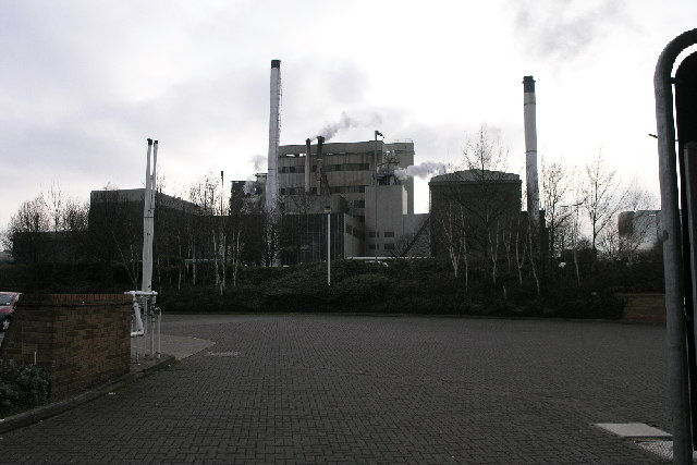
Grimsbury Reservoir is a relatively small reservoir owned by Thames Water just off Hennef Way, near the Grimsbury estate of Banbury, Oxfordshire. A waterworks...

Grimsbury

Grimsbury is a largely residential area which forms the eastern part of Banbury, Oxfordshire, England. It is situated east of the River Cherwell, the Oxford...
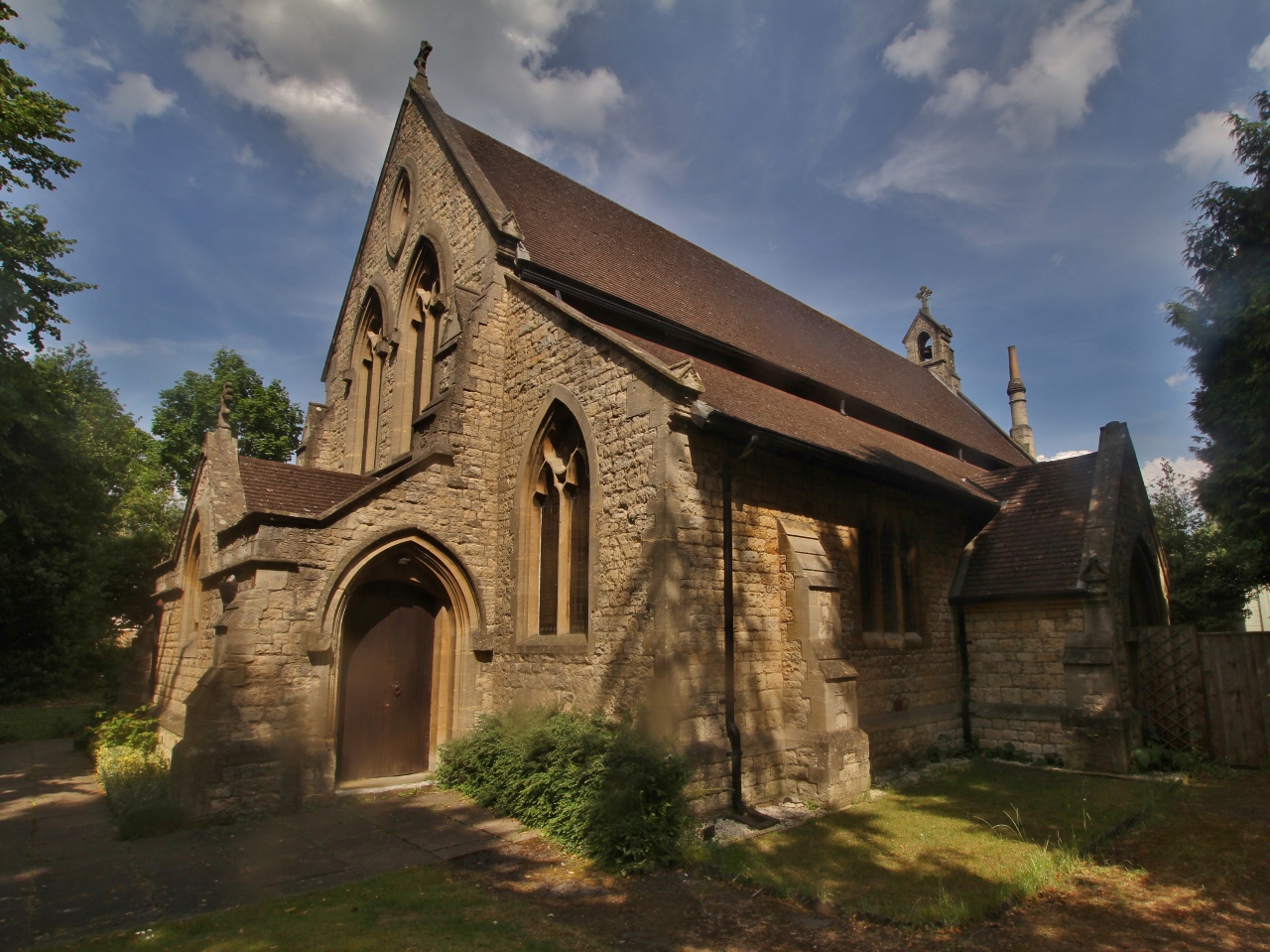
Banbury Museum

Banbury Museum & Gallery is a local museum in the town of Banbury, north Oxfordshire, England.The museum is located in the centre of Banbury by the Oxford...
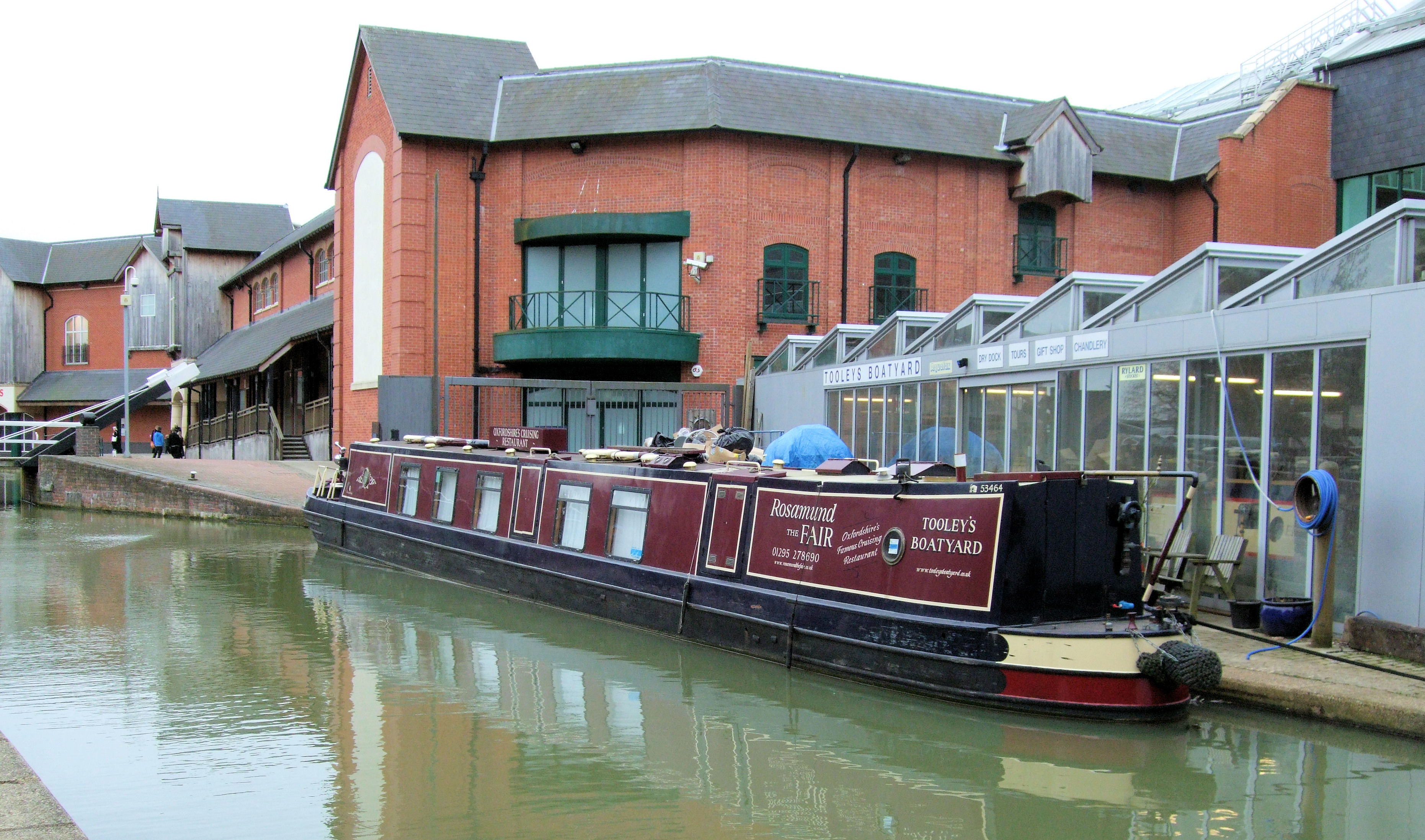
Tooley's Boatyard

Tooley's Boatyard is a dockyard on the Oxford Canal in the centre of the town of Banbury, Oxfordshire, England. The opening of the Oxford Canal from Hawkesbury...

Related Videos

Nearby Amenities

Located within 500m of 52.075921,-1.3308313
Traffic Signals
Traffic Signals: traffic_lights
Traffic Signals Direction: both
Lat/Long: 52.0760317/-1.3366778
Barrier: bollard
Lat/Long: 52.0723669/-1.3269339
Crossing
Crossing: unmarked
Crossing Island: no
Kerb: lowered
Tactile Paving: yes
Lat/Long: 52.0760715/-1.3370964
Power: tower
Source: Bing!
Lat/Long: 52.0757366/-1.326641
Power: tower
Source: Bing!
Lat/Long: 52.071925/-1.3301439
Power: tower
Source: Bing!
Lat/Long: 52.0747013/-1.3291676
Reservoir Junction
Railway: site
Ref Tiploc: BNBRRJN
Lat/Long: 52.077132/-1.3272539
Railway: switch
Lat/Long: 52.0765311/-1.3274867
Operator: Network Rail
Railway: switch
Lat/Long: 52.0760357/-1.3276388
Barrier: height_restrictor
Maxheight: 5
Lat/Long: 52.0716664/-1.332264
Barrier: stile
Lat/Long: 52.0781687/-1.3289603
Man Made: mast
Tower Type: communication
Lat/Long: 52.0742984/-1.3272777
Operator: Network Rail
Railway: switch
Lat/Long: 52.0778871/-1.3271479
Banbury Signal OL7143
Railway: site
Ref Tiploc: BNBR743
Lat/Long: 52.0750571/-1.3279888
Operator: Network Rail
Railway: switch
Lat/Long: 52.0758708/-1.327628
Railway: buffer_stop
Lat/Long: 52.0716905/-1.329349
Banbury Reservoir Neck
Railway: site
Ref Tiploc: BNBRRN
Lat/Long: 52.0726836/-1.3288943
Banbury Reservoir Sidings
Railway: site
Ref Tiploc: BNBRRS
Lat/Long: 52.0756274/-1.3279462
Railway: buffer_stop
Lat/Long: 52.0734166/-1.3286386
Operator: Network Rail
Railway: switch
Lat/Long: 52.076769/-1.3274937
Operator: Network Rail
Railway: switch
Lat/Long: 52.0761169/-1.3277651
Operator: Network Rail
Railway: switch
Lat/Long: 52.0776067/-1.3273034
Railway: buffer_stop
Lat/Long: 52.0768253/-1.3275421
Railway: buffer_stop
Lat/Long: 52.0754274/-1.3281027
Railway: switch
Lat/Long: 52.0770954/-1.3272641
Barrier: swing_gate
Lat/Long: 52.0730181/-1.3321085
Generator Method: combustion
Generator Output Electricity: ~2 MW
Generator Source: gas
Power: generator
Lat/Long: 52.0716372/-1.3297128
Generator Method: combustion
Generator Output Electricity: ~2 MW
Generator Source: gas
Power: generator
Lat/Long: 52.0716794/-1.3297006
Generator Method: combustion
Generator Output Electricity: ~2 MW
Generator Source: gas
Power: generator
Lat/Long: 52.0717239/-1.3296858
Generator Method: combustion
Generator Output Electricity: ~2 MW
Generator Source: gas
Power: generator
Lat/Long: 52.0717683/-1.3296675
Generator Method: combustion
Generator Output Electricity: ~2 MW
Generator Source: gas
Power: generator
Lat/Long: 52.0718075/-1.329654
Generator Method: combustion
Generator Output Electricity: ~2 MW
Generator Source: gas
Power: generator
Lat/Long: 52.0718482/-1.3296331
Operator: Network Rail
Railway: switch
Lat/Long: 52.0750872/-1.3279796
Power: pole
Lat/Long: 52.0721647/-1.329583
Bench
Lat/Long: 52.0766666/-1.3326539
Bench
Lat/Long: 52.0779535/-1.3287673
Barrier: bollard
Lat/Long: 52.0730008/-1.3264992
The data included in this document is from www.openstreetmap.org. The data is made available under ODbL.

Have you been to Grimsbury Reservoir?

Leave your review of Grimsbury Reservoir below (or comments, questions and feedback).