Bacton

Settlement in Norfolk North Norfolk

England

Bacton

High Seas and Sunset at Walcott Gap
High Seas and Sunset at Walcott Gap Credit: malcolm tebbit

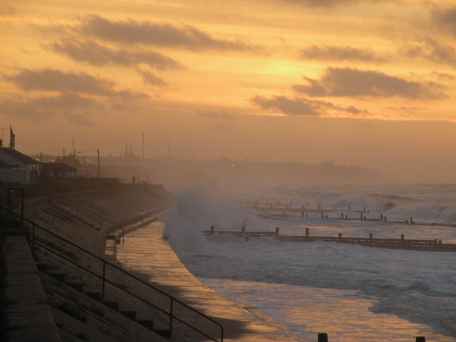
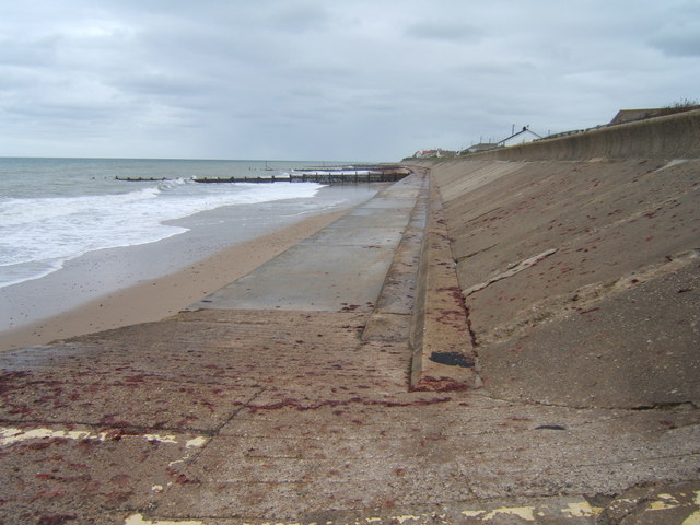
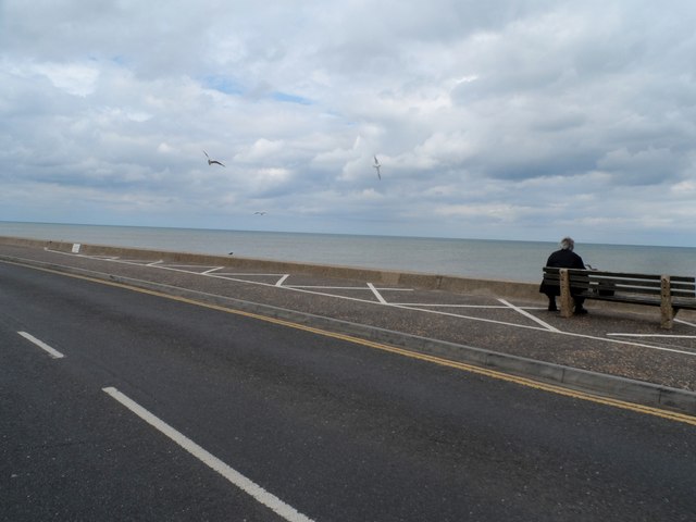
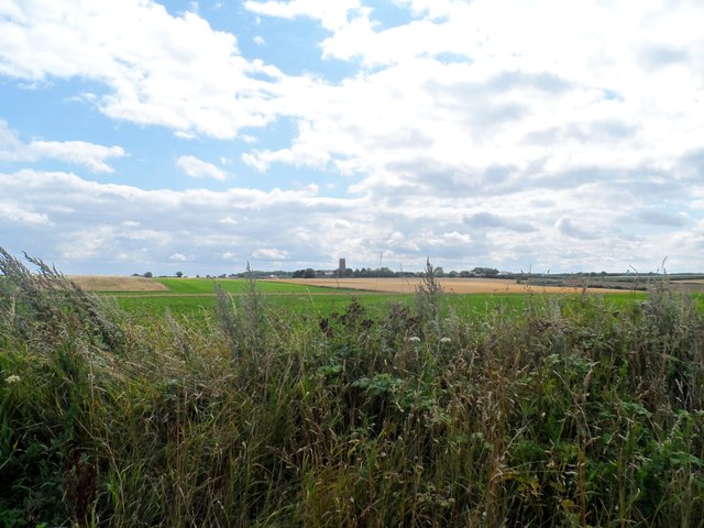
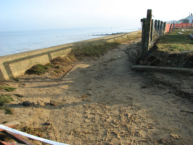
Bacton is a small coastal village located in the county of Norfolk, England. Situated on the east coast of the country, it is part of the North Norfolk District and is approximately 20 miles north-east of the city of Norwich. Bacton is positioned between the larger towns of Cromer and Great Yarmouth.

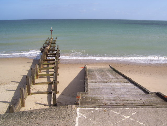
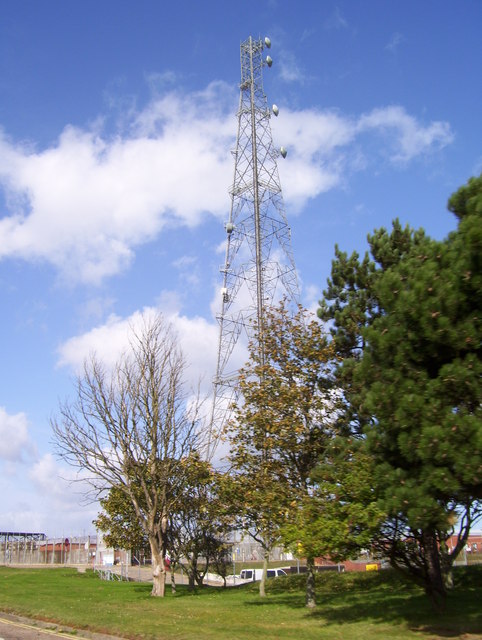
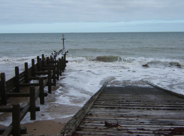
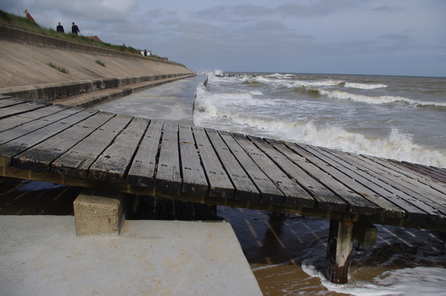
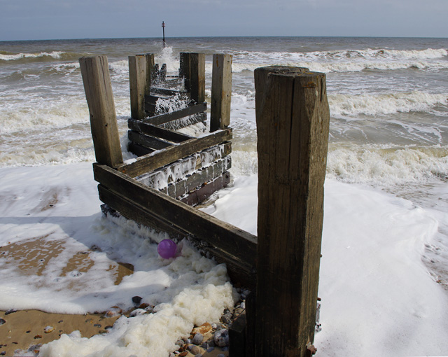
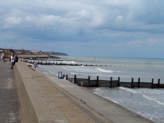
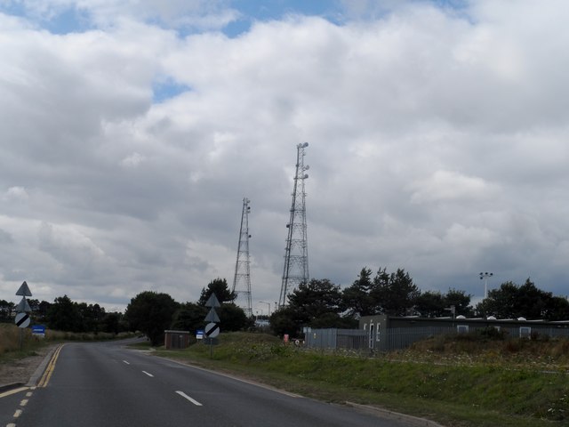
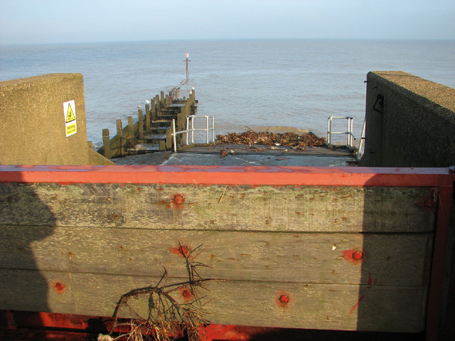
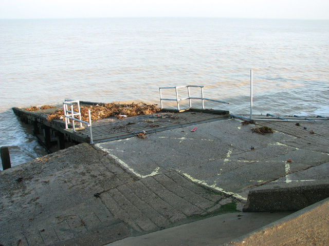
The village is known for its stunning sandy beaches and beautiful natural surroundings. It is a popular destination for tourists and locals alike, attracting visitors with its picturesque views and peaceful atmosphere. Bacton is also famous for its offshore gas terminals, which play a vital role in the country's energy infrastructure.

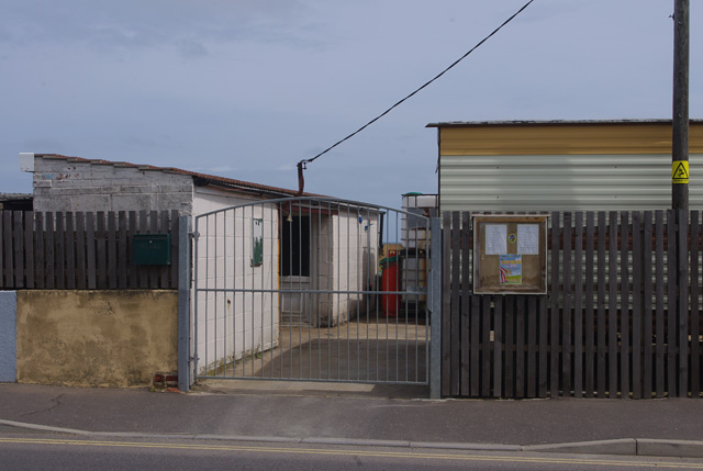
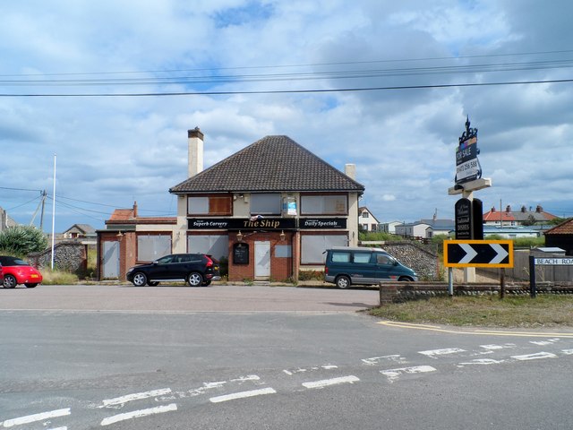
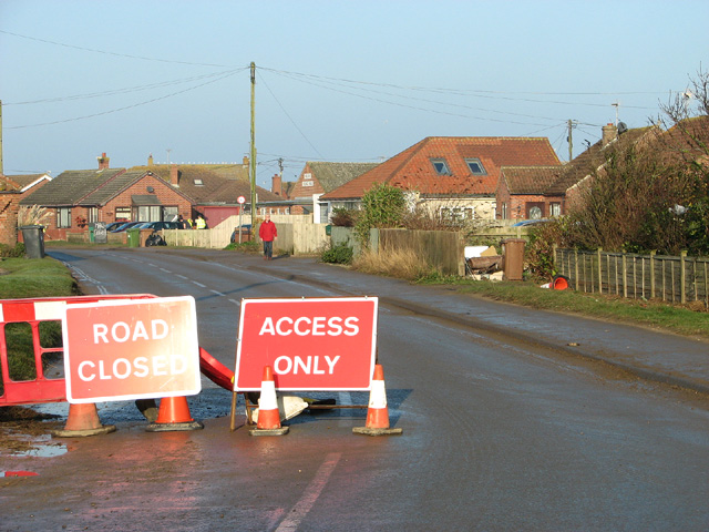
In terms of amenities, Bacton offers a range of facilities to cater to the needs of residents and visitors. These include a village hall, a primary school, a church, a convenience store, and several pubs and restaurants. The village also has a caravan park, which is popular during the summer months.

Bacton is steeped in history, with evidence of human habitation dating back to the Roman era. The area is dotted with archaeological sites, including the remains of a Roman fort. Additionally, Bacton played a significant role during World War II, serving as a defense site against potential enemy invasions.

Overall, Bacton is a charming coastal village that offers a mix of natural beauty, historical significance, and modern amenities. It is a place where visitors can relax on the beach, explore the rich history, and enjoy the tranquil atmosphere of a traditional English village.

If you have any feedback on the listing, please let us know in the comments section below.

Bacton Images

Images are sourced within 2km of 52.850013/1.483023 or Grid Reference TG3433. Thanks to Geograph Open Source API. All images are credited.

High Seas and Sunset at Walcott Gap
Slipway at Walcott Gap
Communications mast at Bacton Gas Terminal
The sea wall at Walcott Groynes and concrete slopes defend the coastline at Walcott.
The sea wall at Walcott
Groynes and concrete slopes defend the coastline at Walcott.
Groyne and slipway, Walcott Gap A grey October sea at Walcott .... I think that might be a 'GBBG' (great black-backed gull, Larus marinus) on the post at the end of the groyne.
Groyne and slipway, Walcott Gap
A grey October sea at Walcott .... I think that might be a 'GBBG' (great black-backed gull, Larus marinus) on the post at the end of the groyne.
Sea wall at Rudram's Gap
Groyne at Rudram's Gap Wooden zig-zag groyne and a balloon.
Groyne at Rudram's Gap
Wooden zig-zag groyne and a balloon.
Micro-brewery at Walcott Bees Brewery
Micro-brewery at Walcott
Bees Brewery
The sea front at Walcott
Groynes at Walcott
Groynes at Walcott
The Ship pub, Bacton Closed down and up for sale.
The Ship pub, Bacton
Closed down and up for sale.
Transmitters near Bacton gas distribution station
Arable land with St Andrew's church, Bacton, in the distance
St Andrew's Church, Bacton
The B1159 through Walcott is closed On 5 December 2013, a storm surge, said to have been the worst in 60 years, flooded the coastal village of Walcott.  Five days later, the main road through the village is still closed and workers are busy removing lots of sand which had been washed onto it.  A number of sea front chalets were destroyed or badly damaged by flood water, and gardens and side roads are still covered with debris.  People from 13 homes have been moved into emergency accommodation.  The public footpath leading along the top of the sea wall is also still closed.
The B1159 through Walcott is closed
On 5 December 2013, a storm surge, said to have been the worst in 60 years, flooded the coastal village of Walcott. Five days later, the main road through the village is still closed and workers are busy removing lots of sand which had been washed onto it. A number of sea front chalets were destroyed or badly damaged by flood water, and gardens and side roads are still covered with debris. People from 13 homes have been moved into emergency accommodation. The public footpath leading along the top of the sea wall is also still closed.
Storm surge damage, Walcott The flood gate is still closed at Walcott Gap, with the slipway being covered with debris. On 5 December 2013, a storm surge, said to have been the worst in 60 years, flooded the coastal village of Walcott.  Five days later, the main road through the village is still closed >  <a title="https://www.geograph.org.uk/photo/3774028" href="https://www.geograph.org.uk/photo/3774028">Link</a> and workers are busy removing lots of sand which had been washed onto it.  A number of sea front chalets were destroyed or badly damaged by flood water, and gardens and side roads are still covered with debris.  People from 13 homes have been moved into emergency accommodation.  The public footpath leading along the top of the sea wall is also still closed.
Storm surge damage, Walcott
The flood gate is still closed at Walcott Gap, with the slipway being covered with debris. On 5 December 2013, a storm surge, said to have been the worst in 60 years, flooded the coastal village of Walcott. Five days later, the main road through the village is still closed > Link and workers are busy removing lots of sand which had been washed onto it. A number of sea front chalets were destroyed or badly damaged by flood water, and gardens and side roads are still covered with debris. People from 13 homes have been moved into emergency accommodation. The public footpath leading along the top of the sea wall is also still closed.
Storm surge damage, Walcott The slipway at Walcott Gap is covered with debris and the railing is broken. On 5 December 2013, a storm surge, said to have been the worst in 60 years, flooded the coastal village of Walcott.  Five days later, the main road through the village is still closed >  <a title="https://www.geograph.org.uk/photo/3774028" href="https://www.geograph.org.uk/photo/3774028">Link</a> and workers are busy removing lots of sand which had been washed onto it.  A number of sea front chalets were destroyed or badly damaged by flood water, and gardens and side roads are still covered with debris.  People from 13 homes have been moved into emergency accommodation.  The public footpath leading along the top of the sea wall is also still closed.
Storm surge damage, Walcott
The slipway at Walcott Gap is covered with debris and the railing is broken. On 5 December 2013, a storm surge, said to have been the worst in 60 years, flooded the coastal village of Walcott. Five days later, the main road through the village is still closed > Link and workers are busy removing lots of sand which had been washed onto it. A number of sea front chalets were destroyed or badly damaged by flood water, and gardens and side roads are still covered with debris. People from 13 homes have been moved into emergency accommodation. The public footpath leading along the top of the sea wall is also still closed.
Storm surge damage, Walcott The public footpath running along the top of the sea wall is still closed. Many of the adjacent properties are damaged or completely destroyed. On 5 December 2013, a storm surge, said to have been the worst in 60 years, flooded the coastal village of Walcott.  Five days later, the main road through the village is still closed >  <a title="https://www.geograph.org.uk/photo/3774028" href="https://www.geograph.org.uk/photo/3774028">Link</a> and workers are busy removing lots of sand which had been washed onto it.  A number of sea front chalets were destroyed or badly damaged by flood water, and gardens and side roads are still covered with debris.  People from 13 homes have been moved into emergency accommodation.
Storm surge damage, Walcott
The public footpath running along the top of the sea wall is still closed. Many of the adjacent properties are damaged or completely destroyed. On 5 December 2013, a storm surge, said to have been the worst in 60 years, flooded the coastal village of Walcott. Five days later, the main road through the village is still closed > Link and workers are busy removing lots of sand which had been washed onto it. A number of sea front chalets were destroyed or badly damaged by flood water, and gardens and side roads are still covered with debris. People from 13 homes have been moved into emergency accommodation.
Show me another place!

Bacton is located at Grid Ref: TG3433 (Lat: 52.850013, Lng: 1.483023)

Administrative County: Norfolk

District: North Norfolk

Police Authority: Norfolk

What 3 Words

///plots.scooped.refrained. Near Bacton, Norfolk

Nearby Locations

Broomholm Bacton

Related Wikis

Bacton, Norfolk

Bacton is a village and civil parish in Norfolk, England. It is on the Norfolk coast, some 12 miles (20 km) south-east of Cromer, 25 miles (40 km) north...
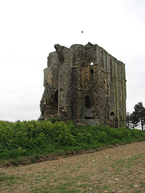
Bromholm Priory

Bromholm Priory was a Cluniac priory, situated in a coastal location near the village of Bacton, Norfolk, England == History == Bromholm Priory, also known...

RAF Bacton

RAF Bacton is a former Royal Air Force landing field, built to accommodate aircraft intercepting Zeppelin bombers during the First World War. == History... ==

Walcott, Norfolk

Walcott is a small village and civil parish on the North Norfolk coast in England between Mundesley and Happisburgh. The name is formed from the Anglian...

Related Videos

VanLife S14E05 Walking a Dog on the Beach

I noticed that a lot of vanlifers have dogs, but as I walk Richard Hewitt's dog Scruffy along the beach in Norfolk I go into the ...

Hoseasons Castaways Holiday Park Oyster 6 Sea View Bacton Norfolk

Right after a night in Seashell 6 ( see other videos ) we have been moved to number 10 this has central heating , and no smell, ...

Nearby Amenities

Located within 500m of 52.850013,1.483023
Bus Stop
school, adj
Naptan AtcoCode: 2900B021
Naptan Bearing: W
Naptan BusStopType: CUS
Naptan CommonName: school
Naptan Indicator: adj
Naptan Landmark: Coast Road
Naptan Locality: Bacton
Naptan NaptanCode: nfoadmpg
Naptan ShortCommonName: school
Naptan Street: Walcott Road
Naptan Verified: no
Source: naptan_import
Lat/Long: 52.8479033/1.4822085
Bus Stop
Abbey Street, adj
Bench: no
Bin: no
Lit: yes
Naptan AtcoCode: 2900B0216
Naptan Bearing: W
Naptan BusStopType: CUS
Naptan CommonName: Abbey Street
Naptan Indicator: adj
Naptan Landmark: Coast Road
Naptan Locality: Bacton
Naptan NaptanCode: nfoadmpt
Naptan ShortCommonName: Abbey St
Naptan Street: Abbey Street
Shelter: no
Source: naptan_import
Tactile Paving: no
Lat/Long: 52.8475033/1.484015
shops, opp
Naptan AtcoCode: 2900B0217
Naptan Bearing: N
Naptan BusStopType: CUS
Naptan CommonName: shops
Naptan Indicator: opp
Naptan Landmark: car park
Naptan Locality: Bacton
Naptan NaptanCode: nfoadmpw
Naptan ShortCommonName: shops
Naptan Street: Coast Road
Naptan Verified: no
Source: naptan_import
Lat/Long: 52.8510989/1.476908
shops, adj
Naptan AtcoCode: 2900B022
Naptan Bearing: S
Naptan BusStopType: CUS
Naptan CommonName: shops
Naptan Indicator: adj
Naptan Landmark: car park
Naptan Locality: Bacton
Naptan NaptanCode: nfoadmtg
Naptan ShortCommonName: shops
Naptan Street: Coast Road
Naptan Verified: no
Source: naptan_import
Lat/Long: 52.851077/1.4770399
Bus Stop
school, opp
Naptan AtcoCode: 2900B0220
Naptan Bearing: E
Naptan BusStopType: CUS
Naptan CommonName: school
Naptan Indicator: opp
Naptan Landmark: Coast Road
Naptan Locality: Bacton
Naptan NaptanCode: nfoadmtj
Naptan ShortCommonName: school
Naptan Street: Walcott Road
Naptan Verified: no
Source: naptan_import
Lat/Long: 52.848002/1.4822164
Bus Stop
Abbey Street, opp
Naptan AtcoCode: 2900B0221
Naptan Bearing: E
Naptan CommonName: Abbey Street
Naptan Indicator: opp
Naptan Landmark: Abbey Street
Naptan Locality: Bacton
Naptan NaptanCode: nfoadmtm
Naptan ShortCommonName: Abbey St
Naptan Street: Coast Road
Naptan Verified: no
Source: naptan_import
Lat/Long: 52.8474142/1.4850811
Bacton
Name Ru: Бактон
Place: village
Lat/Long: 52.8508198/1.4792065
Booth: K6
Colour: red
Covered: booth
Disused Amenity: telephone
Information: office
Listed Status: Grade II
Man Made: telephone_box
Opening Hours: 24/7
Tourism: information
Lat/Long: 52.8472859/1.4842209
Crossing
Crossing: unmarked
Tactile Paving: yes
Lat/Long: 52.8487439/1.4775579
Post Box
Collection Times: Mo-Fr 15:45; Sa 09:00
Collection Times Lastcheck: 2018-08-17
Operator: Royal Mail
Operator Wikidata: Q638098
Post Box Design: type_b
Post Box Type: pillar
Ref: NR12 1200
Royal Cypher: EIIR
Royal Cypher Wikidata: Q33102113
Lat/Long: 52.8512226/1.4771335
Bacton Superstore
Addr Country: GB
Addr Housename: Superstores
Addr Postcode: NR12 0AA
Addr Street: Coast Road
Addr Village: Bacton
Brand: Premier
Brand Wikidata: Q7240340
Fhrs Id: 281497
Opening Hours: Mo-Sa 06:00-08:00; Su 06:00-12:30,14:00-20:00
Phone: +44 1692 650209
Shop: convenience
Lat/Long: 52.8512128/1.4776955
Broomholm
Place: hamlet
Lat/Long: 52.8461007/1.484185
Buttercup Meadow
Phone: +44 1692650965
Tourism: caravan_site
Lat/Long: 52.848805/1.4856977
Bacton / Bromholm & Keswick
Inscription: 1113 / 1977
Man Made: village_sign
Material: wood
Short Name: Bacton
Start Date: 1977
Lat/Long: 52.8478198/1.4833597
Bench
Backrest: yes
Colour: brown
Material: wood
Seats: 4
Lat/Long: 52.8474218/1.4842344
Entrance: main
Lat/Long: 52.8468146/1.4878412
Give Way
Lat/Long: 52.8498179/1.4762584
Give Way
Direction: forward
Lat/Long: 52.8495288/1.4770657
Give Way
Lat/Long: 52.8501241/1.4761358
Give Way
Lat/Long: 52.8505743/1.4767921
Crossing
Crossing: uncontrolled
Crossing Ref: zebra
Lat/Long: 52.8496843/1.4774572
Post Office
Bacton Mobile Post Office Service
Addr City: Norwich
Addr Housename: Bacton Village Hall
Addr Postcode: NR12 0ES
Addr Street: Coast Road
Addr Village: Bacton
Brand: Post Office
Brand Wikidata: Q1783168
Contact Website: https://www.postoffice.co.uk/branch-finder/7321368/bacton-mobile-service
Fixme: verify by survey
Opening Hours: Tu 10:30-11:30
Ref Pol Id: 140688
Source: pol_branch_list_2018-01
Lat/Long: 52.849728/1.4780257
Fast Food
Village Kebab & Pizza House
Addr City: Norwich
Addr Country: GB
Addr Postcode: NR12 0AA
Addr Street: Coast Road
Addr Village: Bacton
Cuisine: pizza;burger;kebab;english;sandwich;breakfast;cake;tea;coffee
Fhrs Id: 1393674
Internet Access Fee: no
Old Name: Royal Star Cafe
Outdoor Seating: yes
Lat/Long: 52.8511245/1.4777022
Parking
Fee: no
Parking: surface
Lat/Long: 52.847197/1.4842379
Give Way
Lat/Long: 52.8474476/1.4843526
Defibrillator
Access: yes
Brand: Heart2
Defibrillator Location: Beside school gate
Emergency: defibrillator
Ref GB The Circuit: FBB0264B-9823-4640-A5AC-AE14009FD73B
Lat/Long: 52.8478891/1.4822672
Traffic Calming: bump
Lat/Long: 52.8512526/1.4771555
Waste Basket
Waste: trash
Lat/Long: 52.8511862/1.4771207
Bacton & Edingthorpe Parish Council
Board Type: notice
Information: board
Tourism: information
Lat/Long: 52.851204/1.4771274
Traffic Calming: bump
Lat/Long: 52.8510643/1.4770912
Recycling
Recycling Glass Bottles: yes
Recycling Type: container
Lat/Long: 52.8511437/1.4771126
Give Way
Direction: forward
Lat/Long: 52.848819/1.4773937
Bench
Backrest: yes
Colour: light_brown
Inscription: 50th Anniversary donation on behalf of the BTC
Material: wood
Lat/Long: 52.8478522/1.482866
Laundrette Revolution
Self Service: yes
Shop: laundry
Lat/Long: 52.8512753/1.4774571
Waste Basket
Lat/Long: 52.8474045/1.4842342
Defibrillator
Defibrillator Location: On exterior wall of Bacton Superstore, facing the car park off Coast Road.
Emergency: defibrillator
Indoor: no
Ref GB The Circuit: 9FC336EB-6E10-45B9-9B5A-ADD200F79ABE
Lat/Long: 52.8512252/1.4775322
Barrier: bollard
Lat/Long: 52.8490225/1.4838986
Kindergarten
Starfish Preschool
Lat/Long: 52.8475768/1.4821739
Gooch's Garage
Shop: car_repair
Lat/Long: 52.8472472/1.4878133
Waste Basket
Waste: dog_excrement
Lat/Long: 52.8490509/1.4838557
Waste Basket
Waste: dog_excrement
Lat/Long: 52.8509643/1.4835506
Bench
Lat/Long: 52.8511833/1.483505
Bench
Lat/Long: 52.8527468/1.480397
The data included in this document is from www.openstreetmap.org. The data is made available under ODbL.

Have you been to Bacton?

Leave your review of Bacton below (or comments, questions and feedback).