Minni Loch

Lake, Pool, Pond, Freshwater Marsh in Shetland

Scotland

Minni Loch

Stone Structure at Burn of Forse Small stone structure perched on the bank of the Burn of Forse with waterfall in background.
Stone Structure at Burn of Forse Credit: David Nicolson

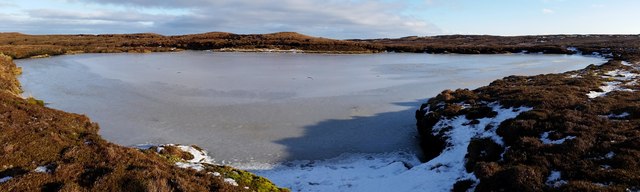
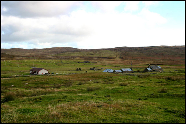
Minni Loch is a small freshwater loch located in the Shetland Islands, an archipelago in Scotland. Situated in the north of the mainland, Minni Loch is nestled amidst picturesque surroundings, boasting stunning views of rolling hills and rugged landscapes. It is considered one of the most enchanting and serene bodies of water in the region.

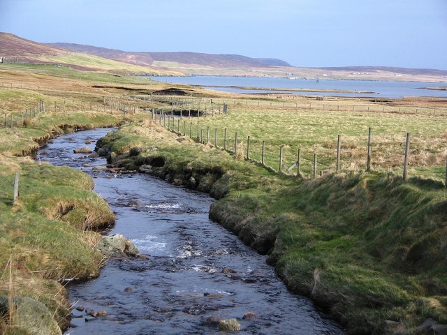
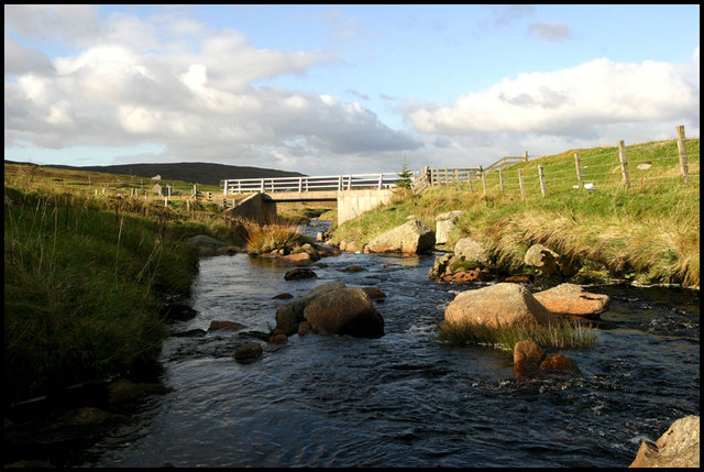
Covering an area of approximately 4 hectares, Minni Loch is relatively shallow, with an average depth of around 3 meters. The loch is fed by a combination of rainfall, freshwater springs, and small streams, ensuring a constant supply of water throughout the year. It is also home to a diverse array of aquatic plants and wildlife.

The loch's tranquil waters provide a habitat for various aquatic species, including brown trout, which are popular among anglers. Angling enthusiasts often visit Minni Loch to enjoy a day of fishing and appreciate the peaceful ambiance. Additionally, the loch attracts a variety of migratory birds, making it a haven for birdwatchers.

Surrounding the loch, there is a lush freshwater marsh, which supports a rich ecosystem of wetland vegetation. This marshland, with its reeds, sedges, and water lilies, provides a vital habitat for numerous species of birds, insects, and amphibians. It is an ideal spot for nature enthusiasts to explore and observe the diverse flora and fauna.

Minni Loch is a hidden gem within the Shetland Islands, offering visitors a serene and idyllic setting to immerse themselves in nature. Its unspoiled beauty and abundant wildlife make it a must-visit destination for those seeking tranquility and a glimpse into the natural wonders of the region.

If you have any feedback on the listing, please let us know in the comments section below.

Minni Loch Images

Images are sourced within 2km of 60.315701/-1.2022303 or Grid Reference HU4459. Thanks to Geograph Open Source API. All images are credited.

Stone Structure at Burn of Forse Small stone structure perched on the bank of the Burn of Forse with waterfall in background.
Stone Structure at Burn of Forse
Small stone structure perched on the bank of the Burn of Forse with waterfall in background.
East Peerieden Snowy peat hags in the East Peerieden.
East Peerieden
Snowy peat hags in the East Peerieden.
The Minni Loch The small Minni Loch completely frozen over.
The Minni Loch
The small Minni Loch completely frozen over.
The Long Loch The Long Loch frozen over after a recent cold spell.
The Long Loch
The Long Loch frozen over after a recent cold spell.
Knowe west of Muckle Hill Active peat erosion and active plant recolonisation on the top of this unnamed knowe west of the Muckle Hill.
Knowe west of Muckle Hill
Active peat erosion and active plant recolonisation on the top of this unnamed knowe west of the Muckle Hill.
Water Holes One of a series of water holes shown on the OS Map below Moo Field.
Water Holes
One of a series of water holes shown on the OS Map below Moo Field.
Burn of Grunnafirth, Shetland Looking north and downstream along the Burn of Grunnafirth out to Ayre of Dury beyond.
Burn of Grunnafirth, Shetland
Looking north and downstream along the Burn of Grunnafirth out to Ayre of Dury beyond.
Houses at Lower House Croft House at Lower House, old buildings to right and new dwelling left
Houses at Lower House
Croft House at Lower House, old buildings to right and new dwelling left
Derelict House Old croft now disused
Derelict House
Old croft now disused
Fern Croft "Access road" to the croft at Fern
Fern Croft
"Access road" to the croft at Fern
Burn and Bridge Burn of Grunnafirth with bridge over road
Burn and Bridge
Burn of Grunnafirth with bridge over road
Fern, Dury Ruined crofthouse beside the Burn of Grunnafirth at Dury.
Fern, Dury
Ruined crofthouse beside the Burn of Grunnafirth at Dury.
Burn of Grunnafirth, Dury Looking downstream towards Dury Voe.
Burn of Grunnafirth, Dury
Looking downstream towards Dury Voe.
Ruin at Dury
Ruin at Dury
Eastern end of Gossa Water Arriving at a misty Gossa Water after following up the Atler Burn over some fairly difficult ground.
Eastern end of Gossa Water
Arriving at a misty Gossa Water after following up the Atler Burn over some fairly difficult ground.
Gossa Water A narrow spit sticks out from Gossa Water's southern shore.
This loch is mainly shallow with several small isles and features in its dark water.
Gossa Water
A narrow spit sticks out from Gossa Water's southern shore. This loch is mainly shallow with several small isles and features in its dark water.
Burn of Gossawater The burn of Gossa Water a little below the loch.
Sea trout have started to make a comeback to this system in recent years, travelling up the burn from Laxo Voe.
Burn of Gossawater
The burn of Gossa Water a little below the loch. Sea trout have started to make a comeback to this system in recent years, travelling up the burn from Laxo Voe.
Show me another place!

Minni Loch is located at Grid Ref: HU4459 (Lat: 60.315701, Lng: -1.2022303)

Unitary Authority: Shetland Islands

Police Authority: Highlands and Islands

What 3 Words

///riding.ozone.nutty. Near Vidlin, Shetland Islands

Related Wikis

Viking Wind Farm

Viking Wind Farm is a large on-shore wind farm under construction in the Shetland Islands which is being developed by Viking Energy, a partnership between...

Geopark Shetland

Geopark Shetland is the name used by the Geopark formally established in September 2009 on its entry into the European Geoparks Network. The Geopark extends...

Central Mainland

The Central Mainland of the Shetland Islands is the part of the Mainland, the largest of the Shetland Islands, Scotland. It is located between Hellister...

Billister

Billister is a settlement in the parish of Nesting, on the island of Mainland, in Shetland, Scotland. It is on Lax Firth. Billister was formerly the terminal...

Nearby Amenities

Located within 500m of 60.315701,-1.2022303
Muckle Hill
Corbett: no
Ele: 168
Graham: no
Marilyn: no
Munro: no
Natural: peak
Lat/Long: 60.3112609/-1.203687
Construction Power: generator
Generator Method: wind_turbine
Generator Output Electricity: 4.2 MW
Generator Source: wind
Generator Type: horizontal_axis
Manufacturer: Vestas
Model: V117-4.2 MW
Model Wikidata: Q117805651
Power: generator
Lat/Long: 60.3133586/-1.1960721
Construction Power: generator
Generator Method: wind_turbine
Generator Output Electricity: 4.2 MW
Generator Source: wind
Generator Type: horizontal_axis
Manufacturer: Vestas
Model: V117-4.2 MW
Model Wikidata: Q117805651
Power: generator
Lat/Long: 60.3120089/-1.2052453
The data included in this document is from www.openstreetmap.org. The data is made available under ODbL.

Have you been to Minni Loch?

Leave your review of Minni Loch below (or comments, questions and feedback).