Black Loch

Lake, Pool, Pond, Freshwater Marsh in Shetland

Scotland

Black Loch

Boat on the shore of a frozen Loch of Girlsta
Boat on the shore of a frozen Loch of Girlsta Credit: Mike Pennington

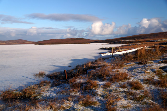
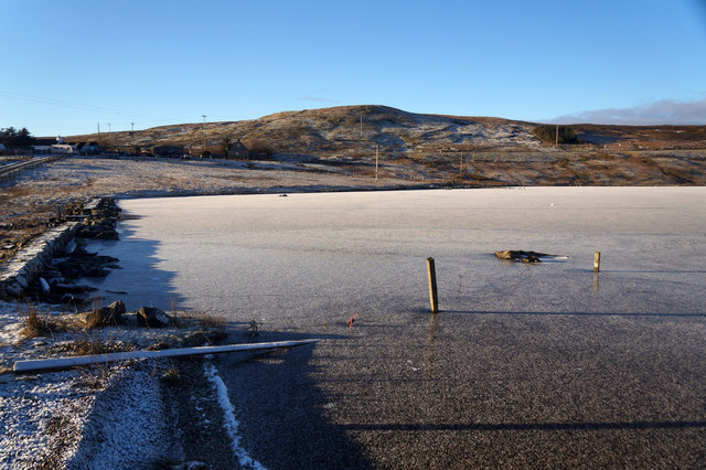
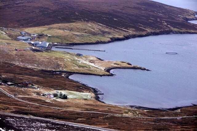
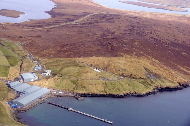
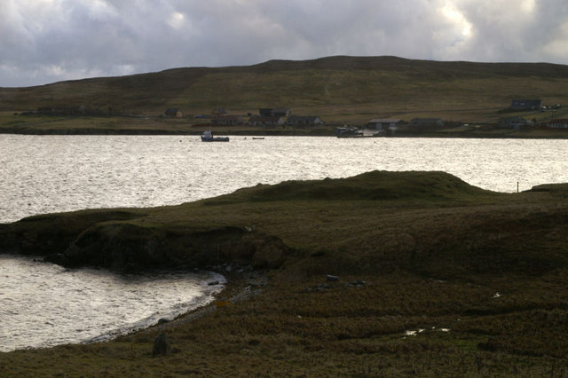
Black Loch is a small freshwater loch located in the Shetland Islands, Scotland. Covering an area of approximately 10 acres, it is nestled within the rolling hills and picturesque landscape of the region. The loch is situated about 2 miles northeast of the village of Aithsetter and lies at an elevation of around 250 feet above sea level.

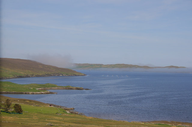
Surrounded by lush vegetation and heather-covered hills, Black Loch is a tranquil and scenic spot that attracts nature enthusiasts and anglers alike. The loch is home to a variety of freshwater fish species, including brown trout and Arctic char, making it a popular fishing destination. Anglers can enjoy the serene surroundings while casting their lines in search of a prized catch.

The loch itself has a relatively shallow depth, with an average depth of around 8 feet. It has a gently sloping shoreline, which provides easy access for fishing or leisurely walks along the water's edge. The water in Black Loch is clear and pristine, reflecting the beauty of the surrounding landscape.

The area around Black Loch is also rich in birdlife, attracting a diverse range of species throughout the year. Visitors may spot various waterfowl, such as mallards, tufted ducks, and goldeneyes, as well as wading birds like oystercatchers and redshanks.

Overall, Black Loch offers a peaceful retreat for those seeking to immerse themselves in the natural beauty of the Shetland Islands. Its idyllic setting, abundant wildlife, and opportunities for fishing make it a hidden gem in this remote part of Scotland.

If you have any feedback on the listing, please let us know in the comments section below.
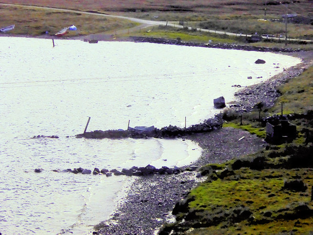
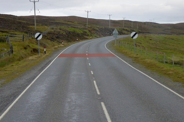
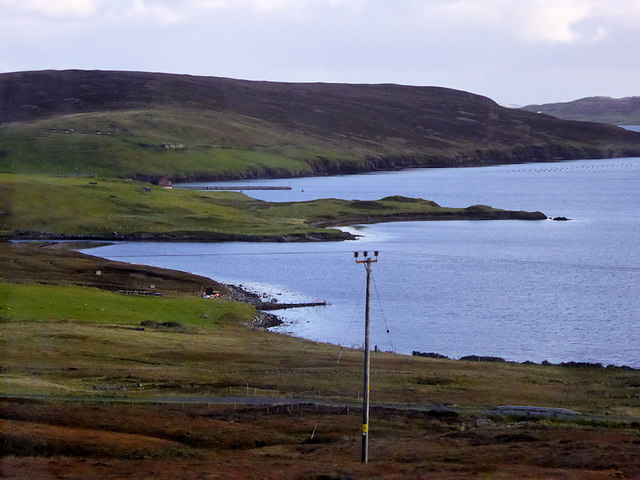
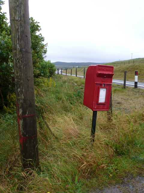
Black Loch Images

Images are sourced within 2km of 60.225093/-1.2297042 or Grid Reference HU4249. Thanks to Geograph Open Source API. All images are credited.

Boat on the shore of a frozen Loch of Girlsta
Frozen outflow from Loch of Girlsta
The Junction Bus Stop near Girlsta The A970 runs for 71 miles across most of the length of the "Mainland" in the Shetland Islands. It is a good-quality single-carriageway road for most of its route. Travelling from south to north, the road begins at Grutness near Sumburgh Airport and winds around the many hills and inlets passing close to a number of small villages without going through any large ones before Lerwick. After looping around Lerwick, a short spur runs to Scalloway whilst the main route continues northwards towards Brae where it crosses the narrow isthmus of Mavis Grind. At Sandy Lochs the road splits and a four-mile spur goes through Urafirth to Hillswick. The main route continuing to the right towards its northern terminus at Isbister. This last part of the route tends to be narrower with passing places.

<span class="nowrap"><a title="https://www.sabre-roads.org.uk/wiki/index.php?title=A970" rel="nofollow ugc noopener" href="https://www.sabre-roads.org.uk/wiki/index.php?title=A970">Link</a><img style="margin-left:2px;" alt="External link" title="External link - shift click to open in new window" src="https://s1.geograph.org.uk/img/external.png" width="10" height="10"/></span>  SABRE
The Junction Bus Stop near Girlsta
The A970 runs for 71 miles across most of the length of the "Mainland" in the Shetland Islands. It is a good-quality single-carriageway road for most of its route. Travelling from south to north, the road begins at Grutness near Sumburgh Airport and winds around the many hills and inlets passing close to a number of small villages without going through any large ones before Lerwick. After looping around Lerwick, a short spur runs to Scalloway whilst the main route continues northwards towards Brae where it crosses the narrow isthmus of Mavis Grind. At Sandy Lochs the road splits and a four-mile spur goes through Urafirth to Hillswick. The main route continuing to the right towards its northern terminus at Isbister. This last part of the route tends to be narrower with passing places. LinkExternal link SABRE
Motorcyclists on the A970 near Girlsta The A970 runs for 71 miles across most of the length of the "Mainland" in the Shetland Islands. It is a good-quality single-carriageway road for most of its route. Travelling from south to north, the road begins at Grutness near Sumburgh Airport and winds around the many hills and inlets passing close to a number of small villages without going through any large ones before Lerwick. After looping around Lerwick, a short spur runs to Scalloway whilst the main route continues northwards towards Brae where it crosses the narrow isthmus of Mavis Grind. At Sandy Lochs the road splits and a four-mile spur goes through Urafirth to Hillswick. The main route continuing to the right towards its northern terminus at Isbister. This last part of the route tends to be narrower with passing places.

<span class="nowrap"><a title="https://www.sabre-roads.org.uk/wiki/index.php?title=A970" rel="nofollow ugc noopener" href="https://www.sabre-roads.org.uk/wiki/index.php?title=A970">Link</a><img style="margin-left:2px;" alt="External link" title="External link - shift click to open in new window" src="https://s1.geograph.org.uk/img/external.png" width="10" height="10"/></span>  SABRE
Motorcyclists on the A970 near Girlsta
The A970 runs for 71 miles across most of the length of the "Mainland" in the Shetland Islands. It is a good-quality single-carriageway road for most of its route. Travelling from south to north, the road begins at Grutness near Sumburgh Airport and winds around the many hills and inlets passing close to a number of small villages without going through any large ones before Lerwick. After looping around Lerwick, a short spur runs to Scalloway whilst the main route continues northwards towards Brae where it crosses the narrow isthmus of Mavis Grind. At Sandy Lochs the road splits and a four-mile spur goes through Urafirth to Hillswick. The main route continuing to the right towards its northern terminus at Isbister. This last part of the route tends to be narrower with passing places. LinkExternal link SABRE
Loch of Girlsta The loch at Girlsta is the deepest in Shetland, at about 65ft deep in places. The name "Girlsta" comes from the Old Norse "Geirhildastadr" - meaning "the place of Geirhilda". Geirhilda was a young Viking princess, daughter of the famous 9th century Viking explorer, Flóki Vilgerðarson. According to local folklore, Geirhilda drowned in the loch after falling through the ice and she is buried on the small island within the loch. 
More information about the story at <span class="nowrap"><a title="https://www.shetlandwithlaurie.com/blog/geirhildrs-loch-a-viking-saga" rel="nofollow ugc noopener" href="https://www.shetlandwithlaurie.com/blog/geirhildrs-loch-a-viking-saga">Link</a><img style="margin-left:2px;" alt="External link" title="External link - shift click to open in new window" src="https://s1.geograph.org.uk/img/external.png" width="10" height="10"/></span> (Shetland with Laurie) and <span class="nowrap"><a title="https://madbassist.wixsite.com/hobbitpaw/folklore" rel="nofollow ugc noopener" href="https://madbassist.wixsite.com/hobbitpaw/folklore">Link</a><img style="margin-left:2px;" alt="External link" title="External link - shift click to open in new window" src="https://s1.geograph.org.uk/img/external.png" width="10" height="10"/></span> (Folklore and Shetland Stories)
Loch of Girlsta
The loch at Girlsta is the deepest in Shetland, at about 65ft deep in places. The name "Girlsta" comes from the Old Norse "Geirhildastadr" - meaning "the place of Geirhilda". Geirhilda was a young Viking princess, daughter of the famous 9th century Viking explorer, Flóki Vilgerðarson. According to local folklore, Geirhilda drowned in the loch after falling through the ice and she is buried on the small island within the loch. More information about the story at LinkExternal link (Shetland with Laurie) and LinkExternal link (Folklore and Shetland Stories)
A970 near Girlsta The A970 runs for 71 miles across most of the length of the "Mainland" in the Shetland Islands. It is a good-quality single-carriageway road for most of its route. Travelling from south to north, the road begins at Grutness near Sumburgh Airport and winds around the many hills and inlets passing close to a number of small villages without going through any large ones before Lerwick. After looping around Lerwick, a short spur runs to Scalloway whilst the main route continues northwards towards Brae where it crosses the narrow isthmus of Mavis Grind. At Sandy Lochs the road splits and a four-mile spur goes through Urafirth to Hillswick. The main route continuing to the right towards its northern terminus at Isbister. This last part of the route tends to be narrower with passing places.

<span class="nowrap"><a title="https://www.sabre-roads.org.uk/wiki/index.php?title=A970" rel="nofollow ugc noopener" href="https://www.sabre-roads.org.uk/wiki/index.php?title=A970">Link</a><img style="margin-left:2px;" alt="External link" title="External link - shift click to open in new window" src="https://s1.geograph.org.uk/img/external.png" width="10" height="10"/></span>  SABRE
A970 near Girlsta
The A970 runs for 71 miles across most of the length of the "Mainland" in the Shetland Islands. It is a good-quality single-carriageway road for most of its route. Travelling from south to north, the road begins at Grutness near Sumburgh Airport and winds around the many hills and inlets passing close to a number of small villages without going through any large ones before Lerwick. After looping around Lerwick, a short spur runs to Scalloway whilst the main route continues northwards towards Brae where it crosses the narrow isthmus of Mavis Grind. At Sandy Lochs the road splits and a four-mile spur goes through Urafirth to Hillswick. The main route continuing to the right towards its northern terminus at Isbister. This last part of the route tends to be narrower with passing places. LinkExternal link SABRE
Wadbister Voe
Wadbister Voe
Girlsta: the Methodist chapel A small chapel in an isolated spot, west of the village on the road towards Whiteness.
Girlsta: the Methodist chapel
A small chapel in an isolated spot, west of the village on the road towards Whiteness.
Girlsta: postbox № ZE2 21 This small postbox stands at a junction on the A970 and is emptied at 9am on weekdays and Saturdays. Judging by the red paint on the neighbouring telegraph pole, the box was previously clasped to it.
Girlsta: postbox № ZE2 21
This small postbox stands at a junction on the A970 and is emptied at 9am on weekdays and Saturdays. Judging by the red paint on the neighbouring telegraph pole, the box was previously clasped to it.
Girsta Service Reservoir I parked near Girlsta Service Reservoir before climbing the moorland HuMP called Hill of Hamarsland.
Girsta Service Reservoir
I parked near Girlsta Service Reservoir before climbing the moorland HuMP called Hill of Hamarsland.
Haar over Wadbister Voe Chalder Ness in the foreground, haar over Ritta Taing in the background.
Haar over Wadbister Voe
Chalder Ness in the foreground, haar over Ritta Taing in the background.
Girlsta from the air
Girlsta pier from the air
Loch of Girlsta, Shetland Looking NE across the south end of the Loch of Girlsta.
Loch of Girlsta, Shetland
Looking NE across the south end of the Loch of Girlsta.
Girlsta burn The outflow burn from the loch of Girlsta. In the past a large mill was in operation at Girlsta and the crofters came here with their corn to be ground into flour.
Girlsta burn
The outflow burn from the loch of Girlsta. In the past a large mill was in operation at Girlsta and the crofters came here with their corn to be ground into flour.
Chalder Ness, Wadbister Voe Looking across Wadbister Voe to Wadbister.
Chalder Ness, Wadbister Voe
Looking across Wadbister Voe to Wadbister.
Trees south of Girlsta.
Show me another place!

Black Loch is located at Grid Ref: HU4249 (Lat: 60.225093, Lng: -1.2297042)

Unitary Authority: Shetland Islands

Police Authority: Highlands and Islands

What 3 Words

///bashful.laughs.daunted. Near Lerwick, Shetland Islands

Nearby Locations

Black Loch

Related Wikis

Breiwick

Breiwick is a village on the island of Mainland in Shetland, Scotland. Breiwick is in the parish of Tingwall, and is 1.6 mi (2.5 km) north-east of Gott...

Tingwall Airport

Tingwall Airport (IATA: LWK, ICAO: EGET), also known as Lerwick/Tingwall Airport, is located in the Tingwall valley, near the village of Gott, 4 NM (7...

South Isle of Gletness

The South Isle of Gletness is an islet off Gletness, in Nesting in east central, Mainland, Shetland. It is 30m at its highest point. Amongst its features...

Veensgarth

Veensgarth (Old Norse: Vikingsgarðr, Viking farm, or Vingarðr, Meadow Farm), is a village in the Tingwall valley west of Lerwick on Mainland in Shetland...

Nearby Amenities

Located within 500m of 60.225093,-1.2297042
Power: pole
Lat/Long: 60.2228577/-1.2366867
Power: pole
Lat/Long: 60.2236248/-1.2368543
Power: pole
Lat/Long: 60.2243445/-1.2370133
Power: pole
Lat/Long: 60.2251351/-1.237185
Power: pole
Lat/Long: 60.2258852/-1.2373476
Power: pole
Lat/Long: 60.2266138/-1.237503
Wadbister
Place: hamlet
Lat/Long: 60.2277015/-1.2224284
Barrier: cattle_grid
Lat/Long: 60.2286029/-1.229366
Power: pole
Lat/Long: 60.2279907/-1.2352514
Power: pole
Lat/Long: 60.2273741/-1.2345646
Power: pole
Lat/Long: 60.2265351/-1.2336322
Power: pole
Lat/Long: 60.225714/-1.2327066
Power: pole
Lat/Long: 60.2248648/-1.2317537
Power: pole
Lat/Long: 60.22409/-1.2308917
Power: pole
Lat/Long: 60.2232633/-1.2299547
Power: pole
Lat/Long: 60.222781/-1.2290337
Power: pole
Lat/Long: 60.2221429/-1.2277919
Power: pole
Lat/Long: 60.221664/-1.2268845
Power: pole
Lat/Long: 60.2260156/-1.2212535
Power: pole
Lat/Long: 60.2254125/-1.2227045
Power: pole
Lat/Long: 60.2248275/-1.2240827
Power: pole
Lat/Long: 60.2243294/-1.2252789
Power: pole
Lat/Long: 60.2238235/-1.2264979
Power: pole
Lat/Long: 60.2232926/-1.2277692
The data included in this document is from www.openstreetmap.org. The data is made available under ODbL.

Have you been to Black Loch?

Leave your review of Black Loch below (or comments, questions and feedback).