Tirrack Loch

Lake, Pool, Pond, Freshwater Marsh in Shetland

Scotland

Tirrack Loch

The Loch of the Grey Yowe, behind Ronas Hill The first thing that was a little odd to me about this loch on Shetland was the name. I had always associated yowes being used for ewes to occur much further south; the Scottish Dictionary has its use in Angus and Buchan and yet here it was as far north in Scotland as you could go. The second surprise was that, in spite of the northern isles having a poor summer, the loch was really quite low. It had and still has, at least one nice trout in it. Spot-on navigation is needed to find the loch. You can't see it until you're within 50 yards or less.
The Loch of the Grey Yowe, behind Ronas Hill Credit: AlastairG

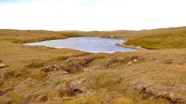
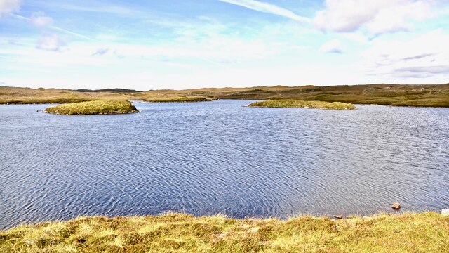
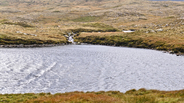
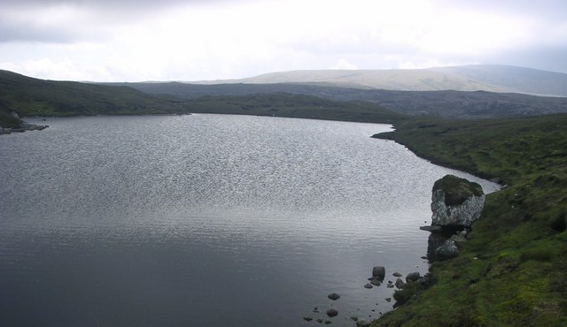
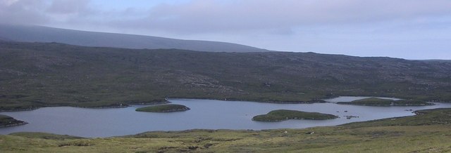
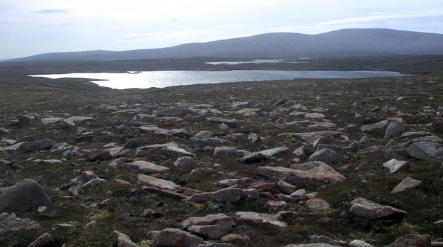
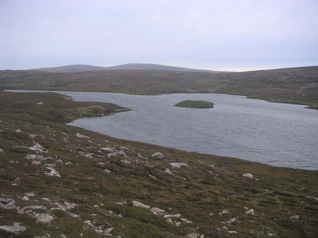
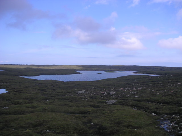
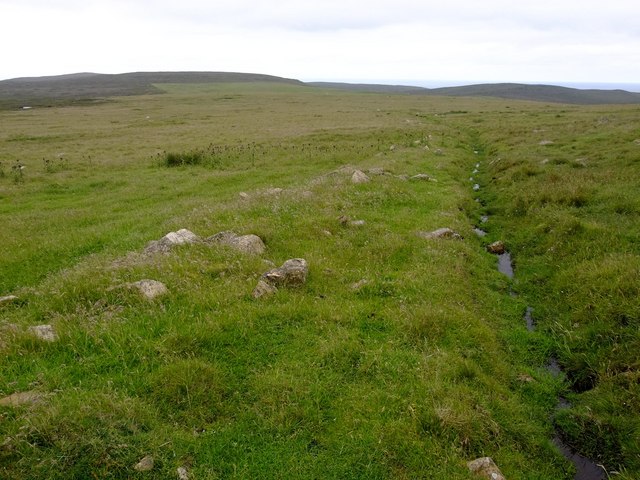
Tirrack Loch is a small freshwater loch located in the picturesque Shetland Islands, Scotland. Covering an area of approximately 2 hectares, it is nestled amidst rolling hills and lush greenery. The loch is situated about 12 kilometers northeast of Lerwick, the capital of Shetland.

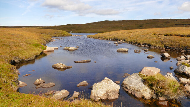
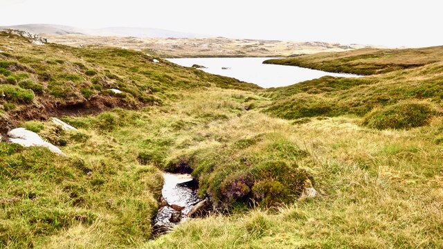
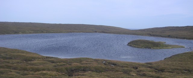
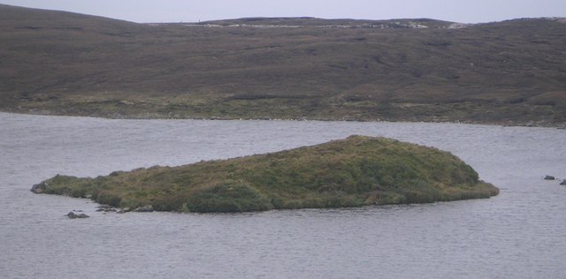
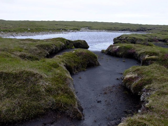
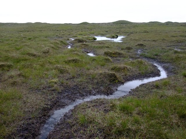
Tirrack Loch is a shallow body of water with an average depth of around 2 meters. It is fed by a combination of rainwater runoff and underground springs, ensuring a constant flow of freshwater. The loch is surrounded by a mix of heather, grasses, and shrubs, creating a beautiful and serene environment.

The loch serves as an important habitat for a diverse range of plant and animal species. It is home to various aquatic plants, such as water lilies, reeds, and mosses, which provide a habitat for insects, amphibians, and small fish. Birdwatchers can also spot a variety of waterfowl, including ducks, swans, and herons, which use the loch as a resting place during their migrations.

Tirrack Loch is a popular spot for recreational activities such as fishing and birdwatching. Anglers can try their luck catching brown trout, which thrive in the loch's clear waters. Visitors can also enjoy peaceful walks along the loch's shores, taking in the stunning scenery and observing the local wildlife.

Overall, Tirrack Loch offers a tranquil and idyllic setting for nature lovers and those seeking a peaceful retreat in the heart of Shetland's natural beauty.

If you have any feedback on the listing, please let us know in the comments section below.

Tirrack Loch Images

Images are sourced within 2km of 60.579077/-1.3840897 or Grid Reference HU3388. Thanks to Geograph Open Source API. All images are credited.

The Loch of the Grey Yowe, behind Ronas Hill The first thing that was a little odd to me about this loch on Shetland was the name. I had always associated yowes being used for ewes to occur much further south; the Scottish Dictionary has its use in Angus and Buchan and yet here it was as far north in Scotland as you could go. The second surprise was that, in spite of the northern isles having a poor summer, the loch was really quite low. It had and still has, at least one nice trout in it. Spot-on navigation is needed to find the loch. You can't see it until you're within 50 yards or less.
The Loch of the Grey Yowe, behind Ronas Hill
The first thing that was a little odd to me about this loch on Shetland was the name. I had always associated yowes being used for ewes to occur much further south; the Scottish Dictionary has its use in Angus and Buchan and yet here it was as far north in Scotland as you could go. The second surprise was that, in spite of the northern isles having a poor summer, the loch was really quite low. It had and still has, at least one nice trout in it. Spot-on navigation is needed to find the loch. You can't see it until you're within 50 yards or less.
Drainage in North Roe, Shetland This shows the western end of the connection shown in  <a href="https://www.geograph.org.uk/photo/7285614">HU3386 : Drainage in North Roe, Shetland</a>. These interconnected lochs both contain brown trout.
Drainage in North Roe, Shetland
This shows the western end of the connection shown in HU3386 : Drainage in North Roe, Shetland. These interconnected lochs both contain brown trout.
Clubbi Shuns, Shetland This loch forms part of the catchment area for the public water supply for the area. It drains into Roeg Water where the water is drawn off. Like its neighbour, Clubbi Shuns contains a stock of brown trout.
Clubbi Shuns, Shetland
This loch forms part of the catchment area for the public water supply for the area. It drains into Roeg Water where the water is drawn off. Like its neighbour, Clubbi Shuns contains a stock of brown trout.
Moorland drainage, Shetland In a landscape of peat bogs, running water is actually rather rare. This burn is one of the very few which are crossed while walking along the north side of a chain of lochs between Roer Water and Birka Water.
Moorland drainage, Shetland
In a landscape of peat bogs, running water is actually rather rare. This burn is one of the very few which are crossed while walking along the north side of a chain of lochs between Roer Water and Birka Water.
Looking across to Maadle Swankie from Clubbi Shuns, Shetland Even in a region of strange placenames, this pair are a bit odd. They are located north of Ronas Hill.
Looking across to Maadle Swankie from Clubbi Shuns, Shetland
Even in a region of strange placenames, this pair are a bit odd. They are located north of Ronas Hill.
Neolithic axe factory The large rock is felsite, and was the source for stone tools. The hole to the right of it has dry stone walls and a partial roof.
Neolithic axe factory
The large rock is felsite, and was the source for stone tools. The hole to the right of it has dry stone walls and a partial roof.
Loch a Grey Yowe Said to take its name from the moss covered boulder on the shore of the loch.
Loch a Grey Yowe
Said to take its name from the moss covered boulder on the shore of the loch.
Peaty terrain Soft peaty terrain, approaching from the west to the larger of the Mill Lochs of Sandvoe.
Peaty terrain
Soft peaty terrain, approaching from the west to the larger of the Mill Lochs of Sandvoe.
Clubbi Shuns View of the Clubbi Shuns from Oxna Leog.
Clubbi Shuns
View of the Clubbi Shuns from Oxna Leog.
Pettadale Water Small shallow loch with abundant wild brown trout. Pettadale, meaning Picts valley. Island mound.
Pettadale Water
Small shallow loch with abundant wild brown trout. Pettadale, meaning Picts valley. Island mound.
Moosa Water Rocky terrain on the approach to Moosa Water.
Moosa Water
Rocky terrain on the approach to Moosa Water.
Mill Loch Holm
Mill Loch Holm
Inniscord Loch View south from the north shore of Inniscord to Ronas Hill.
Inniscord Loch
View south from the north shore of Inniscord to Ronas Hill.
Neolithic axe factory Large rock outcrop with stone built roof, the stone of 'Felsite' was mined and used for the production of stone tools by ancient man. Tool chippings are scattered around the area.
Neolithic axe factory
Large rock outcrop with stone built roof, the stone of 'Felsite' was mined and used for the production of stone tools by ancient man. Tool chippings are scattered around the area.
Tonga Water, Ronas Hill. View from the south bay, the name 'Tonga' comes from its shape and jutting land points.
Tonga Water, Ronas Hill.
View from the south bay, the name 'Tonga' comes from its shape and jutting land points.
Moorland NE of Roer Water This moorland looks bleak, but it is alive with birds such as Great Skua (Bonxies), Curlew, Whimbrel, Golden Plover and Pink-footed Geese.
Moorland NE of Roer Water
This moorland looks bleak, but it is alive with birds such as Great Skua (Bonxies), Curlew, Whimbrel, Golden Plover and Pink-footed Geese.
Blanket bog NE of Roer Water
Drainage ditch west of Beorgs of Skelberry When we arrived, these wet meadows were thick hundreds with Greylag geese. The wet grass provides excellent grazing sompared with the adjacent moorland
Drainage ditch west of Beorgs of Skelberry
When we arrived, these wet meadows were thick hundreds with Greylag geese. The wet grass provides excellent grazing sompared with the adjacent moorland
Show me another place!

Tirrack Loch is located at Grid Ref: HU3388 (Lat: 60.579077, Lng: -1.3840897)

Unitary Authority: Shetland Islands

Police Authority: Highlands and Islands

What 3 Words

///drummers.banana.vibes. Near Ulsta, Shetland Islands

Related Wikis

North Roe

North Roe is a village, and protected area at the northern tip in the large Northmavine peninsula of the Mainland of Shetland, Scotland. It is a small...

Uyea, Northmavine

Uyea (Scots: Öya in Shetland dialect spelling) is an uninhabited tidal island located to the northwest of Mainland, Shetland. Uyea lies off the Northmavine...

Lang Ayre

The Lang Ayre is a beach on the west side of Ronas Hill, Northmavine, Shetland. At 1 kilometre (0.6 mi) in length it is the archipelago's longest. It is...

Ronas Hill

Ronas Hill (or Rönies Hill) is a hill in Shetland, Scotland. It is classed as a Marilyn, and is the highest point in the Shetland Islands at an elevation...

Have you been to Tirrack Loch?

Leave your review of Tirrack Loch below (or comments, questions and feedback).