Middle Linacre Reservoir

Lake, Pool, Pond, Freshwater Marsh in Derbyshire North East Derbyshire

England

Middle Linacre Reservoir

Barley field near the Linacre Reservoirs Chesterfield is seen in the distance.
Barley field near the Linacre Reservoirs Credit: Bill Boaden

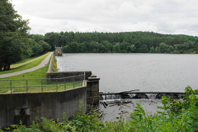
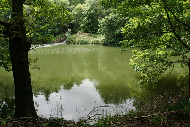
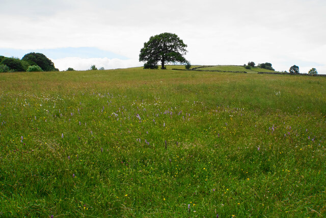
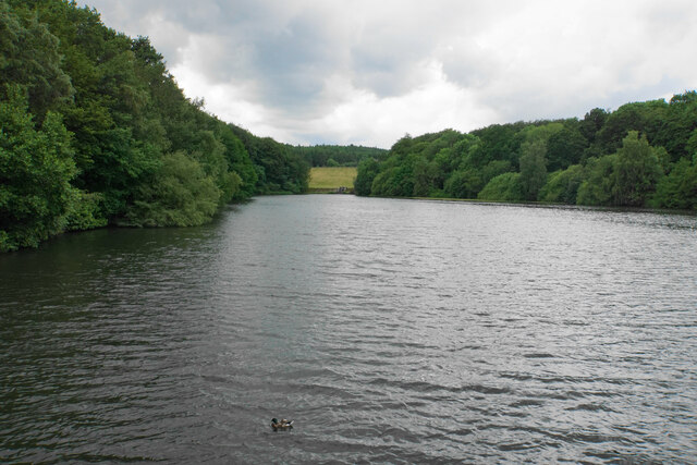
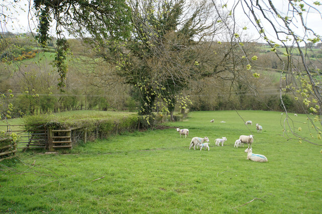
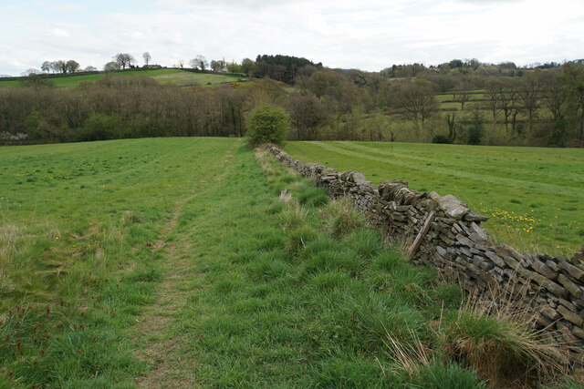
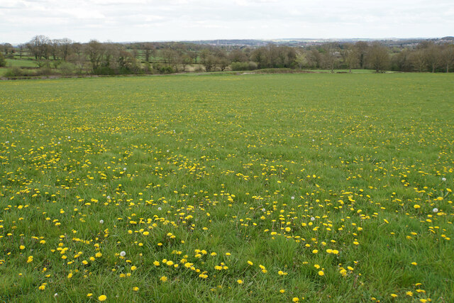
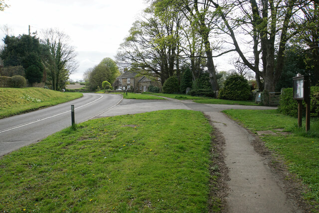
Middle Linacre Reservoir is a picturesque body of water located in Derbyshire, England. This freshwater reservoir, also known as a lake, is situated within the Linacre Woods, a popular destination for nature lovers and outdoor enthusiasts. The reservoir covers an area of approximately 4.7 hectares and is surrounded by lush greenery, making it a tranquil and serene spot.

The reservoir was originally constructed in the 19th century to supply drinking water to the nearby towns of Chesterfield and Sheffield. Today, it serves as a recreational area, attracting visitors who come to enjoy its natural beauty and engage in various activities such as walking, cycling, and picnicking.

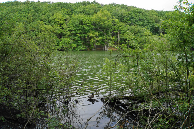
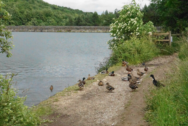
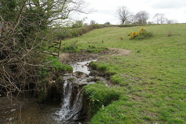
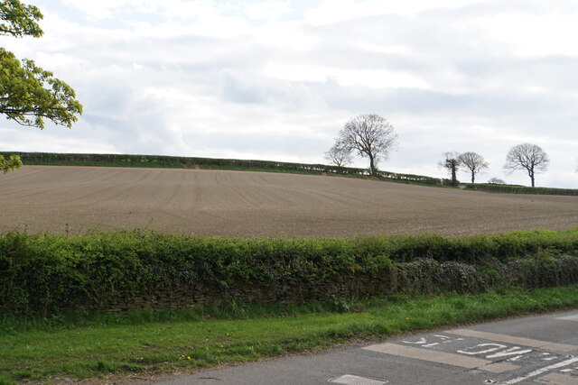
Surrounded by a diverse range of flora and fauna, Middle Linacre Reservoir is home to a variety of bird species, making it a haven for birdwatchers. The tranquil waters provide a perfect habitat for waterfowl such as ducks, geese, and swans. Additionally, the reservoir supports a thriving population of fish, including trout and perch, making it a popular spot for angling enthusiasts.

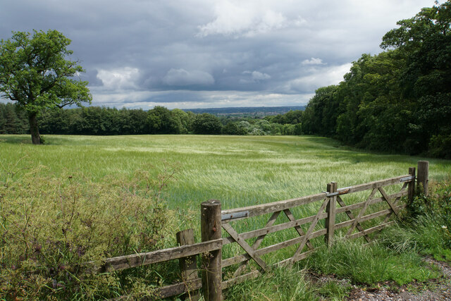
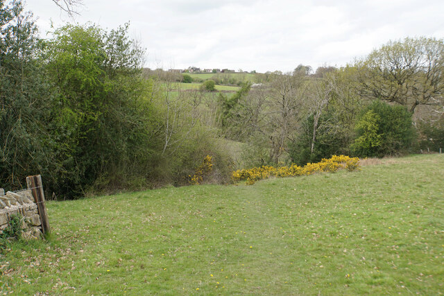
The reservoir is also connected to Upper Linacre Reservoir and Lower Linacre Reservoir, forming a chain of water bodies that are interconnected by footpaths. These footpaths allow visitors to explore the area and enjoy scenic walks while taking in the stunning views.

Overall, Middle Linacre Reservoir is a beautiful freshwater body that offers a peaceful escape from the hustle and bustle of daily life. Its natural surroundings, abundant wildlife, and recreational opportunities make it a popular destination for both locals and tourists alike.

If you have any feedback on the listing, please let us know in the comments section below.

Middle Linacre Reservoir Images

Images are sourced within 2km of 53.248356/-1.50332 or Grid Reference SK3372. Thanks to Geograph Open Source API. All images are credited.

Barley field near the Linacre Reservoirs Chesterfield is seen in the distance.
Barley field near the Linacre Reservoirs
Chesterfield is seen in the distance.
Outflow from Middle Linacre Reservoir
The head of Middle Linacre Reservoir Opposite is the outflow from the Upper Reservoir.
The head of Middle Linacre Reservoir
Opposite is the outflow from the Upper Reservoir.
Upper Linacre Reservoir Much of it is surrounded by ancient woodland.
Upper Linacre Reservoir
Much of it is surrounded by ancient woodland.
Meadow above Upper Linacre Reservoir The meadow has a wide diversity of plants, including marsh orchids.
Meadow above Upper Linacre Reservoir
The meadow has a wide diversity of plants, including marsh orchids.
Ducks gathering by Upper Linacre Reservoir The reservoir dam is seen behind.
Ducks gathering by Upper Linacre Reservoir
The reservoir dam is seen behind.
Lower Linacre Reservoir The smallest of the three reservoirs. The dam of the Middle Reservoir can be seen.
Lower Linacre Reservoir
The smallest of the three reservoirs. The dam of the Middle Reservoir can be seen.
Brampton, Woodnook Lane BM on roadside wall

Sk33427300
Brampton, Woodnook Lane
BM on roadside wall Sk33427300
Lambs with their mothers near Ladywood Farm The valley behind carries a tributary of the River Hipper.
Lambs with their mothers near Ladywood Farm
The valley behind carries a tributary of the River Hipper.
Footpath to Old Brampton Perhaps not the most scenic start for the path as it leaves the A619.
Footpath to Old Brampton
Perhaps not the most scenic start for the path as it leaves the A619.
Footpath to Old Brampton The path has just left Westwick Lane. It descends to a brook, then climbs to Old Brampton which can be seen at the top of the hill.
Footpath to Old Brampton
The path has just left Westwick Lane. It descends to a brook, then climbs to Old Brampton which can be seen at the top of the hill.
Brook below Frithhallwood Farm A footpath crosses this brook. It is fine at the moment, but could be a challenge in the winter months when the mud is wet and soft.
Brook below Frithhallwood Farm
A footpath crosses this brook. It is fine at the moment, but could be a challenge in the winter months when the mud is wet and soft.
Footpath towards Chanderhill Two brooks are crossed in the valley bottom before the path climbs the other side.
Footpath towards Chanderhill
Two brooks are crossed in the valley bottom before the path climbs the other side.
Field of dandelions near Old Brampton From this field you can see down to Chesterfield with its crooked spire.
Field of dandelions near Old Brampton
From this field you can see down to Chesterfield with its crooked spire.
Old Brampton A view of the old part of the village from a footpath approaching from the south.
Old Brampton
A view of the old part of the village from a footpath approaching from the south.
Parish church of St Peter & St Paul, Old Brampton A Grade I listed church dating from the 14th Century with Victorian renovations. The lych gate is one of a pair donated in 1937.
Parish church of St Peter & St Paul, Old Brampton
A Grade I listed church dating from the 14th Century with Victorian renovations. The lych gate is one of a pair donated in 1937.
Hemming Green The road is climbing steadily from Old Brampton. On the right is a parish council noticeboard.
Hemming Green
The road is climbing steadily from Old Brampton. On the right is a parish council noticeboard.
Prepared field at Hollins Coming up from Old Brampton, this is the first bit of open field that you see, as most of the road is bounded by houses or foliage.
Prepared field at Hollins
Coming up from Old Brampton, this is the first bit of open field that you see, as most of the road is bounded by houses or foliage.
Show me another place!

Middle Linacre Reservoir is located at Grid Ref: SK3372 (Lat: 53.248356, Lng: -1.50332)

Administrative County: Derbyshire

District: North East Derbyshire

Police Authority: Derbyshire

What 3 Words

///expert.budding.outwards. Near Walton, Derbyshire

Related Wikis

Old Brampton

Old Brampton is a village in the civil parish of Brampton, in the county of Derbyshire, England. It lies 3 miles to the west of Chesterfield, on a spur...

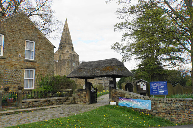
St Peter and St Paul's Church, Old Brampton

St Peter and St Paul's Church is a Grade I listed parish church in the Church of England in Old Brampton, Brampton, North East Derbyshire. == History... ==

Ingmanthorpe, Derbyshire

Ingmanthorpe is a hamlet in Brampton, Derbyshire, England. Ingmanthorpe is located on the B6050 road some 3 miles (4.8 km) west of the town of Chesterfield...

Brampton, North East Derbyshire

Brampton is a civil parish in North East Derbyshire, England, with a population of 1,201 in 2011. Lying 130 miles (210 km) north west of London, 20 miles...

Wadshelf

Wadshelf is a small village in Derbyshire, England. It is located between Chesterfield and Baslow, just inside the Peak District national park. It is near...

Barlow, Derbyshire

Barlow is a village and civil parish in the North East Derbyshire district of Derbyshire, England. According to the 2001 census the parish had a population...

Barlow Common

Barlow Common is a village in Derbyshire, England, near Barlow and Chesterfield. It includes the hamlet of Crowhole, which contains several buildings surviving...

Barlow Woodseats Hall

Barlow Woodseats Hall is a Grade II* listed manor house situated at Barlow Woodseats, on the edge of the village of Barlow, in Derbyshire. It remains the...

Nearby Amenities

Located within 500m of 53.248356,-1.50332
Bench
Ele: 172.9216309
Lat/Long: 53.2501624/-1.5079336
Bench
Ele: 169.0762939
Lat/Long: 53.2499616/-1.5058163
Bench
Ele: 168.3552246
Lat/Long: 53.2496466/-1.50432
Bench
Backrest: no
Ele: 164.2697754
Lat/Long: 53.249407/-1.5037329
Ele: 209
Lat/Long: 53.2513516/-1.5074932
Ele: 204
Lat/Long: 53.2509754/-1.5033991
Ele: 204
Lat/Long: 53.250957/-1.5033998
Ele: 205
Lat/Long: 53.2510215/-1.5033543
Ele: 205
Lat/Long: 53.2509319/-1.5036311
Ele: 175
Lat/Long: 53.2500453/-1.4977775
Ele: 170
Lat/Long: 53.2498418/-1.4978862
Ele: 155.8582764
Lat/Long: 53.2463535/-1.4974851
Ele: 154.1759033
Lat/Long: 53.2462706/-1.4974707
Information: board
Tourism: information
Lat/Long: 53.2518312/-1.4987779
Bench
Lat/Long: 53.2518328/-1.4988315
Leisure: picnic_table
Lat/Long: 53.249515/-1.5010183
Bench
Lat/Long: 53.2493135/-1.5018322
Information: board
Tourism: information
Lat/Long: 53.25152/-1.498376
Bench
Lat/Long: 53.2472588/-1.4985201
Board Title: Bodging
Board Type: history
Information: board
Tourism: information
Lat/Long: 53.2471898/-1.4990083
Bench
Lat/Long: 53.2506393/-1.5002857
Leisure: picnic_table
Lat/Long: 53.2506072/-1.5004353
Spire View
Direction: 136
Tourism: viewpoint
Lat/Long: 53.2506368/-1.5002581
Leisure: picnic_table
Lat/Long: 53.250648/-1.5003897
Leisure: picnic_table
Lat/Long: 53.2495146/-1.5011373
The data included in this document is from www.openstreetmap.org. The data is made available under ODbL.

Have you been to Middle Linacre Reservoir?

Leave your review of Middle Linacre Reservoir below (or comments, questions and feedback).