Loch of Brunthill

Lake, Pool, Pond, Freshwater Marsh in Shetland

Scotland

Loch of Brunthill

Dandi Geo Muckle Roe is formed entirely of igneous rocks forming a pluton of Old Red Sandstone (Devonian) age, and all except the NE side are a Granophyre which forms dramatic red cliffs riven by geos, caves and natural arches. Dandi Geo is one of the narrower geos eroded from the west coast of the island just at the point where a small stream drains northwestwards from a series of small lochans. In the far distance, Esha Ness can be seen across St. Magnus Bay, itself a large basin possibly associated with an ancient meteorite impact.
Dandi Geo Credit: Andy Waddington

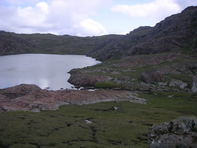
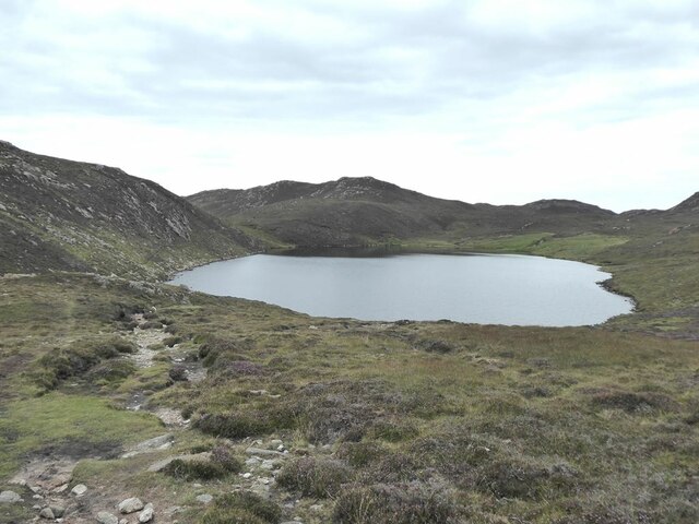
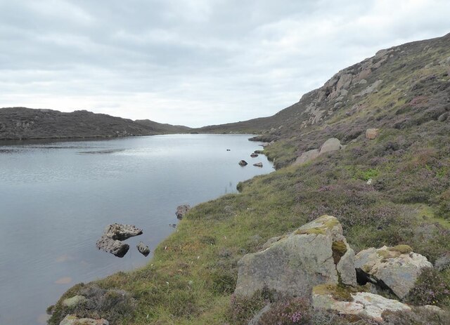
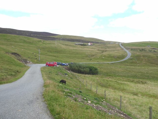
Loch of Brunthill is a picturesque freshwater loch located in the Shetland Islands, Scotland. Nestled amidst the rugged landscape, it is an enchanting body of water that offers a tranquil escape to both locals and visitors alike.

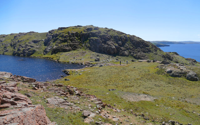
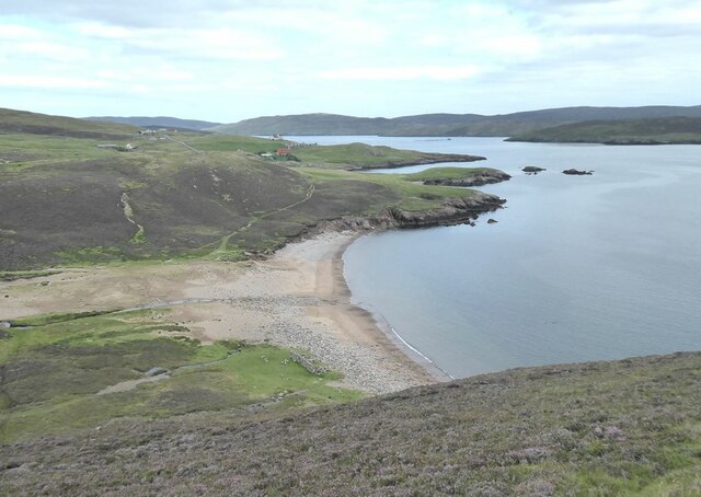
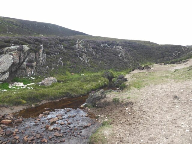
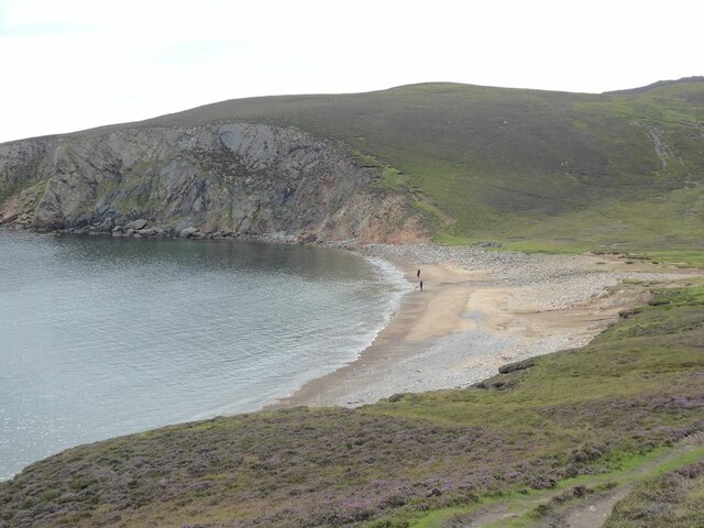
Covering an area of approximately 10 hectares, the Loch of Brunthill is surrounded by rolling hills and abundant greenery, creating a stunning backdrop for nature enthusiasts. The loch is primarily fed by rainfall and small streams, resulting in a calm and serene environment.

The water in Loch of Brunthill is crystal clear, allowing for excellent visibility of the aquatic life thriving within. It is home to a variety of freshwater fish species, including brown trout and Arctic char, making it a popular spot for anglers. The gently sloping shores of the loch provide easy access for fishing and other recreational activities.

The surrounding area of the loch is a haven for birdwatchers. It serves as a nesting ground for several bird species, including greylag geese, whooper swans, and tufted ducks. These birds can often be seen gracefully floating on the water or soaring high above the loch.

The natural beauty of Loch of Brunthill is further enhanced by the presence of freshwater marshes and wetlands surrounding its edges. These marshes support a diverse range of plant life, including reeds, sedges, and water lilies, creating a vibrant and colorful ecosystem.

Overall, Loch of Brunthill is a hidden gem in the Shetland Islands, offering a serene and captivating experience for those seeking solace in nature's embrace.

If you have any feedback on the listing, please let us know in the comments section below.

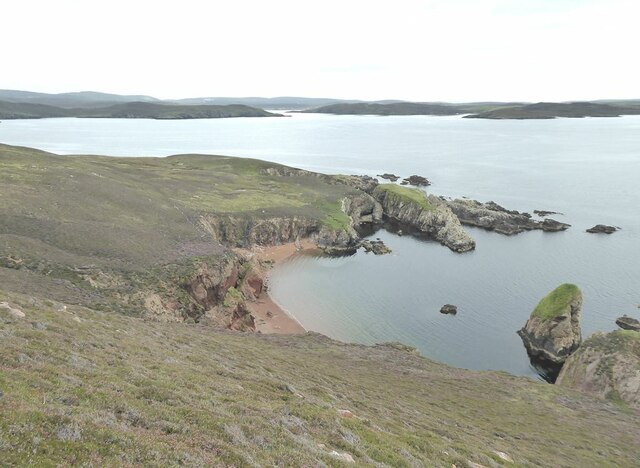
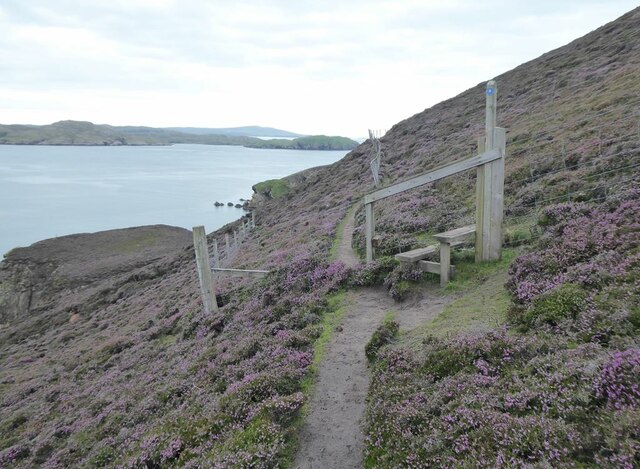
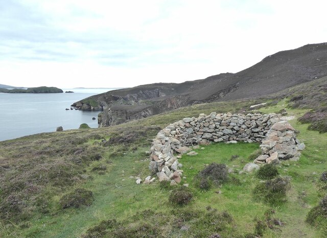
Loch of Brunthill Images

Images are sourced within 2km of 60.350251/-1.4396329 or Grid Reference HU3163. Thanks to Geograph Open Source API. All images are credited.
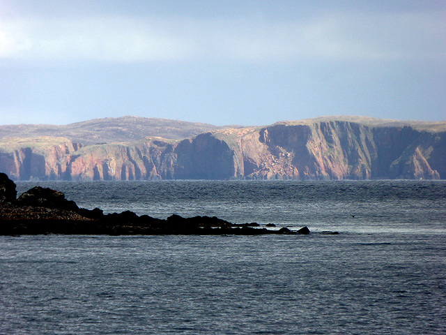
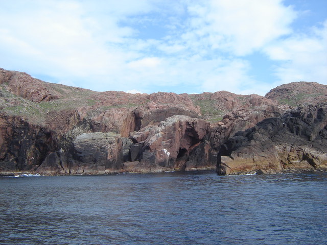
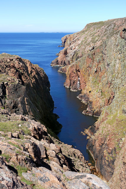
Dandi Geo Muckle Roe is formed entirely of igneous rocks forming a pluton of Old Red Sandstone (Devonian) age, and all except the NE side are a Granophyre which forms dramatic red cliffs riven by geos, caves and natural arches. Dandi Geo is one of the narrower geos eroded from the west coast of the island just at the point where a small stream drains northwestwards from a series of small lochans. In the far distance, Esha Ness can be seen across St. Magnus Bay, itself a large basin possibly associated with an ancient meteorite impact.
Dandi Geo
Muckle Roe is formed entirely of igneous rocks forming a pluton of Old Red Sandstone (Devonian) age, and all except the NE side are a Granophyre which forms dramatic red cliffs riven by geos, caves and natural arches. Dandi Geo is one of the narrower geos eroded from the west coast of the island just at the point where a small stream drains northwestwards from a series of small lochans. In the far distance, Esha Ness can be seen across St. Magnus Bay, itself a large basin possibly associated with an ancient meteorite impact.
Crossing the outlet of Loch of Rusness Apart from needing to detour inland to avoid deep geos, the southwest coast of Muckle Roe offers easy walking terrain with short grass on the shallow soil formed by the disintegration of the hard granophyre into coarse sand. Paths materialise and evaporate from time to time as the terrain constrains the route, such as at the crossing point of the small stream draining Loch of Rusness. Two paths are apparent on the far side, one contouring nearer the cliffs on the right, and one diagonalling up the far side of the lochan. The latter was the one we chose, and it duly evaporated within a hundred metres.
Crossing the outlet of Loch of Rusness
Apart from needing to detour inland to avoid deep geos, the southwest coast of Muckle Roe offers easy walking terrain with short grass on the shallow soil formed by the disintegration of the hard granophyre into coarse sand. Paths materialise and evaporate from time to time as the terrain constrains the route, such as at the crossing point of the small stream draining Loch of Rusness. Two paths are apparent on the far side, one contouring nearer the cliffs on the right, and one diagonalling up the far side of the lochan. The latter was the one we chose, and it duly evaporated within a hundred metres.
Dandi Geo A long and deep inlet in the sea cliffs of Muckle Roe.
Dandi Geo
A long and deep inlet in the sea cliffs of Muckle Roe.
Moorland by Loch of Rusness A fine and bright morning had rapidly turned to heavy rain in the afternoon. The usual crisp and gravelly Muckle Roe moorland.
Moorland by Loch of Rusness
A fine and bright morning had rapidly turned to heavy rain in the afternoon. The usual crisp and gravelly Muckle Roe moorland.
Muckle Roe Viewed from Melby.
Muckle Roe
Viewed from Melby.
Rusness West Loch Mouth of the outflow burn from Rusness West Loch, Muckle Roe.
Rusness West Loch
Mouth of the outflow burn from Rusness West Loch, Muckle Roe.
Picts Ness & cliffs, Muckle Roe Coastal scenery which can only be truly appreciated from a boat!
Picts Ness & cliffs, Muckle Roe
Coastal scenery which can only be truly appreciated from a boat!
Cliff scenery near Quilts Ness This stunning cliff scenery can only be seen from a boat - and it's well worth it on a lovely Shetland summer day!
[My thanks to Ross for helping with the accuracy of positioning this photo.]
Cliff scenery near Quilts Ness
This stunning cliff scenery can only be seen from a boat - and it's well worth it on a lovely Shetland summer day! [My thanks to Ross for helping with the accuracy of positioning this photo.]
Headland to the west of Gilsa Ayre
Gilsa Water
Gilsa Water
Two secret beaches at Bungil Accessible only by boat. At the mouth of the bay are the Burki Skerries.
Two secret beaches at Bungil
Accessible only by boat. At the mouth of the bay are the Burki Skerries.
On the path to the Muckle Roe light Beyond the stile, a railing has been installed to protect walkers traversing the extremely steep slope above Bungil.
On the path to the Muckle Roe light
Beyond the stile, a railing has been installed to protect walkers traversing the extremely steep slope above Bungil.
Sheepfold on Burki Hill
Muckle Ayre Beach on the south coast of Muckle Roe.
Muckle Ayre
Beach on the south coast of Muckle Roe.
Mill Burn Where the Mill Burn emerges onto the beach of Muckle Ayre.
Mill Burn
Where the Mill Burn emerges onto the beach of Muckle Ayre.
Muckle Ayre Beach on the south coast of Muckle Roe.
Muckle Ayre
Beach on the south coast of Muckle Roe.
Loch of Brunthill
Loch of Brunthill
End of the road at Little-Ayre The car park at the end of the road which runs along the south side of Muckle Roe caters for many walkers and cyclists, mostly taking the rough road over to South Ham at the north-west corner of the island.
End of the road at Little-Ayre
The car park at the end of the road which runs along the south side of Muckle Roe caters for many walkers and cyclists, mostly taking the rough road over to South Ham at the north-west corner of the island.
Show me another place!

Loch of Brunthill is located at Grid Ref: HU3163 (Lat: 60.350251, Lng: -1.4396329)

Unitary Authority: Shetland Islands

Police Authority: Highlands and Islands

What 3 Words

///statement.darts.cowboy. Near Brae, Shetland Islands

Related Wikis

Muckle Roe

Muckle Roe is an island in Shetland, Scotland, in St. Magnus Bay, to the west of Mainland. It has a population of around 130 people, who mainly croft and...

Linga (near Vementry)

Linga is one of the Shetland Islands, near Vementry. It is one of many islands in Shetland called Linga. The island is uninhabited. == Geography and... ==

Vementry

Vementry (Old Norse: "Vemunðarey") is an uninhabited Scottish island in Shetland on the north side of the West Mainland, lying south of Muckle Roe. �...

Papa Little

Papa Little (Scots: Papa Little; Old Norse: Papey Litla, meaning "the little island of the priests") is an island in St Magnus Bay, Shetland, Scotland...

Linga, Busta Voe

Linga is a small, uninhabited island, 1 km (0.62 mi) east of Muckle Roe in the Shetland Islands. The island is roughly circular in shape and its highest...

Clousta

Clousta is a hamlet on Mainaland, in the island's west, Shetland, Scotland. Approximately seventy people live here, many of whom are commuters, but local...

Braewick, Sandsting

Braewick is a settlement on the west Mainland of Shetland, Scotland. Braewick is on the western shore of Aith Voe and 1.2 mi (2 km) north of Aith itself...

Busta Voe

Busta Voe, (HU665350), in the north central Mainland, Shetland, is a sea inlet lying between the village of Brae and the island of Muckle Roe. At the head...

Have you been to Loch of Brunthill?

Leave your review of Loch of Brunthill below (or comments, questions and feedback).