Loch of Whitebrigs

Lake, Pool, Pond, Freshwater Marsh in Shetland

Scotland

Loch of Whitebrigs

Brace Burn leaving Loch of Voxterby, Shetland This burn connects Loch of Voxterby with Upper Loch of Brouster. Both contain trout but Loch of Voxterby is the more attractive of the two.
Brace Burn leaving Loch of Voxterby, Shetland Credit: AlastairG

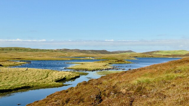
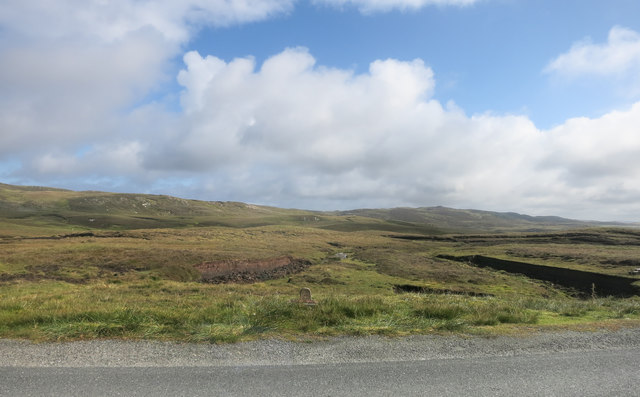
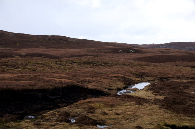
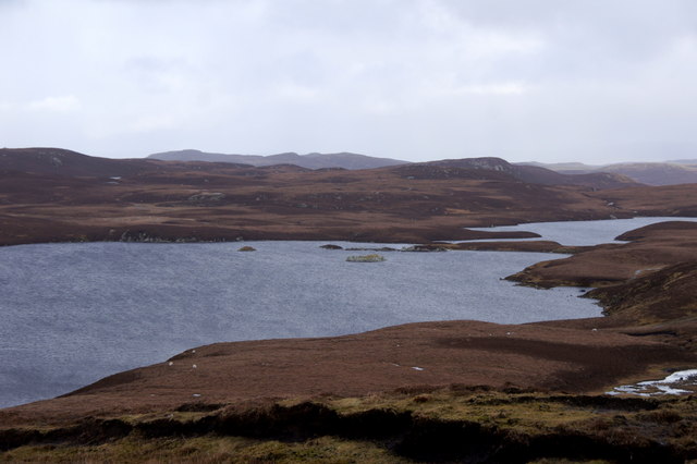
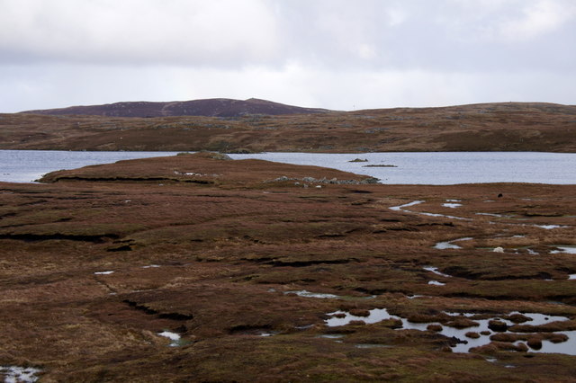
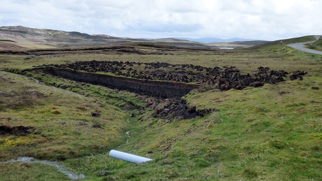
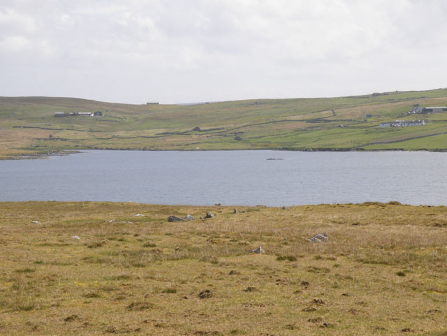
Loch of Whitebrigs is a freshwater loch located in the Shetland Islands, Scotland. It covers an area of approximately 9 hectares and has a maximum depth of around 6 meters. The loch is surrounded by peatland and heath, creating a peaceful and scenic setting for visitors to enjoy.

The water in Loch of Whitebrigs is clear and supports a variety of aquatic plants and wildlife. Common species found in the loch include brown trout, eels, and various species of freshwater invertebrates. The loch is also a popular spot for birdwatching, with a variety of waterfowl and wading birds frequenting the area throughout the year.

Visitors to Loch of Whitebrigs can enjoy activities such as fishing, birdwatching, and hiking along the surrounding trails. The loch is also a designated Site of Special Scientific Interest (SSSI) due to its importance for supporting a diverse range of plant and animal species.

Overall, Loch of Whitebrigs is a tranquil and picturesque spot in the Shetland Islands, offering visitors the chance to immerse themselves in the natural beauty of this remote and unspoiled landscape.

If you have any feedback on the listing, please let us know in the comments section below.

Loch of Whitebrigs Images

Images are sourced within 2km of 60.265259/-1.56194 or Grid Reference HU2453. Thanks to Geograph Open Source API. All images are credited.

Brace Burn leaving Loch of Voxterby, Shetland This burn connects Loch of Voxterby with Upper Loch of Brouster. Both contain trout but Loch of Voxterby is the more attractive of the two.
Brace Burn leaving Loch of Voxterby, Shetland
This burn connects Loch of Voxterby with Upper Loch of Brouster. Both contain trout but Loch of Voxterby is the more attractive of the two.
Lawby Knowe between Sandness and Walls
Brace Burn, Shetland Taken from the same spot as  <a href="https://www.geograph.org.uk/photo/7446337">HU2652 : Footbridge across the Brace Burn by Upper Loch of Brouster</a>  this upstream view shows the Brace Burn which drains the Loch of Voxterby near Walls.
Brace Burn, Shetland
Taken from the same spot as HU2652 : Footbridge across the Brace Burn by Upper Loch of Brouster this upstream view shows the Brace Burn which drains the Loch of Voxterby near Walls.
Lunga Water
Lunga Water
Neuglesbreck An interesting name for a random bit of hillside, which prompted a quick look-up to see if there was an explanation/translation.
Not exactly, but I did find out about Njugles, mystical horses which lure unwary travellers to their doom, in the way these sort of creatures so often do. See
<span class="nowrap"><a title="https://jordanoggblog.wordpress.com/category/folklore/" rel="nofollow ugc noopener" href="https://jordanoggblog.wordpress.com/category/folklore/">Link</a><img style="margin-left:2px;" alt="External link" title="External link - shift click to open in new window" src="https://s1.geograph.org.uk/img/external.png" width="10" height="10"/></span> for more njugle stories.
And also <span class="nowrap"><a title="https://www.shetlink.com/index.php?/topic/245-njugle/" rel="nofollow ugc noopener" href="https://www.shetlink.com/index.php?/topic/245-njugle/">Link</a><img style="margin-left:2px;" alt="External link" title="External link - shift click to open in new window" src="https://s1.geograph.org.uk/img/external.png" width="10" height="10"/></span> for a bit of informed rambling on the same subject with special references to bathwater, and bears on Fetlar.
Neuglesbreck
An interesting name for a random bit of hillside, which prompted a quick look-up to see if there was an explanation/translation. Not exactly, but I did find out about Njugles, mystical horses which lure unwary travellers to their doom, in the way these sort of creatures so often do. See LinkExternal link for more njugle stories. And also LinkExternal link for a bit of informed rambling on the same subject with special references to bathwater, and bears on Fetlar.
Stone by the Road This is the "Stone" marked on the map. There's a similar one a bit further back towards Walls.
I guess they're landmarks of some kind. They don't get Olde Script, so presumably they are recent.
Stone by the Road
This is the "Stone" marked on the map. There's a similar one a bit further back towards Walls. I guess they're landmarks of some kind. They don't get Olde Script, so presumably they are recent.
Moorland on Neuglesbreck, between Walls and Sandness
Burga Water in west Mainland The broch in the loch is named a Dun on the map for some reason.
Burga Water in west Mainland
The broch in the loch is named a Dun on the map for some reason.
Lunga Water in west Mainland
The dam at Lunga Water in west Mainland
Loch of Flatpunds, near Walls
Peat cutting near Burga Water
Burga Water dun A small fortified homestead of Iron Age date. <span class="nowrap"><a title="https://www.megalithic.co.uk/article.php?sid=31146" rel="nofollow ugc noopener" href="https://www.megalithic.co.uk/article.php?sid=31146">Link</a><img style="margin-left:2px;" alt="External link" title="External link - shift click to open in new window" src="https://s1.geograph.org.uk/img/external.png" width="10" height="10"/></span>
Burga Water dun
A small fortified homestead of Iron Age date. LinkExternal link
Burga Water cairn A prehistoric cairn standing close to Burga Water. <span class="nowrap"><a title="https://www.megalithic.co.uk/article.php?sid=53032" rel="nofollow ugc noopener" href="https://www.megalithic.co.uk/article.php?sid=53032">Link</a><img style="margin-left:2px;" alt="External link" title="External link - shift click to open in new window" src="https://s1.geograph.org.uk/img/external.png" width="10" height="10"/></span>
Burga Water cairn
A prehistoric cairn standing close to Burga Water. LinkExternal link
Chambered Cairn at Trolligarts A small chambered cairn (Scale 1m). <span class="nowrap"><a title="https://canmore.org.uk/site/427/trolligarts" rel="nofollow ugc noopener" href="https://canmore.org.uk/site/427/trolligarts">Link</a><img style="margin-left:2px;" alt="External link" title="External link - shift click to open in new window" src="https://s1.geograph.org.uk/img/external.png" width="10" height="10"/></span>
Chambered Cairn at Trolligarts
A small chambered cairn (Scale 1m). LinkExternal link
Chambered Cairn at Trolligarts A much disturbed large chambered cairn (Scale 1m). <span class="nowrap"><a title="https://canmore.org.uk/site/450/trolligarts" rel="nofollow ugc noopener" href="https://canmore.org.uk/site/450/trolligarts">Link</a><img style="margin-left:2px;" alt="External link" title="External link - shift click to open in new window" src="https://s1.geograph.org.uk/img/external.png" width="10" height="10"/></span>
Chambered Cairn at Trolligarts
A much disturbed large chambered cairn (Scale 1m). LinkExternal link
Galta Water Galta Water, looking north to Smiths Hamar.
Galta Water
Galta Water, looking north to Smiths Hamar.
Galta Water West bay with thick weed bed.
Galta Water
West bay with thick weed bed.
Show me another place!

Loch of Whitebrigs is located at Grid Ref: HU2453 (Lat: 60.265259, Lng: -1.56194)

Unitary Authority: Shetland Islands

Police Authority: Highlands and Islands

What 3 Words

///muddy.toast.transcribes. Near Walls, Shetland Islands

Nearby Locations

Loch of Whitebrigs

Related Wikis

Scord of Brouster

The Scord of Brouster is one of the earliest Neolithic farm sites in Shetland, Scotland. It has been dated to 2220 BC with a time window of 80 years on...

West Mainland

The West Mainland of the Shetland Islands is the part of the Shetland Mainland lying west of Aith (1° 23′ W). == Geography == Points of interest include...

Broch of West Burrafirth

The Broch of West Burrafirth is an Iron Age broch located on the west side of Mainland, Shetland (grid reference HU25625720). == Location == The broch...

Browland

Browland is a village on Mainland in Shetland, Scotland situated about 1.9 miles (3 km) east north east of Walls. Browland is within the parish of Sandsting...

Have you been to Loch of Whitebrigs?

Leave your review of Loch of Whitebrigs below (or comments, questions and feedback).