Beaver Dyke Reservoirs
Lake, Pool, Pond, Freshwater Marsh in Yorkshire Harrogate
England
Beaver Dyke Reservoirs

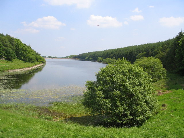
Beaver Dyke Reservoirs are a series of freshwater bodies located in Yorkshire, England. Consisting of a lake, pool, pond, and freshwater marsh, these reservoirs are an important component of the region's water management system.
The main feature of Beaver Dyke Reservoirs is the lake, which covers a significant area and serves as a primary source of drinking water for the surrounding communities. The lake is formed by a dam constructed across a natural river valley, effectively creating a large body of water that can store and regulate the supply of freshwater.
Adjacent to the lake is a smaller pool, which is also used for water storage purposes. This pool is connected to the lake through channels and is utilized as an overflow area during periods of heavy rainfall or high water levels. It acts as a buffer, preventing flooding in the surrounding areas.
The reservoir complex also includes a pond, which serves as a habitat for various aquatic species. This pond provides an environment for fish populations to thrive and supports a diverse ecosystem. It is a popular spot for fishing enthusiasts and nature lovers to observe and interact with wildlife.
Furthermore, the freshwater marsh in Beaver Dyke Reservoirs supports a unique and fragile ecosystem. This wetland area is characterized by the presence of vegetation such as reeds, rushes, and water lilies. It acts as a natural filter, purifying the water and providing a breeding ground for numerous bird species.
Overall, Beaver Dyke Reservoirs play a crucial role in maintaining the water supply, managing flood risks, and preserving biodiversity in the region.
If you have any feedback on the listing, please let us know in the comments section below.
Beaver Dyke Reservoirs Images
Images are sourced within 2km of 53.987053/-1.6549219 or Grid Reference SE2254. Thanks to Geograph Open Source API. All images are credited.


Beaver Dyke Reservoirs is located at Grid Ref: SE2254 (Lat: 53.987053, Lng: -1.6549219)
Division: West Riding
Administrative County: North Yorkshire
District: Harrogate
Police Authority: North Yorkshire
What 3 Words
///testy.definite.sheet. Near Stainburn, North Yorkshire
Nearby Locations
Related Wikis

Beaver Dyke Reservoirs
Beaver Dyke Reservoirs were two water supply reservoirs (one of which is still extant), 5 miles (8 km) west of Harrogate in North Yorkshire, England. The...

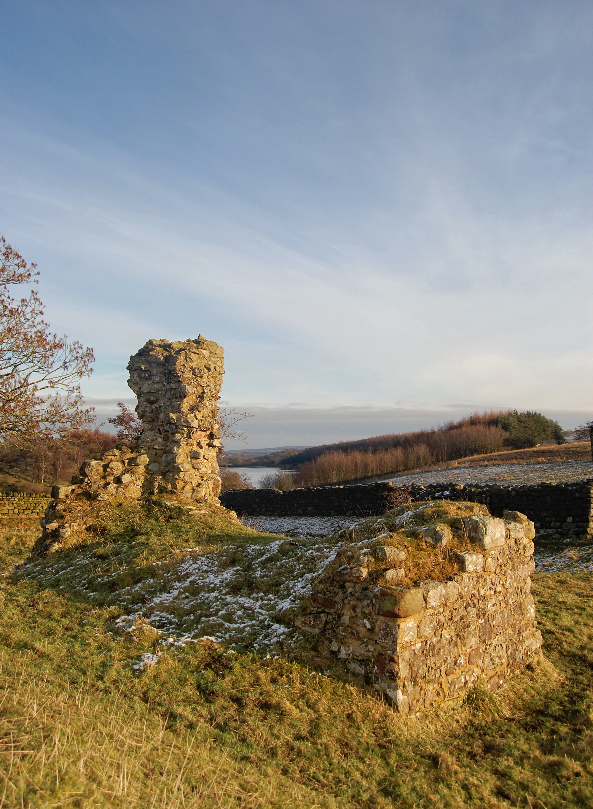
John O'Gaunt's Castle
John O'Gaunt's Castle was a royal hunting lodge in the West Riding of Yorkshire in England. == History == John of Gaunt's Castle is situated near Harrogate...

Knabs Ridge Wind Farm
Knabs Ridge Wind Farm is an electricity generating site just south of the A59 road near to Felliscliffe, Kettlesing, North Yorkshire, England. It was the...
Haverah Park
Haverah Park is a civil parish in the Harrogate district of North Yorkshire, England. It is located 3 miles (5 km) west of Harrogate. The parish consists...
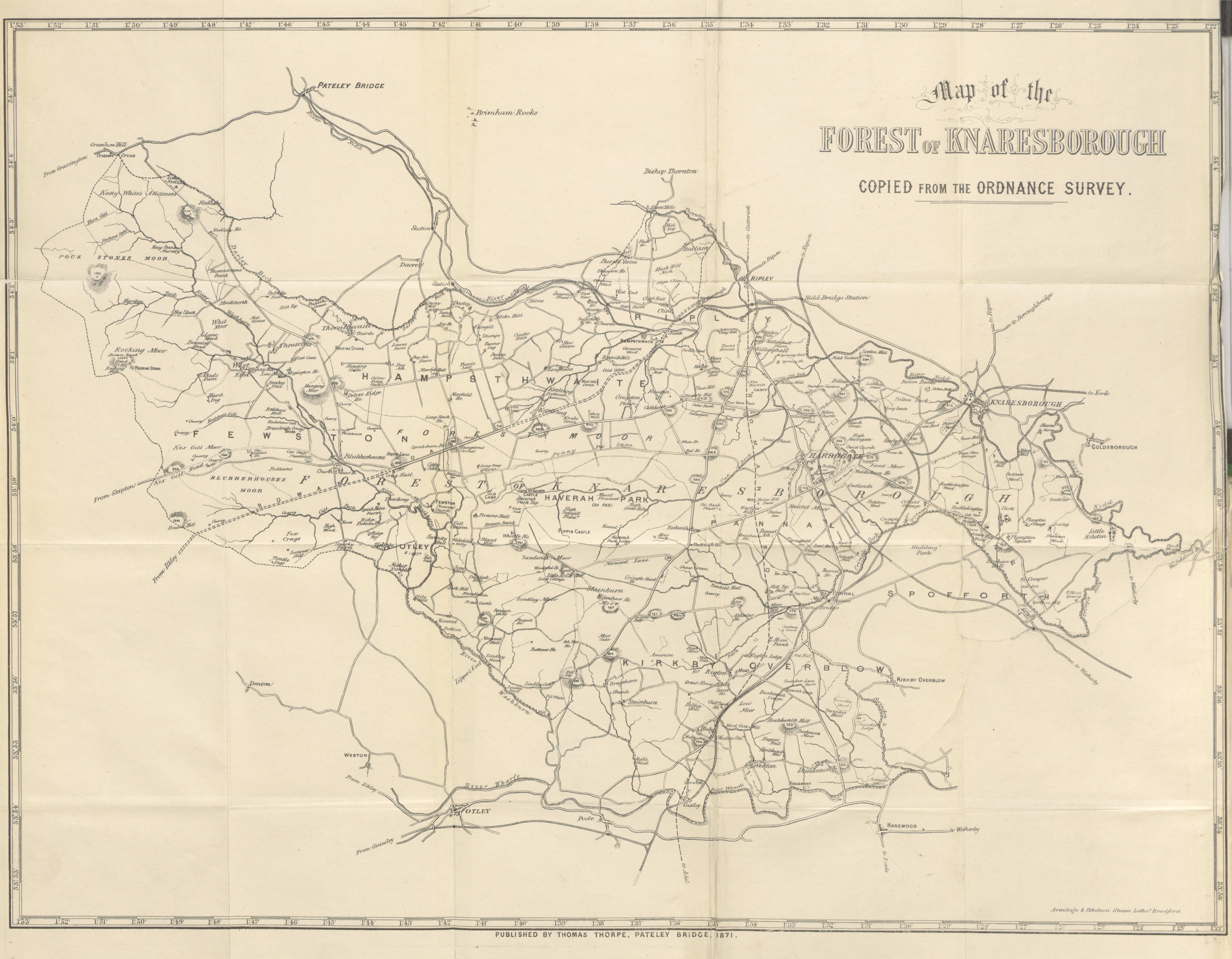
Forest of Knaresborough
The Forest of Knaresborough was a royal hunting forest in Yorkshire, England. It covered an area of some 45 square miles (120 km2) west and south of the...

Haverah Park experiment
The Haverah Park experiment was a cosmic ray air shower detection array consisting of water Cherenkov detectors distributed over an area of 12 km2 on Haverah...

Norwood, North Yorkshire
Norwood is a civil parish in the Harrogate district of North Yorkshire, England. According to the 2001 UK census, Norwood parish had a population of 200...
Felliscliffe
Felliscliffe is a civil parish in North Yorkshire, England, in Nidderdale, Borough of Harrogate. The population of the civil parish at the 2011 census...
Nearby Amenities
Located within 500m of 53.987053,-1.6549219Have you been to Beaver Dyke Reservoirs?
Leave your review of Beaver Dyke Reservoirs below (or comments, questions and feedback).