Big Pool

Lake, Pool, Pond, Freshwater Marsh in Warwickshire Warwick

England

Big Pool

Wroxall Abbey Estate Farmland near the Lodge.
Wroxall Abbey Estate Credit: Ian Rob

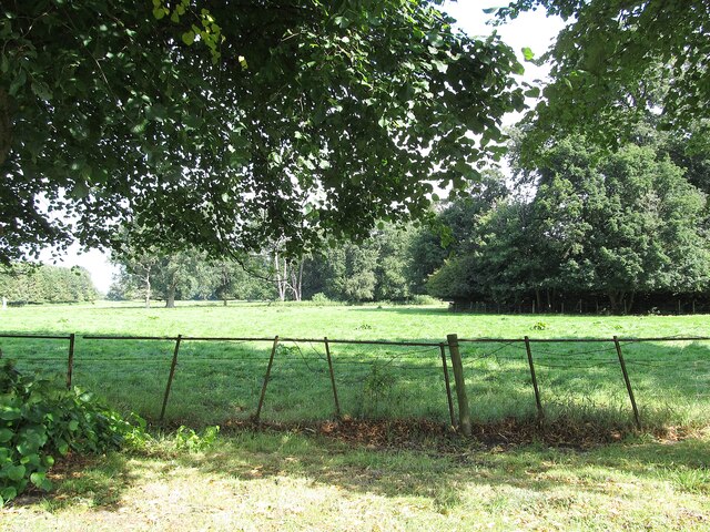
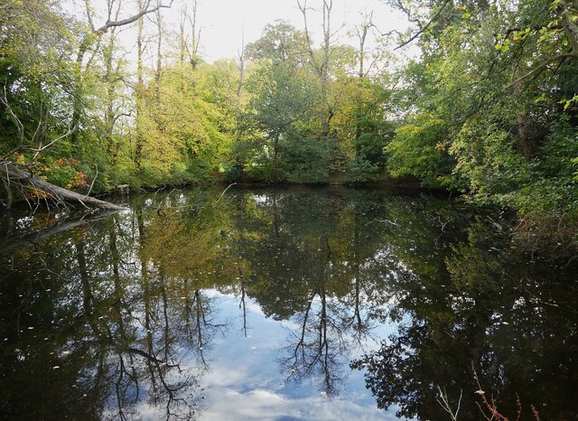
Big Pool is a freshwater marsh located in Warwickshire, England. It is a prominent feature within the local landscape, covering an area of approximately 5 hectares. The pool itself is surrounded by lush vegetation, including reeds and water lilies, which thrive in the marshy environment.

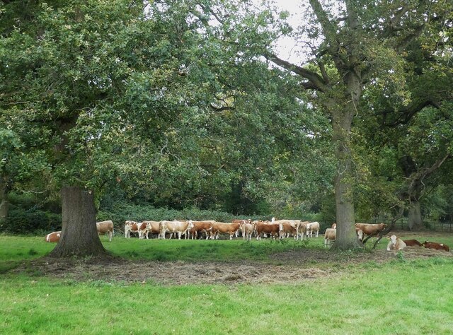
The pool is fed by several small streams and natural springs, resulting in a constant flow of freshwater. This abundance of water attracts a diverse range of wildlife, making Big Pool a haven for nature enthusiasts. The area is home to various species of birds, including ducks, swans, and herons, which can be observed gracefully gliding across the water or nesting in the surrounding trees.

The marshy terrain surrounding the pool is known for its rich biodiversity. It provides a suitable habitat for various aquatic plants, such as water horsetail and bladderwort, while also supporting a variety of amphibians and insects. Frogs, toads, and dragonflies are commonly spotted in and around the pool, adding to the natural beauty and ecological significance of the area.

Visitors to Big Pool can enjoy a peaceful and serene environment, with designated walking trails and viewing platforms offering glimpses of the diverse wildlife. The pool also provides opportunities for recreational activities, including fishing and boating, under certain regulations.

Big Pool is not only a picturesque location but also an important ecological site, contributing to the overall biodiversity and conservation efforts in Warwickshire. Its diverse range of flora and fauna make it a valuable resource for both local residents and visitors alike.

If you have any feedback on the listing, please let us know in the comments section below.
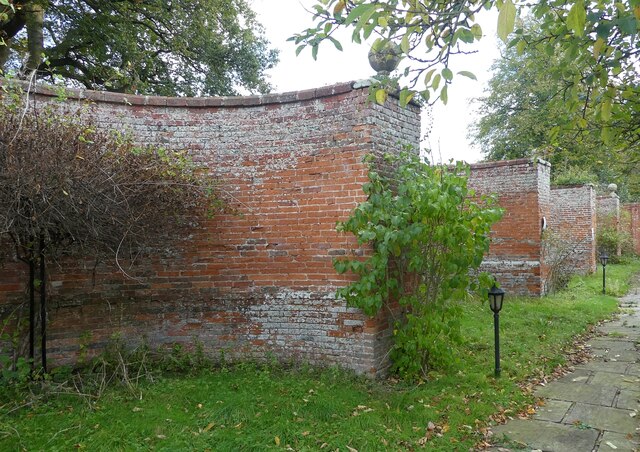
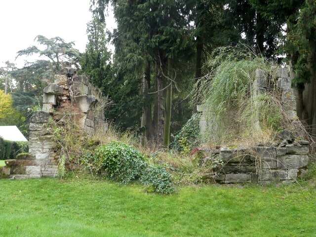
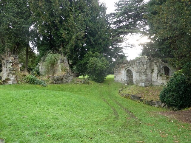
Big Pool Images

Images are sourced within 2km of 52.318043/-1.6711204 or Grid Reference SP2268. Thanks to Geograph Open Source API. All images are credited.

Wroxall Abbey Estate Farmland near the Lodge.
Wroxall Abbey Estate
Farmland near the Lodge.
Haseleygreen Farm
Haseleygreen Farm
Birmingham Road approaching Five Ways
Wroxall Abbey - Church of St Leonard Dating originally from c.1315 with the west tower (seen prominently here) added in c.1663. It takes its dedication from the former St Leonard's priory, the ruins of which lie to its south. The church is to the east of the C19th Wroxall Abbey which was never actually an abbey. See shared description below for more information and links.
Wroxall Abbey - Church of St Leonard
Dating originally from c.1315 with the west tower (seen prominently here) added in c.1663. It takes its dedication from the former St Leonard's priory, the ruins of which lie to its south. The church is to the east of the C19th Wroxall Abbey which was never actually an abbey. See shared description below for more information and links.
Wroxall Abbey - St Leonard's church through priory arch Taken from inside the ruins of St Leonard's Priory looking through its northern arch to the tower of St Leonard's church. See shared description for more information.
Wroxall Abbey - St Leonard's church through priory arch
Taken from inside the ruins of St Leonard's Priory looking through its northern arch to the tower of St Leonard's church. See shared description for more information.
Wroxall Abbey - Arches of ruined St Leonard's priory Looking through the northern arch of part of the ruins of St Leonard's Priory (probably the former frater) through to the arch in its southern wall.
See also <a href="https://www.geograph.org.uk/photo/7006464">SP2270 : Wroxall Abbey - St Leonard's Priory ruins (frater)</a>
and <a href="https://www.geograph.org.uk/photo/7006832">SP2270 : Wroxall Abbey - St Leonard's Priory ruins (chapter house)</a>
and <a href="https://www.geograph.org.uk/photo/7006840">SP2270 : Wroxall Abbey - St Leonard's Priory ruins (both parts)</a>
and shared description below.
Wroxall Abbey - Arches of ruined St Leonard's priory
Looking through the northern arch of part of the ruins of St Leonard's Priory (probably the former frater) through to the arch in its southern wall. See also SP2270 : Wroxall Abbey - St Leonard's Priory ruins (frater) and SP2270 : Wroxall Abbey - St Leonard's Priory ruins (chapter house) and SP2270 : Wroxall Abbey - St Leonard's Priory ruins (both parts) and shared description below.
Wroxall Abbey - St Leonard's Priory ruins (frater) There are two main clumps of ruins of St Leonard's Priory at Wroxall Abbey - this is the most complete which lies to the WSW of the other remains (see <a href="https://www.geograph.org.uk/photo/7006832">SP2270 : Wroxall Abbey - St Leonard's Priory ruins (chapter house)</a>). It is thought that part of this ruin is the former priory frater, with a screens passage to the eastern end.
See also <a href="https://www.geograph.org.uk/photo/7006459">SP2270 : Wroxall Abbey - Arches of ruined St Leonard's priory</a>
and <a href="https://www.geograph.org.uk/photo/7006840">SP2270 : Wroxall Abbey - St Leonard's Priory ruins (both parts)</a>
and shared description below.
Wroxall Abbey - St Leonard's Priory ruins (frater)
There are two main clumps of ruins of St Leonard's Priory at Wroxall Abbey - this is the most complete which lies to the WSW of the other remains (see SP2270 : Wroxall Abbey - St Leonard's Priory ruins (chapter house)). It is thought that part of this ruin is the former priory frater, with a screens passage to the eastern end. See also SP2270 : Wroxall Abbey - Arches of ruined St Leonard's priory and SP2270 : Wroxall Abbey - St Leonard's Priory ruins (both parts) and shared description below.
Wroxall Abbey - rear view The rear (western) aspect of Wroxall Abbey. See shared description for more information.
Wroxall Abbey - rear view
The rear (western) aspect of Wroxall Abbey. See shared description for more information.
Wroxall Abbey - front The front of Wroxall Abbey which is now a hotel and spa. See shared description below.
Wroxall Abbey - front
The front of Wroxall Abbey which is now a hotel and spa. See shared description below.
Wroxall Abbey - St Leonard's church tower Although the church dates from 1315 originally the tower was added (probably replacing an earlier one) in 1663 and is substantially made of brick rather than the stone of the earlier building.
Wroxall Abbey - St Leonard's church tower
Although the church dates from 1315 originally the tower was added (probably replacing an earlier one) in 1663 and is substantially made of brick rather than the stone of the earlier building.
Wroxall Abbey - Stained glass window on the stairs This fine Victorian stained glass window is halfway up the main stairs of Wroxall Abbey.
The bottom row of three panes tells the story of the foundation of St Leonard's Priory, the ruins of which lie in the hotel's grounds. It was a Benedictine nunnery founded by Dame Alice Crafte in the C12th after a visitation by the Blessed Virgin Mary and the appearance of a miraculous blob of snow.
Pane 1 <a href="https://www.geograph.org.uk/photo/7006915">SP2270 : Wroxall Abbey - Stained glass window (bottom left pane)</a>
Pane 2 <a href="https://www.geograph.org.uk/photo/7006922">SP2270 : Wroxall Abbey - Stained glass window (bottom central pane)</a>
Pane 3 <a href="https://www.geograph.org.uk/photo/7006923">SP2270 : Wroxall Abbey - Stained glass window (bottom right pane)</a>
See shared description below for more information.
Wroxall Abbey - Stained glass window on the stairs
This fine Victorian stained glass window is halfway up the main stairs of Wroxall Abbey. The bottom row of three panes tells the story of the foundation of St Leonard's Priory, the ruins of which lie in the hotel's grounds. It was a Benedictine nunnery founded by Dame Alice Crafte in the C12th after a visitation by the Blessed Virgin Mary and the appearance of a miraculous blob of snow. Pane 1 SP2270 : Wroxall Abbey - Stained glass window (bottom left pane) Pane 2 SP2270 : Wroxall Abbey - Stained glass window (bottom central pane) Pane 3 SP2270 : Wroxall Abbey - Stained glass window (bottom right pane) See shared description below for more information.
Wroxall Abbey - Curved boundary wall - exterior The northern wall of the garden to the east of Wroxall Abbey is made up of five semi-circular lobes described as "pierced cusped balustrades" by EH. They are very unusual.
See <a href="https://www.geograph.org.uk/photo/7006500">SP2270 : Wroxall Abbey - Curved boundary wall - interior</a> for the interior view and the shared description below.
Wroxall Abbey - Curved boundary wall - exterior
The northern wall of the garden to the east of Wroxall Abbey is made up of five semi-circular lobes described as "pierced cusped balustrades" by EH. They are very unusual. See SP2270 : Wroxall Abbey - Curved boundary wall - interior for the interior view and the shared description below.
Wroxall Abbey - Curved boundary wall - interior The 'inside' view of the unusual multi-curved garden wall around the former formal gardens at Wroxall Abbey.
See <a href="https://www.geograph.org.uk/photo/7006495">SP2270 : Wroxall Abbey - Curved boundary wall - exterior</a> for the exterior view.
See also the shared description below.
Wroxall Abbey - Curved boundary wall - interior
The 'inside' view of the unusual multi-curved garden wall around the former formal gardens at Wroxall Abbey. See SP2270 : Wroxall Abbey - Curved boundary wall - exterior for the exterior view. See also the shared description below.
Wroxall Abbey - Pool This tree-fringed pool lies to the east of the buildings comprising Wroxall Abbey. I would assume that it is a man-made as its sides are very square, though nature has softened them somewhat over the decades.
Wroxall Abbey - Pool
This tree-fringed pool lies to the east of the buildings comprising Wroxall Abbey. I would assume that it is a man-made as its sides are very square, though nature has softened them somewhat over the decades.
Wroxall Abbey - St Leonard's Priory ruins (chapter house) It is thought that this portion of the ruins is part of the former chapter house of the former St Leonard's Priory. The other substantial ruin (likely the former frater) can be seen here: <a href="https://www.geograph.org.uk/photo/7006464">SP2270 : Wroxall Abbey - St Leonard's Priory ruins (frater)</a> 
See also <a href="https://www.geograph.org.uk/photo/7006459">SP2270 : Wroxall Abbey - Arches of ruined St Leonard's priory</a>
and <a href="https://www.geograph.org.uk/photo/7006840">SP2270 : Wroxall Abbey - St Leonard's Priory ruins (both parts)</a>
and shared description below.
Wroxall Abbey - St Leonard's Priory ruins (chapter house)
It is thought that this portion of the ruins is part of the former chapter house of the former St Leonard's Priory. The other substantial ruin (likely the former frater) can be seen here: SP2270 : Wroxall Abbey - St Leonard's Priory ruins (frater) See also SP2270 : Wroxall Abbey - Arches of ruined St Leonard's priory and SP2270 : Wroxall Abbey - St Leonard's Priory ruins (both parts) and shared description below.
Wroxall Abbey - St Leonard's Priory ruins (both parts) To the left in this image is what is thought to be the remains of the Chapter House, while those on the right are thought to have probably been part of the frater of the former St Leonard's Priory, a Benedictine nunnery found in the C12th.
See also
<a href="https://www.geograph.org.uk/photo/7006464">SP2270 : Wroxall Abbey - St Leonard's Priory ruins (frater)</a>
<a href="https://www.geograph.org.uk/photo/7006459">SP2270 : Wroxall Abbey - Arches of ruined St Leonard's priory</a>
<a href="https://www.geograph.org.uk/photo/7006832">SP2270 : Wroxall Abbey - St Leonard's Priory ruins (chapter house)</a>
and shared description below.
Wroxall Abbey - St Leonard's Priory ruins (both parts)
To the left in this image is what is thought to be the remains of the Chapter House, while those on the right are thought to have probably been part of the frater of the former St Leonard's Priory, a Benedictine nunnery found in the C12th. See also SP2270 : Wroxall Abbey - St Leonard's Priory ruins (frater) SP2270 : Wroxall Abbey - Arches of ruined St Leonard's priory SP2270 : Wroxall Abbey - St Leonard's Priory ruins (chapter house) and shared description below.
Wroxall Abbey - St Leonard's church - blocked doorway This blocked former doorway is approximately midway along the exterior northern wall of the nave of St Leonard's church at Wroxall Abbey.
It is a two-centre arched doorway featuring 'ball flower' moulding.
See shared description for more information.
Wroxall Abbey - St Leonard's church - blocked doorway
This blocked former doorway is approximately midway along the exterior northern wall of the nave of St Leonard's church at Wroxall Abbey. It is a two-centre arched doorway featuring 'ball flower' moulding. See shared description for more information.
Wroxall Abbey - Cows beneath the trees All the cows in this field to the north-east of the buildings of Wroxall Abbey had gathered together under the trees.
Wroxall Abbey - Cows beneath the trees
All the cows in this field to the north-east of the buildings of Wroxall Abbey had gathered together under the trees.
Show me another place!

Big Pool is located at Grid Ref: SP2268 (Lat: 52.318043, Lng: -1.6711204)

Administrative County: Warwickshire

District: Warwick

Police Authority: Warwickshire

What 3 Words

///purified.dude.slamming. Near Wroxall, Warwickshire

Related Wikis

Haseley

Haseley is a small village and former civil parish in Warwickshire, England. It is four miles north-west of the county town of Warwick and nine miles...

Shrewley

Shrewley is a village and civil parish in Warwickshire, England, about 5 miles north-west of Warwick. It consists of Little Shrewley, and Shrewley Common...
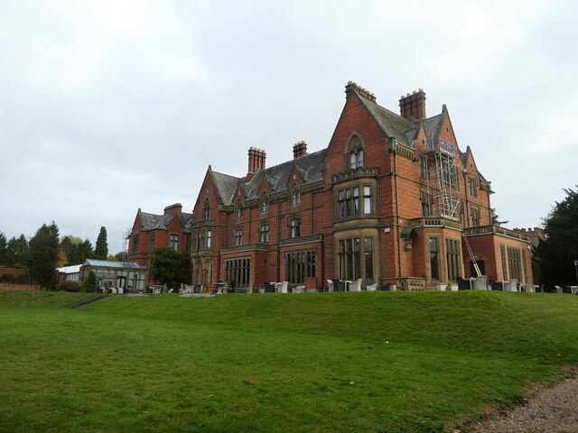
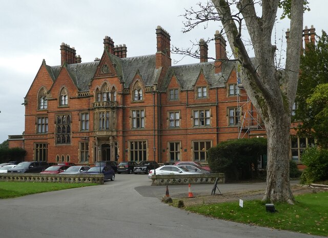
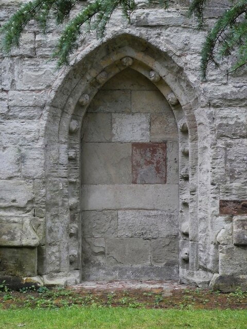
Wroxall Abbey

Wroxall Abbey is a substantial Victorian mansion house situated at Wroxall, Warwickshire which was converted for use as a hotel, spa, wedding venue and...
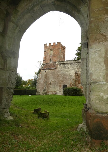
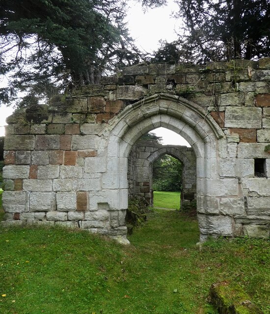
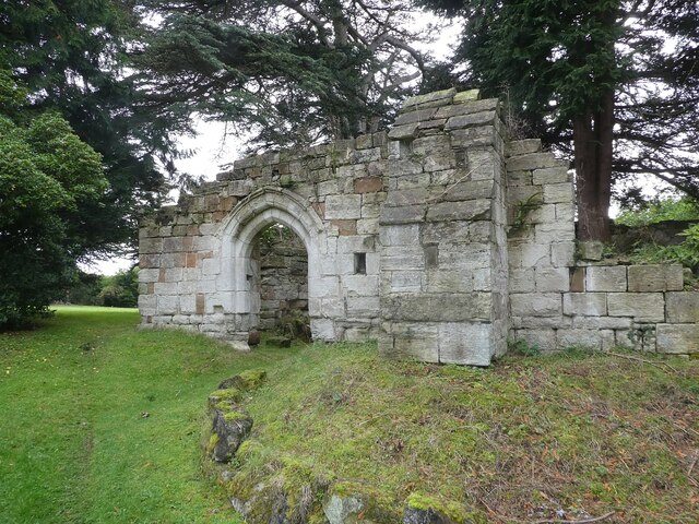
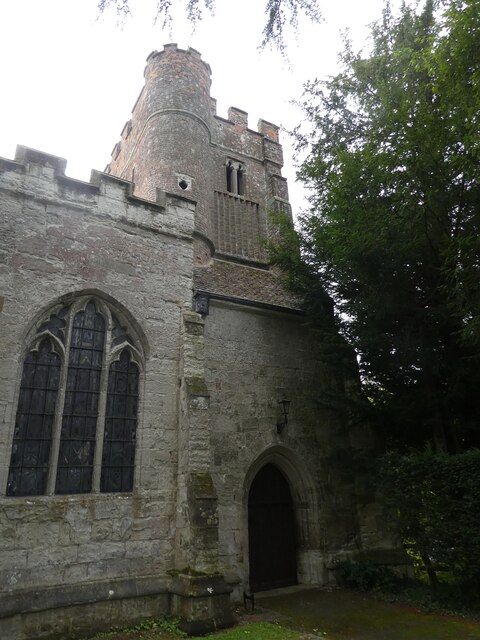
Wroxall Priory

Wroxall Priory was a medieval monastic house in Wroxall, Warwickshire, England. It was founded c.1135 by Hugh, Lord of Hatton and Wroxall in thanks for...
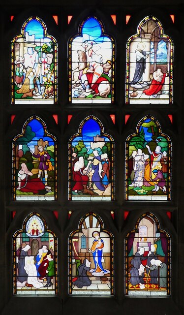
Wren's Cathedral

Wren's Cathedral, properly the Church of St Leonard and now a cathedral of the Communion of Evangelical Episcopal Churches, was originally the Lady Chapel...

Beausale, Haseley, Honiley and Wroxall

Beausale, Haseley, Honiley and Wroxall is a civil parish in the Warwick District of Warwickshire, England. It was created in 2007 by the merger of the...

Rowington

Rowington is a village and civil parish in the English county of Warwickshire. It is five miles north-west of the town of Warwick and five miles south...
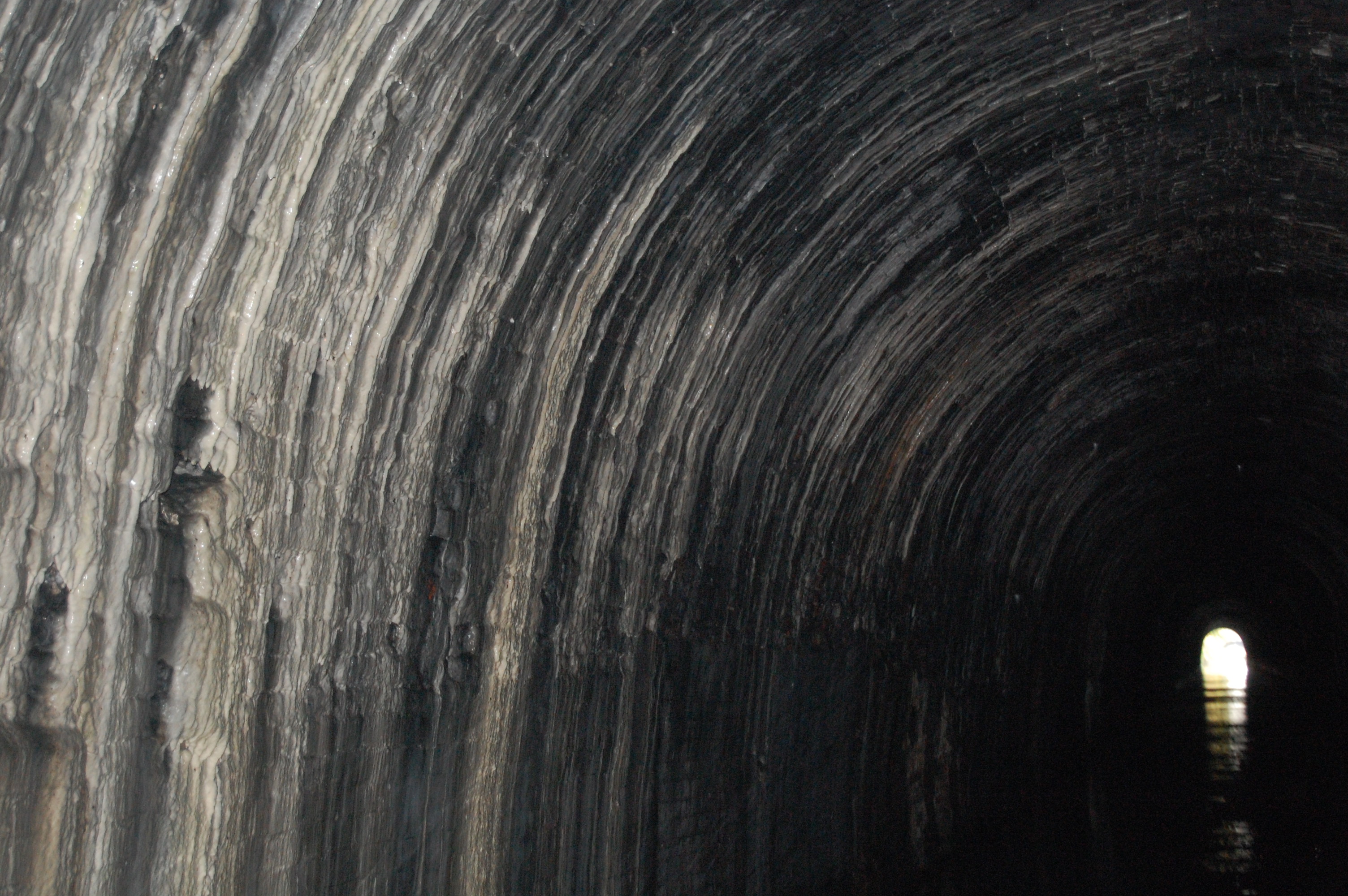
Shrewley Tunnel

Shrewley Tunnel is a canal tunnel near Shrewley, Warwickshire, England, which opened in 1799. It became part of the Grand Union Canal in 1929. == History... ==

Related Videos

Really Good & Generous 😂 😂 #travelvlog #vanlife #motorhome #travel #canal #helpful

Join us taking a walk along the Grand Union Canal in Warwickshire as we talk about the steep flight of 21 locks at Hatton.

Walking Shakespeare’s Avon Way - Stage 6 - Warwick to Hampton Lucy

Stage 6 was an 11.5 mile stretch which saw us leave Warwick to rejoin the Grand Union Canal tow path and ascend the ...

Nearby Amenities

Located within 500m of 52.318043,-1.6711204
Turning Circle
Lat/Long: 52.3187351/-1.6751915
Operator: National Grid Electricity Distribution
Operator Wikidata: Q7988183
Power: pole
Ref: 931655
Source: wpd_opendata
Transformer: distribution
Lat/Long: 52.3198099/-1.6741155
Operator: National Grid Electricity Distribution
Operator Wikidata: Q7988183
Power: pole
Source: bing
Lat/Long: 52.319641/-1.6744749
Operator: National Grid Electricity Distribution
Operator Wikidata: Q7988183
Power: pole
Ref: 931654
Source: wpd_opendata
Transformer: distribution
Lat/Long: 52.3183073/-1.6728643
Operator: National Grid Electricity Distribution
Operator Wikidata: Q7988183
Power: pole
Source: bing
Lat/Long: 52.3185614/-1.6741571
Operator: National Grid Electricity Distribution
Operator Wikidata: Q7988183
Power: pole
Source: bing
Lat/Long: 52.3190164/-1.6755652
Operator: National Grid Electricity Distribution
Operator Wikidata: Q7988183
Power: pole
Source: bing
Lat/Long: 52.3193984/-1.6768031
The data included in this document is from www.openstreetmap.org. The data is made available under ODbL.

Have you been to Big Pool?

Leave your review of Big Pool below (or comments, questions and feedback).