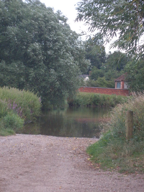
Hall Pool

Lake, Pool, Pond, Freshwater Marsh in Warwickshire North Warwickshire

England

Hall Pool

HS2, Solihull district, February 2022 This is the general area of the HS2 interchange, seen from the A452. As well as the railway itself, construction of new roads is everywhere, to serve the interchange station, connecting roads and associated development. Location of this photo is estimated. It may show a road crossing HS2.
HS2, Solihull district, February 2022 Credit: Robin Stott

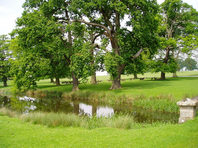
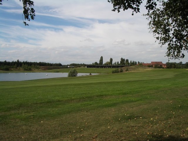
Hall Pool is a picturesque freshwater marsh located in Warwickshire, England. Nestled amidst rolling green fields and surrounded by the tranquil beauty of the Warwickshire countryside, it is a popular destination for nature enthusiasts and bird watchers.

Covering an area of approximately 5 acres, the pool is fed by natural springs and rainwater, resulting in crystal-clear freshwater that supports a diverse ecosystem. The pool is home to a variety of aquatic plants, including water lilies and reeds, which provide essential habitats for numerous species of birds, insects, and small mammals.

Birdlife flourishes at Hall Pool, making it a well-known birdwatching site. Visitors can spot a wide range of bird species, including herons, kingfishers, swans, and various types of ducks. These birds are attracted to the abundant food sources found in and around the pool, such as fish, insects, and amphibians.

The pool itself offers opportunities for recreational activities such as fishing and boating. Fishing enthusiasts can try their luck at catching carp, roach, and tench, among other species. The calm and serene atmosphere of the pool makes it an ideal spot for a leisurely boat ride, allowing visitors to immerse themselves in the peaceful surroundings.

Overall, Hall Pool is a haven of natural beauty and tranquility. Its diverse wildlife, clear waters, and stunning scenery make it a must-visit destination for anyone seeking a peaceful retreat in the heart of Warwickshire.

If you have any feedback on the listing, please let us know in the comments section below.

Hall Pool Images

Images are sourced within 2km of 52.451742/-1.6799556 or Grid Reference SP2183. Thanks to Geograph Open Source API. All images are credited.

HS2, Solihull district, February 2022 This is the general area of the HS2 interchange, seen from the A452. As well as the railway itself, construction of new roads is everywhere, to serve the interchange station, connecting roads and associated development. Location of this photo is estimated. It may show a road crossing HS2.
HS2, Solihull district, February 2022
This is the general area of the HS2 interchange, seen from the A452. As well as the railway itself, construction of new roads is everywhere, to serve the interchange station, connecting roads and associated development. Location of this photo is estimated. It may show a road crossing HS2.
HS2 construction work Earthworks and storage facilities which are part of the huge HS2 construction project which is changing this part of the countryside for ever.
HS2 construction work
Earthworks and storage facilities which are part of the huge HS2 construction project which is changing this part of the countryside for ever.
Entrance to HS2 contractor's site Entrance to the Skanska Construction site, which is carefully sentried by a man in a small shelter just inside the gate (that part of is job is basically to book visiting traffic in and out of the site)
Entrance to HS2 contractor's site
Entrance to the Skanska Construction site, which is carefully sentried by a man in a small shelter just inside the gate (that part of is job is basically to book visiting traffic in and out of the site)
HS2 construction site from East Way A view looking pretty much directly along the expected trackline of the HS2 railway, construction work is busily underway all around this area.
HS2 construction site from East Way
A view looking pretty much directly along the expected trackline of the HS2 railway, construction work is busily underway all around this area.
A452 Kenilworth Road approaching Stonebridge Island
A45 Intermediate Silos This construction comprises a set of 4 powder storage silos, with 2 load-out bays beneath them. Two were erected in March 2023 by Balfour Beatty Vinci (BBV) the main construction contractor on this part of the HS2 site, and the other two by Tarmac who will keep them stocked with material for the HS2 works. Initially they will store quicklime powder from plants in the Peak District, which will be used for ground stabilisation purposes around this part of the HS2 site, but may also hold some hydrated lime powder when that's needed. Their combined total capacity is nearly 2500 tonnes.
A45 Intermediate Silos
This construction comprises a set of 4 powder storage silos, with 2 load-out bays beneath them. Two were erected in March 2023 by Balfour Beatty Vinci (BBV) the main construction contractor on this part of the HS2 site, and the other two by Tarmac who will keep them stocked with material for the HS2 works. Initially they will store quicklime powder from plants in the Peak District, which will be used for ground stabilisation purposes around this part of the HS2 site, but may also hold some hydrated lime powder when that's needed. Their combined total capacity is nearly 2500 tonnes.
HS2 works, Solihull area, March 2023 – new bridge This is one of many roads and road junctions being remodelled along the HS2 corridor. It is to be hoped that access to the interchange station and development around it have been planned for. The photo shows a new bridge over the parting of the A452 Chester Road (ahead) and the A446 Kenilworth Road (right), a spot labelled Denbigh Corner by the A-Z. Ahead is a remodelled gyratory giving access to Birmingham Business Park. On the left the A452 is joined by the exit from the lanes that serve the Packington landfill site <a href="https://www.geograph.org.uk/photo/3126732">SP2085 : Packington Mountain from the north</a>.
Photo number 7567735.
HS2 works, Solihull area, March 2023 – new bridge
This is one of many roads and road junctions being remodelled along the HS2 corridor. It is to be hoped that access to the interchange station and development around it have been planned for. The photo shows a new bridge over the parting of the A452 Chester Road (ahead) and the A446 Kenilworth Road (right), a spot labelled Denbigh Corner by the A-Z. Ahead is a remodelled gyratory giving access to Birmingham Business Park. On the left the A452 is joined by the exit from the lanes that serve the Packington landfill site SP2085 : Packington Mountain from the north. Photo number 7567735.
Slip road from A45, Stonebridge It joins the A452. Up the slope is a branch of Toby Carvery in its pink livery. A large car park is reached from the A452 at this major junction.
Photo number 7567808.
Slip road from A45, Stonebridge
It joins the A452. Up the slope is a branch of Toby Carvery in its pink livery. A large car park is reached from the A452 at this major junction. Photo number 7567808.
Packington Park Unbelievable that this tranquil spot is less than 2-miles from the M6 and just over the road from the National Exhibition Centre, but Lord Aylesford built his house here before anyone knew what a motorway was.
Packington Park
Unbelievable that this tranquil spot is less than 2-miles from the M6 and just over the road from the National Exhibition Centre, but Lord Aylesford built his house here before anyone knew what a motorway was.
Stonebridge Golf Course Accessed from Hampton Lane, looking north west from the driveway.
Stonebridge Golf Course
Accessed from Hampton Lane, looking north west from the driveway.
Somers Wood Caravan Park Adjacent to Stonebridge Golf Course and using the same access from Hampton Lane.
Somers Wood Caravan Park
Adjacent to Stonebridge Golf Course and using the same access from Hampton Lane.
National Motor Cycle Museum, Bickenhill, Nr Solihull This museum is located just off the M42 motorway and has recently been completely rebuilt following a devastating fire.  It has now re-opened again to the public and is also available as a unique Conference Centre venue
National Motor Cycle Museum, Bickenhill, Nr Solihull
This museum is located just off the M42 motorway and has recently been completely rebuilt following a devastating fire. It has now re-opened again to the public and is also available as a unique Conference Centre venue
Diddington Hall Diddington is historically a hamlet in the Parish of Hampton in Arden. The Hall is now used for commercial purposes.
Diddington Hall
Diddington is historically a hamlet in the Parish of Hampton in Arden. The Hall is now used for commercial purposes.
The River Blythe A very peaceful scene, however the junction of the A45 and A452 is a few yards away.
The River Blythe
A very peaceful scene, however the junction of the A45 and A452 is a few yards away.
Ford at Little Packington School Lane at Little Packington leads to this ford.
Ford at Little Packington
School Lane at Little Packington leads to this ford.
Middle Bickenhill This rural scene, with one field being harvested, was taken from an approach road to the NEC. It was in this area that the Birmingham alternative to the New Wembley Stadium (Brumbley) was proposed to be located.
Middle Bickenhill
This rural scene, with one field being harvested, was taken from an approach road to the NEC. It was in this area that the Birmingham alternative to the New Wembley Stadium (Brumbley) was proposed to be located.
St Bartholomew's, Little Packington Judging from the sign at the entrance, this (one time) church is now a private residence. 

See Wikipedia:
Little Packington is a hamlet in the North Warwickshire district of the county of Warwickshire in England. It is situated just to the north west of Great Packington and outside the boundaries of Packington Park. There is a small, interesting church dedicated to St Bartholomew. It is of Norman origin with medieval timber framing and 17th century internal additions.
<span class="nowrap"><a title="http://en.wikipedia.org/wiki/Little_Packington" rel="nofollow ugc noopener" href="http://en.wikipedia.org/wiki/Little_Packington">Link</a><img style="margin-left:2px;" alt="External link" title="External link - shift click to open in new window" src="https://s1.geograph.org.uk/img/external.png" width="10" height="10"/></span>
St Bartholomew's, Little Packington
Judging from the sign at the entrance, this (one time) church is now a private residence. See Wikipedia: Little Packington is a hamlet in the North Warwickshire district of the county of Warwickshire in England. It is situated just to the north west of Great Packington and outside the boundaries of Packington Park. There is a small, interesting church dedicated to St Bartholomew. It is of Norman origin with medieval timber framing and 17th century internal additions. LinkExternal link
Church at Packington Park
Show me another place!

Hall Pool is located at Grid Ref: SP2183 (Lat: 52.451742, Lng: -1.6799556)

Administrative County: Warwickshire

District: North Warwickshire

Police Authority: Warwickshire

What 3 Words

///inviting.garage.acrobats. Near Meriden, West Midlands

Nearby Locations

Mill Shrubbery Hall Pool

Related Wikis

Little Packington

Little Packington is a hamlet and civil parish in the North Warwickshire district of the county of Warwickshire, England. It is situated just to the northwest...
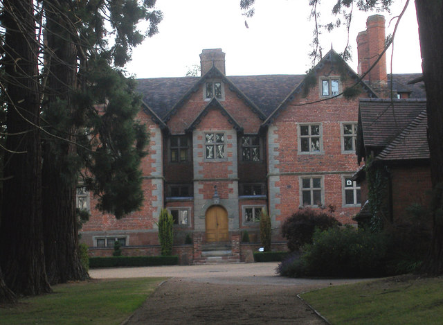
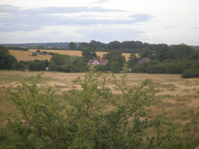
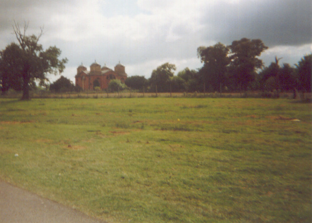
Packington Hall

Packington Hall is a 17th-century mansion situated at Great Packington, near Meriden, Warwickshire, England the seat of the Earl of Aylesford. It is a...

Stonebridge, West Midlands

Stonebridge (AKA Stonebridge Island or Stonebridge Roundabout) is a flyover–and–roundabout junction of the A45 and A452 roads in West Midlands, England...

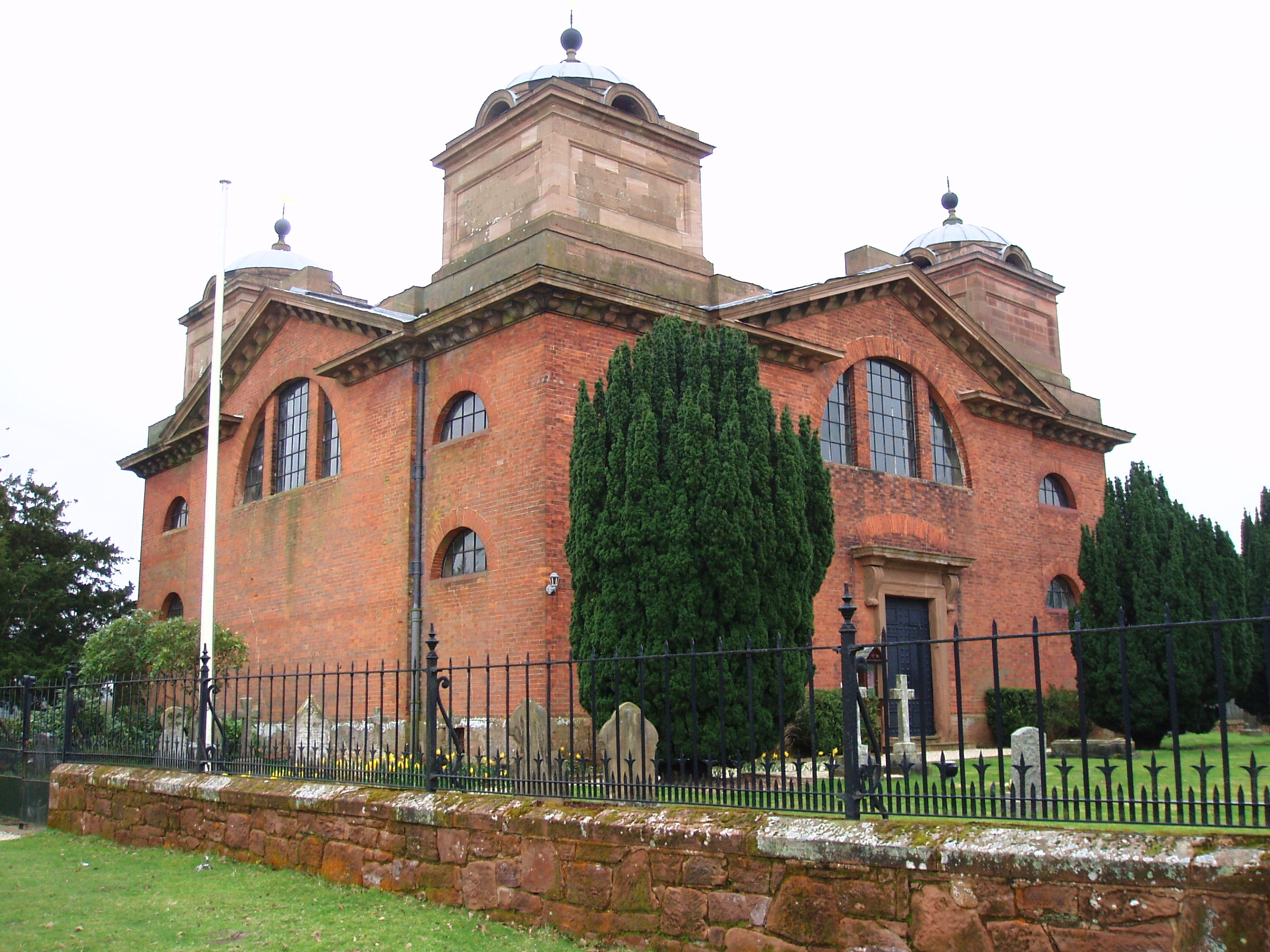
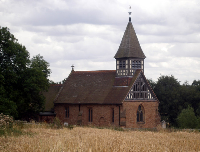
St James' Church, Great Packington

St James' Church is an 18th-century chapel situated in the grounds of Packington Hall, near Meriden, Warwickshire. It is a Grade I listed building. The...

Nearby Amenities

Located within 500m of 52.451742,-1.6799556
Power: pole
Source: bing
Lat/Long: 52.4492831/-1.6857952
Power: pole
Source: bing
Lat/Long: 52.4501037/-1.6862217
Power: pole
Source: bing
Lat/Long: 52.4509962/-1.6866481
Power: pole
Source: bing
Lat/Long: 52.4518969/-1.68708
The data included in this document is from www.openstreetmap.org. The data is made available under ODbL.

Have you been to Hall Pool?

Leave your review of Hall Pool below (or comments, questions and feedback).