Swinsty Reservoir

Lake, Pool, Pond, Freshwater Marsh in Yorkshire Harrogate

England

Swinsty Reservoir

Swinsty Reservoir The car park and picnic area at Swinsty Reservoir, there are toilet facilities and good views over the lake.
Swinsty Reservoir Credit: Mick Melvin

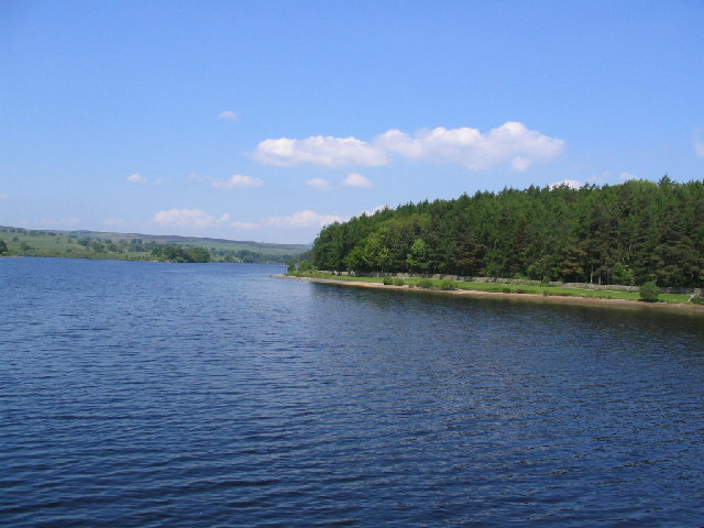
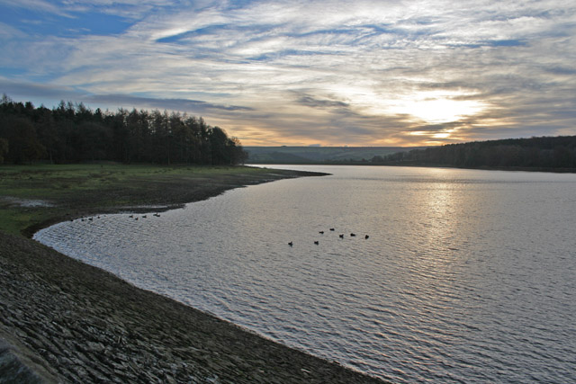
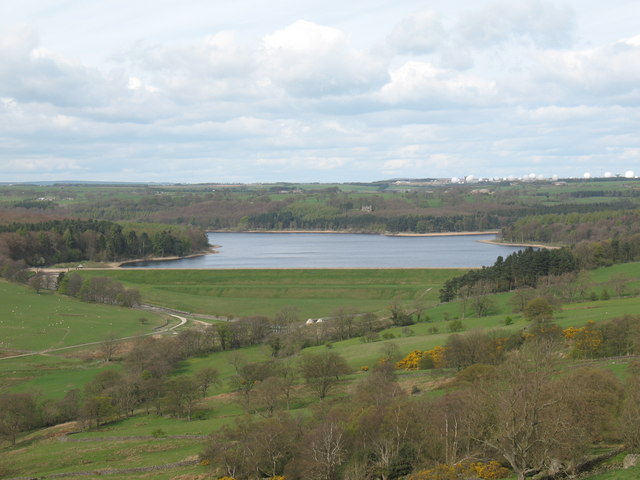
Swinsty Reservoir is a picturesque body of water located in Yorkshire, England. It is classified as a reservoir, serving as a freshwater storage facility for the region. The reservoir is situated within the Washburn Valley, nestled between the towns of Harrogate and Otley.

Covering an area of approximately 120 acres, Swinsty Reservoir boasts a serene and tranquil environment. The reservoir is surrounded by lush greenery, including rolling hills and dense forests, making it a haven for nature enthusiasts and wildlife alike. The water is crystal clear and supports a variety of aquatic life, including fish and waterfowl.

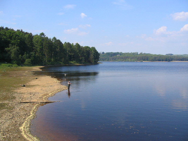
The reservoir offers several recreational activities for visitors to enjoy. Fishing is a popular pastime here, with anglers having the opportunity to catch species such as brown trout, pike, and perch. Additionally, the reservoir boasts a network of walking and cycling trails, providing an ideal setting for leisurely strolls or energetic bike rides.

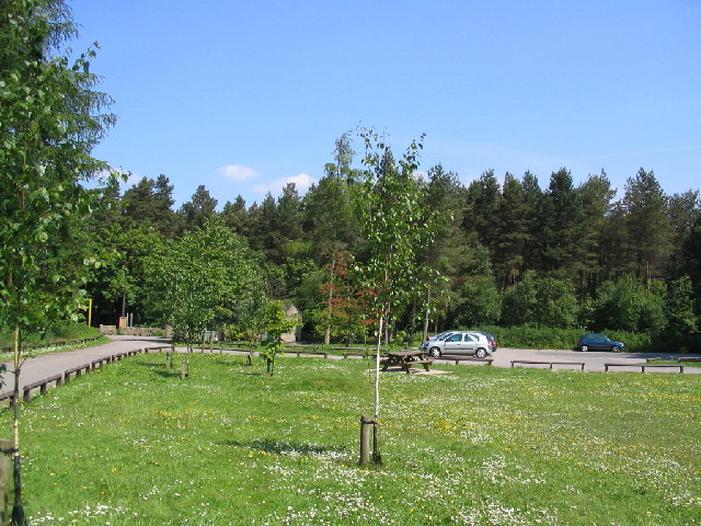
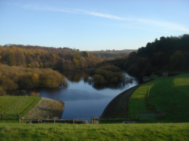
Swinsty Reservoir also features a picnic area, allowing visitors to relax and enjoy the stunning views while having a meal or snack. The surrounding landscape provides the perfect backdrop for photography enthusiasts, with breathtaking vistas in every direction.

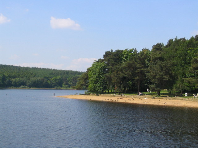
Overall, Swinsty Reservoir is a cherished natural gem in Yorkshire, offering a peaceful retreat from the hustle and bustle of daily life. Whether it's fishing, walking, or simply immersing oneself in the beauty of nature, this reservoir provides a delightful experience for all who visit.

If you have any feedback on the listing, please let us know in the comments section below.

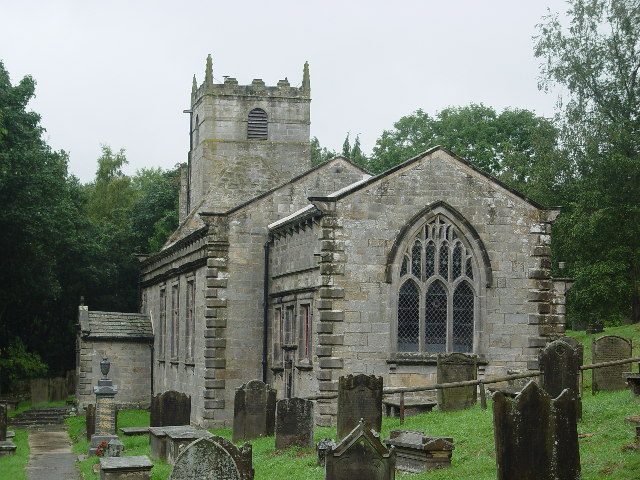
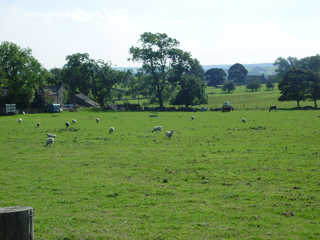
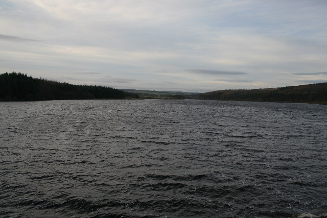
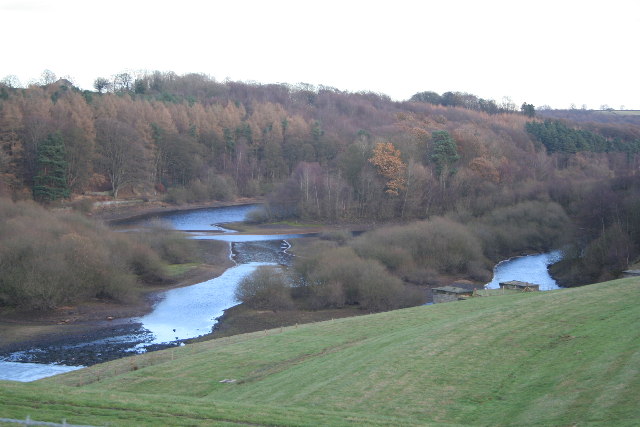
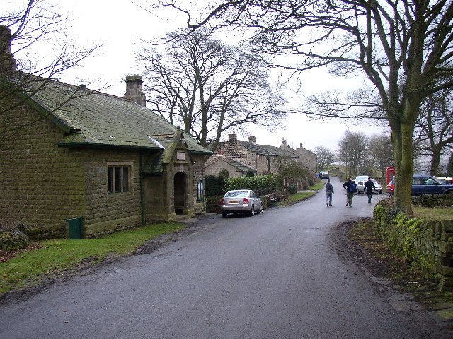
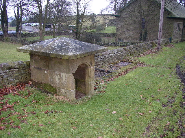
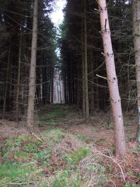
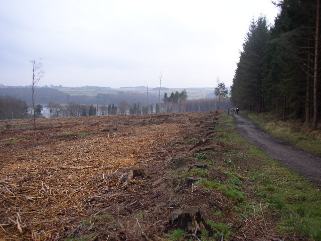
Swinsty Reservoir Images

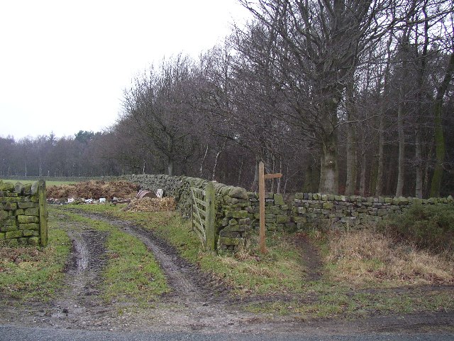
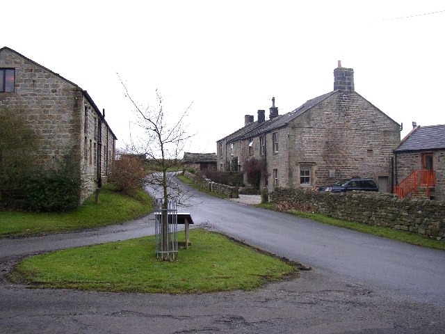
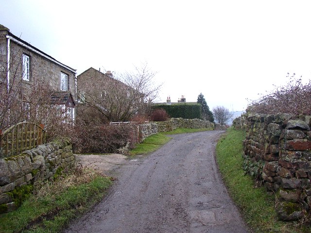
Images are sourced within 2km of 53.975797/-1.704276 or Grid Reference SE1953. Thanks to Geograph Open Source API. All images are credited.

Swinsty Reservoir The car park and picnic area at Swinsty Reservoir, there are toilet facilities and good views over the lake.
Swinsty Reservoir
The car park and picnic area at Swinsty Reservoir, there are toilet facilities and good views over the lake.
Fewston Reservoir Wharfedale Taken looking North east from Fewston Embankment.
Fewston Reservoir Wharfedale
Taken looking North east from Fewston Embankment.
Swinsty Reservoir A view looking North from Swinsty Embankment, with two fly fishermen in the foreground.
Swinsty Reservoir
A view looking North from Swinsty Embankment, with two fly fishermen in the foreground.
Swinsty Reservoir A view of the lakeside picnic area at Swinsty, taken looking North west.
Swinsty Reservoir
A view of the lakeside picnic area at Swinsty, taken looking North west.
Fewston Church Dedicated to St Michael and St Lawrence
Fewston Church
Dedicated to St Michael and St Lawrence
Prospect House Farm and Farmland
Prospect House
Farm and Farmland
Fewston Reservoir On a dull December afternoon: a brisk wind was breaking up the surface of the water. This reservoir is fed by the River Washburn, a tributary of the River Wharfe. Completed in 1879 it has a capacity of 846 million gallons. It is one of the major network of reservoirs owned by Yorkshire Water in the Skipton area. See <span class="nowrap"><a title="http://www.yorkshirewater.com/?SCH=&RGN=17&ACT=0&search=Go&OBH=864#" rel="nofollow ugc noopener" href="http://www.yorkshirewater.com/?SCH=&RGN=17&ACT=0&search=Go&OBH=864#">Link</a><img style="margin-left:2px;" alt="External link" title="External link - shift click to open in new window" src="https://s1.geograph.org.uk/img/external.png" width="10" height="10"/></span> for a list.
Fewston Reservoir
On a dull December afternoon: a brisk wind was breaking up the surface of the water. This reservoir is fed by the River Washburn, a tributary of the River Wharfe. Completed in 1879 it has a capacity of 846 million gallons. It is one of the major network of reservoirs owned by Yorkshire Water in the Skipton area. See LinkExternal link for a list.
Swinsty Reservoir from Fewston Embankment The out fall from Fewston Reservoir feeds immediately into Swinsty Reservoir. The grass bank and the trees in the foreground are in <a href="https://www.geograph.org.uk/gridref/SE1854">SE1854</a>, the island at the centre of the photograph and the far bank are in <a href="https://www.geograph.org.uk/gridref/SE1954">SE1954</a>
Swinsty Reservoir from Fewston Embankment
The out fall from Fewston Reservoir feeds immediately into Swinsty Reservoir. The grass bank and the trees in the foreground are in SE1854, the island at the centre of the photograph and the far bank are in SE1954
Swinsty Reservoir, Washburn Valley One of four large reservoirs in the Washburn Valley, Swinsty holds 866 million gallons and was completed in 1876. This was taken looking SW about 3.00 pm on a cold December afternoon.
Swinsty Reservoir, Washburn Valley
One of four large reservoirs in the Washburn Valley, Swinsty holds 866 million gallons and was completed in 1876. This was taken looking SW about 3.00 pm on a cold December afternoon.
Start of footpaths at Timble Ridge Beyond the stile three footpaths fan out through Beecroft Moor Plantation.
Start of footpaths at Timble Ridge
Beyond the stile three footpaths fan out through Beecroft Moor Plantation.
The western end of Timble Village Here there is a little green with an information board about the area (although in the village it only mentions an old oak).  To the left a little lane leads down to some houses and a farm.
The western end of Timble Village
Here there is a little green with an information board about the area (although in the village it only mentions an old oak). To the left a little lane leads down to some houses and a farm.
The lane to the SE from Timble village This lane starts at the western end of the village and leads to High Field Farm and footpaths beyond it.  This view is looking E from a point just beyond a track to the N leading to the Timble Inn.
The lane to the SE from Timble village
This lane starts at the western end of the village and leads to High Field Farm and footpaths beyond it. This view is looking E from a point just beyond a track to the N leading to the Timble Inn.
Sword Point House, Norwood A house in an enviable position with a view across the Washburn valley.  Sword Point is the name of a sharp ridge up beyond the wood on the right.
Sword Point House, Norwood
A house in an enviable position with a view across the Washburn valley. Sword Point is the name of a sharp ridge up beyond the wood on the right.
Timble Village, Great Timble, North Yorkshire On the left is the Village Institute, and opposite it, out of sight, the Timble Inn.
Timble Village, Great Timble, North Yorkshire
On the left is the Village Institute, and opposite it, out of sight, the Timble Inn.
Village well, Great Timble, North Yorkshire This well looks to have been made (in the 18C?) by a benelovent Lord of the Manor.  There are what look to be filled-up water troughs next to it.
Village well, Great Timble, North Yorkshire
This well looks to have been made (in the 18C?) by a benelovent Lord of the Manor. There are what look to be filled-up water troughs next to it.
Forest Ride, Little Timble, North Yorkshire There is something mysterious about conifer plantations.  This view is from the main footpath around the south-west side of Swinsty Reservoir.
Forest Ride, Little Timble, North Yorkshire
There is something mysterious about conifer plantations. This view is from the main footpath around the south-west side of Swinsty Reservoir.
Path and Stumps, Little Timble, North Yorkshire The path is the main footpath around the south-west side of Swinsty Reservoir, seen in the distance.  The stumps are in a clear-felled area of conifer plantation.
Path and Stumps, Little Timble, North Yorkshire
The path is the main footpath around the south-west side of Swinsty Reservoir, seen in the distance. The stumps are in a clear-felled area of conifer plantation.
Swinsty Reservoir Dam Taken from Jack Hill Lane, this view shows the earth embankment on the south side of the dam, which is stone faced on the reservoir side. Swinsty is the 3rd of 4 reservoirs as one goes downstream along the washburn Valley, and was originally constructed to serve the city of Leeds.
Swinsty Reservoir Dam
Taken from Jack Hill Lane, this view shows the earth embankment on the south side of the dam, which is stone faced on the reservoir side. Swinsty is the 3rd of 4 reservoirs as one goes downstream along the washburn Valley, and was originally constructed to serve the city of Leeds.
Show me another place!

Swinsty Reservoir is located at Grid Ref: SE1953 (Lat: 53.975797, Lng: -1.704276)

Division: West Riding

Administrative County: North Yorkshire

District: Harrogate

Police Authority: North Yorkshire

What 3 Words

///herring.commended.samples. Near Stainburn, North Yorkshire

Related Wikis

Swinsty Reservoir

Swinsty Reservoir is a reservoir in the Washburn valley north of Otley and west of Harrogate in Yorkshire, England. Construction began in 1871 and was...

Timble

Timble is a village in the Harrogate district of North Yorkshire, England. It is situated on the slopes of the Washburn valley, north of Otley and close...

Fewston Reservoir

Fewston Reservoir is located in the Washburn valley north of Otley and west of Harrogate in Yorkshire, England. It was built in 1879. The capacity is about...

Fewston

Fewston is a village and civil parish in the Harrogate district of North Yorkshire, England. It is situated north of Otley and close to Swinsty and Fewston...

Norwood, North Yorkshire

Norwood is a civil parish in the Harrogate district of North Yorkshire, England. Several areas of Norwood are significantly affluent, with a large number...

John O'Gaunt's Castle

John O'Gaunt's Castle was a royal hunting lodge in the West Riding of Yorkshire in England. == History == John of Gaunt's Castle is situated near Harrogate...

Snowden Crags

Snowden Crags is a prehistoric archaeological site on Askwith Moor in North Yorkshire, England. Local antiquarian Eric Cowling recorded a stone circle...

Menwith Hill Elementary/High School

Menwith Hill Elementary/High School was an American facility located at RAF Menwith Hill in North Yorkshire, England. It closed in 2015. == Academics... ==

Nearby Amenities

Located within 500m of 53.975797,-1.704276
Historic: quarry
Mineral: sandstone
Site Type: mineral_extraction
Source: OS Yorkshire 170,publ. 1851
Source Mineral: OS Yorkshire 170,publ. 1851
Lat/Long: 53.9737954/-1.707468
Historic: quarry
Mineral: sandstone
Site Type: mineral_extraction
Source: OS Yorkshire 170,publ. 1851
Source Mineral: OS Yorkshire 170,publ. 1851
Lat/Long: 53.9739913/-1.7067706
The data included in this document is from www.openstreetmap.org. The data is made available under ODbL.

Have you been to Swinsty Reservoir?

Leave your review of Swinsty Reservoir below (or comments, questions and feedback).