Derwent Reservoir

Lake, Pool, Pond, Freshwater Marsh in Derbyshire High Peak

England

Derwent Reservoir

Foliage above Howden Reservoir There are rare glimpses of the reservoir through the leaves from the main track, but this one gives a brief view of Howden Dam.
Foliage above Howden Reservoir Credit: Bill Boaden

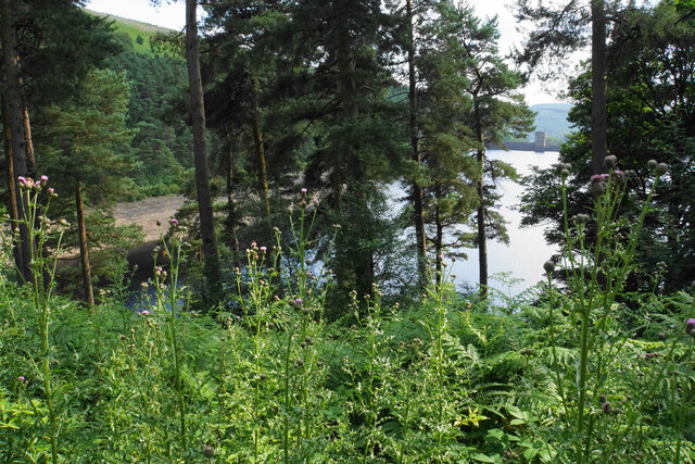
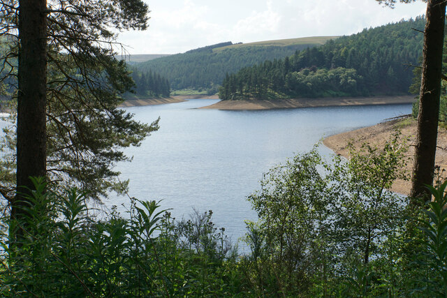
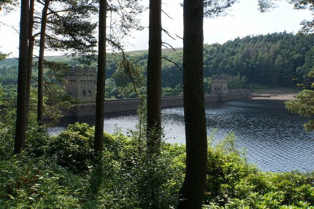
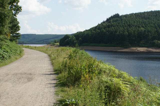
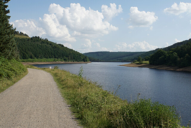
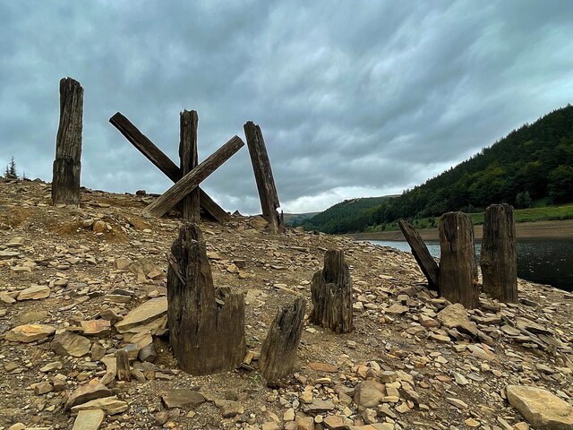
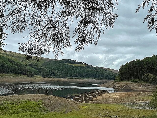
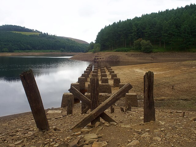
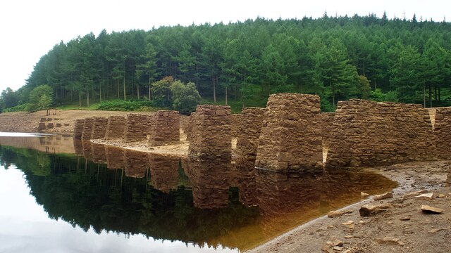
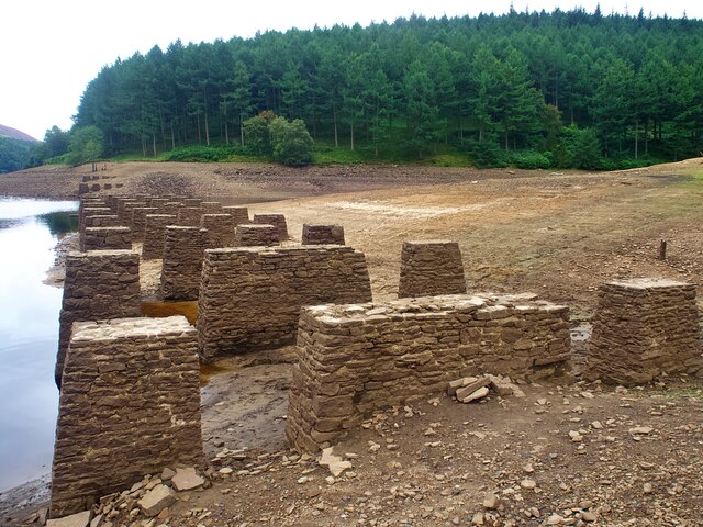
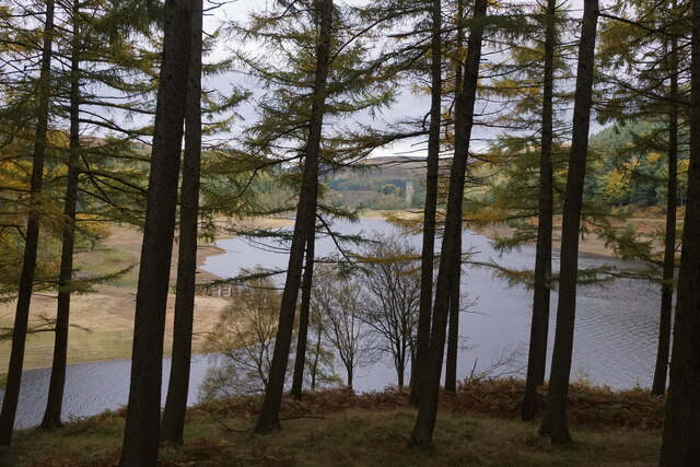
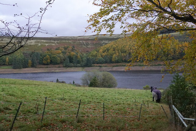
Derwent Reservoir, located in Derbyshire, England, is a large freshwater lake nestled in the scenic Upper Derwent Valley. It was constructed in the 20th century to supply water to the nearby cities of Sheffield and Derby. With a surface area of approximately 280 acres, the reservoir serves as a vital source of drinking water for the region.

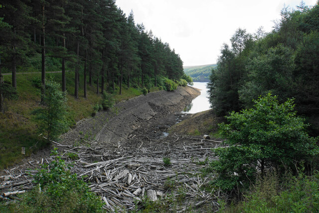
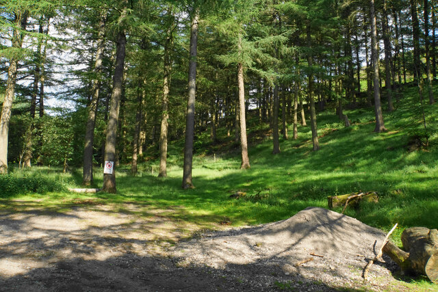
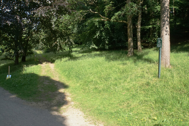
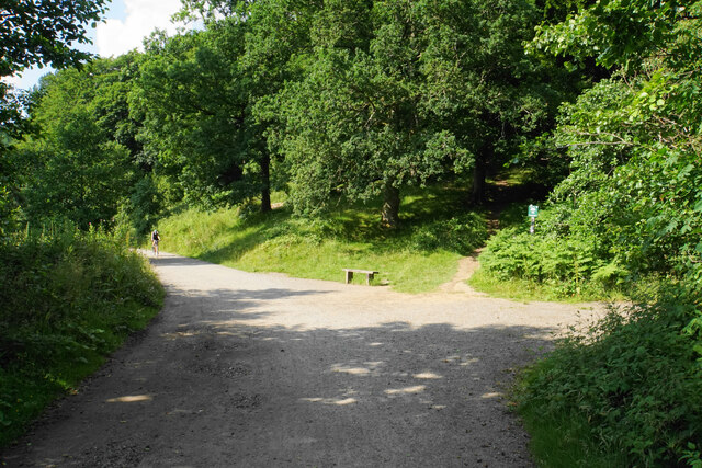
The lake is surrounded by picturesque landscapes, offering a tranquil environment for visitors. The reservoir is encompassed by rolling hills and dense woodlands, creating a stunning backdrop for outdoor enthusiasts. Numerous walking trails traverse the area, providing opportunities for leisurely strolls and more challenging hikes.

Derwent Reservoir is popular among anglers, boasting a diverse range of fish species. Angling enthusiasts can cast their lines in the hopes of catching trout, pike, perch, and roach. The lake is regularly stocked with fish to maintain healthy populations and enhance the fishing experience.

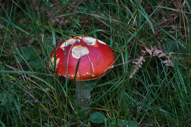
In addition to its recreational uses, Derwent Reservoir plays a crucial role in wildlife conservation. The surrounding wetlands and marshes provide a habitat for a variety of bird species, including herons, swans, and ducks. Birdwatchers flock to the area to observe these feathered inhabitants in their natural environment.

Overall, Derwent Reservoir offers a peaceful and scenic destination for outdoor activities, such as walking, fishing, and birdwatching. Its importance as a water supply and wildlife sanctuary further adds to its significance in the region.

If you have any feedback on the listing, please let us know in the comments section below.

Derwent Reservoir Images

Images are sourced within 2km of 53.424992/-1.7460463 or Grid Reference SK1692. Thanks to Geograph Open Source API. All images are credited.

Foliage above Howden Reservoir There are rare glimpses of the reservoir through the leaves from the main track, but this one gives a brief view of Howden Dam.
Foliage above Howden Reservoir
There are rare glimpses of the reservoir through the leaves from the main track, but this one gives a brief view of Howden Dam.
The bottom of Howden Clough Where the clough enters Howden Reservoir, it is full of flotsam.
The bottom of Howden Clough
Where the clough enters Howden Reservoir, it is full of flotsam.
Howden Reservoir The arm in the foreground is the former bottom of Howden Clough.
Howden Reservoir
The arm in the foreground is the former bottom of Howden Clough.
Howden Dam A view from the eastern side into bright afternoon sun.
Howden Dam
A view from the eastern side into bright afternoon sun.
Woodland in Abbey Clough The sign warns about forestry operations, but there is not much evidence of any.
Woodland in Abbey Clough
The sign warns about forestry operations, but there is not much evidence of any.
Path to Ewden via Broomhead Marked by Peak & Northern Footpaths Society sign no. 72.
Path to Ewden via Broomhead
Marked by Peak & Northern Footpaths Society sign no. 72.
Cycle path by Upper Derwent Reservoir This is the first view of Derwent Dam when coming down the eastern side of the reservoir.
Cycle path by Upper Derwent Reservoir
This is the first view of Derwent Dam when coming down the eastern side of the reservoir.
Cycle path by Upper Derwent Reservoir Derwent Dam is now visible straight ahead.
Cycle path by Upper Derwent Reservoir
Derwent Dam is now visible straight ahead.
Path junction at the bottom of Walker's Clough The path up the clough is marked by Peak & Northern Footpaths Society sign no. 191.
Path junction at the bottom of Walker's Clough
The path up the clough is marked by Peak & Northern Footpaths Society sign no. 191.
Howden Reservoir The northern arm of the reservoir looking south from the end of the public road. The water level looks low though the reservoir was 50% full at the time.
Howden Reservoir
The northern arm of the reservoir looking south from the end of the public road. The water level looks low though the reservoir was 50% full at the time.
Remains of Birchinlee Viaduct The viaduct carried the railway used in the construction of the Derwent dams over Ouzelden Clough. The water level was low with capacity below 50% on the day of the visit. The low water level has exposed the stone foundations <a href="https://www.geograph.org.uk/photo/6943062">SK1691 : Foundations of Birchinlee Viaduct</a> but these fragments of wooden beams have survived over 100 years as they are usually above the water level.
Remains of Birchinlee Viaduct
The viaduct carried the railway used in the construction of the Derwent dams over Ouzelden Clough. The water level was low with capacity below 50% on the day of the visit. The low water level has exposed the stone foundations SK1691 : Foundations of Birchinlee Viaduct but these fragments of wooden beams have survived over 100 years as they are usually above the water level.
Upper Derwent Reservoir The stone foundations of the railway bridge over Ouzelden Clough can be seen in the foreground. The railway was built for the construction of the Derwent and Howden dams and the foundations have been exposed due to the low water level.
Upper Derwent Reservoir
The stone foundations of the railway bridge over Ouzelden Clough can be seen in the foreground. The railway was built for the construction of the Derwent and Howden dams and the foundations have been exposed due to the low water level.
Foundations of Birchinlee Viaduct The viaduct carried the railway used in the construction of the Derwent and Howden dams over Ouzelden Clough. The water level was low with capacity at 50% on the day of the visit.
Foundations of Birchinlee Viaduct
The viaduct carried the railway used in the construction of the Derwent and Howden dams over Ouzelden Clough. The water level was low with capacity at 50% on the day of the visit.
Derwent Reservoir, looking towards the Howden Dam
Fly Agaric (Amanita muscaria), Upper Derwent Valley
Derwent Reservoir from Gores Farm
Show me another place!

Derwent Reservoir is located at Grid Ref: SK1692 (Lat: 53.424992, Lng: -1.7460463)

Administrative County: Derbyshire

District: High Peak

Police Authority: Derbyshire

What 3 Words

///overused.souk.liberty. Near Hope Valley, Derbyshire

Related Wikis

River Westend

The River Westend flows through the Dark Peak of the Derbyshire Peak District in England. Its source is at Bleaklow Stones on Bleaklow, from where it...

Howden Reservoir

The Howden Reservoir is a Y-shaped reservoir, the uppermost of the three in the Upper Derwent Valley, England. The western half of the reservoir lies in...

Derwent Reservoir (Derbyshire)

Derwent Reservoir is the middle of three reservoirs in the Upper Derwent Valley in the north of Derbyshire, England. It lies approximately 10 mi (16 km...

Lost Lad

Lost Lad is a hill, 518 metres (1,699 ft) high on the Derwent Edge in the Peak District in the county of Derbyshire in England. It is a subpeak of Back...

Howden Edge

Howden Edge (grid reference SK187943) is a peak in the north-east of the Upper Derwent Valley area of the Peak District National Park in England. At 545...

Alport Castles

The Alport Castles are a landslip feature in the Peak District National Park in Derbyshire. At over half a mile long, it is thought to be the largest landslide...

High Stones

High Stones, at 548 metres (1,798 ft), is the highest point within the boundaries of both the City of Sheffield and South Yorkshire, England.High Stones...

River Alport

The River Alport flows for 5.6 miles (9 km) in the Dark Peak of the Peak District in Derbyshire, England. Its source is on Bleaklow, 3 miles (4.8 km)...

Nearby Amenities

Located within 500m of 53.424992,-1.7460463
Birchinlee Village
Source: gps
Tourism: information
Lat/Long: 53.4226641/-1.7496743
Bank Clough
Place: locality
Lat/Long: 53.4241064/-1.7533865
Marebottom Cottage
Old Name: Marebottom Farm
Place: isolated_dwelling
Lat/Long: 53.4283651/-1.7482242
Abbey Grange
Historic Place: isolated_dwelling
Lat/Long: 53.4241591/-1.743882
Birchinlee Farm
Historic Place: farm
Lat/Long: 53.422952/-1.7508574
Tin Town
Information: board
Tourism: information
Lat/Long: 53.4223734/-1.7503895
Bench
Lat/Long: 53.4224652/-1.7457057
Information: guidepost
Operator: Peak & Northern Footpaths Society
Ref: 72
Source: survey;gps
Tourism: information
Lat/Long: 53.4239219/-1.7445959
The data included in this document is from www.openstreetmap.org. The data is made available under ODbL.

Have you been to Derwent Reservoir?

Leave your review of Derwent Reservoir below (or comments, questions and feedback).