Bell Pool

Lake, Pool, Pond, Freshwater Marsh in Northumberland

England

Bell Pool

Brinkburn Priory Church and Manor House Not much remains of the Priory, although there are various parts in the manor house, including a wonderful bricked up arch with a modern door in it. Very interesting site with activity from 1130's-1950's

<span class="nowrap"><a title="https://en.wikipedia.org/wiki/Brinkburn_Priory" rel="nofollow ugc noopener" href="https://en.wikipedia.org/wiki/Brinkburn_Priory">Link</a><img style="margin-left:2px;" alt="External link" title="External link - shift click to open in new window" src="https://s1.geograph.org.uk/img/external.png" width="10" height="10"/></span>
Brinkburn Priory Church and Manor House Credit: Brian Deegan

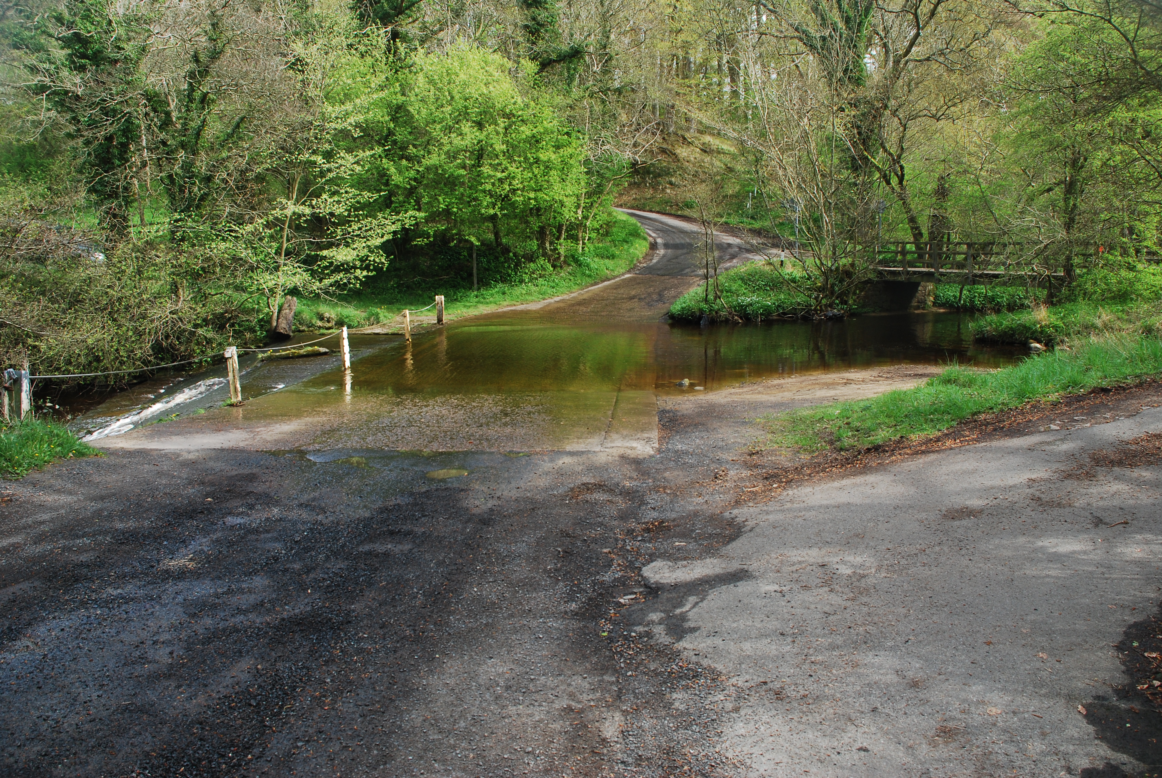
Bell Pool is a picturesque freshwater feature located in Northumberland, England. Nestled amidst the serene countryside, it covers an area of approximately 2 hectares and is surrounded by lush vegetation and rolling hills.

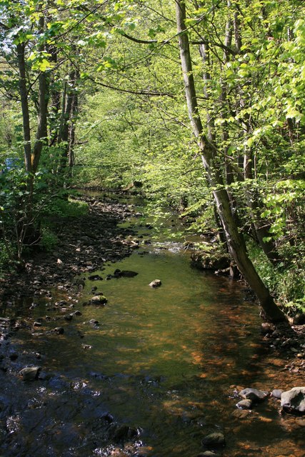
The pool itself is a natural water body formed by the accumulation of rainwater and groundwater over time. It boasts crystal-clear, calm waters that reflect the surrounding landscape, creating a stunning mirror-like effect. The pool is mainly fed by rainfall, with a few small streams and springs contributing to its water source.

Surrounding the pool is a diverse range of flora, including reeds, grasses, and water lilies. These plants provide a habitat for a variety of wildlife, attracting numerous bird species such as mallards, coots, and herons. The pool is also home to a thriving population of fish, including perch and roach, making it a popular spot for anglers.

Bell Pool is not only a visual delight but also serves an essential ecological function. It acts as a freshwater marsh, filtering and purifying the water as it flows through the various plant species. This marshland also serves as a natural flood control system, absorbing excess water during heavy rainfall and preventing flooding in the surrounding areas.

Visitors to Bell Pool can enjoy its tranquility and natural beauty by taking leisurely walks along the designated paths that encircle the pool. The surrounding area offers ample opportunities for picnicking, birdwatching, and photography, making it a popular destination for nature enthusiasts and families alike.

If you have any feedback on the listing, please let us know in the comments section below.

Bell Pool Images

Images are sourced within 2km of 55.280151/-1.8188742 or Grid Reference NZ1198. Thanks to Geograph Open Source API. All images are credited.

Brinkburn Priory Church and Manor House Not much remains of the Priory, although there are various parts in the manor house, including a wonderful bricked up arch with a modern door in it. Very interesting site with activity from 1130's-1950's

<span class="nowrap"><a title="https://en.wikipedia.org/wiki/Brinkburn_Priory" rel="nofollow ugc noopener" href="https://en.wikipedia.org/wiki/Brinkburn_Priory">Link</a><img style="margin-left:2px;" alt="External link" title="External link - shift click to open in new window" src="https://s1.geograph.org.uk/img/external.png" width="10" height="10"/></span>
Brinkburn Priory Church and Manor House
Not much remains of the Priory, although there are various parts in the manor house, including a wonderful bricked up arch with a modern door in it. Very interesting site with activity from 1130's-1950's LinkExternal link
Pauperhaugh on Christmas Day Partially frozen River Coquet, before global warming took hold.
Pauperhaugh on Christmas Day
Partially frozen River Coquet, before global warming took hold.
Brinkburn Priory
Brinkburn Priory
Brinkburn Priory
Brinkburn Priory
Norman north doorway to Brinkburn Priory
Proper winters River Coquet frozen over, Christmas Day 1981.  The dog happily walked around on the ice; I didn't.
Proper winters
River Coquet frozen over, Christmas Day 1981. The dog happily walked around on the ice; I didn't.
Forest Burn Looking upstream from the road bridge near Bushygap.
Forest Burn
Looking upstream from the road bridge near Bushygap.
Forest Burn Near East Raw.
Forest Burn
Near East Raw.
Woodland near East Raw The Forest Burn flows through this woodland downstream of The Lee.
Woodland near East Raw
The Forest Burn flows through this woodland downstream of The Lee.
Footbridge over the Forest Burn Near Butterknowes.
Footbridge over the Forest Burn
Near Butterknowes.
Ford through Forest Burn The burn is soon to flow into the River Coquet.
Ford through Forest Burn
The burn is soon to flow into the River Coquet.
Ford at Bushygap This substantial irish bridge ford is found at Bushygap.
Ford at Bushygap
This substantial irish bridge ford is found at Bushygap.
Footbridge over Forest Burn The burn soon joins the River Coquet.
Footbridge over Forest Burn
The burn soon joins the River Coquet.
Stone Arch Road Bridge, Pauperhaugh Photograph taken from south side of this stone arch bridge over River Coquet looking towards Pauperhaugh on B6334 on north bank
Stone Arch Road Bridge, Pauperhaugh
Photograph taken from south side of this stone arch bridge over River Coquet looking towards Pauperhaugh on B6334 on north bank
Brinkburn Priory Built originally in 1135 for Augustian monks the Priory later fell into ruin and was restored to its former glory in 1858. Brinkburn stands in a secluded and peaceful setting with an air of quiet tranquillity.
Brinkburn Priory
Built originally in 1135 for Augustian monks the Priory later fell into ruin and was restored to its former glory in 1858. Brinkburn stands in a secluded and peaceful setting with an air of quiet tranquillity.
Reflection The reflection of the stained glass is almost as beautiful as the window itself (Brinkburn Priory).
Reflection
The reflection of the stained glass is almost as beautiful as the window itself (Brinkburn Priory).
Weldon A tiny hamlet consisting of a few cottage and the Anglers Arms Pub. The bridge which can just be seen was built in the mid 18th century and is a grade 1 listed building and crosses the River Coquet famous for salmon fishing.
Weldon
A tiny hamlet consisting of a few cottage and the Anglers Arms Pub. The bridge which can just be seen was built in the mid 18th century and is a grade 1 listed building and crosses the River Coquet famous for salmon fishing.
The Manor House, Brinkburn. Owned by the Cadogan Fenwick family until the mid 1950's, this impressive house incorporated part of the original refectory. It overlooks the River Coquet and is in the process of renovation by English Heritage.
The Manor House, Brinkburn.
Owned by the Cadogan Fenwick family until the mid 1950's, this impressive house incorporated part of the original refectory. It overlooks the River Coquet and is in the process of renovation by English Heritage.
Show me another place!

Bell Pool is located at Grid Ref: NZ1198 (Lat: 55.280151, Lng: -1.8188742)

Unitary Authority: Northumberland

Police Authority: Northumbria

What 3 Words

///irritate.probe.estate. Near Longhorsley, Northumberland

Related Wikis

Brinkburn

Brinkburn is a civil parish in Northumberland, England. It is divided by the River Coquet. The parish includes the hamlet of Pauperhaugh. == History... ==
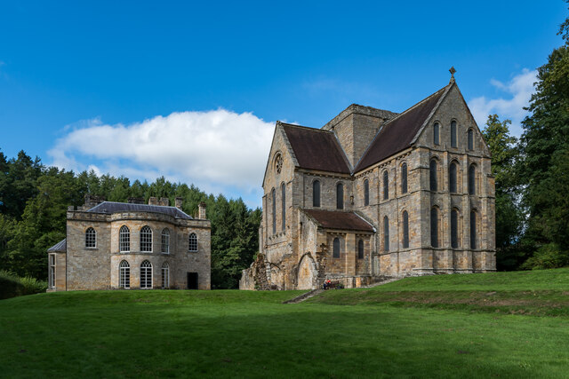
Brinkburn Priory

Brinkburn Priory is a former monastery built, starting in the 12th century, on a bend of the River Coquet, about 4 miles (6 km) east of Rothbury, Northumberland...

Brinkburn Mill

Brinkburn Mill is a water mill located near Rothbury, in Northumberland. It once formed part of the precincts of Brinkburn Priory and was constructed in...

Longframlington

Longframlington is a small village in Northumberland, England, located on the A697, 11 miles (18 km) north-west of Morpeth and 5 miles (8 km) south-east...
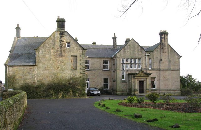
Embleton Hall

Embleton Hall is a country manor house in the small ex-mining village of Longframlington, Northumberland, England. It is a Grade II listed building. The...

Brinkburn railway station

Brinkburn was a weatherboard- and corrugated-iron-built railway station in Northumberland on the Rothbury Branch built to serve the Healy Coate Colliery...

Hesleyhurst

Hesleyhurst is a civil parish in the county of Northumberland in England. At the 2011 Census the population was only minimal. It is served by a joint parish...

Cragend Silo

Cragend Silo is a Grade II* listed building located at Cragend Farm near the town of Rothbury in Northumberland, England. It was designed and built by...

Nearby Amenities

Located within 500m of 55.280151,-1.8188742
Brinkburn Mill
Place: locality
Lat/Long: 55.2786892/-1.8167097
Toilets
Operator: English Heritage
Lat/Long: 55.2790994/-1.8195521
Coquetdale
Place: locality
Lat/Long: 55.277011/-1.8188177
Power: pole
Lat/Long: 55.2794678/-1.8250477
Power: pole
Lat/Long: 55.2795029/-1.8265627
Power: pole
Lat/Long: 55.279618/-1.8238081
Power: pole
Lat/Long: 55.2797795/-1.8225405
Power: pole
Lat/Long: 55.2798959/-1.8216204
The data included in this document is from www.openstreetmap.org. The data is made available under ODbL.

Have you been to Bell Pool?

Leave your review of Bell Pool below (or comments, questions and feedback).